


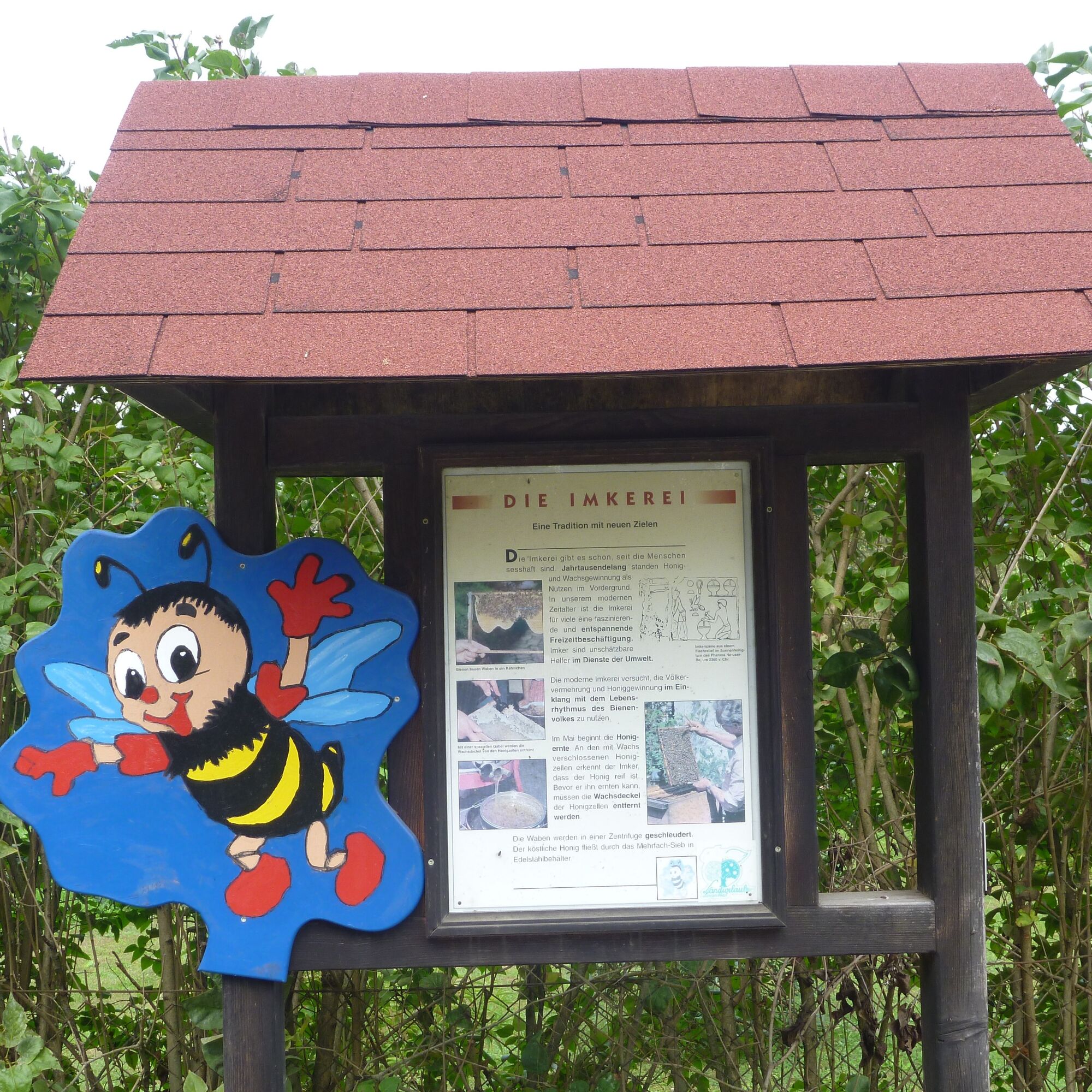
St. Andrä: bee educational trail
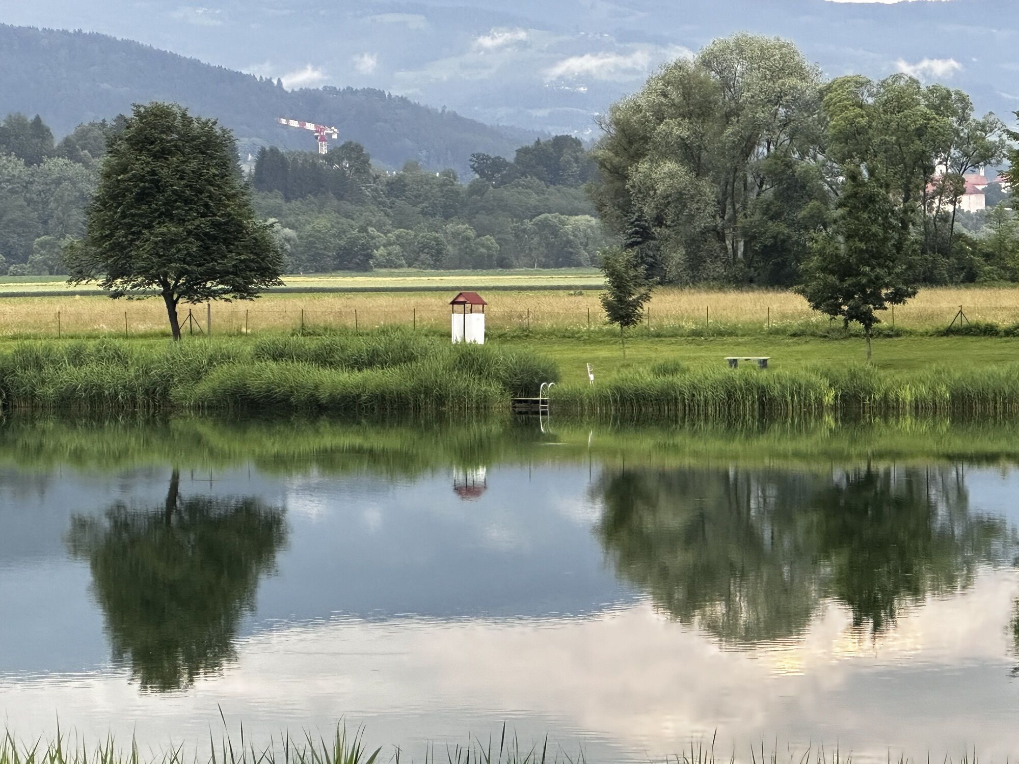
Along the newly created course of the Lavant and the resulting new floodplain landscapes, the bee educational trail offers quite a bit of interesting knowledge about the life of our native fauna and flora.
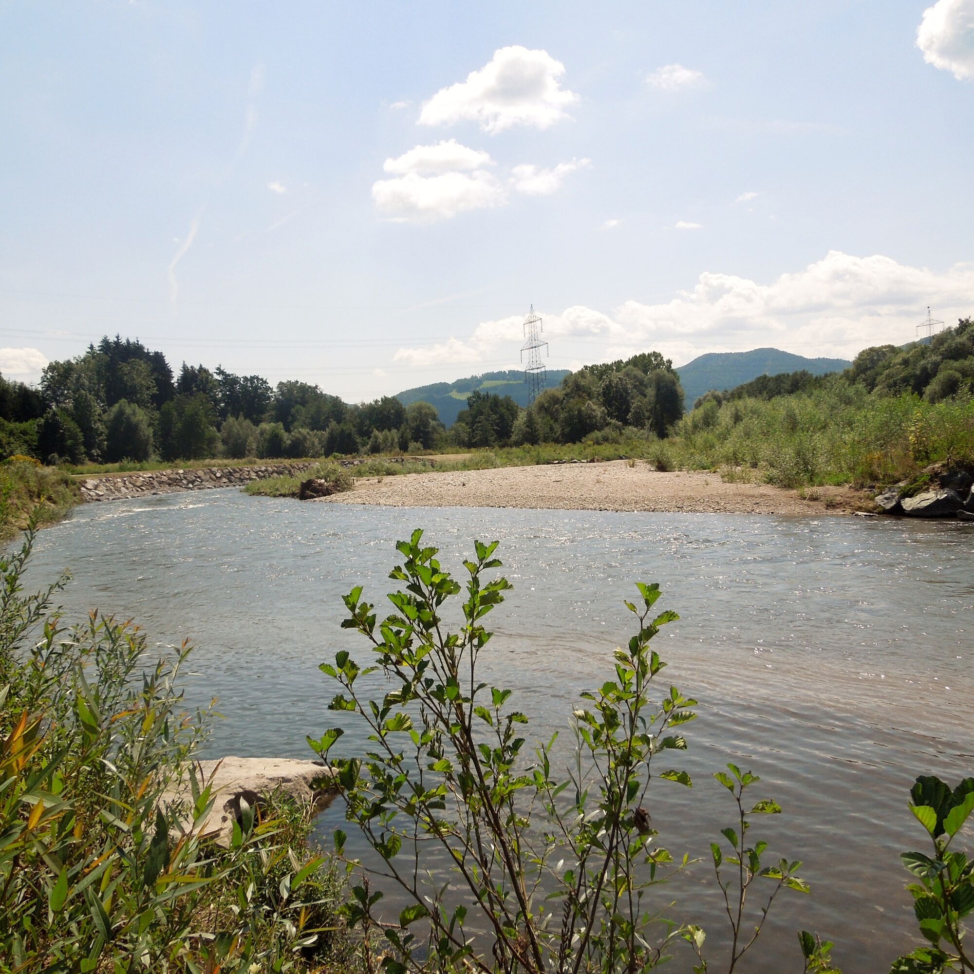

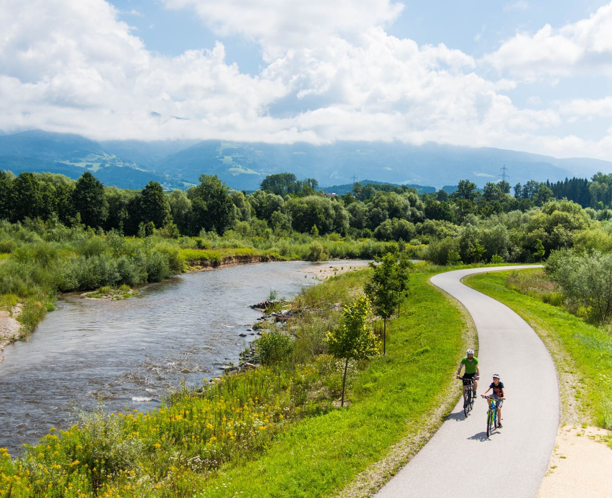
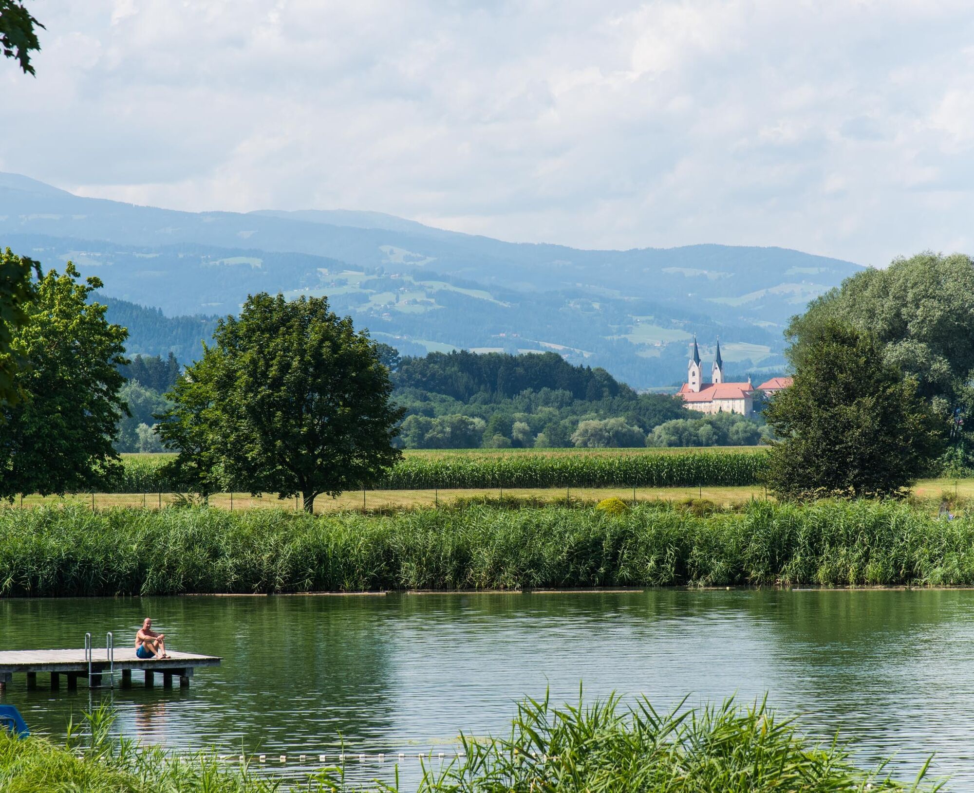
From the St. Andrä recreation area, heading south, always along the Lavant, you reach the Mühldorfer Au in just over 2 km. The destination and turning point of the bee educational trail.
Áno
Áno
Áno
Áno
For this route, good footwear and a small backpack with the essentials are sufficient.
10 Recommendations from the Alpine Club
1. Healthy in the mountains: Hiking is an endurance sport. The positive stress on the heart and circulation requires health and a realistic self-assessment. Avoid time pressure and choose a pace so that no one in the group is out of breath.
2. Careful planning: Hiking maps, guide literature, internet and experts inform about length, elevation difference, difficulty and current conditions. Always tailor routes to the group! Pay special attention to the weather forecast as rain, wind and cold increase accident risk.
3. Complete equipment: Adapt your gear to your undertaking and keep backpack weight low. Rain, cold and sun protection always belong in the backpack, as do first aid kit and mobile phone (Euro emergency call 112). Map or GPS aid orientation.
4. Suitable footwear: Good hiking boots protect and relieve the foot and improve surefootedness! Make sure to choose perfect fit, slip-resistant soles, waterproofness and light weight.
5. Surefootedness is key: Falls due to slipping or stumbling are the most common cause of accidents! Note that too high a pace or fatigue strongly reduce your surefootedness and concentration. Beware of falling rocks: careful walking helps avoid loosening stones.
6. Stay on marked paths: Off-path terrain increases the risk of losing orientation, falling and rockfall. Avoid shortcuts and return to the last known point if you deviate from the path. Often underestimated and very dangerous: steep old snowfields!
7. Regular breaks: Timely rest serves recovery, enjoyment of the landscape and socializing. Eating and drinking are necessary to maintain performance and concentration. Isotonic drinks are ideal thirst quenchers. Muesli bars, dried fruit and biscuits satisfy hunger on the way.
8. Responsibility for children: Note that variety and playful discovery are foremost for children! In passages with risk of falling an adult can only supervise one child. Very exposed routes requiring long-lasting concentration are not suitable for children.
9. Small groups: Small groups ensure flexibility and allow mutual help. Inform trusted persons about destination, route and return. Stay together in the group. Beware of solo hikers: Even small incidents can become serious emergencies.
10. Respect for nature and environment: To protect mountain nature: Do not leave waste, avoid noise, stay on paths, do not disturb wild and grazing animals, leave plants untouched and respect protected areas. Use public transport or form car pools for travel.
(Source: Austrian Alpine Club, 2014)
Via A2 exit St. Andrä - first exit at the roundabout - turn left after 800 m to St. Paul - turn left after 900 m to St. Jakob.
St. Andrä/Lav. accessible by bus and train. Info at ÖBB timetable.
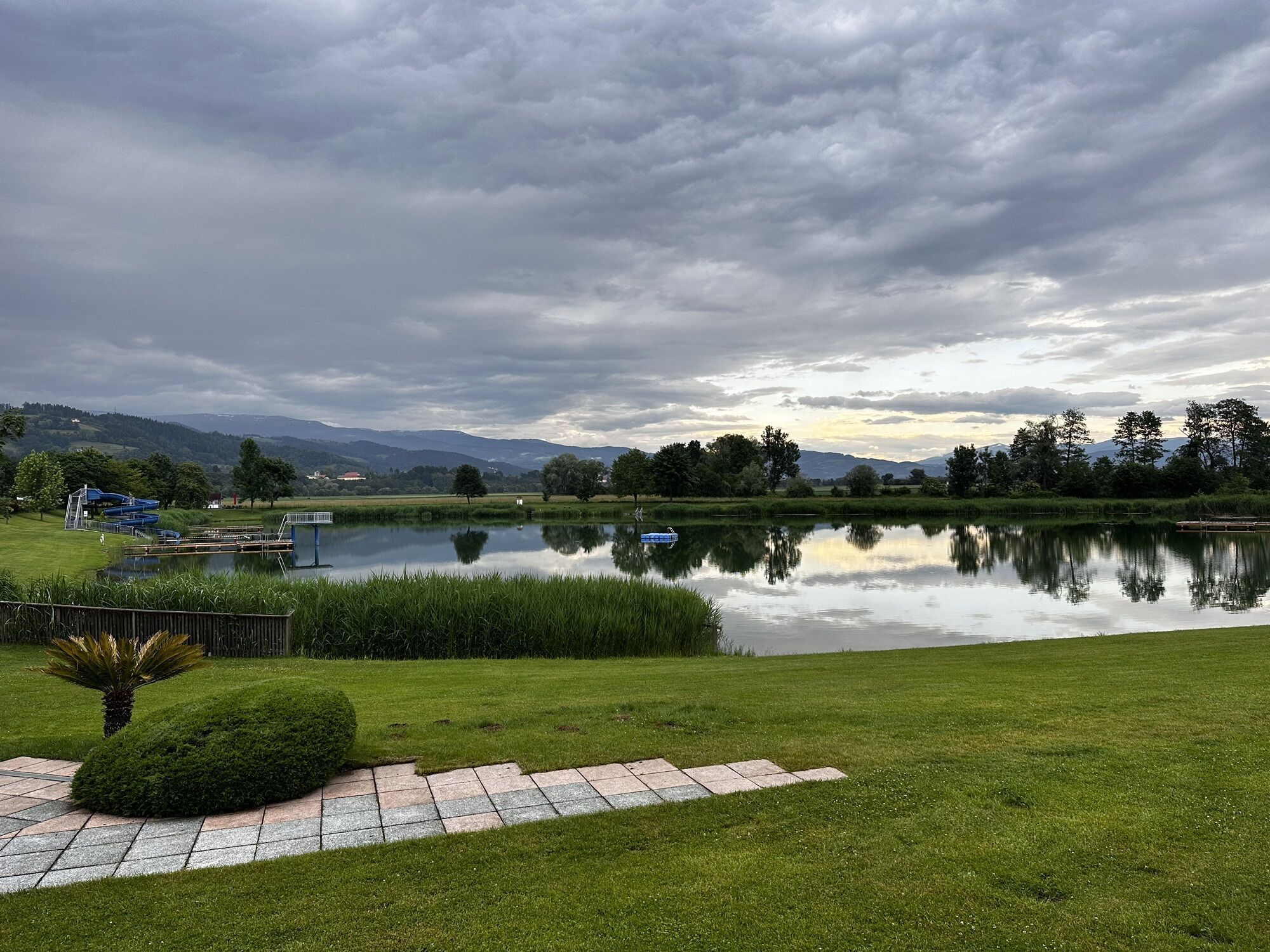
Parking directly at the St. Andrä lake recreation area.
At the St. Andrä recreation area lake, 4 motorhome parking spaces invite you to stay for a few days.
Hobby-Farm Schildberger - An experience for the whole family!
Obľúbené výlety v okolí
-
4,7
Koralpe: hike to the summit cross
svetloZimná turistika 4,23 km -
4,4
Koralpe: summit tour to the Großer Speikkogel
strednáSkitour 11,6 km -
5,0
Koralpe: Hike to the Großer Speikkogel
strednáSnežnice 10,5 km -
4,2
St. Paul: Klettergarten und Klettersteig Rabenstein
strednáVia ferrata 0,89 km -
4,0
Koralpe: panoramic hike
svetloZimná turistika 6,57 km -
3,7
Koralpe: panoramic circular hike
strednáTuristika 13,2 km -
4,8
Großer Speikogel, Koralpe, Kärnten
svetloHorská turistika 8,46 km -
4,3
Soboth Runde St.Vinzenz-Dreieckhütte-Gundischhütte
svetloTuristika 12,4 km -
4,0
Loskogel - Steinmandl- Großer Speikkogel
strednáTuristika 16,1 km -
4,7
St. Paul: Most Hiking Trail 1-3
ťažkéTuristika 22,0 km
Turistika a stopovanie


Nenechajte si ujsť ponuky a inšpiráciu na ďalšiu dovolenku
Vaša e-mailová adresa bol pridaný do poštového zoznamu.