


St. Florian (5)
Follow the hiking trail sign No. 5
The hiking trail leads east from Launsdorf over a canal and the Gurk. From the village of Gösseling, it goes through the quiet and idyllic Elsgraben and Garzern on shady...
Follow the hiking trail sign No. 5
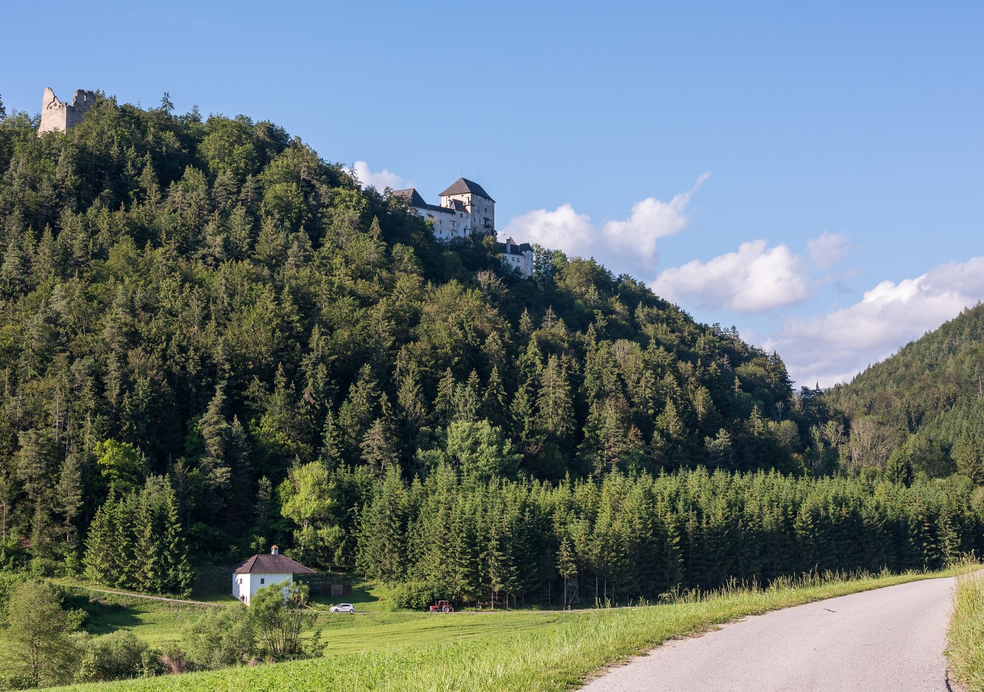
The hiking trail leads east from Launsdorf over a canal and the Gurk. From the village of Gösseling, it goes through the quiet and idyllic Elsgraben and Garzern on shady forest paths and forestry roads to St. Florian. The return route leads through the forest valley – part of the Natura 2000 area Mannsberg-Boden – past the impressive Mannsberg castle and continues into the village of Pölling. The railway line is crossed through a tunnel, then we follow the ascending forest road towards the east. At the fork, we observe sign No. 5 and reach the settlement area of Launsdorf and our starting point, the train station, again on the forest road.

Follow the hiking trail sign No. 5
The hiking trail leads east from Launsdorf over a canal and the Gurk. From the village of Gösseling, it goes through the quiet and idyllic Elsgraben and Garzern on shady forest paths and forestry roads to St. Florian. The return route leads through the forest valley – part of the Natura 2000 area Mannsberg-Boden – past the impressive Mannsberg castle and continues into the village of Pölling. The railway line is crossed through a tunnel, then we follow the ascending forest road towards the east. At the fork, we observe sign No. 5 and reach the settlement area of Launsdorf and our starting point, the train station, again on the forest road.
Sturdy footwear, water supply, and sun protection are recommended.
please pay attention to the weather
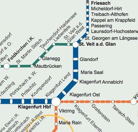
By train to Launsdorf - Hochosterwitz station
Parking available at Launsdorf - Hochosterwitz station
Find more routes here:
https://regio.outdooractive.com/oar-mittelkaernten/de/
Bring enough provisions and water on this hike and enjoy your snack in nature at one of the viewpoints!
Obľúbené výlety v okolí
-
4,3
Mariahilferweg
strednáTuristika 11,2 km -
3,6
Umelecký chodník - Längsee (1)
svetloTuristika 5,43 km -
5,0
Weißbergerhütte - Gertrusk - Ladingerspitz
strednáTuristika 8,95 km -
4,8
Winter sun on the Saualm
svetloSnežnice 4,70 km -
4,1
MAGDALENSBERG RUNDWANDERUNG
strednáTuristika 11,7 km -
4,4
Diex panorama trail
svetloTuristika 12,1 km -
4,4
Magdalensberg von St.Donat
svetloTuristika 9,28 km -
4,2
Saualpen ridge – Speikkogel, Großer and Kleiner Sauofen
strednáTuristika 10,8 km -
3,8
Schloss Frauenstein - Kraiger lake circular route
svetloTuristika 6,96 km -
4,1
Althofen Wald Ausichtsweg
svetloTuristika 3,94 km

Turistika a stopovanie


Nenechajte si ujsť ponuky a inšpiráciu na ďalšiu dovolenku
Vaša e-mailová adresa bol pridaný do poštového zoznamu.