



Kaartjoki paddling route

The Kaartjoki paddling route is located in Länsi-Loppi and is about 11 km long. The Sähkönokka boat harbor at the southern end of Kaartjärvi is an excellent starting point for the Kaartjoki paddling adventure....
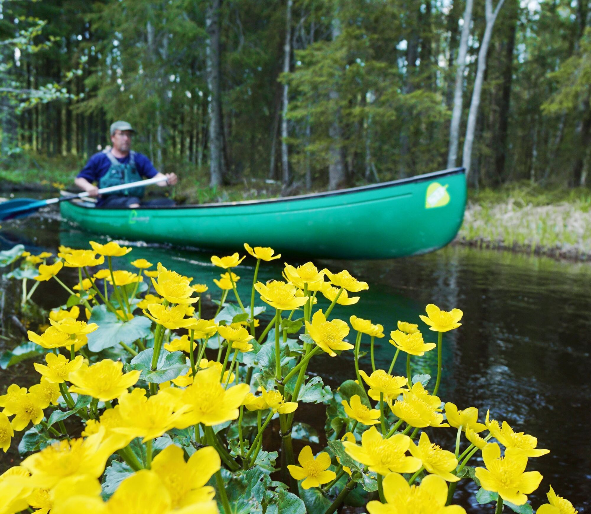
The Kaartjoki paddling route is located in Länsi-Loppi and is about 11 km long. The Sähkönokka boat harbor at the southern end of Kaartjärvi is an excellent starting point for the Kaartjoki paddling adventure. After about twenty minutes of paddling, the mouth of the Kaartjoki emerges from the reeds and floating markers on the route confirm the right direction. The river flows quietly winding in the forest shade, and along the route you can find, among others, the Kurtlamminmäki shelter hut where you can enjoy a packed lunch with a wonderful shore view. Approaching the route's end point, Kalamylly, the field landscape becomes more common and creates a whole new atmosphere as the old cultural landscape with pastures prevails.
Watch the introduction video of the Kaartjoki paddling route from this link.


The starting point of the route, the Sähkönokka boat harbor, is excellent. The boat harbor has a parking lot, a swimming pier, a changing cabin for clothes, and restroom facilities. At the renovated campfire site, you can still pour yourself coffee before heading out on the water.
The majestic scenery at the southern end of Kaartjärvi with long ridge-like islands charms the paddler immediately at departure. After about twenty minutes of paddling, the mouth of the Kaartjoki becomes visible through the reeds and the floating markers confirm the direction. The strong spring flow pulls the canoe into the channel framed by alder trees, and after half an hour of river paddling, you arrive at the Kaartlampi campfire site. If you just want a brief visit to the river nature, there is a good opportunity here to paddle back upstream. The river continues past the campfire site, where there's again a floating marker guiding paddlers.
After Kaartlampi, the river flows quietly winding in the forest shade, and the scenery sometimes opens up due to logging. Besides the bends, your progress is slightly slowed by trees fallen across the river, but all of these can be crossed over or under during the spring flood. After about an hour of weaving and a few calm pools, you reach the beautiful Kurtlamminmäki shelter hut, which also has a dining shelter and toilet. Here you can enjoy your packed lunch with a wonderful shore view before the last one and a half hour leg to Kalamylly.
From the Kurtlammi shelter, the river continues winding and the first bridges force you to lift the canoe out of the river and bypass them over dry land. However, most of the oncoming bridges can also be passed under during flood time with a little acrobatic skill. The river also crosses cottage yards in its lower section, and there are man-made bottom dams here. Depending on water conditions, you may have to lift the canoe at some bottom dams. Approaching Kalamylly, the field landscape becomes more common and creates a whole new atmosphere as the old cultural landscape with pastures prevails.
A few hundred meters before Kalamylly, a bridge crosses the river and marks the end of the paddling section. To crown the trip, you can enjoy coffee and doughnuts at Kalamylly before driving back to the starting point by car.
Áno
Paddling services:
Multievent Oy
The Kaartjoki paddling route is well suited for beginners. The river is sheltered from the wind, so even strong wind does not hinder paddling. You should allow a full day for paddling the Kaartjoki. Paddling the route upstream is not recommended. Instead, a short trip from Kaartjärvi along the Kaartjoki to Kaartlampi and back is suitable for example for paddling with children and already gives the atmosphere of river paddling in the wilderness. In dry seasons, water level drops may complicate paddling on some river sections as well as trees fallen across the current.
The starting point of the paddling route is Sähkönokka. Turn from road 54 onto Rautakoskentie (2832) towards Räyskälä, continue on Rautakoskentie for about 6.4 kilometers and turn right onto Räyskäläntie. Drive about 2 kilometers where there is a sign for Sähkönokka boat harbor on the right.
The Sähkönokka boat harbor has a parking lot, a swimming pier, and a changing cabin for clothes as well as a campfire site and restroom facilities.
At the Kalamylly parking lot, paddlers are asked to park their cars on the left side of the parking area.
Meal services:
Accommodation services:
Lopen Erähuvila and Räyskälä's Great Villa
More information about the route:
The paddling time for the route is about 4 hours and it is easy in difficulty. The paddling route can be followed using the DigiTrail app.
Obľúbené výlety v okolí
-
Kivijärvi circular route 27 km (Hämeen Ilvesreitti)
ťažkéTuristika 28,4 km -
Luutaharjun Samo 12km
strednáTuristika 11,9 km -
Poronpolku mountain biking route
ťažkéMountainbike 42,7 km -
Pääjärven kierto 7,5 km
strednáTuristika 7,32 km -
Kynnysniemen lenkki 4,5 km
strednáTuristika 4,38 km -
Hämeen Ilvesreitti Riihimäki Kormu-Poronpolku 45.3 km
ťažkéMountainbike 44,3 km -
Häme Lynx route Räyskälä-Pääjärvi 31.8 km
ťažkéMountainbike 31,1 km -
Hämeen Ilvesreitti Iso-Melkutin-Kaitajärvi 10.2 km
strednáMountainbike 9,80 km -
Pikku-Samo 3,5 km
Turistika 3,39 km -
Häme Lynx route Kaitajärvi - Iso-Melkutin 6 km
Turistika 2,96 km
Turistika a stopovanie


Nenechajte si ujsť ponuky a inšpiráciu na ďalšiu dovolenku
Vaša e-mailová adresa bol pridaný do poštového zoznamu.


