


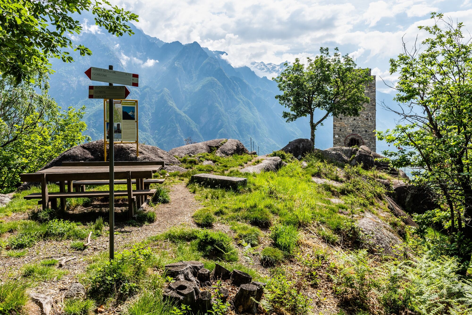
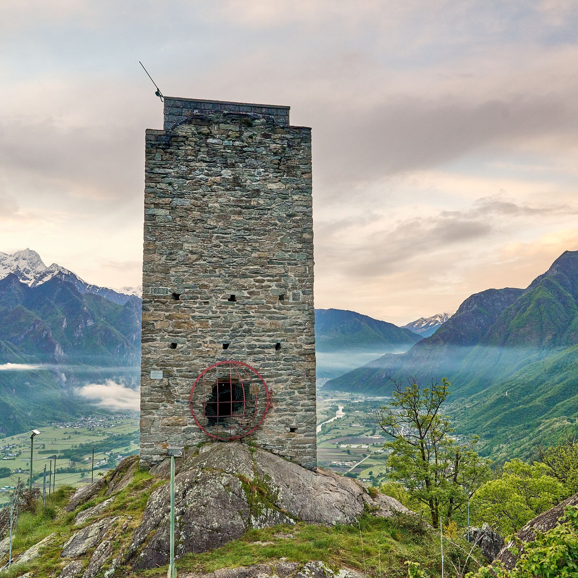
Tower of Signame
Úroveň náročnosti: T2
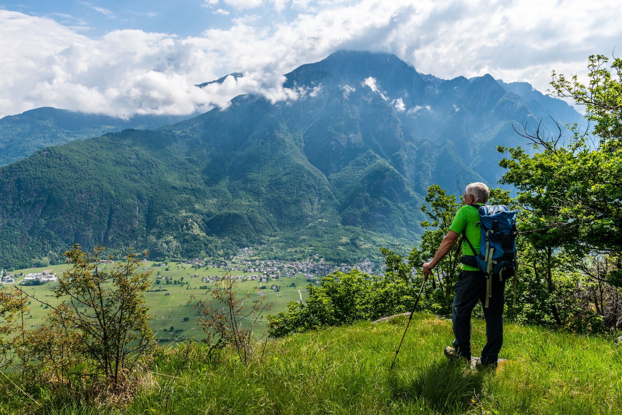
Lonely, on top of the mighty rocky spur overlooking the right bank of the valley, between Gordona and San Pietro di Samolaco, this construction draws the attention of many.
The construction dates back...
The construction dates back to the second half of the 12th century and was part of a complex system of sighting and signaling of possible invaders.Easily reached on foot, it is absolutely worth a visit if only for the splendid view it offers once you reach its summit.
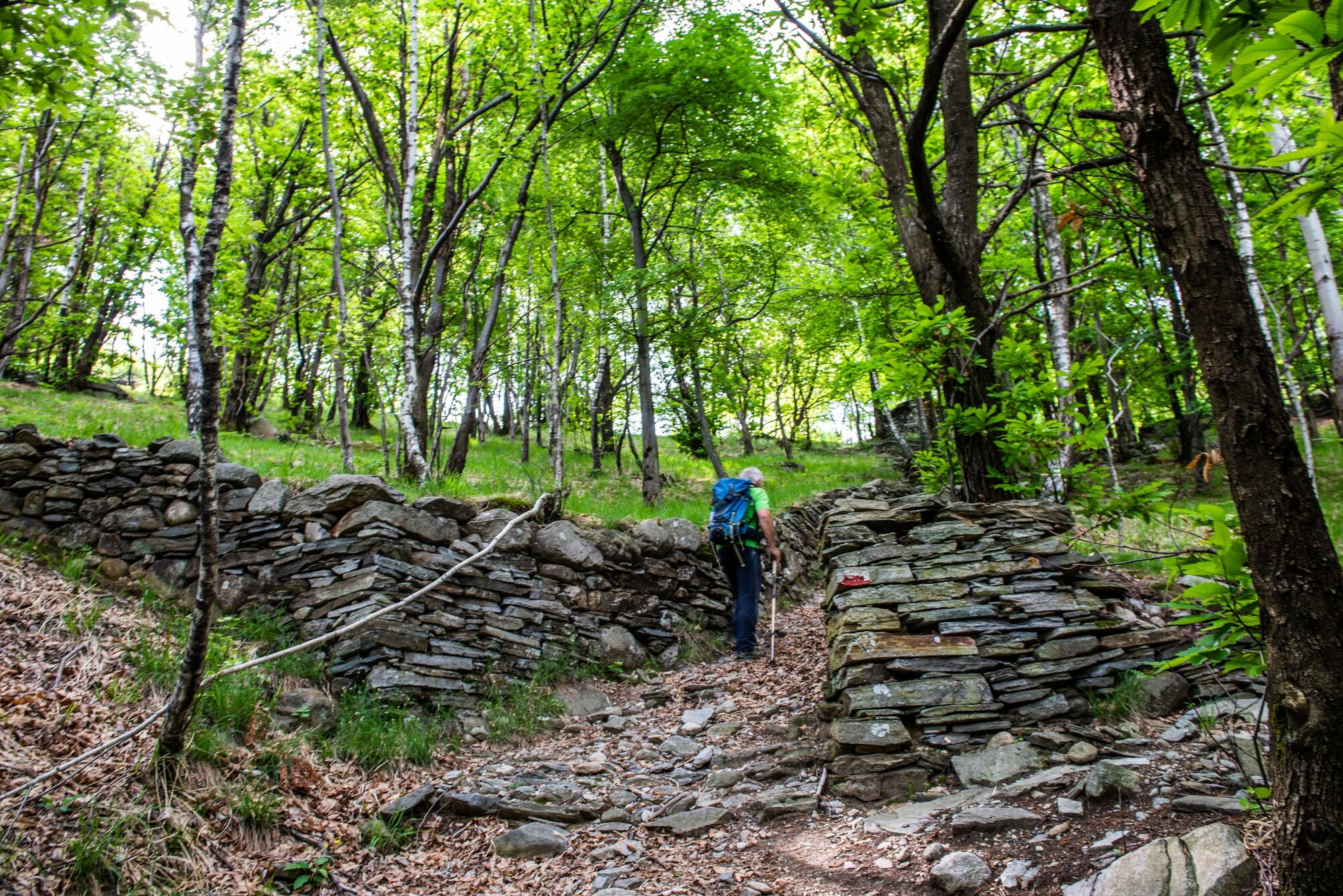
The trail is well-marked and starts from the Boggia locality in Gordona, climbing up the slope, with a noteworthy gradient (it is possible to start the route from the Church Square in Gordona).
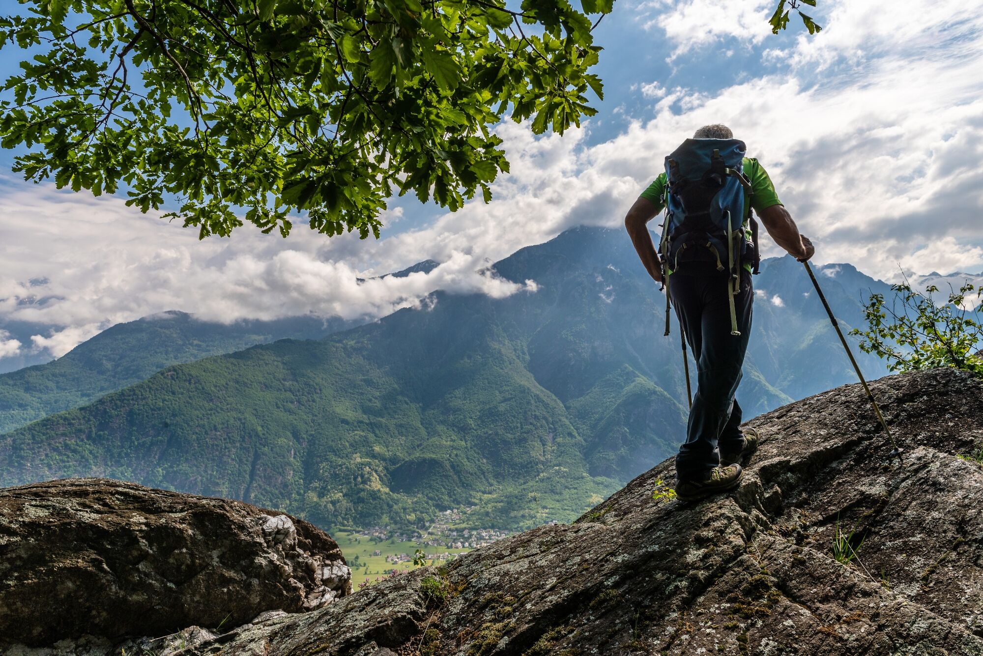
Gradually the path becomes gentler as you approach the ridge, limiting the view of the valley because of the birch thickets you pass along the way.The arrival at the summit holds an extraordinary surprise. The view runs from the mouth of the Spluga and Bregaglia valleys to the peak of Legnone overlooking Lake Como. From here, soldiers dominated the entire Valchiavenna, ready to signal with fires to nearby towers, the arrival of enemies from new territories. The tower can also be visited internally, and an equipped staircase, allows you to climb to its top.
It is worth considering a loop route that touches both approaches so as to fully appreciate the various interesting locations (e.g. Cà Pipeta)..
Possible departure or arrival from Loc. Ronscione in Samolaco.
For schedules click here
T2
Obľúbené výlety v okolí
-
5,0
Bocchetta Graglio Impressionante
strednáTuristika 8,85 km -
5,0
Monte Berlinghera da San Bartolomeo
strednáTuristika 8,74 km -
Acqua Fraggia waterfall scenic loop - Savogno
svetloTuristika 3,44 km -
5,0
Hike in Val Codera Novate - Rifugio Brasca ( Sentiero Roma first stage)
strednáTuristika 10,7 km -
5,0
Berg und See „at it’s best“
strednáHorská turistika 6,59 km -
4,0
Von Livo nach Alpe Motta
strednáHorská turistika 12,3 km -
5,0
Val Codera
strednáTuristika 13,6 km -
4,0
Ciclabile Valchiavenna
svetloCyklistika 37,5 km -
4,0
Argigno, Italien
strednáMountainbike 23,0 km -
5,0
Lago di Darengo
strednáTuristika 7,85 km
Turistika a stopovanie


Nenechajte si ujsť ponuky a inšpiráciu na ďalšiu dovolenku
Vaša e-mailová adresa bol pridaný do poštového zoznamu.