






Stelvio Historical Trek: Hike from the 4th Road Maintenance Station – Forcola Pass – 3rd Road Maintenance Station
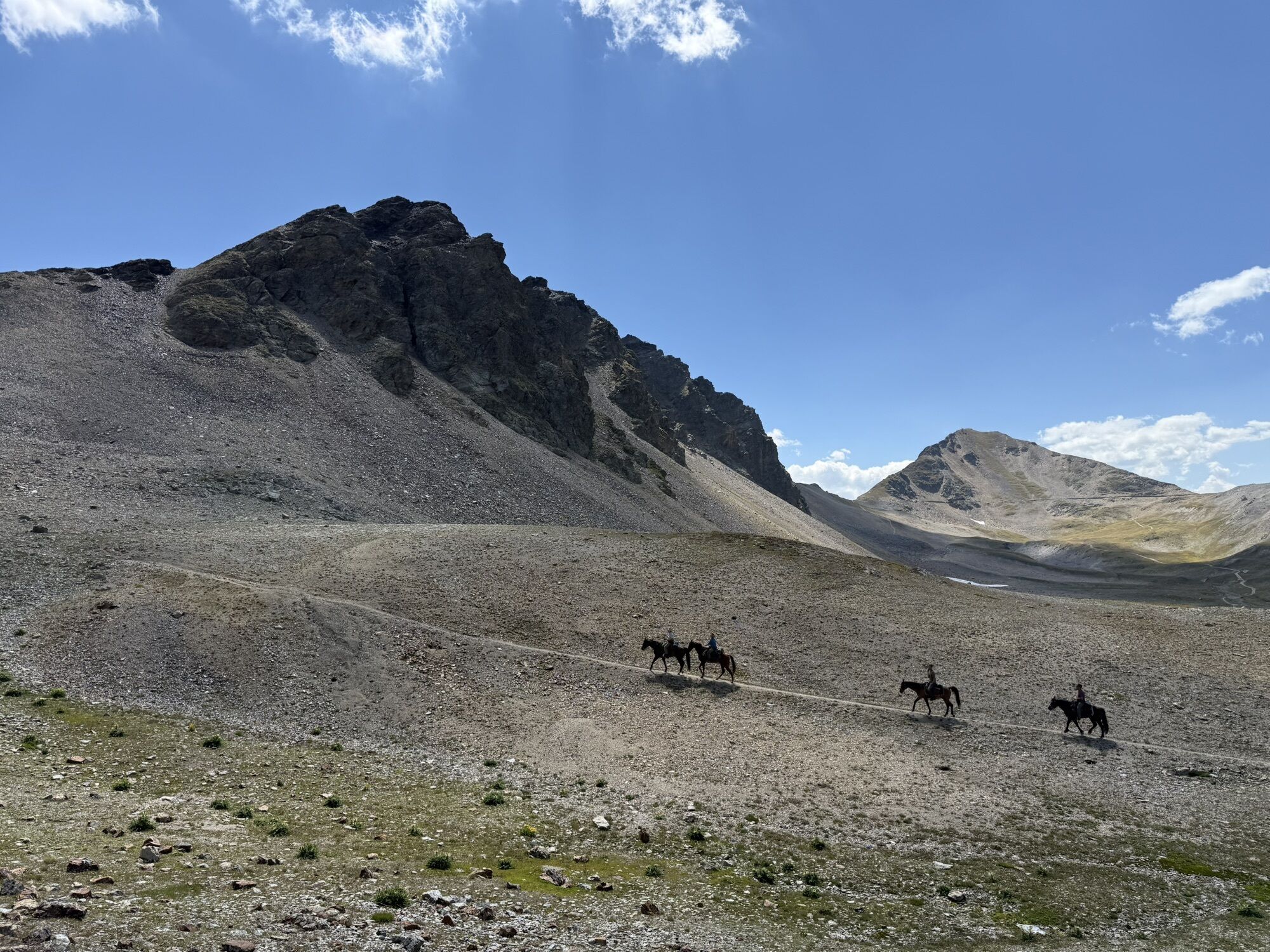
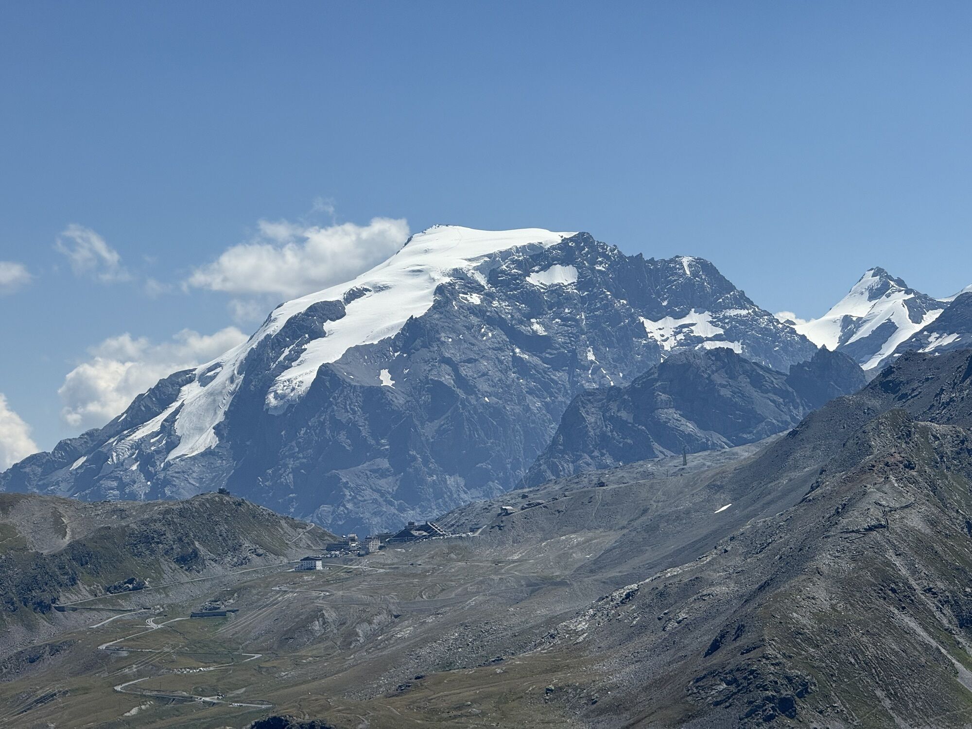
The hike to Bocchetta di Forcola begins at the IV Cantoniera (approx. 2,490 m above sea level), which served as a forward headquarters for Italian troops during World War I. Following an easy trail with...
The hike to Bocchetta di Forcola begins at the IV Cantoniera (approx. 2,490 m above sea level), which served as a forward headquarters for Italian troops during World War I. Following an easy trail with little elevation gain, you reach the “Foppe della Mogenaggia” (approx. 2,600 m above sea level), a series of broad plateaus used primarily for grazing. From here, the trail climbs to Bocchetta di Forcola (2,768 m above sea level), the highest point of the hike. Bocchetta served as one of the most important defensive positions against potential Imperial breakthroughs along the Braulio Valley. This is evidenced by the many remains found here, the most spectacular of which are a trench reinforced with thick concrete armor—an unusual feature—and several cave-based gun emplacements. A short descent leads to the Caserma below (2,741 m a.s.l.). The return follows the ascent route to the Foppe della Mogenaccia, then along the historic military mule trails to the III Cantoniera. The first part of the hike winds through beautiful pastures and across several small valleys at the foot of Piz Umbrail, a spectacular ridge with a “Dolomite-like” appearance along which the border with Switzerland runs. In the final section, you walk through a wide basin overlooked by Monte Braulio and Punta di Rims. In addition to its historical significance, the route is particularly interesting from a naturalistic perspective. In summer, you can appreciate the rich flora resulting from the variety of substrates. The fauna is no less diverse. Along the route, there are several colonies of marmots, and you may encounter an ermine or a white hare. On the cliffs above, you can spot chamois and ibex, and it’s not uncommon to see large birds of prey soaring over the area.
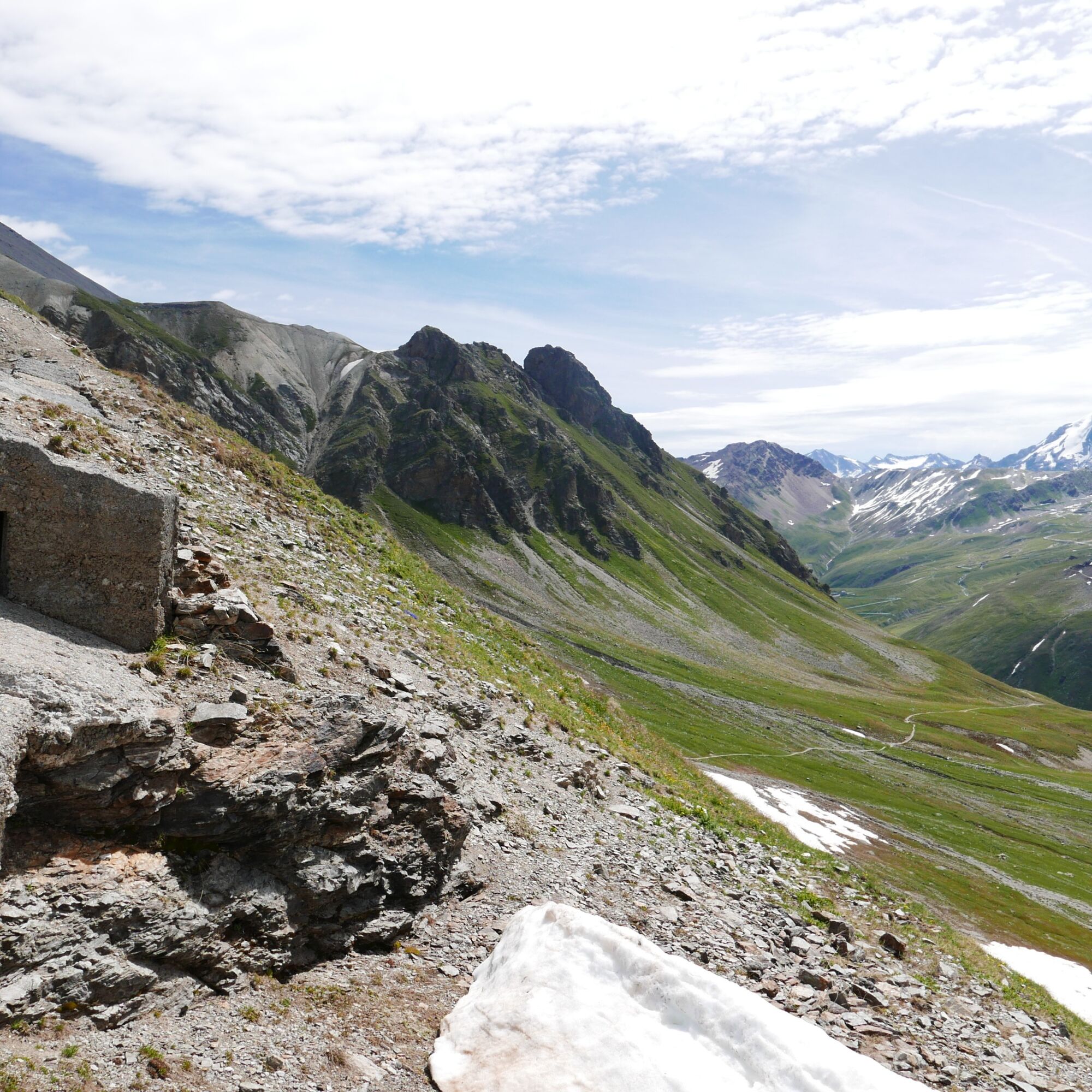
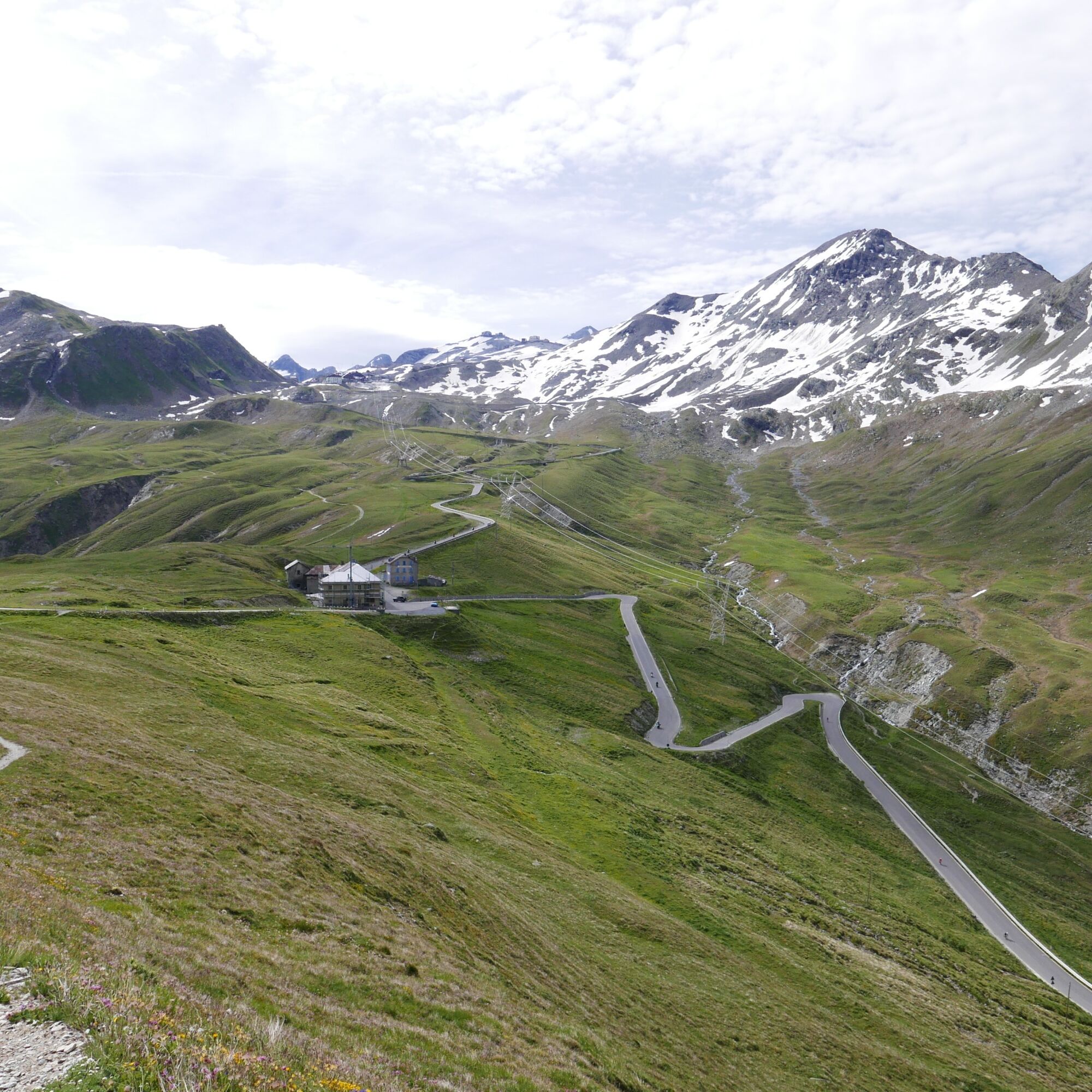
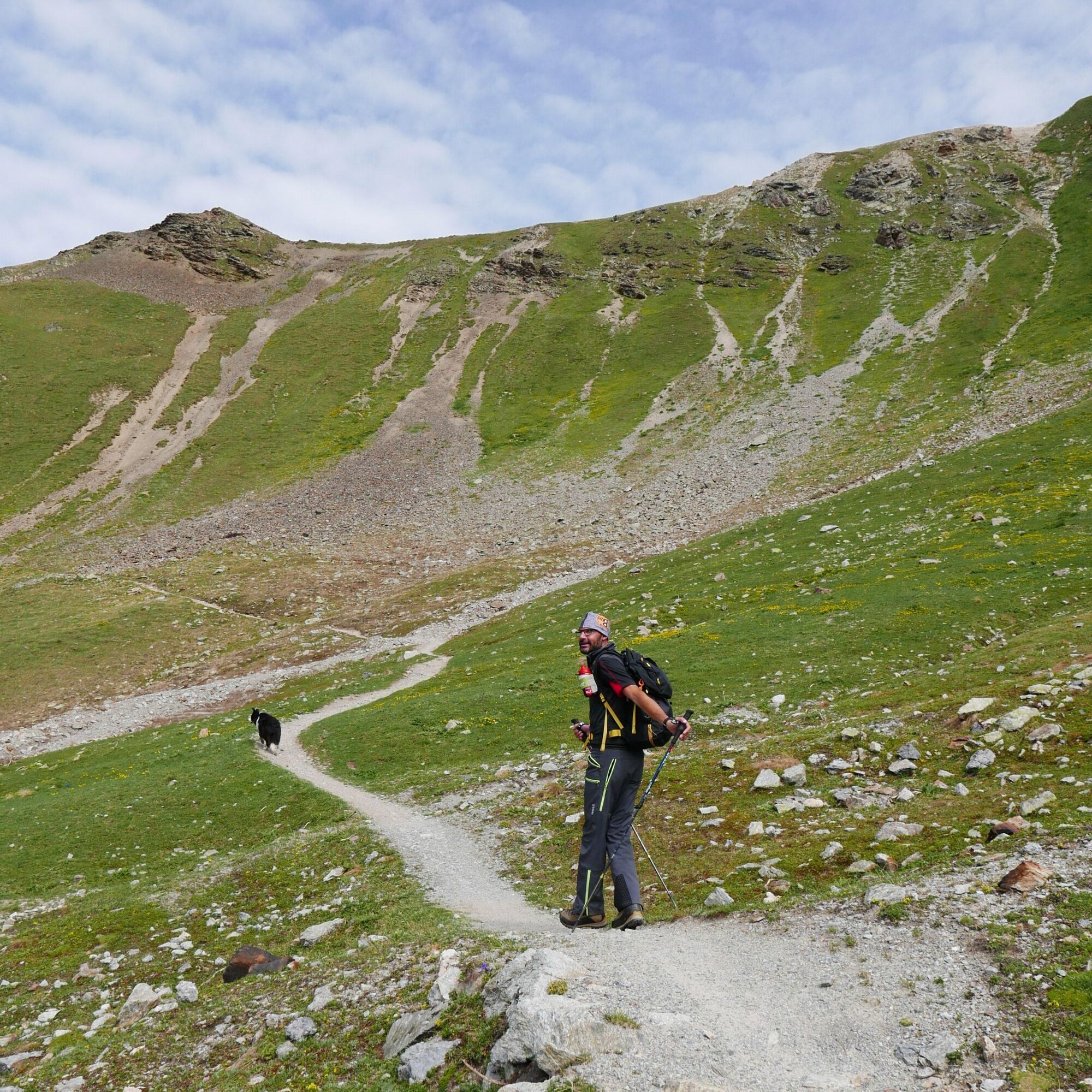

From the IV Cantoniera, follow the trail toward the Foppe della Mogenaccia and continue on to the Bocchetta di Forcola. After visiting the military structures, return to the Foppe della Mogenaccia and follow the historic military mule trails that lead to the III Cantoniera.
Hiking boots, layered clothing, a waterproof jacket, a hat, sunscreen, water, and snacks.
The trail is at high altitude: always check the weather conditions before setting out, and be careful in case of fog or thunderstorms. Always stay on the marked trail.
Maximum bus length: 10 m
The IV Cantoniera can be reached during the summer season by taking the regular buses that connect Bormio to the Stelvio Pass. We recommend checking schedules and operating periods before departure: www.bormio.eu/it/cosa-fare/outdoor/tr...
There is parking available at the turnoff for the Giogo di S. Maria - Pass Umbrail.
This hike is recommended from late June to early October, when there is no snow. To help preserve the environment of the Stelvio National Park, please do not litter and respect the wildlife by keeping your distance.
Don't miss the military fortifications at Bocchetta di Forcola, and be sure to bring binoculars to observe the alpine wildlife along the trail.
Získajte prehľad
Vždy naživo na mieste s viac ako 9 500 webovými kamerami. bergfex Ako používateľ Pro si teraz môžete pozrieť príslušné webové kamery pre mnohé zájazdy v aplikácii zájazdy z. Môžete si tak priamo prezerať aktuálne podmienky.
Obľúbené výlety v okolí
-
3,7
Payerhütte 3020m
Turistika 6,98 km -
5,0
Wanderung/Aufstieg zur Payerhütte
svetloTuristika 15,9 km -
4,3
Sonnenaufgang auf der Rötelspitze im Nationalpark Stilfserjoch
Turistika 2,02 km -
3,4
Sta.Maria, Prà da Vau - Lai da Rims - Alp Sot - Prà da Vau
ťažkéTuristika 14,7 km -
4,3
Ortler – Normalweg
ťažkéVysoké turné 7,30 km -
3,0
Wanderung zum Hinteren Schöneck
svetloTuristika 13,2 km -
Hintergrathütte 2661m
Turistika 8,77 km -
5,0
Ortler über Hintergrat
ťažkéVysoké turné 8,03 km -
3,3
Watervallen wandeling
svetloTuristika 4,95 km -
1,0
Tabarettahütte 2555m zur Payerhütte 3020m
Turistika 3,82 km
Turistika a stopovanie


Nenechajte si ujsť ponuky a inšpiráciu na ďalšiu dovolenku
Vaša e-mailová adresa bol pridaný do poštového zoznamu.





