






Panorama route Steinkogel Sonnstein
The start is at the Ablass farm, which is right between the house and the farm on a meadow path into the forest. The forest roads are already very overgrown and therefore pleasant to walk on. Then there...
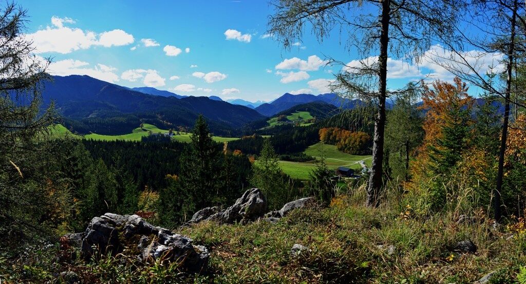
The start is at the Ablass farm, which is right between the house and the farm on a meadow path into the forest. The forest roads are already very overgrown and therefore pleasant to walk on. Then there is a section on a well-marked path and you reach the Steinkogl (910 m above sea level) with a view over the whole of Hochreit: Voralpe Gamsstein, Gesäuseberge, Hochkar...
From the Steinkogl you descend to the Wildsattel and right up to the Panoramasteig which leads to the Sonnstein (1019 m). Good footwear is an advantage here.
From the Sonnstein we now descend the steep forest road past a gravel pit, then it's a leisurely walk back to the Wildsattel where we turn left downhill (in winter the cross-country ski trail is groomed here) in serpentines to the Hochreitstraße and then right again back to the Ablass.


Sturdy mountain or hiking boots, provisions.
Surefootedness and good footwear required on the panorama route. Otherwise forest road.
From Göstling an der Ybbs, 4 km via the Hochreit road (max. 15%) to the Ablass farm snack station, family Zettel
Farm Ablass
Tourism association Ybbstaler Alps
Göstling 46/2
3345 Göstling/Ybbs
+43-5-93049
After the route, also visit the Hochmoor nature reserve.
Získajte prehľad
Vždy naživo na mieste s viac ako 9 500 webovými kamerami. bergfex Ako používateľ Pro si teraz môžete pozrieť príslušné webové kamery pre mnohé zájazdy v aplikácii zájazdy z. Môžete si tak priamo prezerať aktuálne podmienky.
Obľúbené výlety v okolí
-
4,5
Hochkar - Schmalzmauer - Geißhöhe - Ringkogel - Schwarzalmhütte - Brunneckerhütte
strednáTuristika 13,2 km -
4,4
Das 3 Seen-Erlebnis (Lunzer See - Mittersee - Obersee)
strednáTuristika 9,33 km -
4,3
Rund um den smaragdgrünen Lunzer See
svetloTuristika 4,80 km -
4,9
Panoramic summit Maiszinken - alpine experience included
strednáTuristika 12,6 km -
4,9
Kurzeck- Siebenhütten- Turnhöhe- Kitzhütte Göstling an der Ybbs, Österreich
svetloTuristika 12,8 km -
4,6
Lechner Graben - Ybbstaler Hütte
strednáTuristika 14,2 km -
4,9
Lechnergraben-Grünloch-Ybbstalerhütte
svetloTuristika 9,72 km -
4,4
Palfauer Wasserlochklamm
strednáTuristika 1,78 km -
4,1
wanderung auf den alpl
strednáTuristika 8,18 km -
4,6
Dürrenstein über die Herrnalm
strednáTuristika 9,52 km
Turistika a stopovanie


Nenechajte si ujsť ponuky a inšpiráciu na ďalšiu dovolenku
Vaša e-mailová adresa bol pridaný do poštového zoznamu.





