







Schwarzauweg Nr. 19
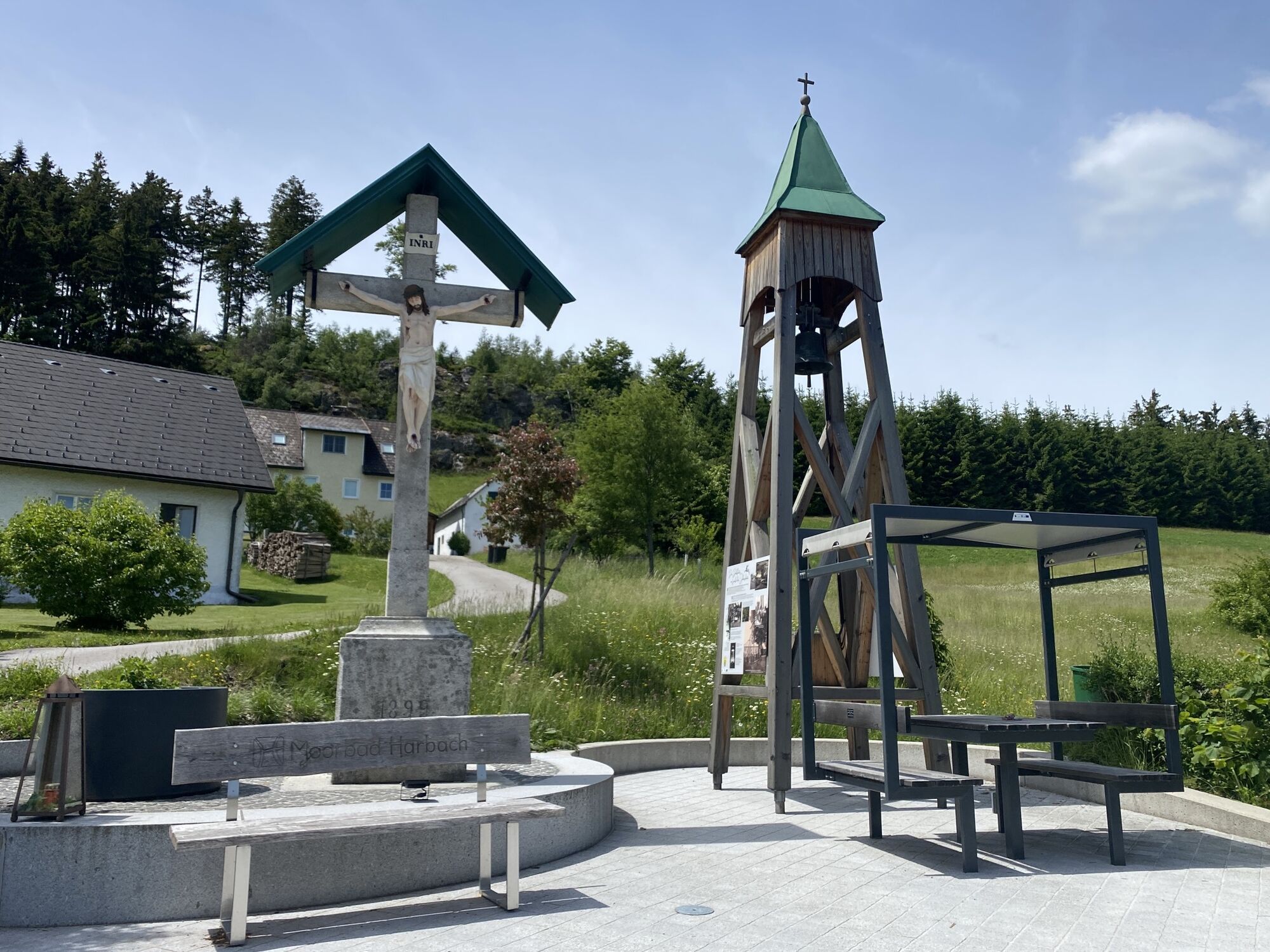
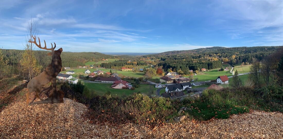
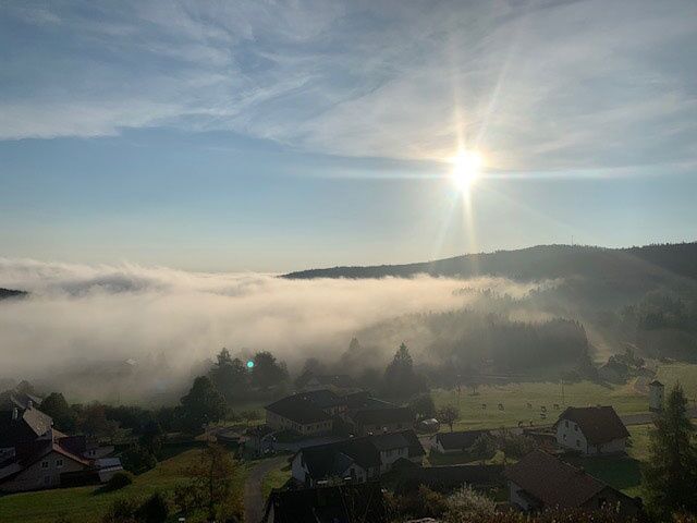

The starting point for your hike is at an elevation of about 750 m above sea level, at the Xundwärts Parcours (Motorikpark®) in Hirschenwies. The trail follows the state road for about 400 meters on paved surfaces, passing the “Glockenstuhl”—a wooden structure with a bell—on the way to the center of Hirschenwies. While the bell used to be rung by hand with a rope, today an automatic mechanism rings it at noon and in the evening. From here, you can already see the imposing Hirschenstein, which is the next destination on the hike. The trail now branches off to the right and leads along a narrow road, over the Schusterberg, into the forest. Here, you leave the trail and turn left onto a hiking path leading to the “Hoch über Hirschenwies” lookout point. Passing blueberry and blackberry bushes, the trail leads up to the 860-meter-high Hirschenstein. Here, you’ll enjoy a magnificent view of the nearby Nebelstein and across the town of Moorbad Harbach, stretching far beyond the district capital of Gmünd. A bench invites you to take a break and linger for a while. The trail continues along a wildlife fence, past the Wetterstein, up to about 950 m. From there, the terrain slopes downward, and the trail leads downhill to the former lumberjack settlement of Schwarzau at 814 m above sea level. In a clearing, you’ll find a small wooden chapel and the “Schwarzauer Hof” forester’s lodge. Here, the trail branches off and, following an avenue of maple trees, leads you almost to the state border. After another fork, the trail climbs again and, passing along forest roads, mushroom-picking spots, and benches, leads back to the Glockenstuhl in Hirschenwies. Just a short stretch along the road, and you’re back at the Xundwärts Parcours (Motorikpark®) Hirschenwies, your starting point. If you’re still up for it, you can train your strength, endurance, and agility at the Motorikpark’s 30 exercise stations. Those who are tired, however, can take a break at Gasthof Nordwald or Gasthof Kristall and treat themselves to some culinary delights.
Route characteristics: 20% asphalt, 40% forest road, 40% forest trail
Moorbad Harbach Tourism Association
3970 Moorbad Harbach, Hirschenwies 32
(T) +43 680 2382939
(E) info@moorbad-harbach.at
(I) www.moorbad-harbach.at
Waldviertel Tourism
3910 Zwettl, Sparkassenplatz 1/2/2
(T) +43 2822 54109
(E) info@waldviertel.at
(I) www.waldviertel.at
Získajte prehľad
Vždy naživo na mieste s viac ako 9 500 webovými kamerami. bergfex Ako používateľ Pro si teraz môžete pozrieť príslušné webové kamery pre mnohé zájazdy v aplikácii zájazdy z. Môžete si tak priamo prezerať aktuálne podmienky.
Obľúbené výlety v okolí
-
4,5
Nebelstein Adventure Hiking Trail
strednáTuristika 11,1 km -
4,5
Mandelstein von Moorbad aus
svetloTuristika 9,47 km -
4,8
Nebelsteinweg
Turistika 6,98 km -
4,1
Naturparkweg Bad Großpertholz
svetloTuristika 7,17 km -
3,6
Zwei-Tausender-Tour Tischberg-Eichelberg
svetloTuristika 12,4 km -
4,9
Mandlstein Heinrichs bei Weitra Erlebnisweg
svetloTuristika 13,1 km -
4,5
Sandl - Rosenhoferteiche Rundweg
svetloTuristika 6,40 km -
4,4
Windhaag bei Freistadt - W1, Österreich
svetloTuristika 11,6 km -
4,4
Nebelstein vom Moorheilbad
strednáTuristika 12,9 km -
4,8
4-Berge Marsch Mandelstein - Nebelstein - Wachberg - Johannesberg
Turistika 30,8 km
Turistika a stopovanie


Nenechajte si ujsť ponuky a inšpiráciu na ďalšiu dovolenku
Vaša e-mailová adresa bol pridaný do poštového zoznamu.





