







B18 Wallfahrerweg zur Toten Frau
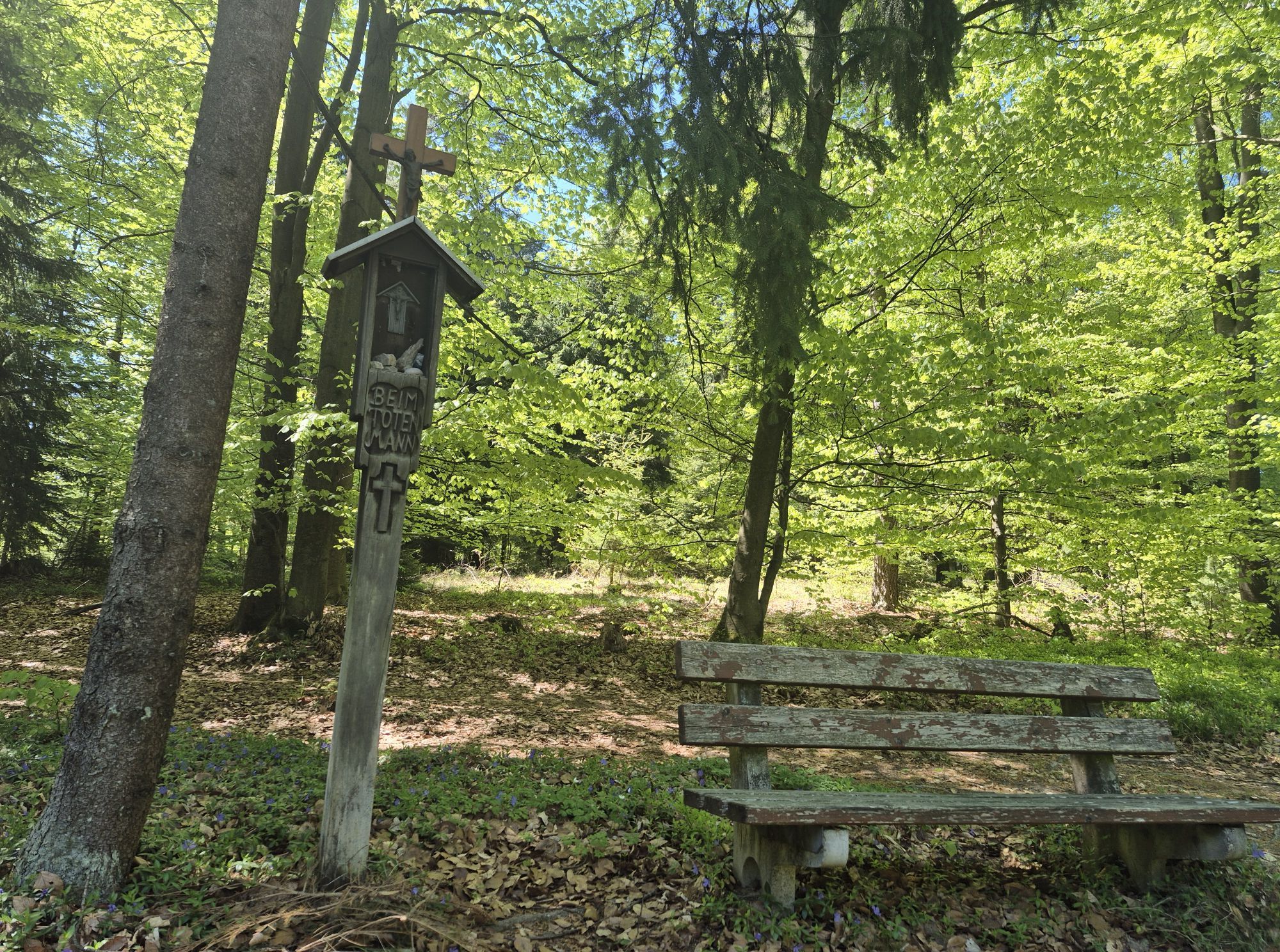
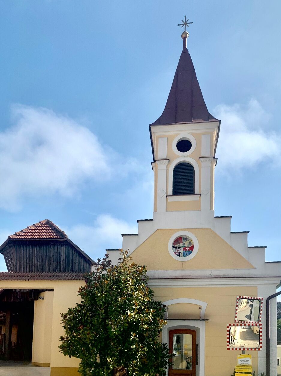

From the starting point at the chapel in Oberbergern, follow the historic Mariazeller Weg 06 trail, which initially winds gently through a peaceful forest landscape. Passing the idyllically situated Burgbründl, where fresh drinking water invites you to take a break, you reach the atmospheric forest chapel “Zur Toten Frau,” a place of reflection in the heart of nature. After a few minutes, you’ll continue on to the striking “Toten Mannes” cross, which stands quietly by the side of the trail and is steeped in ancient lore. About 200 meters past this point, the trail branches off to the right onto a forest path that leads down through the shady Erste Klingelbach Valley. Finally, the trail joins the country road near the brick kiln, from where you can take a leisurely stroll back to the starting point in Oberbergern via the Rudi-Meixner Promenade—a varied loop full of nature, history, and peaceful spots.
Trail markers: red – white – red
then: red – yellow – blue
Oberbergern is easy to reach by car: Coming from Krems or Mautern, first take the B33 (Aggsteiner Straße) to Mautern. There, turn onto the state road toward Bergern im Dunkelsteinerwald and follow the signs via Mauternbach to Oberbergern.
From Krems, bus line 489 goes directly to the starting point at the "Oberbergern b.Krems Ortsmitte" stop.
You can find the schedule here and online at www.vor.at
There are parking options in the town itself that make for a good starting point for hikes.
Person responsible for the content of this tour:
Wachau-Nibelungengau-Krems Valley ("Kremstal" in German):
For more information, contact the Bergern Municipal Office
Website: bergern-dunkelsteinerwald.gv.at
Municipality of Bergern im Dunkelsteinerwald, 3512 Unterbergern, No. 29
Phone: +43 2714 7220 Fax: +43 2714 7220 20
Email: gde@bergern-dunkelsteinerwald.gv.at
Získajte prehľad
Vždy naživo na mieste s viac ako 9 500 webovými kamerami. bergfex Ako používateľ Pro si teraz môžete pozrieť príslušné webové kamery pre mnohé zájazdy v aplikácii zájazdy z. Môžete si tak priamo prezerať aktuálne podmienky.

Obľúbené výlety v okolí
-
4,6
Welterbesteig Wachau 02: Dürnstein-Weißenkirchen
svetlodiaľková pešia trasa 15,9 km -
4,4
Welterbesteig Wachau 03: Weißenkirchen-Spitz
svetlodiaľková pešia trasa 10,4 km -
4,6
Welterbesteig Wachau 01: Krems-Dürnstein
svetlodiaľková pešia trasa 12,3 km -
4,9
Vogelbergsteig -Kanzel- Fesselhütte - Ruine Dürnstein zum Heurigen in Furth
strednáTuristika 7,59 km -
4,7
Rundhöhenwanderweg Weißenkirchen in der Wachau - Schildhütten - Cholerakreuz - Weißenkirchen
svetloTuristika 8,75 km -
4,7
Wachau: Seekopf - Hirschwand
strednáTuristika 10,4 km -
4,6
Krems (Welterbesteig) - Dürnstein - Vogelbergsteig - Kanzel - Fesslhütte - Krems
strednáTuristika 18,0 km -
4,5
Panoramaweg Weissenkirchen
svetloTuristika 5,04 km -
4,5
Maria Langegg - Rote Wand - Hoher Stein - Kastlkreuz
strednáTuristika 11,4 km -
4,4
Wachauer Marillenerlebnisweg, Krems-Angern
svetloTuristika 6,04 km

Turistika a stopovanie


Nenechajte si ujsť ponuky a inšpiráciu na ďalšiu dovolenku
Vaša e-mailová adresa bol pridaný do poštového zoznamu.





