






Plettenberg: AquaMagis Tour with Versetalsperre
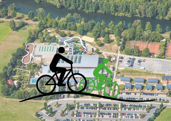
The circular route begins in the immediate vicinity of the AquaMagis Plettenberg adventure pool on the Lenne cycle path. First, it starts with a relaxed warm-up along the Lenne. Just behind the confluence...
The circular route begins in the immediate vicinity of the AquaMagis Plettenberg adventure pool on the Lenne cycle path. First, it starts with a relaxed warm-up along the Lenne. Just behind the confluence of the Else into the Lenne, the path turns right. The routes then run along the Else and pass through the town center of Plettenberg. The first small ascent happens before the village of Köbbinghausen. Then it continues towards the museum station of the Märkische Museum Railway. A short break is recommended here; on running days, you can ride along in one of the lovingly restored carriages with the historic steam locomotive.
Afterwards, following the Hüinghausen airfield, the more challenging part of the route begins, as Herscheid lies at a higher elevation. In Herscheid, there are numerous places to stop as well as a café and an ice cream parlor along the route. Above the Fattorel ice cream café, the route turns left and after crossing the country road by bridge, heads towards the upper course of the Versetalsperre. Here starts the athletic part of the route, gradually but steadily climbing to Ober-Holte. A rest stop is possible at the Vedder inn in Nieder-Holte before descending to the Versetalsperre, along whose shore the route continues.
At the dam of the Versetalsperre, the cycle path turns right and follows the country road uphill until reaching Silberg at the top, where the road is crossed. Then a small road leads left downhill to the foot of the Versetalsperre. At the bottom, the road runs past the Treckinghausen waterworks, which supplies the cities of Lüdenscheid, Werdohl, Herscheid, and parts of Plettenberg and Schalksmühle with drinking water. Afterward, it runs a short distance along the Verse; on the left are the ponds of the Versetal trout farm.
In Oberbrüninghausen, the cycle path turns right and now it gets truly sporty. In quick succession, three hills have to be climbed, but there are also beautiful, relaxing descents. Noteworthy is the hill behind Altenmühle towards Ludemert, which is not long but has an initial steepness of about 18%. The last strength is expended on the hill near Kleinhammer towards Pungelscheid, with gradients partly reaching 16%.
The districts Pungelscheid, Riesei, and Königsburg are passed before crossing the Lenne and arriving in Werdohl at the town hall.
From Werdohl, the cycle path initially follows the road, then jumps and runs through the Kettling industrial area alongside McDonald's along the railway track. After the Bauckloh industrial area, the cycle path joins the federal road, on which about 500 m must be ridden with great care. In the district of Teindeln, the path leaves the road, crosses railway and Lenne, and winds gently through the valley towards Plettenberg.
Now it goes again over and along the Lenne. After the Lenne bridge in Ohle, the last small climb can be tackled. The tour ends at the AquaMagis adventure pool.
The 54 km long route has 790 meters of elevation and is an athletically ambitious round with several hills not to be underestimated. There are numerous opportunities to take a break. The route can be ridden by mountain bikers, well-trained touring cyclists, and e-bikers. About 4 hours of pure riding time should be calculated. Since the route also runs on smaller roads and a stretch of the federal road, it is suitable for larger, very well-trained children if they are confident in traffic. The route is not suitable for road cyclists.


Plettenberg - Herscheid (Versetalsperre) - Werdohl - Plettenberg
Stop plan Plettenberg, Grünestraße: https://www.mvg-online.de/fileadmin/user_upload/user_upload/Dokumente/Karten/Haltestellenumgebungsplaene/Plettenberg_Gruenestrasse_ZOB.pdf
Stop plan Plettenberg, train station: https://www.mvg-online.de/fileadmin/user_upload/user_upload/Dokumente/Karten/Haltestellenumgebungsplaene/Plettenberg_Bahnhof.pdf
Line 75, stop AquaMagis: https://www.mvg-online.de/fileadmin/user_upload/user_upload/Dokumente/Fahrplaene/Linie075.pdf
Line 90, stop AquaMagis: https://www.mvg-online.de/fileadmin/user_upload/user_upload/Dokumente/Fahrplaene/Linie090.pdf
Získajte prehľad
Vždy naživo na mieste s viac ako 9 500 webovými kamerami. bergfex Ako používateľ Pro si teraz môžete pozrieť príslušné webové kamery pre mnohé zájazdy v aplikácii zájazdy z. Môžete si tak priamo prezerať aktuálne podmienky.
Obľúbené výlety v okolí
-
4,0
Rundweg an der Versetahlsperre
strednáTuristika 10,9 km -
5,0
Um die Nordhelle
strednáTuristika 6,81 km -
5,0
Bommecketal - Naturerlebnisweg in Plettenberg
svetloTuristika 4,07 km -
Plettenbergs größtes Schwimmbecken: Die Oestertalsperre
strednáTuristika 7,23 km -
P-Weg - Der Plettenberger Rundwanderweg
ťažkéTuristika 57,6 km -
Herscheid - Plettenberg: Museumseisenbahntour mit Versetalsperre
ťažkéCyklistika 47,7 km -
Wiblingwerde 12
svetloTuristika 10,8 km -
Radroute Biggesee
svetloCyklistika 16,6 km -
Plettenberg: Hestenberg circular route PE2
strednáTuristika 7,61 km -
Lehrpfad & Spazierweg Fürwigge-Talsperre - Staunen & Entdecken
svetloTematická trasa 4,11 km
Turistika a stopovanie


Nenechajte si ujsť ponuky a inšpiráciu na ďalšiu dovolenku
Vaša e-mailová adresa bol pridaný do poštového zoznamu.





