


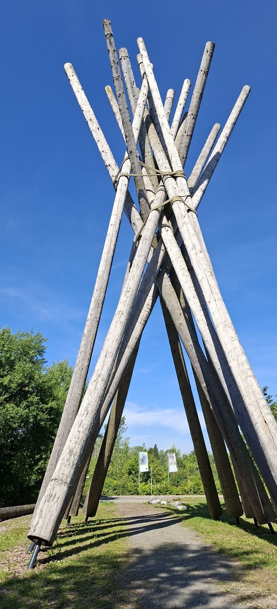
Brilon Pilgrim Route 2


The routes start and end at the Church of St. Michael and cover, on 3.5 kilometers and seven stations (route 1), 7.5 kilometers and nine stations (route 2), and 15 kilometers and eleven stations (route...
The routes start and end at the Church of St. Michael and cover, on 3.5 kilometers and seven stations (route 1), 7.5 kilometers and nine stations (route 2), and 15 kilometers and eleven stations (route 3), different themes each:
Route 1 is dedicated on the station panels to the "Our Father", Route 2 to the "Psalms", and Route 3 is titled "Life Paths". The routes are intended to offer hikers/pilgrims the opportunity, in addition to discovering and experiencing nature (directly on the Rothaarsteig), to reflect on themselves; they provide rest and relaxation for body and soul. The theme panels take up the respective route and landscape impulses. The route offering is complemented by the pilgrim house St. Michael set up directly at the church, a self-catering house (former rectory) for groups of up to twelve people.

From the church (1st station) the path leads downhill and to the left along the road to Hubertushof. From there we follow a small forest path on the left, the forest route ("W"), which leads steeply uphill over stairs after about 100 m. Continuing on the path (2nd station), after about 600 m there is a gravel path to the right, after about 400 m we reach the road leading to Petersborn. We follow the road to the right, then at the intersection after about 150 m, left onto the field path. We follow the path, after about 700 m reaching the 3rd station. The path bends right and ends at an asphalted path, where we turn left to the 4th station (approx. 350 m). Continue to the crossroad, then right. After about 600 m we follow the 2nd path, which turns left and leads below the quarry. At the fork in the road (5th station) continue left. Following the path we reach the 6th station at the transition from forest to meadow. At the end of this path we pass a small parking lot, cross the asphalt road and continue on a small gravel path towards "Hiebammen Hütte". At the beginning of the hut area on the left side there is a bridge with the 7th station. We continue over the bridge and then follow the slightly ascending path towards Petersborn, following the sign "Rothaarsteig" (a white R lying on a red background) to the Kyrill Gate and the landscape window (8th station). From here back to St. Michael Church (9th station).
Sturdy footwear
Rescue points on the hiking trail posts
Brilon-Gudenhagen, Breslauer Straße
Bus stop Gudenhagen Chapel
Church St. Michael
www.tourismus-brilon-olsberg.de
...
Obľúbené výlety v okolí
-
4,0
Langenberg trail (quality route)
ťažkéTuristika 14,6 km -
4,5
Hike to the waterfall
strednáTuristika 15,8 km -
Olsberg summit cross tour (Quality route Germany's hiking network) 4th stage Kneipp hiking trail
ťažkéTuristika 5,47 km -
Schmalahtal circular route (quality route Walkable Germany)
strednáTuristika 8,49 km -
5,0
Circular route Skywalk/Hill - Ettelsberg
svetloTuristika 4,10 km -
4,0
Willingen (W8)
strednáTuristika 12,9 km -
4,7
Bruchhauser Steine B1
strednáTuristika 11,8 km -
4,0
Mining trail in Ramsbeck
strednáTematická trasa 9,94 km -
5,0
Rothaarsteig from Brilon to Willingen
ťažkéTuristika 25,8 km -
Bestwiger Panoramaweg (B)
strednádiaľková pešia trasa 56,2 km
Turistika a stopovanie


Nenechajte si ujsť ponuky a inšpiráciu na ďalšiu dovolenku
Vaša e-mailová adresa bol pridaný do poštového zoznamu.