


Brilon-Wald (BW1)


About 200 m steeply uphill behind the Schützenhalle, past the former evangelical church into the Kerpsiepen. Further, behind the houses on Hammerweg to Lüttmecke. From here, you always follow the stream...
About 200 m steeply uphill behind the Schützenhalle, past the former evangelical church into the Kerpsiepen. Further, behind the houses on Hammerweg to Lüttmecke. From here, you always follow the stream to the so-called “Breakfast spot”, well known to all Brilon Schnadegänger.
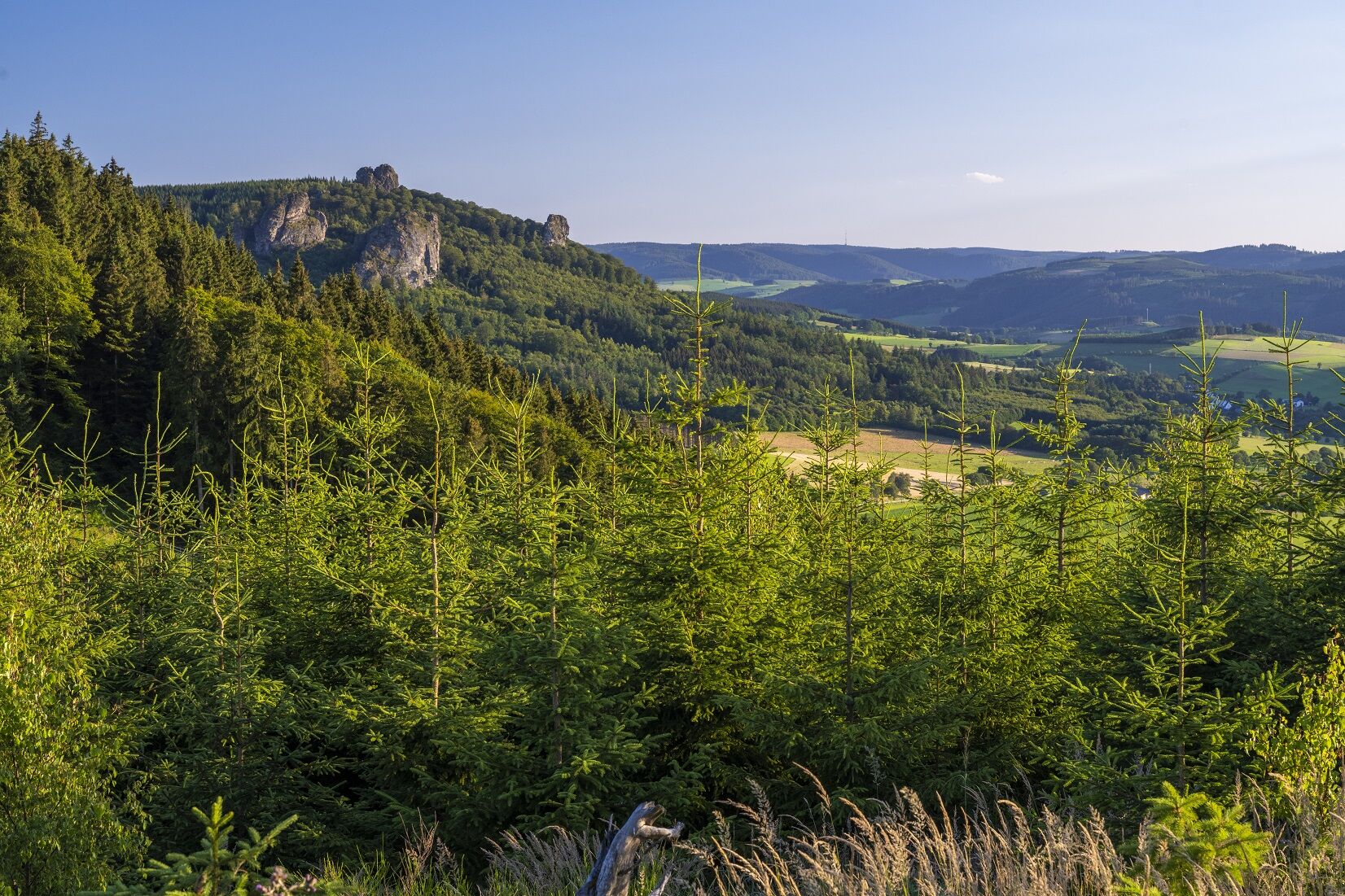
Now you go over the Rothaarsteig and the Brilon ridgeway, i.e. over the Habberg (652 m) and the Ginsterköpfe (661 m and 663 m) with a magnificent view of the “Bruchhauser Steine” to the shelter with a view of NRW’s highest mountain, the Langenberg (843 m). Through beech and coniferous forest, the path then goes straight back to the hiking car park above the Schützenhalle Brilon-Wald and thus to the starting point.

Hiking car park Brilon-Wald - Lüttmecke - Breakfast spot - Ginsterkopf - Hiking car park Brilon-Wald
Áno
Sturdy footwear
Rescue points on the hiking trail posts
Brilon-Wald, at Ginsterkopf/Kirchweg
Hiking car park above the Schützenhalle Brilon-Wald
...
Obľúbené výlety v okolí
-
4,0
Langenberg trail (quality route)
ťažkéTuristika 14,6 km -
4,5
Hike to the waterfall
strednáTuristika 15,8 km -
Olsberg summit cross tour (Quality route Germany's hiking network) 4th stage Kneipp hiking trail
ťažkéTuristika 5,47 km -
Schmalahtal circular route (quality route Walkable Germany)
strednáTuristika 8,49 km -
5,0
Circular route Skywalk/Hill - Ettelsberg
svetloTuristika 4,10 km -
4,0
Willingen (W8)
strednáTuristika 12,9 km -
4,7
Bruchhauser Steine B1
strednáTuristika 11,8 km -
4,0
Mining trail in Ramsbeck
strednáTematická trasa 9,94 km -
5,0
Rothaarsteig from Brilon to Willingen
ťažkéTuristika 25,8 km -
Bestwiger Panoramaweg (B)
strednádiaľková pešia trasa 56,2 km
Turistika a stopovanie


Nenechajte si ujsť ponuky a inšpiráciu na ďalšiu dovolenku
Vaša e-mailová adresa bol pridaný do poštového zoznamu.