


Dans les pas des Hommes de Lascaux Etape 4: Sergeac- Les Eyzies
From Terrasson-Lavilledieu to Limeuil where the Vézère joins the Dordogne, the river runs through one of the most beautiful regions of the Périgord. This fourth stage will take you from Sergeac to Les...
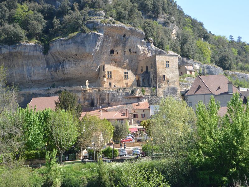
From Terrasson-Lavilledieu to Limeuil where the Vézère joins the Dordogne, the river runs through one of the most beautiful regions of the Périgord. This fourth stage will take you from Sergeac to Les Eyzies. Cross the village of Sergeac to arrive in the valley of Castelmerle, high place of prehistory in the Vézère Valley. You will discover successively the troglodytic site of La Roque St Christophe, the site of La Madeleine and the deposits of Le Moustier, La Micoque and Laugerie.


Áno
Dordogne-Périgord le Département
Obľúbené výlety v okolí
-
5,0
Boucle de la Ferrassie n° 26 / Savignac de Miremont
svetloTuristika 7,46 km -
Boucle La Combe du Loup
svetloTuristika 12,9 km -
5,0
Boucle de la Turançonnaise n°14 / La Chapelle Aubareil
strednáTuristika 9,42 km -
Boucle de la Fontaine des Graves
strednáTuristika 8,99 km -
Boucle Promenade de Lascaux n° 17 / Montignac
strednáTuristika 6,95 km -
Voie verte Les Eyzies/Saint-Chamassy
svetloTuristika 22,1 km -
Boucle de Saint Quentin
strednáTuristika 14,0 km -
5,0
Boucle de la Forêt Sud / de la Marquise n° 4 / Campagne
svetloJazda na koni 3,87 km -
5,0
Boucle des Cabanes n °9 / Sergeac
strednáJazda na koni 7,29 km -
Dans les pas des Hommes de Lascaux Etape 5: Les Eyzies-Le Bugue
svetloTuristika 12,9 km
Turistika a stopovanie


Nenechajte si ujsť ponuky a inšpiráciu na ďalšiu dovolenku
Vaša e-mailová adresa bol pridaný do poštového zoznamu.