
GR6 en Gironde du Sud
stredná
Získajte túto prehliadku v mobilnom telefóne
GR6 en Gironde du Sud
stredná
Turistika
354,30
km
Naskenujte kód QR a spustite navigáciu v aplikácii bergfex


Turistika a stopovanie





GR6 en Gironde du Sud
stredná
Vzdialenosť
354,3
km
Trvanie
86:14
h
Ascent
1 286
hm
Hladina mora
-
m
Stiahnutie skladby
GR6 en Gironde du Sud
stredná
Turistika
354,30
km
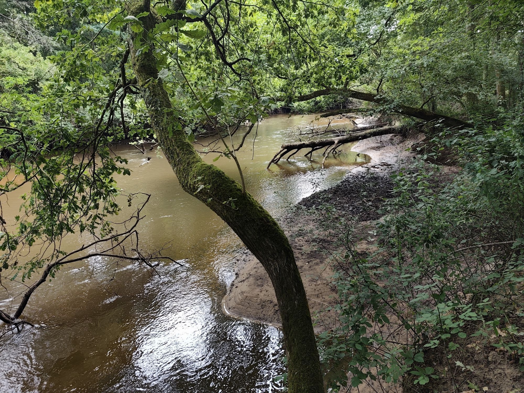
This great southern itinerary passes through the southern Gironde.From the banks of the Canal de Garonne to Castets-et-Castillon, it will also take you to Langon and Sauternes, on the Bordeaux Wine Route...
Opis
This great southern itinerary passes through the southern Gironde. From the banks of the Canal de Garonne to Castets-et-Castillon, it will also take you to Langon and Sauternes, on the Bordeaux Wine Route in Graves and Sauternes. Next, a change of scenery, as the Ciron valley unfolds to reveal Villandraut and its famous fortress, a legacy of Pope Clement V. You now enter the Landes de Gascogne Regional Nature Park and discover the village of Saint-Symphorien and the Gérard Lagors estate in Hostens.
Points to watch : - Discontinuity Commune de Noaillan, site d'Antonion: municipal order following the collapse of a footbridge - Discontinuity Villandraut municipality, Ciron banks: damaged banks - Impossible to tour Lac du Bousquet from the north at Hostens: follow alternative route via the cycle path from the Écuries du lac or via the center of town
Points to watch : - Discontinuity Commune de Noaillan, site d'Antonion: municipal order following the collapse of a footbridge - Discontinuity Villandraut municipality, Ciron banks: damaged banks - Impossible to tour Lac du Bousquet from the north at Hostens: follow alternative route via the cycle path from the Écuries du lac or via the center of town
Autor
Prehliadku GR6 en Gironde du Sud zabezpečuje outdooractive.com.

Informácie o trase
Vhodné pre invalidné vozíky
Áno
Ďalšie informácie a tipy
Ďalšie informácie
La Gironde du Sud https://www.lagirondedusud.com/
Tipy
White and red (GR®)
cdt64.media.tourinsoft.eu/upload/Broc...
Zatiaľ žiadne recenzie
Obľúbené výlety v okolí
-
Boucle vélo: Entre vignes et Dordogne
svetloCyklistika 30,4 km -
[temporairement fermé] Les Pistes de Robin : La Réole
svetloTuristika 1,67 km -
Les Pistes de Robin : Monségur
Turistika 1,31 km -
Boucle de l'Escouach
strednáTuristika 18,6 km -
Boucle vélo n°02 Sauveterre-de-Guyenne - Castelmoron d'Albret
strednáCyklistika 18,6 km -
Boucle vélo n°04 Loubens
svetloCyklistika 16,6 km -
Tour de Gironde à vélo : étape 3 - Sauveterre-de-Guyenne / La Réole
strednáCyklistika 19,0 km -
Boucle vélo n°20 Romagne
svetloCyklistika 17,8 km -
Boucle locale des Châteaux
svetloTuristika 5,64 km -
Boucle du Moulin de Piis
Turistika 2,56 km

Turistika a stopovanie

Viac ako 550.000 návrhov výletov, podrobné mapy a intuitívny plánovač trás robia z aplikácie povinnú výbavu pre všetkých nadšencov prírody.

Nenechajte si ujsť ponuky a inšpiráciu na ďalšiu dovolenku
Prihlásiť sa k odberu noviniek
Chyba
Vyskytla sa chyba. Prosím, skúste to znova.
Ďakujeme za vašu registráciu
Vaša e-mailová adresa bol pridaný do poštového zoznamu.
Zájazdy po celej Európe
Rakúsko
Švajčiarsko
Nemecko
Taliansko
Slovinsko
Francúzsko
Holandsko
Belgicko
Poľsko
Lichtenštajnsko
Česko
Slovensko
španielsko
Hrvaška
Bosna a Hercegovina
Luxembursko
Andorra
Portugalsko
Island
Spojené kráľovstvo
Írsko
Grécko
Albánsko
Severné Macedónsko
Malta
Nórsko
Čierna Hora
Moldavsko
Kosovo
Maďarsko
San Maríno
Rumunsko
Estónsko
Lotyšsko
Bielorusko
Cyprus
Litva
Srbsko
Bulharsko
Monako
Dánsko
Švédsko
Fínsko





