


The Ariège MTB Crossing - Stage 06: Mirepoix to Saint-Amadou
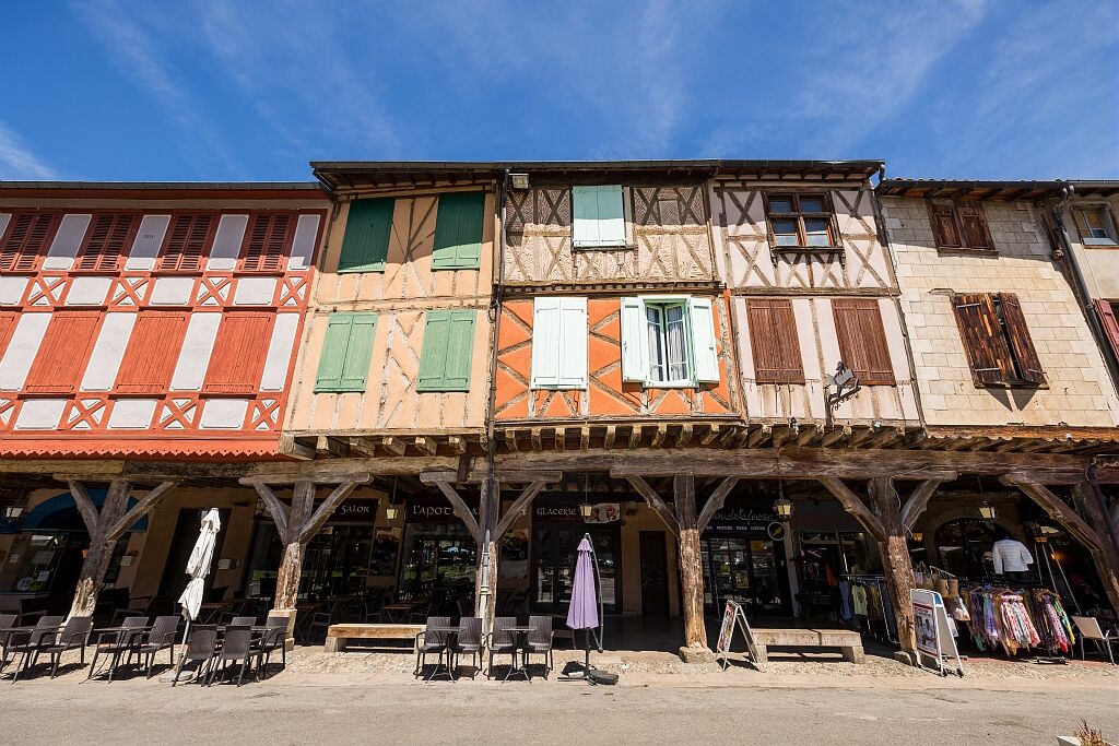
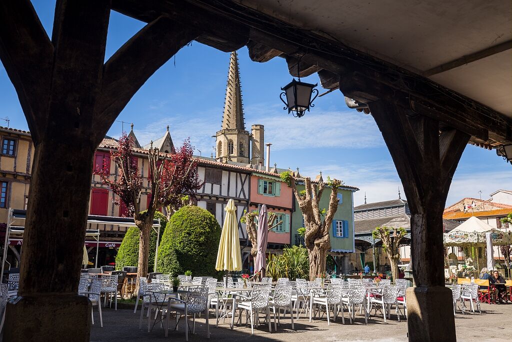
Mirepoix
The town was built in the 11th century, on the right bank of the Hers, at the foot of the Terride castle (now private, it is a former feudal castle, besieged by Simon de Montfort in 1209, where...
Mirepoix
The town was built in the 11th century, on the right bank of the Hers, at the foot of the Terride castle (now private, it is a former feudal castle, besieged by Simon de Montfort in 1209, where the great gathering of Cathars took place in 1206). In 1289, the town was destroyed by flooding caused by the rupture of the natural dam of Puivert. Immediately, Guy de Lévis, who became lord of Mirepoix after the crusade, rebuilt the town on the other bank, following a regular plan, typical of "bastides" or "new towns", with a central square and streets intersecting at right angles. Mirepoix suffered during the Hundred Years' War, then became an important cloth-making center in the 15th century. Today, the "heritage and traditions" museum is housed in the episcopal palace.
Teilhet
Excavations carried out on the Tabariane and Palosse mounds, northeast of the village, attest to the antiquity of human life in Teilhet but above all to its belonging to the kingdom of the Visigoths. Teilhet depended on the Abbey of Camon, a priory of the Abbey of Lagrasse (Aude).
Vals
The site bears witness to a very ancient, very dense, and uninterrupted human occupation (from prehistory to modern times); excavations carried out on the Rahus plateau have made it possible to observe these different phases of habitation. The site of Vals presents itself as faults or natural shelters that have been developed and complemented by architectural elements. Thus the village was established.
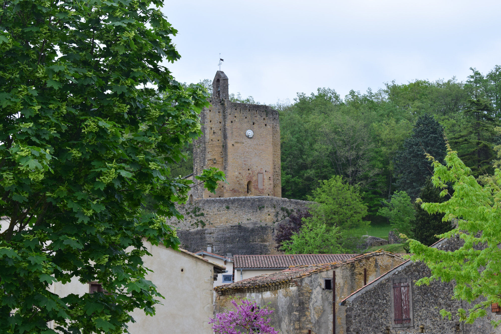
Rock-cut church Sainte-Marie-de-Vals
Located on the heights of the small village of Vals, the sanctuary carved into the rock is the most curious and original church in the area. The tower seems to invite the pilgrim or tourist to stop. Following the staircase after the cave, you can admire the different styles (Carolingian and Roman), as well as the Romanesque paintings that over time have made this singular place famous. This church is made up of 2 superimposed naves. It was Abbot Durand who revealed the site of Vals by carrying out excavations around the church and in the rock shelters (source fault and cornillons shelter). Interesting frescoes (late 11th century), discovered in 1952, depict 3 phases of Christ: his childhood, the Apostolic period, and the Parousia. On this site, a cross called "the calvary" was erected on April 18, 1851. Not to be missed, the panorama of the Pyrenees and the foothills from the terrace.
Saint James of Compostela
On the traces of the pilgrims to Compostela... Between the Mediterranean and Atlantic, there is an intimate and characterful path: the Pyrenean foothills path (GR 78). It passes through the Corbières, Plantaurel, Couserans, Comminges, Bigorre and joins the Arles route at Oloron-Sainte-Marie. From Mirepoix, you take the Ariège section which runs along the axial chain of the Central Pyrenees. This path crosses the high places of Ariège history, giving an overview of the variety of its landscapes and the richness of its traditions. You will take this ancient route of communication which over the centuries has welcomed peddlers and merchants, crusaders and warriors, shepherds and resisters, pilgrims.

Áno
Emergency number: 112
To go further on the destination, visit our site
Obľúbené výlety v okolí
-
Cyclosport route 2 - The textile country
strednáCestný bicykel 86,5 km -
Cycling route - The church of Vals
svetloCyklistika 49,5 km -
Circuit cyclotourisme - Dans les plaines autour de Foix
strednáCestný bicykel 58,6 km -
The Ariège MTB Crossing - Stage 05: Chalabre to Mirepoix
svetloMountainbike 21,1 km -
Cyclotourism route - At the heart of the Douctouyre
strednáCestný bicykel 38,5 km -
The Tabariane Loop
svetloTuristika 2,60 km -
Ariège MTB Crossing - Stage 07: Saint-Amadou to Pamiers
strednáMountainbike 14 km -
Cyclotourism route - around Pic de Montégut
strednáCestný bicykel 28,2 km -
Circuit cyclotourisme - Entre lac et cascades
strednáCestný bicykel 79,2 km -
5,0
Belloc - Église de Queille
svetloTuristika 6,66 km

Turistika a stopovanie


Nenechajte si ujsť ponuky a inšpiráciu na ďalšiu dovolenku
Vaša e-mailová adresa bol pridaný do poštového zoznamu.