Navigácia na stránke
Získajte túto prehliadku v mobilnom telefóne
Mapa
Lourdes Col d'Aspin
ťažké
Cestný bicykel
98,35 km
Naskenujte kód QR a spustite navigáciu v aplikácii bergfex
QR Code
Turistika a stopovanie

Lourdes Col d'Aspin

Vzdialenosť
98,4 km
Trvanie
05:40 h
Ascent
1 470 hm
Hladina mora
384 - 1 487 m

Úroveň náročnosti: 5

Stiahnutie skladby
Mapa
Lourdes Col d'Aspin
ťažké
Cestný bicykel
98,35 km

Fotografie našich používateľov

The route from Lourdes to the Col d'Aspin offers you a varied and captivating cycling experience. Starting with a small secret road at the col de Saoucède, you will then descend towards Bagnères-de-Bigorre...

Opis

The route from Lourdes to the Col d'Aspin offers you a varied and captivating cycling experience. Starting with a small secret road at the col de Saoucède, you will then descend towards Bagnères-de-Bigorre before starting the classic ascent via Campan.

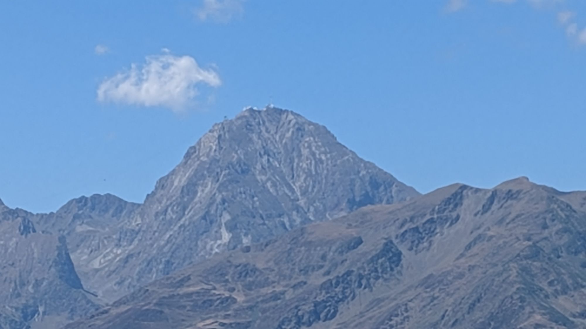
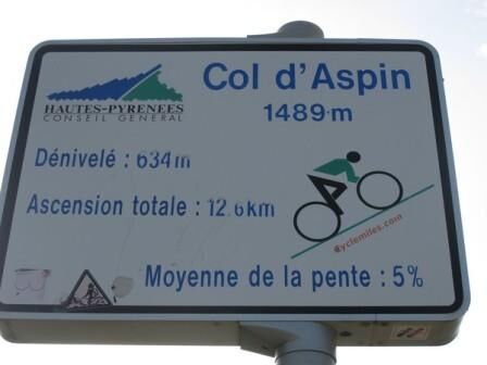
During this climb, you will be rewarded with a magnificent view of Lac de Payolle, adding a touch of splendor to the effort. The Col d'Aspin, located at 1489 m altitude, near Pic du Midi and Col du Tourmalet, is classified as a 1st category pass.

Its prestige is enhanced by the regular passages of the Grand Boucle, including in 2023 during the 6th stage of the Tour de France.

Trasa
Lourdes
(402 m)
Mesto
0,0 km
Église Saint-Caprais
(411 m)
Miesto uctievania
5,2 km
La Serre
(724 m)
Zúčtovanie
16,8 km
Église Saint-Vincent-de-Paul
(953 m)
Miesto uctievania
42,6 km
Chapelle Saint-Joseph
(1 104 m)
Miesto uctievania
46,8 km
Église Saint-Jean-Baptiste
(657 m)
Miesto uctievania
69,8 km
Église Saint-Vincent
(550 m)
Miesto uctievania
76,5 km
Trasa
Mapa
Lourdes Col d'Aspin
ťažké
Cestný bicykel
98,35 km
Lourdes
(402 m)
Mesto
0,0 km
Lézignan
(406 m)
Dedina
3,6 km
Arcizac-ez-Angles
(408 m)
Dedina
5,0 km
Église Saint-Caprais
(411 m)
Miesto uctievania
5,2 km
Les Angles
(423 m)
Dedina
6,3 km
Lasmarriguès
(559 m)
Koridor/terén
8,9 km
Esclate-Caouat
(587 m)
Koridor/terén
10,5 km
Arrodets-ez-Angles
(739 m)
Dedina
13,7 km
Coume de Lahaille
(726 m)
Koridor/terén
14,8 km
La Serre
(724 m)
Zúčtovanie
16,8 km
Cartau
(679 m)
Zúčtovanie
17,5 km
Neuilh
(694 m)
Dedina
17,6 km
Luscarda
(607 m)
Zúčtovanie
19,3 km
Pouzac
(506 m)
Dedina
24,4 km
Bagnères-de-Bigorre
(546 m)
Dedina
27,3 km
Asté
(610 m)
Dedina
30,5 km
Campan
(655 m)
Dedina
33,2 km
Saint Roch
(698 m)
Zúčtovanie
34,6 km
Chapelle Saint-Roch
(699 m)
Miesto uctievania
35,3 km
Galade
(724 m)
Zúčtovanie
35,7 km
Rimoula
(754 m)
Zúčtovanie
37,2 km
La Séoube
(952 m)
Zúčtovanie
42,6 km
Église Saint-Vincent-de-Paul
(953 m)
Miesto uctievania
42,6 km
la bergerie
(962 m)
Reštaurácia
42,7 km
Payolle
(1 093 m)
Zúčtovanie
46,6 km
Espiadet
(1 103 m)
Zúčtovanie
46,7 km
Chapelle Saint-Joseph
(1 104 m)
Miesto uctievania
46,8 km
Chapelle Saint-Joseph
(1 104 m)
Miesto uctievania
56,8 km
Espiadet
(1 103 m)
Zúčtovanie
56,8 km
Payolle
(1 093 m)
Zúčtovanie
57,1 km
la bergerie
(962 m)
Reštaurácia
60,7 km
Église Saint-Vincent-de-Paul
(953 m)
Miesto uctievania
60,8 km
La Séoube
(952 m)
Zúčtovanie
60,8 km
Rimoula
(754 m)
Zúčtovanie
66,2 km
Galade
(724 m)
Zúčtovanie
67,3 km
Saint Roch
(698 m)
Zúčtovanie
68,3 km
Chapelle Saint-Roch
(699 m)
Miesto uctievania
68,4 km
Campan
(655 m)
Dedina
69,8 km
Église Saint-Jean-Baptiste
(657 m)
Miesto uctievania
69,8 km
Asté
(610 m)
Dedina
73,2 km
Bagnères-de-Bigorre
(546 m)
Dedina
76,4 km
Église Saint-Vincent
(550 m)
Miesto uctievania
76,5 km
Pouzac
(506 m)
Dedina
78,6 km
Trébons
(474 m)
Dedina
79,8 km
Riouhour
(461 m)
Koridor/terén
83,9 km
Passade
(483 m)
Koridor/terén
84,4 km
Loucrup
(527 m)
Dedina
86,7 km
Siaoubère
(514 m)
Koridor/terén
87,3 km
Lacoste
(484 m)
Koridor/terén
87,4 km
Arrioume
(392 m)
Koridor/terén
88,8 km
Escoubès-Pouts
(388 m)
Dedina
90,7 km
Arcizac-ez-Angles
(408 m)
Dedina
93,0 km
Lézignan
(406 m)
Dedina
93,9 km
Lourdes
(402 m)
Mesto
98,0 km
Informácie o prehliadke

Round-trip Lourdes Aspin route. Challenge a legendary pass directly from Lourdes.

Technológia
5 / 6
Stav
5 / 6
Krajina
6 / 6
Skúsenosti
5 / 6
Najlepšie ročné obdobie
Jan
Feb
Mar
Apr
Máj
Jún
Júl
Aug
Sep
Okt
Nov
Dec
Autor
Prehliadku Lourdes Col d'Aspin zabezpečuje outdooractive.com.
Logo
Zdieľať prehliadku
Mapa
Lourdes Col d'Aspin
ťažké
Cestný bicykel
98,35 km
Chyba
Vyskytla sa chyba. Prosím, skúste to znova.
Informácie o trase
Geologické zaujímavosti

Áno

Prehliadka vrcholu

Áno

Jednosmerná prehliadka

Áno

Zariadenie

Before setting off:  

Ensure the bike is in perfect mechanical condition, including the tires and brakes Adjust the bike properly to your body shape Wearing a helmet is highly recommended Bring a repair kit Remember that the traffic rules apply to cyclists at all times Never ride more than two abreast and move into a single file when traffic conditions require it Respect other road users as you would want them to respect you Choose a route adapted to your physical capabilities Inform those around you of your itinerary Check the weather conditions A first aid kit is not essential but can be very useful Inform yourself and keep emergency numbers handy Respect the environment by not throwing food packaging on the roadside If you have to return at nightfall, make sure you can see and be seen
Bezpečnostné pokyny

In case of emergency, call 112

Informácie o príchode
Príchod

Consider carpooling

Verejná doprava
Parkovanie

Parking close to the starting point

Ďalšie informácie a tipy
Úroveň náročnosti

5

Ďalšie informácie

To learn more about our destination, visit our website

Tipy

This route combines the exploration of picturesque roads, the demanding ascent of the Col d'Aspin, and the opportunity to follow the tracks of professional cyclists on legendary terrain.

Turistika a stopovanie

Turistika a stopovanie

Turistika a stopovanie
Viac ako 550.000 návrhov výletov, podrobné mapy a intuitívny plánovač trás robia z aplikácie povinnú výbavu pre všetkých nadšencov prírody.
bergfex