L'Ariégeoise xxl - circuit n°6
ťažké
Cestný bicykel
Navigácia na stránke
Získajte túto prehliadku v mobilnom telefóne
Mapa
L'Ariégeoise xxl - circuit n°6
ťažké
Cestný bicykel
176,10 km
Naskenujte kód QR a spustite navigáciu v aplikácii bergfex
QR Code
Turistika a stopovanie

L'Ariégeoise xxl - circuit n°6

Vzdialenosť
176,10 km
Trvanie
10:00 h
Ascent
4 826 hm
Hladina mora
457 - 1 997 m
Stiahnutie skladby
Mapa
L'Ariégeoise xxl - circuit n°6
ťažké
Cestný bicykel
176,10 km
Trasa
Trasa
Mapa
L'Ariégeoise xxl - circuit n°6
ťažké
Cestný bicykel
176,10 km
Tarascon-sur-Ariège
(497 m)
Dedina
0,0 km
Bompas
(464 m)
Dedina
2,4 km
Mercus
(478 m)
Zúčtovanie
3,4 km
Mercus-Garrabet
(493 m)
Dedina
4,0 km
Le Cathare
(484 m)
Reštaurácia
4,1 km
Garrabet
(500 m)
Zúčtovanie
5,6 km
Saint-Antoine
(460 m)
Zúčtovanie
9,0 km
Saint-Paul-de-Jarrat
(495 m)
Dedina
10,8 km
Grand-Chemin
(489 m)
Zúčtovanie
13,0 km
Celles
(493 m)
Dedina
13,0 km
Les Clots
(492 m)
Zúčtovanie
13,2 km
Catufet
(506 m)
Koridor/terén
15,4 km
Palau
(533 m)
Koridor/terén
18,1 km
Église Saint-Jean-Baptiste
(637 m)
Miesto uctievania
20,3 km
Nalzen
(636 m)
Dedina
20,4 km
Villeneuve-d'Olmes
(596 m)
Dedina
25,9 km
Ô petit resto
(631 m)
Reštaurácia
26,9 km
La Cousinette
(681 m)
Susedstvo
27,1 km
Montferrier
(691 m)
Dedina
27,4 km
Église Saint-Barthélémy
(681 m)
Miesto uctievania
28,4 km
La Fount de Sicre
(693 m)
Zdroj
28,6 km
Regunis
(898 m)
Zúčtovanie
30,6 km
Col du Tremblement
(1 031 m)
Horské sedlo
33,0 km
Montségur
(910 m)
Dedina
34,3 km
Moulin
(865 m)
Koridor/terén
35,3 km
Le Pigeonnier
(553 m)
Susedstvo
41,9 km
Claouso
(551 m)
Susedstvo
42,1 km
Le Cristol
(550 m)
Susedstvo
42,2 km
Barrineuf
(549 m)
Dedina
42,2 km
Camaüt
(544 m)
Susedstvo
42,5 km
Le Martinet
(544 m)
Susedstvo
42,8 km
Église Saint-Michel
(540 m)
Miesto uctievania
43,0 km
La Hille
(537 m)
Susedstvo
43,0 km
Fougax
(537 m)
Dedina
43,1 km
Delalaygue
(532 m)
Zúčtovanie
43,7 km
Fontaine intermittente de Fontestorbes
(518 m)
Zdroj
45,7 km
Le Casteillat
(502 m)
Susedstvo
46,9 km
Bélesta
(494 m)
Dedina
46,9 km
Restaurant Auberge de la Scierie
(914 m)
Reštaurácia
61,3 km
Les Prats de Dejoux
(897 m)
Zúčtovanie
62,2 km
Espezel
(898 m)
Dedina
62,7 km
La Devèse
(905 m)
Zúčtovanie
63,9 km
Mazuby
(939 m)
Dedina
68,2 km
Rodome
(915 m)
Dedina
71,2 km
Aunat
(940 m)
Dedina
73,0 km
Bessède-de-Sault
(930 m)
Dedina
76,5 km
Gesse
(545 m)
Zúčtovanie
82,2 km
Grotte du TM71
(722 m)
Vchod do jaskyne
89,0 km
Usson-les-Bains
(777 m)
Dedina
90,8 km
Usson
(868 m)
Zúčtovanie
91,7 km
Rouze
(982 m)
Dedina
92,8 km
Mijanès
(1 130 m)
Dedina
95,0 km
Port de Pailleres
(1 928 m)
Zúčtovanie
106,9 km
Lavail
(1 115 m)
Zúčtovanie
117,3 km
Restaurant Bar Gîte d'étape
(1 089 m)
Reštaurácia
117,8 km
Goulours
(1 084 m)
Zúčtovanie
118,1 km
Ascou
(1 011 m)
Dedina
120,6 km
Église Saint-Simon et Saint-Jude
(1 002 m)
Miesto uctievania
120,6 km
Sorgeat
(1 056 m)
Dedina
122,1 km
Ignaux
(1 006 m)
Dedina
123,0 km
Col du Chioula
(1 449 m)
Horský priechod
127,8 km
Fontaine de Biron
(1 329 m)
Zdroj
130,8 km
Chapelle Saint-Roch
(867 m)
Miesto uctievania
140,4 km
Caussou
(853 m)
Dedina
140,6 km
Église Saint-Jean Baptiste
(863 m)
Miesto uctievania
140,8 km
Bestiac
(853 m)
Dedina
142,1 km
Vernaux
(752 m)
Dedina
144,8 km
Lordat
(885 m)
Dedina
145,2 km
Église Saint-Julien
(885 m)
Miesto uctievania
146,6 km
Axiat
(886 m)
Dedina
147,0 km
Appy
(955 m)
Dedina
149,4 km
Caychax
(906 m)
Dedina
150,5 km
Senconac
(933 m)
Dedina
151,9 km
Chapelle de Sourdeign
(849 m)
Miesto uctievania
155,1 km
Verdun
(568 m)
Dedina
158,5 km
Pech
(580 m)
Dedina
159,6 km
Les Cabannes
(537 m)
Dedina
159,8 km
Château-Verdun
(544 m)
Dedina
161,2 km
Opis

An ULTRA itinerary! 5 famous Tour de France passes are on the menu: Montségur, the cross of the dead, the "roof of the Ariège passes": Pailhères at 2m, the Chioula pass, and finally the emblematic Beille plateau at 001m .

Technológia
n.a.
Stav
6 / 6
Krajina
n.a.
Skúsenosti
n.a.
Zdieľať prehliadku
Mapa
L'Ariégeoise xxl - circuit n°6
ťažké
Cestný bicykel
176,10 km
Chyba
Vyskytla sa chyba. Prosím, skúste to znova.
Informácie o trase
Trasa

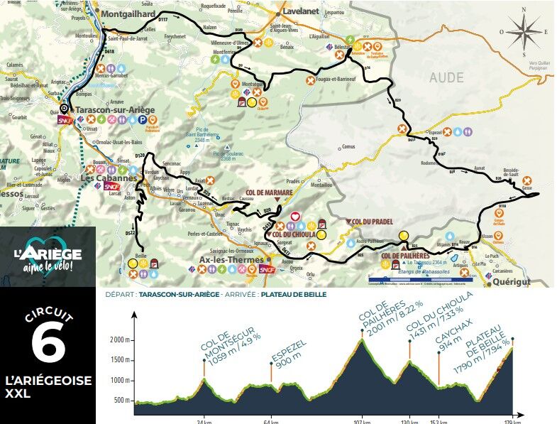
1 - FROM TARASCON-SUR-ARIÈGE TO THE MONTSÉGUR PASS
Leaving from the Tarascon-sur-Ariège Tourist Office, catch up with Avenue Victor Pilhès D618. Pass Mercus Garrabet, arrive at the Saint Antoine roundabout, la charmille, first right towards D117 Lavelanet, pass Saint Paul de Jarrat, Celles, Nalzen. At the veterinary clinic turn right D509 direction Montségur. Pass Villeneuve d'Olmes, direction Montferrier D9. Climb to the Col de Montségur, descend to the village.
2 - FROM MONTSÉGUR TO ESPEZEL
Continue to Bélesta via Fougax and Barrineuf D9. After the intermittent Fontestorbe fountain and the lemonade, pay attention to the junction, turn right on the D16 towards Belcaire / Querigut Mijanes. Climb through the forest, pass the cross of the dead. Arrive in the Aude department D29. Pass the Bénagues. Continue to the sawmill inn, turn left on the D613 towards Espezel. Drive, turn right D29 Espezel / Belfort. Enter the village of Espezel.
3 - FROM ESPEZEL TO ROUZE
Cross Espezel at the stop sign in the village, go straight ahead, still on the D29. At the give way go straight on D29 towards Mazuby. Go down into the forest to reach a junction, turn right D107 towards Aunat. Continue on the 107 to turn left, go up on the D20 to Rodome, then Aunat. Stay on the D20 to Bessède de Sault. At the fork, turn right towards Gesse. Go down in the bends, at the fork, turn right towards Quérigut / Mijanes D118. Stay on the D118, pass the old Usson baths. Turn right on D16 towards Rouze. Begin the ascent to reach Rouze.
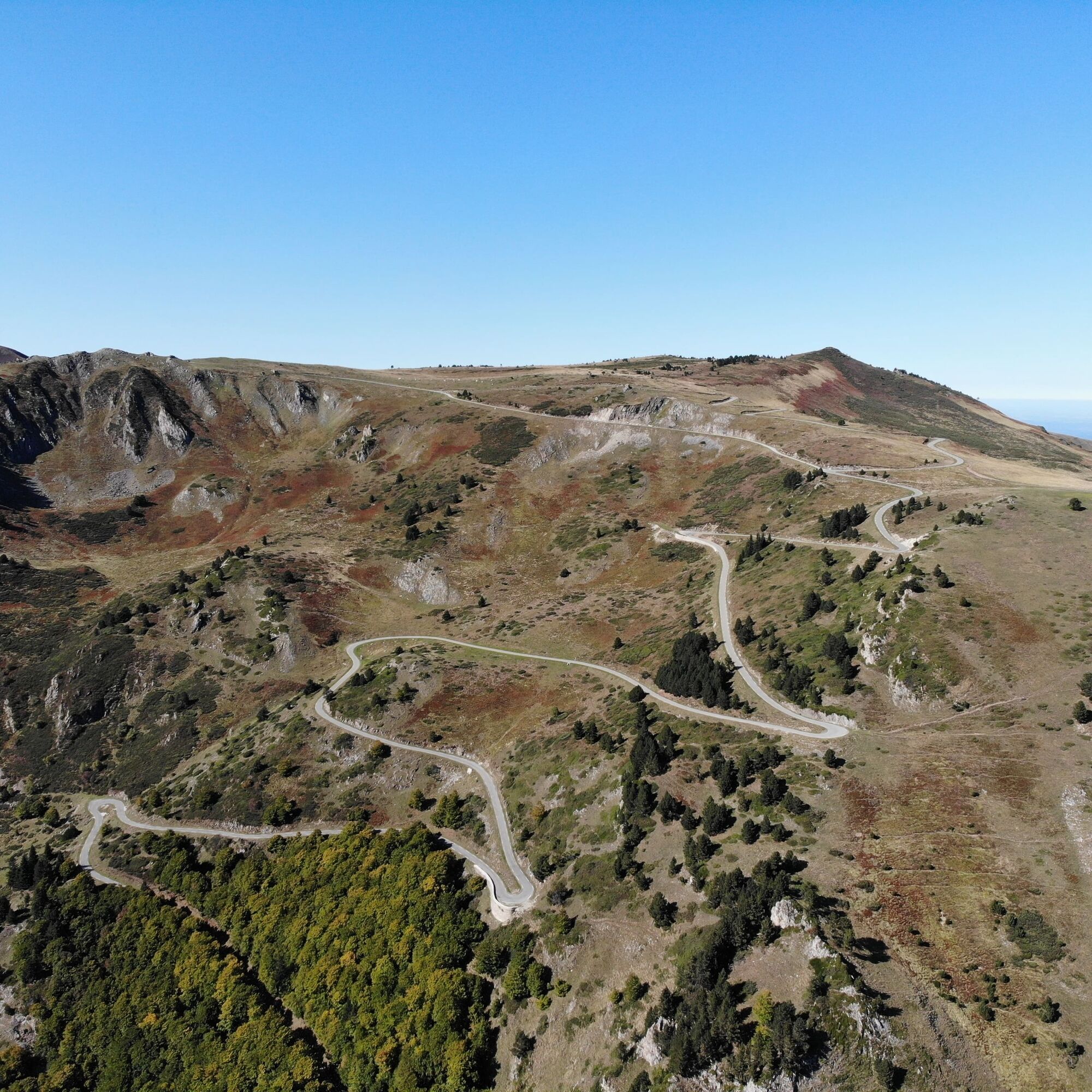
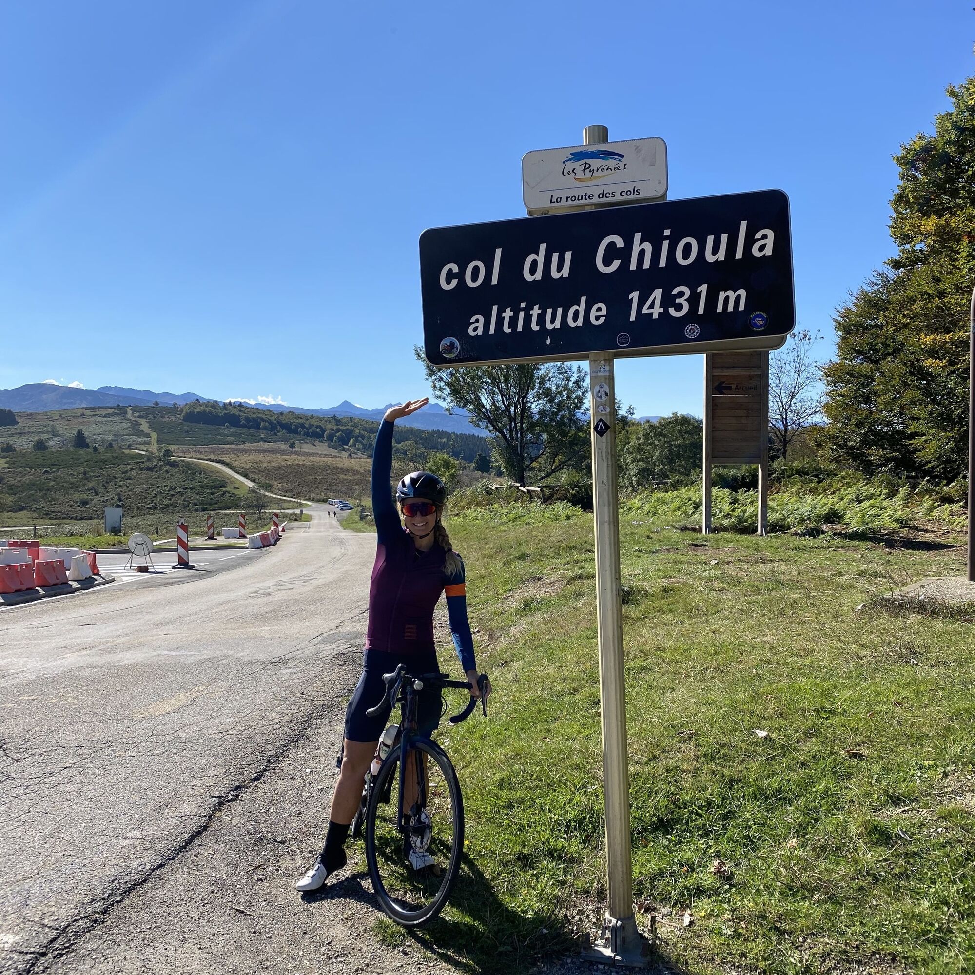
4 - FROM ROUZE TO COL DE PAILHÈRES AND THEN COL DU CHIOULA
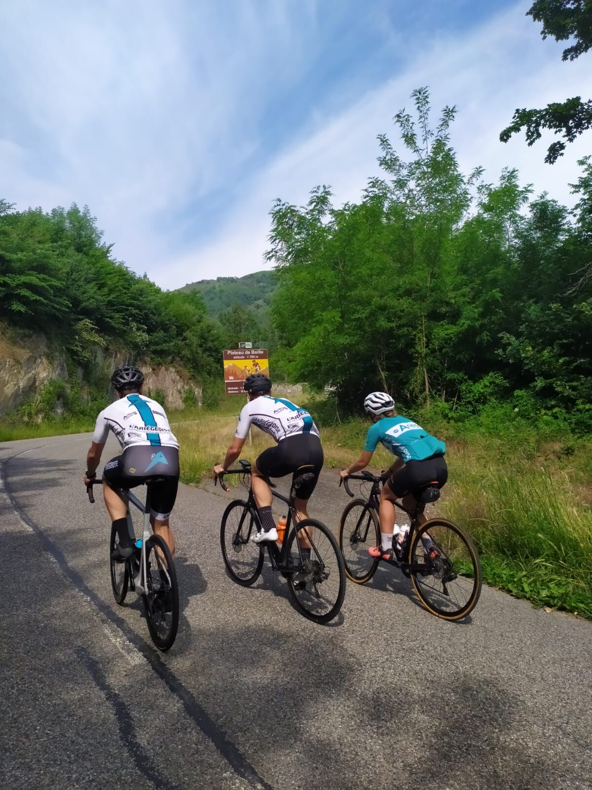
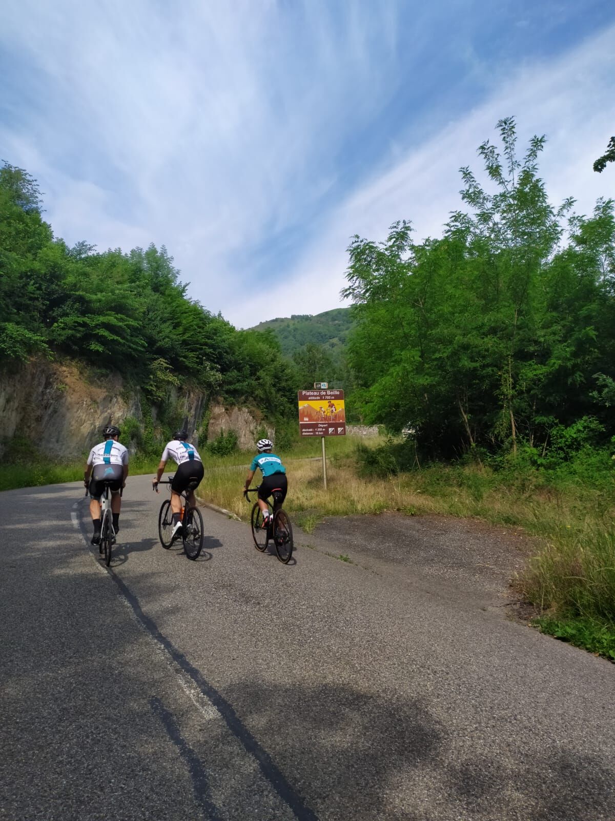
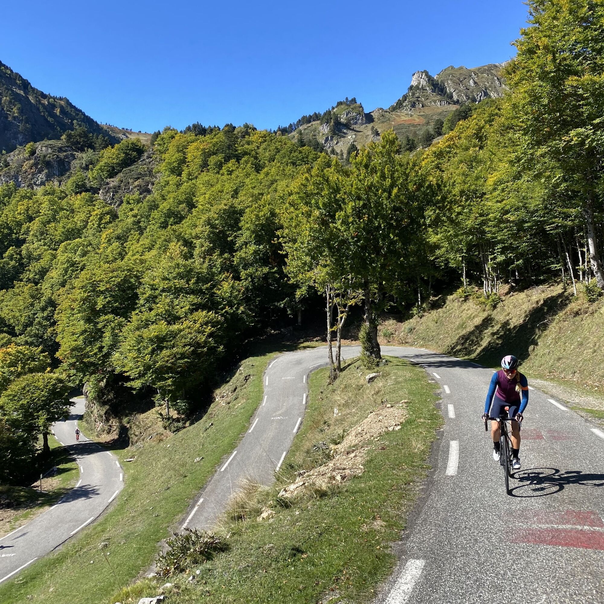
On leaving Rouze, turn right on the D116 towards Mijanès. On leaving Mijanès turn right D25 Col de Pailhères/Mijanès. Ascent of the pass then descent. Pass the station of Ascou then the village. After Ascou turn right towards Ignaux D613 Col du Chioula. Leave Ignaux and Sorgeat to climb to the pass. From the Col du Chioula to the Col de Marmare, route des Corniches then Plateau de Beille. From the col du chioula go down to the col de Marmare then turn left D20 towards Caussou/ route des corniches. Continue on the D20 past Bestiac, Lordat, Axiat, Appy, Caychax. After Senconac turn left before descending on the D120 to reach Verdun and Les Cabannes. Arrive at Cabannes, take the direction of Plateau de Beille by the D522.
5 - RETURN TO THE CABANNES
Arriving at Les Cabannes, head towards the SNCF station to take the train.

Zatiaľ žiadne recenzie
Napíšte recenziu

Recenzie pomáhajú ostatným používateľom vybrať si ďalšie dobrodružstvo. Prosím, hodnoťte len prehliadku, nie počasie alebo občerstvenie.

Vyberte jednu z hviezdičiek a ohodnoťte prehliadku
Zlé turné
Slabé turné
Priemerné turné
Dobrá prehliadka
Vynikajúca prehliadka

Webové kamery z prehliadky

bergfex logo Získajte prehľad Vždy naživo na mieste s viac ako 9 500 webovými kamerami. bergfex Ako používateľ Pro si teraz môžete pozrieť príslušné webové kamery pre mnohé zájazdy v aplikácii zájazdy z. Môžete si tak priamo prezerať aktuálne podmienky.
Turistika a stopovanie

Turistika a stopovanie

Turistika a stopovanie
Viac ako 550.000 návrhov výletov, podrobné mapy a intuitívny plánovač trás robia z aplikácie povinnú výbavu pre všetkých nadšencov prírody.
Turistika a stopovanie