


The "Bonnevie" Path
A short hike above Cerbère between vineyard and "mas" (old stone house).
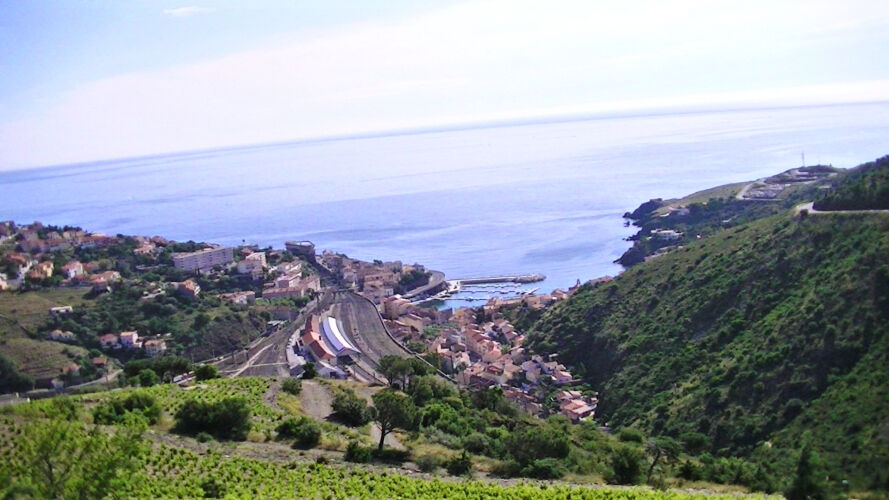
From the Tourist Office of Cerbère turn to the right avenue Maréchal Joffre, take the first street on the right to join rue du Riberal and leave to the left. At the level of "transbordeuses" square, go to the right and cross the old railway track.
Stay right along the river. At the bridge turn left, you will pass "Mas Mingou" and "Mas Tounet".
Turn right on the river and follow the path.
At this point go left on the path (DFCI-AL66) then the path (DFCI-AL66bis) for 2km.
Arriving on the D914, make a few meters on the left, the old border post is located in front of you. Go back down towards the village of Cerbère.
Cross the railway tracks and reach the "Transbordeuses" square. Return to the Tourist Office by the same route as going.
Take your trash with you.
Obľúbené výlety v okolí
-
Madeloc
strednáTuristika 8,83 km -
GR10 Pyrenäenweg Etappe 55
strednádiaľková pešia trasa 23,2 km -
Monestir de Sant Pere de Roses
strednáTuristika 4,56 km -
17 Roses Palau-Savardera Pau Pedret Marzà Monestir-de-Sant-Quirze-de-Colera Garriguella Vilajuïga Vilaüt Ciutadella
E-MTB 60,0 km -
17 Roses Palau-Savardera Pau Vilajuïga Can-Julio Veïnat-de-Dalt Montperdut Garriguella Vilajuïga Vilaüt Ciutadella
E-MTB 41,2 km -
17 Roses Vilajuïga Santa-Helena Monestir-de-Sant-Pere de-Rodes La-Selva-de-Mar Mas-Estela Can-Berta Bombo Pla-d'en-Caussa Fràgam
E-MTB 46,2 km -
The border crossing via the GR 10
ťažkéTrailrunning 29,2 km -
Roses - Puig d'en Manyana - Puig de Cervera - Menje Ecaille
strednáTuristika 97,3 km -
el Port de la Selva - La Tina - Turó d'en Llaures - Puig Gros
strednáTuristika 9,20 km -
Llançà - Ribera d'en Prim - la Vall de Santa Creu - Restaurant La Vall
strednáTuristika 15,1 km

Turistika a stopovanie


Nenechajte si ujsť ponuky a inšpiráciu na ďalšiu dovolenku
Vaša e-mailová adresa bol pridaný do poštového zoznamu.