Étang du Laurenti
svetlo
Získajte túto prehliadku v mobilnom telefóne
Étang du Laurenti
svetlo
Turistika
5,57
km
Naskenujte kód QR a spustite navigáciu v aplikácii bergfex

Turistika a stopovanie


Étang du Laurenti
svetlo
Vzdialenosť
5,57
km
Trvanie
02:15
h
Ascent
321
hm
Hladina mora
1 618 -
1 945
m
Stiahnutie skladby
Étang du Laurenti
svetlo
Turistika
5,57
km
Access: Arriving from Ax-les-Thermes via the Col de Pailhères, follow the D25.
Just before the village of Le Pla, turn left on the local road towards "Des Soulades", "La Pradaille".
Then take the route forestière...
Opis
Access: Arriving from Ax-les-Thermes via the Col de Pailhères, follow the D25.
Just before the village of Le Pla, turn left on the local road towards "Des Soulades", "La Pradaille".
Then take the route forestière du Laurenti to the refuge du Laurenti parking lot.
Do not start on the route forestière du Laurenti from "Le Mas", as this section is very degraded and not recommended.
Trasa
Refuge Forestier du Laurenti
(1 616 m)
Útočisko (nespravované)
0,0 km
Cabane du Counc
(1 854 m)
Útočisko (nespravované)
1,7 km
Refuge Forestier du Laurenti
(1 616 m)
Útočisko (nespravované)
5,5 km
Trasa
Étang du Laurenti
svetlo
Turistika
5,57
km
Autor
Poskytuje Ariège Pyrénées Tourismus
Prehliadku Étang du Laurenti zabezpečuje outdooractive.com.

Naposledy sledované
Pred 2 týždňami
Informácie o trase
Trasa
(D/A) The departure is from this parking area near the Laurenti Refuge, on the forest road.
The trail starts to the right of the torrent between fir and beech trees. The start is gentle. In fact, it is an old logging track. Very soon, the slope steepens and you move among the rocks. Watch your ankles.
0h20 - You are in a small clearing, the path veers left to cross a small stream after a few steps downhill. Again, the slope is steep and progress is made among the stones, hopping from one rock to another, depending on your balance.
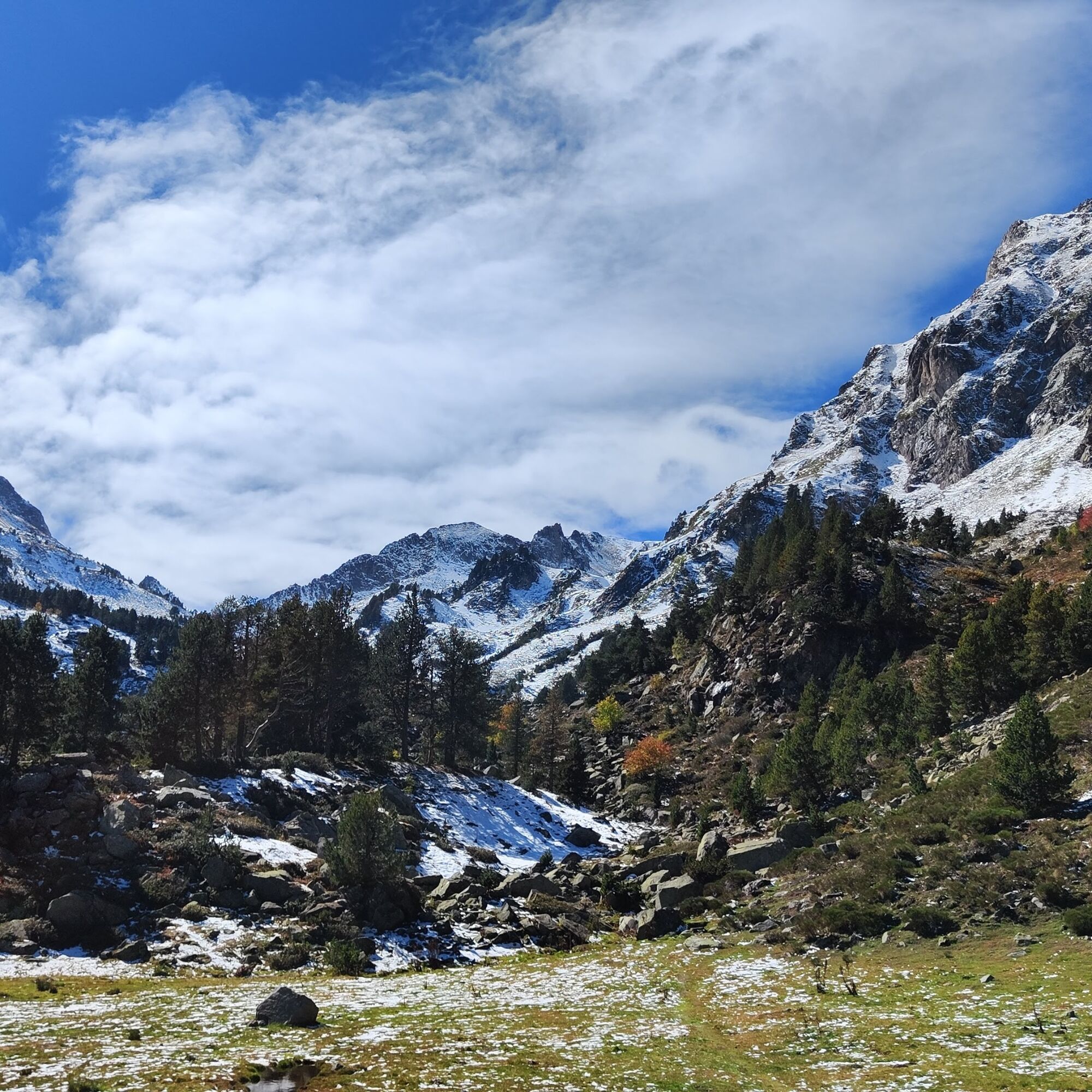
0h30 - After a right-left switchback, you reach a new plateau where the view opens up a bit. Breathe and enjoy the scenery. The hooked pine becomes dominant along the path. The roaring of the torrent fades.
0h40 - To your right is the Counc hut, by a grassland dotted with large yellow gentians and pines. After the grassland, a steep climb awaits you. Once past this climb, the Roc Blanc reveals itself to you.
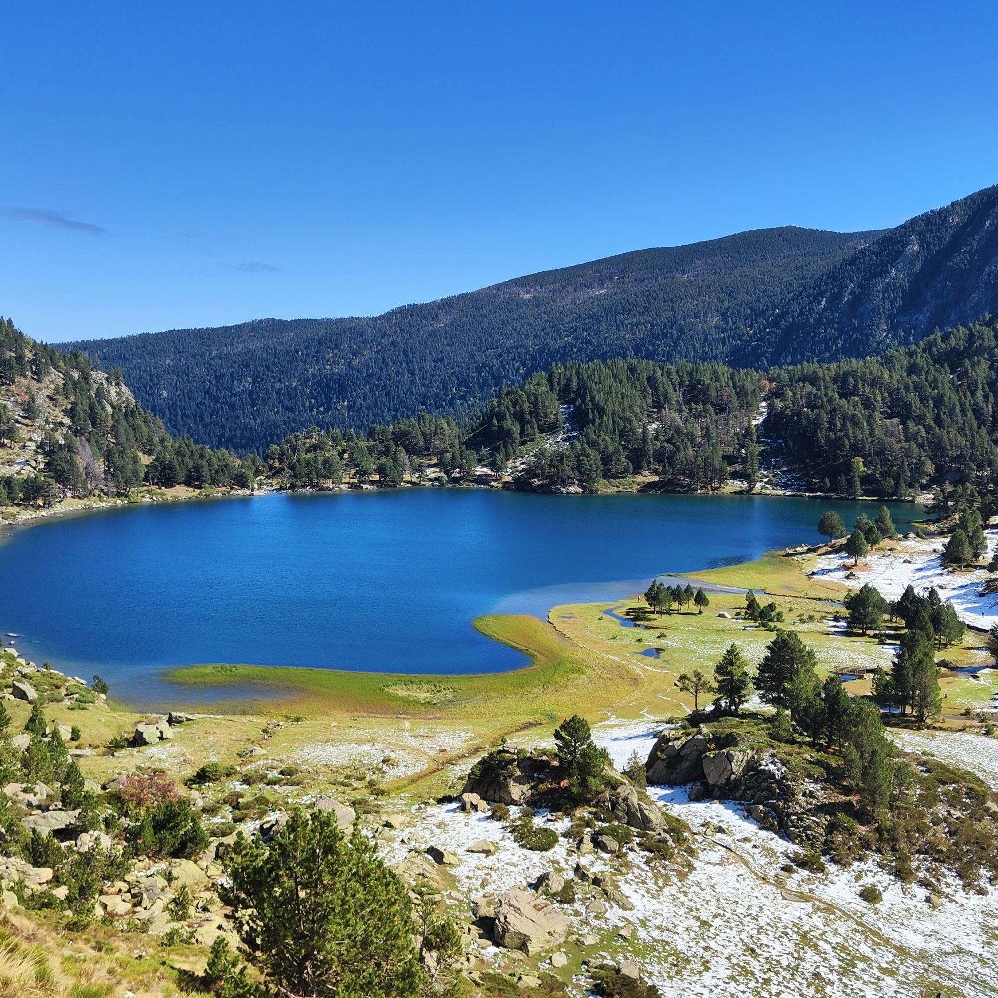
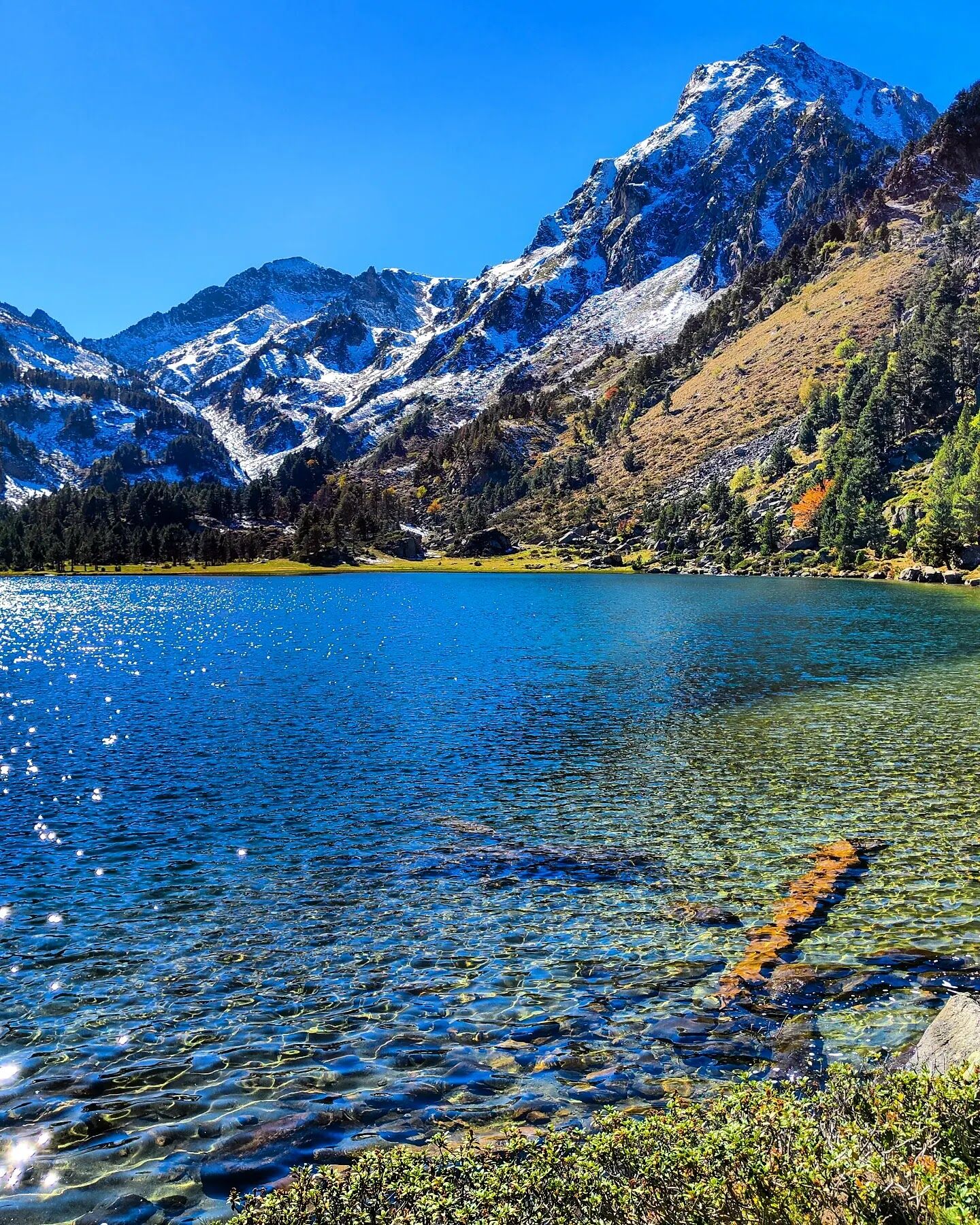
1h10 - A small zigzag between pines, a small scree to cross, and there you are at Laurenti with its clear and sparkling waters in a splendid setting. You can walk around the pond. Marmots accompany you with their whistles and some chamois watch your movements. The return is by the same path. It is a family walk.
The trail starts to the right of the torrent between fir and beech trees. The start is gentle. In fact, it is an old logging track. Very soon, the slope steepens and you move among the rocks. Watch your ankles.
0h20 - You are in a small clearing, the path veers left to cross a small stream after a few steps downhill. Again, the slope is steep and progress is made among the stones, hopping from one rock to another, depending on your balance.
0h30 - After a right-left switchback, you reach a new plateau where the view opens up a bit. Breathe and enjoy the scenery. The hooked pine becomes dominant along the path. The roaring of the torrent fades.
0h40 - To your right is the Counc hut, by a grassland dotted with large yellow gentians and pines. After the grassland, a steep climb awaits you. Once past this climb, the Roc Blanc reveals itself to you.
1h10 - A small zigzag between pines, a small scree to cross, and there you are at Laurenti with its clear and sparkling waters in a splendid setting. You can walk around the pond. Marmots accompany you with their whistles and some chamois watch your movements. The return is by the same path. It is a family walk.
Jednosmerná prehliadka
Áno
Zatiaľ žiadne recenzie
Obľúbené výlety v okolí
-
4,0
Pic de Tarbesou - Carena Runde - Etang Noir et Blue
strednáTuristika 12,3 km -
Le Pic du Tarbésou
strednáTuristika 2,82 km -
The Perics tour
strednáTuristika 47,5 km -
Cycling route 11 - The Ariège cycle route - Stage 4: from Prades to Ax-les-Thermes
ťažkéCestný bicykel 68,4 km -
GR10 Pyrenäenweg Etappe 45
strednádiaľková pešia trasa 16,9 km -
La dent d'Orlu
strednáTuristika 4,88 km -
Balbonne Pond
svetloTuristika 5,44 km -
En Beys pond and refuge
strednáTuristika 16,6 km -
Pic de la camisette 2426m par les etangs et l'epave
strednáTuristika 13,3 km -
Roc Blanc
ťažkéTuristika 10,4 km

Turistika a stopovanie

Viac ako 550.000 návrhov výletov, podrobné mapy a intuitívny plánovač trás robia z aplikácie povinnú výbavu pre všetkých nadšencov prírody.

Nenechajte si ujsť ponuky a inšpiráciu na ďalšiu dovolenku
Prihlásiť sa k odberu noviniek
Chyba
Vyskytla sa chyba. Prosím, skúste to znova.
Ďakujeme za vašu registráciu
Vaša e-mailová adresa bol pridaný do poštového zoznamu.
Zájazdy po celej Európe
Rakúsko
Švajčiarsko
Nemecko
Taliansko
Slovinsko
Francúzsko
Holandsko
Belgicko
Poľsko
Lichtenštajnsko
Česko
Slovensko
španielsko
Hrvaška
Bosna a Hercegovina
Luxembursko
Andorra
Portugalsko
Island
Spojené kráľovstvo
Írsko
Grécko
Albánsko
Severné Macedónsko
Malta
Nórsko
Čierna Hora
Moldavsko
Kosovo
Maďarsko
San Maríno
Rumunsko
Estónsko
Lotyšsko
Bielorusko
Cyprus
Litva
Srbsko
Bulharsko
Monako
Dánsko
Švédsko
Fínsko