Au fil de l'Eau 6,5km / 2h30
ťažké
Získajte túto prehliadku v mobilnom telefóne
Au fil de l'Eau 6,5km / 2h30
ťažké
Turistika
6,45
km
Naskenujte kód QR a spustite navigáciu v aplikácii bergfex

Turistika a stopovanie


Au fil de l'Eau 6,5km / 2h30
ťažké
Vzdialenosť
6,45
km
Trvanie
02:30
h
Ascent
291
hm
Hladina mora
251 -
434
m
Stiahnutie skladby
Au fil de l'Eau 6,5km / 2h30
ťažké
Turistika
6,45
km
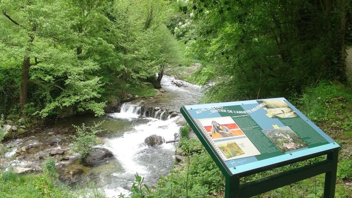
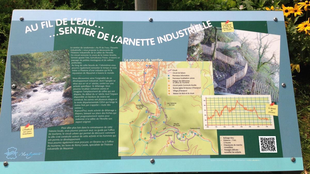
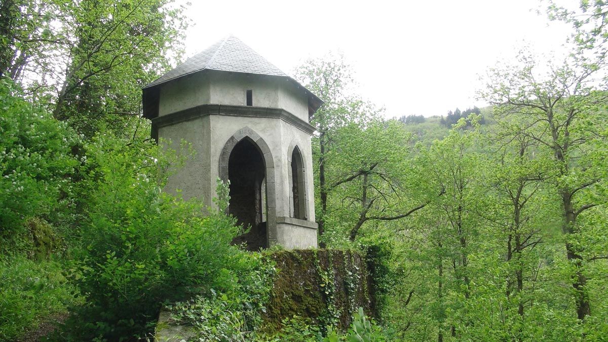
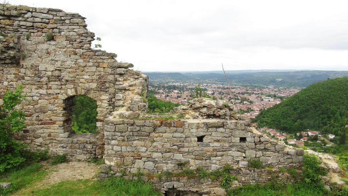
Mazamet owes its existence and its economic development to
the Arnette River. It is the quality and the force of the tumultuous
water flowing down the green slopes of the Montagne
Noire that brought the industry...
Opis
Mazamet owes its existence and its economic development to
the Arnette River. It is the quality and the force of the tumultuous
water flowing down the green slopes of the Montagne
Noire that brought the industry to this town.
Taking you on a journey along its banks, through hills and
forests, this circuit will allow you to discover the industrial and
human evolution that has taken place over the centuries.
Just like a history book, 16 signs retrace the steps of the main
elements of this exceptional adventure which, through the wool
and leather industry, brought Mazamet and the surrounding
Valley international acclaim. They show how the area has benefited
since the Middle Ages due to the energy and the purity of
the river’s water. After centuries of eventful activity, the Arnette
River and surrounding valley has finally become a place of
tranquility where the quality of this natural environment is respected
and preserved. The circuit is the initiative of a partnership
between the town of Mazamet, the Association of Heritage
Promotion, and the mission for local employment.
Trasa
Temple neuf
(258 m)
Miesto uctievania
0,1 km
Castaunouze
(360 m)
Zúčtovanie
4,0 km
Aux Saveurs l'Autan
(252 m)
Reštaurácia
6,2 km
Mazamet
(246 m)
Mesto
6,3 km
Trasa
Au fil de l'Eau 6,5km / 2h30
ťažké
Turistika
6,45
km
Temple neuf
(258 m)
Miesto uctievania
0,1 km
Hautpoul
(466 m)
Dedina
3,3 km
Castaunouze
(360 m)
Zúčtovanie
4,0 km
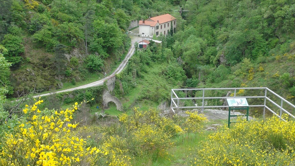
Moulin de l'Oule
(345 m)
Zúčtovanie
4,6 km
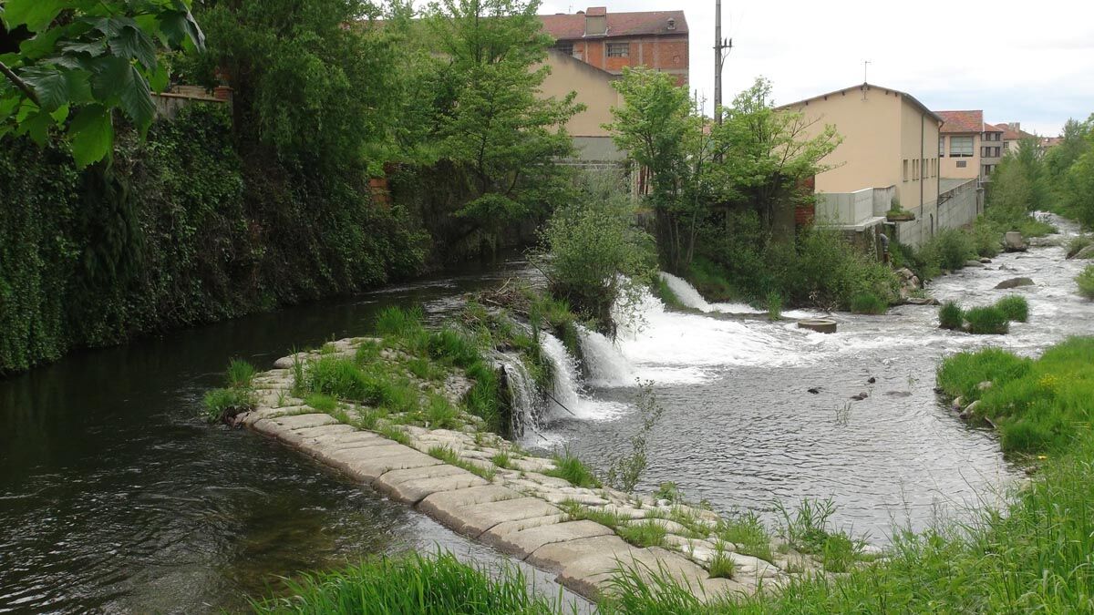
Les.Saveurs du Quai
(253 m)
Reštaurácia
6,1 km
Aux Saveurs l'Autan
(252 m)
Reštaurácia
6,2 km
Mazamet
(246 m)
Mesto
6,3 km
Le Grand Balcon
(252 m)
Reštaurácia
6,4 km
Autor
Poskytuje Tarn Tourisme
Prehliadku Au fil de l'Eau 6,5km / 2h30 zabezpečuje outdooractive.com.

Zatiaľ žiadne recenzie
Obľúbené výlety v okolí
-
5,0
Les Escaunelles
svetloTuristika 6,87 km -
Peyremaux rock
ťažkéTuristika 13,3 km -
Randonnée pédestre : Les Hauts de la Môle 13km / 3h30
ťažkéTuristika 11,3 km -
Le Carbonéral
ťažkéTuristika 18,3 km -
Sentier Randonnée du Patrimoine 13km / 3h30
svetloTuristika 13,0 km -
Hike La Ronda del Peiraire
svetloTuristika 15,0 km -
Hiking: The Wibault route
ťažkéTuristika 9,26 km -
Randonnée VTT Le Lac par l'Orée du Bois
ťažkéMountainbike 26,9 km -
GR7® Montagne Noire
ťažkéTuristika 73,5 km -
Hiking in the Chaos de la Balme
svetloTuristika 6,16 km

Turistika a stopovanie

Viac ako 550.000 návrhov výletov, podrobné mapy a intuitívny plánovač trás robia z aplikácie povinnú výbavu pre všetkých nadšencov prírody.

Nenechajte si ujsť ponuky a inšpiráciu na ďalšiu dovolenku
Prihlásiť sa k odberu noviniek
Chyba
Vyskytla sa chyba. Prosím, skúste to znova.
Ďakujeme za vašu registráciu
Vaša e-mailová adresa bol pridaný do poštového zoznamu.
Zájazdy po celej Európe
Rakúsko
Švajčiarsko
Nemecko
Taliansko
Slovinsko
Francúzsko
Holandsko
Belgicko
Poľsko
Lichtenštajnsko
Česko
Slovensko
španielsko
Hrvaška
Bosna a Hercegovina
Luxembursko
Andorra
Portugalsko
Island
Spojené kráľovstvo
Írsko
Grécko
Albánsko
Severné Macedónsko
Malta
Nórsko
Čierna Hora
Moldavsko
Kosovo
Maďarsko
San Maríno
Rumunsko
Estónsko
Lotyšsko
Bielorusko
Cyprus
Litva
Srbsko
Bulharsko
Monako
Dánsko
Švédsko
Fínsko