Saint-Sauveur Walk
svetlo
Navigácia na stránke
Navigácia na stránke
Získajte túto prehliadku v mobilnom telefóne
Saint-Sauveur Walk
svetlo
Turistika
3,17
km
Naskenujte kód QR a spustite navigáciu v aplikácii bergfex

Turistika a stopovanie


Saint-Sauveur Walk
svetlo
Vzdialenosť
3,17
km
Trvanie
01:30
h
Ascent
214
hm
Hladina mora
376 -
599
m
Stiahnutie skladby
Saint-Sauveur Walk
svetlo
Turistika
3,17
km
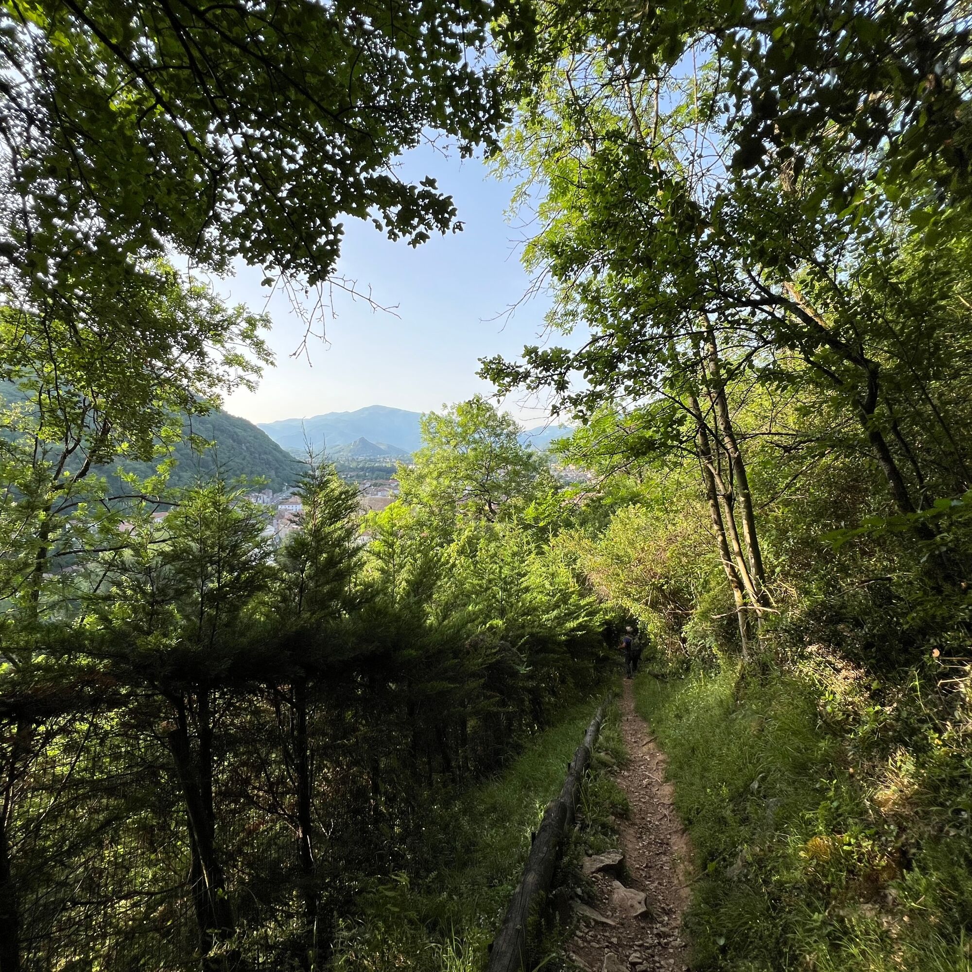
Well marked with sometimes steep slopes, the trail passes through a nearly Mediterranean natural woodland dominated by holm oak and boxwood.
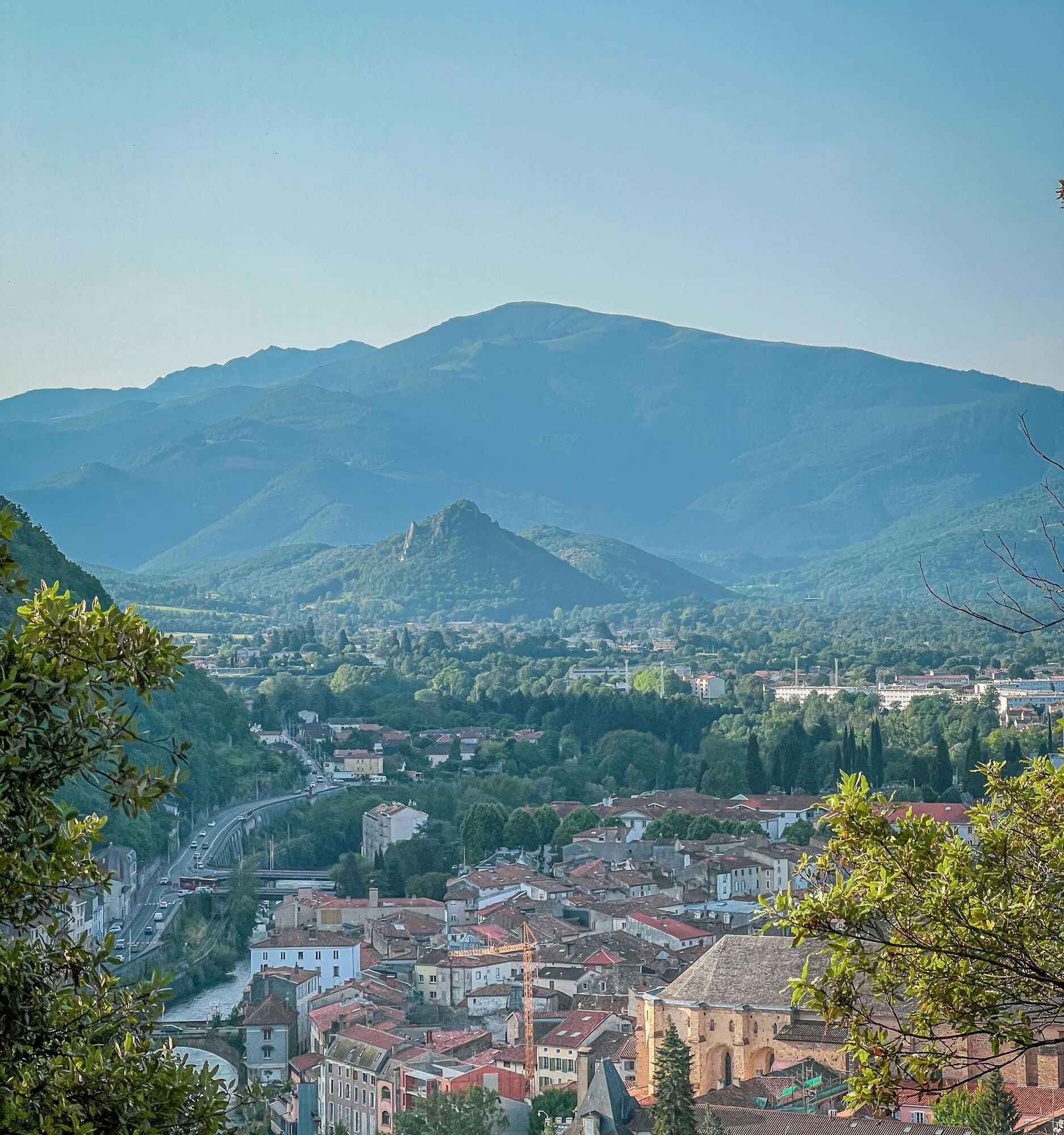
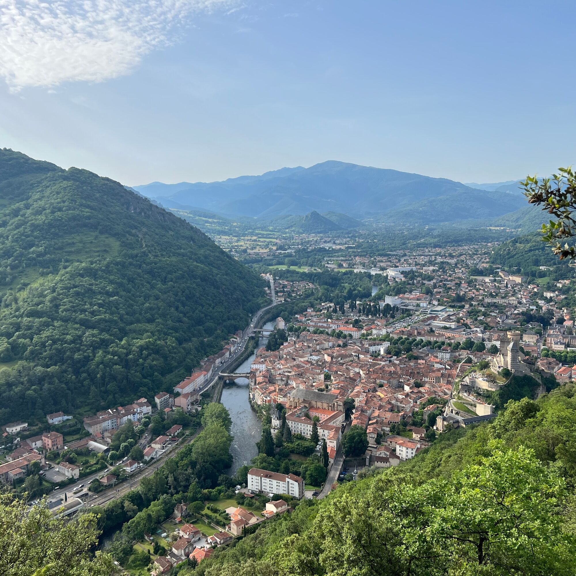
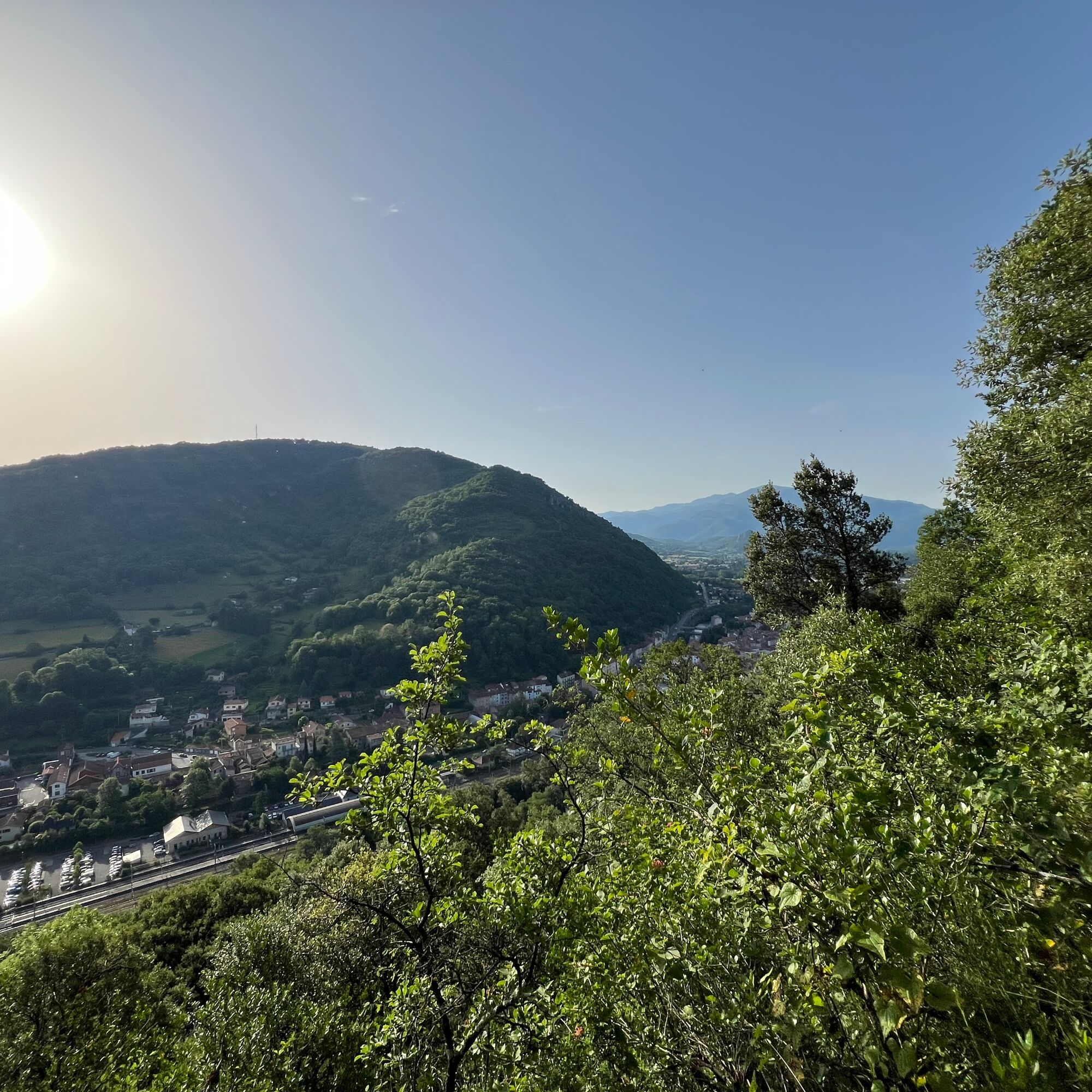
Saint-Sauveur overlooks the Foix gorge, carved by the Ariège...
Opis
Well marked with sometimes steep slopes, the trail passes through a nearly Mediterranean natural woodland dominated by holm oak and boxwood.
Saint-Sauveur overlooks the Foix gorge, carved by the Ariège river as it makes its way toward the Toulouse plain. The sweeping view of the town is superb: the historic center, the castle, the Saint-Volusien abbey, the Villote alleys, and the Old Bridge.
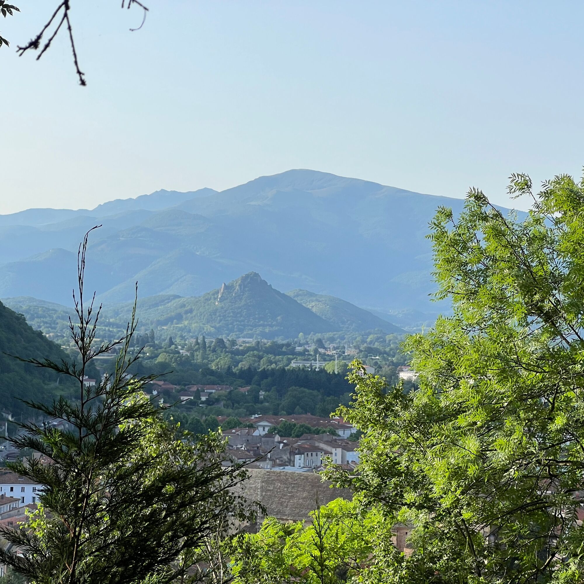
In the background, the Montgailhard peak, also called Sugarloaf, appears.
Behind it stands clearly Mount Fourcat (2001m), then Saint-Barthélemy peak (2348 m).
Saint-Sauveur overlooks the Foix gorge, carved by the Ariège river as it makes its way toward the Toulouse plain. The sweeping view of the town is superb: the historic center, the castle, the Saint-Volusien abbey, the Villote alleys, and the Old Bridge.
In the background, the Montgailhard peak, also called Sugarloaf, appears.
Behind it stands clearly Mount Fourcat (2001m), then Saint-Barthélemy peak (2348 m).
Trasa
Abbatiale Saint-Volusien
(383 m)
Miesto uctievania
0,3 km
Foix
(388 m)
Mesto
3,2 km
Trasa
Saint-Sauveur Walk
svetlo
Turistika
3,17
km
Abbatiale Saint-Volusien
(383 m)
Miesto uctievania
0,3 km
Foix
(388 m)
Mesto
3,2 km
Autor
Poskytuje Ariège Pyrénées Tourismus
Prehliadku Saint-Sauveur Walk zabezpečuje outdooractive.com.

Informácie o trase
Trasa
1 - From the Tourist Office, go down Delcassé street to take Labistour street on the left. Go straight ahead, to the right of the Oie fountain, following Marchands street to reach Saint-Volusien Square. Cross the square to the left to take Préfecture street then turn left onto Lespinet street. Cross the abattoir bridge and take Saint-Sauveur street to the right.
2 - The trail starts a little further on the left, between two low walls. It climbs steadily. On the left, see terraces and dry stone walls overrun by vegetation, remnants of a vanished agricultural activity.
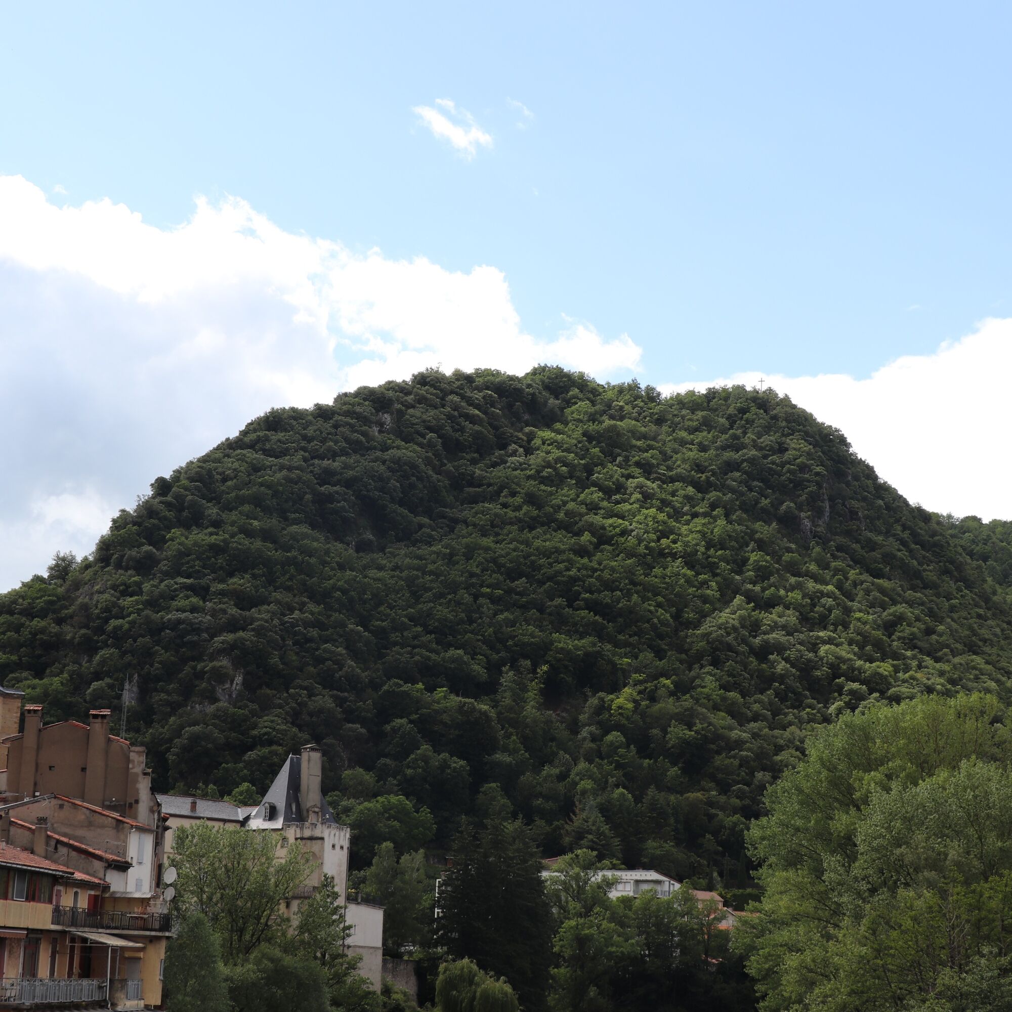
3 - After about 20 minutes of walking, the trail reaches a small crossroads. Leave the path going straight ahead to take the left path that ascends. A little further on, the view opens onto the station and the northwest slope of Pech de Foix with a landscape of terraces and bocage meadows now overgrown by forest.
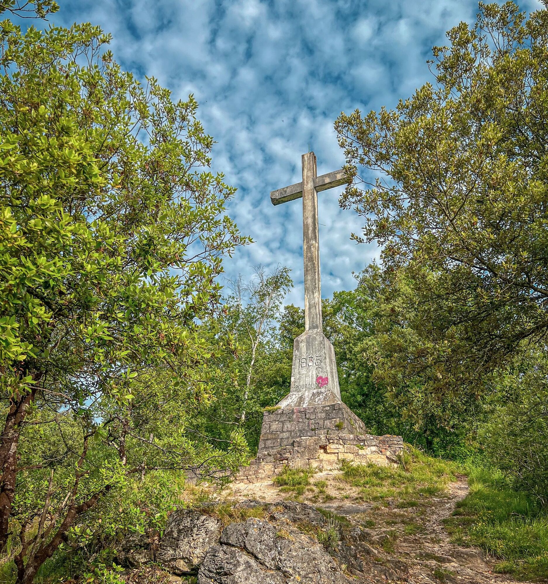
4 - Arrival at the Saint-Sauveur Cross erected in 1935 on the site of an old hermitage.
2 - The trail starts a little further on the left, between two low walls. It climbs steadily. On the left, see terraces and dry stone walls overrun by vegetation, remnants of a vanished agricultural activity.
3 - After about 20 minutes of walking, the trail reaches a small crossroads. Leave the path going straight ahead to take the left path that ascends. A little further on, the view opens onto the station and the northwest slope of Pech de Foix with a landscape of terraces and bocage meadows now overgrown by forest.
4 - Arrival at the Saint-Sauveur Cross erected in 1935 on the site of an old hermitage.
Jednosmerná prehliadka
Áno
Zatiaľ žiadne recenzie
Obľúbené výlety v okolí
-
Les terrasses du Pech
svetloTuristika 3,22 km -
Die Runde von Vals
svetloTuristika 7,25 km -
Randonnée d'Uscla
svetloTuristika 5,95 km -
Grande Traversée VTT Ariège Pyrénées
ťažkéMountainbike 207,3 km -
Cyclosport route 10 - The three bumps near Foix
ťažkéCestný bicykel 78,8 km -
Le chemin des 3 cascades
strednáTuristika 7,20 km -
Cyclotour de l'Ariège in 5 days
ťažkéCestný bicykel 441,0 km -
The Grande Traversée VTT de l'Ariège
ťažkéMountainbike 208,5 km -
Cyclosport route 9 - The wall of Péguère
ťažkéCestný bicykel 69,7 km -
Le Pic de Montgailhard
svetloTuristika 3,26 km

Turistika a stopovanie

Viac ako 550.000 návrhov výletov, podrobné mapy a intuitívny plánovač trás robia z aplikácie povinnú výbavu pre všetkých nadšencov prírody.

Nenechajte si ujsť ponuky a inšpiráciu na ďalšiu dovolenku
Prihlásiť sa k odberu noviniek
Chyba
Vyskytla sa chyba. Prosím, skúste to znova.
Ďakujeme za vašu registráciu
Vaša e-mailová adresa bol pridaný do poštového zoznamu.
Zájazdy po celej Európe
Rakúsko
Švajčiarsko
Nemecko
Taliansko
Slovinsko
Francúzsko
Holandsko
Belgicko
Poľsko
Lichtenštajnsko
Česko
Slovensko
španielsko
Hrvaška
Bosna a Hercegovina
Luxembursko
Andorra
Portugalsko
Island
Spojené kráľovstvo
Írsko
Grécko
Albánsko
Severné Macedónsko
Malta
Nórsko
Čierna Hora
Moldavsko
Kosovo
Maďarsko
San Maríno
Rumunsko
Estónsko
Lotyšsko
Bielorusko
Cyprus
Litva
Srbsko
Bulharsko
Monako
Dánsko
Švédsko
Fínsko