
The Sérénac forest
svetlo
Získajte túto prehliadku v mobilnom telefóne
The Sérénac forest
svetlo
Turistika
5,03
km
Naskenujte kód QR a spustite navigáciu v aplikácii bergfex


Turistika a stopovanie





The Sérénac forest
svetlo
Vzdialenosť
5,03
km
Trvanie
01:40
h
Ascent
13
hm
Hladina mora
380 -
395
m
Stiahnutie skladby
The Sérénac forest
svetlo
Turistika
5,03
km
Beautiful and good
The autumn coloring of the foliage of the American red oak, with extraordinarily varied reds, greatly contributes to its ornamental appeal. Its leaves, large in surface, sharply lobed...
Opis
Beautiful and good
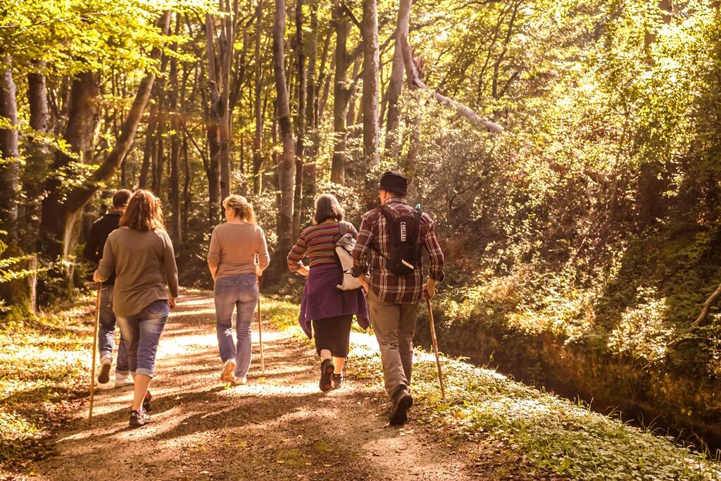
The autumn coloring of the foliage of the American red oak, with extraordinarily varied reds, greatly contributes to its ornamental appeal. Its leaves, large in surface, sharply lobed and remarkably matte, differ considerably from the attire of its European relatives. The tree excels in park decoration. Its aesthetic also delights forests equally. It did not arrive here by chance… Introduced in Europe at the beginning of the 18th century, it won over wealthy private parks before spreading to forests. Because its wood, with rapid growth, is of quality. The immigrant from eastern United States has well adapted. Once artificial, the stands now multiply by themselves.
The autumn coloring of the foliage of the American red oak, with extraordinarily varied reds, greatly contributes to its ornamental appeal. Its leaves, large in surface, sharply lobed and remarkably matte, differ considerably from the attire of its European relatives. The tree excels in park decoration. Its aesthetic also delights forests equally. It did not arrive here by chance… Introduced in Europe at the beginning of the 18th century, it won over wealthy private parks before spreading to forests. Because its wood, with rapid growth, is of quality. The immigrant from eastern United States has well adapted. Once artificial, the stands now multiply by themselves.


Informácie o trase
Trasa
Follow the yellow markings
Zariadenie
Clothing adapted to the season and conditions (cold, hot, humid…)
Hiking shoes suitable for the terrain (even for children!)
Hiking poles (useful for stability and to relieve joints)
Mobile phone and spare battery
Bezpečnostné pokyny
Before leaving:
Check the general and local weather ensuring no precipitation Get information about the approach walk, height of the route, duration, possible escape (IGN map, GPS, guidebook, etc.) Assess possible risks by consulting mountain professionals, refuges, lodges Inform a close person of your plan and contact them in case of changes: departure and return times, number of participants with each phone number, vehicle(s), parking Avoid going alone, use equipment suitable for the activity, adjusted and in good condition, headlamp, complete first aid kit, survival blanket, etc.In case of problems, call 112 (European emergency number)
Informácie o príchode
Parkovanie
Parking along the access road to the Forest House.
Ďalšie informácie a tipy
Ďalšie informácie
Parking along the access road to the Forest House.
Zatiaľ žiadne recenzie
Obľúbené výlety v okolí
-
Path of the Springs
svetloTuristika 6,93 km -
Corniches du Tarn
strednáTuristika 9,13 km -
Tour of Tarn on Horseback
strednáJazda na koni 502,7 km -
Le Sentier de Calle
svetloTuristika 7,19 km -
Camin de Comba Granda
strednáTuristika 11,2 km -
Des Éoliennes aux Moulins
svetloTuristika 5,50 km -
Lo camin des Carboniers
strednáTuristika 10,4 km -
Sentier des Cabannes
svetloTuristika 8,49 km -
Tour du Tarn riding: Ambialet / Alban
ťažkéJazda na koni 26,0 km -
GR36 ® - Crossing Tarn from North to South
ťažkéTuristika 236,1 km
Turistika a stopovanie

Viac ako 550.000 návrhov výletov, podrobné mapy a intuitívny plánovač trás robia z aplikácie povinnú výbavu pre všetkých nadšencov prírody.

Nenechajte si ujsť ponuky a inšpiráciu na ďalšiu dovolenku
Prihlásiť sa k odberu noviniek
Chyba
Vyskytla sa chyba. Prosím, skúste to znova.
Ďakujeme za vašu registráciu
Vaša e-mailová adresa bol pridaný do poštového zoznamu.
Zájazdy po celej Európe
Rakúsko
Švajčiarsko
Nemecko
Taliansko
Slovinsko
Francúzsko
Holandsko
Belgicko
Poľsko
Lichtenštajnsko
Česko
Slovensko
španielsko
Hrvaška
Bosna a Hercegovina
Luxembursko
Andorra
Portugalsko
Island
Spojené kráľovstvo
Írsko
Grécko
Albánsko
Severné Macedónsko
Malta
Nórsko
Čierna Hora
Moldavsko
Kosovo
Maďarsko
San Maríno
Rumunsko
Estónsko
Lotyšsko
Bielorusko
Cyprus
Litva
Srbsko
Bulharsko
Monako
Dánsko
Švédsko
Fínsko





