


Pizol summit tour


Fotografie našich používateľov
-

 © Michael KVytvorené dňa 08.10.2022
 -

 © Andreas VolkVytvorené dňa 12.10.2025
 -
 © ElisabethaVytvorené dňa 15.09.2025
 -
 © ElisabethaVytvorené dňa 15.09.2025
 -
 © ElisabethaVytvorené dňa 15.09.2025
 -
 © Daniel HänniVytvorené dňa 23.08.2025
 -
 © Daniel HänniVytvorené dňa 23.08.2025
 -
 © Daniel HänniVytvorené dňa 23.08.2025
 -
 © Daniel HerzVytvorené dňa 09.08.2025
 -

 © deniuruVytvorené dňa 09.08.2025
 -
 © deniuruVytvorené dňa 09.08.2025
 -
 © deniuruVytvorené dňa 09.08.2025
 -
 © Magnus MoserVytvorené dňa 30.04.2025
 -
 © Volker HirtVytvorené dňa 20.10.2024
 -
 © Volker HirtVytvorené dňa 20.10.2024
 -
 © Laura Acosta CruzVytvorené dňa 22.09.2024
 -
 © Laura Acosta CruzVytvorené dňa 22.09.2024
 -
 © Laura Acosta CruzVytvorené dňa 22.09.2024
 -
 © Laura Acosta CruzVytvorené dňa 22.09.2024
 -
 © Michael KVytvorené dňa 08.10.2022
 -

 © Joe TäschlerVytvorené dňa 06.08.2025
 -
 © Joe TäschlerVytvorené dňa 06.08.2025
 -
 © Joe TäschlerVytvorené dňa 06.08.2025
 -
 © Joe TäschlerVytvorené dňa 06.08.2025
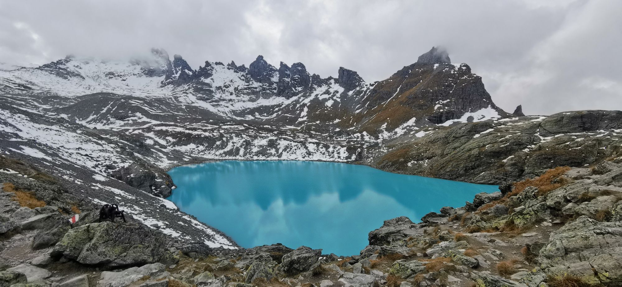
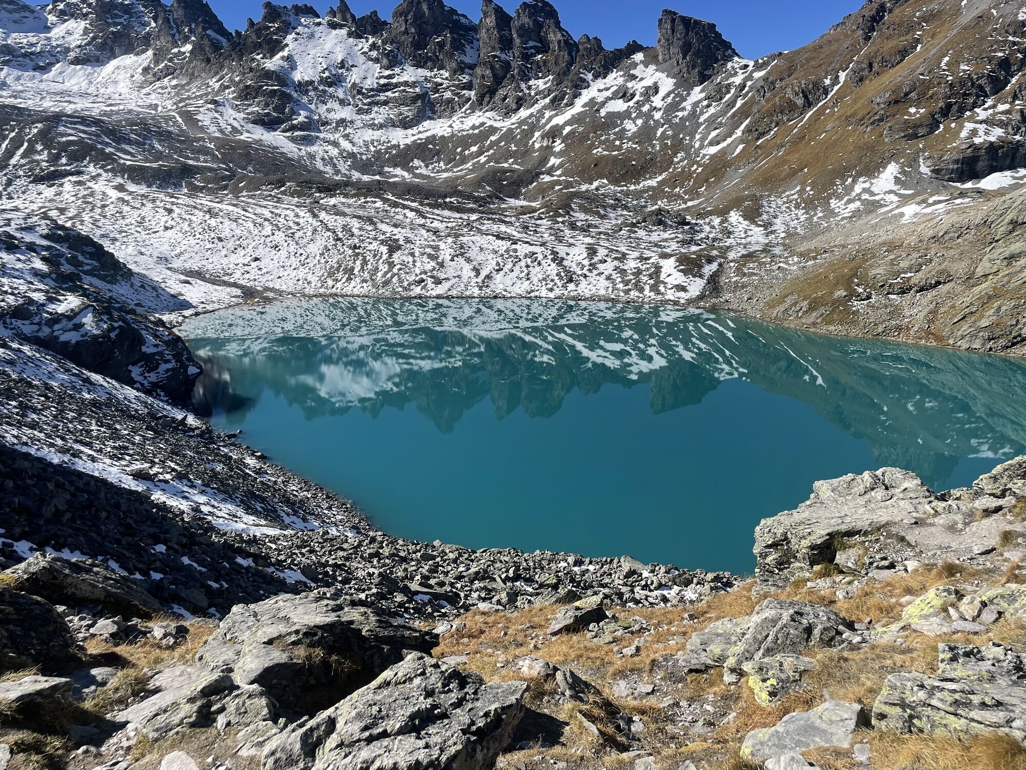

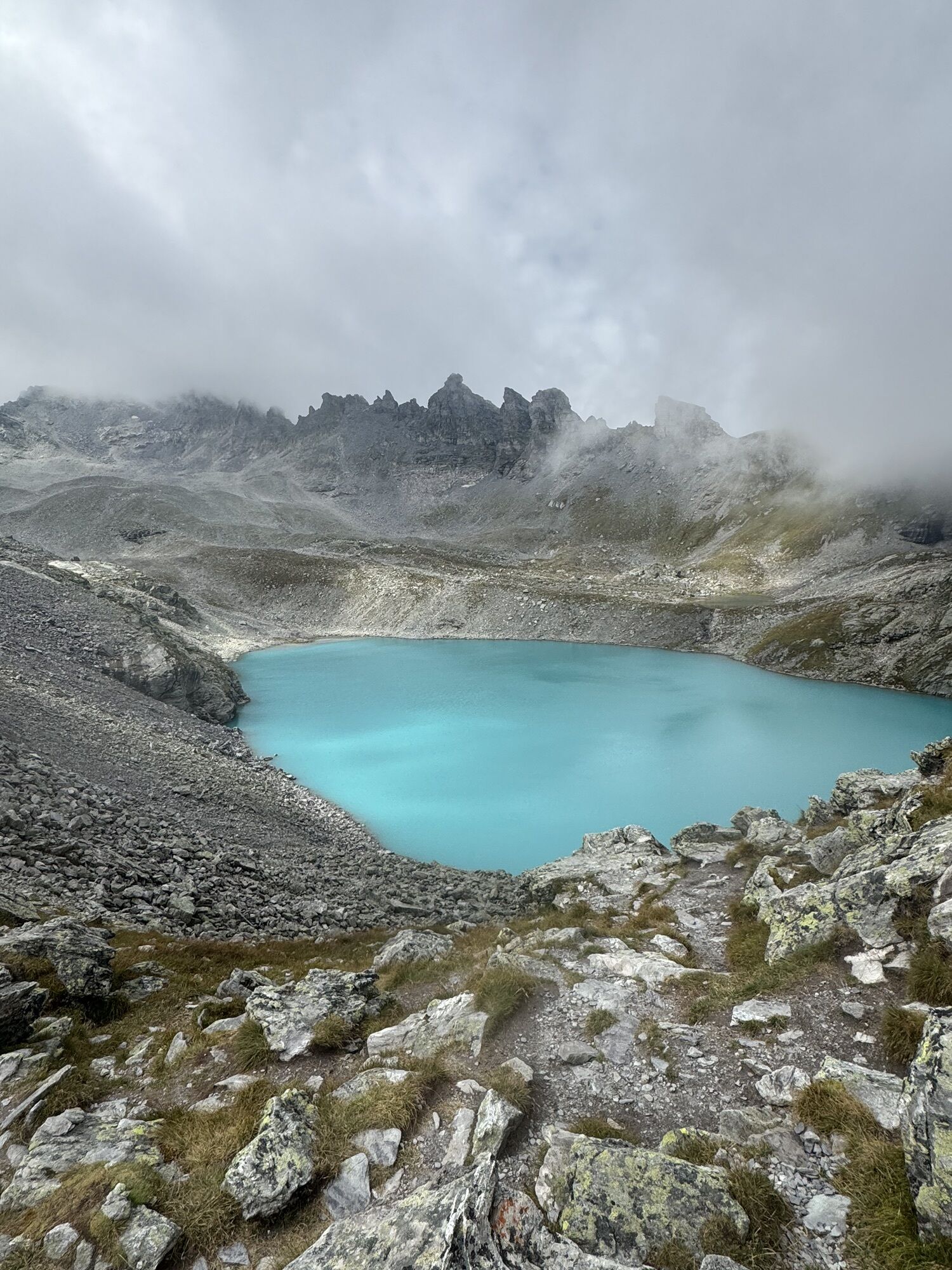

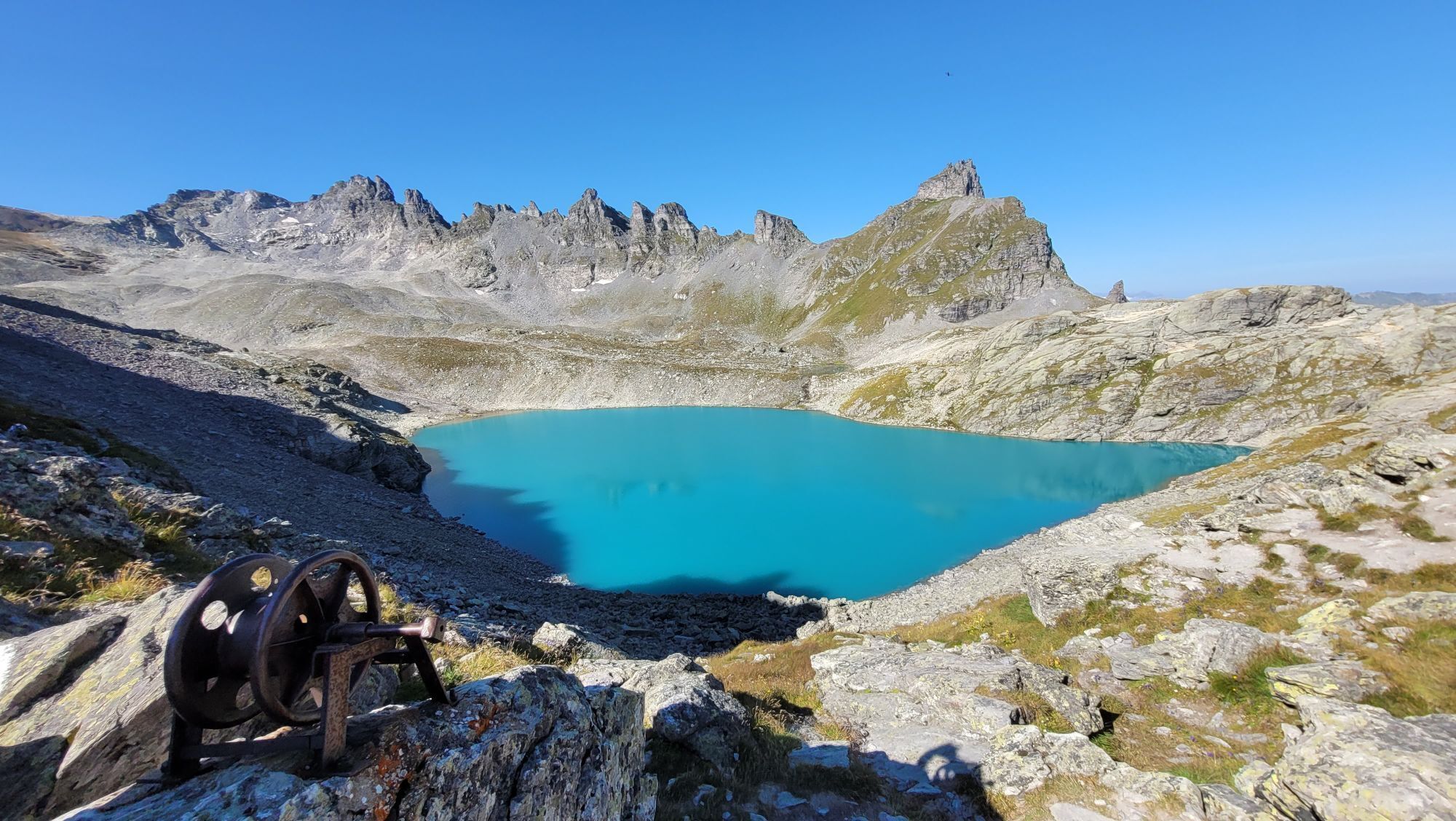


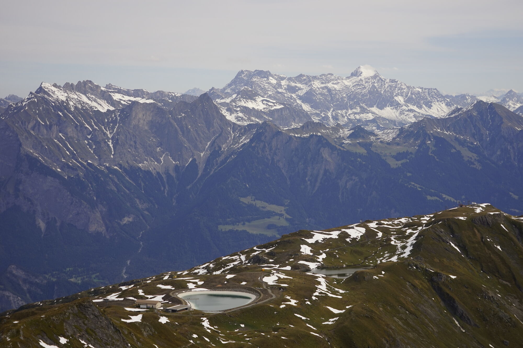

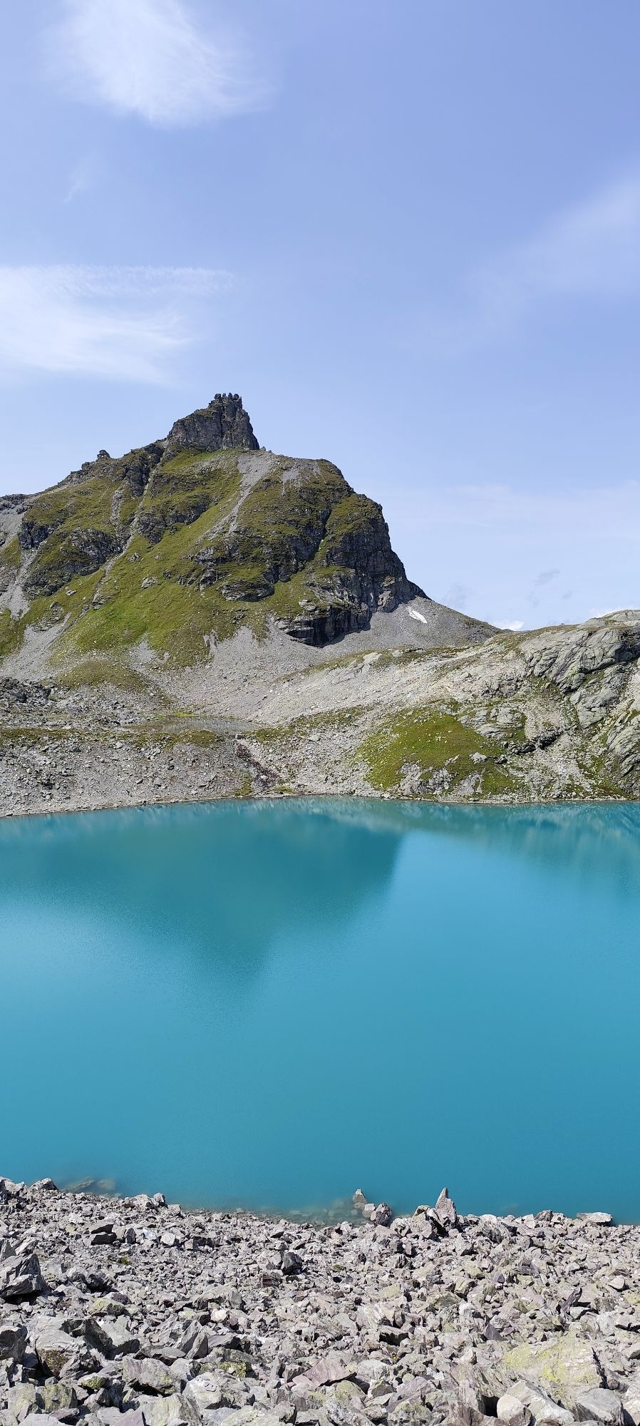
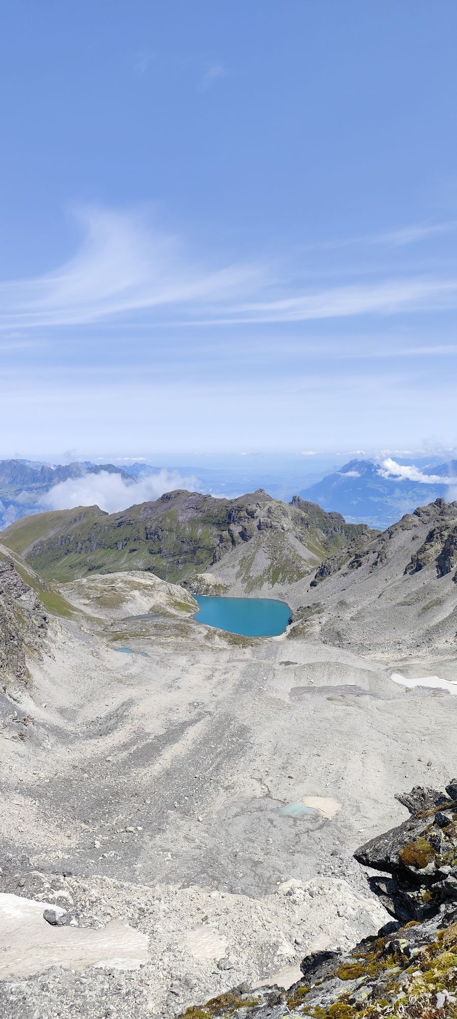
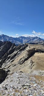
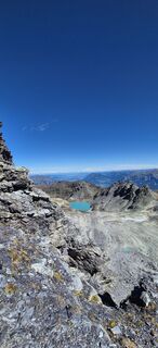
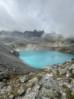
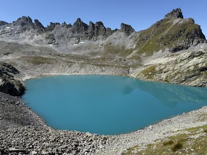
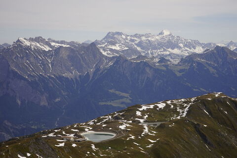
The first highlight of the hike is the Wildseeluggen. There, an impressive view opens up to the well-known turquoise Wildsee in front of the striking mountain range with the majestic Pizol summit at 2,844...
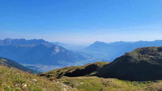
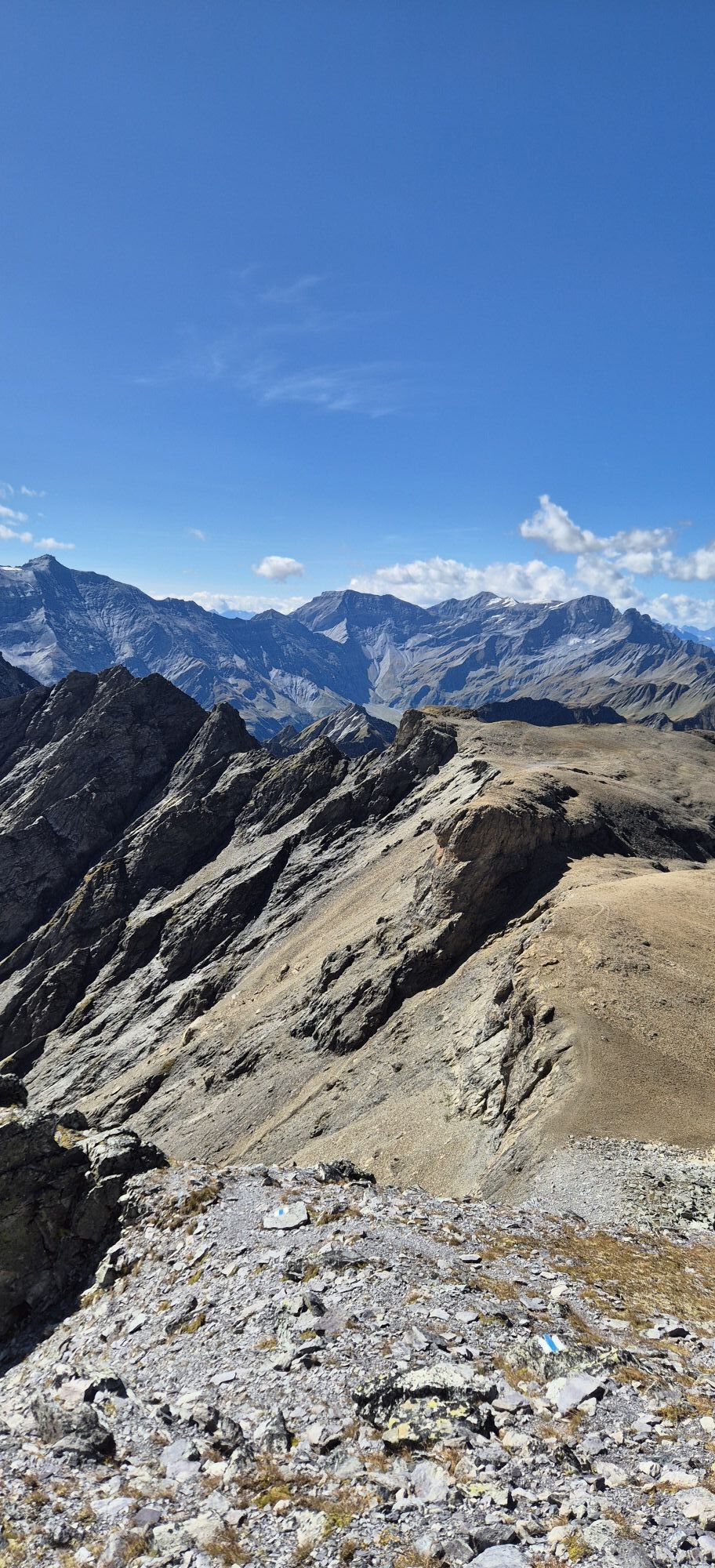
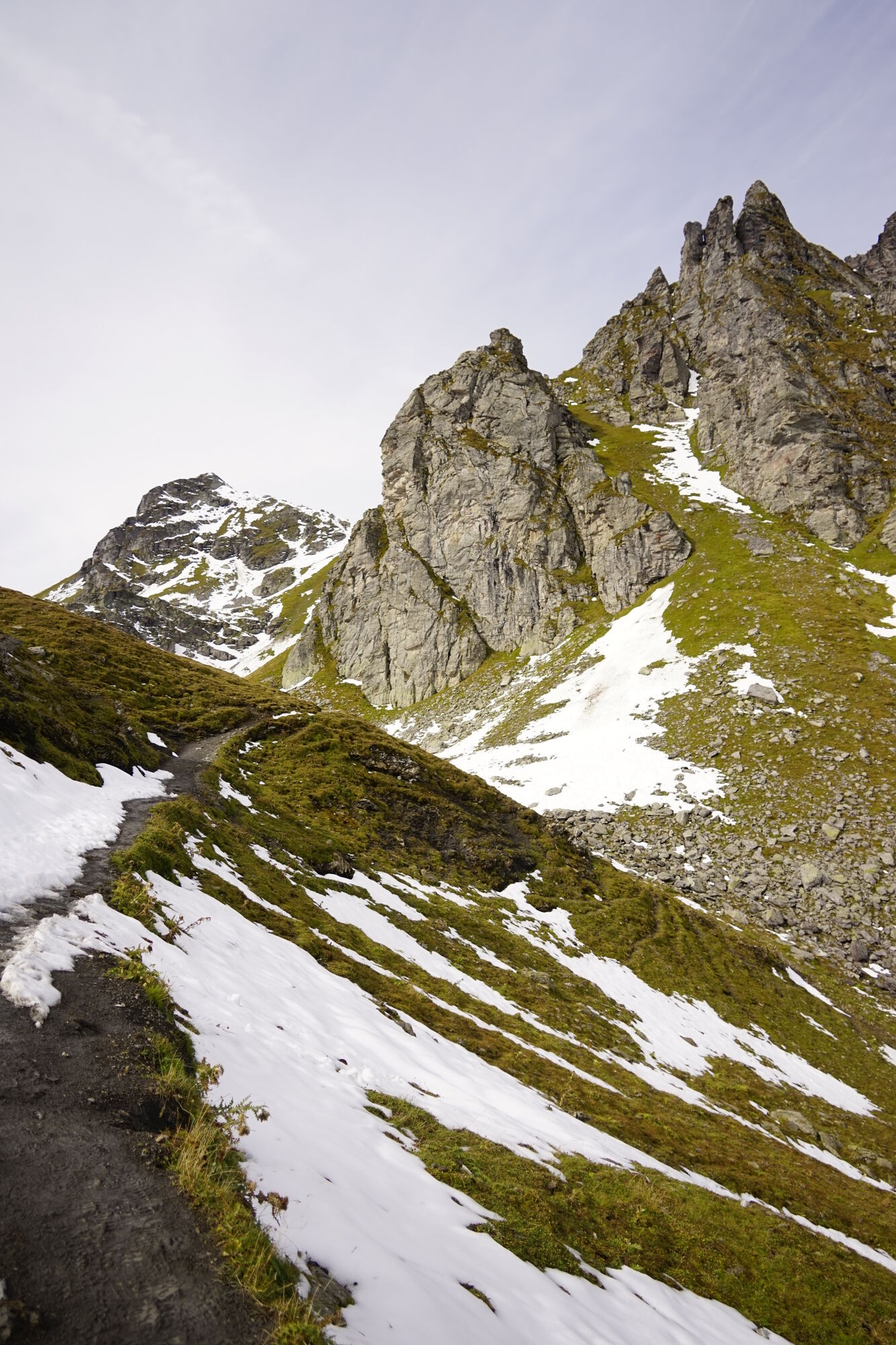
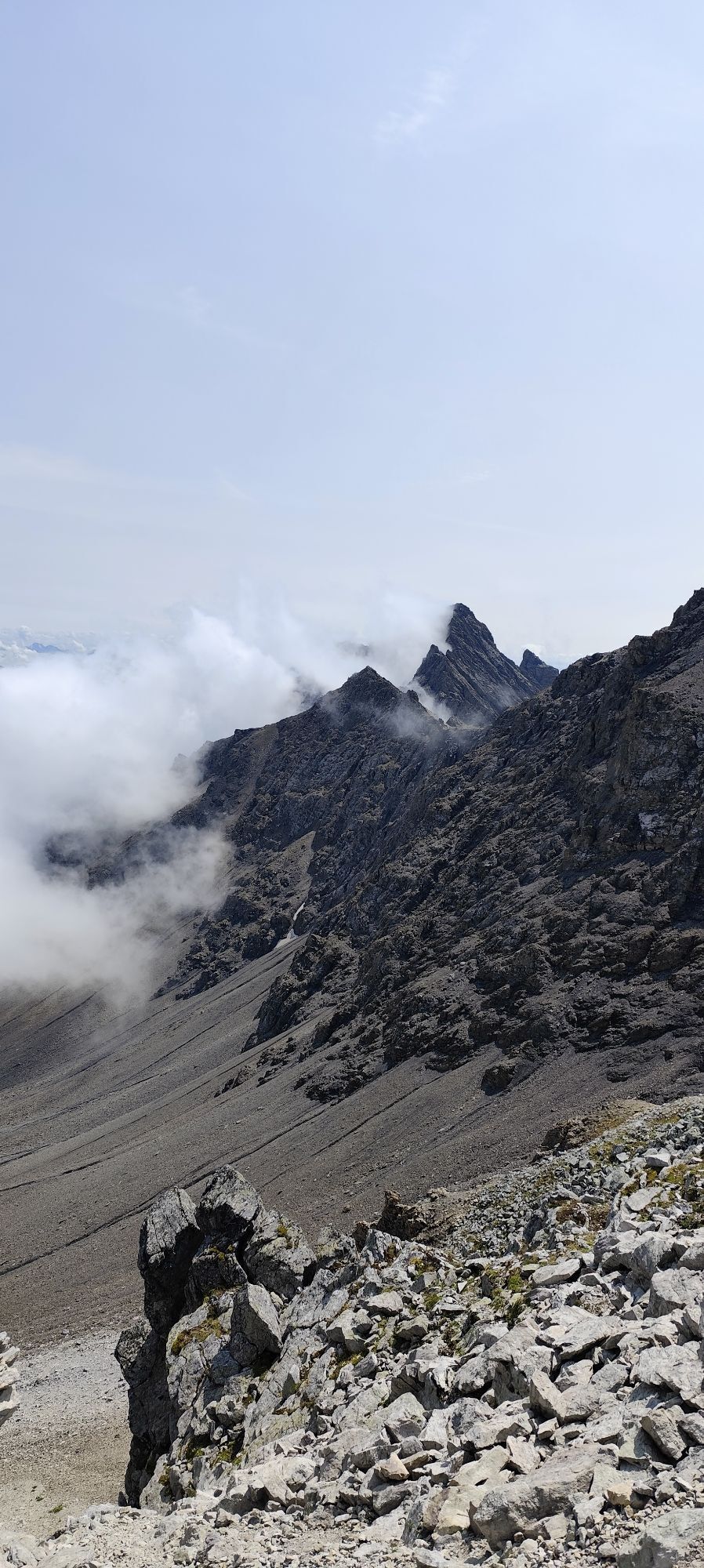
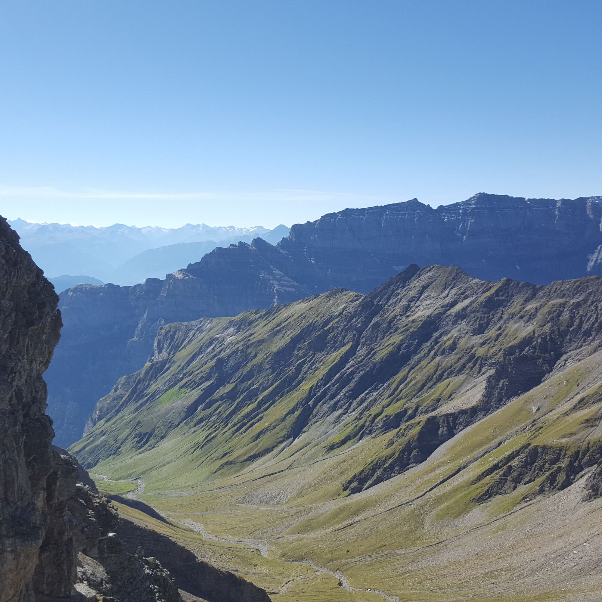
The first highlight of the hike is the Wildseeluggen. There, an impressive view opens up to the well-known turquoise Wildsee in front of the striking mountain range with the majestic Pizol summit at 2,844 m above sea level. The ascent is adventurous, with exposed sections and steel cables as handrails. Once at the top, we experience the second highlight. The view from the summit of the Pizol glacier and the surrounding mountain world is breathtaking.
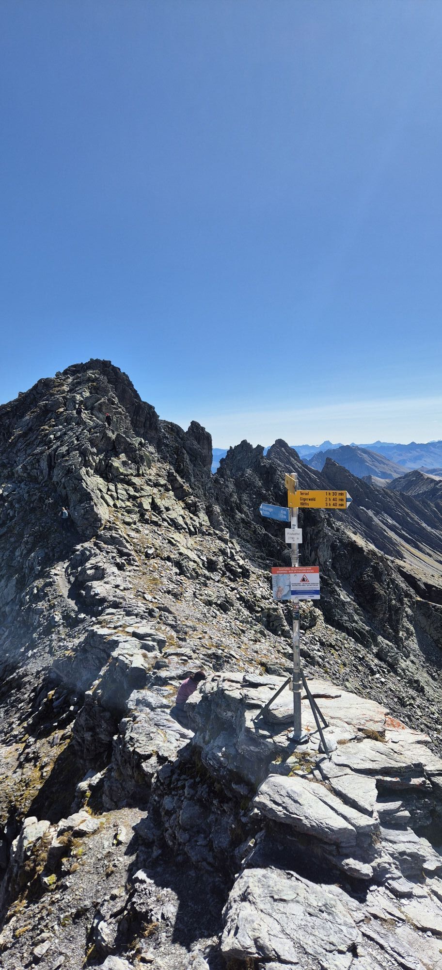
The Pizol is a massive block summit with two summit points separated by a small notch. The higher southern peak carries a small summit cross with summit book. The first documented ascent was achieved by Emil Frey-Gessner on August 15, 1864.
The hike to the Pizol summit is part of the summit quartet at Pizol. The stages Garmil, Gamidauerspitz, Hochwart, and Pizol can all be done independently but are also popular to combine as desired.

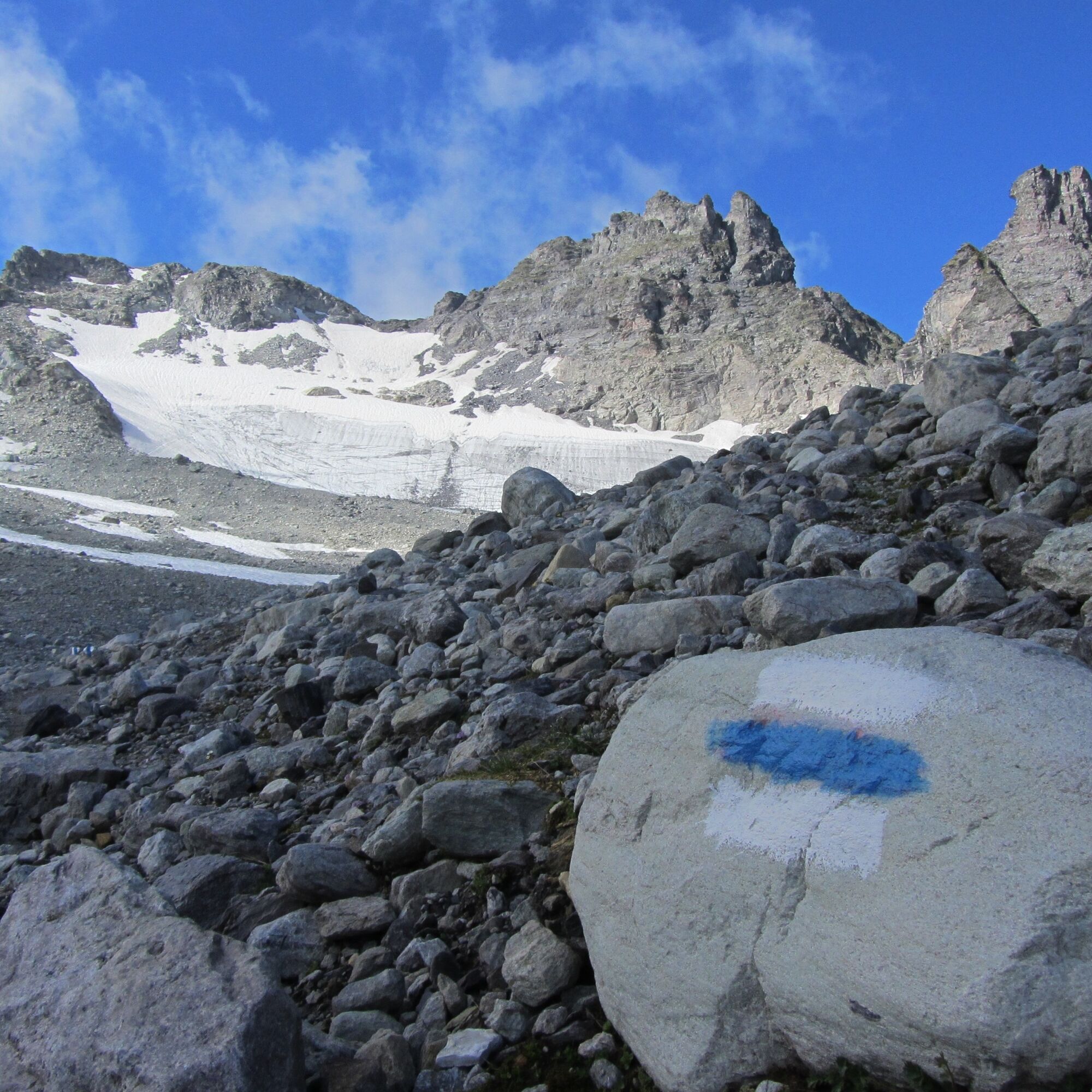

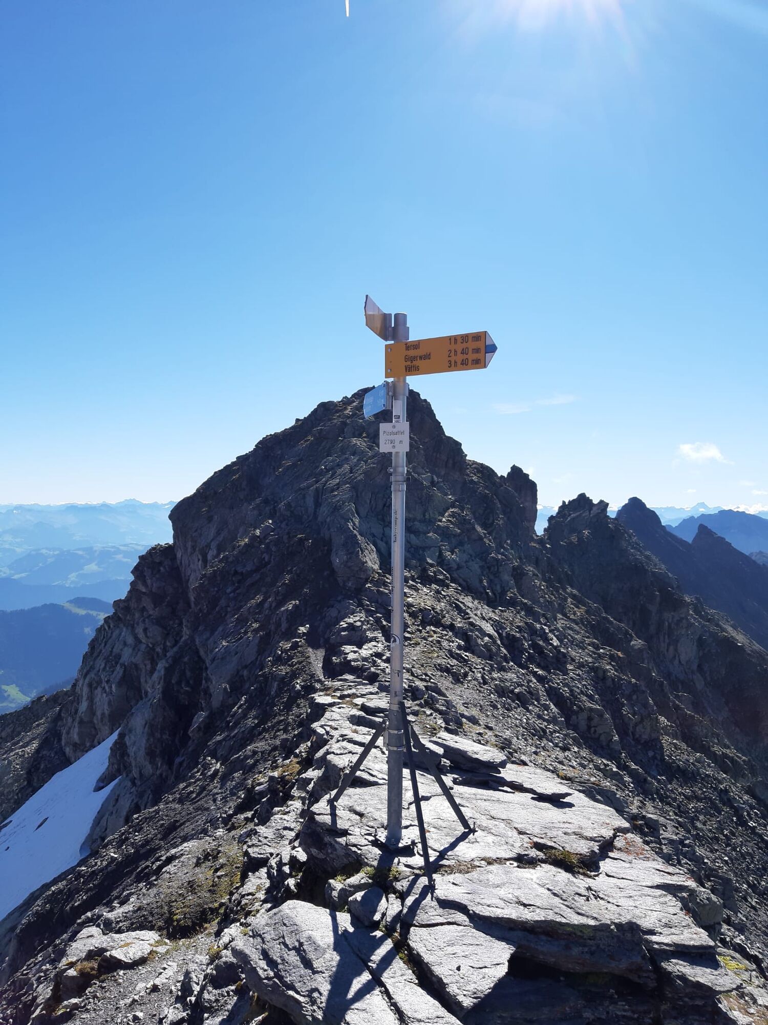


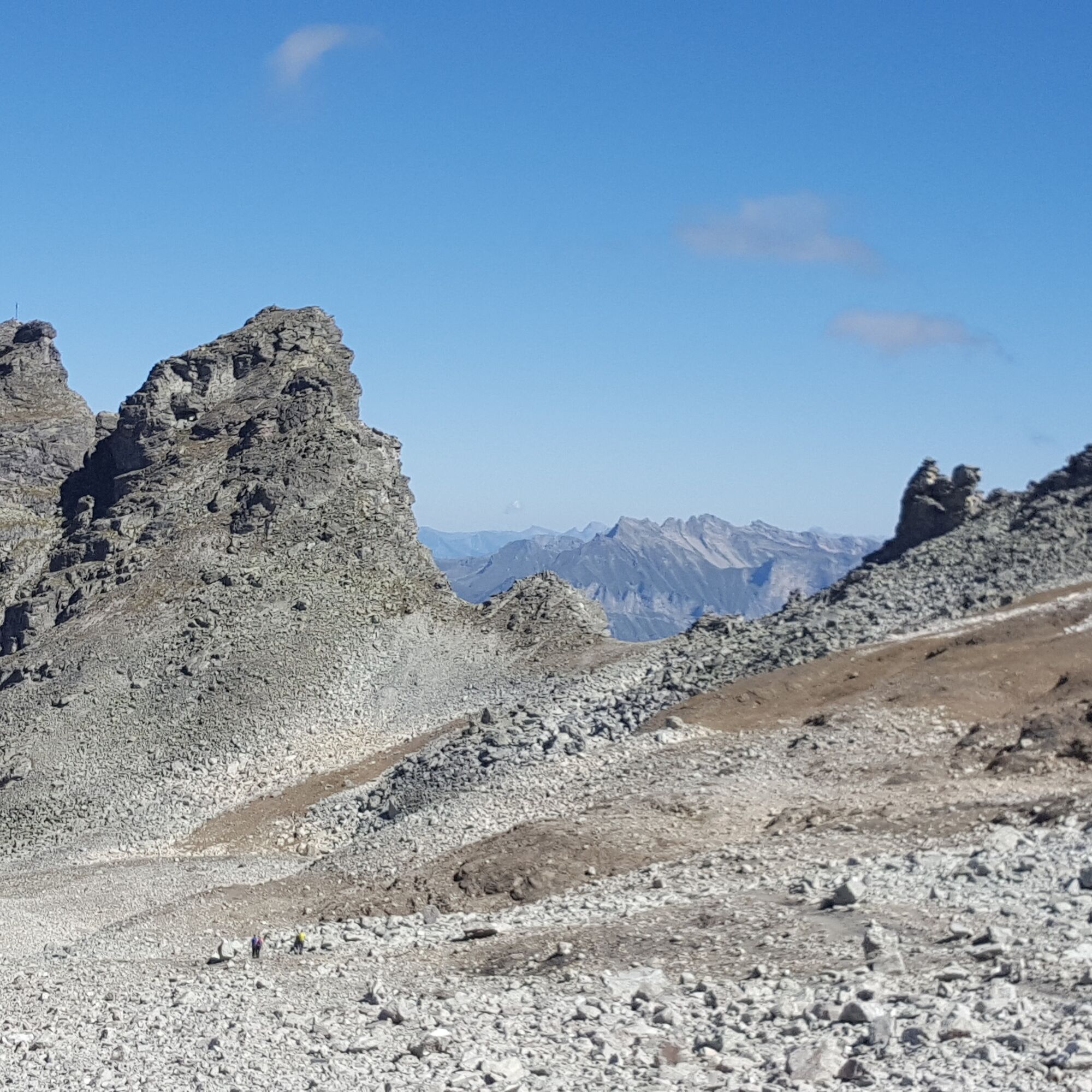
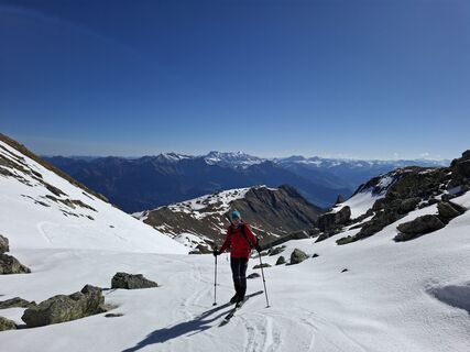
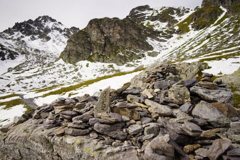
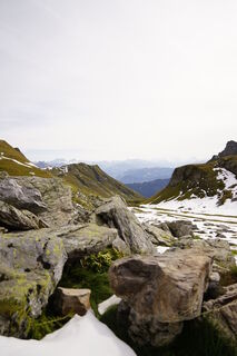
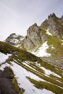
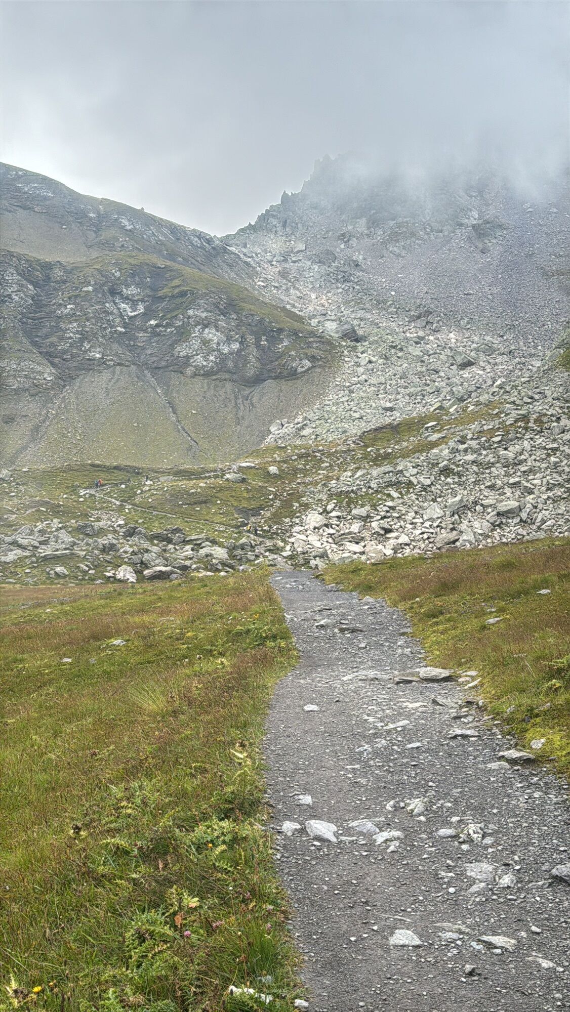
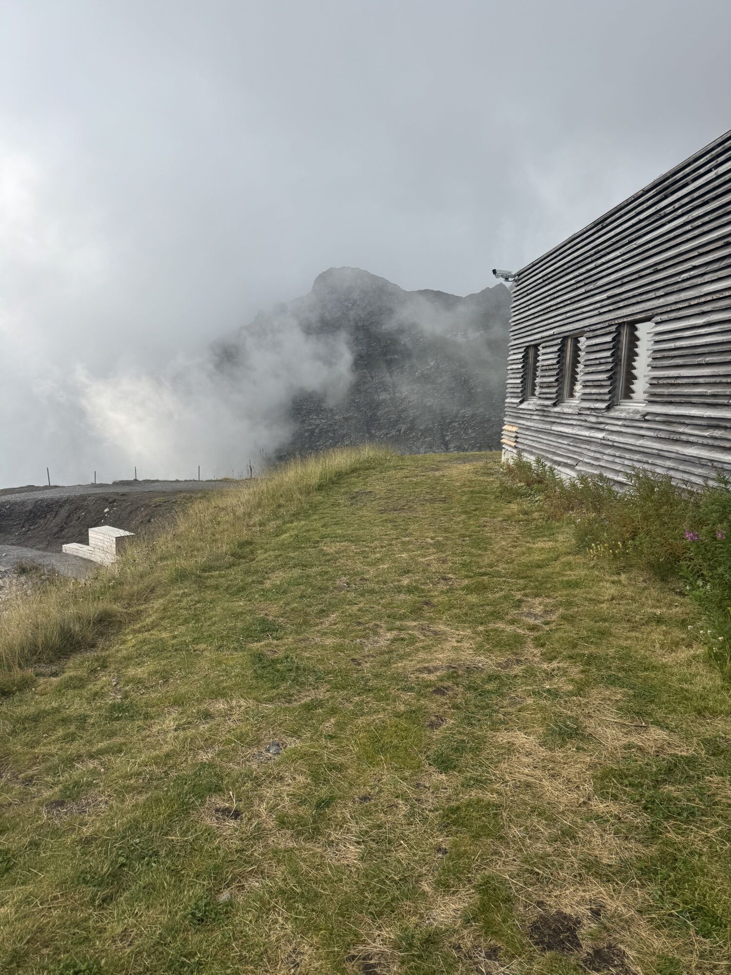
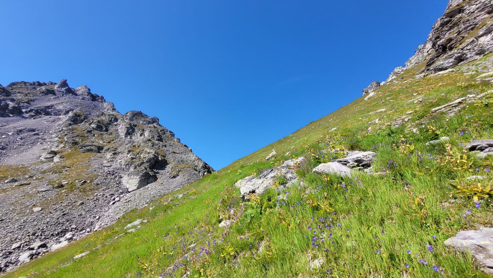
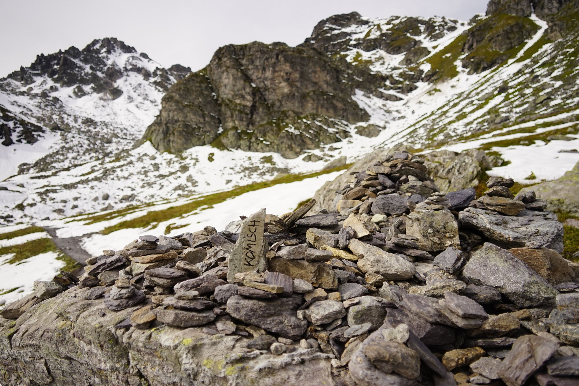
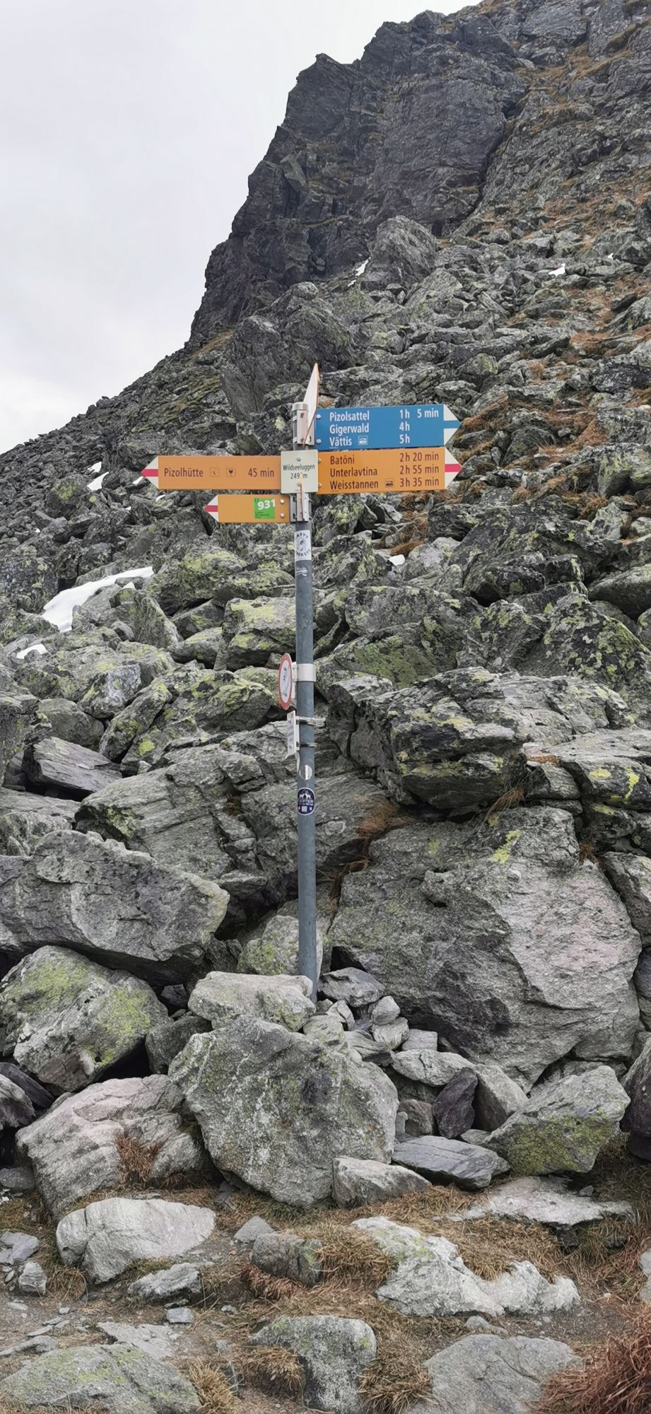
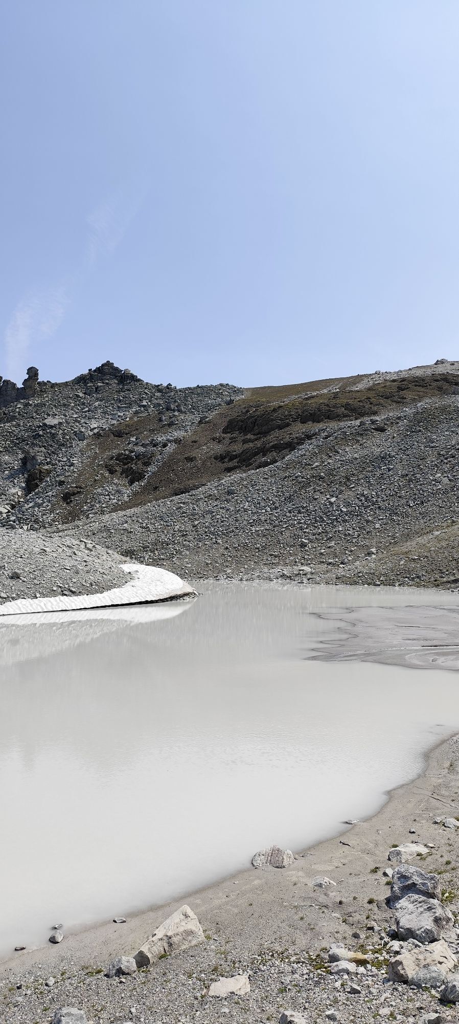
We reach the Pizol hut by gondola and chairlifts from Wangs via Furt and Gaffia. From there, we start the hike with the first ascent on the path of the famous 5-lakes route. It goes up in a zigzag to the Wildseeluggen. Here we turn left and hike through the scree past the lake towards the Pizol saddle. For safety reasons, the next ascent was moved from the Pizol glacier to the rocks. Steel cables are installed as handrails at exposed sections. Once at the saddle, we continue right along the ridge until we reach the Pizol summit from behind.
For the return route, we have various combination options:
Return the same way Combinations with the summit quartet or the 5-lakes route
Áno
Áno
Áno
Áno
Day hiking backpack (approx. 20 liters) with rain cover, sturdy and comfortable footwear, weather-appropriate and durable clothing in layered principle, optionally telescopic poles, sun and rain protection, provisions and drinking water, first aid kit, pocket knife, mobile phone, optionally headlamp, maps
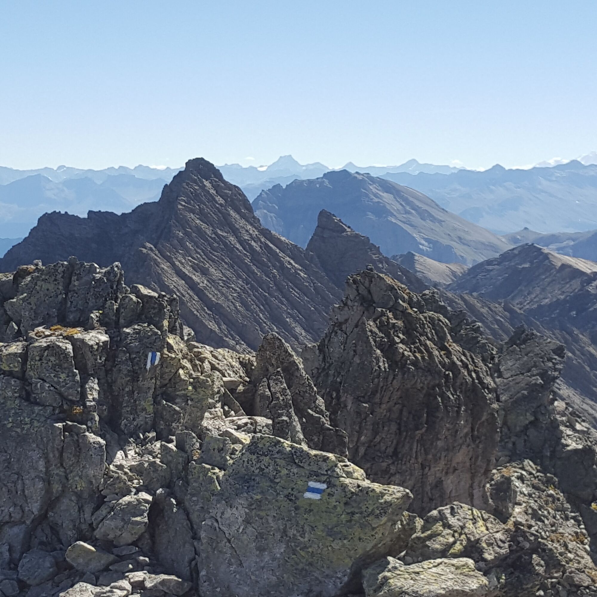
The route to the Pizol summit is an alpine route and marked blue-white. Surefootedness and a head for heights are required.
For the Wangs valley station, take the Sargans exit, and for the Bad Ragaz valley station, take the Bad Ragaz Nord exit. The valley stations are well signposted from the motorway exit.
The two valley stations are only 5 minutes from the motorway exit and are accessible even in winter without snow chains or other aids. Ideal accessibility via the A3 (Zurich-Chur) and the A13 (Lake Constance-Sargans-Chur).
Navigation system destination input:
Bad Ragaz valley station: Loisstrasse 50, 7310 Bad Ragaz
Wangs valley station: Pizolstrasse 3, 7323 Wangs
For the summit tour to the Pizol, we recommend arriving via the Wangs valley station.
The Pizol area is quickly and conveniently reachable by public transport: from Zurich and St. Gallen in one hour to Sargans or Bad Ragaz, from Chur in 15 minutes. From the Sargans and Bad Ragaz train stations, buses run in a few minutes to the valley stations of the Pizol lifts.
For the summit tour to the Pizol, we recommend arriving via the Wangs valley station.
Parking options at the Pizol lifts
Our guests benefit from well-accessible public parking spaces at both valley stations – Bad Ragaz and Wangs. The parking spaces are subject to a fee.
Wangs valley station
Payment: parking ticket online via Parkingpay, Twint or with common debit/credit cards.
Alternatively, during opening hours at the cable car ticket office.
Disabled parking spaces: 2 reserved spaces
E-charging stations: 4 charging points available
Bad Ragaz valley station
Payment: ticket at entry barrier. Payment before exit at the machine (card payment only) or at the ticket office.
Disabled parking spaces: 8 reserved spaces
E-charging stations: 4 charging points available
Motorhome parking in Bad Ragaz
During the summer season, we offer a quiet and natural motorhome parking space at the Bad Ragaz valley station.
More information: www.pizol.com
Pizolbahnen AG
+41 81 300 48 20
Heidiland Tourism, Bad Ragaz info point
+41 81 300 40 20
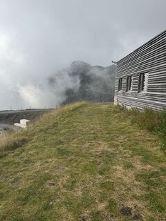
The mountain hotel Furt is the ideal overnight accommodation and starting point for this route, especially for combinations with the summit quartet.
Webové kamery z prehliadky
-
Laufböden
-
Furt - Wangs Bergstation
-
Furt - Wangs Bergstation
-
Furt - Wangs Bergstation
-
Furt - Wangs Bergstation
-
Furt - Wangs Bergstation
-
Furt - Wangs Bergstation
-
Pardiel
-
Gaffia
-
Pizolhütte
-
Furt - Wangs Bergstation
-
Pardiel-Prodboden
-
Station-Pardiel
-
SAC Bergstation
-
Pizol
-
Pardiel
-
Pardiel
-
Pardiel
-
Pardiel
-
Pardiel
Obľúbené výlety v okolí
-
4,8
Pizalun circular route
svetloTuristika 7,18 km -
4,6
5-Seen Wanderung am Pizol
svetloTuristika 10,1 km -
4,7
Alvier
strednáTuristika 3,33 km -
4,7
Pizol - Batöni - Weisstannen
ťažkéTuristika 11,7 km -
Lake Chapfen round trip
svetloTuristika 4,27 km -
5,0
Circular hike Bettlerweg & 2-Lakes Hike Pizol
strednáTuristika 11,4 km -
4,6
Mädems Trail
strednáSnežnice 7,48 km -
5,0
Guscha ridge path
strednáTuristika 7,96 km -
4,5
Bad Ragatz mit Taminaschlucht nach Pfäffers
strednáTuristika 16,3 km -
5,0
Maienfeld-Fläsch Wine Route
svetloTuristika 12,3 km
Turistika a stopovanie


Nenechajte si ujsť ponuky a inšpiráciu na ďalšiu dovolenku
Vaša e-mailová adresa bol pridaný do poštového zoznamu.