


Itinerary of the country churches and gullies in the Bormida Valley of Spigno and Erro - Stage 4: Spigno Monferrato - Montechiaro d'Acqui
After having walked through the historic center of Spigno Monferrato, perched between the Valla Torrent and the Bormida di Spigno, crossed the SP for Acqui Terme again and from the crossroads on which...
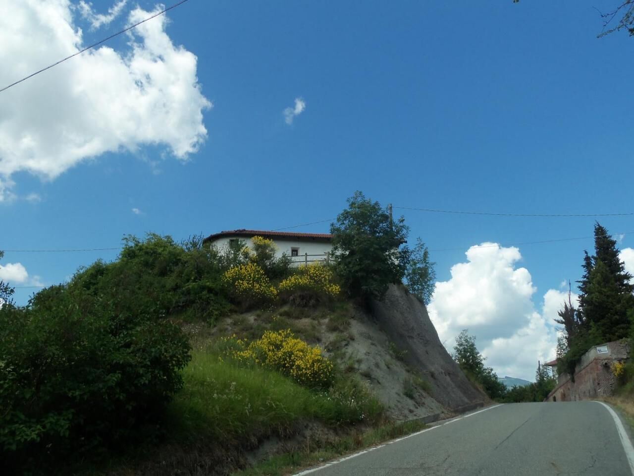
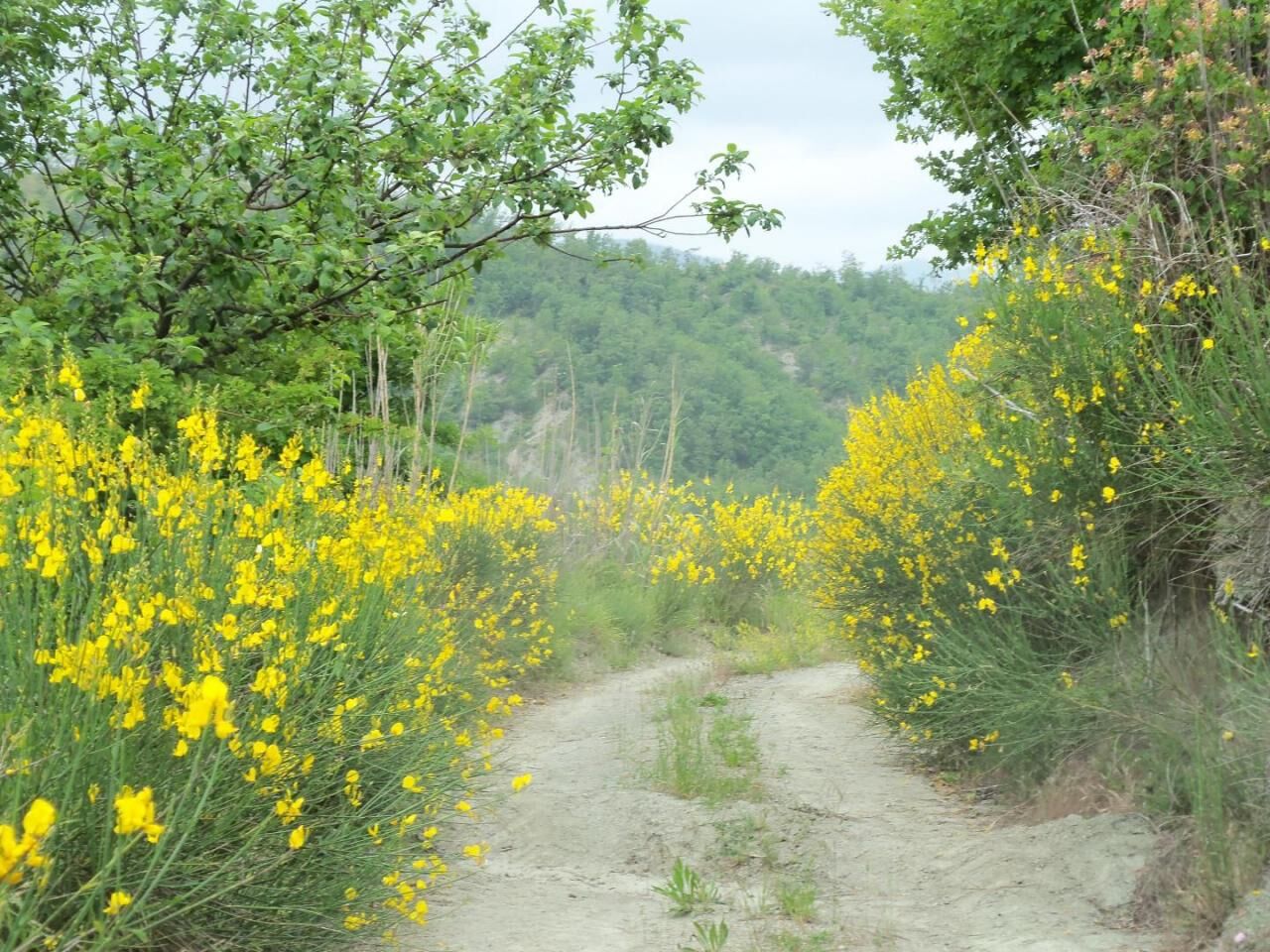
After having walked through the historic center of Spigno Monferrato, perched between the Valla Torrent and the Bormida di Spigno, crossed the SP for Acqui Terme again and from the crossroads on which the Chapel of San Giuseppe stands, walked along a stretch of the SP for Pareto, passed the bridge before which the SP branches off for Turpino (Spigno hamlet) leads to the ancient SC on the left and goes up to Località San Giacomo, returning to the SP and skirting the hill on which the country chapel of San Giacomo stands, turning to the left and proceed along the gullies, through the numerous paths that intersect there and which offer wide panoramic views of the villages (Denice, Roccaverano) and the towers that dominate the Bormida Valley, turn right, then left and then right again above Località Barbania, you reach the crossroads between the SP for Turpino and the SC for Località Bergagiolo, go down to the right along the latter and cross the village with the country chapel of Sant'Anna, go up the gullies again, along a panoramic route that reaches the top of the hill overlooking Rio Rabbioso, here you go down, cross the stream in an almost enchanted place and go up from the other bank through the woods to the SC for Turpino where, turning left, you continue until below Località Burci here you turn right and enter Path 573 (Montechiaro Ring). Continuing to the left, thanks to a branch of the Path you can arrive at the Church of Santa Maria della Visitazione in Turpino, a country church built on the gullies around the year 1000. The route of the Itinerary instead proceeds to the right, climbing up the gully slope up to to rejoin the asphalt road in Località Costabella (485 m), where there is an excellent panoramic point of the Maritime Alps in the shade of an ancient oak tree. Continued for a stretch on the SP for Pareto, the route, having reached its southernmost stretch, turns left and enters a comfortable carriage road immersed first in a chestnut grove and then in a forest of oaks and flowering ash which follows the ridge line that it divides the territory of Malvicino from that of Pareto and then descends towards Albareta (513 m), a small nucleus of abandoned houses. Having reached the SP for Roboaro (Fraction of Pareto), the route turns north towards the town of Malvicino and after about a kilometer and a half of asphalt, which is also very scenic and not very frequented by cars, it turns left and enters the woods going down along the slope suddenly. After crossing an area recently subjected to forest cutting, the route arrives at the valley floor, passes a small tributary and turns right onto a comfortable gravel road, which it leaves at Case Serena, to reach the asphalt at the ford point on the Rio Belvicino. The route follows the road for a few hundred meters and then turns right to go up the gully slope to the slopes of the concentric Malvicino. As you go up, the panorama becomes increasingly wider, immersed in the fragrant and colorful shrubby vegetation and , following the ridge line, you reach the panoramic Punta Marelli (470 m), from where you can admire the sought-after destination and the villages of the Erro Valley. The route heads east and proceeds downhill, bypassing another enchanting area of gullies, then enters the woods and with a series of left turns arrives at a dirt road, turns left again, crosses a dry watershed and then it continues downhill on a stony and uneven surface. At the end of the descent, the path runs along the valley floor following a series of small fords that allow you to gently go up the slope immersed in a typically riparian environment and, after passing an area with significant conglomerate formations, it starts crossing the gullies on the slopes of the town again of Montechiaro Alto. With a sudden turn to the right, the route leaves the main carriage road, ends up climbing the wooded slope and reaches the SC in Località Arbi (405 m). After a short stretch of asphalt it turns left, to descend again to the valley floor, plunging into the typical forest of this part of the territory, with its inevitable downy oaks. The route crosses the Rio Plissone, which here flows between the rocks forming characteristic ravines, and then starts climbing back towards Località Vaccamorta, on a comfortable and wide dirt road until reaching the farmhouse of the same name, where renowned cheeses are produced. Path 573 rejoins the SC and after a few meters turns right to go up the slope that leads to the ancient and suggestive village of Montechiaro Alto. Here you walk along the ancient cobbled streets, with the ancient buildings, the sandstone stairways, the architraves dated on the doors of the houses. Just before reaching the town square, you can go up with a short detour to the site of the ancient Montechiaro Castle, built in the 12th century, perched on the hill, and largely demolished in the 17th century by the Spanish. the motte with the base of the tower, part of the bastions and some underground rooms. The route instead reaches the Town Hall square, where on the first Sunday of May the annual "Anciuada der Castlan" festival takes place to commemorate the trade in salted anchovies, a historical activity of the inhabitants of the Municipality, and then descends along a comfortable staircase to the below Proloco, home of the Casa per Ferie.


Obľúbené výlety v okolí
-
5,0
Sentiero anello di Bistagno - Sentiero 500 in camminata
Pútnická trasa 14,7 km -
5,0
IL GRANDE CAMMINO DEL MONFERRATO - 7°TAPPA: CANELLI - PONTI
ťažkéPútnická trasa 20,3 km -
Sentiero "Giro delle 5 Torri" - Sentiero 5T in mountain bike
Mountainbike 29,4 km -
3,0
SV_02 Ring path of Foresta Deiva
Turistika 12,0 km -
Rundweg Montechiaro - Weg 573 mit dem Mountainbike
Mountainbike 30,9 km -
Sentiero anello di Cimaferle - Sentiero 534 in camminata
Pútnická trasa 8,13 km -
Sentiero anello di Cimaferle - Sentiero 534 in mountain bike
Mountainbike 8,13 km -
Sentiero anello di Merana - Sentiero 575 in camminata
Pútnická trasa 10,5 km -
Rundwanderweg Montechiaro - Weg 573 zum Wandern
Pútnická trasa 30,8 km -
Sentiero delle Chiese Campestri - Sentiero 571 in camminata
Pútnická trasa 21,5 km

Turistika a stopovanie


Nenechajte si ujsť ponuky a inšpiráciu na ďalšiu dovolenku
Vaša e-mailová adresa bol pridaný do poštového zoznamu.