


Sentiero 13 laghi (13 lake path)
Úroveň náročnosti: T2
The itinerary is functional to an area with distinctive landscape, natural and historical elements.
The area of the 13 Lakes is a Site of Regional Importance (SIR). The "Protected Areas and Natura 2000...
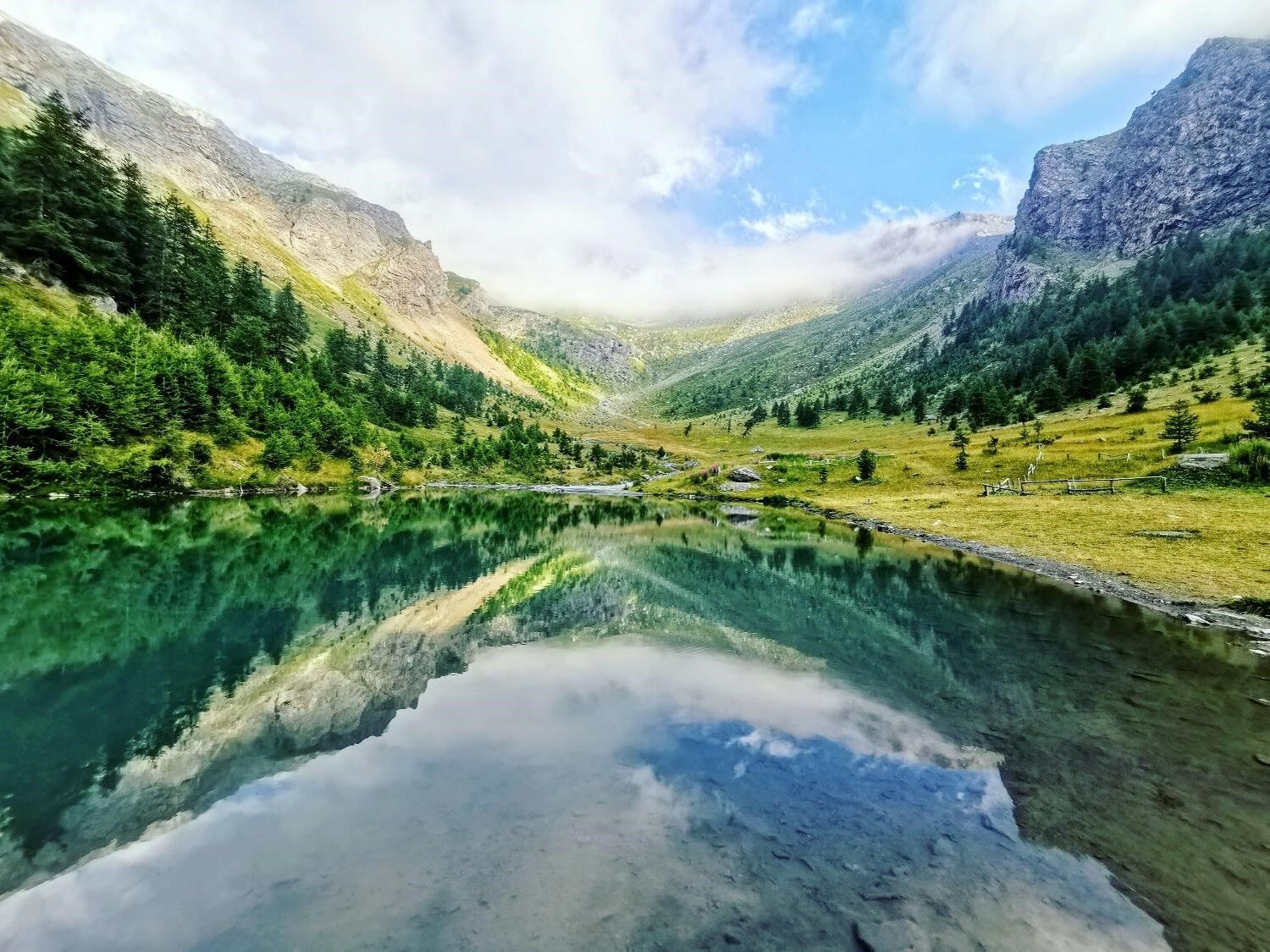
The area of the 13 Lakes is a Site of Regional Importance (SIR). The "Protected Areas and Natura 2000 Network" are a perimeter of sites of naturalistic interest at local level proposed by the Regione Piemonte within the Bioitaly Project (Ministry of the Environment) pursuant to Regional Law 47/1995, now nodes of the Regional Ecological Network. The basin of the thirteen lakes is located between Cappello d'Envie (2,618 m), Passo della Cialancia (2,683 m), Punta Cialancia (2,855 m), Passo Roux (2,830 m) and Punta Cournour (2,867 m), in the heart of Val Gemanasca. The area has this name because of the presence on its territory of thirteen small stretches of water, probably of glacial origin. Besides the naturalistic beauties and the suggestive panoramas, the basin also offers various historical-military testimonies. In fact, in this area there are the Ricoveri Perrucchetti shelters (built between the 19th and 20th century and dedicated to the founder of the Alpini corps, Giuseppe Domenico Perrucchetti), several small abandoned barracks and the military roads (paths 201 and 230), which go up from the valley along the surrounding slopes. At Lake Ramella there are also two cannon barrels, the remains of the four used in June 1940 by the 149th artillery battery of the Guardia alla Frontiera (Italian Army Border Guard) during the battle of the Western Alps.

You reach Prali and then the chairlift station, for those who do not want to take path 204 which in 950 meters of altitude difference leads to Bric Rond.
By chairlift, you travel the first section, Malzat - Pian Alpet (2232 m), and the last from Pian Alpet to Bric Rond (2480 m), where the circular hike of the 13 lakes begins.
Once at Bric Rond, follow the signs for path “A - Lakes Circuit,” turning right and shortly after you will already have the first 3 lakes in sight.
From here, the path descends and in about 30 minutes you reach Lake dell’Uomo, at 2360 m, the lowest point of our hike, after leaving behind Lake Primo.
From Lake dell’Uomo, continue with a slight ascent approaching Lake Drajo and the first shelters. These are the “Ricoveri Perrucchetti,” former military structures built between 1888 and the early 1900s, later refurbished by the military during the Second World War. Today they are abandoned.
Continuing always on path “A,” along nearly flat sections and slight climbs, you encounter Lake della Noce, the Twin Lakes, Lake Lungo, and the Green Lakes.
If desired, shortly after the Green Lakes, you can leave path A to follow B (signposted for Passo del Roux, path 204) to reach Punta Cialancia at an altitude of 2855 m. Otherwise, along the path, you will find Lake Nero and then Lake Rametta, also called the “cannon lake” due to the presence of the remains of two cannons dated 1940.
Since you will be moving in a high mountain environment, the use of trekking boots, fleece, trousers, and a windbreaker in technical fabric is recommended.
From Turin, follow the SP 23 of the Colle di Sestriere and then from Inverso Pinasca the SP 166 to the Ghigo hamlet of Prali
The public transport service is provided by the company “Sadem.”
Morning: Departure from Turin at 7:15 AM and arrival in Prali at 9:55 AM
Evening: Departure from Prali at 6:00 PM and arrival in Turin at 8:19 PM
http://Www.sadem.it/It/Prodotti/Calcola-percorso.aspx
T2
The area dei tredici laghi (area of thirteen lakes) at an altitude of 2300 m, is home to numerous alpine lakes and military buildings. The most important buildings are the Ricoveri Perrucchetti (shelters), built between 1888 and the early 1900s on the wide plateau around Lago della Draja and dedicated to Giuseppe Domenico Perrucchetti, one of the founders of the Alpine troops.
Obľúbené výlety v okolí
-
Excursion to Pra la Peira on the road to Lazarà Pass.
strednáTuristika 3,11 km -
PRALI Praly4All Path
svetloTuristika 2,30 km -
INVERSO PINASCA In the Footsteps of the Partisans.
strednáTuristika 5,30 km -
Monte Giulian
strednáTuristika 19,3 km -
SAN GERMANO C. Ascent to Ruata (Pramollo)
svetloCestný bicykel 9,24 km -
Beth Lakes and Arcane Hill: between rock, sky and water, a dreamy, nature hike
ťažkéTuristika 12,1 km -
5,0
BOBBIO PELLICE Upslowtour - Ring 2 of the refuges
ťažkéCyklistika 37,6 km -
5,0
SESTRIERE Monte Rognosa
ťažkéTuristika 6,42 km -
PRAGELATO The winter charm of the Val Troncea Natural Park
svetloSnežnice 4,62 km -
5,0
Invincibles valley - Alpe Caugis
Turistika 15,3 km
Turistika a stopovanie


Nenechajte si ujsť ponuky a inšpiráciu na ďalšiu dovolenku
Vaša e-mailová adresa bol pridaný do poštového zoznamu.