


Cycling between the Sesia and Po rivers
A circular route by mountain bike along the rice fields of Vercelli, to discover the typical farmhouses and rice farms of the past, evidence of a past that no longer exists. This evocative itinerary, linked...
A circular route by mountain bike along the rice fields of Vercelli, to discover the typical farmhouses and rice farms of the past, evidence of a past that no longer exists. This evocative itinerary, linked to the stretch that runs along the bank of the Sesia river up to the confluence of the Po, winds along asphalted stretches and gravel roads used for rice threshing between canals and the typical irrigation ditches, minor canals used for the irrigation of rice fields.

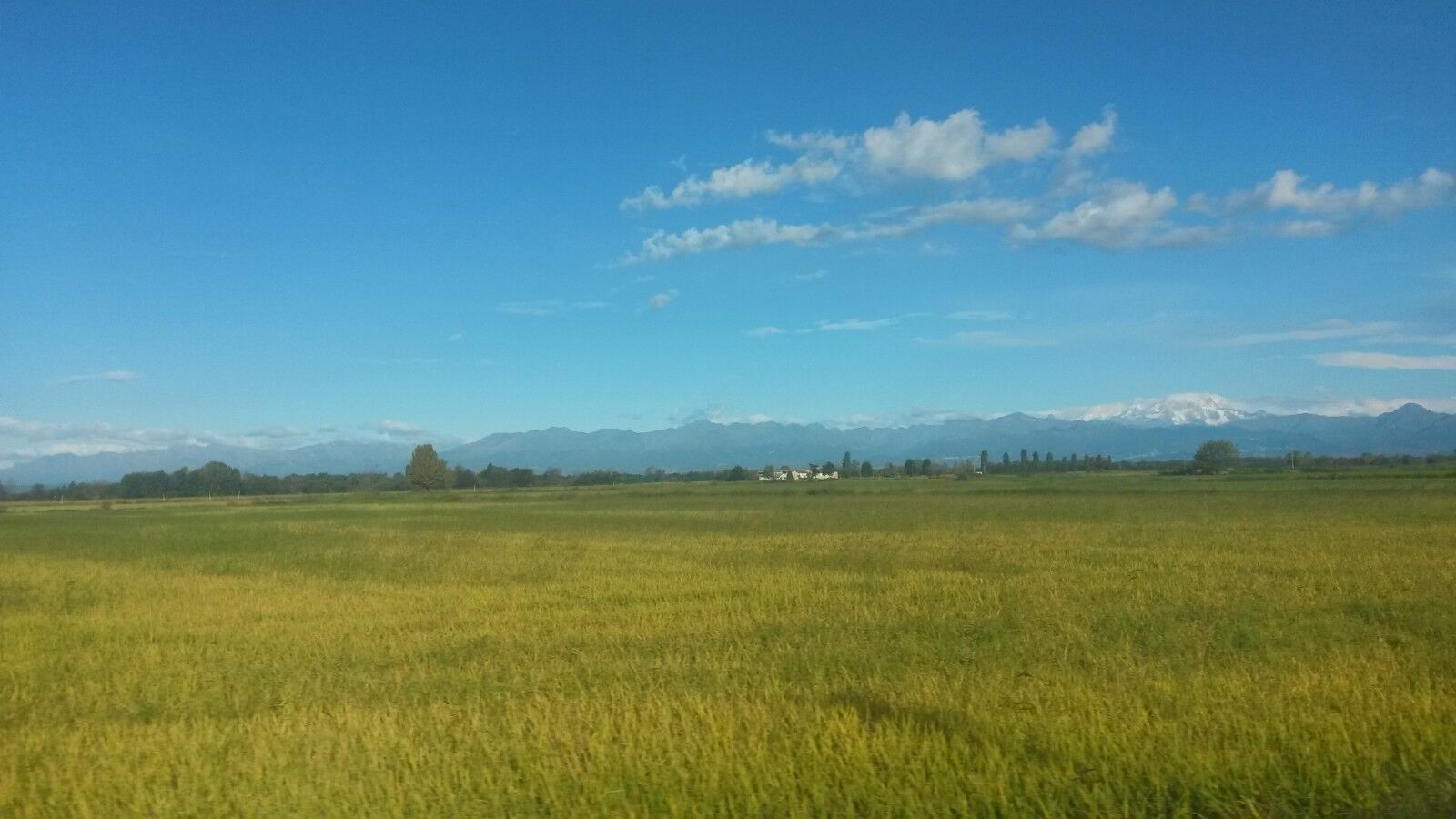
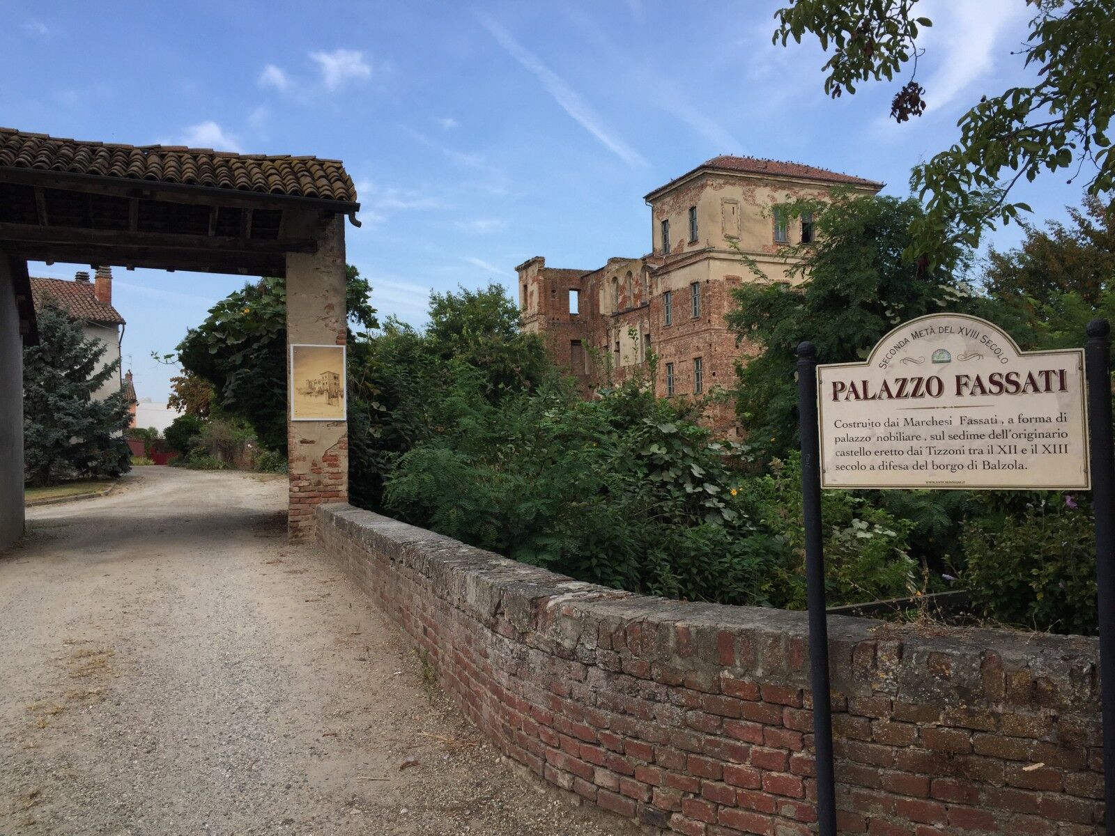
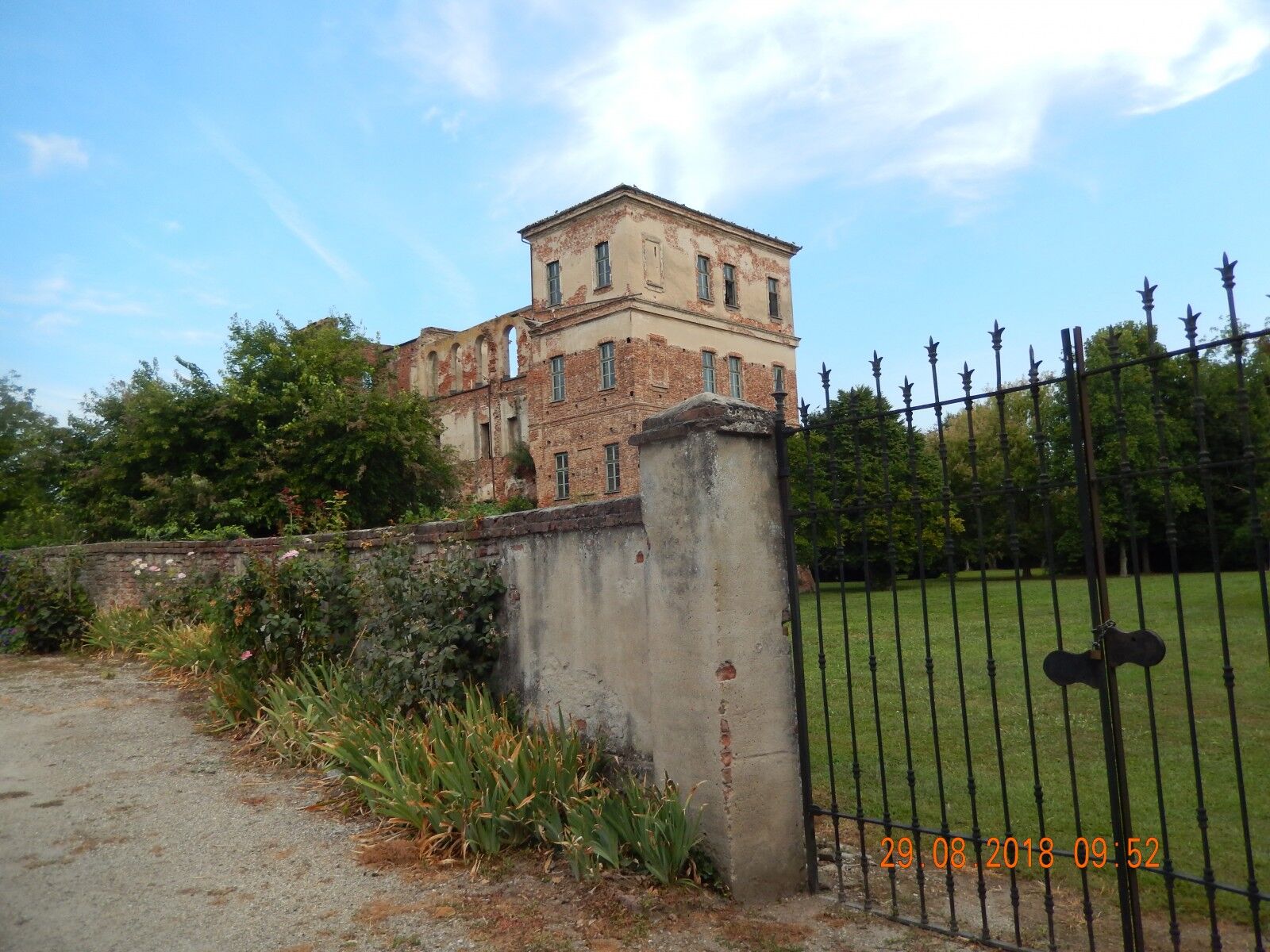
Departure from Trino Vercellese, from Piazza Garibaldi: exit the square, turn right and pass in front of the bar, turn left at the traffic light and continue to the underpass of the SS455, immediately after, turn left onto the dirt road that runs alongside the state road, you pass the visible roundabout of Trino and turn into the second dirt road (white road), Continuing you pass in front of a ruined chapel and after about 600 m. turn right you enter Robella at the crossroads with the SP20 in front of the church turn left, continue until the next crossroads go right to "Torrione", (typical example of farmhouse used by weeders, with military construction of great value, but in a bad state of conservation), we go down for a 400 m. up to the church to take a look then we retrace our steps and at the crossroads, we turn right initially paved and then Bianca, we stay on this road, it takes us to "Rive" we enter following the directions of travel, we turn into the main street to the right and we pass in front of the church, leaving the village we take the first road to the right, after two curves we turn left continue past the railway up to a farmhouse and turn immediately behind it, at the next farmhouse turn left, you arrive on the SP25 turn left you go to "Villanova" and always on asphalt you reach "Motte De Conti", you pass in front of the half-ruined castle and in the main square, then turn right out of the village and after the bridge on the "Roggia Bona or Marcova", take the second road on the left, you arrive on the bank of the "Fiume Sesia", turn right and continue passing under the bridge and take the SS596 dir, turn left and, after the big bend and before the level crossing, turn left on a white road, and continue until the asphalt begins, after a few meters turn left onto the bridge of the Stura canal (!!) from here you arrive on the embankment that runs along the Po river and therefore at the gates of Casale Monferrato, at the end of the embankment, turn right and get close to the level crossing, turn left onto a paved road which, crossing the SP31 bis, takes us to Casale Popolo. Continue on the main road that crosses the town in the direction of Balzola, pass the church and after about one km. and the last houses of the Cantone Corno in the left-hand bend, turn right onto the Cavalca Ferrovia, the road becomes Inghiaiata (white) after 2 km. about and without any detour you arrive at Balzola in front of the church, take a look at the remains of Palazzo Fassati (also called Castello Vecchio) then head towards the square and turn right, then turn right again into the first small street that passes in front to the rice mill and on the other side of Palazzo Fassati, here a dirt road begins, continue without turning off, you arrive on the SP24 turn left and take the dirt road on the right with signs for Cascina Morabina, continue and cross the SS455 and enter Trino Vercellese passing in front of the cemetery, you arrive at the traffic light and after the Bar, turn left and we arrive in Piazza Garibaldi, our starting point. Itinerary geomapped by Claudio Trombin
Obľúbené výlety v okolí
-
Sentiero "Vigneti e Infernot" - Sentiero 726 in mountain bike
Mountainbike 14,1 km -
Sentiero "Vigneti e Infernot" - Sentiero 726 in camminata
Pútnická trasa 14,1 km -
Sentiero panorami e ciminiere di Ozzano - Sentiero 738 in camminata
Pútnická trasa 7,20 km -
Among medieval forests
svetloMountainbike 10,1 km -
Panoramas and chimneys path of Ozzano - Path 738 by mountain bike
Mountainbike 7,20 km -
Sentiero 700 - SVC Tratto Crea - Casale in camminata
Pútnická trasa 25,2 km -
Sentiero anello di Coniolo - Sentiero 751 in mountain bike
Mountainbike 9,94 km -
Sentiero 700 - SVC Tratto Crea - Casale in mountain bike
Mountainbike 25,2 km -
Sentiero anello di Coniolo - Sentiero 751 in camminata
Pútnická trasa 9,94 km -
Sentiero anello di Cella Monte - Sentiero 731 in mountain bike
Mountainbike 8,75 km
Turistika a stopovanie


Nenechajte si ujsť ponuky a inšpiráciu na ďalšiu dovolenku
Vaša e-mailová adresa bol pridaný do poštového zoznamu.