







Alta Via dell'Anfiteatro Morenico di Ivrea: Stage 3 Castello di Masino - Castellazzo
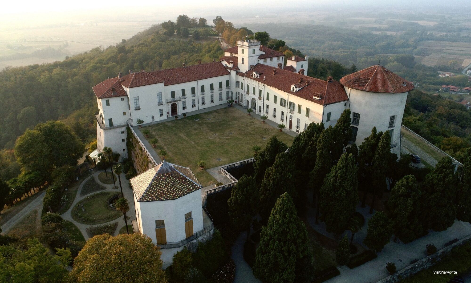
Starting from the Castle of Masino, proceed along the path that runs along the moraine, between chestnut and peach groves on a dirt path up to Sweater, where it is possible to admire frescoes, paintings,...
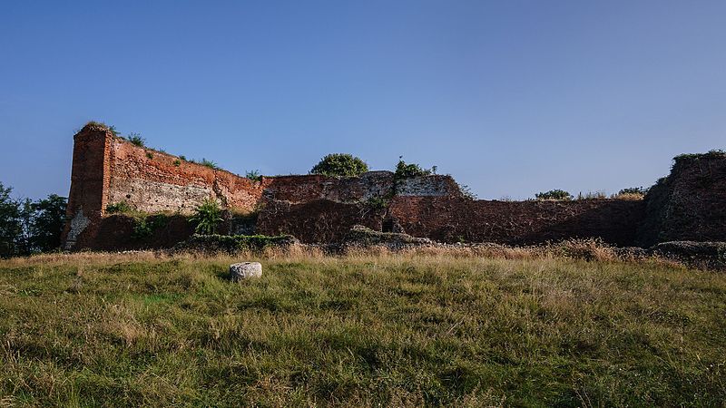
Starting from the Castle of Masino, proceed along the path that runs along the moraine, between chestnut and peach groves on a dirt path up to Sweater, where it is possible to admire frescoes, paintings, installations and sculptures from the "Museum of Contemporary Art in the Open Air". After having skirted the sweater lake and the Moncrivello lake, and having passed the town of the same name along a stretch in the city between churches and the Moncrivello Castle, you will gradually reach the Dora Baltea river, which you cross between Villareggia and Mazzè. It then climbs the low morainic reliefs to reach Caluso, the production area of the DOCG Erbaluce di Caluso, which houses the Regional Enoteca of the wines of the province of Turin. The stage ends in the thick vegetation of Castellazzo, or Rocca di Caluso, a military construction dating back to the XIII century. The itinerary was promoted within the platform as part of the PITEM M.I.T.O. project. – Outdoor OFF - Interreg Italy-France Cross-Border Cooperation Program ALCOTRA 2014-2020.


Once you have passed Cascina Campore, proceed straight until you reach a large shrine where you turn left. Shortly after (stake "Lusenta 2"), you go up to the right reaching the "Gola di Finestrella". Turn left along the Val Sorda until you reach Maglione. At the end of the dirt road go straight on and then turn right into via Regina Elena. When you come to the end, turn right again into via Cavour. Walking along the streets of the village it is possible to admire frescoes, paintings, installations and sculptures that make up the "Museum of Contemporary Outdoor Art". Once you are in piazza XX Settembre continue left along via Vittorio Emanuele. Ignore the diversion to Moncrivello and a little further on, turn left into via Lago. Then leave strada di Montiglione turning left and, after having skirted the lake of Maglione, take the road that connects Borgomasino with Cigliano. Then take the road on the opposite side that leads to the lake of Moncrivello. At the STOP sign go straight on and then turn right along via P.G. Ferraris. Ignore the diversion to Cigliano and shortly afterwards, take via S. Spirito on the left. When you reach the square where there is the church of S. Francesco, follow via Matteotti to the right. At the end of it, turn right, pass under an arch and then next to the little church of S. Rocco. Then take via Miralta that leads to the homonymous Sanctuary on the left. Here you continue straight on and immediately after passing a cart road that descends to the right, turn right onto the track that after a stretch on the crest starts to descend. When you reach a nice dirt road, turn right going around Cascina Maglietto. Further on, turn left and head towards Naviglio di Ivrea. Cross the canal and turn left onto the dirt road that runs alongside it. After passing a dam, make sure you keep to the right to reach the bridge over the Dora Baltea. Cross it and follow the main road back to Piazza Mattea di Mazzè. Take Via Italia in the direction of Cigliano, which becomes via Dora further on. Leave the diversion for Rondissone-Torrazza, take two hairpin bends and at the next bend turn left onto a dirt road (sign indicating "Dora Baltea"). The route goes alongside the Dora, skirting it until km 2.47 when you take a steep path on the left (signposted "Regione Masi"). When you reach a clearing, turn right until you come to a more evident dirt road that you must follow to the left. When you reach the SP81 road go left and then take the first dirt road on the right (signposted "Valle della Motta"). At the first fork keep left. You come out onto an asphalt road that you follow straight ahead and after about a hundred metres you take a natural terrain road on the right. You will reach the dirt road that runs along the Motta valley. Follow it to the right until you turn left after a canal. Follow the stakes until reaching the SP84 road. Here go to the right and then, shortly afterwards, to the left. When you reach a crossroads with a shrine, go down to the right and then take the dirt road on the left that leads to Castellazzo di Caluso.
Áno
Suitable trekking equipment is recommended.
Good
There are public transport services.
During the harvest period, a good tour of the vineyards and hills is recommended, with a stop at the beautiful Masino Castle complex and nearby Caluso.
Obľúbené výlety v okolí
-
3,0
Via Francigena Etappe 5
strednáTuristika 36,7 km -
CANDIA Lake Candia MTB loop
svetloMountainbike 10,8 km -
Erratic boulders trail of Vialfré
svetloTuristika 7,15 km -
IVREA Ivrea - Viverone Route
strednáDiaľková cyklotrasa 52,4 km -
Ring of the Ancient Balteo Glacier - stage 4
strednáDiaľková cyklotrasa 51,0 km -
Ancient Balteo Glacier Ring - stage 1
strednáDiaľková cyklotrasa 49,0 km -
MAZZE' Anello Mazzè - Strambino
strednáDiaľková cyklotrasa 41,3 km -
CORIO Runde Oberes Canavese Westmoräne
strednáCyklistika 76,4 km -
MAZZE' Lake Candia and Masino Castle Loop
strednáCyklistika 44,8 km -
CALUSO Lake Candia Loop Morena West
strednáCyklistika 31,0 km
Turistika a stopovanie


Nenechajte si ujsť ponuky a inšpiráciu na ďalšiu dovolenku
Vaša e-mailová adresa bol pridaný do poštového zoznamu.





