Anello del Vermenagna (ADV)
stredná
Turistika
Navigácia na stránke
Získajte túto prehliadku v mobilnom telefóne
Mapa
Anello del Vermenagna (ADV)
stredná
Turistika
66,81 km
Naskenujte kód QR a spustite navigáciu v aplikácii bergfex
QR Code
Turistika a stopovanie

Anello del Vermenagna (ADV)

Vzdialenosť
66,81 km
Trvanie
23:15 h
Ascent
3 268 hm
Hladina mora
632 - 1 572 m
Stiahnutie skladby
Mapa
Anello del Vermenagna (ADV)
stredná
Turistika
66,81 km

Using the itinerary it is possible to reach France or connect to the ex-military road “Limone-Monesi” through the Colle di Tenda, the Colle della Perla, the Passo della Boaria or through the adjacent municipalities....


Opis
Using the itinerary it is possible to reach France or connect to the ex-military road “Limone-Monesi” through the Colle di Tenda, the Colle della Perla, the Passo della Boaria or through the adjacent municipalities. The Vermenagna Valley has great tourist and hiking potential, especially given its geographical location and its location between the two Protected Areas of the Maritime Alps and the Mercantour National Park, in France. The route also has the value of an inter-regional connection - as it connects the paths of the lower Vermenagna Valley, or of the adjacent valleys with the GTA - and can also represent a valid alternative to this, especially in the event of snowfall at high altitude or lack of managed accommodation facilities .

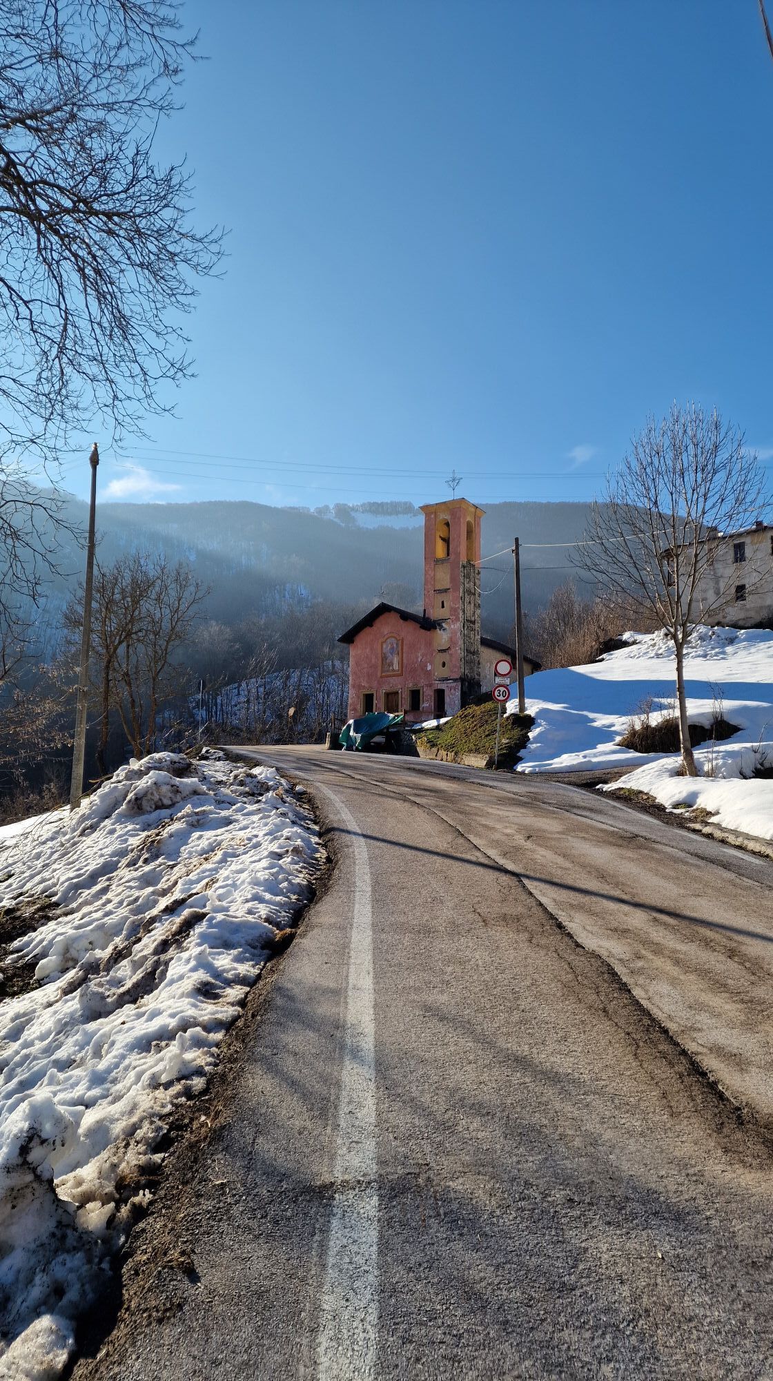
On a local scale the itinerary is configured as a connection between the upper and lower valley and with respect to the adjacent valleys, it also favors the train-car/camper-bike and cycle path interchange. The entire Vermenagna ring can be covered by mountain bike and in the winter season it is possible to cover it entirely with snowshoes.

Trasa
Trasa
Mapa
Anello del Vermenagna (ADV)
stredná
Turistika
66,81 km
Vernante
(791 m)
Dedina
0,0 km
Tetto Pertus
(800 m)
Zúčtovanie
0,0 km
Madonnina della Valle
(798 m)
Miesto uctievania
0,0 km
Croce della Moler
(927 m)
Summit
1,0 km
Pianot 't l'Arp
(1 014 m)
Koridor/terén
1,6 km
Bric Martinet
(1 232 m)
Summit
2,7 km
Tetti Polin
(1 151 m)
Zúčtovanie
3,1 km
Cappella di San Giacomo
(882 m)
Miesto uctievania
10,5 km
Sorgente Canun
(746 m)
Zdroj
23,0 km
Confraternita
(651 m)
Miesto uctievania
23,6 km
Roccavione
(650 m)
Dedina
23,7 km
Cappella di San Rocco
(648 m)
Miesto uctievania
23,9 km
Bric Berciassa
(962 m)
Summit
27,1 km
Garp ‘dla Räna Giäna
(915 m)
Uhol pohľadu
27,2 km
Cappella del Malandré
(955 m)
Miesto uctievania
30,6 km
Tetto Carletto
(999 m)
Koridor/terén
30,9 km
Tetto Poriata
(1 048 m)
Koridor/terén
31,5 km
Cappella del Montasso
(1 057 m)
Miesto uctievania
33,0 km
Fontana Magister
(1 165 m)
Zdroj
39,0 km
Vernante
(791 m)
Dedina
41,6 km
Casali Barat
(1 067 m)
Susedstvo
55,2 km
Limone Piemonte
(984 m)
Dedina
56,2 km
Rocca del Pino
(1 603 m)
Summit
62,7 km
Tetto Brin
(1 159 m)
Zúčtovanie
64,0 km
Tetto Duru
(1 046 m)
Zúčtovanie
64,4 km
Tetto Pursil
(867 m)
Zúčtovanie
65,7 km
Tetto Ciastel
(832 m)
Zúčtovanie
65,8 km
Tetto Pertus
(800 m)
Zúčtovanie
66,6 km
Madonnina della Valle
(798 m)
Miesto uctievania
66,7 km
Vernante
(791 m)
Dedina
66,7 km
Informácie o prehliadke

The “Vermenagna Ring” represents a fundamental connection between the lower valley and the cross-border Alpine ridge.

Technológia
n.a.
Stav
4 / 6
Krajina
4 / 6
Skúsenosti
4 / 6
Najlepšie ročné obdobie
Jan
Feb
Mar
Apr
Máj
Jún
Júl
Aug
Sep
Okt
Nov
Dec
Zdieľať prehliadku
Mapa
Anello del Vermenagna (ADV)
stredná
Turistika
66,81 km
Chyba
Vyskytla sa chyba. Prosím, skúste to znova.
Informácie o príchode
Verejná doprava

Ferrovia (Linea Cuneo-Nizza)
Trasporti pubblici Autobus ATI (Linea Cuneo-Roccavione-Roaschia)
Consorzio GrandaBus numero verde 800.33.81.71 info@grandabus.it
www.grandabus.it/index.html

Zatiaľ žiadne recenzie
Napíšte recenziu

Recenzie pomáhajú ostatným používateľom vybrať si ďalšie dobrodružstvo. Prosím, hodnoťte len prehliadku, nie počasie alebo občerstvenie.

Vyberte jednu z hviezdičiek a ohodnoťte prehliadku
Zlé turné
Slabé turné
Priemerné turné
Dobrá prehliadka
Vynikajúca prehliadka
bergfex logo Získajte prehľad Vždy naživo na mieste s viac ako 9 500 webovými kamerami. bergfex Ako používateľ Pro si teraz môžete pozrieť príslušné webové kamery pre mnohé zájazdy v aplikácii zájazdy z. Môžete si tak priamo prezerať aktuálne podmienky.
Turistika a stopovanie

Turistika a stopovanie

Turistika a stopovanie
Viac ako 550.000 návrhov výletov, podrobné mapy a intuitívny plánovač trás robia z aplikácie povinnú výbavu pre všetkých nadšencov prírody.
Turistika a stopovanie
bergfex bergfex