


Vekarus accessible route 500 m
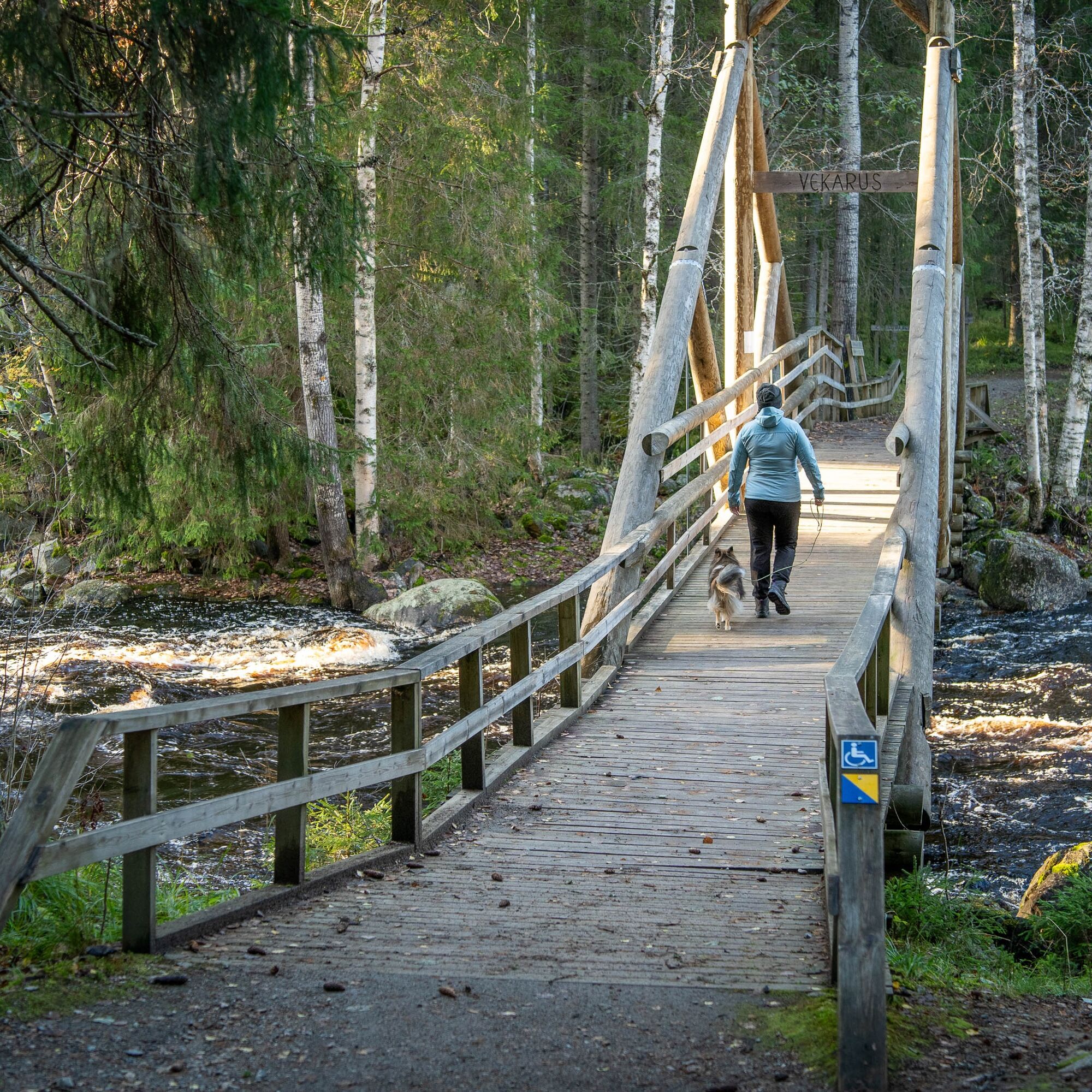
The accessible nature trail crossing Kotajoki at Vekarus offers powerful nature experiences in an unusually compact package. In the middle of the out-and-back route roars Vekaruskoski.
The route is marked...
The accessible nature trail crossing Kotajoki at Vekarus offers powerful nature experiences in an unusually compact package. In the middle of the out-and-back route roars Vekaruskoski.
The route is marked with blue and yellow signs and has a rather steep hill at both the start and end. Use of an assistant is recommended for wheelchair users.
The long sandy road section to the area’s parking lot is well marked. The roar of the rapids and the magnificent spruce forests immediately lift the hiking atmosphere from the edge of the parking area.
About 200 meters to the Vekaruskoski kota is accessible, although the outdoor path is steep. Apart from this, the route has moderate elevation changes. The area also has a 2 km nature trail, where rocky and root-filled sections occasionally make passage difficult.
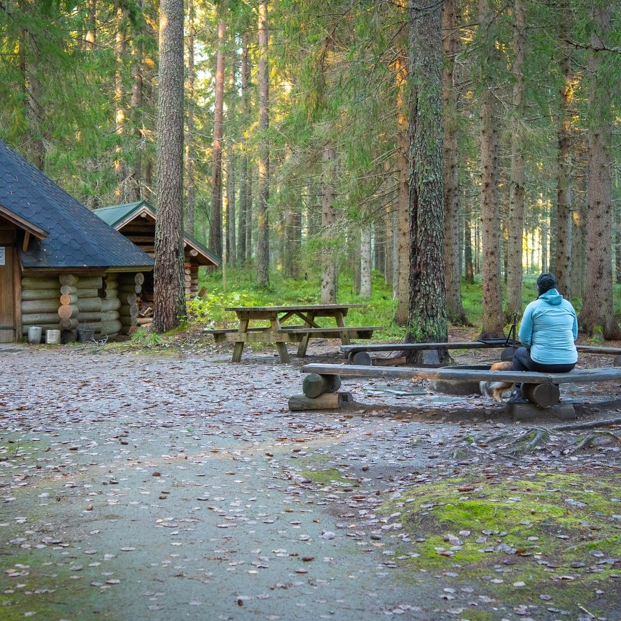
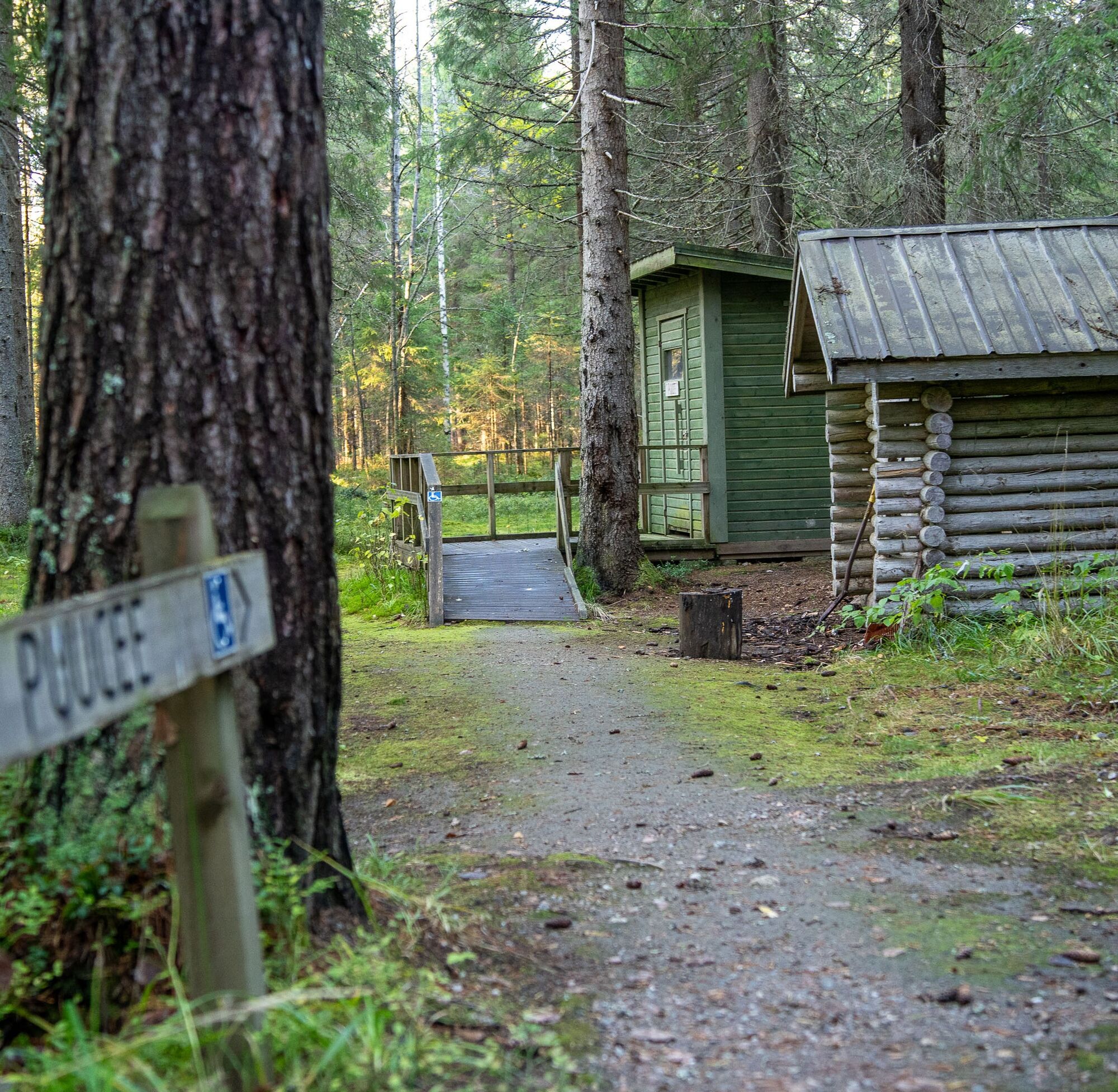
The Vekaruskoski campfire site, kota, and outhouse are accessible. Firewood supply is available at the campfire site.
The campfire site at Vekaruskoski is charming due to its ease.
About 200 meters off the accessible route there is a six-person rental cabin, alongside which are a lakeside sauna with a pier, outhouse, and cooking shelter. The rental cabin is available year-round but is not accessible.

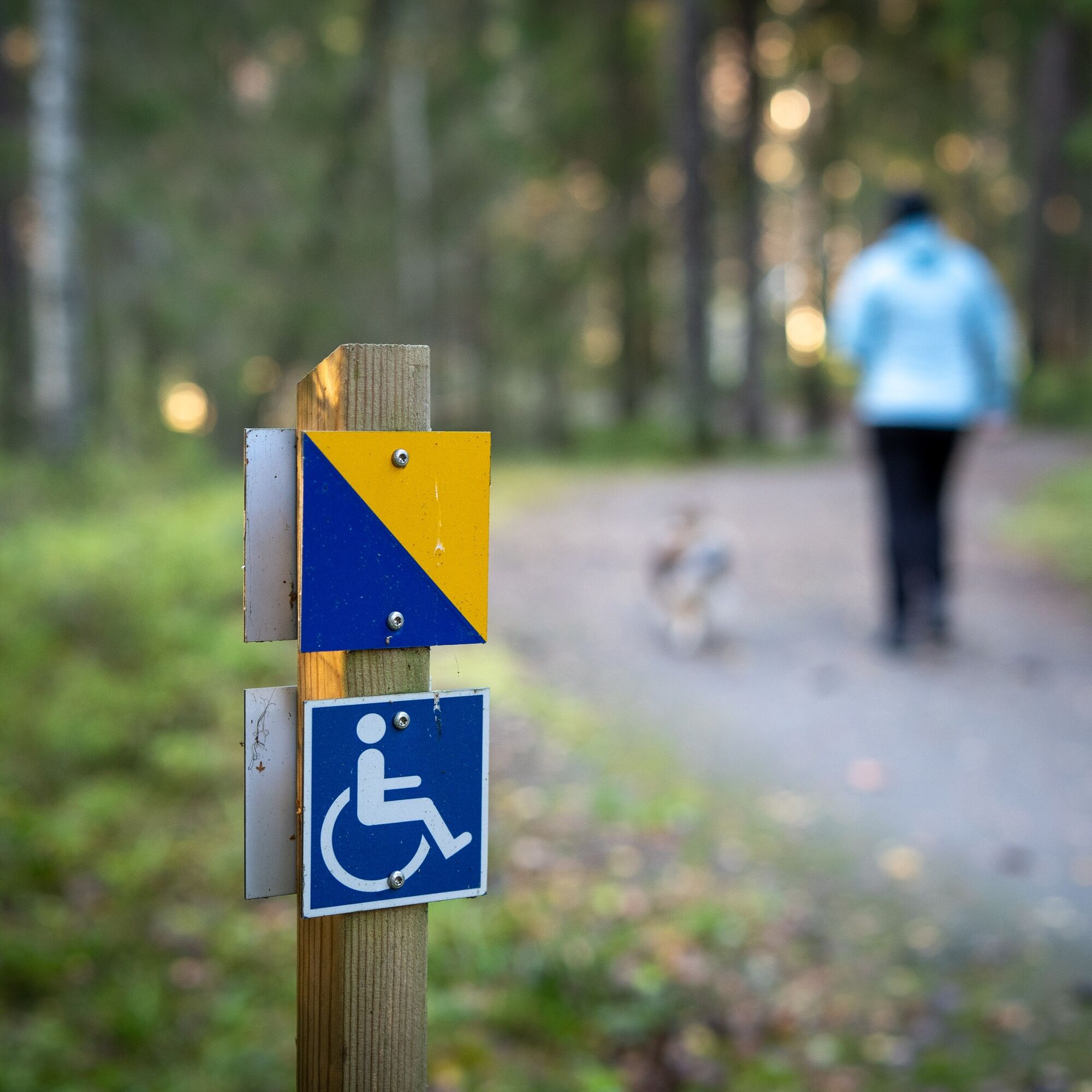
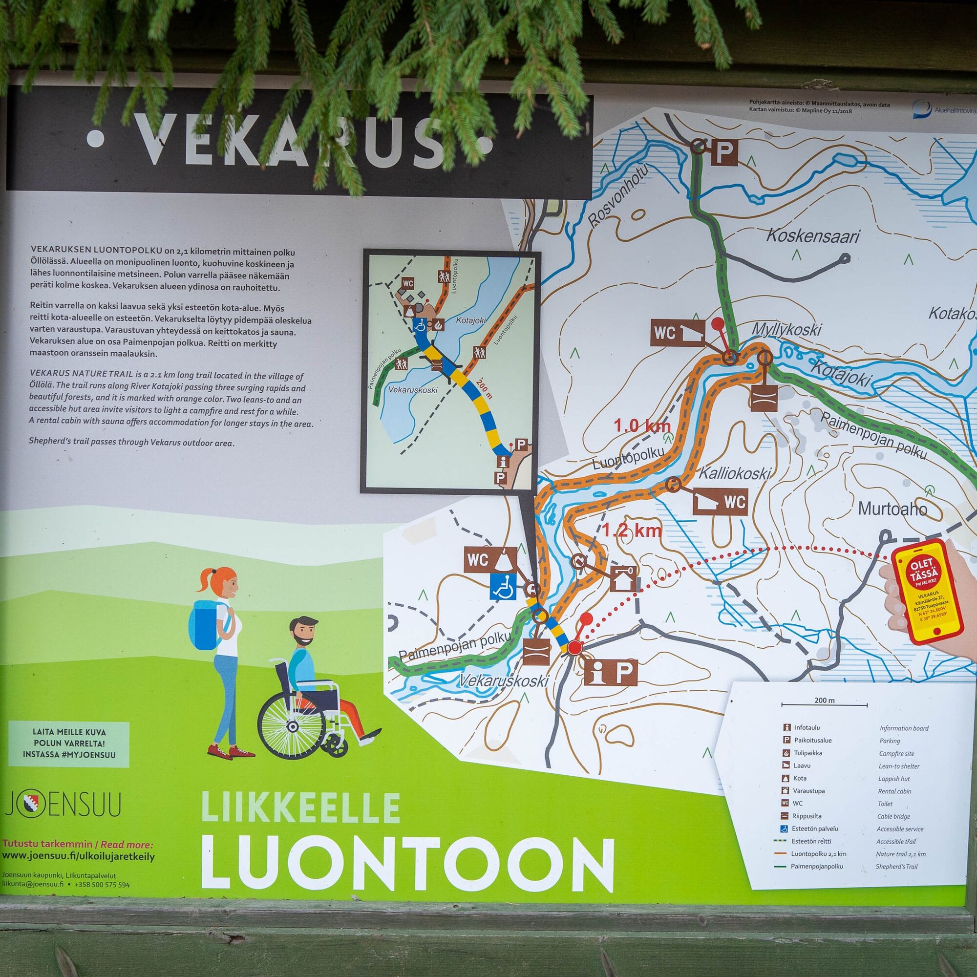
Follow the blue and yellow signs.
Áno
Áno
Áno
Áno
Áno
Hiking equipment, puukko knife, fire-starting tools
It is recommended that wheelchair users have an assistant. The route has an elevation change of about five meters over 200 m.
Guidance to Vekarus begins from Öllöläntie, about 12 km south of Tuupovaara. There are good signs from the asphalt road junction to the nature trail starting point, about 5 km away.
Parking Kärnäläntie 27, 82750 Tuupovaara
An assistant is recommended for wheelchair users because the route has about 5 meters elevation change.
The Vekaruskoski bridge and Vekarusjoki river are magnificent.
Turistika a stopovanie


Nenechajte si ujsť ponuky a inšpiráciu na ďalšiu dovolenku
Vaša e-mailová adresa bol pridaný do poštového zoznamu.