


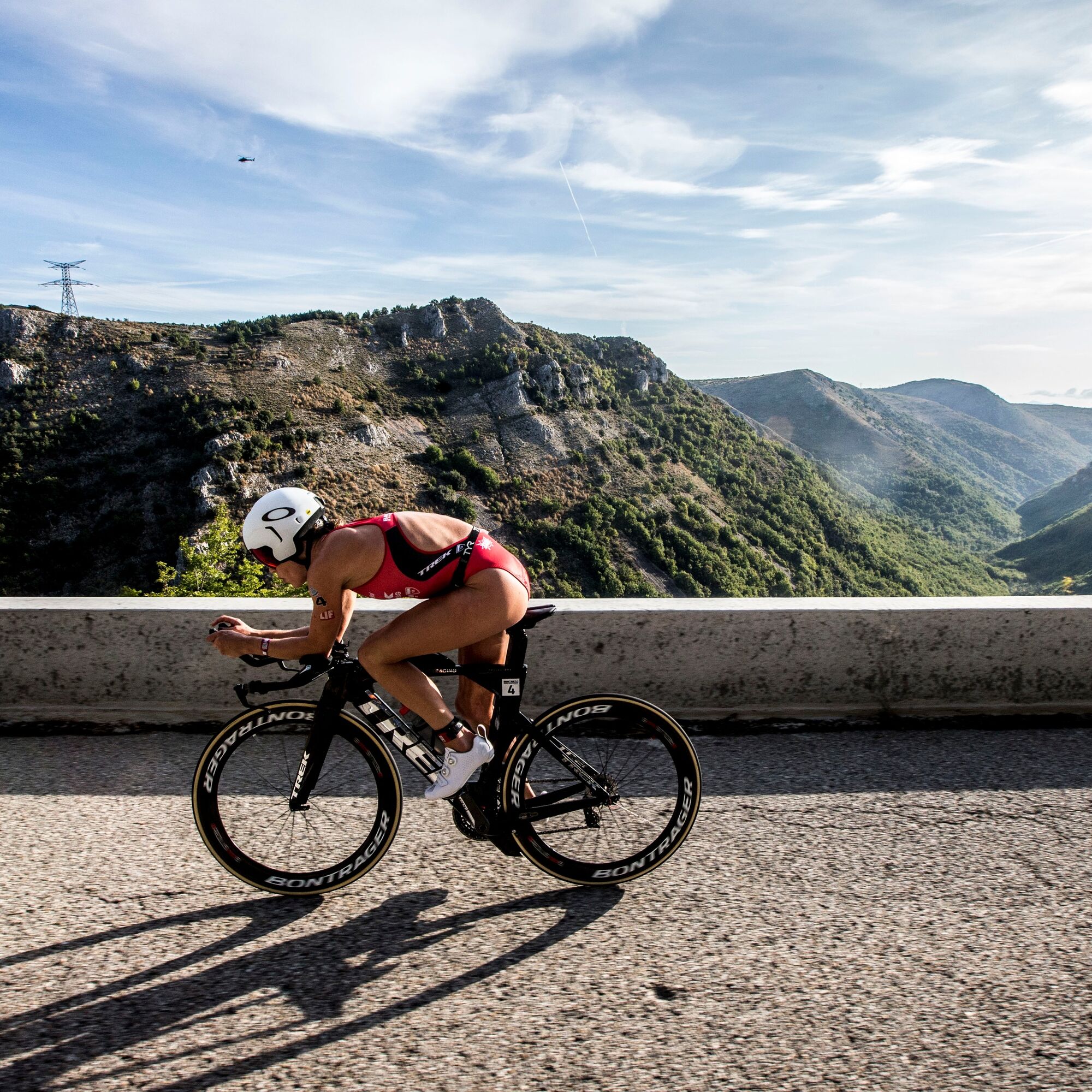
Bike route No. 9: The new IRONMAN NICE route
This Ironman route is the most beautiful of its kind, highly appreciated by triathletes worldwide. Its course is varied, with many climbs and descents. The highest point of this race and its true test...
This Ironman route is the most beautiful of its kind, highly appreciated by triathletes worldwide. Its course is varied, with many climbs and descents. The highest point of this race and its true test remains the Col de l'Ecre (1,118 m)
If this loop has a sportive character referencing Yves Cordier's race, former European triathlon champion, the cyclist will take the time to discover numerous medieval villages: Tourrettes sur Loup, renowned for its violets, Gourdon perched on a dizzying peak at 760 m overlooking the Loup valley. This location earned it the nickname "Eagle's Nest" and the detour through the alleys leading to the village's high point: the courtyard of miracles, is worth the detour. Coursegoules, Bouyon, Le Broc... are all villages worth a short stop before continuing the route.
The cyclist will be keen to take less frequented roads, shaded and crossing the forest on the southern slope of Cheiron mountain after the village of Gréolières to reach Coursegoules.
The new route will extend further to take the magnificent plateaus of Caille and Thorenc before rejoining the traditional route starting from Gréolières.
All outdoor activities of the Métropole Nice Côte d'Azur are on https://outdoor.nicecotedazur.org
From the Promenade des Anglais at the Centenaire level, starting point of the Ironman cycling event, head west of Nice on the cycle path along the seaside.
After crossing the Napoléon III bridge spanning the Var river, take the cycle path on the left that connects to RM 95 towards Saint-Laurent du Var Centre.
At the 5th roundabout turn left onto rue Jean-Aicard and at the second roundabout turn right towards Les Pugets.
From here, a climb with steep sections leads cyclists along the moyenne corniche des Pugets, towards the route de la Gaude (RM 118).
Following RM 118 to the right, towards La Gaude, you arrive at Peyron de Saint-Jeannet. At the roundabout, turn left towards Vence via RD 2210.
Arrived at Vence, at the intersection with route du col de Vence, turn right then immediately left to join the old road to Grasse (RM 2210) and Tourrettes-sur-Loup.
Once past Tourrettes-sur-Loup village, continue descending on RD 2210 towards Pont du Loup.
At the intersection with RD 6, just before Pont du Loup, it is advised to fill water bottles at the fountain a few meters after the right turn.
From here, start the long climb by turning right onto the road of the gorges du Loup (RD 6) towards Col de l'Ecre.
Along the way, you can admire the cascade du Saut du Loup.
At the place called Bramafan, turn left onto RD 3 towards Gourdon.
The second part of the ascent starts at the roundabout of Gourdon village to reach the summit of Col de l'Ecre via RD 12 towards Caussols.
Once past the summit Col de l'Ecre and crossed Caussols in a lunar landscape via RD 12, join RD 5, negotiating a hairpin turn to head towards Gréolières-St Auban (do not shortcut via RD 112).
On RD 5, you will pass the col de la Sine with a gentle incline and not very long to reach Pont du Loup.
From there, turn left onto RD 79 towards Andon.
At the roundabout at the exit of Andon village, take the first exit towards Caille continuing on RD 79.
At the intersection with RD 80, turn right towards Valderoure – Thorenc via RD 80.
Pass the col du Bas (1,199 m) continue on RD 80.
At the intersection with RD 2, turn right towards Thorenc – Gréolières.
At the roundabout of Gréolières des Neiges, take the first exit straight on and continue on RD 2 towards Gréolières.
At the entrance to Gréolières village, at the roundabout, take the second exit towards Nice-Grasse via RD 402.
At the intersection with RD 2, continue straight towards Nice-Grasse.
At the roundabout, take the direction of Coursegoules via RD 2. This starts the climb of côte de Saint-Pons continuing on RD 2.
At the intersection with RD 8, turn left onto RD 8 towards Coursegoules.
Last climb before descending to Bouyon.
From Bouyon village, the road becomes RD 1, then RM 1, passing through the charming villages of Le Broc and Carros-le-Vieux.
At the exit of Carros-le-Vieux village, at the traffic light, turn right towards Gattières via RM 2209.
At the Gattières roundabout take the second exit towards Vence.
Continue 100 m and at the next roundabout take the second exit towards Saint-Laurent du Var via RD 2209.
Pass the locality of la Baronne.
At the Saint-Laurent du Var sign, after a few hundred meters, turn left onto chemin de la Digue towards the industrial zone of Saint-Laurent du Var.
Pass the large successive roundabouts on RM 95.
Pass under the seaside road and turn right onto the cycle path towards Nice.
This slip road gives access to RM98, continue right to cross towards Nice on the Napoléon III bridge.
Continue on the cycle path,
Enter Nice following the seaside road (RM 6098) back to the starting point.
Áno
Áno
-Wear an approved helmet
-Check the condition of your tires
-Carry a repair kit in case of puncture
-Prefer at least a flashing LED light to attach to the seat post to be seen by motorists, especially in the numerous small tunnels in the Metropolis
BASIC RULES
Choose a route that suits your physical condition, do not overestimate your abilities
Check the mountain weather and the status of the mountain passes before leaving
Remember to carry an ID and an emergency contact number with you
Respect traffic lights
Prefer using cycle paths when available. In other words, a sign may require it:
If the "cycle path" sign is square: it's your choice.
If it is round you must use this path.
Respect the environment and other road users
GOOD PRACTICES FOR RIDING IN A GROUP
Riding two abreast is allowed, but single file is mandatory:
- at nightfall or when visibility is poor
- when a vehicle signaling to overtake approaches
In case of breakdown, move to the lower side of the road, not on the road itself
At "Stop", yellow light, fixed or flashing red light, make a complete stop for the entire group
Communicate within the group and use verbal and gestural signals to indicate obstacles or vehicles. A simple gesture or word can prevent a fall or accident.
Route intended for experienced athletes - FFC Color: black
Obľúbené výlety v okolí
-
Grasse - Rundtour
strednáTuristika 14,4 km -
FFC MTB route no. 25: The summit of Broc
strednáMountainbike 18,9 km -
Pic de Courmettes, Frankreich
ťažkéTuristika 6,14 km -
FFC cycling circuit No. 12: Tour of the vineyards of Bellet
svetloCestný bicykel 32,0 km -
FFC bike circuit no. 8: the 70.3 circuit (Half IRONMAN)
strednáCestný bicykel 92,8 km -
Rundwanderung Bois de la Marbière, Grasse, Provence-Alpes-Côte d'Azur/Frankreich
svetloTuristika 5,56 km -
Mountain Bike FFC Route no. 24: La chapelle Sainte-Marguerite
svetloMountainbike 11,9 km -
FFC bike route no. 7: Tour of Vence
svetloCestný bicykel 57,7 km -
Circuit, Col du Ferrier - La Gardette - La Colle
svetloTuristika 5,56 km -
A short walk in Saint-Jeannet : Les Baous de la Gaude and St-Jeannet
strednáTuristika 12,2 km
Turistika a stopovanie


Nenechajte si ujsť ponuky a inšpiráciu na ďalšiu dovolenku
Vaša e-mailová adresa bol pridaný do poštového zoznamu.