


Palatinate Forest Trail Stage 06 Merzalben - Hauenstein
The "king stage" starts in the town center of Merzalben and leads to Gräfenstein Castle. With the flashlight in hand, the bergfried, which is the only seven-sided one in Germany, can be explored via a...
The "king stage" starts in the town center of Merzalben and leads to Gräfenstein Castle. With the flashlight in hand, the bergfried, which is the only seven-sided one in Germany, can be explored via a narrow spiral staircase. Once at the top, the treetops of the Palatinate Forest spread out like a carpet. From the visitor parking lot, the path leads to the Winschertkopf. The rock colossal crowns a hilltop above the valley of the Merzalbe and allows deep insights into the Palatinate Forest. A dense forest section with comfortable ups and downs is followed by the summit of the Weißenberg with Luitpold Tower. At 607 m above sea level, the perspective changes, and not only houses shrink to miniature size. The descent to the hamlet of Hermersbergerhof and past the ruin Falkenburg takes you into the valley of the Queich. A detour to the double-towered sandstone church in Wilgartswiesen is advisable before reaching the day's destination Hauenstein.
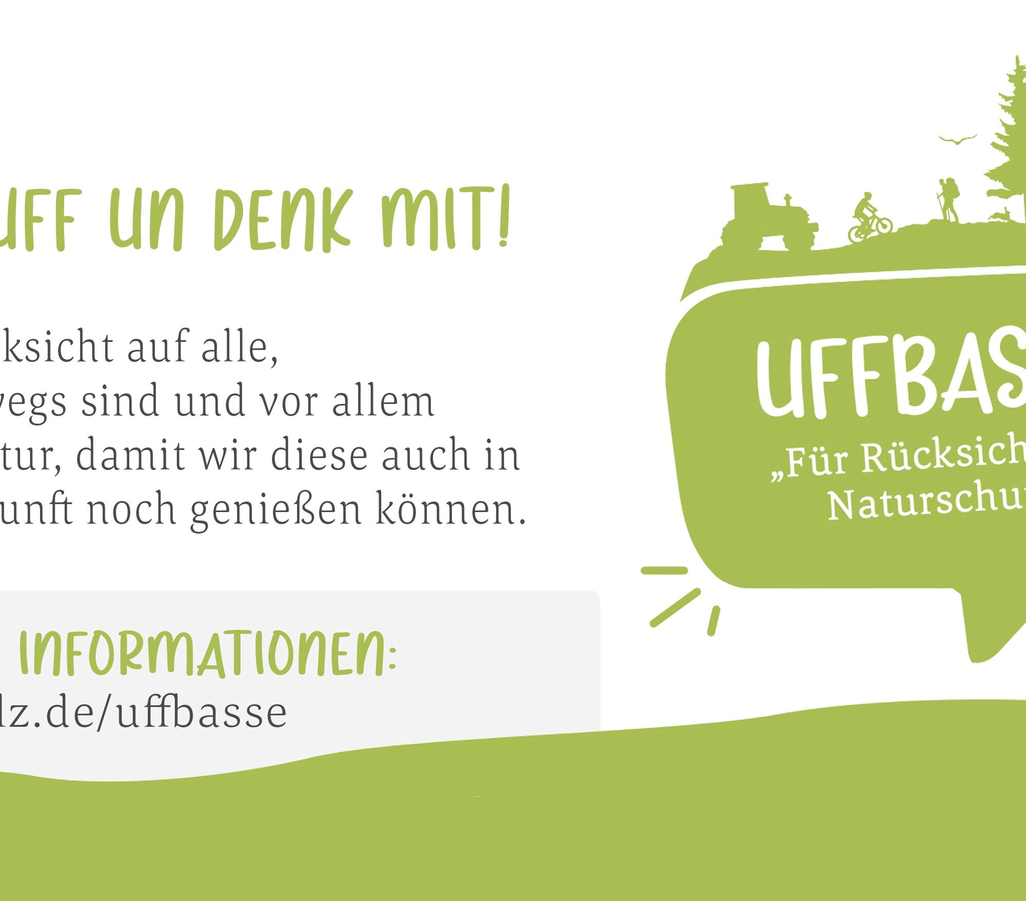
BEWARE! - Campaign for considerate coexistence in nature
Fire & Smoking - Building fires, smoking, and grilling are strictly forbidden in the forest and must be avoided at all costs! Fires and thus great damage to nature and wildlife can be avoided only this way.
Be considerate - Always behave attentively, kindly, and considerately towards everyone you meet on the way.
Nature conservation - Stay on designated paths and avoid unnecessary noise when you are in nature. Leave the forest at the latest at dusk to not disturb the rhythm of nocturnal animals.
Picnic & rubbish - Remember a rubbish bag for the way and take waste back home. Use only the furnished rest areas for breaks and picnics.
Leash your dog - Please always keep your dog on a leash. Other visitors and animals will thank you.
More information at: www.pfalz.de/uffbasse

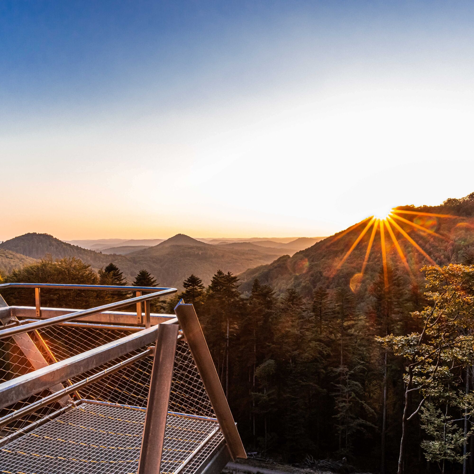
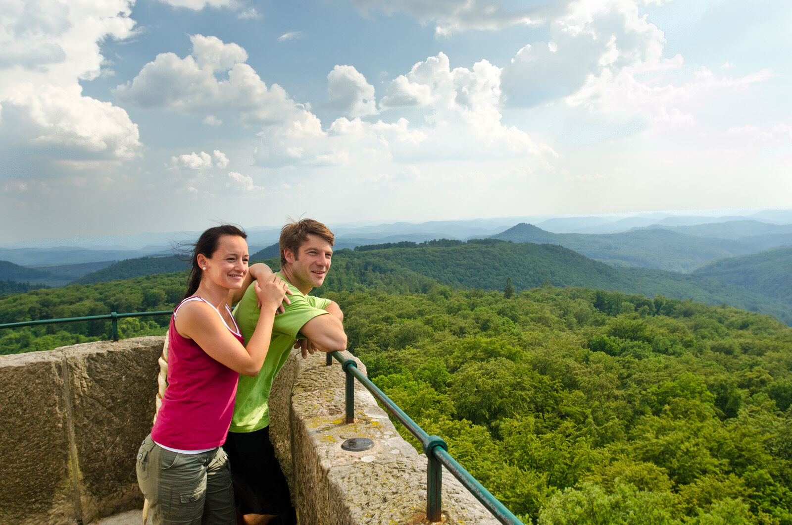
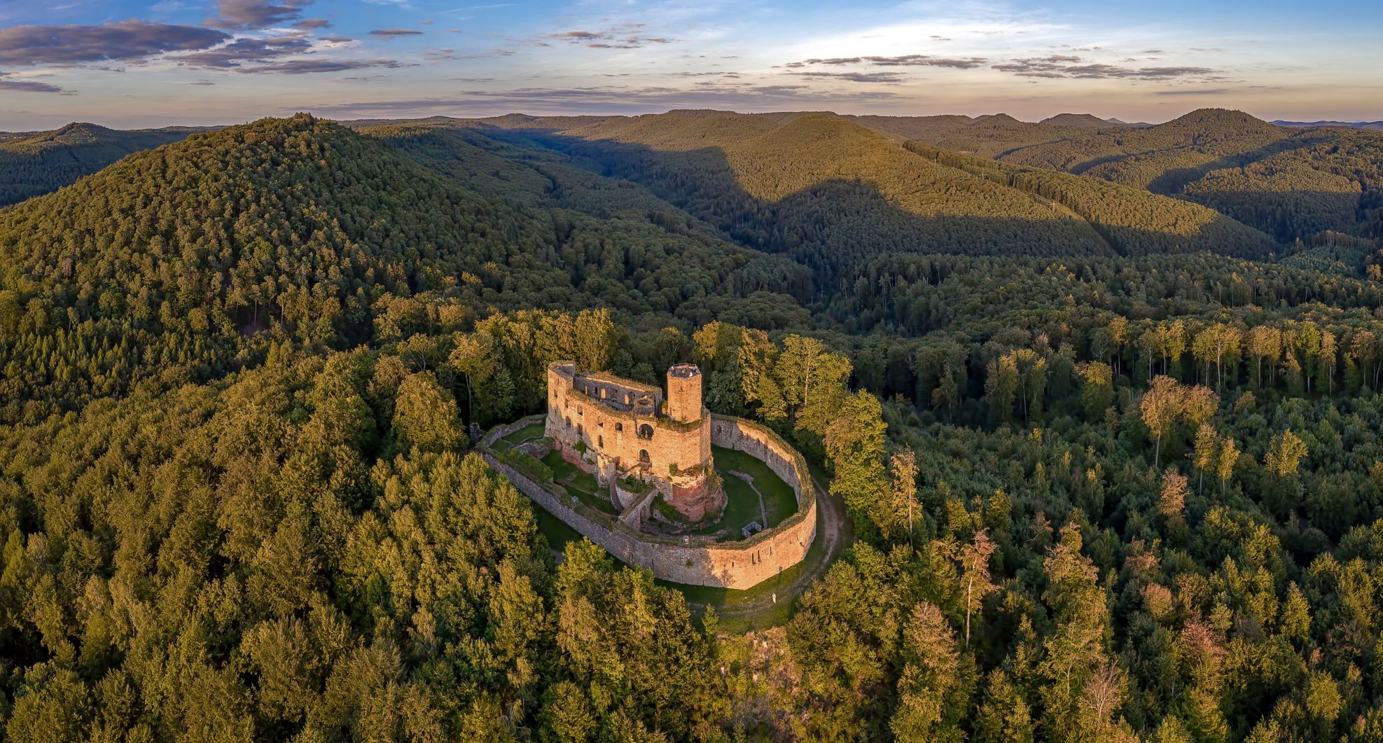

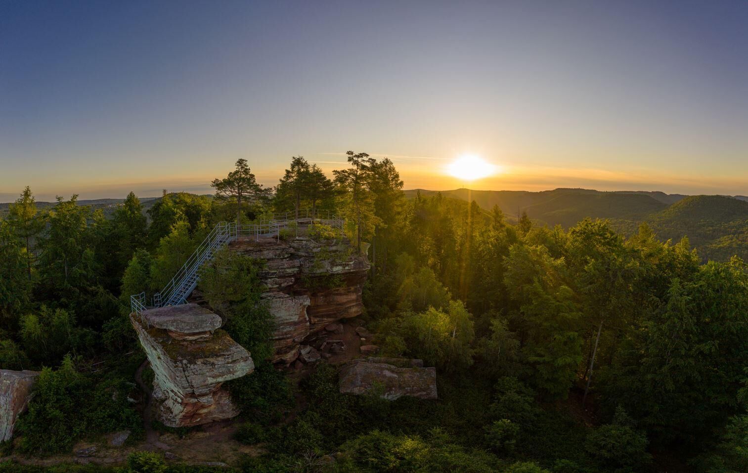
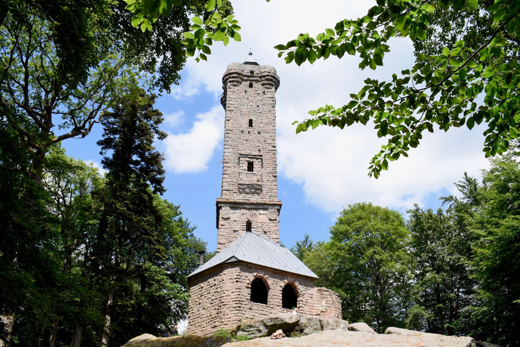
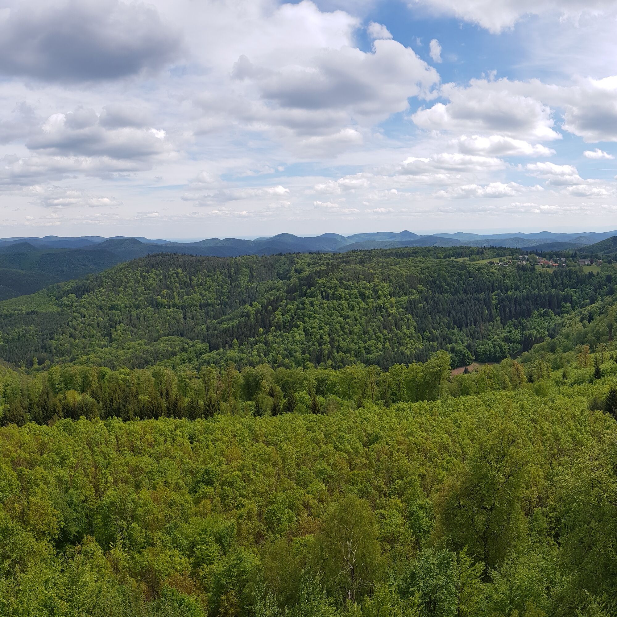
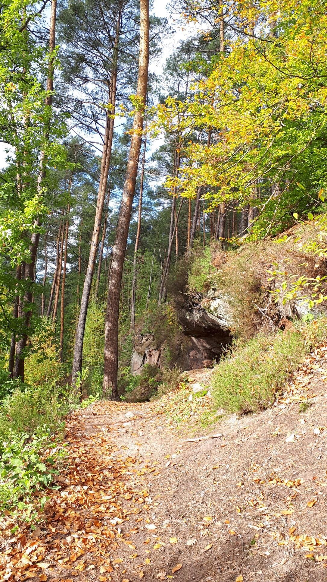
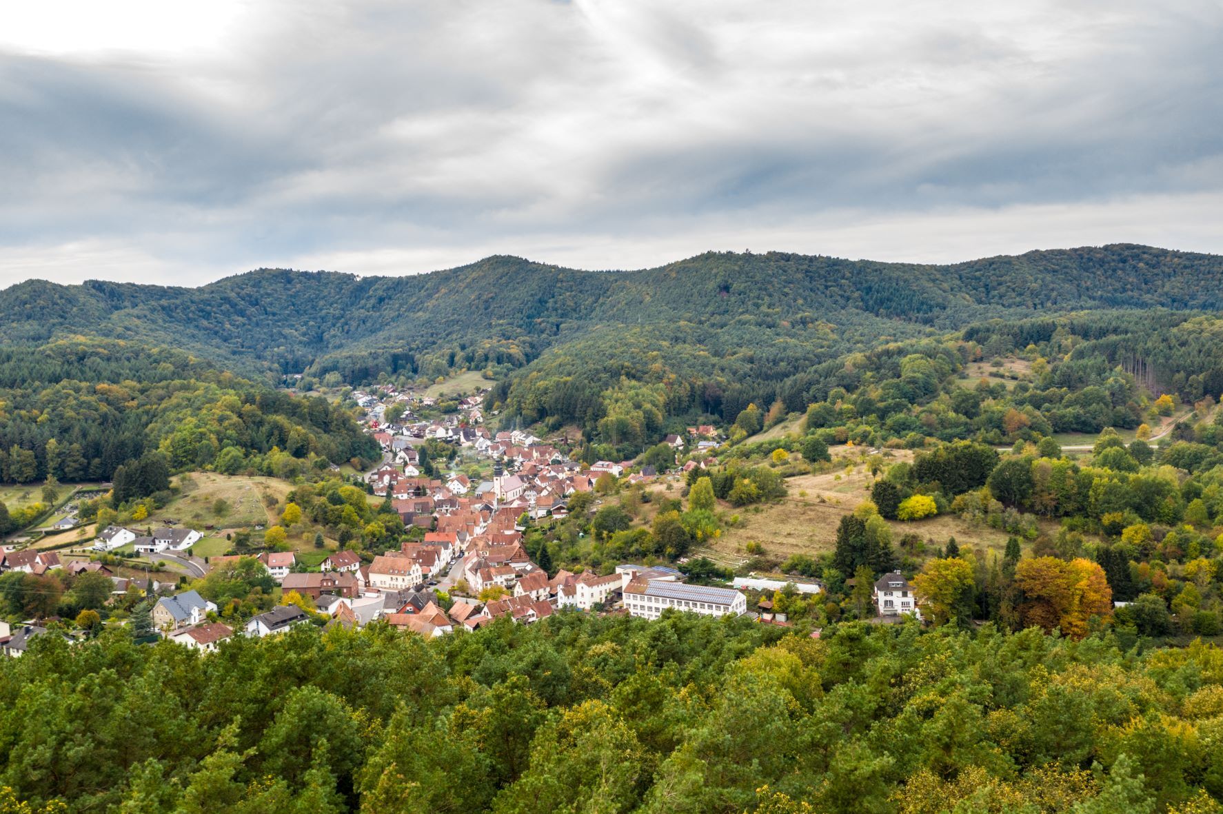

The "king stage" of the Palatinate Forest Trail starts in the center of Merzalben at the street corner Hauptstraße/Zimmerbergstraße. From here, the route leads us out of the town into the forest. After a short climb, we reach the ruin of Gräfenstein Castle, dating from the Staufer period (1). Equipped with our brought flashlight, we climb the seven-sided! bergfried of the castle and enjoy the view over Merzalben far into the surroundings over the green sea of hills of the Palatinate Forest. We leave the castle and descend to the visitor parking lot, from where it goes uphill to the Winschertkopf (2). The mighty sandstone rock stands on a hilltop high above the valley of the Merzalbe. After enjoying a magnificent view there again, we hike with gentle ups and downs through dense forest over the central heights of the Palatinate Forest to the summit of the Weißenberg. At 607 m above sea level, we reach the highest point of the Palatinate Forest Trail here. From the Luitpold Tower (3), we have a magnificent panoramic view over the largest contiguous forest area in Germany. Afterwards, we hike down to the hamlet of Hermersbergerhof and from there along the ruin Falkenburg further into the valley of the Queich. In the valley, we can make a detour to Wilgartswiesen with its double-towered sandstone church before reaching our stage destination Hauenstein.
Áno
For our hiking tours, we recommend the following standard equipment:
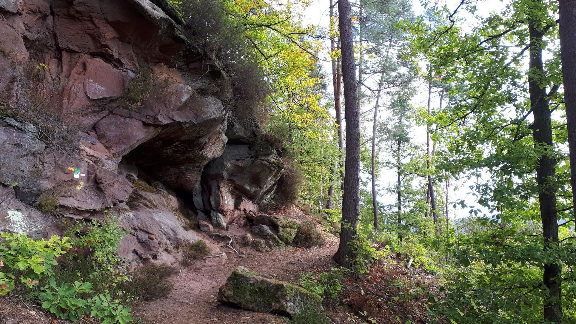
Sturdy footwear Weather-appropriate clothing Sun and rain protection A sufficient supply of food and drinks, as there are not always dining or shopping options available or open everywhere. Although the paths are continuously very well marked, for safety reasons it is always recommended to carry a suitable hiking map, so that you can quickly find a safe area in case of thunderstorms or an emergency.Hiking on natural paths and trails - Especially in autumn, be aware that leaves lying on the ground can cover unevenness, roots, stones, or holes in the path. After thunderstorms or heavy rainstorms, trees may still topple or branches fall afterwards. Especially in adverse weather conditions, natural paths may have muddy and slippery sections. Not all rocks or precipices are secured with ropes or railings. Surefootedness is required in some places. You must expect these kinds of path impairments when going on a hike. If you believe certain path sections are not passable for you, you should avoid them. Despite the "non-divertible" marking of the premium hiking trails, it is always recommended for safety reasons to carry a suitable hiking map so that you can quickly find a safe area in case of thunderstorms or emergencies. Pay close attention to path closures and detours.
Hazard situations - In an emergency, quick help is required. And even though mobile phones can send GPS signals, the classic rescue points are often the fastest way. These are located at points easily accessible for rescue vehicles. Remember the points with green signs and a white cross. In an emergency, return there and provide the number on the sign when calling for help. This way, rescuers will know where to find you.
A65 to exit Landau-Nord, continue on B10 to Münchweiler and from there to Merzalben
Or: A62 to exit Pirmasens, continue on the B10 to Münchweiler and from there to Merzalben
By train to Pirmasens, then with bus 256 towards Goethestr., Leimen to Merzalben (stop: Rathaus)
Schedule information: via the DB journey planner and in the DB Navigator app
In Merzalben: among others, hiking parking lot at Gräfenstein Castle
Please only park in designated parking spaces and always keep access roads for emergency vehicles as well as work paths in the forest and vineyards clear. For overnight stays in camper & caravan, there are explicitly designated motorhome parking places.
Áno
Visit the ruin of Gräfenstein Castle
Take the detour to the Winschert rock!
Climb the Luitpold Tower
Refresh yourself at Hermersbergerhof
Obľúbené výlety v okolí
-
4,8
Dahner Felsenpfad
strednáTuristika 13,2 km -
5,0
Annweiler Richard-Löwenherz-Weg
ťažkéTuristika 13,1 km -
4,0
Annweiler Castle Trail
strednáTuristika 7,72 km -
4,5
Schusterpfad
strednáTuristika 16,4 km -
5,0
Palatinate Weinsteig Stage 08 Dernbach - Annweiler am Trifels
ťažkédiaľková pešia trasa 14,4 km -
5,0
Karlstal Gorge Circular Hiking Route
strednáTuristika 10,1 km -
4,8
Napoleon-Steig
strednáTuristika 12,3 km -
Münchweiler Höhenwanderweg
ťažkéTuristika 16,6 km -
Pfälzer Waldpfad full route
ťažkédiaľková pešia trasa 130,6 km -
Rodalben rock hiking trail
ťažkéTuristika 44,3 km
Turistika a stopovanie


Nenechajte si ujsť ponuky a inšpiráciu na ďalšiu dovolenku
Vaša e-mailová adresa bol pridaný do poštového zoznamu.