


Welterbesteig Upper Middle Rhine Valley Stage 5 Oberwesel - Hirzenach
Fotografie našich používateľov
-
 © MMVytvorené dňa 18.10.2025
 -
 © MMVytvorené dňa 18.10.2025
 -

 © SebastianVytvorené dňa 05.07.2025
 -

 © Andreas OpitzVytvorené dňa 07.10.2022
 -

 © Finn WetterVytvorené dňa 17.08.2025
 -

 © Arthur MuskallaVytvorené dňa 22.03.2025
 -
 © Arthur MuskallaVytvorené dňa 22.03.2025
 -
 © Arthur MuskallaVytvorené dňa 22.03.2025
 -
 © Arthur MuskallaVytvorené dňa 22.03.2025

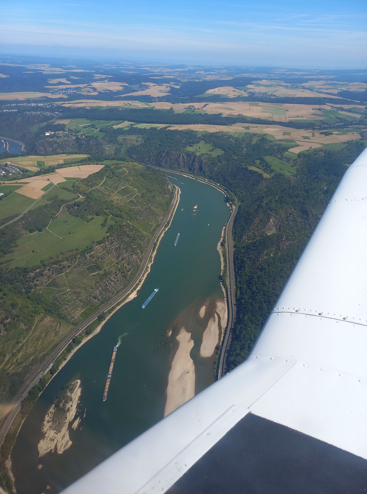


Whether hiking on the right or left bank of the Rhine: one of the key stages awaits, both in terms of distance and the altitude to be mastered. Route length and distance in Rhine kilometers are close together:...
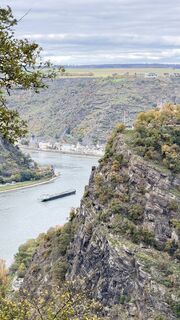
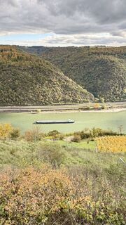
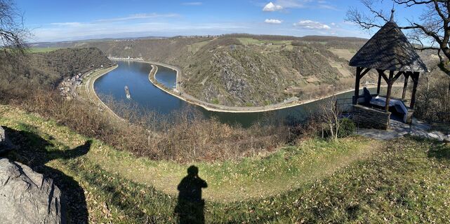
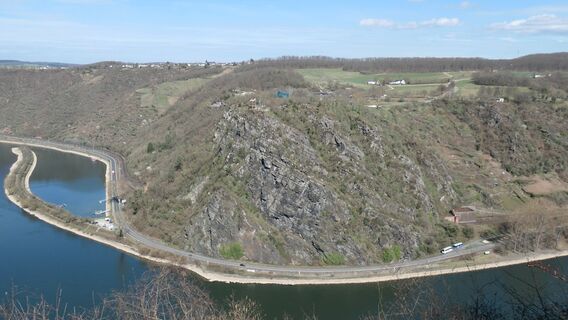
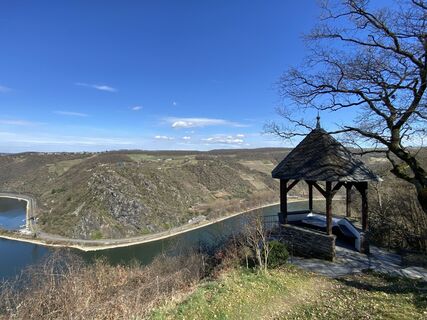
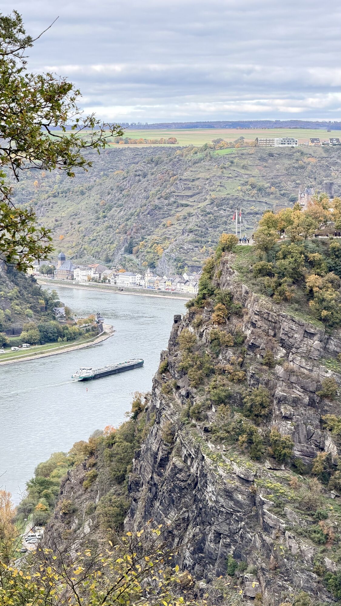
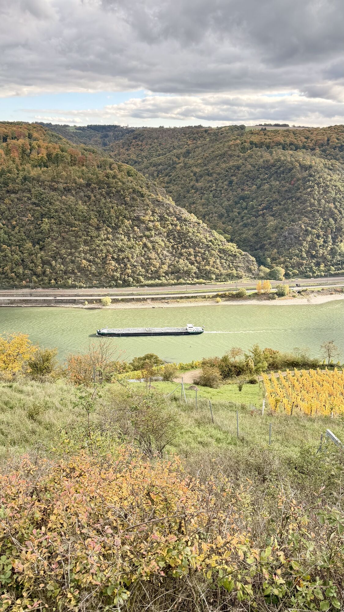
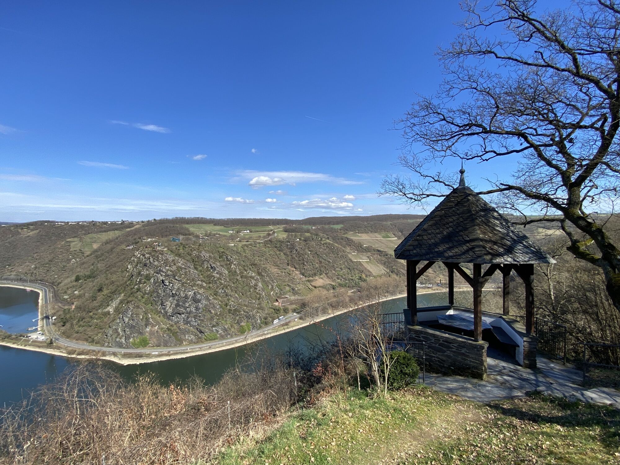
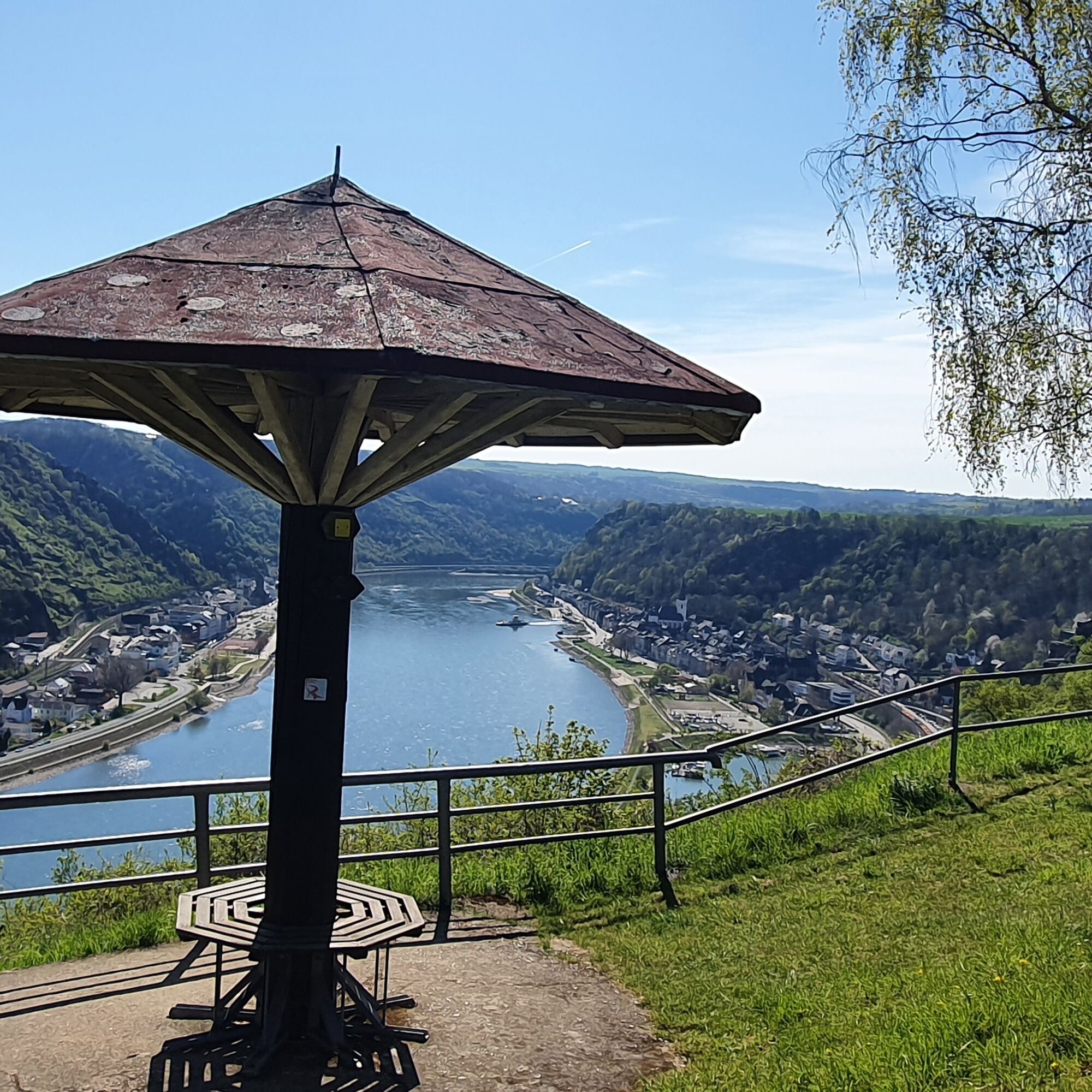
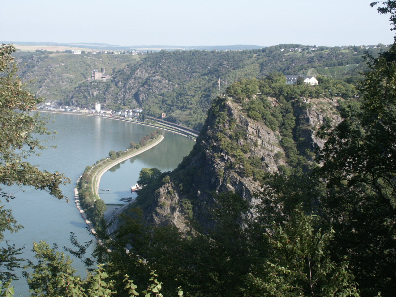
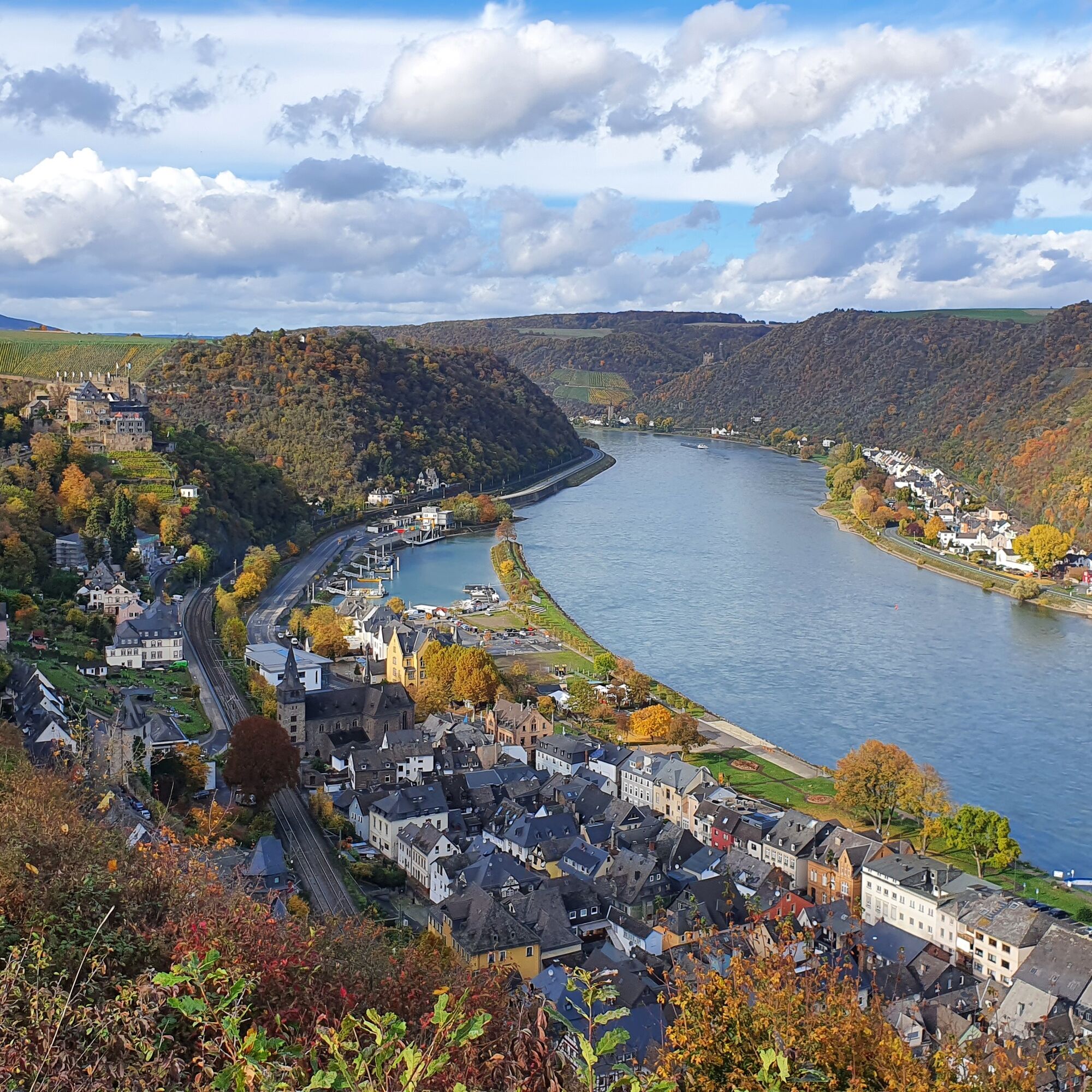
Whether hiking on the right or left bank of the Rhine: one of the key stages awaits, both in terms of distance and the altitude to be mastered. Route length and distance in Rhine kilometers are close together: this indicates a lot of progression along the hillside. You leave Oberwesel via the town wall path. On the way to the Günderrode House, formerly a film set for the movie HEIMAT 3 by Edgar Reitz and beyond, you encounter exhibits of a sculpture park. Again and again, new views open up into the UNESCO World Heritage Upper Middle Rhine Valley with the legendary Loreley rock or onto the Rhine loop and castles, surely one of the most spectacular from the Urbar viewpoint Maria Ruh. But also at other numerous picnic spots or seating areas, you can enjoy the magnificent Rhine panorama.
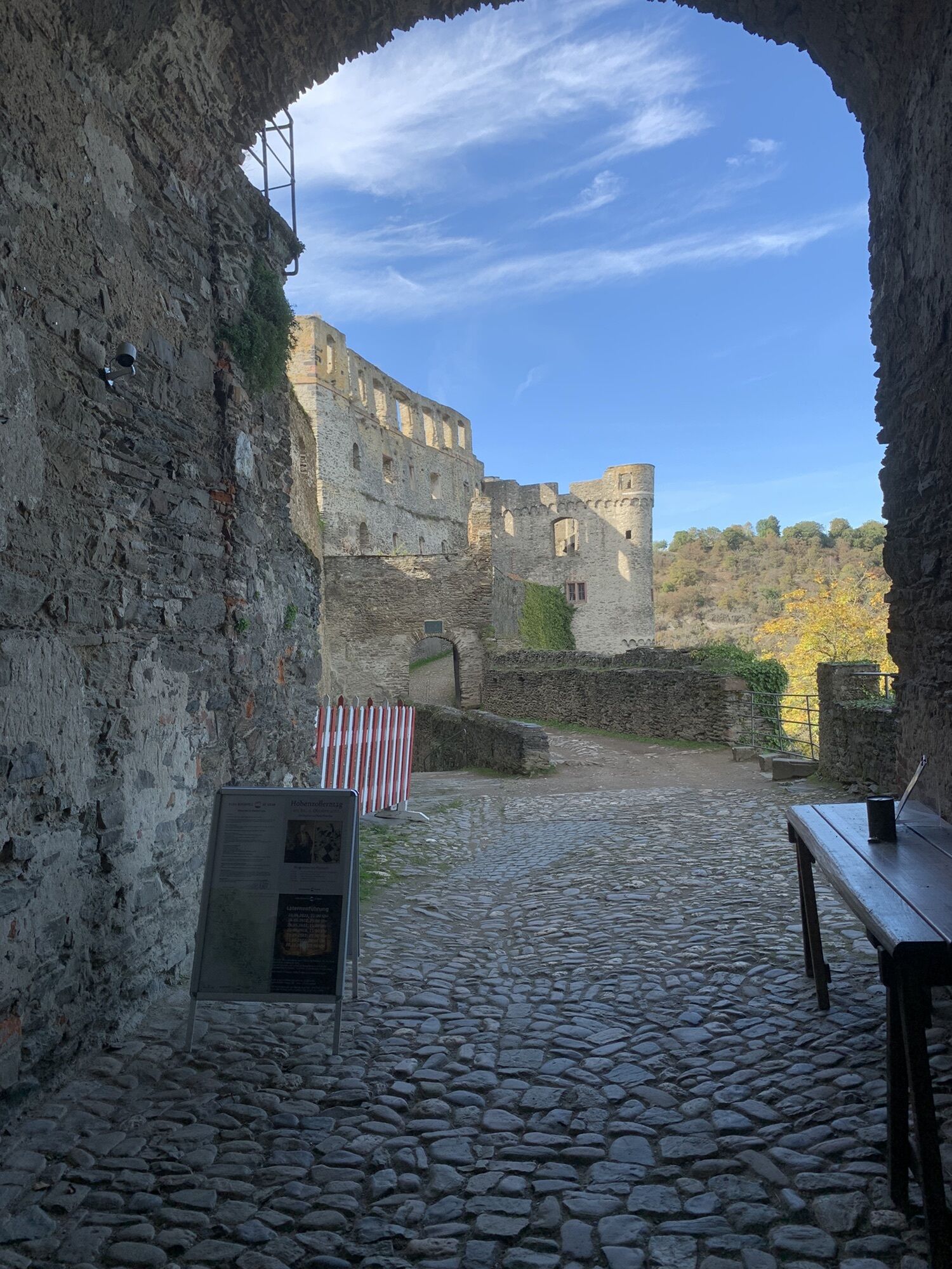
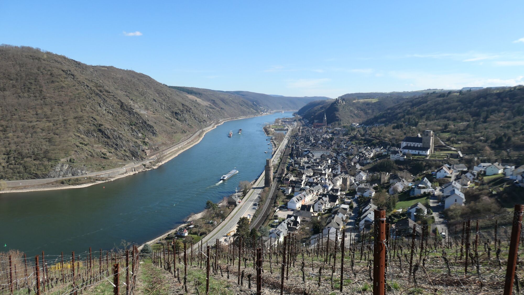
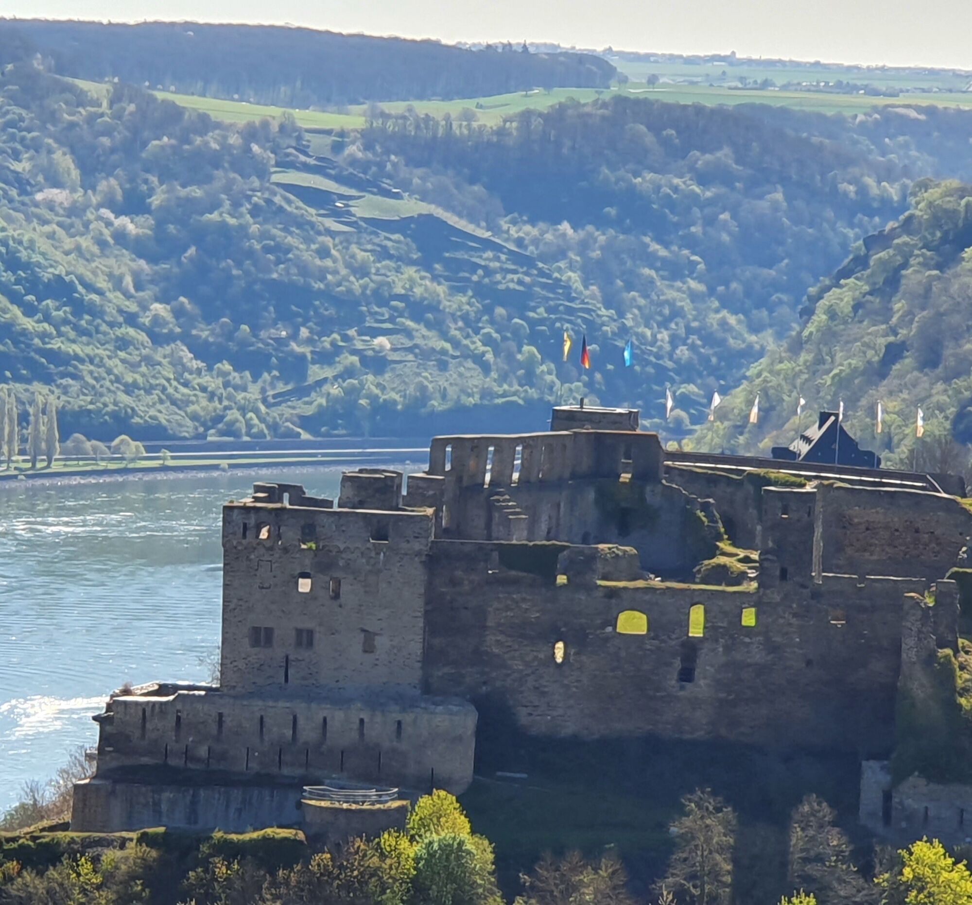
With views of the right bank castles Katz and Maus, Rheinfels Castle is reached above the small town of St. Goar. Again, a note about the ferry service to the opposite Rhine bank for individual planning.
Spectacular views of Rheinfels Castle later from the elevated district Werlau, before the trail continues its way through the "Werlauer Switzerland".
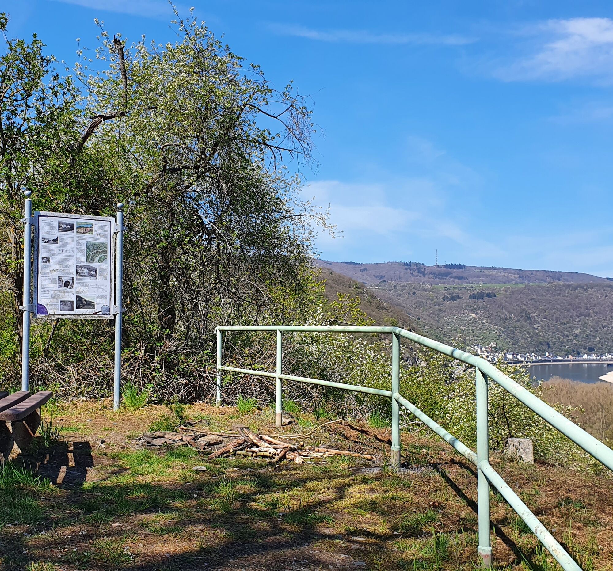
At the Prinzenstein viewpoint above the former namesake mine, mining is once again present: until the 1950s, there was a connecting route under the Rhine to the mine in the right bank Ehrental.
Shady but challenging is the following ascent into the district Holzfeld, which already belongs to Boppard, rewarded in the end with views far into the opposite Taunus mountains.
To Hirzenach, you can then deservedly just let yourself roll and enjoy the view.

Áno
Sturdy footwear, day backpack with provisions.
A trail always requires a certain degree of sure-footedness.
All start and destination points are accessible via the B9 on the left Rhine bank:
Motorway:
Bingen: A 60 exit Bingen-East
Bacharach: A 61 exit Rheinböllen
St. Goar: A 61 exit Emmelshausen
Oberwesel: A 61 exit Laudert
Hirzenach: A 61 exit Emmelshausen
Boppard: A 61 exit Boppard-Buchholz
Rhens: A 61 exit Paffenheck
Koblenz: A 61, A 48
Since there is a train station in almost every town on the left bank route, the routes can be planned individually. Hiking from a fixed base is also very well possible this way.
For orientation, below are the travel times between the individual stations by regional train:
Bingen Main Station - Trechtingshausen: 4 min.
Trechtingshausen - Niederheimbach: 4 min.
Niederheimbach - Bacharach: 3 min.
Bacharach - Oberwesel: 4 min.
Oberwesel - St. Goar: 6 min.
St. Goar - Hirzenach: 4 min.
Hirzenach - Bad Salzig: 3 min.
Bad Salzig - Boppard: 4 min.
Boppard Main Station - Spay: 5 min.
Spay - Rhens: 3 min.
Rhens - Koblenz Main Station: 7 min.
Bingen Main Station - Koblenz Main Station: 48 min.
Bingen: Hindenburganlage, City Center Bingen
Bacharach: On the B9 riverside
Oberwesel: B9 town wall and riverside
St. Goar: On the B9 riverside
Hirzenach: Rhein Street
Boppard: Marienberg parking deck, Remigiusplatz Mühl Valley
The quite long and demanding route can be divided into Stage 5.1 Oberwesel-St. Goar and Stage 5.2 St. Goar-Hirzenach.

Obľúbené výlety v okolí
-
4,7
Langhalsweg Osterspai
strednáTuristika 7,50 km -
5,0
Traumschleife Mittelrhein
ťažkéTuristika 14,7 km -
5,0
Panorama trail St. Goar
strednáTuristika 8,47 km -
5,0
Dream Loop Upper Baybach Valley
ťažkéTuristika 15,6 km -
5,0
Traumschleifchen Pfalzblick
svetloTuristika 5,68 km -
4,3
Dream loop Werlau Mushroom
svetloTuristika 5,60 km -
4,7
Schessels Beersche
strednáTuristika 5,44 km -
5,0
Traumschleifchen Baybachquellen
svetloTuristika 6,22 km -
5,0
Kaub - Burg Herzogenstein - Spitznack - Hasenberg
ťažkédiaľková pešia trasa 22,1 km -
4,5
Mittelrheinsteig Boppard #LL2ROM V09
ťažkéTuristika 5,01 km
Turistika a stopovanie


Nenechajte si ujsť ponuky a inšpiráciu na ďalšiu dovolenku
Vaša e-mailová adresa bol pridaný do poštového zoznamu.