


Ranschbach Römerweg
Úroveň náročnosti: T2
Fotografie našich používateľov
The hiking trail is based on old path connections - it probably even dates back to Roman times. In any case, one highlight follows the next on this tour! Even if you can't get enough of the Seligmacher...
UFFBASSE! - Campaign for considerate coexistence in nature
Fire & smoking - Lighting fires, smoking and barbecues are strictly prohibited in the forest and must be avoided at all costs! This is the only way to prevent fires and the resulting damage to nature and wildlife. Nature conservation - Stay on the designated paths and avoid making unnecessary noise when you are out in nature. Leave the forest at dusk at the latest so as not to disturb the rhythm of nocturnal animals. Be considerate when out and about - Always behave in a forward-looking, friendly and considerate manner towards everyone you meet along the way. This is particularly important on farm roads where winegrowers, farmers and foresters work at weekends. Picnic & garbage - Think of a garbage bag for the road and take garbage home with you. Only use the furnished rest areas for breaks and picnics. Dogs on a lead - Please keep your dog on a lead at all times. Other visitors and animals will thank you for it.www.pfal z.de/uffbasse
We, your fellow human beings and nature will thank you!

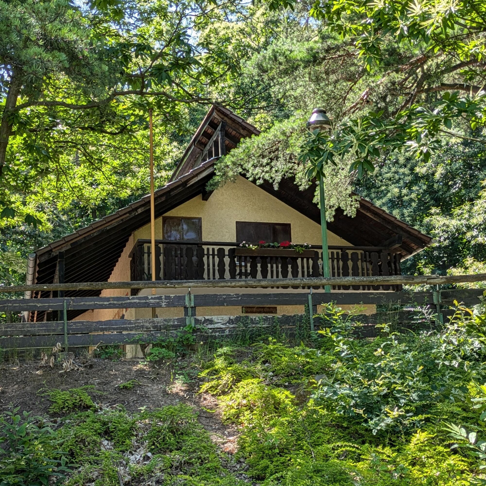

Continue into the forest and to the next stop! At the Kolpinghütte, you can fortify yourself before continuing your walk. The menu includes typical Palatinate delicacies. However, check the opening times before your excursion, as some of the huts in the Palatinate Forest are only open at weekends or on certain days.
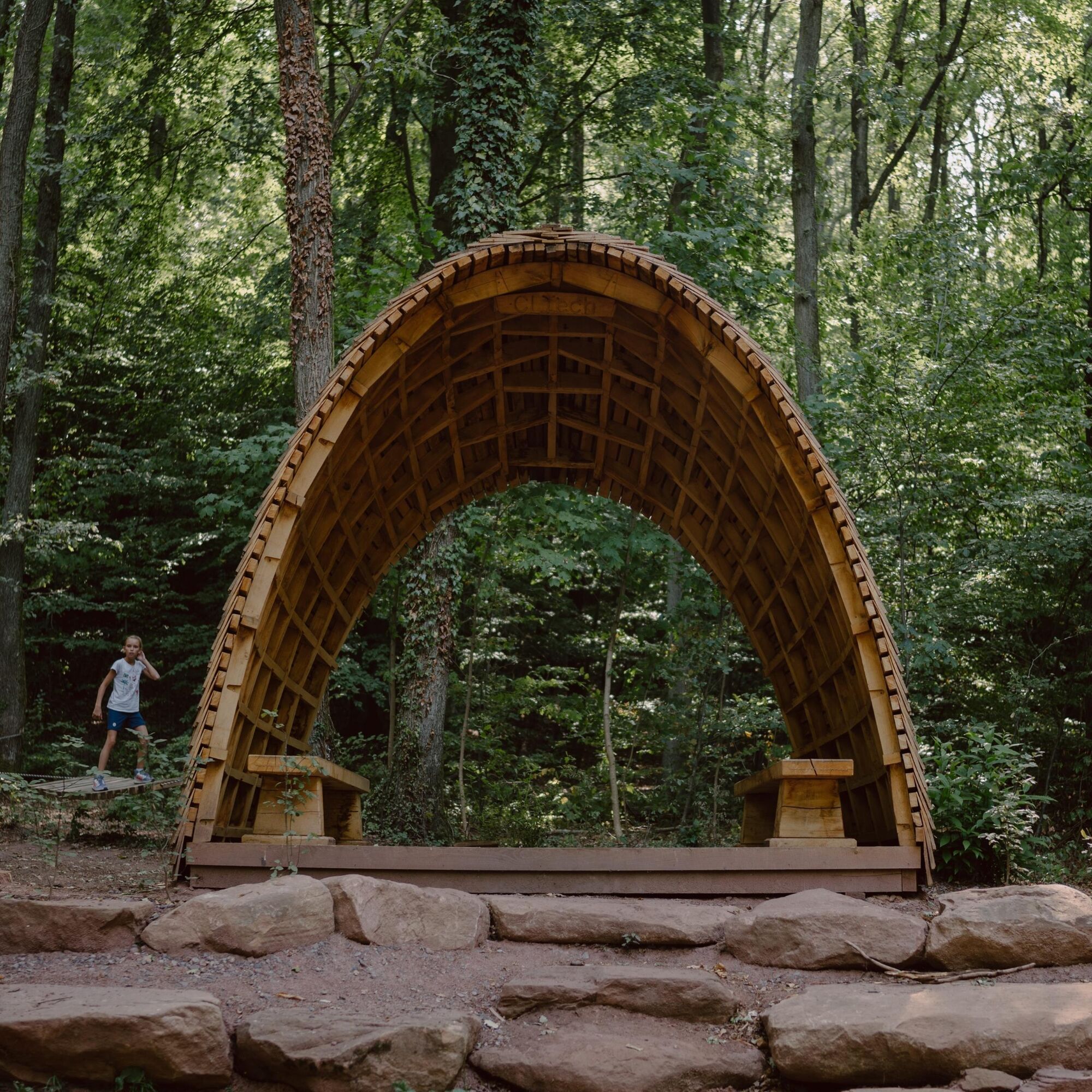
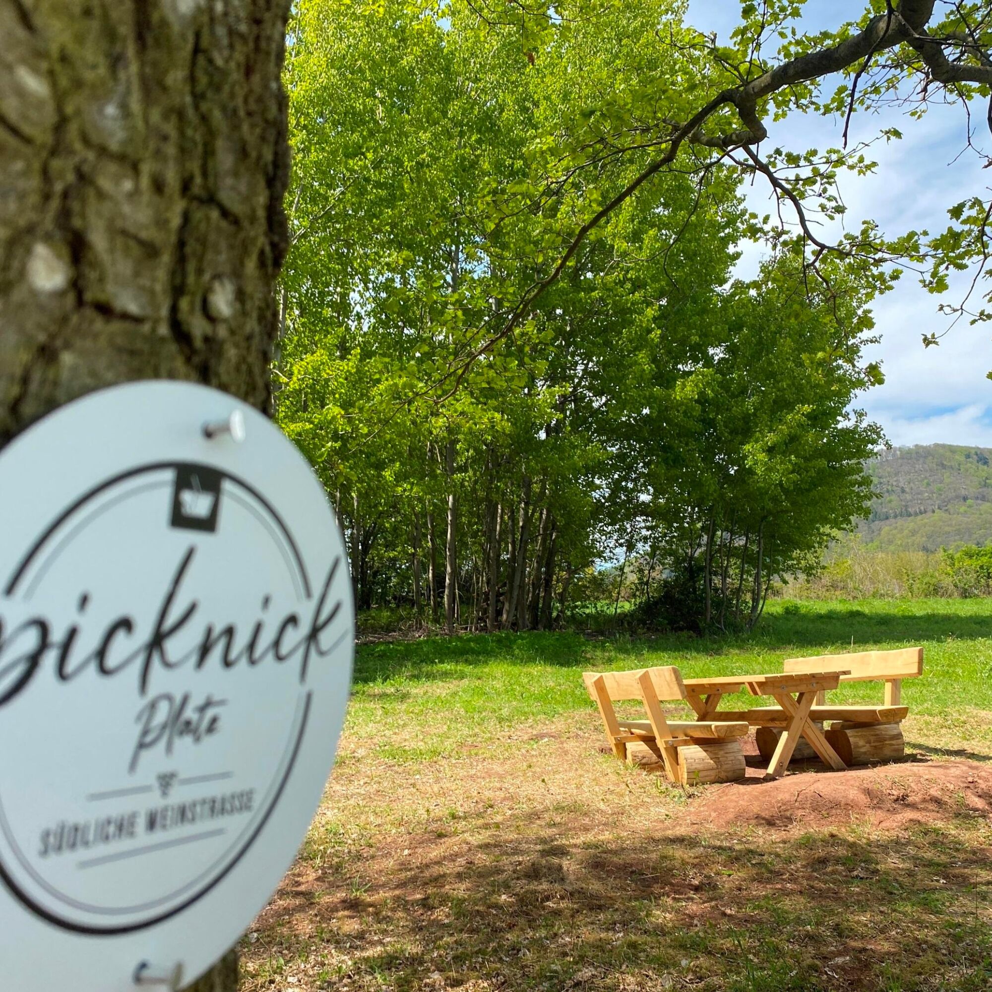
Now head briefly into the vineyards again, past the "Tree of the Year" site and you will find yourself at the Zollstock. A trade route used to run between Hohenberg and Föhrlenberg. This is where the territories of the Electoral Palatinate (Birkweiler), the Bishopric of Speyer (Ranschbach) and the Duchy of Zweibrücken met, which is why there was a customs station here around 1786. After the French Revolution and the dissolution of the dominions in 1789, the customs station was also dissolved. It is definitely worth taking a short breather here: either in the Woodstop shelter or on the chestnut hammocks.
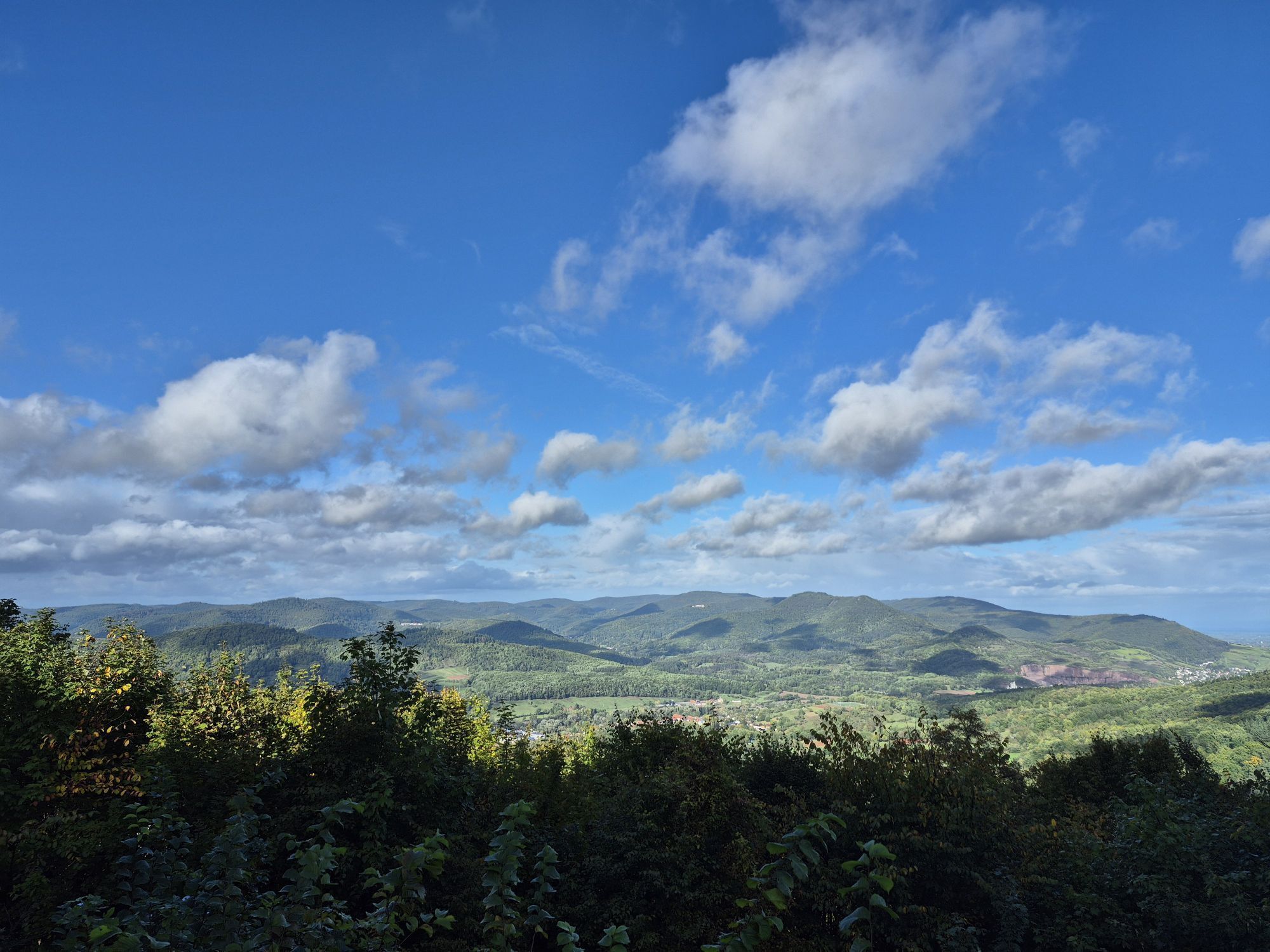
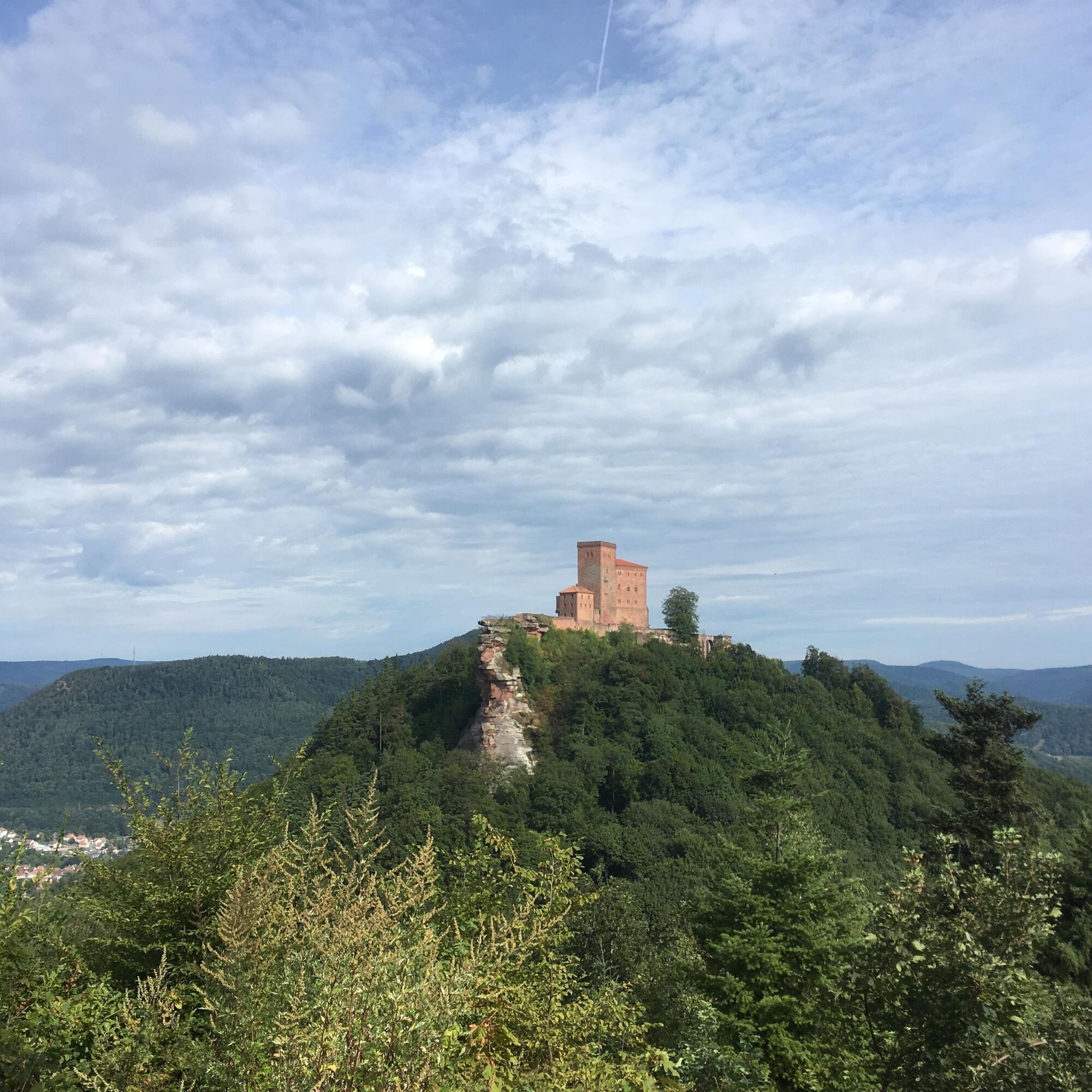
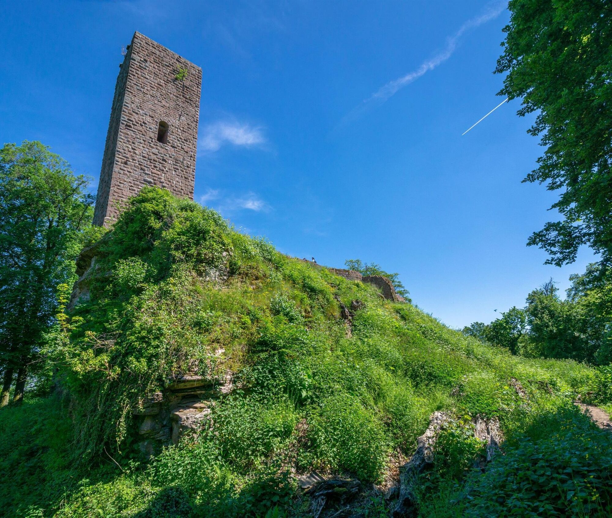
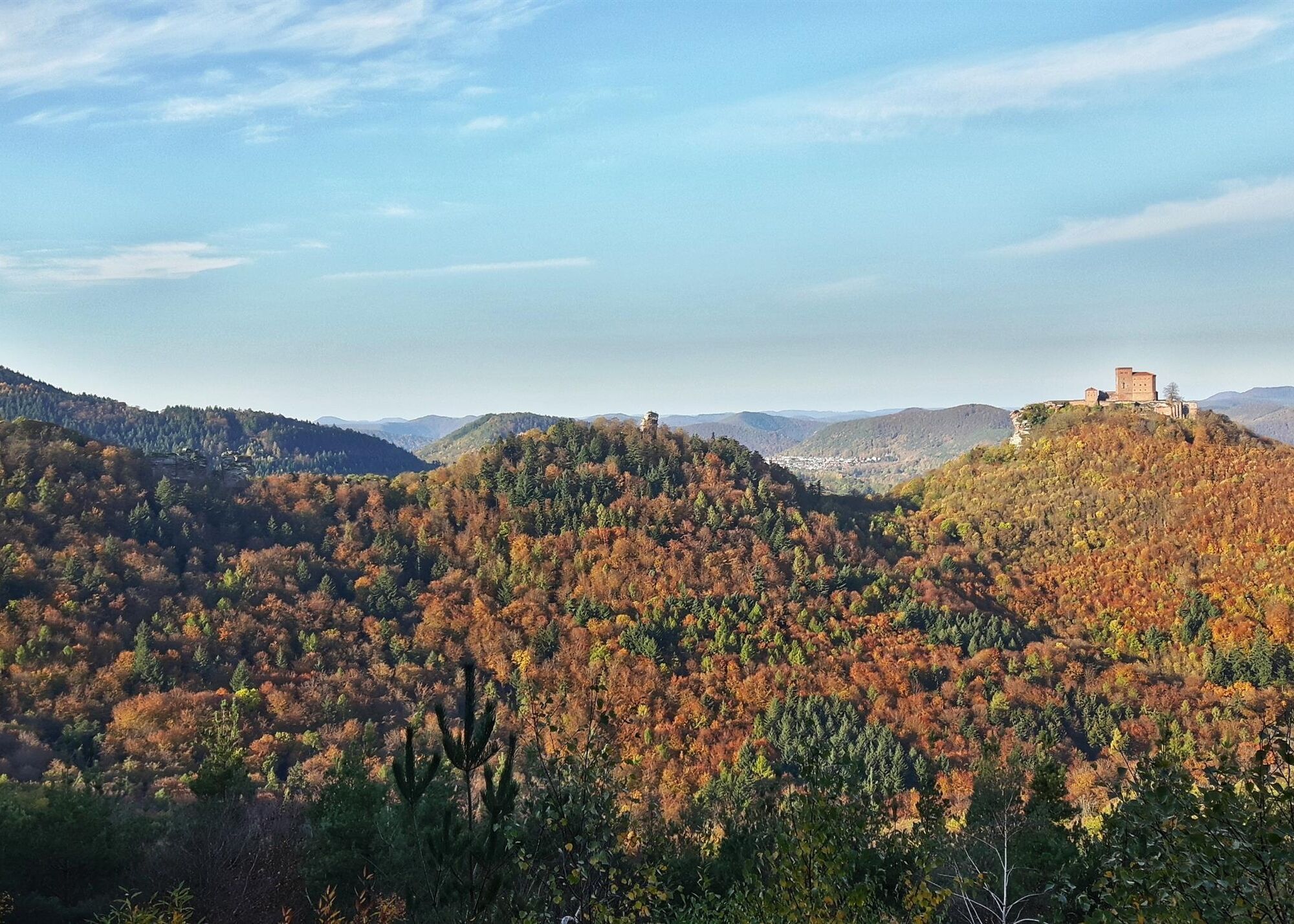
The trail continues gently but steadily uphill through the forest to the Ahlmühle parking lot. This is where the castle exploration part begins! Follow the signposts in the direction of "Burg Trifels" and "Ruine Scharfenberg/Münz". Make sure you take a short detour to the ruins of Scharfenberg/Münz and Anebos. There is not much more than a rock left of Anebos, but the view of Trifels Castle, which you reach shortly afterwards, is well worth the detour!
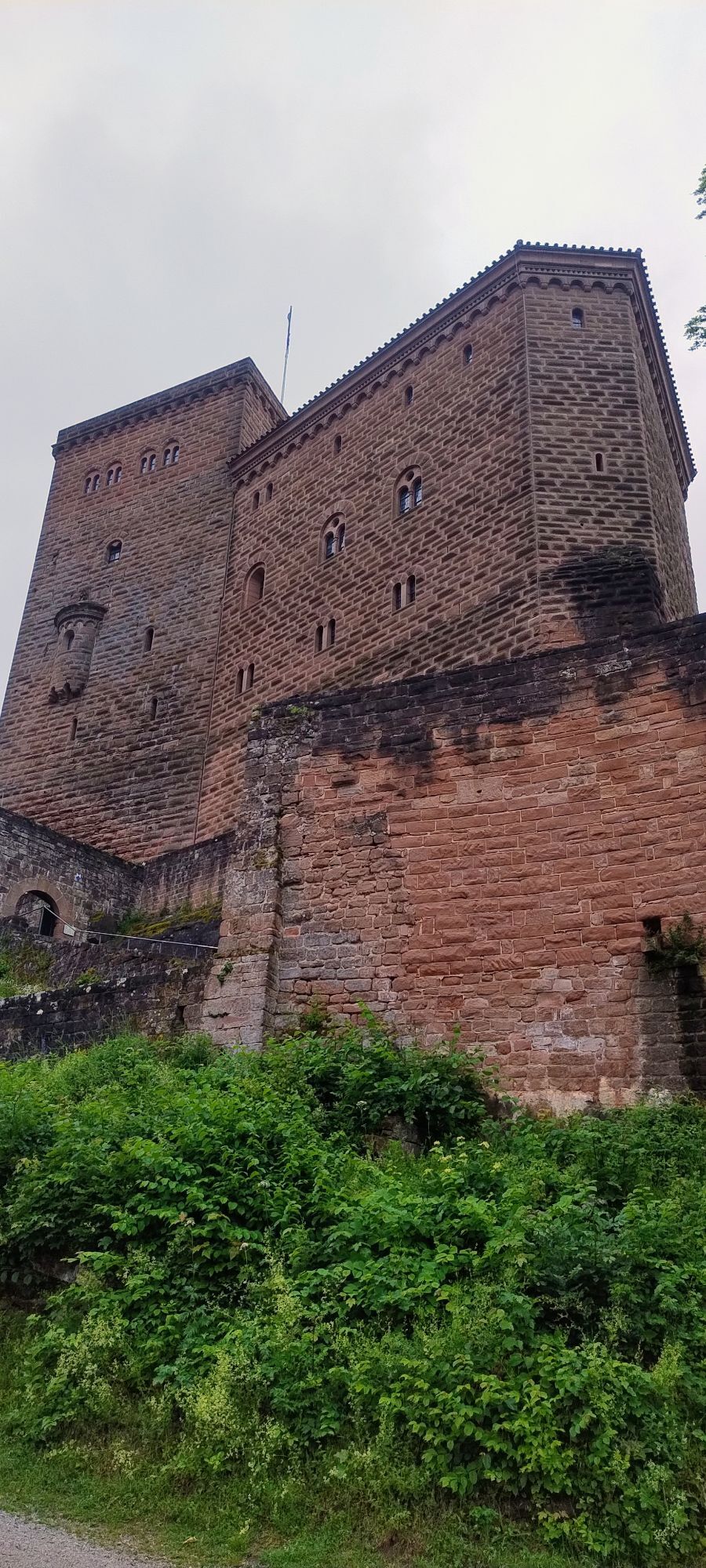
Via the Schlossäcker parking lot, you then follow a steep path to Trifels Castle. Here, too, the view is worthwhile. The castle was an important imperial fortress in the time of the Hohenstaufen emperors and also housed the treasury of the Holy Roman Empire of the German Nation. You can still marvel at replicas of the imperial insignia there. In the exhibition you can learn even more interesting facts about the castle, for example how it came about that the then English King Richard the Lionheart was imprisoned at Trifels Castle from 1193-1194!
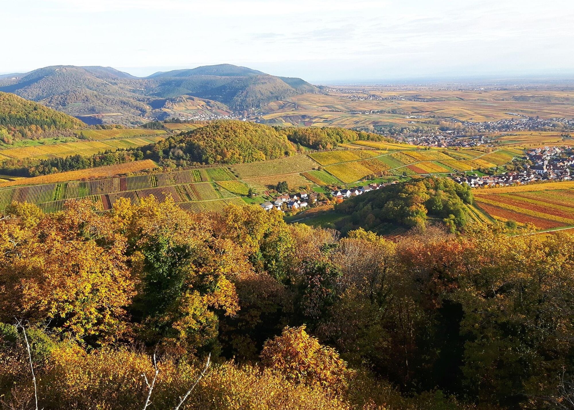
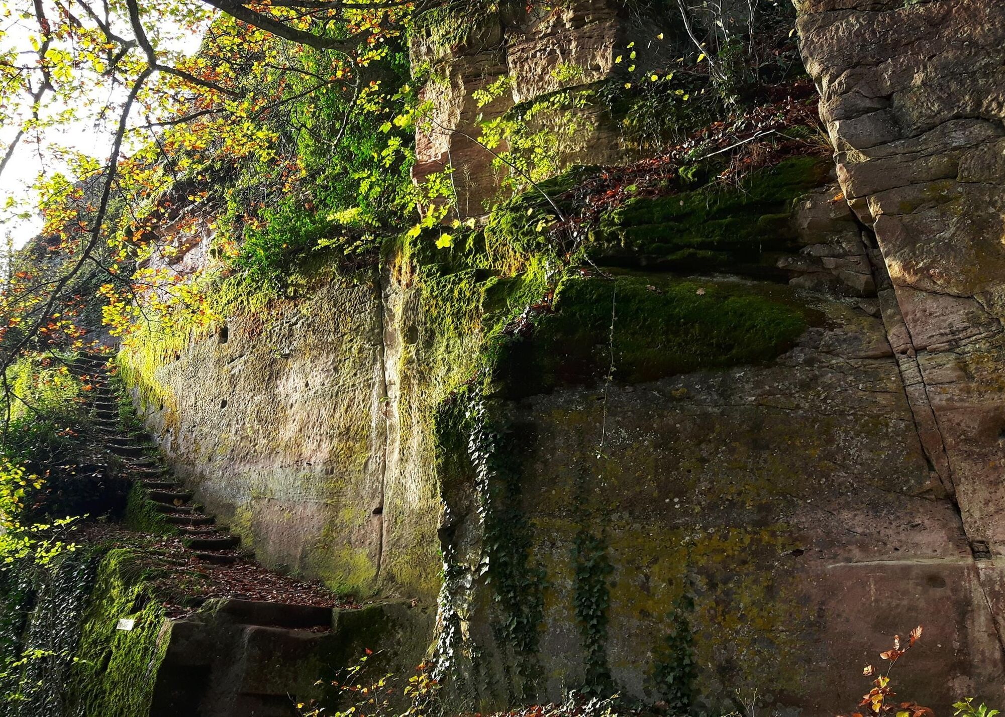
Back at the Schlossäcker parking lot, you complete the circle around the castle trio of Trifels, Anebos and Münz and return to the Ahlmühle parking lot. The route climbs one last time to the highest point of the tour: the Wettereck. From here, you can look back once again at the trio of castles. And while you are now comfortably descending and still thinking about what you have seen and experienced, you will find yourself at the next highlight and the next castle ruin. The former castle can only be guessed at, not much is left of it. But the ascent to the ruins of Neukastel Castle via the lattice ladder (not for the faint-hearted or those with a fear of heights!) opens your eyes once again: the view stretches far across the vineyards and the small wine villages. And now the location of the castle seems quite logical. Neukastel Castle was probably built at the beginning of the 12th century to protect the entrance to the valley towards Trifels Castle, as the enemy could be seen coming from afar.
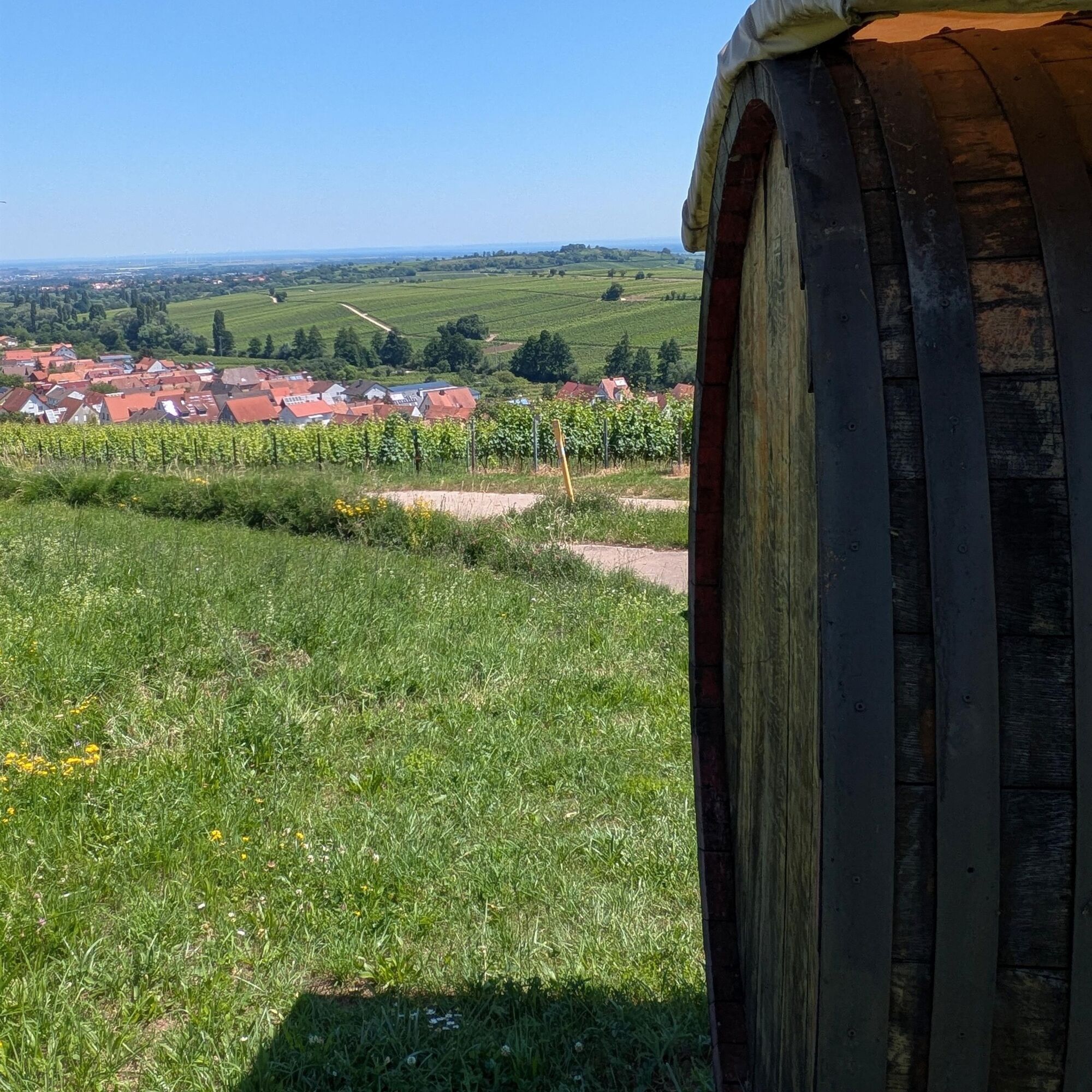
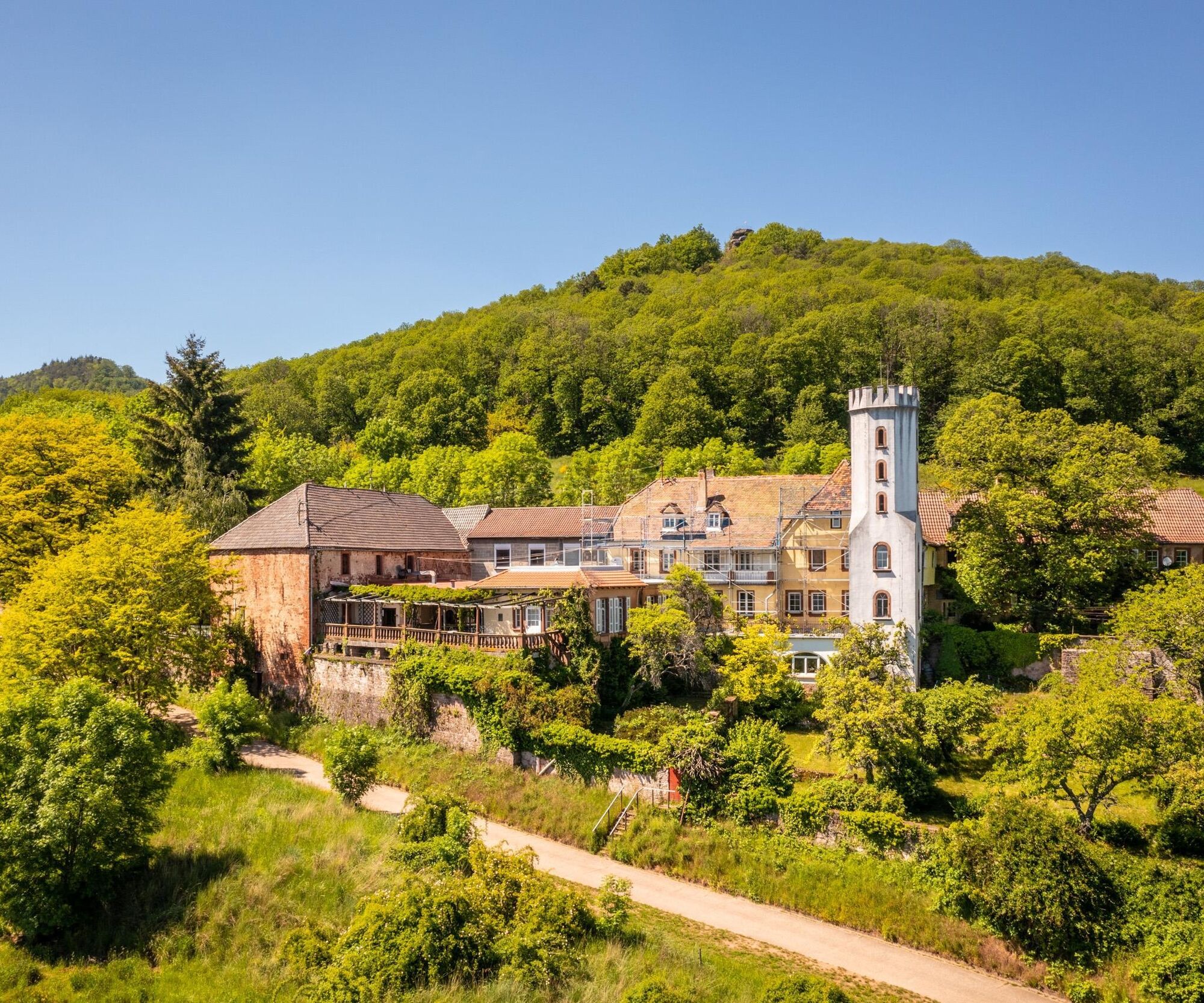
The markings now lead you steeply downhill on a narrow path to the Slevogthof, the former home of one of the most important German Impressionists, Max Slevogt. Behind the striking building with the white tin tower, the trail continues to the picnic area at Kammertwingert right on the edge of the forest. Here you can make yourself comfortable once again and enjoy the view before heading back through the vineyards to Ranschbach and your starting point.
Sturdy shoes, clothing suitable for the weather, sun and rain protection as well as a sufficient supply of food and, above all, drinks, as there are not always places to stop for refreshments or to shop, should be in your rucksack for every tour. Although the trail is marked throughout, you should always have a suitable map or hiking app with you for safety reasons.
Use of farm tracks - Our tours in the vineyards often take us along paths that we share with others. We therefore ask you to be considerate and friendly at all times. Winegrowers, farmers and foresters use the farm roads through fields, forests and vineyards for their everyday work - even at weekends. Due to work and/or weather conditions, the paths may be more heavily soiled at times. Special care must also be taken when walking along the roads in and around the Palatinate villages. Road closures and detour must be observed at all times.
Dangerous situations - If an emergency situation arises, help is needed quickly. And even if cell phones can send GPS signals, the classic rescue points are often the quickest. These are located in places that are easily accessible for rescue vehicles. Remember the points with the green signs and a white cross. Return there in an emergency and quote the number on the sign when you make an emergency call. This way, the emergency services will know where to find you.
On the A65 highway, take the Landau-Nord exit onto the B10 towards Annweiler. Leave the B10 at the Leinsweiler/Siebeldingen/Birkweiler exit and turn left towards Birkweiler. Follow the signs to Ranschbach.
Take the train to Landau/Pfalz and from there take the bus(line 520 towards Ranschbach) to Ranschbach. The bus stop Ranschbach Unterdorf is located directly at the starting point of the tour.
Timetable information: via the railroad websites(www.bahn.de) and the transport associations(www.vrn.de) or the apps "DB Navigator" or "myVRN"
Free parking is available in Peter-Morio-Straße, at the starting point of the tour.
Please only park in the designated parking spaces and always keep access routes for emergency vehicles and work routes in the forest and vineyards clear. For overnight stays in camper vans and caravans, there are designated camper van parking spaces.
T2
Hauptstraße 4
76829 Leinsweiler
06345 3531
urlaub@landauland.de
www.landauland.de
March to October
Monday to Friday: 09.00 - 12.00
additionally Monday, Wednesday and Friday: 14.00 - 16.00
November to February:
Monday to Friday: 09.00 - 12.00
The "Power and Myth" exhibition at Trifels Castle explains the history of the legendary castle. In the treasure chamber, you can also admire superbly crafted replicas of the imperial insignia.
Obľúbené výlety v okolí
-
5,0
Annweiler Richard-Löwenherz-Weg
ťažkéTuristika 13,1 km -
4,0
Annweiler Castle Trail
strednáTuristika 7,72 km -
4,5
Schusterpfad
strednáTuristika 16,4 km -
5,0
Palatinate Weinsteig Stage 08 Dernbach - Annweiler am Trifels
ťažkédiaľková pešia trasa 14,4 km -
3,5
Pfälzer Weinsteig Stage 10 Klingenmünster - Bad Bergzabern
strednádiaľková pešia trasa 12,9 km -
5,0
Rundtour Roth unter Riethburg
strednáTuristika 14,5 km -
Palatinate Wine Trail Stage 09 Annweiler am Trifels - Klingenmünster
ťažkédiaľková pešia trasa 17,6 km -
Palatinate Wine Route Stage 06 St. Martin - Burrweiler
ťažkédiaľková pešia trasa 16,8 km -
Palatinate Forest Trail stage 07 Dahn - Erlenbach
strednádiaľková pešia trasa 17,0 km -
Palatinate Wine Trail complete route
ťažkédiaľková pešia trasa 176,9 km
Turistika a stopovanie


Nenechajte si ujsť ponuky a inšpiráciu na ďalšiu dovolenku
Vaša e-mailová adresa bol pridaný do poštového zoznamu.