Waldheim - Spitzberg - Alberthöhe - Knobelsdorf
stredná
Navigácia na stránke
Navigácia na stránke
Získajte túto prehliadku v mobilnom telefóne
Waldheim - Spitzberg - Alberthöhe - Knobelsdorf
stredná
Turistika
9,47
km
Naskenujte kód QR a spustite navigáciu v aplikácii bergfex

Turistika a stopovanie


Waldheim - Spitzberg - Alberthöhe - Knobelsdorf
stredná
Vzdialenosť
9,47
km
Trvanie
02:38
h
Ascent
319
hm
Hladina mora
178 -
263
m
Stiahnutie skladby
Waldheim - Spitzberg - Alberthöhe - Knobelsdorf
stredná
Turistika
9,47
km
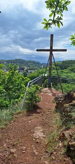
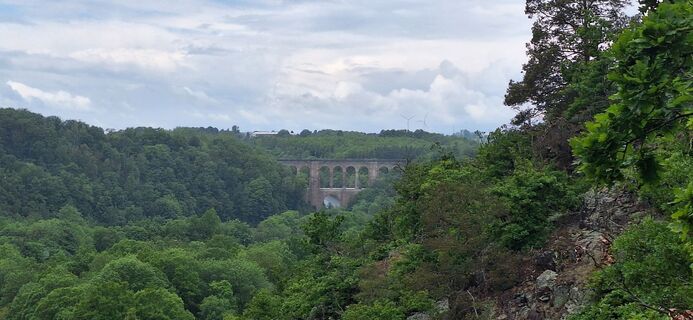
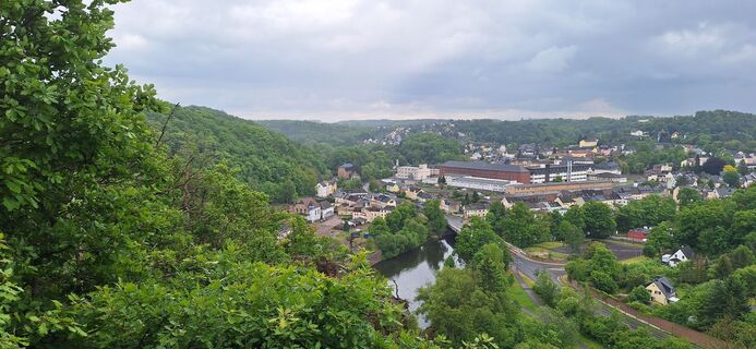
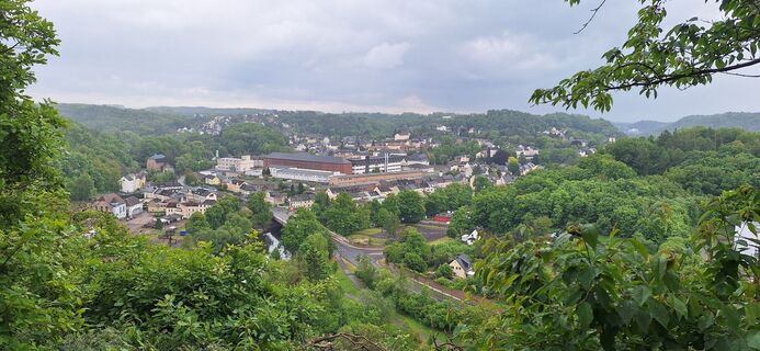
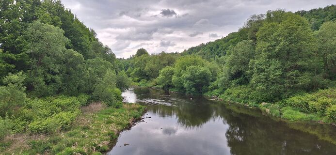
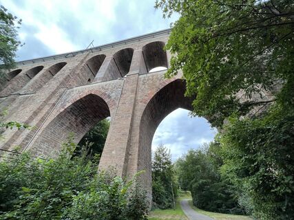
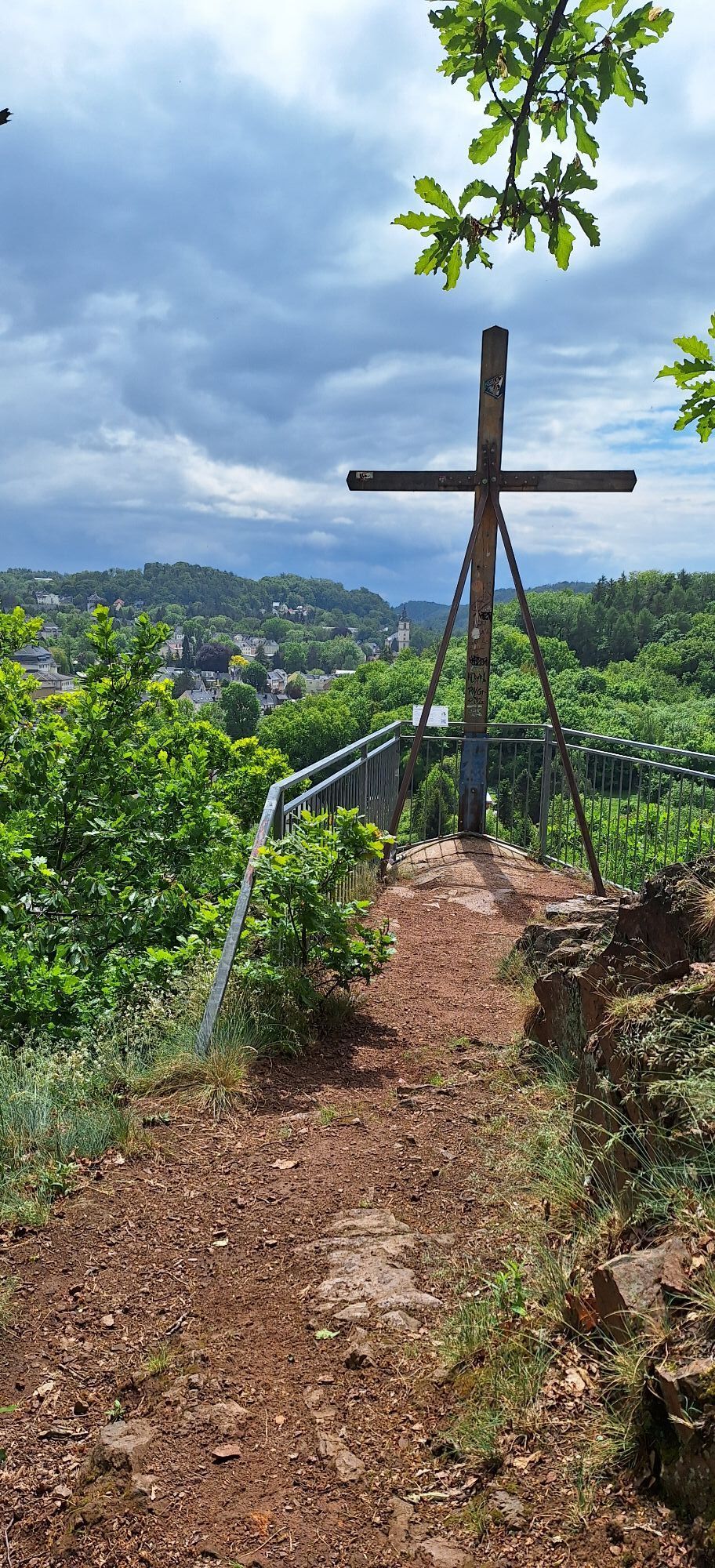
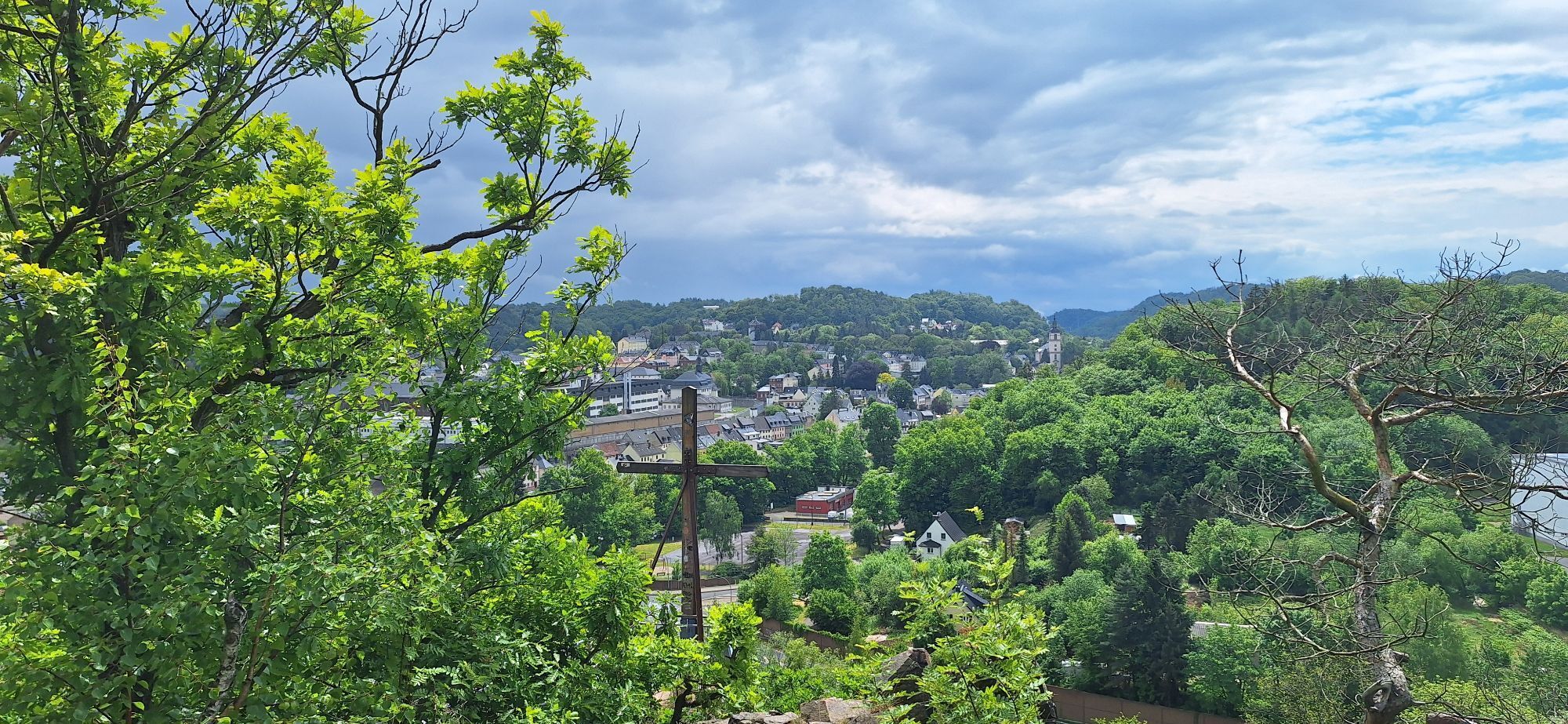
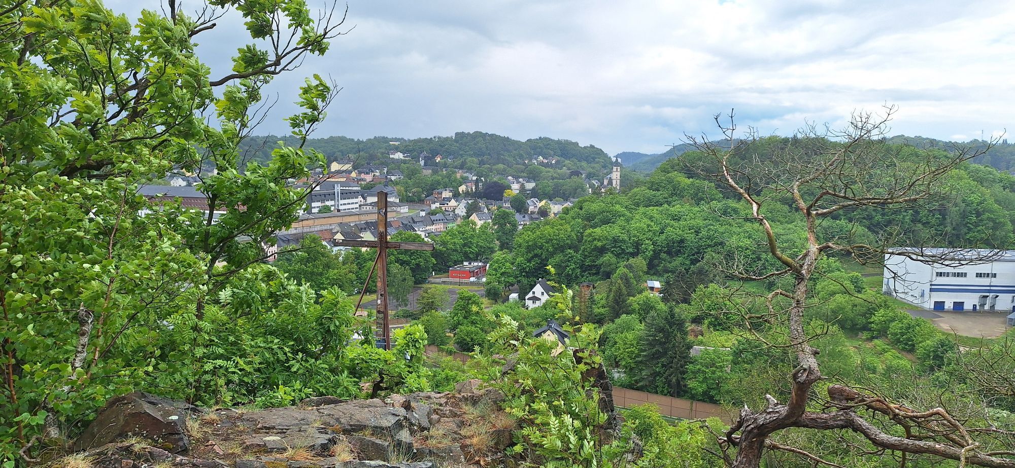
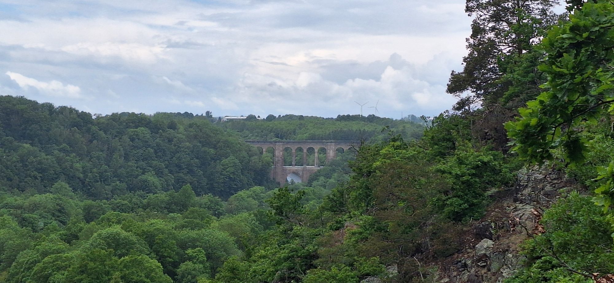
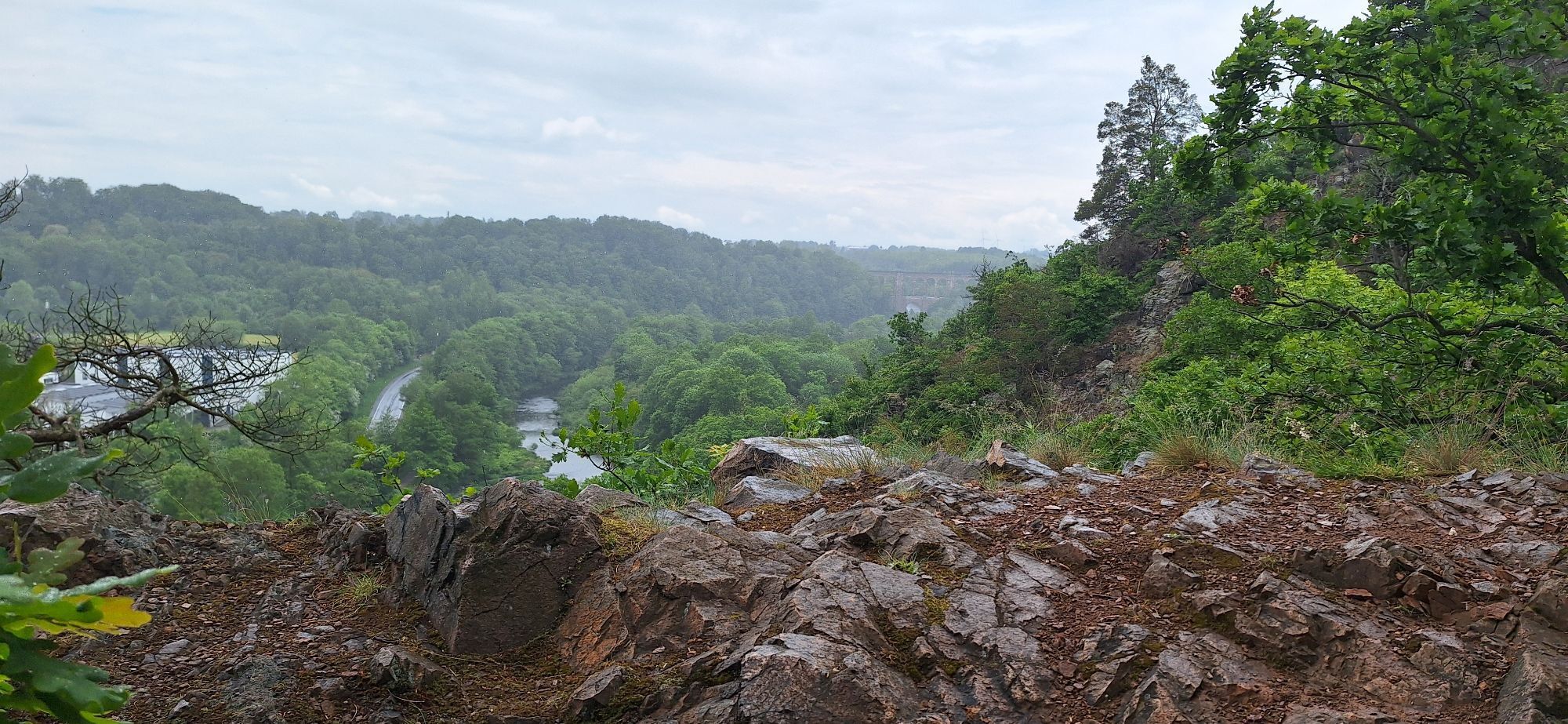
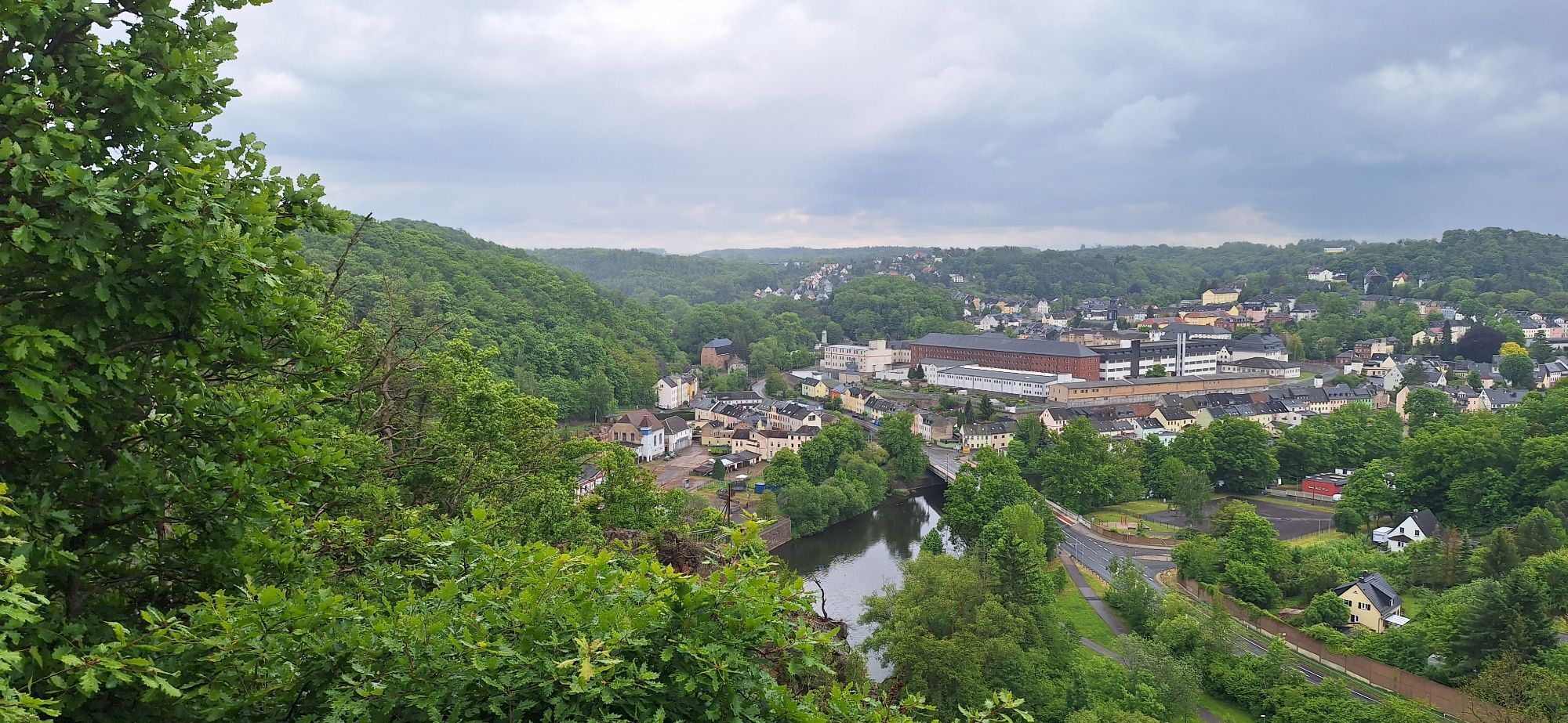
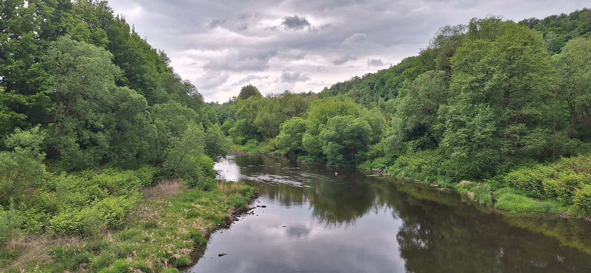
Fotografie našich používateľov
-
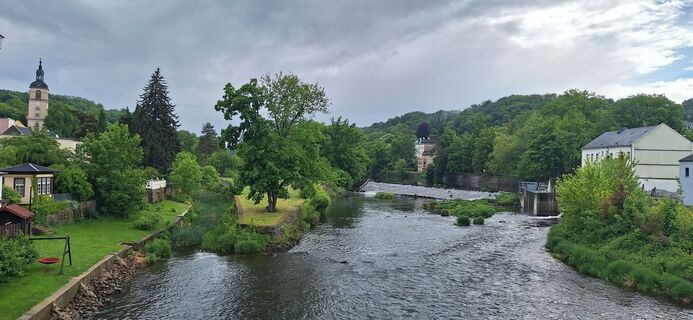
 © Hallunke FrankVytvorené dňa 18.05.2025
 -
 © Hallunke FrankVytvorené dňa 18.05.2025
 -
 © Hallunke FrankVytvorené dňa 18.05.2025
 -
 © Hallunke FrankVytvorené dňa 18.05.2025
 -
 © Hallunke FrankVytvorené dňa 18.05.2025
 -
 © Hallunke FrankVytvorené dňa 18.05.2025
 -
 © Hallunke FrankVytvorené dňa 18.05.2025
 -
 © Hallunke FrankVytvorené dňa 18.05.2025
 -
 © Hallunke FrankVytvorené dňa 18.05.2025
 -
 © Volki F.Vytvorené dňa 29.09.2023


Trasa
St. Paulus
(211 m)
Miesto uctievania
0,6 km
Schillerhöhe
(247 m)
Uhol pohľadu
1,0 km
Spitzberg
(257 m)
Summit
6,4 km
Meinsberg
(247 m)
Dedina
6,8 km
Alberthöhe
(253 m)
Summit
7,1 km
Trasa
Waldheim - Spitzberg - Alberthöhe - Knobelsdorf
stredná
Turistika
9,47
km
Waldheim
(240 m)
Mesto
0,0 km
St. Paulus
(211 m)
Miesto uctievania
0,6 km
Schillerhöhe
(247 m)
Uhol pohľadu
1,0 km
Carolahöhe
(244 m)
Uhol pohľadu
1,4 km
Restaurant Waldfrieden
(203 m)
Reštaurácia
5,1 km
Spitzberg
(257 m)
Summit
6,4 km
Meinsberg
(247 m)
Dedina
6,8 km
Alberthöhe
(253 m)
Summit
7,1 km
Oceňovanie
5
(1)
4
(0)
3
(0)
2
(0)
1
(0)
Obľúbené výlety v okolí
-
5,0
Talsperrenrundweg Kriebstein mit Fährüberfahrt
strednáTuristika 6,12 km -
Geo Route Leisnig: Porphyry and Old Town Stories
svetloTematická trasa 1,65 km -
Zum Grubenwehr
strednáTuristika 14,0 km -
Lutherweg Mittweida-Rochlitz
ťažkéTuristika 21,7 km -
Nördliches Striegistal
svetloTuristika 9,58 km -
Rundweg von Leisnig zum Kloster Buch
svetloTuristika 13,7 km -
4,0
Lutherweg Sachsen von Kriebstein nach Mittweida
strednáPútnická trasa 16,6 km -
Ehrenberg nach Tannenberg u. zurück
strednáTuristika 14,7 km -
Stadtwald Mittweida-Bürgerwaldrundweg
svetloTuristika 9,05 km -
5,0
Rundwanderweg um Döbeln
svetloTuristika 12,8 km

Turistika a stopovanie

Viac ako 550.000 návrhov výletov, podrobné mapy a intuitívny plánovač trás robia z aplikácie povinnú výbavu pre všetkých nadšencov prírody.

Nenechajte si ujsť ponuky a inšpiráciu na ďalšiu dovolenku
Prihlásiť sa k odberu noviniek
Chyba
Vyskytla sa chyba. Prosím, skúste to znova.
Ďakujeme za vašu registráciu
Vaša e-mailová adresa bol pridaný do poštového zoznamu.
Zájazdy po celej Európe
Rakúsko
Švajčiarsko
Nemecko
Taliansko
Slovinsko
Francúzsko
Holandsko
Belgicko
Poľsko
Lichtenštajnsko
Česko
Slovensko
španielsko
Hrvaška
Bosna a Hercegovina
Luxembursko
Andorra
Portugalsko
Island
Spojené kráľovstvo
Írsko
Grécko
Albánsko
Severné Macedónsko
Malta
Nórsko
Čierna Hora
Moldavsko
Kosovo
Maďarsko
San Maríno
Rumunsko
Estónsko
Lotyšsko
Bielorusko
Cyprus
Litva
Srbsko
Bulharsko
Monako
Dánsko
Švédsko
Fínsko