


Geo-route Rochlitz – Fischheim – Seelitz – Rochlitz
Úroveň náročnosti: T1
The path runs below Rochlitz Castle along the west bank of the Zwickauer Mulde River to Sörnzig. The castle has a 1000-year history and houses many attractions, such as the impressive ribbed vault of the...
The path runs below Rochlitz Castle along the west bank of the Zwickauer Mulde River to Sörnzig. The castle has a 1000-year history and houses many attractions, such as the impressive ribbed vault of the chapel or the Black Kitchen. Due to its bright red color, porphyry can be encountered as a building material in many different forms along the route.
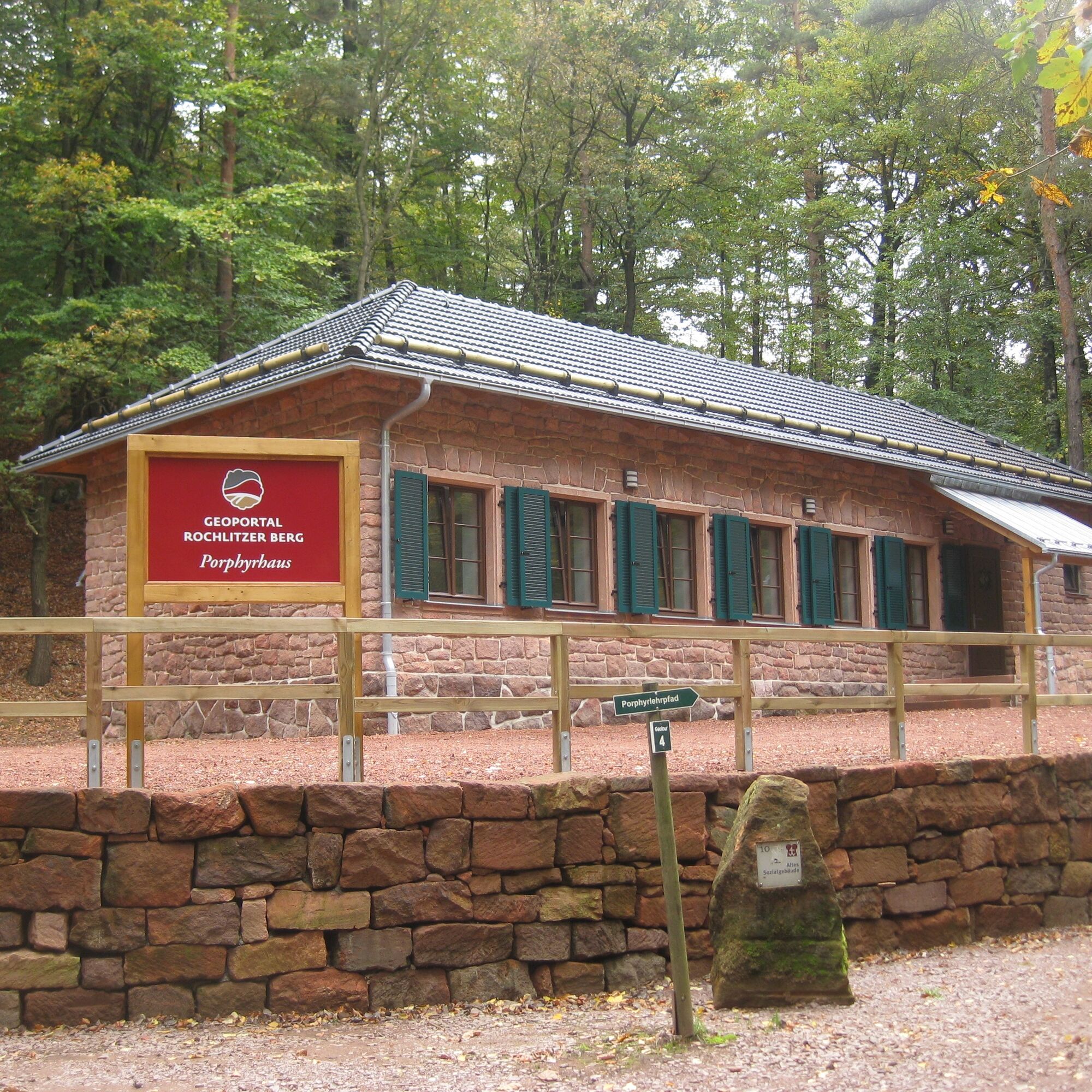
Further along, the Mulde River is crossed on the so-called swinging footbridge to Fischheim at the foot of the Rochlitzer Berg. On this hill, the World Heritage stone "Rochlitz Porphyry Tuff" was quarried until the last century in the Gleisberg quarry. The former social workers' building from that time is now used as a geoportal and offers educational and project programs on the topic of Rochlitz Porphyry Tuff. Over the Biesern Hill with a water-filled former sand pit, which was operated until 1989, the path leads back to Rochlitz.

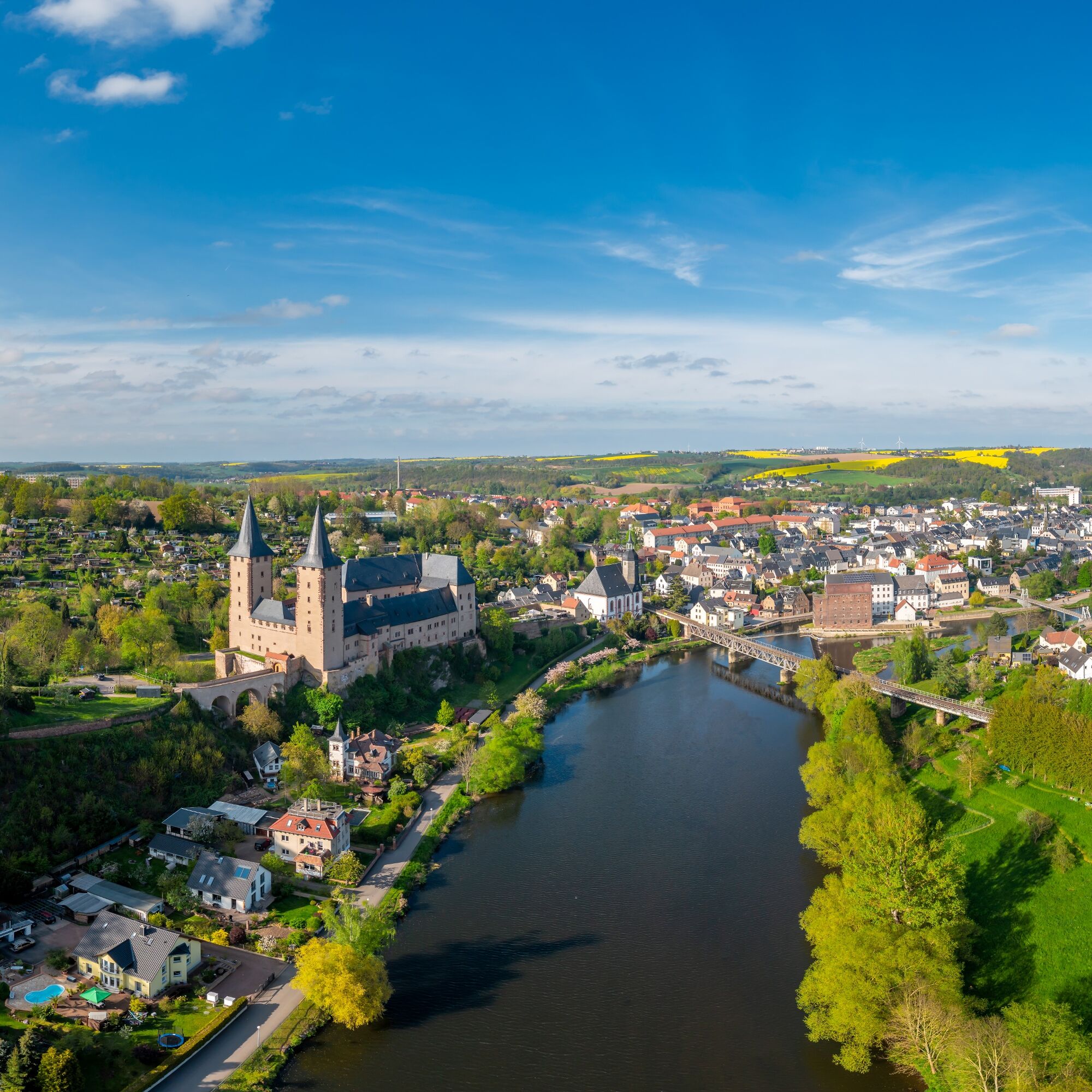
The route begins in Rochlitz at St. Peter’s Church. The church was first mentioned as the parish church of Rochlitz in 1186. The adjacent Mühlplatz probably already had a market function during the time of Slavic settlement and was first documented as "Mühlplan" in 1538.
Only 100m west of the church lies Rochlitz Castle. It was built in the 14th century by converting the Rochlitz fortress, first mentioned in 1009 AD, into a castle. Construction phases occurred repeatedly until the 16th century, so various architectural styles can be recognized.
Through the forester’s lodge, the path goes through the castle meadow to the Mordgrund. This somewhat martial-sounding name probably refers to the term "Mord" or "Mard" for the polecat. Several benches invite you to take a break here.
After crossing the Mordgrundbach stream, the path directly follows the course of the Zwickauer Mulde and passes the Katzenstein, a granite rock that steeply drops to the Zwickauer Mulde.
Following the path further, you reach Sörnzig. The name, which comes from Sorbian, means roughly "millstone cutters": the nearby Rochlitzer Berg was an important quarry, and the earliest quarry owners were from Sörnzig (Emil Oswald Gleisberg).
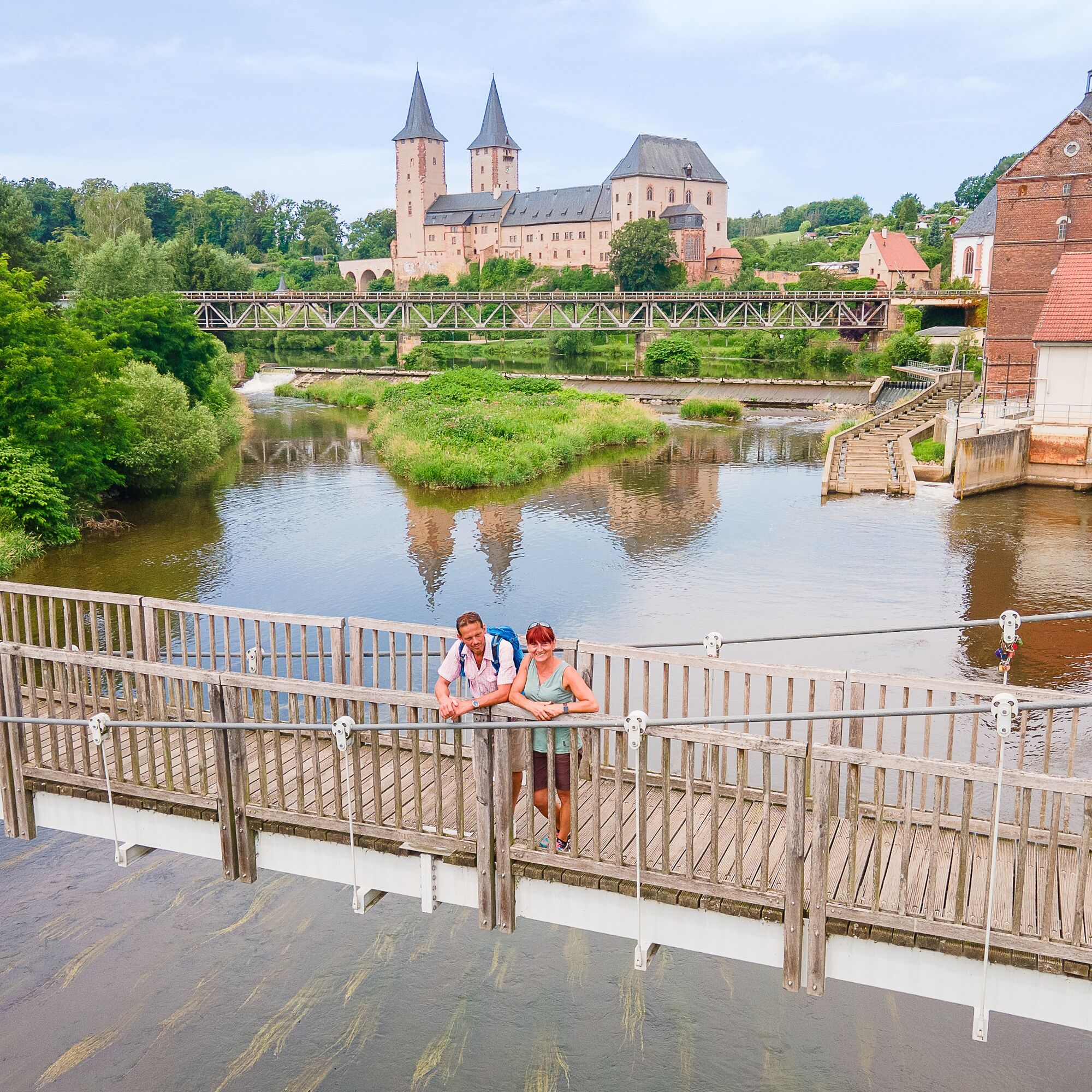
The swinging footbridge crosses the Zwickauer Mulde and connects the districts of Sörnzig and Fischheim. In 1871, a footbridge was first built here, but it was repeatedly destroyed by frequent floods. After floods in 1954 and 2013, the bridge was extensively renovated and now stands as a steel construction on concrete blocks.
Fischheim, founded in 1378, got its name from the then-common Mulde fishing. The atonement cross belongs to Fischheim’s cultural monuments: after the swinging footbridge, it is located on the left. The cross, made of Rochlitzer Porphyry Tuff, points to a church penalty where a convicted murderer had to erect the cross at the site of the crime. Two more such crosses can be found in the region.
Following the road north, you reach Steudten; before Biesern, turn right into Biesener Straße. After about 800m, a small path goes right, leading to the historic St. Johannes mine tunnel, a silver mine from the 15th century. The mine was in operation until the 18th century. Today, the tunnel is accessible as part of guided tours.
Further south, you reach the Alten Bruch Zöllnitz. Via Kolkauer Straße, you now get to Seelitz. The parsonage is considered one of the most beautiful churches made from local Rochlitz Porphyry Tuff.
Near the entrance to Seelitz, another atonement cross can be found. Following the path northwest, you come to the Biesern sand pit, where after the end of mining, a lake of 16 hectares was created. Along the northern shore, the path continues to Zaßnitz, where the Zaßnitz suspension bridge crosses the Zwickauer Mulde back to Rochlitz.
Áno
A4: Exit Chemnitz-East, continue via B107
A17: Exit Döbeln-North, continue via B169 and B175
A72: Exit Rochlitz, continue via B175
Train to Geithain, Narsdorf, Mittweida or Erlau à Bus to Rochlitz
Parking lot at Rochlitz Castle, Petrigasse, 09306 Rochlitz
T1
https://www.rochlitzer-muldental.de/
https://www.geopark-porphyrland.de/
Explore also the ! The Porphyry Educational Trail, the Seelitz experience route, the Rochlitzer Berg – Rochlitz geo-tour and the Wechselburg forest adventure trail let you discover the surroundings anew.
Obľúbené výlety v okolí
-
4,3
Einmal Amerika und zurück
strednáTuristika 12,4 km -
4,0
Wandererlebnispfad Wechselburg
strednáTuristika 10,9 km -
Mulderadweg Rochlitz-Sermuth
svetloCyklistika 16,6 km -
Wanderung von Wechselburg nach Rochlitz
svetloTuristika 7,40 km -
Via Porphyria - Etappe 8 (Claußnitz - Seelitz)
strednáPútnická trasa 17,6 km -
Via Porphyria - Etappe 7 (Lunzenau - Claußnitz)
strednáPútnická trasa 14,6 km -
Via Porphyria - Etappe 10 (Wechselburg - Geithain)
strednáPútnická trasa 12,7 km -
Muldental-Wanderweg Etappe Rochlitz-Colditz
strednáTuristika 14,8 km -
Muldental-Wanderweg Etappe Penig-Rochlitz
ťažkéTuristika 24,4 km -
Altenburg-Colditz-Radroute
strednáCyklistika 50,1 km

Turistika a stopovanie


Nenechajte si ujsť ponuky a inšpiráciu na ďalšiu dovolenku
Vaša e-mailová adresa bol pridaný do poštového zoznamu.