


Waldkirchen circular hiking trail
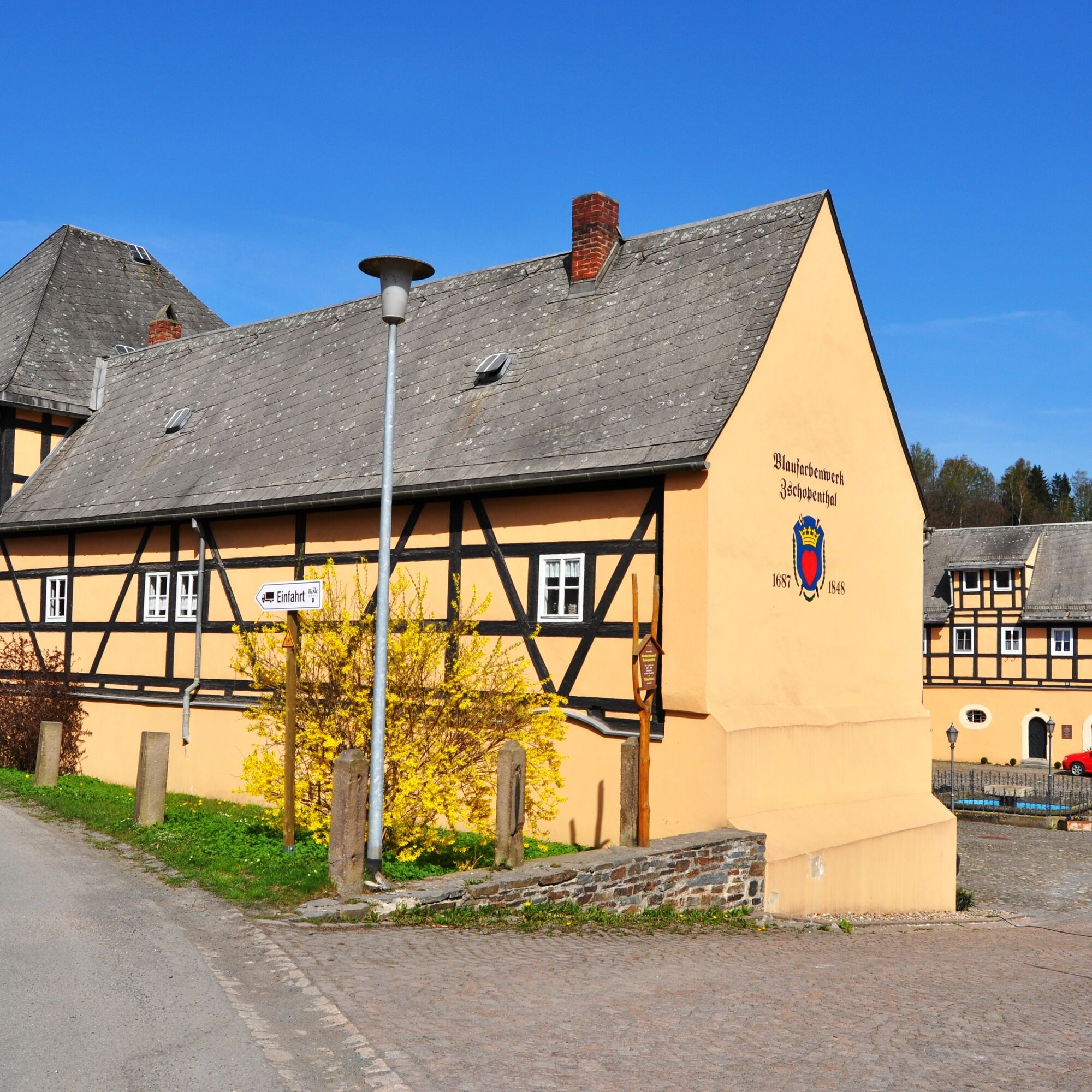
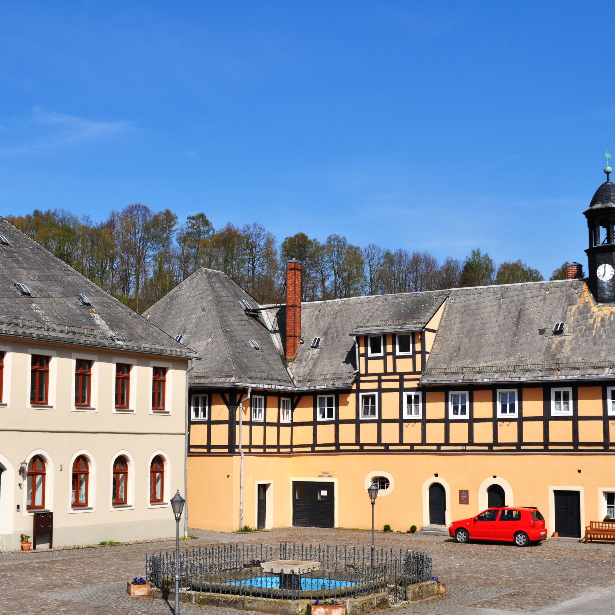
Our hike starts at the Rolle mill in the "Doktorhof" (former blue paint factory) in the direction of the serpentine to the Marbacherweg junction, the path leads uphill. Through the Mörbitz to the "Green...
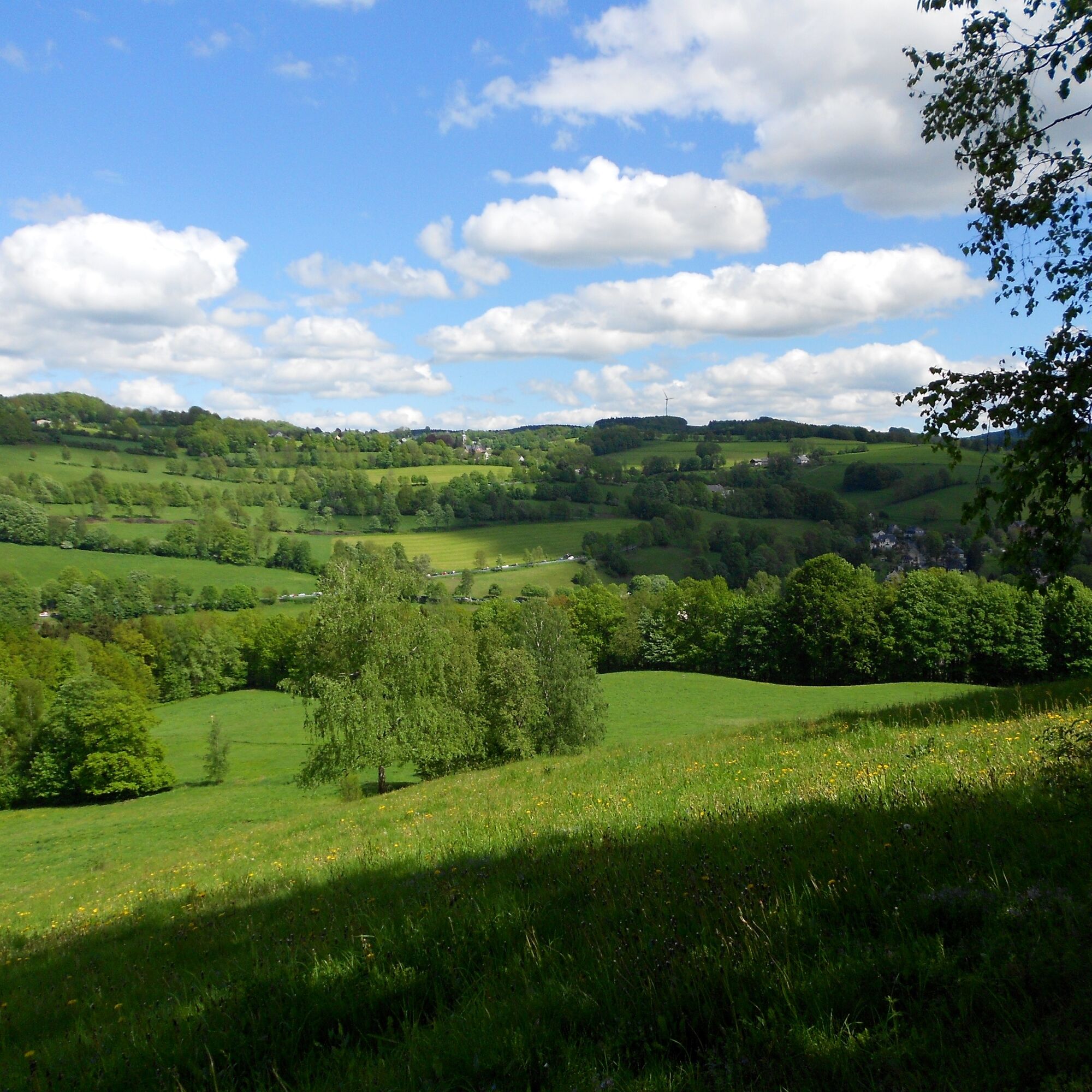
Our hike starts at the Rolle mill in the "Doktorhof" (former blue paint factory) in the direction of the serpentine to the Marbacherweg junction, the path leads uphill. Through the Mörbitz to the "Green Forest". On the way, a seating area invites you to take a break. We cross the road, approx. 200 m along the paved path in the direction of Marbach, then along the field path in the direction of Pfarrwald. Cross the Grünhainichen-Waldkirchen connecting road and walk into the forest in the direction of Börnichen. From the water reservoirs we walk to the windmill on the hill between Waldkirchen and Börnichen, continue down the valley to the Krumhermersdorf meadows, towards the Krumhermersdorf - Waldkirchen connecting road to the Waldkirchen village road and back to the starting point of the tour.

Waldkirchen stop/station (from the station over the Zschopa bridge to the start of the hike)
at the station
Wildenstein Administrative Association
Chemnitzer Straße 41, 09579 Grünhainichen
Tel. +49 37294 17015, Fax: +49 37294 17021
m.richter@wildenstein.ws
Digital hiking pin
Places of interest
Blaufarbenwerk local history museum - open by appointment, tel. +49 176 55931409)
Rollemühle mill store - open Monday - Friday, tel. +49 3725 34730
View of Zschopau and the Zschopau valley
Refreshment stops
unfortunately none, please take provisions with you on the way
Digital hiking pin:
The hike is part of the digital hiking pin "For connoisseurs". The focus here is on the world of indulgence, with restaurants and regional producers of fine schnapps, delicious cheese, refreshing beer and fragrant honey, for example. Download the SummitLynx app, activate your mobile GPS and log in at check-in points on 12 hikes that are well worth seeing.
The special thing about our digital hiking pins is that you can create your own personal tour book with pictures, texts and locations.
Obľúbené výlety v okolí
-
5,0
Rocky idyll and ridge view (Wolkenstein)
strednáTuristika 15,2 km -
5,0
Alpine hiking trail - town of Wolkenstein/Warmbad (Boundless. Wild romantic nature experiences)
strednáTuristika 10,1 km -
3,5
Historical circular hiking trail - Witzschdorf
strednáTuristika 7,38 km -
4,0
Via Mala
svetloTuristika 5,36 km -
Off to the "Crown of the Ore Mountains"
strednáTuristika 9,51 km -
Zschopautalweg
ťažkédiaľková pešia trasa 129,3 km -
4,0
Pockau - discover a paradise
strednáTuristika 14,1 km -
Spa trail in the Ore Mountains spa region
strednáTuristika 10,2 km -
Saxon Way of St. James along the Franconian Road (Bautzen - Hof)
strednáPútnická trasa 300,2 km -
3,0
4 - Mill tour Grünhainichen
strednáTuristika 13,3 km

Turistika a stopovanie


Nenechajte si ujsť ponuky a inšpiráciu na ďalšiu dovolenku
Vaša e-mailová adresa bol pridaný do poštového zoznamu.