


Großarl valley: 6-day hike along the eastern side of the Großarl valley
Úroveň náročnosti: T2
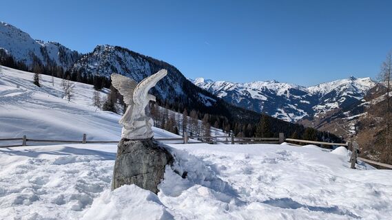
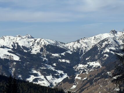
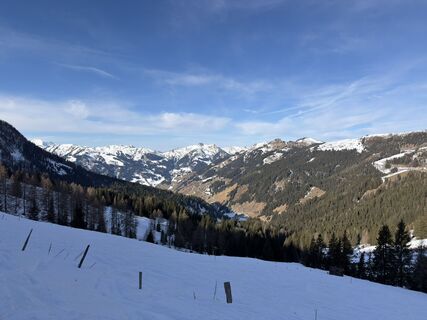
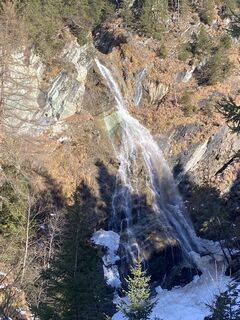
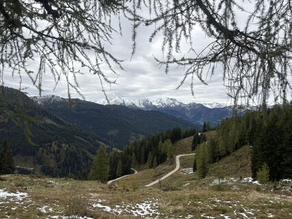
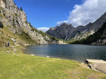
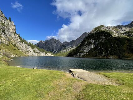
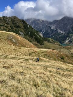
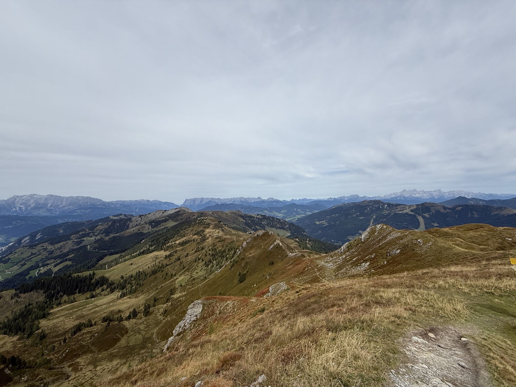
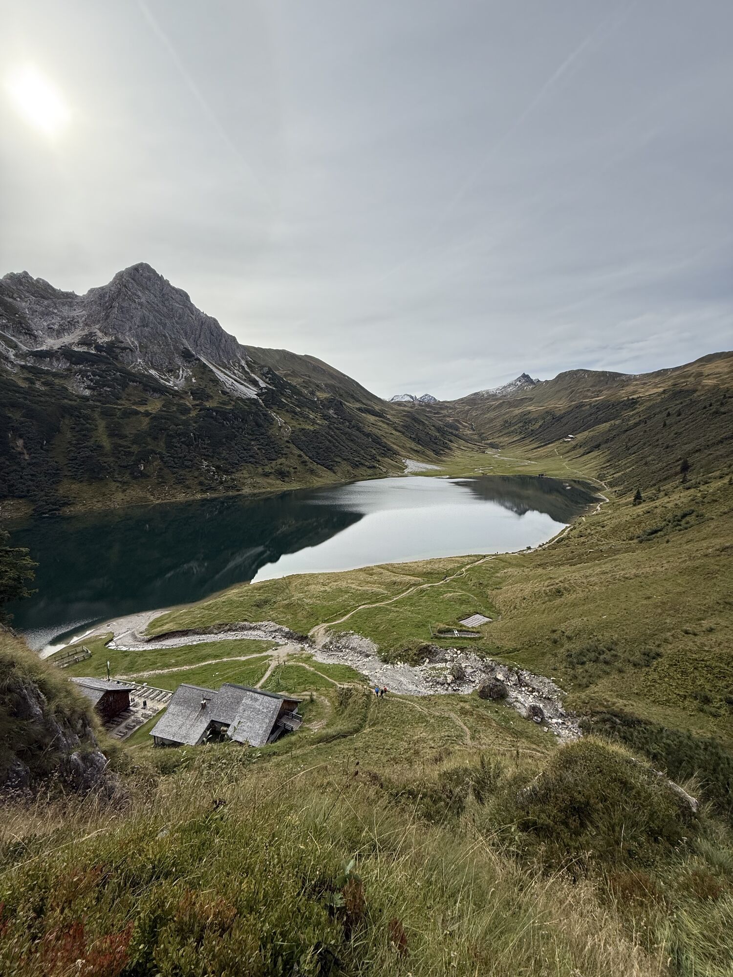
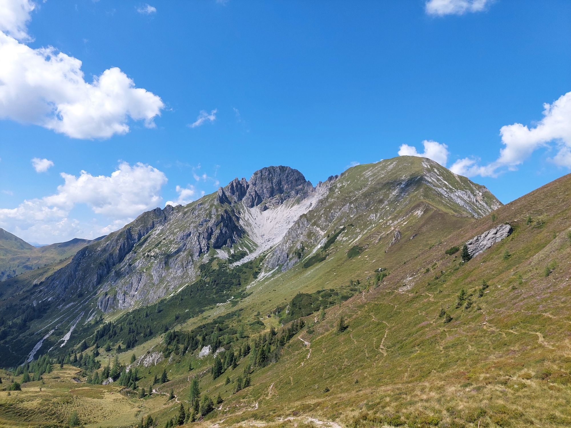
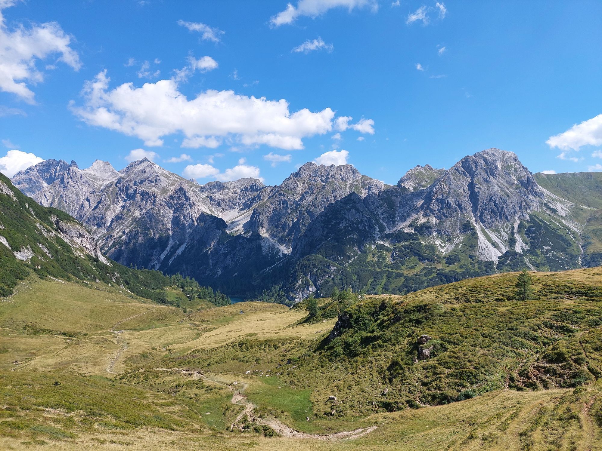
Fotografie našich používateľov
-

 © Johannes PetschkVytvorené dňa 21.06.2025
 -
 © PfefferamVytvorené dňa 27.02.2026
 -
 © Julius ScholzVytvorené dňa 23.01.2026
 -
 © Julius ScholzVytvorené dňa 23.01.2026
 -
 © Sven KrieblinVytvorené dňa 13.12.2025
 -
 © Andrea MahringerVytvorené dňa 31.10.2025
 -
 © Andrea MahringerVytvorené dňa 29.10.2025
 -
 © Andrea MahringerVytvorené dňa 29.10.2025
 -
 © Andrea MahringerVytvorené dňa 29.10.2025
 -
 © Michael GschwandtnerVytvorené dňa 28.10.2025
 -
 © Andrea MahringerVytvorené dňa 28.10.2025
 -
 © Andrea MahringerVytvorené dňa 28.10.2025
 -

 © Peter De Smedt2Vytvorené dňa 08.10.2025
 -
 © Peter De Smedt2Vytvorené dňa 08.10.2025
 -
 © Peter De Smedt2Vytvorené dňa 08.10.2025
 -
 © Peter De Smedt2Vytvorené dňa 08.10.2025
 -
 © Peter De Smedt2Vytvorené dňa 08.10.2025
 -
 © Peter De Smedt2Vytvorené dňa 08.10.2025
 -
 © Peter De Smedt2Vytvorené dňa 08.10.2025
 -
 © Hannah AnyanVytvorené dňa 27.09.2025
 -
 © Hannah AnyanVytvorené dňa 27.09.2025
 -
 © Hannah AnyanVytvorené dňa 27.09.2025
 -
 © Hannah AnyanVytvorené dňa 27.09.2025
 -
 © Hannah AnyanVytvorené dňa 27.09.2025
 -
 © Hannah AnyanVytvorené dňa 27.09.2025
 -
 © Hannah AnyanVytvorené dňa 27.09.2025
 -
 © Rico WeijsVytvorené dňa 22.09.2025
 -

 © stéphanie dalla-faveraVytvorené dňa 20.09.2025
 -

 © PhilVytvorené dňa 13.09.2025
 -
 © PhilVytvorené dňa 13.09.2025
 -
 © Olaf SchmidtVytvorené dňa 07.09.2025
 -
 © Noah RoeVytvorené dňa 07.09.2025
 -
 © Noah RoeVytvorené dňa 07.09.2025
 -
 © Noah RoeVytvorené dňa 07.09.2025
 -

 © Helmut Wagner 2Vytvorené dňa 19.08.2025
 -
 © Helmut Wagner 2Vytvorené dňa 19.08.2025
 -
 © Helmut Wagner 2Vytvorené dňa 19.08.2025
 -
 © Helmut Wagner 2Vytvorené dňa 19.08.2025
 -
 © Helmut Wagner 2Vytvorené dňa 19.08.2025
 -
 © Helmut Wagner 2Vytvorené dňa 19.08.2025
 -
 © Helmut Wagner 2Vytvorené dňa 19.08.2025
 -
 © Helmut Wagner 2Vytvorené dňa 19.08.2025
 -
 © Helmut Wagner 2Vytvorené dňa 19.08.2025
 -
 © Josef NockerVytvorené dňa 09.08.2025
 -

 © KHStraussVytvorené dňa 07.08.2025
 -
 © Christoph MVytvorené dňa 20.07.2025
 -
 © john klokVytvorené dňa 16.07.2025
 -
 © Simon FaißtVytvorené dňa 15.07.2025


Day 1:
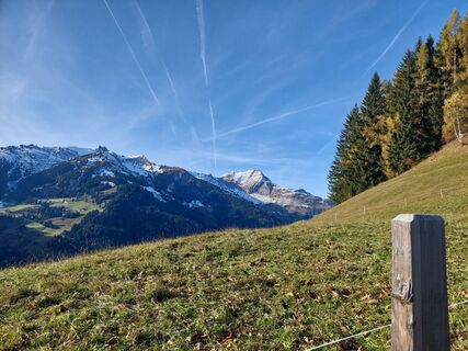
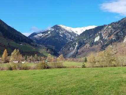
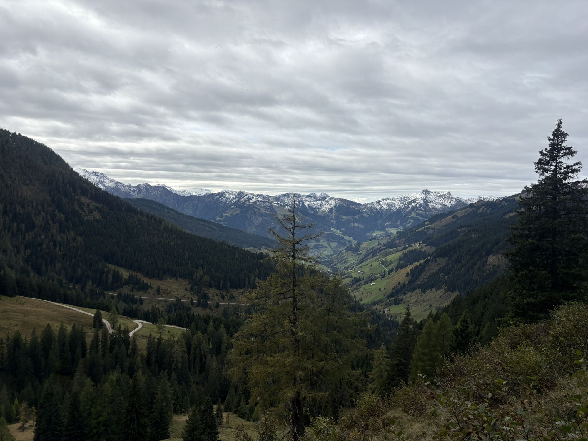
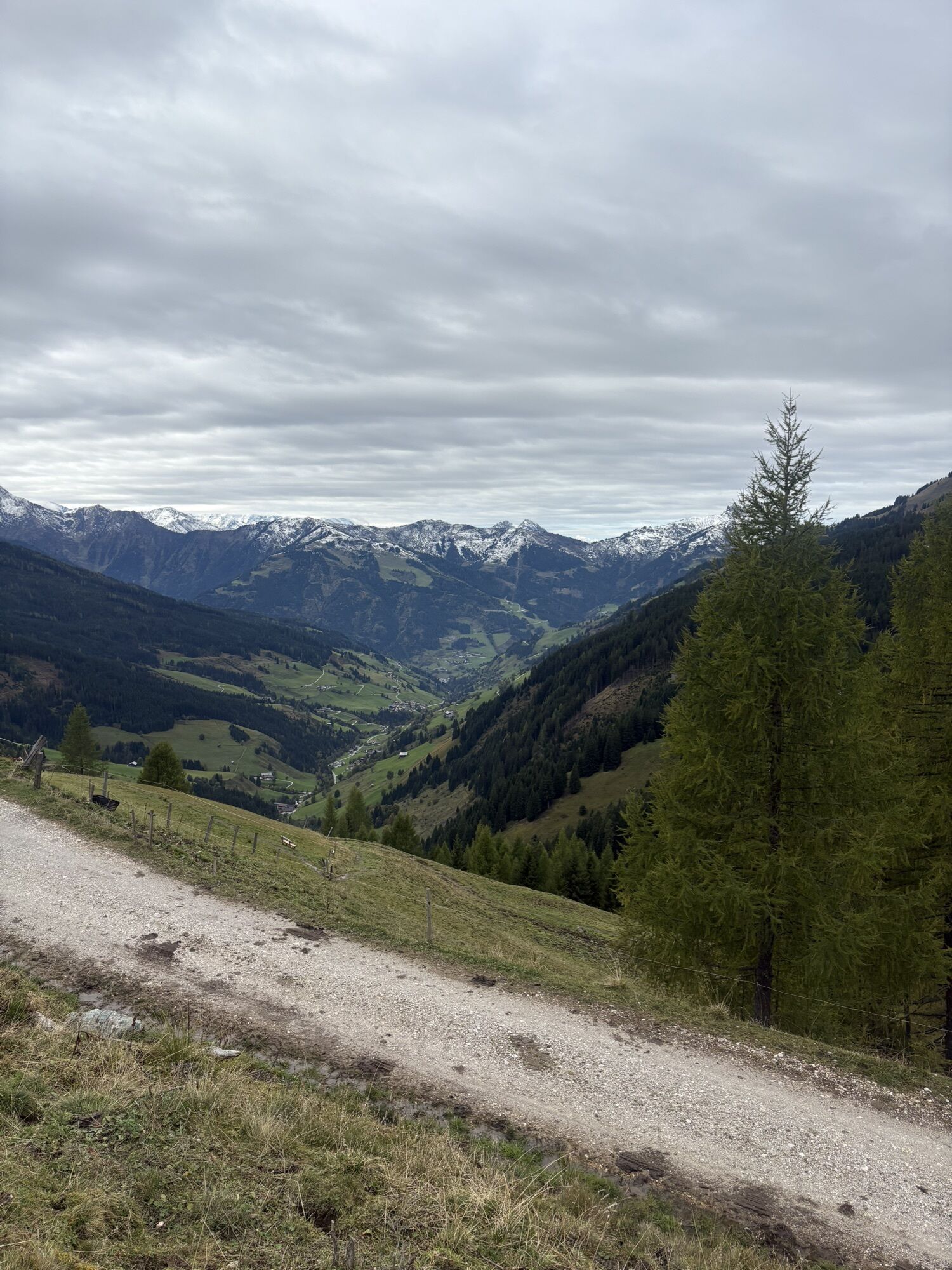
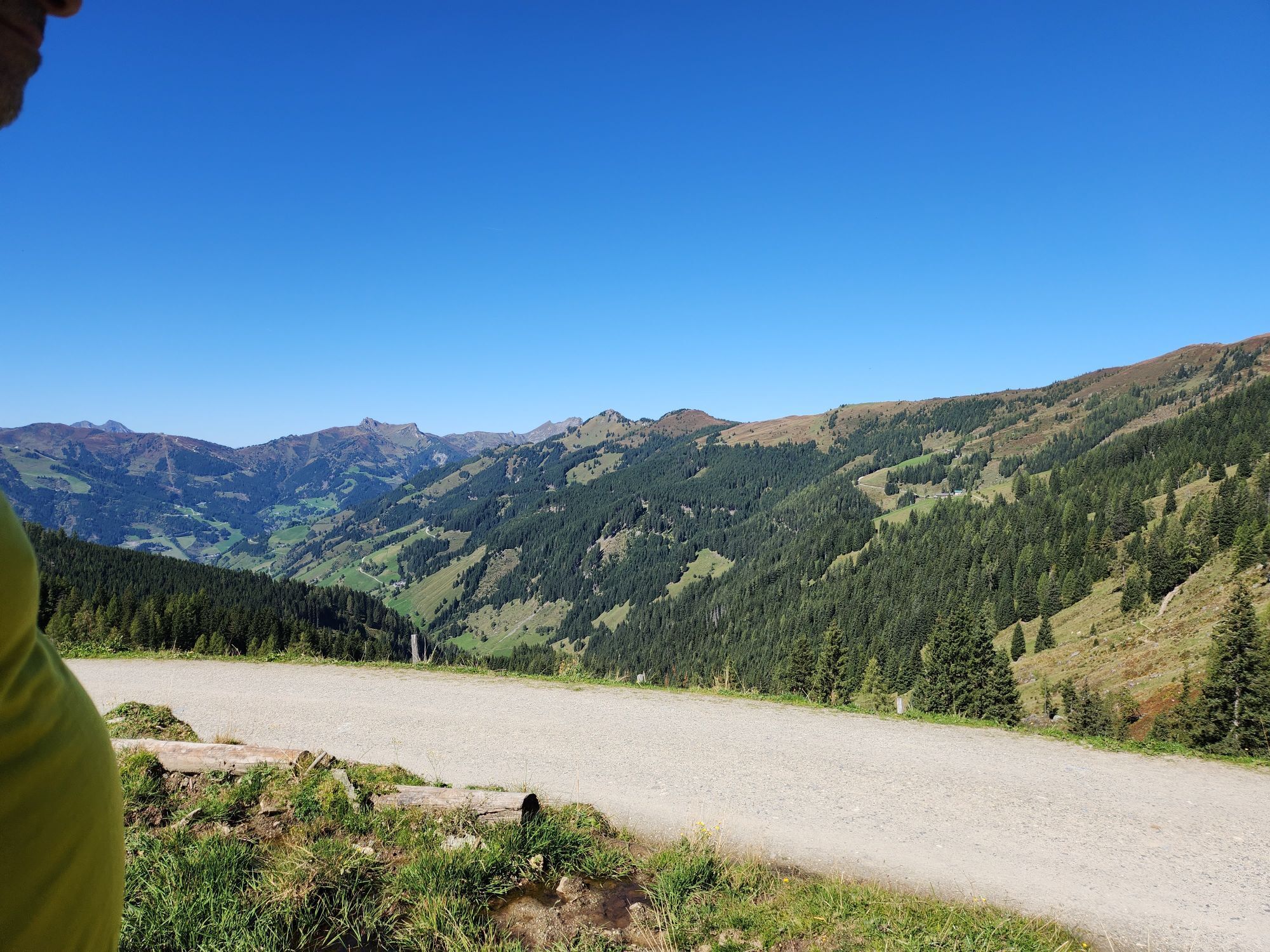
From the center of Großarl a trail leads up through the forest to Hertas Rast. Then the trail continues over meadows and finally alpine pastures to the Gerstreitalm, your first stage destination....
Day 1:
From the center of Großarl a trail leads up through the forest to Hertas Rast. Then the trail continues over meadows and finally alpine pastures to the Gerstreitalm, your first stage destination. You will be spoiled with delicacies from their own production. After a pleasant rest, you will take the beds for the first night.
Day 2:
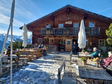
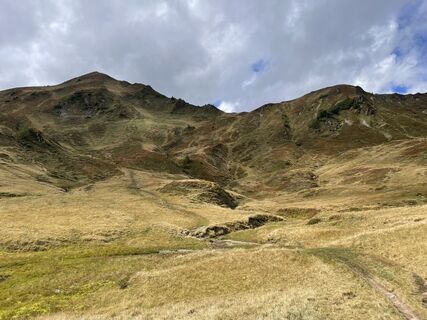
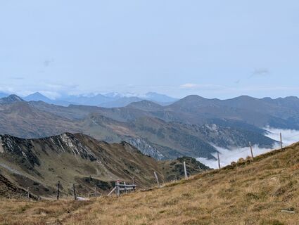
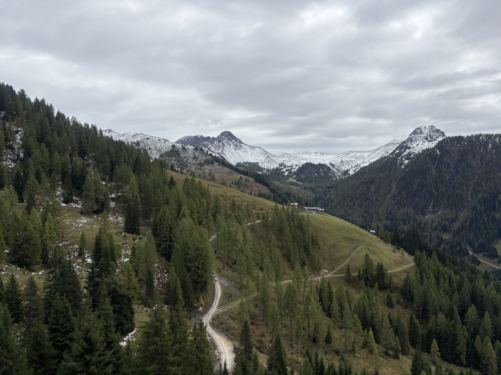
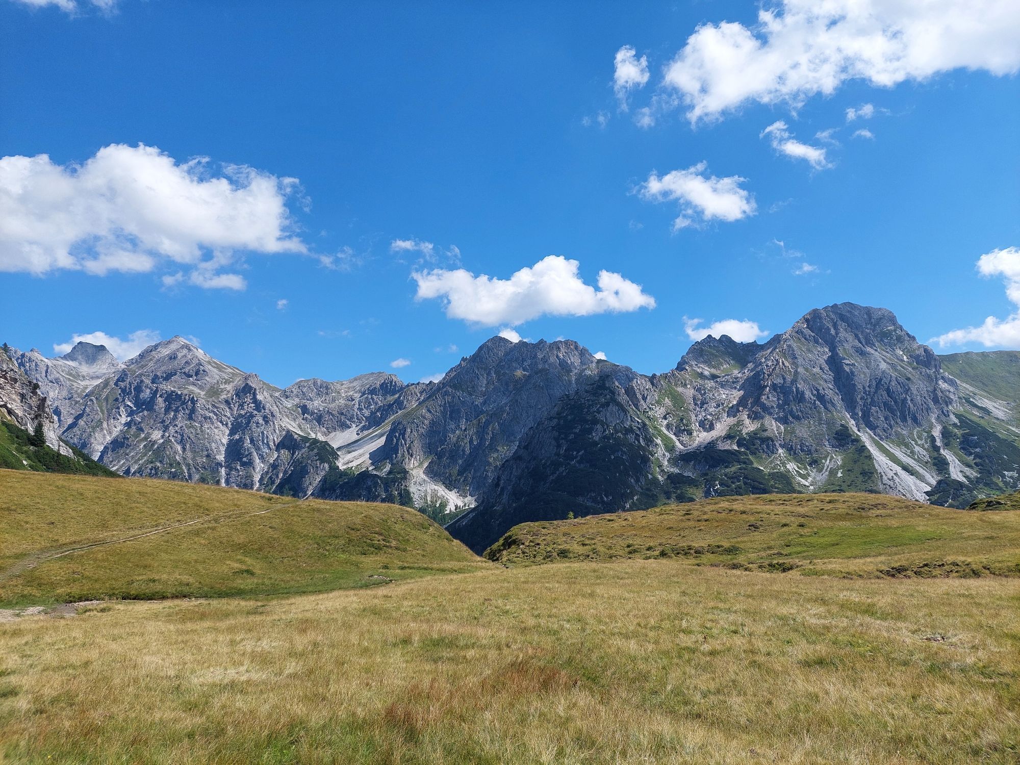
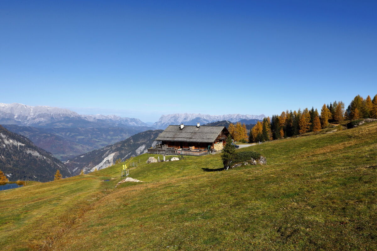
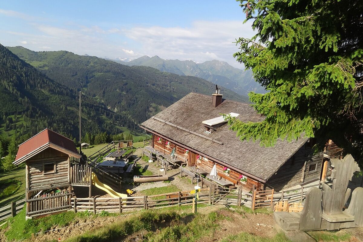
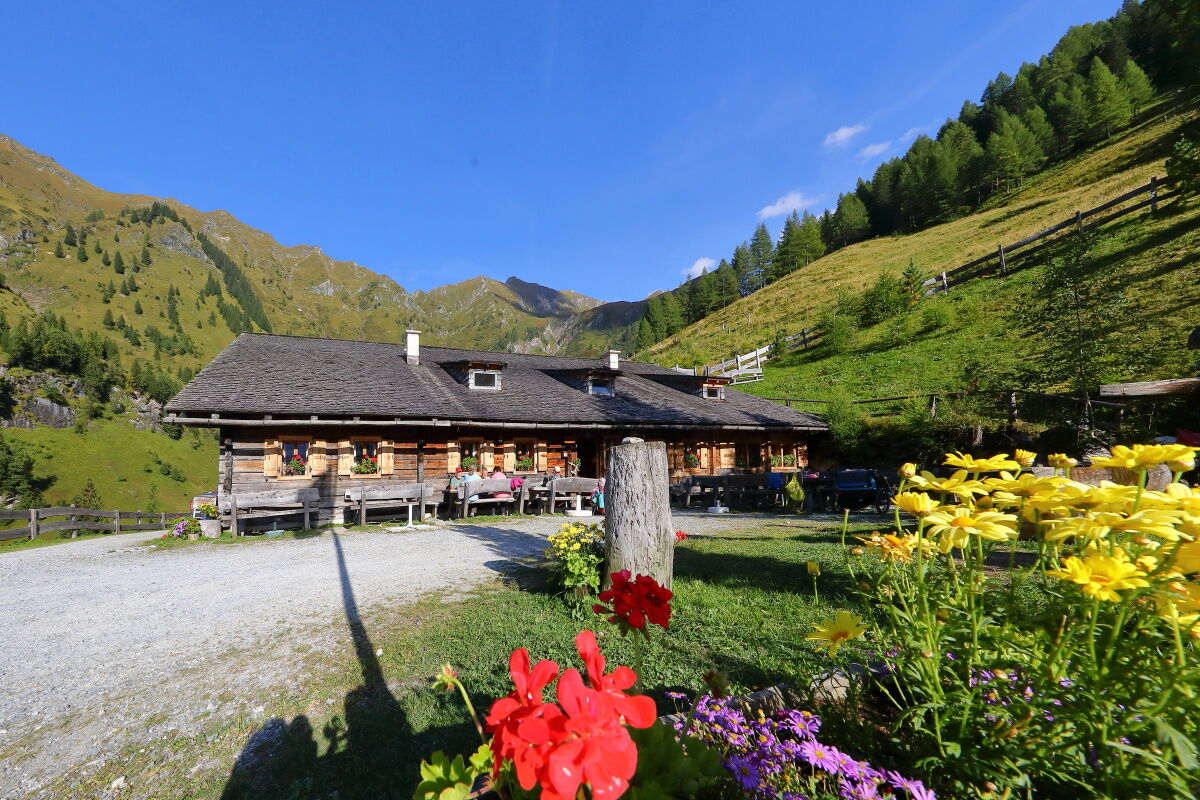
You will be awakened by the ringing of the alpine cows' bells. After a hearty breakfast, you set off uphill to the Röschenbergalm, which is not staffed. Over beautiful alpine meadows, you reach the Saukaralm. This pasture is the highest alpine pasture in the Großarl valley. The Hohe Tauern, the Hochkönig as well as the Tennen and Hagen mountains make this pasture one of the most beautiful viewpoints in the Großarl valley. After a refreshment, you continue over alpine meadows, the so-called Spatkar, over the Spatalm and the Kleinwildalm (both unstaffed) to the Großwildalm. Here you will again be spoiled with delicacies from their own production. Over a romantic alpine path, it goes first downhill a bit, then uphill again to the Karseggalm, the oldest hut in the Großarl valley. With its approx. 400 years, it is a particularly rustic hut. Of course, there are delicacies from their own production here as well. Then it continues very leisurely to the Unterwandalm, where you take quarters for this night. Often the herdsman reaches for his accordion here - so a sociable hut evening is guaranteed.
Day 3:
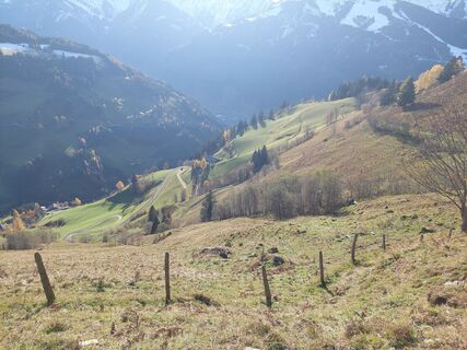
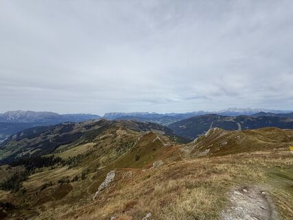
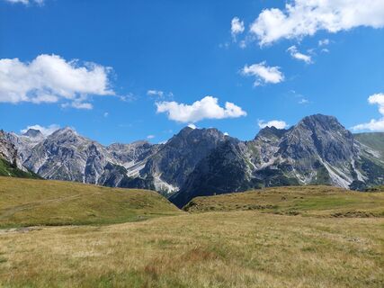
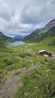
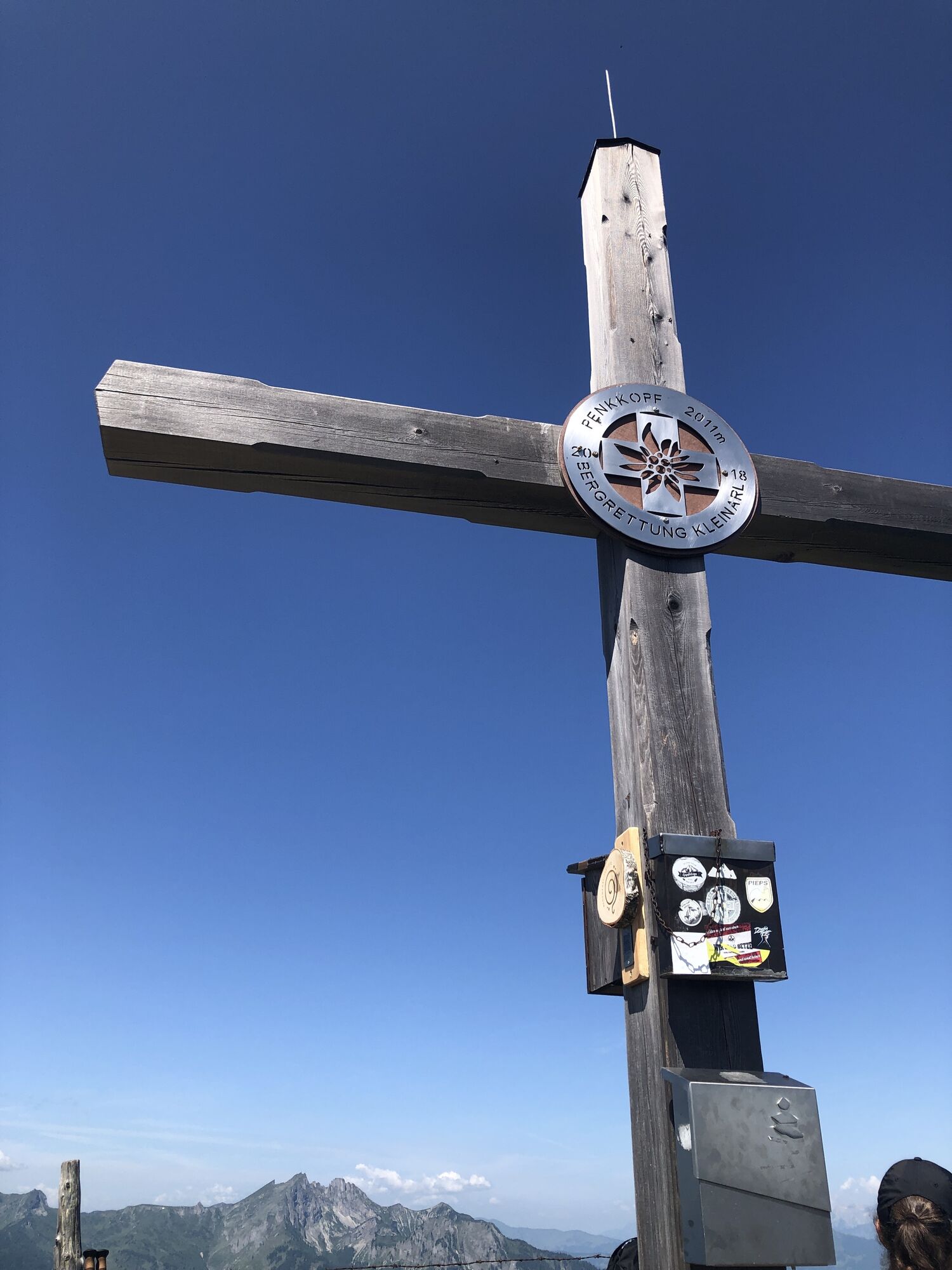
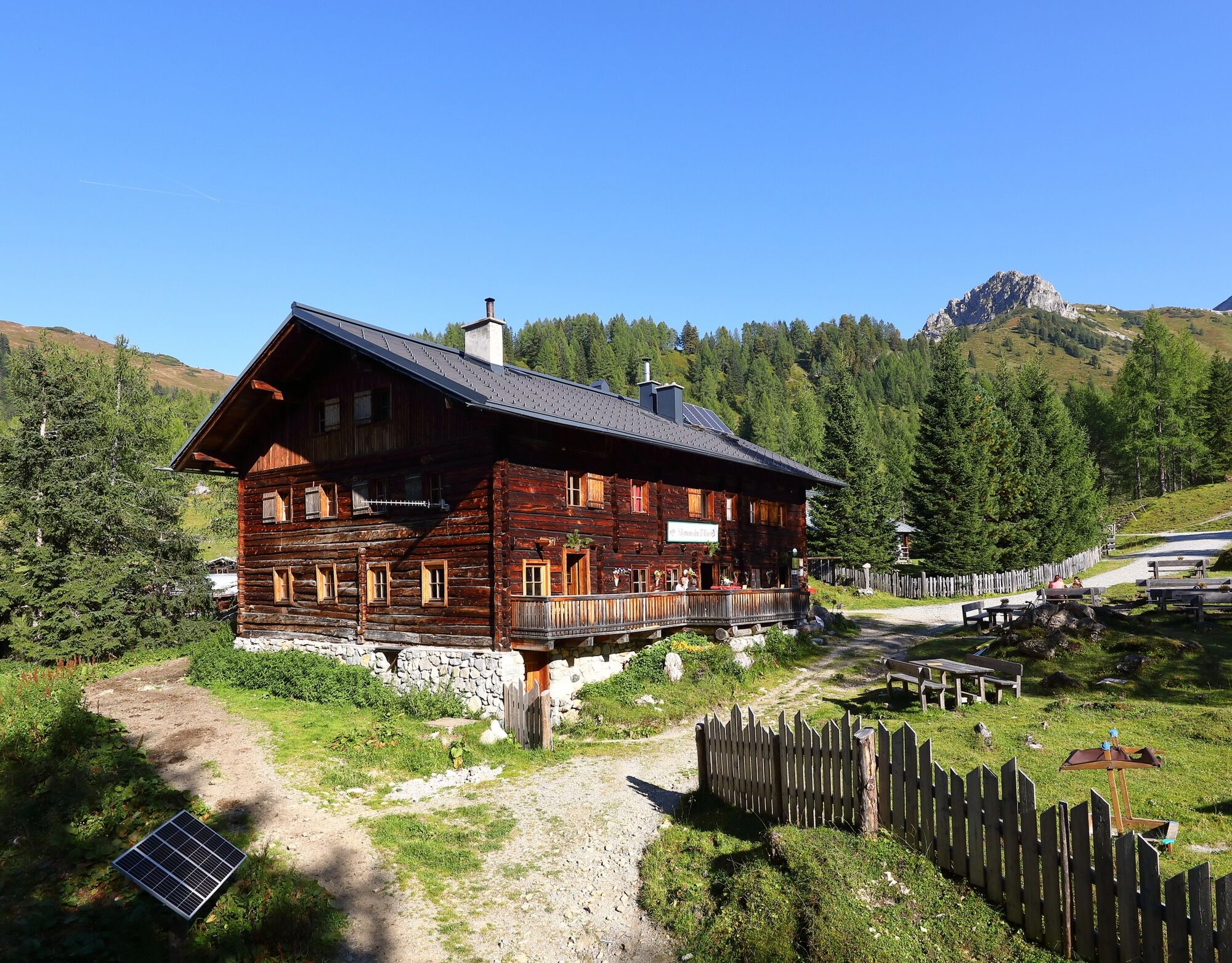
Freshly fortified, you continue the next morning. First you have to follow a section of the Froststraße. You pass the Muggenfeld- (closed) and the Maurachalm. At the Maurachalm, you will be spoiled with delicacies from their own agriculture. The Maurachalm is the northernmost alpine pasture in the Großarl valley and it is especially known for its exquisite spirits (rowanberry or elder). The herdsmen often sing and make music here. Ascent over the Auhofalm (unmanaged) to the Kitzstein (Gabel). From here you have a beautiful view of the Salzach valley as well as the Hochkönig, the Tennen and Hagen mountains on one side and the Hohe Tauern on the other side. Along the mountain ridge it continues to the Penkkopf and the Gründegg. The descent leads to the Ellmaualm, where the beds are already waiting for the tired hikers. Fortified by a tasty snack, you can enjoy the sunset at the Ellmaualm.
Day 4:
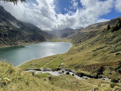
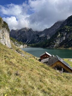
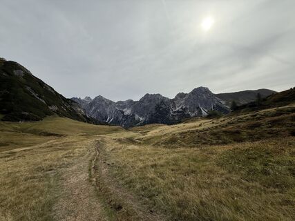
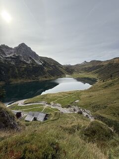
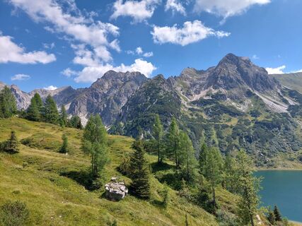
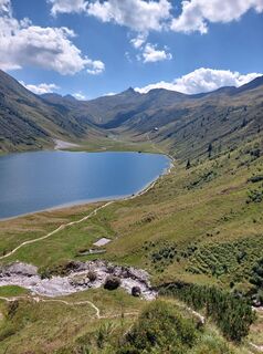
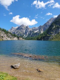
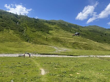
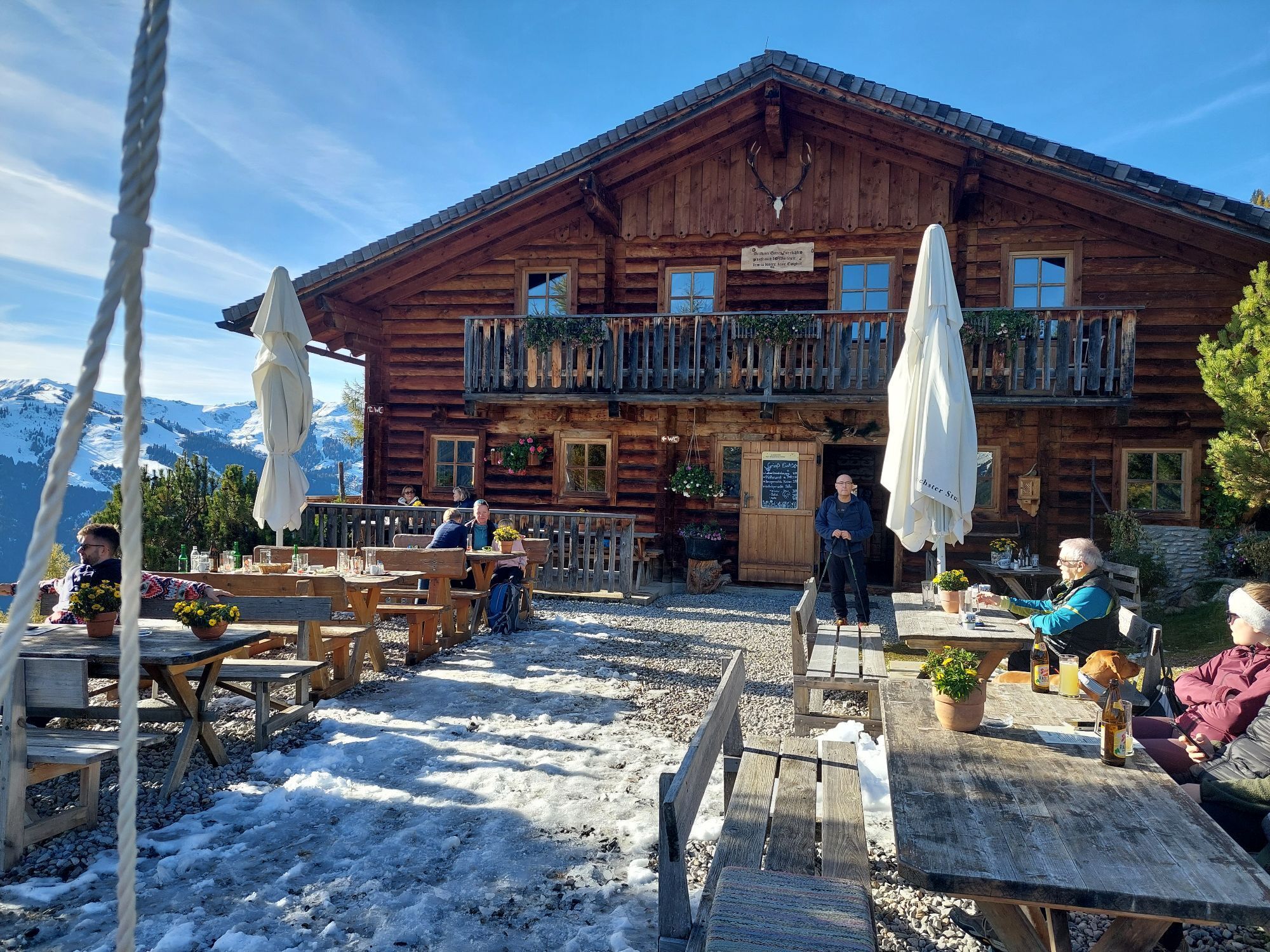
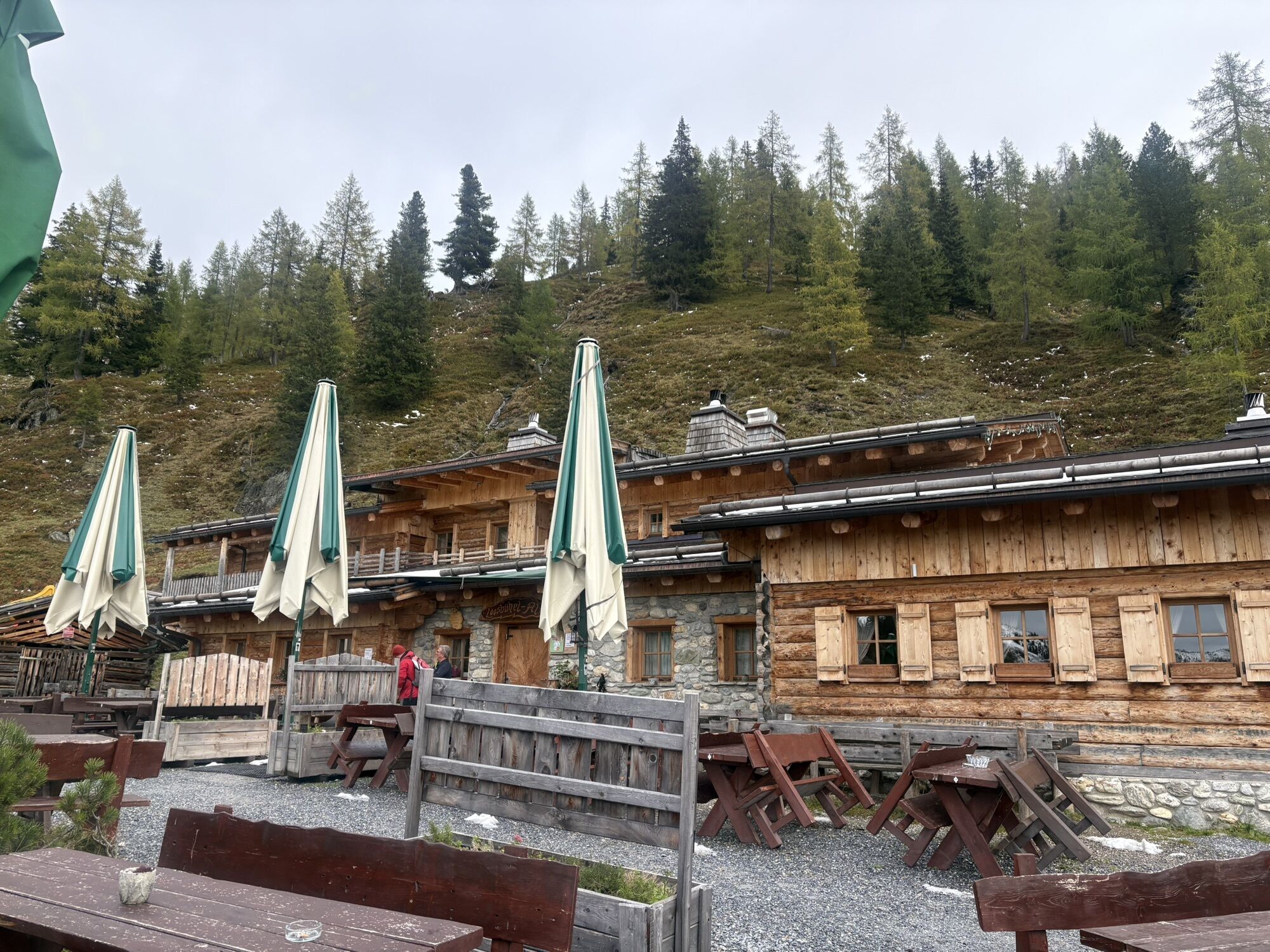
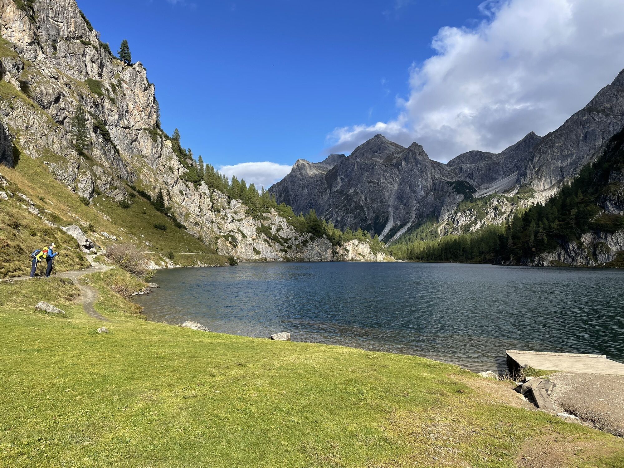
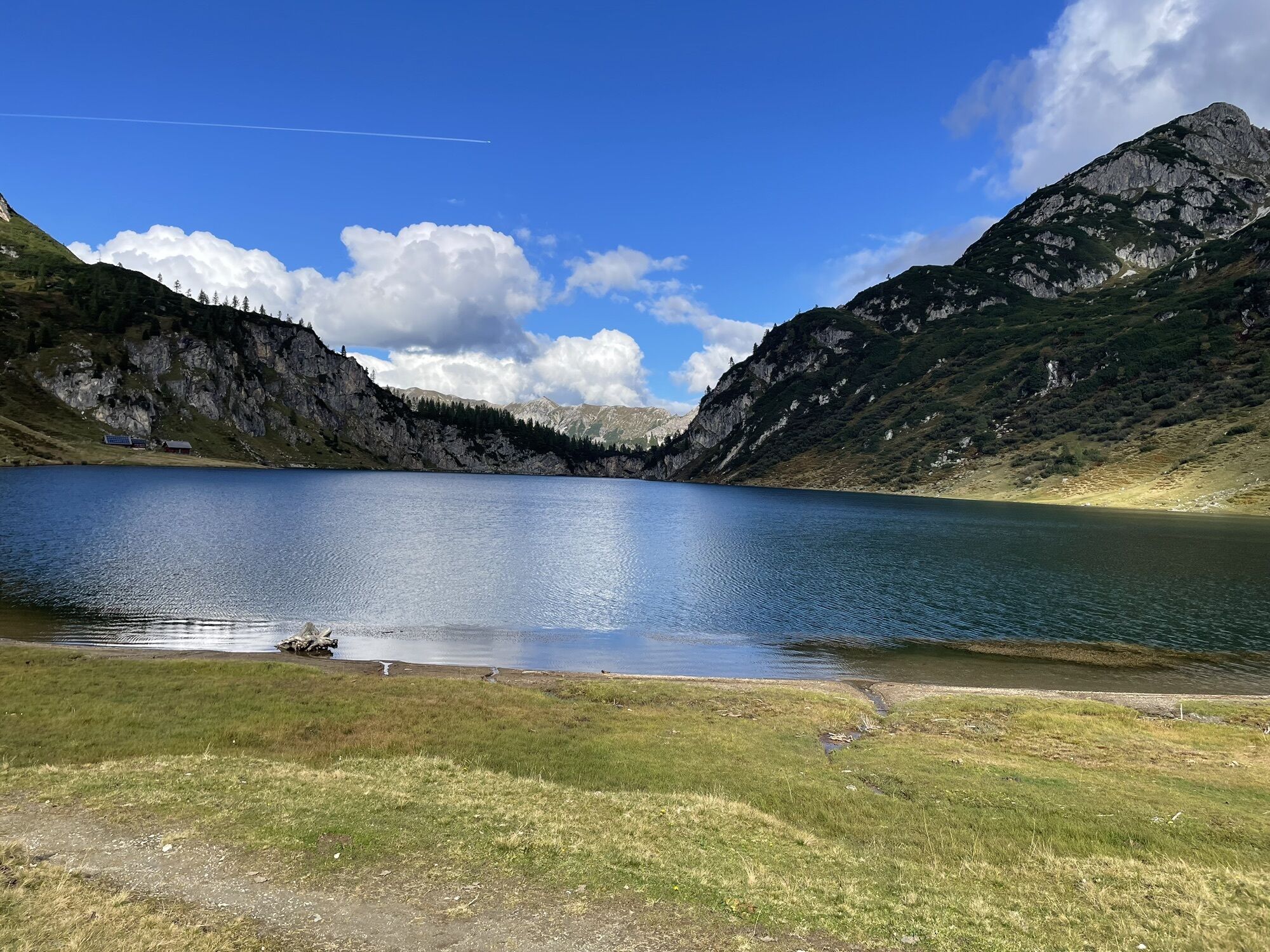
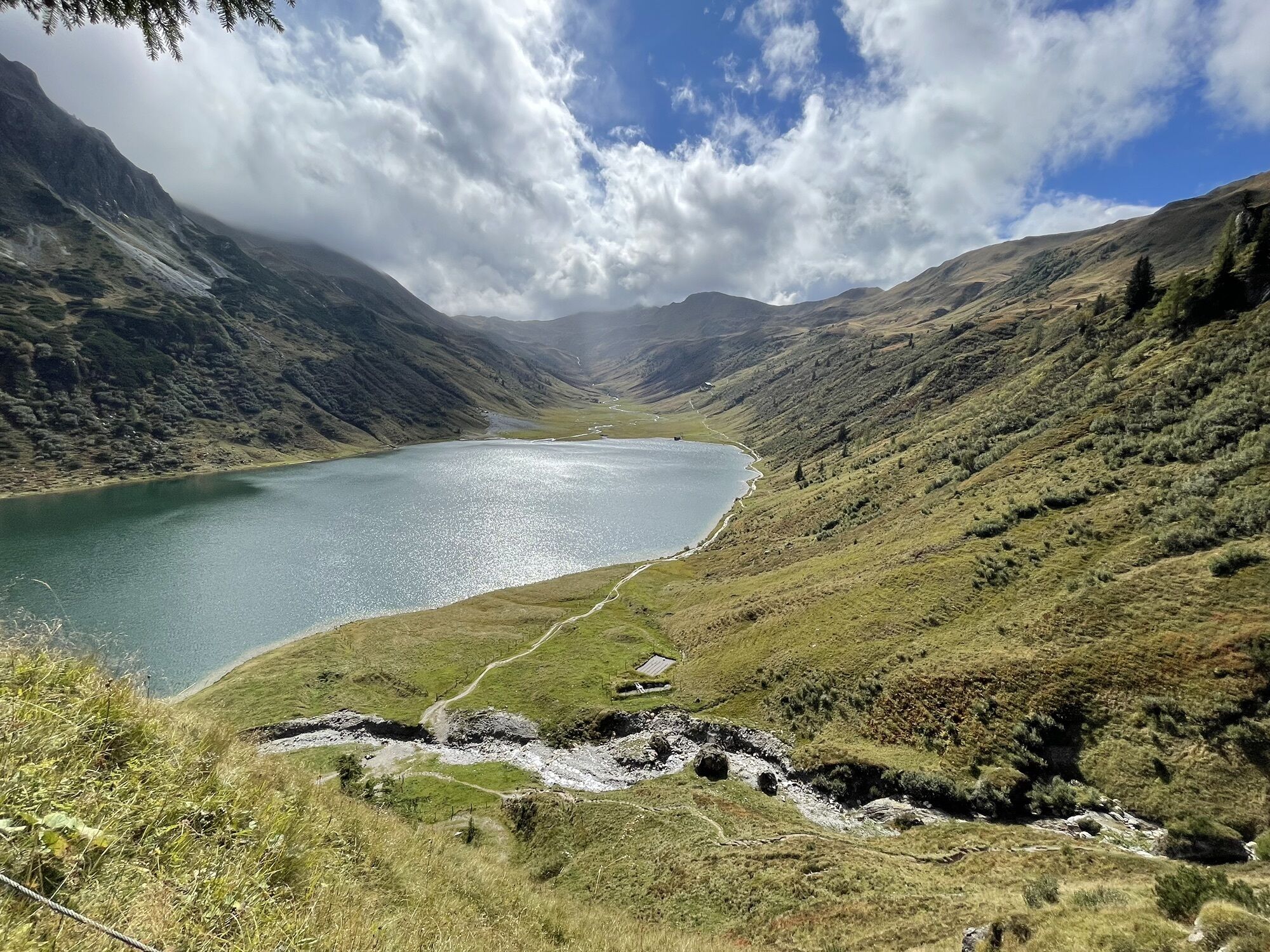
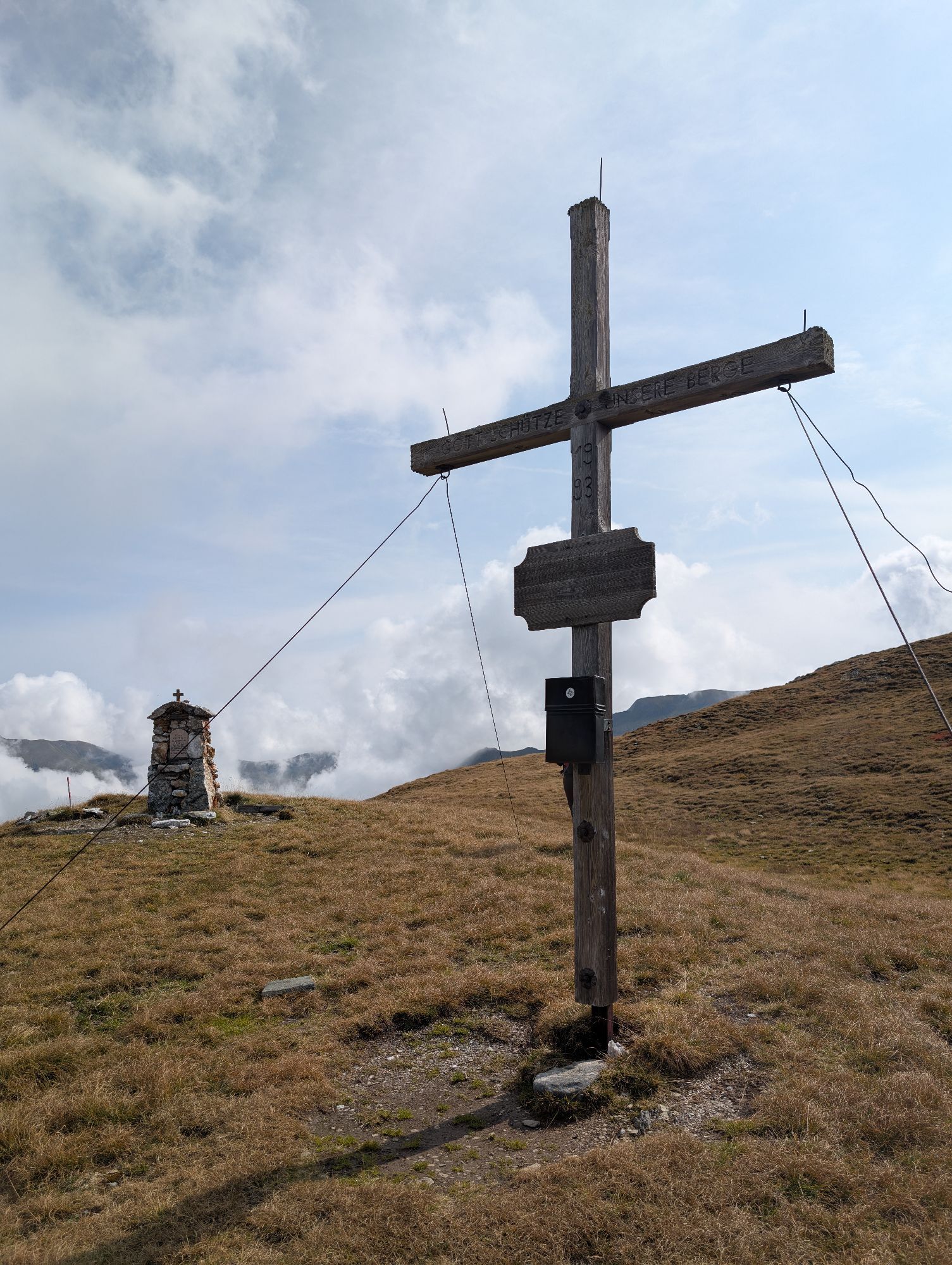
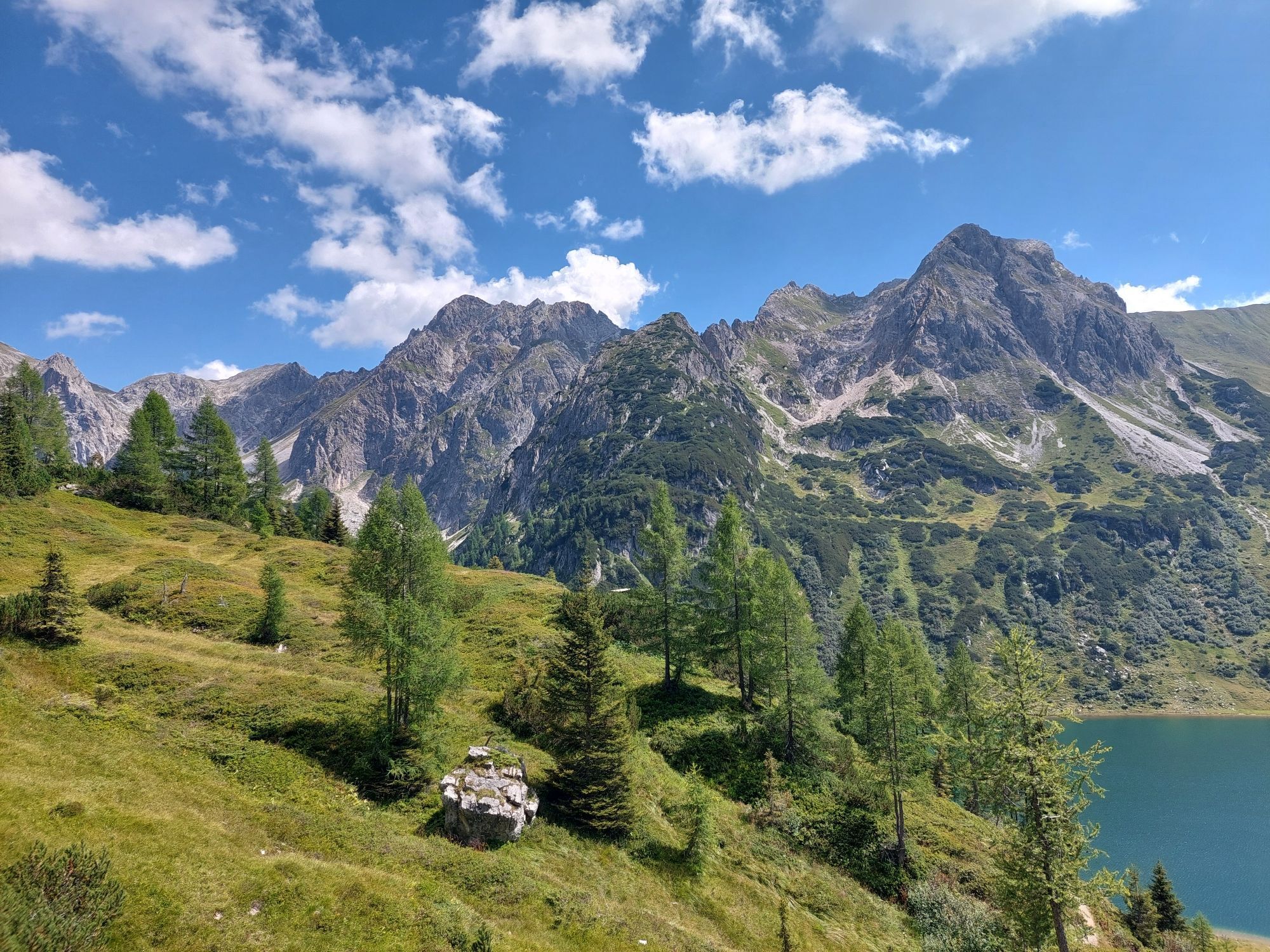
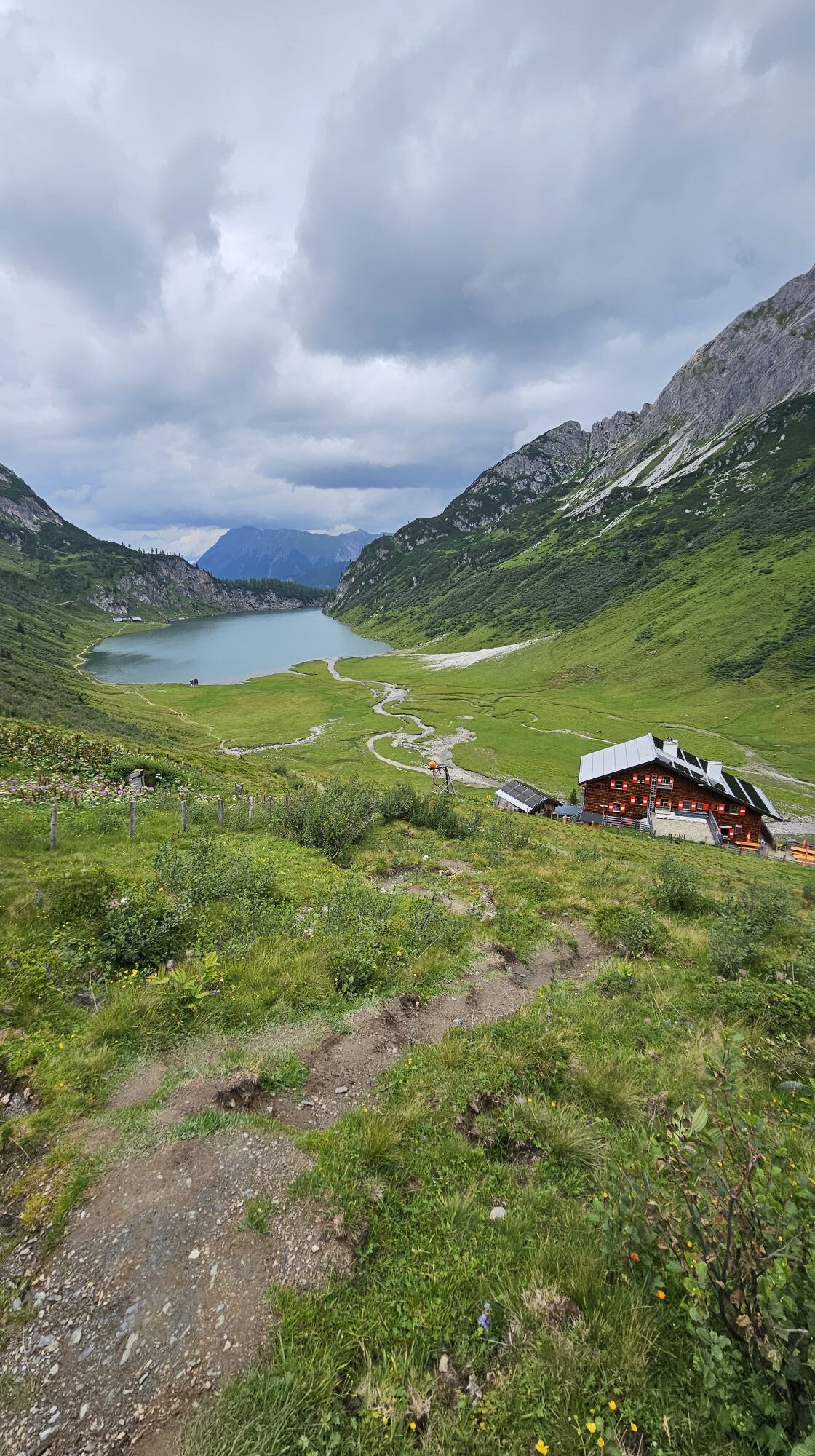
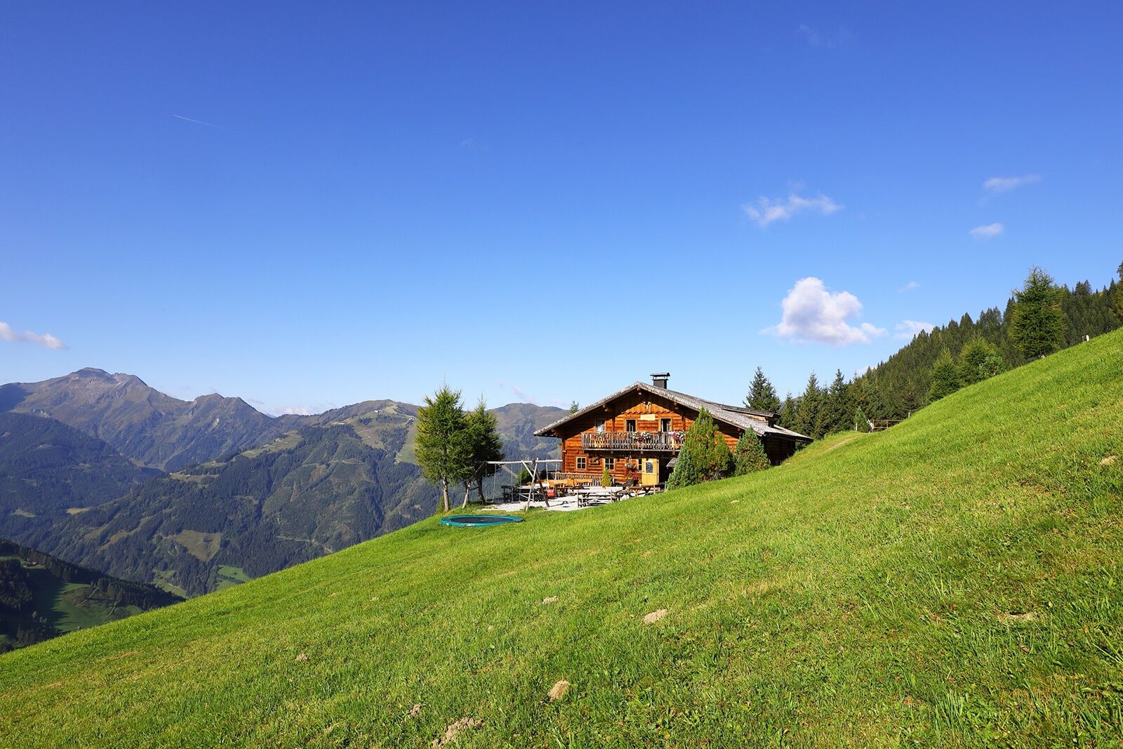
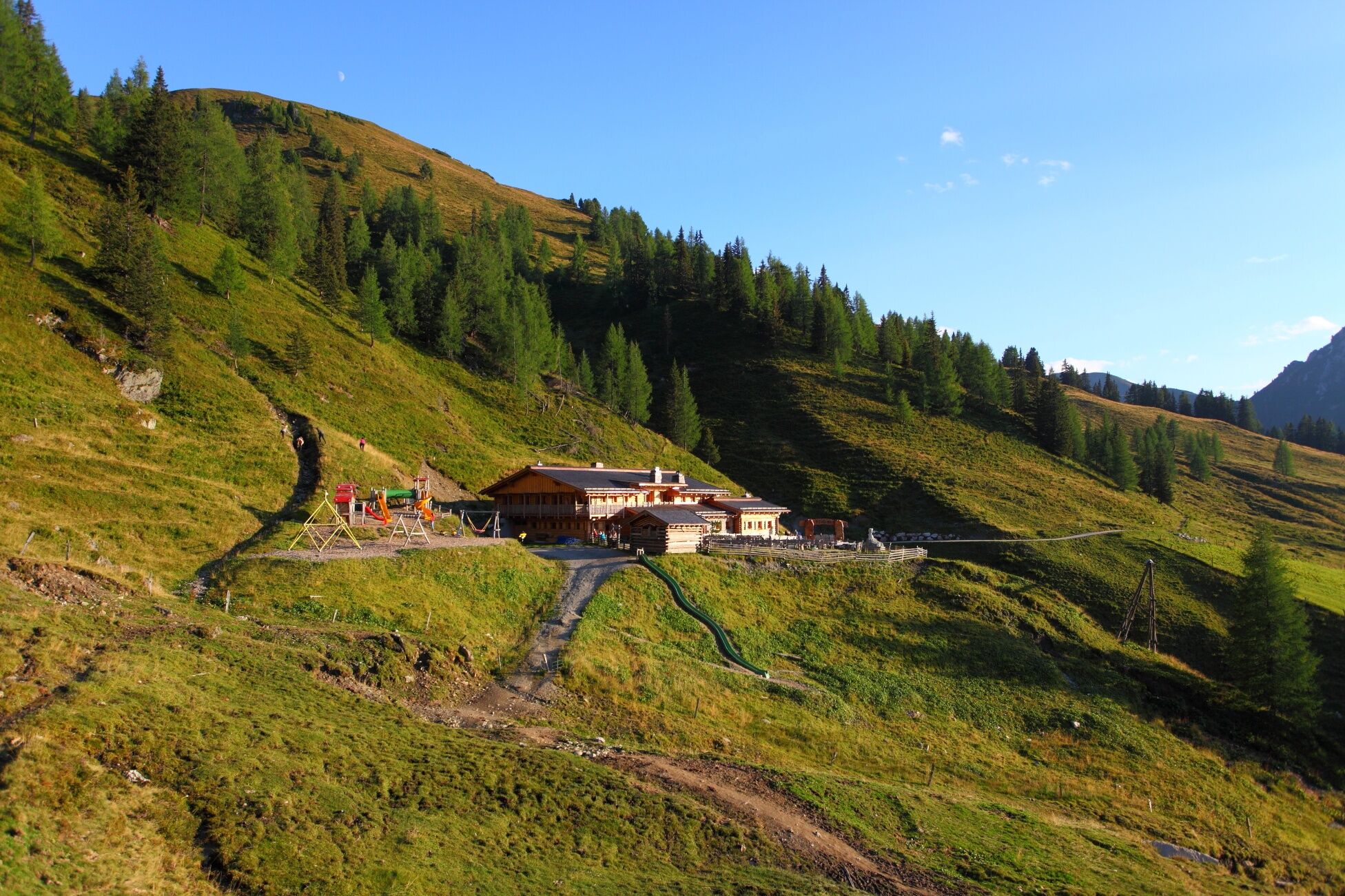
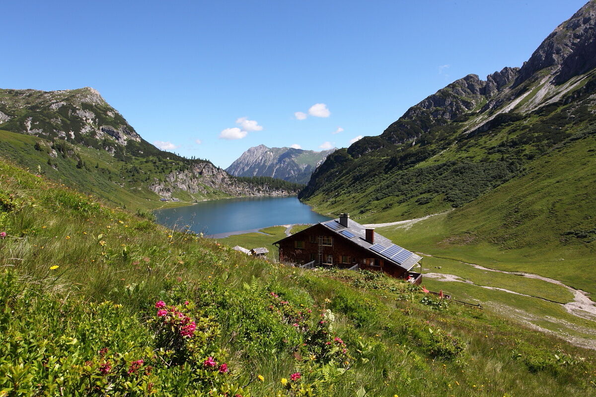
After a good sleep, you walk leisurely along the Salzburg Alpine Trail without major climbs to the Weißalm. The loving furnishing of the hut with old tools reminds of long past days and the arduous work in the mountains. You then comfortably follow the Salzburg Alpine Trail to the Loosbühelalm. Especially for friends of goat milk and goat cheese, the Loosbühelalm ("Klausalm") is a special insider tip. Here you will find, besides the usual snack with homemade delicacies (not only goat milk but also cow milk products), also warm dishes. Via the "Fleischgraben", past the Achtalm (unmanaged), the trail finally leads to the Filzmoosalm. The hut is located in a pristine natural landscape. After a small refreshment, the trail leads uphill past many stone pine trees typical for the upper Ellmau valley. Finally, you reach the Filzmoossattel. Right at the saddle, there is a beautifully designed gentian, the symbol of the Salzburg Alpine Trail. A short detour to the Filzmooshöhe is definitely worthwhile. If you turn around now, you will see the majestic Draugstein watching over the Ellmau valley. This mountain is one of the three limestone mountains in our valley. The hike continues to the Draugsteintörl. From here you already have a nice view of the Tappenkarsee, the largest mountain lake in the Eastern Alps. Leisurely descent to the Tappenkarseehütte. This alpine club hut lies directly on the Tappenkarsee. Here warm delicacies such as Kaiserschmarrn or blueberry pancakes await you. Overnight stay at the Tappenkarseehütte.
Day 5:
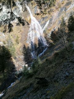
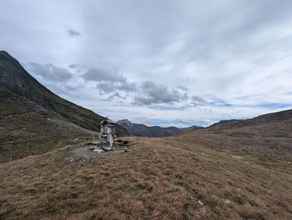
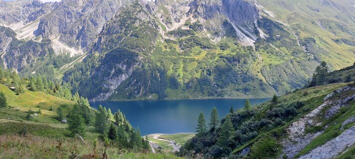
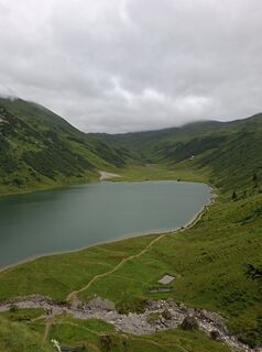
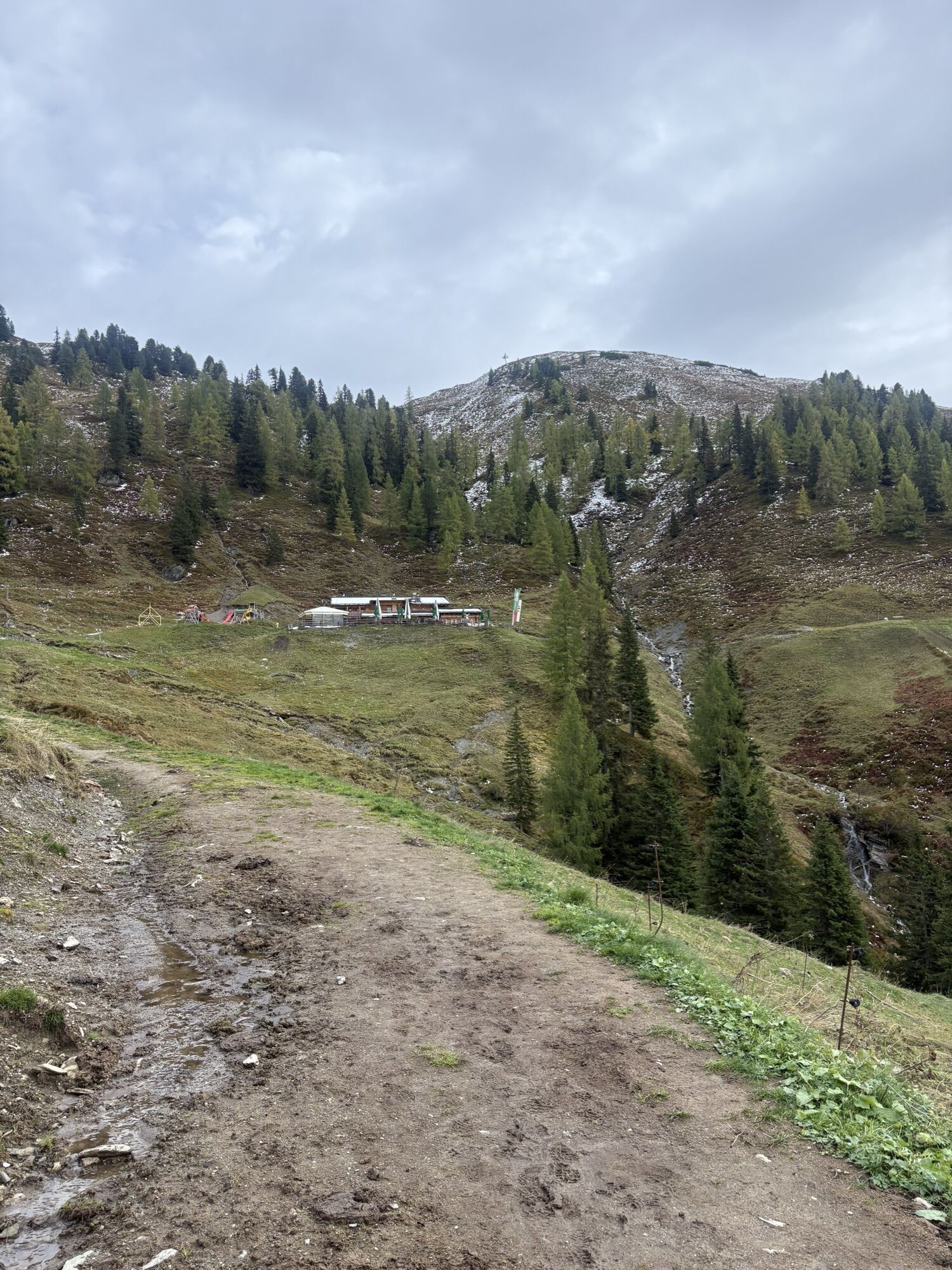
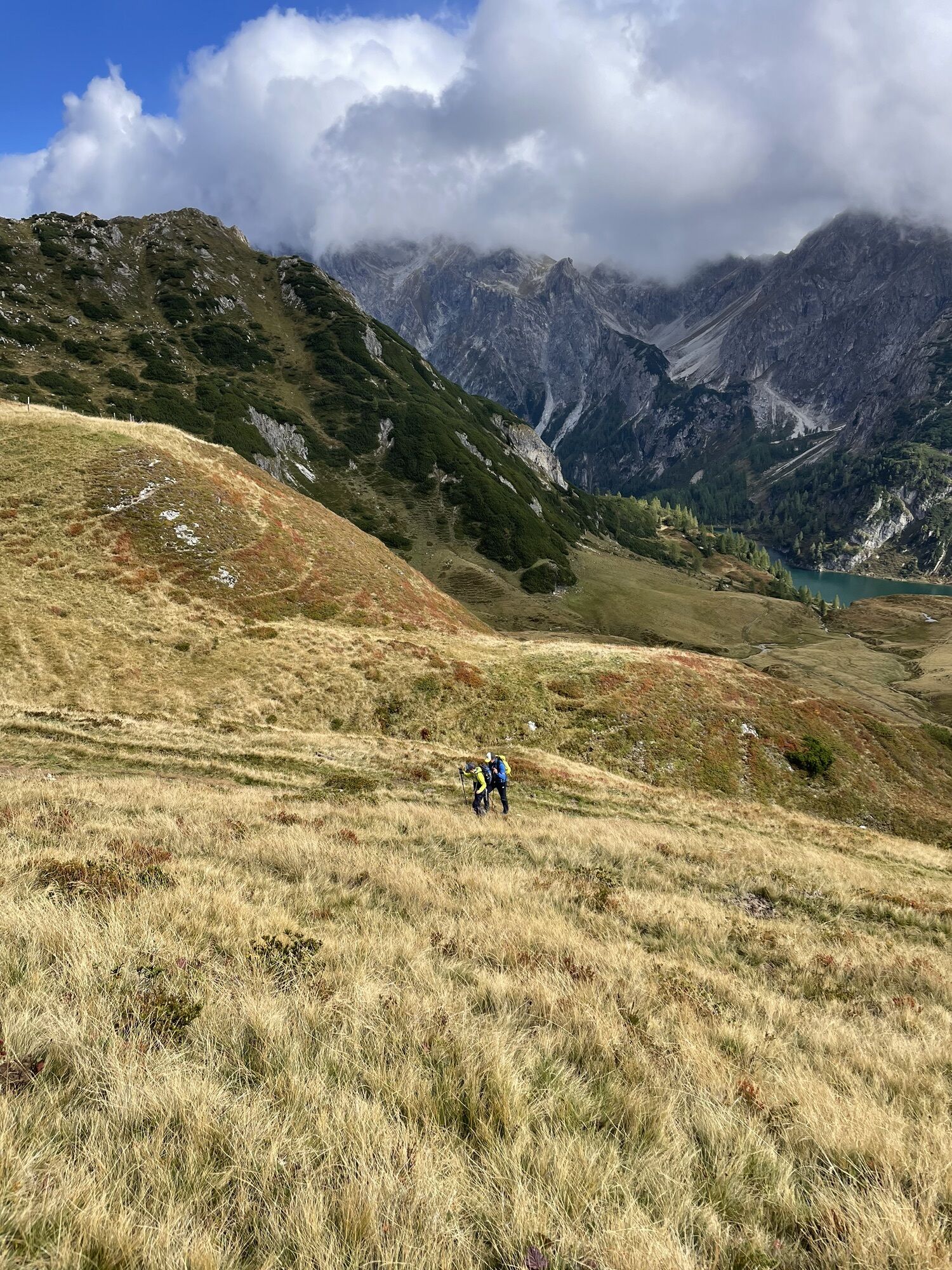
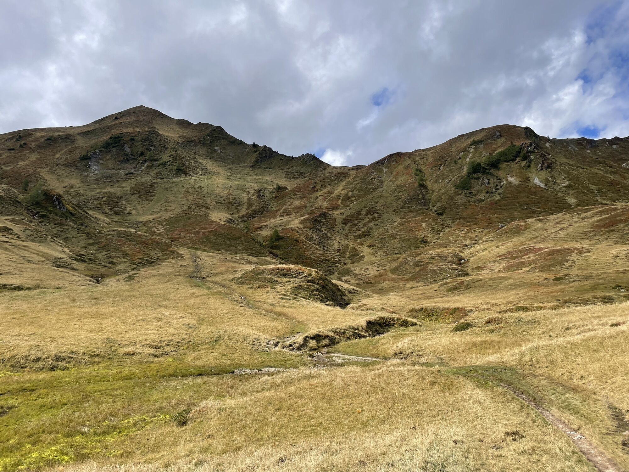
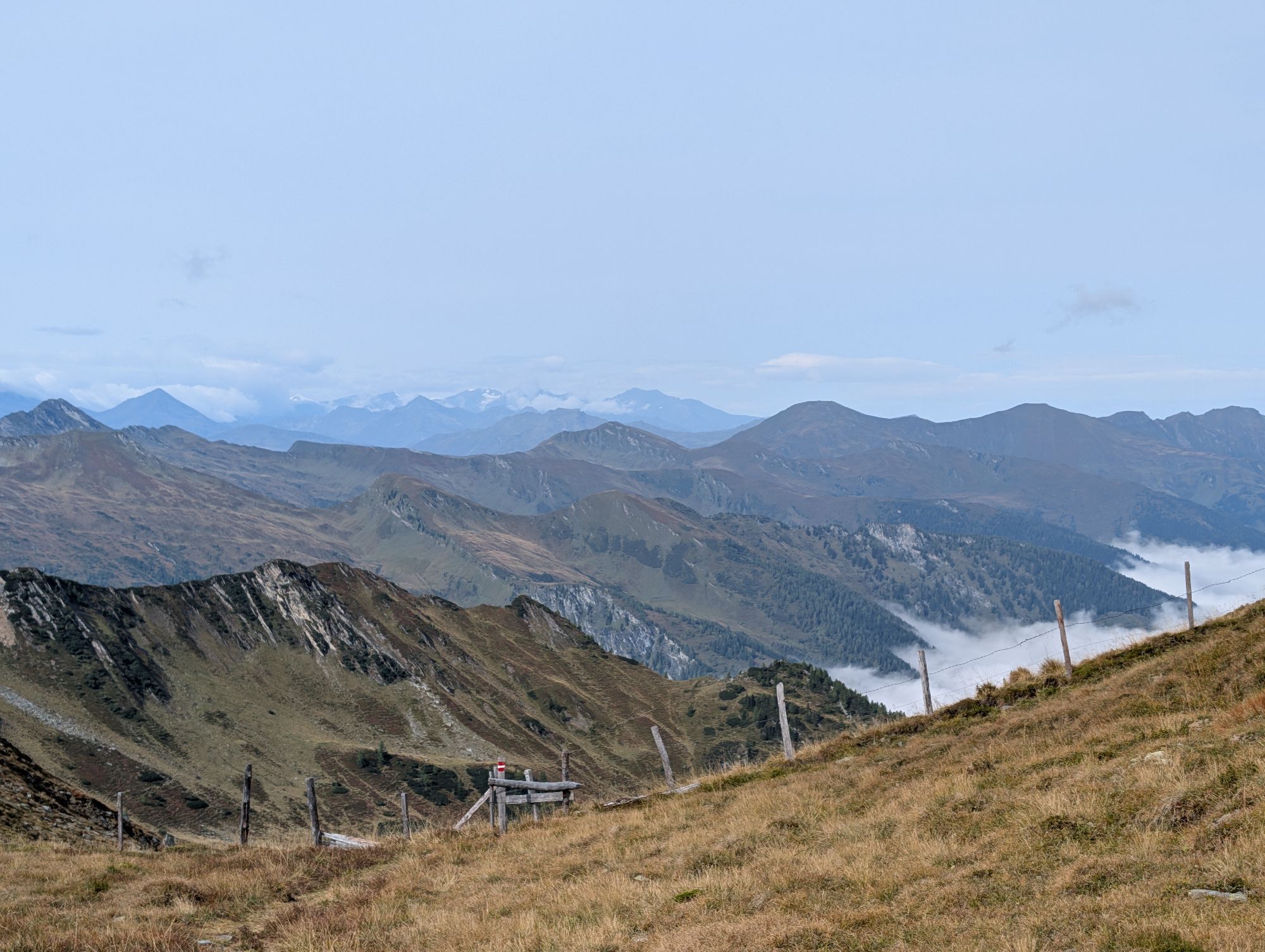
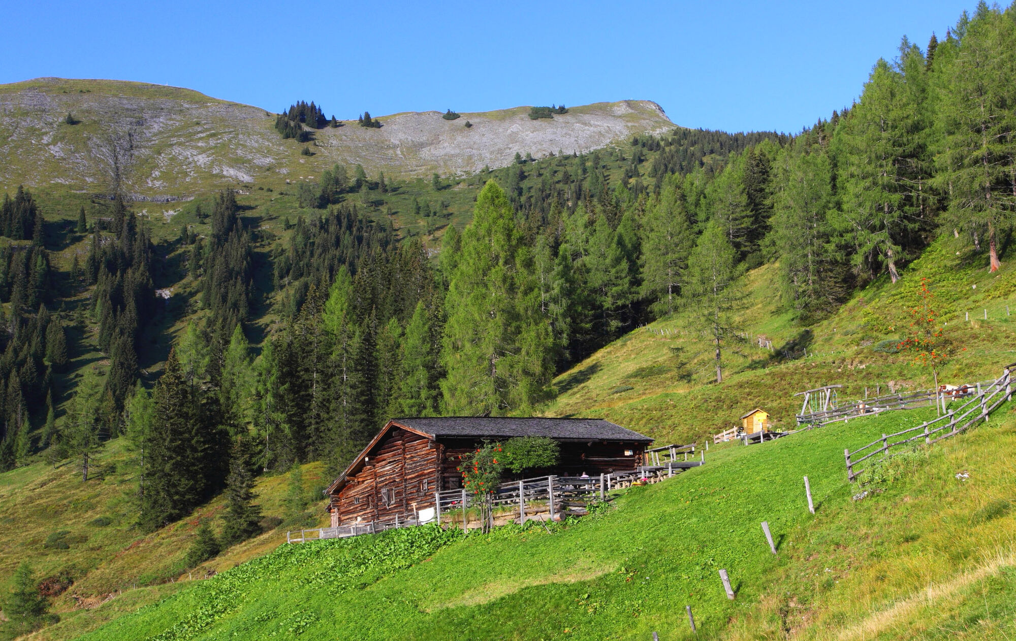
A sunrise at the Tappenkarsee. How could a day start more beautifully? You cross the entire Tappenkar. A small excursion into the history of this area: all Pongau farmers were allowed to drive their cattle into the Tappenkar. However, the Großarl and Hüttschlag farmers considered the right of use solely theirs and behaved accordingly. Eventually, our farmers were completely excluded from grazing rights in the Tappenkar by court. In return, our farmers then refused the cattle drive to the Tappenkaralm through the Großarl valley. And back then, this was the safest access to this beautiful valley, as the other possible connection through Kleinarl was steep and very dangerous for livestock. Finally, you arrive at the Wasserfallscharte and continue to the Nebelkarscharte. On the high trail, you reach the Murtörl. Just below this saddle, the Mur springs. It is often very windy here; it can happen that you walk everywhere with short sleeves while icy cold wind blows on the Murtörl. Attention: on the entire route, you pass no huts. Please take enough drinks and food with you. Through a huge cirque, you finally reach the two Kreealmen, the Kreealm-Bichlhütte and the Kreealm-Kreehütte. Here you will be spoiled with delicacies from their own production. At the lower hut, the Kreehütte, you take your bed for the last night.
Day 6:
The next morning you walk down valley in a relaxed way. Right after the Kreehütte you pass a chapel. Now you must decide whether to hike down the trail or the forest road to the valley. Once down, you can refresh yourself at the Gasthof Talwirt. A detour to the valley museum is well worth it. The return to Großarl is comfortable by Postbus.


Ascent (trail no. 17) via Hertas Rast to Vorderstadluckbauer (approx. 1 hour, accessible by car or hiking taxi up to this point). Shortly after the Vorderstadluck farm, a tractor path (no. 65) branches off from the farm road and leads uphill. After a short stretch, a steep path (trail no. 65A) branches to the right. After crossing the ditch, this alpine path leads a bit steeper through the forest to the Gerstreitalm, 1,575 m (approx. 1 hour from Vorderstadluck farm) - overnight stay at the Gerstreitalm. Total walking time: approx. 2 hours
Day 2:
Ascent on trail no. 65A, then 65 to the Saukaralm, 1,820 m (approx. 1 hour). Then continue on trail no. 64 into the Spatkar and subsequently on trail no. 63 over the Spatalm, 1,808 m and the Kleinwildalm, 1,806 m (both unstaffed) to the Großwildalm, 1,778 m (approx. 1 3/4 hours). Hiking along trail no. 67, then 70 to the Karseggalm, 1,603 m (approx. 1 1/2 hours) and further on the same path to the Unterwandalm, 1,600 m (approx. 1/2 hour) - overnight stay at the Unterwandalm. Total walking time: approx. 4 3/4 hours
Day 3:
Hiking on trail no. 70, then 71 to the Muggenfeldalm, 1,545 m (approx. 1/2 hour, closed) and further to the Maurachalm, 1,620 m (approx. 1/4 hour). Ascent along trails no. 712, 72 to the Gabel/Kitzstein, 2,037 m (approx. 1 1/4 hours). Hiking on trail no. 72 to the Penkkopf, 2,011 m (approx. 1 1/4 hours), then hiking on trail no. 67 to the Gründegg, 2,168 m (approx. 1 hour). Descent on trail no. 64, then 62 to the Ellmaualm, 1,794 m (approx. 1 hour) - overnight stay at the Ellmaualm (overnight also possible at Weiß-, Loosbühel- or Filzmoosalm). Total walking time: approx. 5 1/4 hours
Day 4:
Hiking on trail no. 63 to the Weißalm, 1,723 m (approx. 1/2 hour) and further on the same path to the Loosbühelalm, 1,769 m (approx. 1/2 hour) and to the Filzmoosalm, 1,710 m (approx. 1 hour). Ascent on trails no. 57, 720 to the Filzmoossattel, 2,062 m (approx. 1 1/4 hours). Hiking on trail no. 54A, then 54 to the Draugsteintörl, 2,077 m (approx. 1 1/4 hours). Descent on trail no. 702A to the Tappenkarseehütte, 1,820 m (approx. 1/2 hour) - overnight stay at the Tappenkarseehütte. Total walking time: approx. 5 hours
Day 5:
Hiking along trail no. 702 to the Wasserfallscharte, 2,183 m (approx. 2 hours) and further to the Nebelkarscharte, 2,453 m (approx. 1 hour). Hiking on the same trail to the Murtörl, 2,260 m (approx. 1 hour). Descent on trails no. 724, 51 to the Kreealmen, Kreealm-Bichlhütte, 1,570 m or Kreealm-Kreehütte, 1,483 m (approx. 2 hours) - Overnight stay at the Kreealm-Kreehüte. (Alternatively: descent on the same day - approx. 1 hour). Total walking time: approx. 6 hours
Day 6:
Descent on trails no. 724, 51 to the valley end in Hüttschlag (approx. 1 hour). Total walking time: approx. 1 hour
Áno
Mountain boots with profile sole, some fruit, drinks (refillable bottles), wind and rain protection, toiletries, warm clothes and change of clothes, flashlight, mini first aid kit, hiking map, sunscreen, chocolate or muesli bars, …
Le 5e jour, vous ne passerez devant aucun refuge exploité toute la journée, prenez donc suffisamment de boissons avec vous.
Veuillez absolument réserver les lits dans les refuges à l'avance !
Drive by car or Postbus line no. 540 to the center of Großarl
Parking available at the Viehhauser gas station
T2
Sunsets at the Unterwandalm and sunrises at the Tappenkarsee are especially beautiful.
Webové kamery z prehliadky
-
Kreuzkogel
-
Fulseck
-
Gernkogel - Alpendorf St. Johann
-
Hotel Lammwirt im Großarltal/Ellmautal
-
Dorfgastein - Spiegelsee
-
Talschluss des Grossarltals - Steinmannbauer
-
Bergstation 6er Sesselbahn Harbach
-
Ellmautal - Palfenhof
-
Kühhagerbahn Bergstation
-
Großarl - Ort
-
St.Johann-Alpendorf Gernkogel
-
Gernkogel - Alpendorf St. Johann
-
Dorfgastein - Spiegelsee
-
Dorfgastein - Spiegelsee
-
Dorfgastein - Spiegelsee
-
Dorfgastein - Spiegelsee
-
Mooslehen Berg
-
Großarl - Loosbühelalm
-
Großarl - Kieserlbahn
-
Grossarl - Hotel Gasthof Schützenhof
-
Großarl - Hotel Kristall Übungslift
-
Bergstation Kieserl
-
Fulseck
-
Fulseck
-
Fulseck
-
Fulseck
-
Fulseck
-
Fulseck
-
Fulseck
-
Gernkogel - Alpendorf St. Johann
-
Gernkogel - Alpendorf St. Johann
-
Gernkogel - Alpendorf St. Johann
-
Gernkogel - Alpendorf St. Johann
-
Tappenkarseehütte
-
Großarl
Obľúbené výlety v okolí
-
4,9
Großarl: Aualm - Liechtensteinkopf - Aukopf - Schuhflicker - Schuhflickersee
strednáTuristika 5,84 km -
5,0
Großarl: Alpine pasture circuit in Ellmautal
strednáTuristika 9,69 km -
4,1
Tappenkarsee Kleinarl
strednáTuristika 9,11 km -
4,9
Höhenweg vom Grünen Baum bis Bad Hofgastein
svetloTuristika 7,92 km -
4,8
Großarl: Mooslehenalm – Niggeltalalm – Viehhausalm
strednáTuristika 5,44 km -
4,5
Mountain route from the Kötschachtal to the natural jewel Reedsee
strednáTuristika 12,5 km -
4,6
Bahnhof Bad Hofgastein nach Bahnhof Bad Gastein
strednáTuristika 13,0 km -
4,5
Großarl: Saukaralm - Saukarkopf - Gerstreitalm
strednáTuristika 9,11 km -
4,5
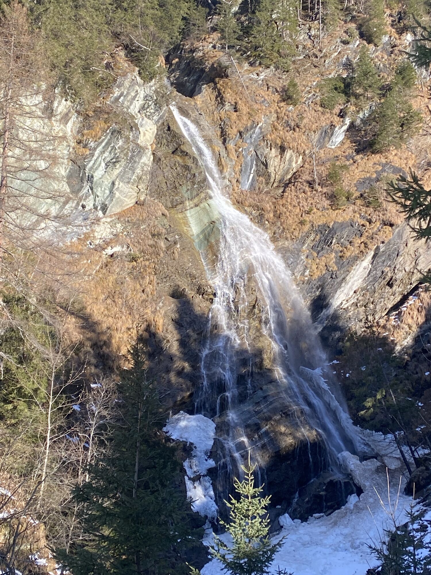
Wasserfall Bad Hofgastein
svetloTuristika 3,89 km -
4,2
Großarl: Unterwandalm - Karseggalm - Breitenebenalm
strednáTuristika 5,93 km

Turistika a stopovanie


Nenechajte si ujsť ponuky a inšpiráciu na ďalšiu dovolenku
Vaša e-mailová adresa bol pridaný do poštového zoznamu.