


The King’s Way stage 2 (Dienten - Mühlbach)
Úroveň náročnosti: T2
Fotografie našich používateľov
-
 © Heinrich SlesakVytvorené dňa 28.12.2025
 -
 © Heinrich SlesakVytvorené dňa 28.12.2025
 -
 © Heinrich SlesakVytvorené dňa 28.12.2025
 -
 © Heinrich SlesakVytvorené dňa 28.12.2025
 -

 © Monika JeskovaVytvorené dňa 20.10.2025
 -
 © Monika JeskovaVytvorené dňa 18.10.2025
 -
 © Monika JeskovaVytvorené dňa 18.10.2025
 -
 © Monika JeskovaVytvorené dňa 18.10.2025
 -
 © Monika JeskovaVytvorené dňa 18.10.2025
 -
 © Monika JeskovaVytvorené dňa 18.10.2025
 -
 © Monika JeskovaVytvorené dňa 18.10.2025
 -
 © Monika JeskovaVytvorené dňa 18.10.2025
 -
 © Monika JeskovaVytvorené dňa 18.10.2025
 -
 © Monika JeskovaVytvorené dňa 18.10.2025
 -
 © Monika JeskovaVytvorené dňa 18.10.2025
 -
 © DaGeorgVytvorené dňa 03.10.2025
 -
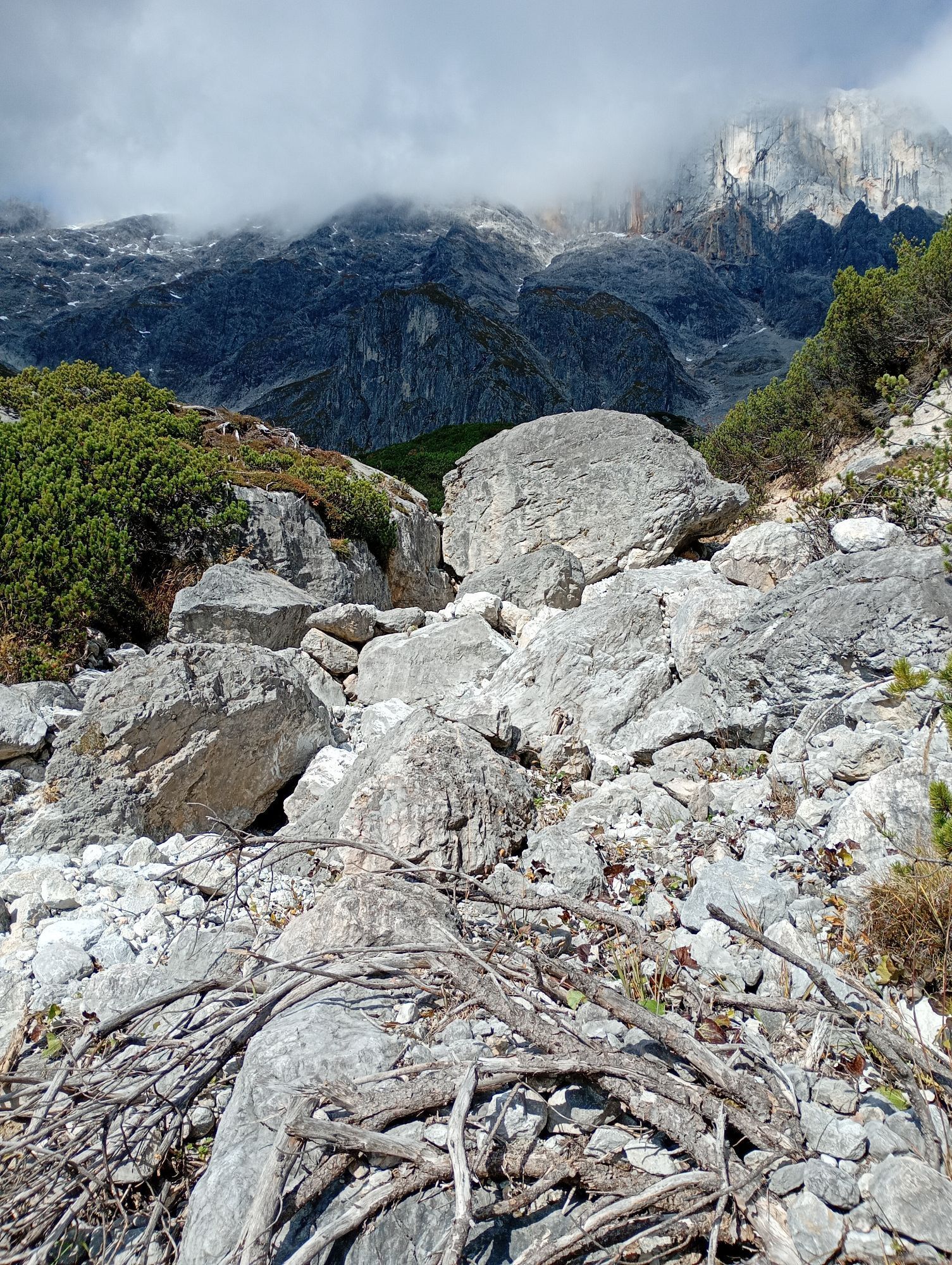
 © Ralf MährVytvorené dňa 11.09.2025
 -
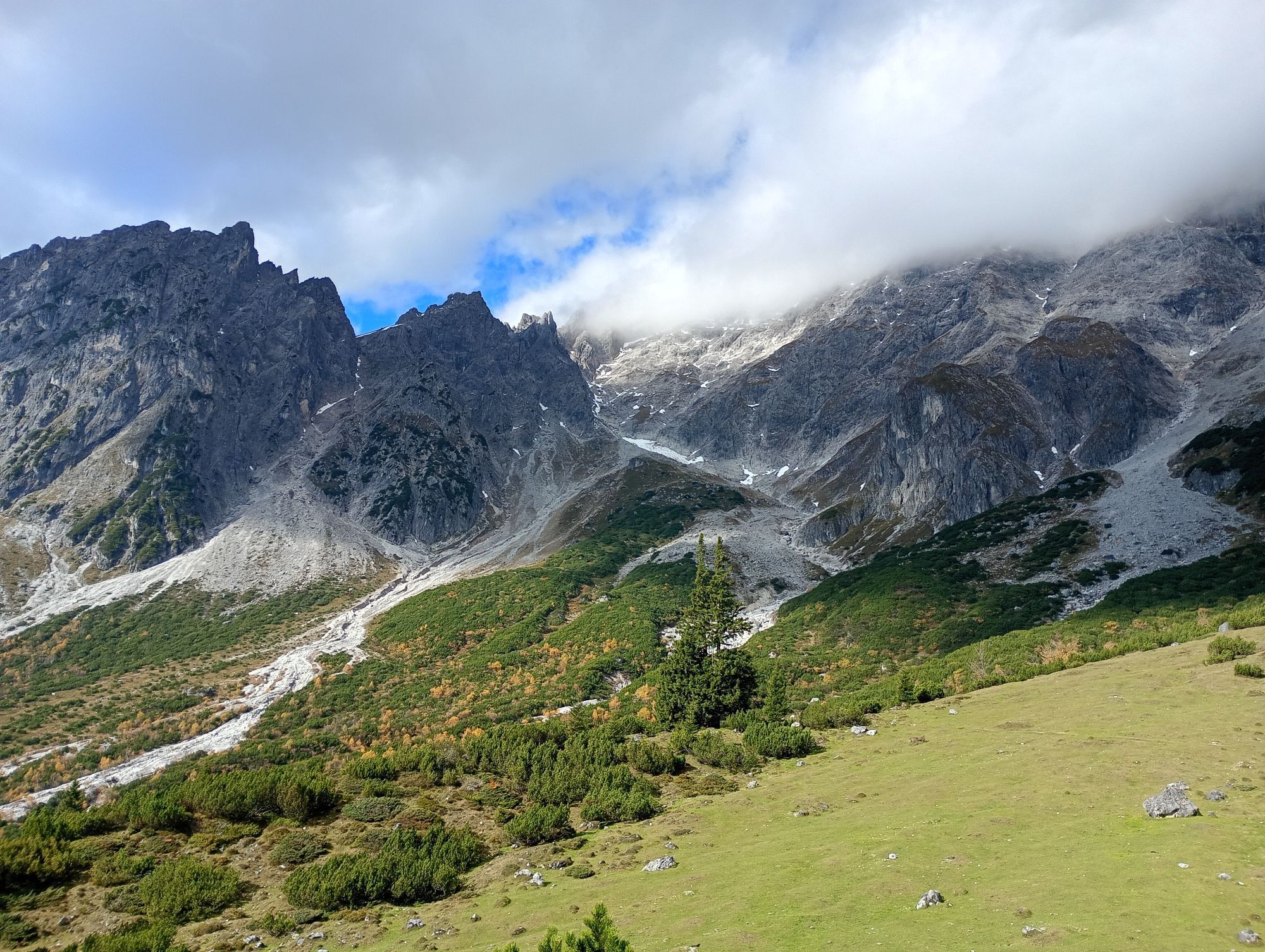
 © Ralf MährVytvorené dňa 11.09.2025
 -
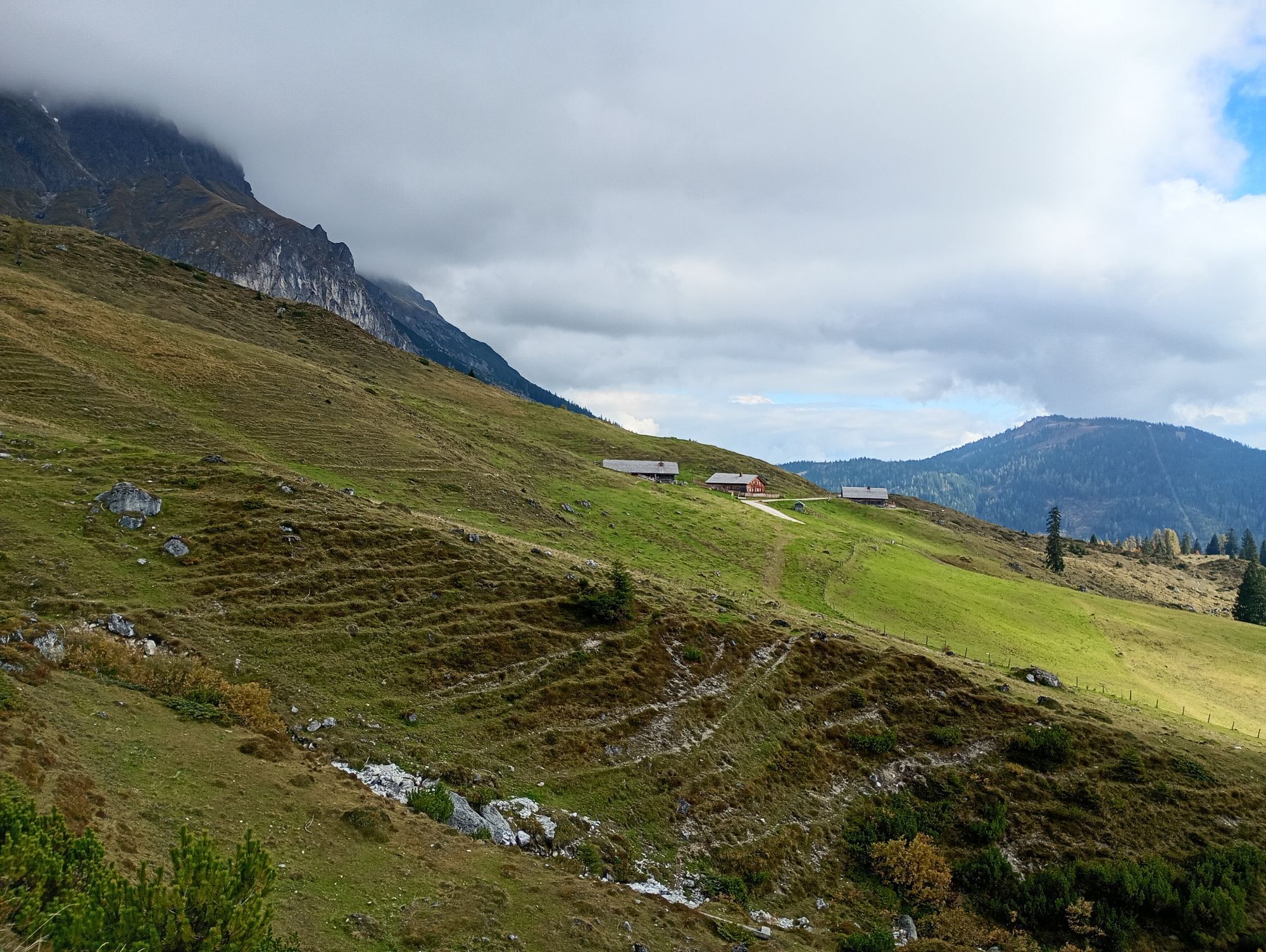
 © Ralf MährVytvorené dňa 11.09.2025
 -
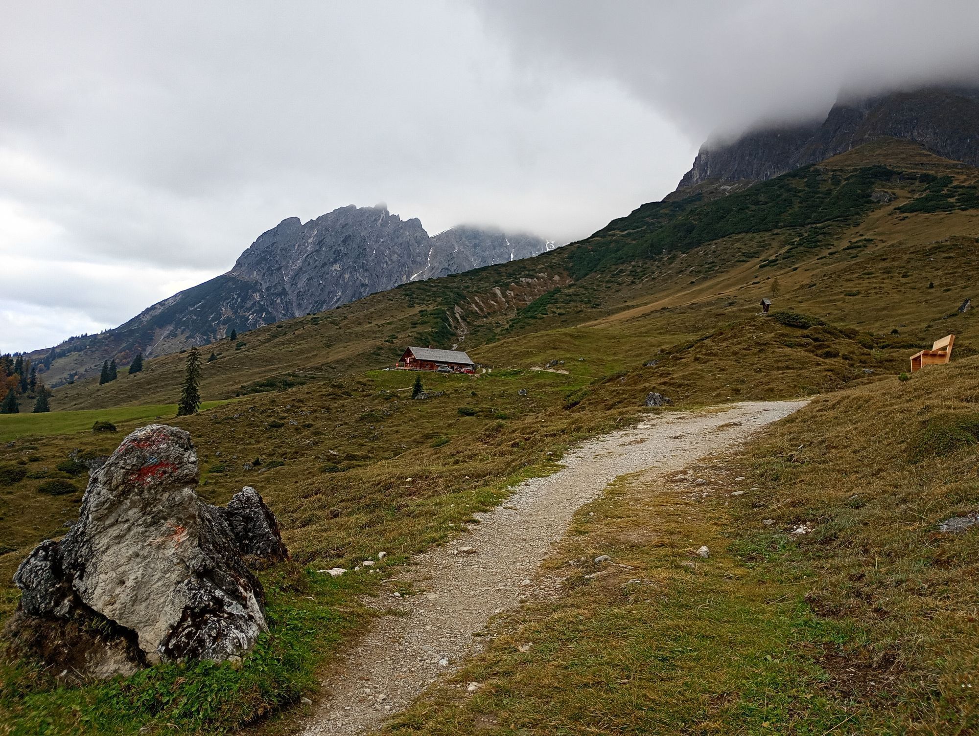
 © Ralf MährVytvorené dňa 11.09.2025
 -
 © Ralf MährVytvorené dňa 11.09.2025
 -
 © Ralf MährVytvorené dňa 11.09.2025
 -
 © Ralf MährVytvorené dňa 11.09.2025
 -
 © Ralf MährVytvorené dňa 11.09.2025
 -
 © Ralf MährVytvorené dňa 11.09.2025
 -
 © Ralf MährVytvorené dňa 11.09.2025
 -
 © Ralf MährVytvorené dňa 11.09.2025
 -
 © Ralf MährVytvorené dňa 11.09.2025
 -
 © Dirk VollbrechtVytvorené dňa 30.07.2025
 -
 © Dirk VollbrechtVytvorené dňa 30.07.2025
 -
 © Dirk VollbrechtVytvorené dňa 30.07.2025
 -
 © Dirk VollbrechtVytvorené dňa 30.07.2025
 -
 © Dirk VollbrechtVytvorené dňa 30.07.2025
 -
 © Dirk VollbrechtVytvorené dňa 30.07.2025
 -
 © Dirk VollbrechtVytvorené dňa 30.07.2025
 -
 © Dirk VollbrechtVytvorené dňa 30.07.2025
 -
 © Dirk VollbrechtVytvorené dňa 30.07.2025
 -
 © Dirk VollbrechtVytvorené dňa 30.07.2025
 -
 © Dirk VollbrechtVytvorené dňa 30.07.2025
 -
 © Dirk VollbrechtVytvorené dňa 30.07.2025
 -
 © Dirk VollbrechtVytvorené dňa 30.07.2025
 -
 © Dirk VollbrechtVytvorené dňa 30.07.2025
 -
 © Dirk VollbrechtVytvorené dňa 30.07.2025
 -
 © Dirk VollbrechtVytvorené dňa 30.07.2025
 -
 © Dirk VollbrechtVytvorené dňa 30.07.2025
 -
 © Dirk VollbrechtVytvorené dňa 30.07.2025
 -
 © Dirk VollbrechtVytvorené dňa 30.07.2025
 -
 © Dirk VollbrechtVytvorené dňa 30.07.2025
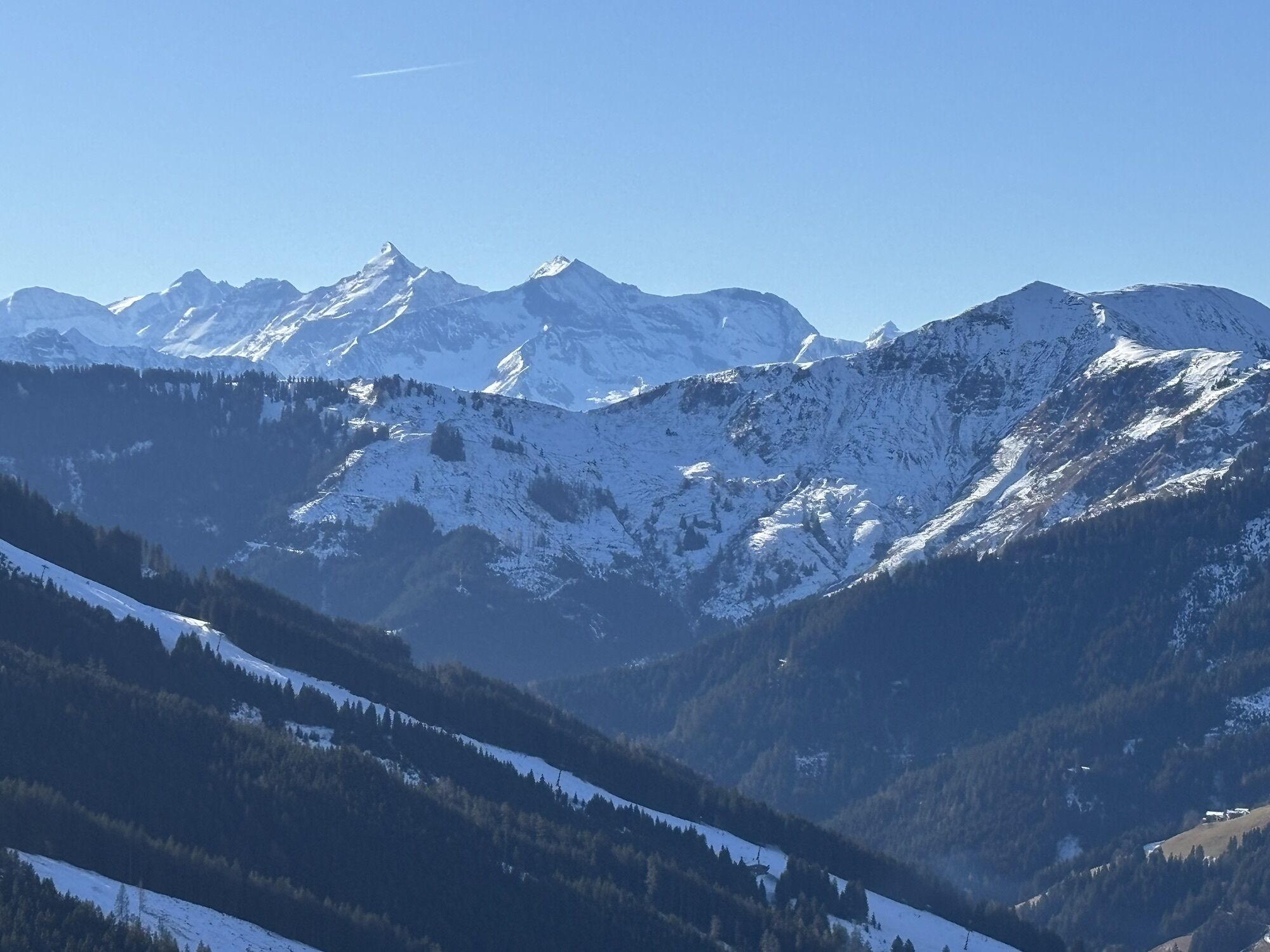

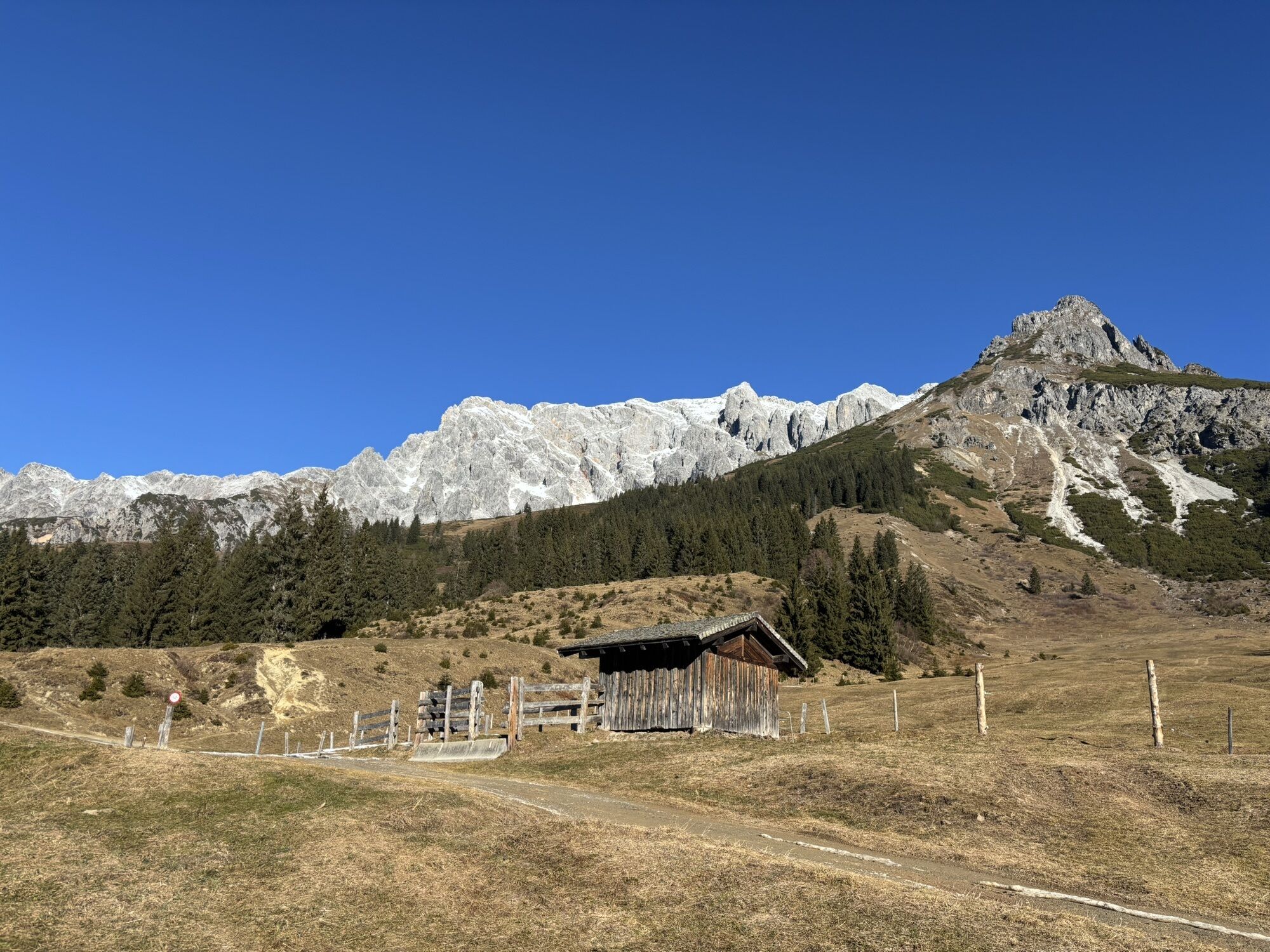


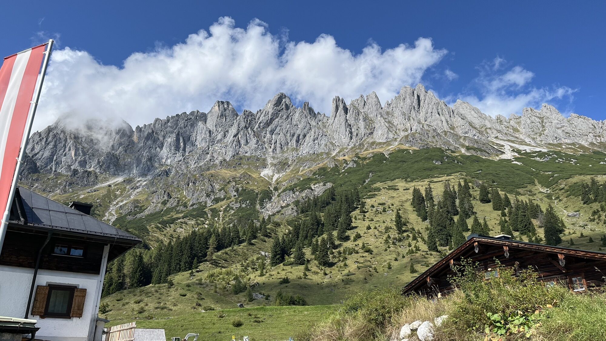
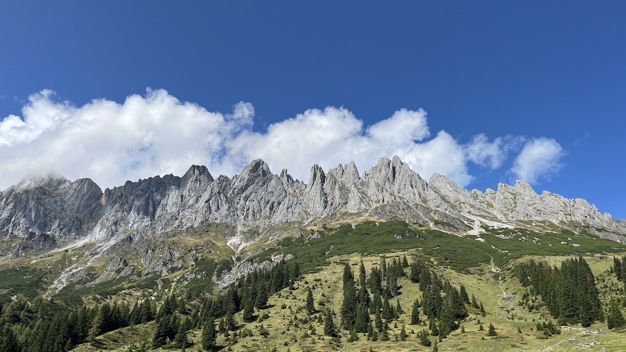


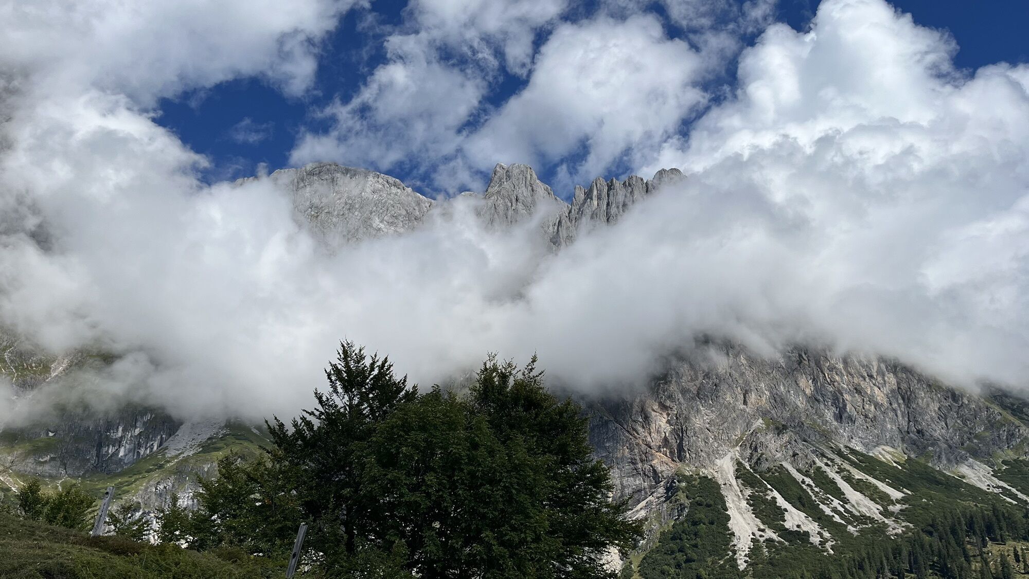
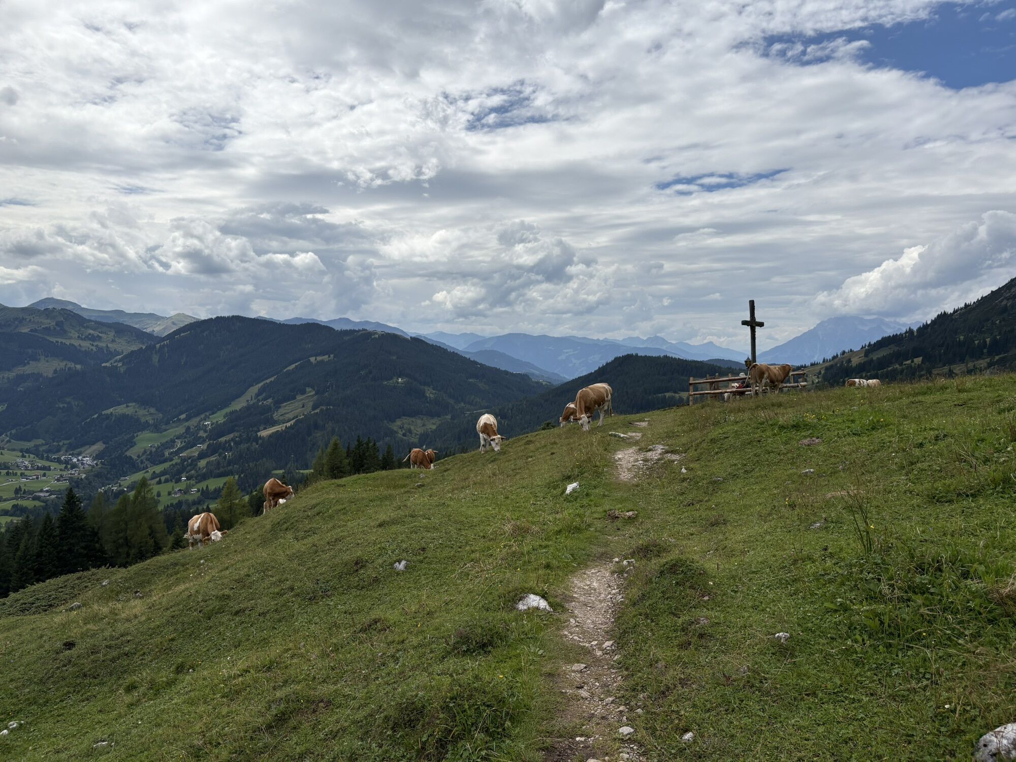


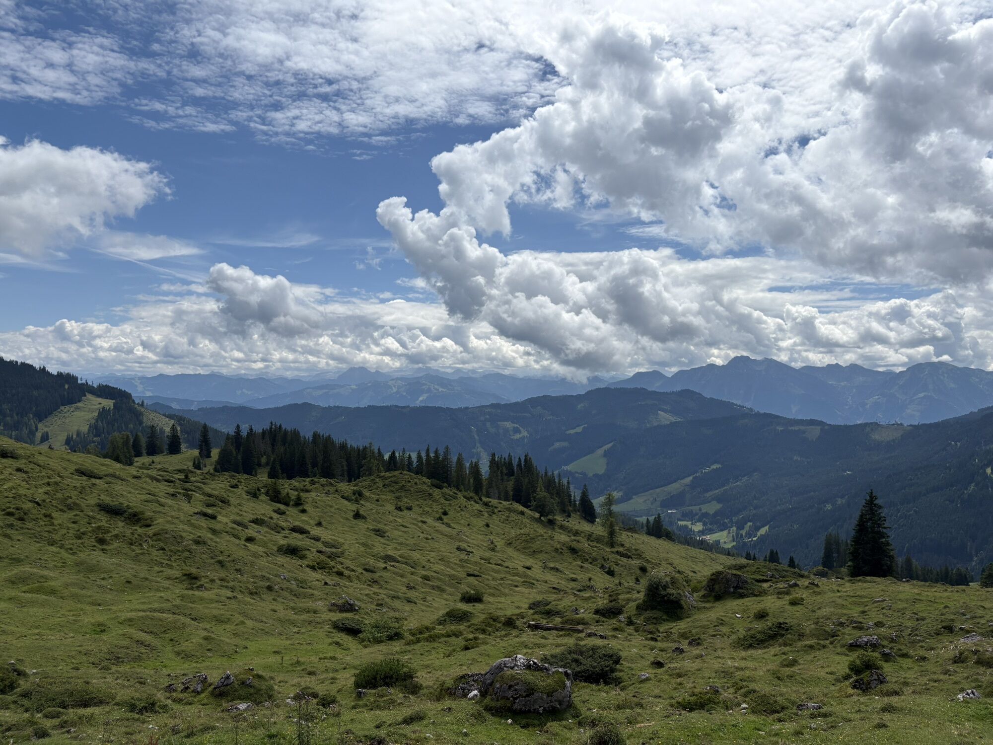

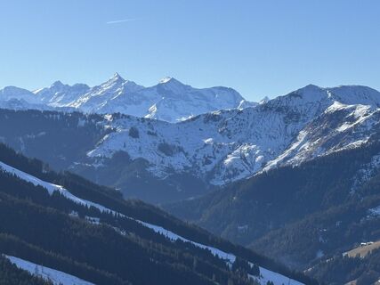
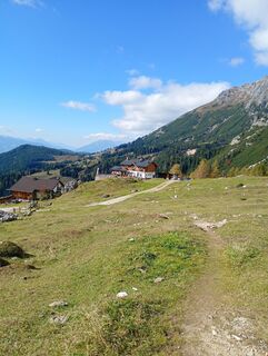
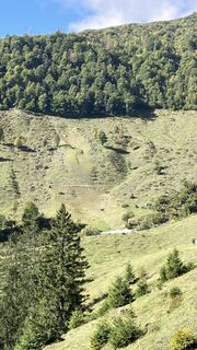
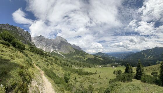
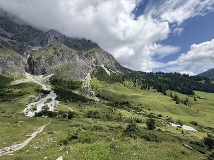
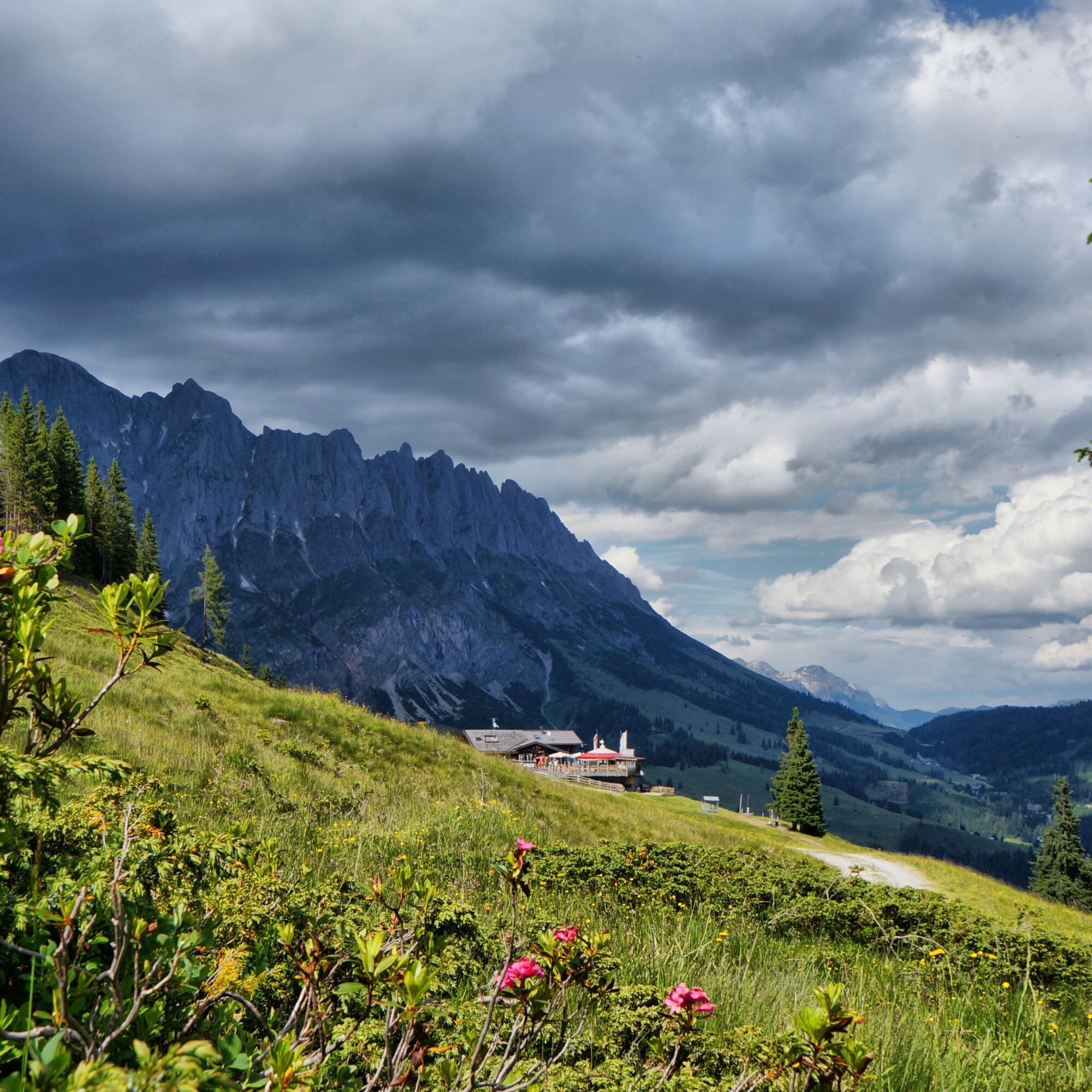
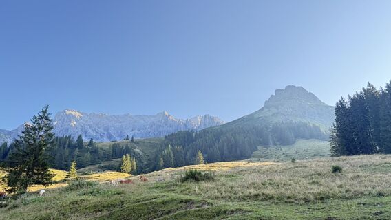
Start your hiking day with the hiking bus to Erichhütte and enjoy the view of the snow-covered peaks of the Hohe Tauern already during the ascent. Past the mighty Hochkönig south face, you hike over the...
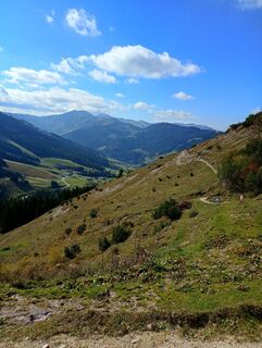
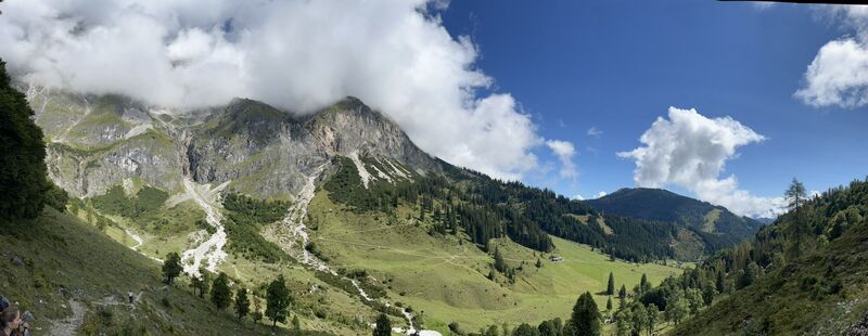
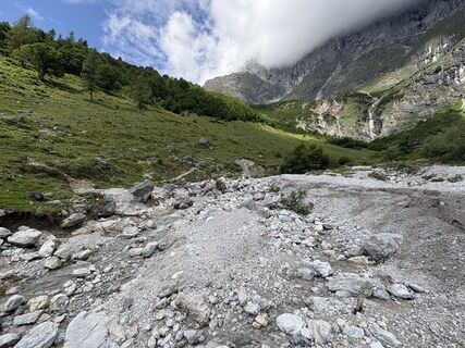
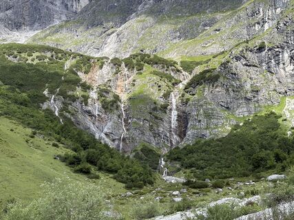
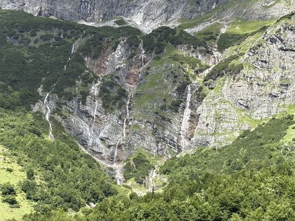
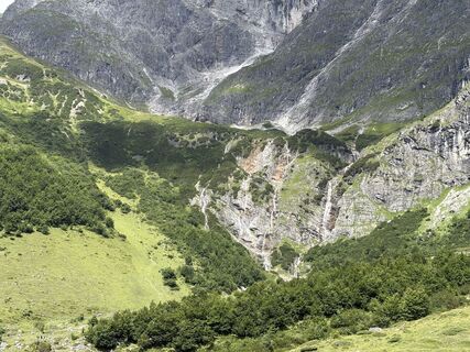
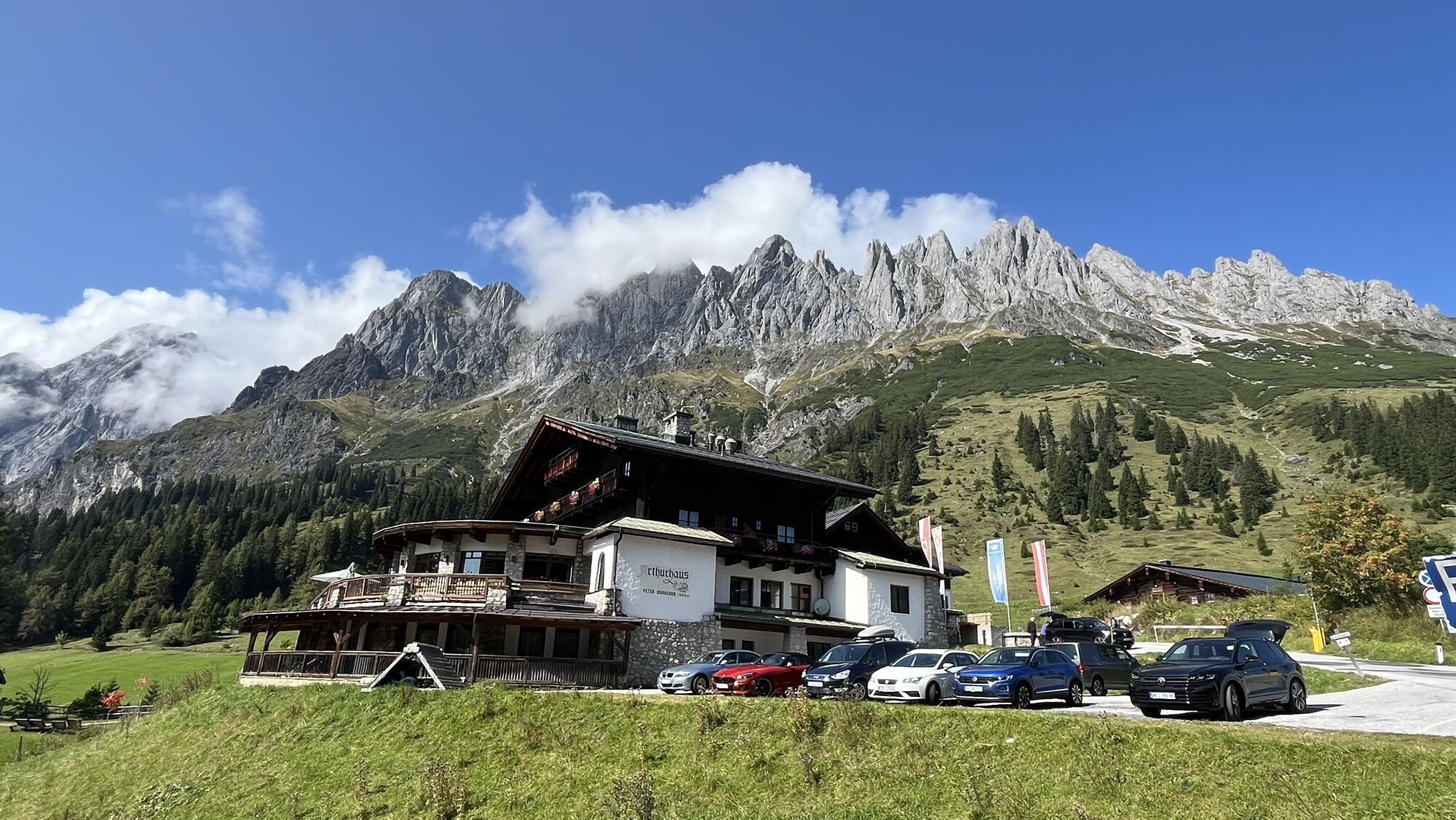
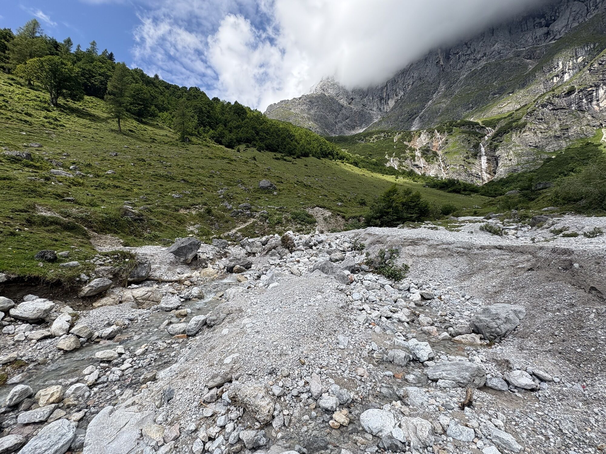
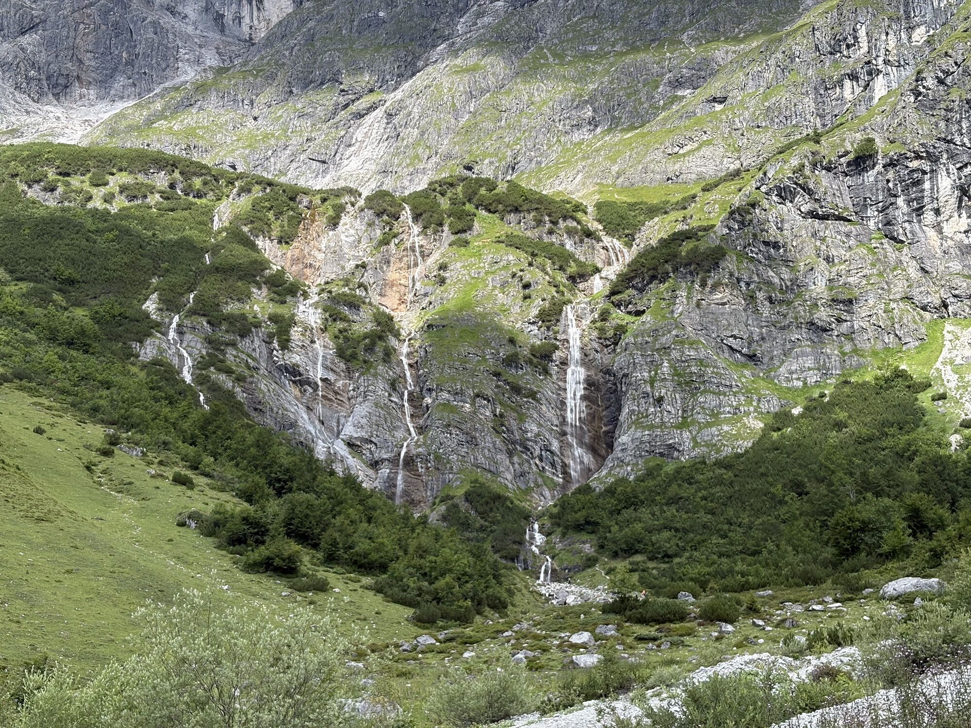
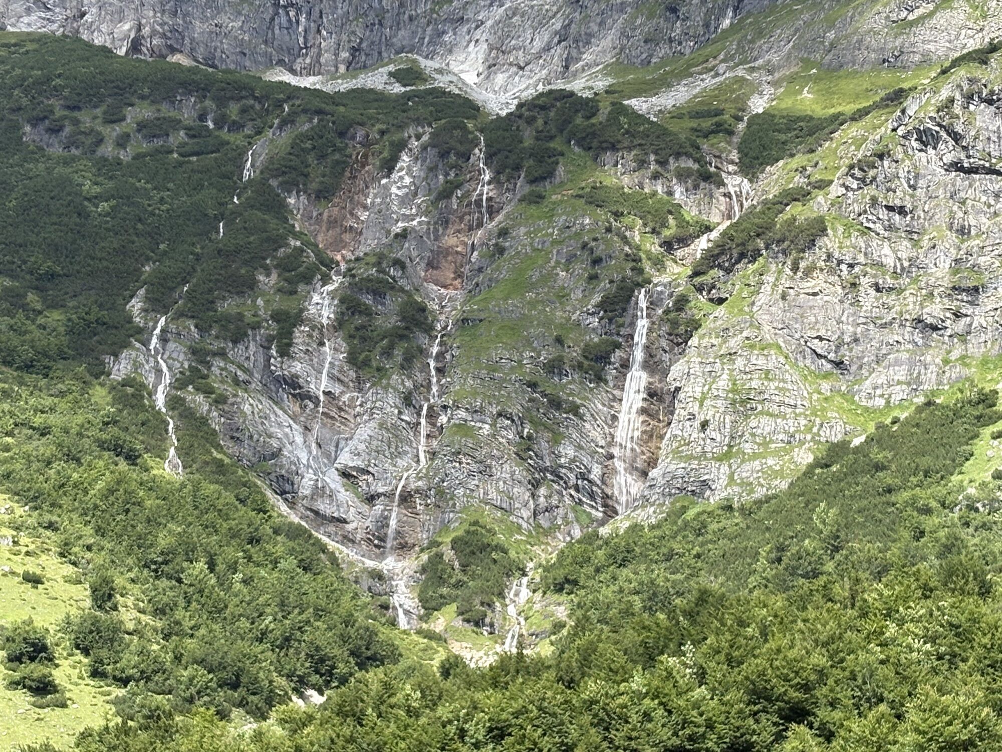
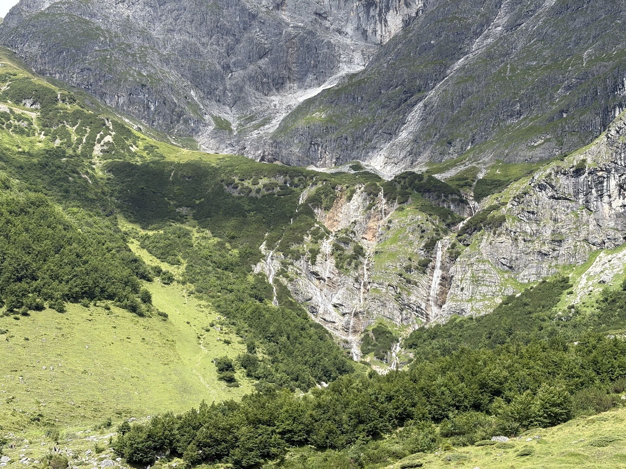
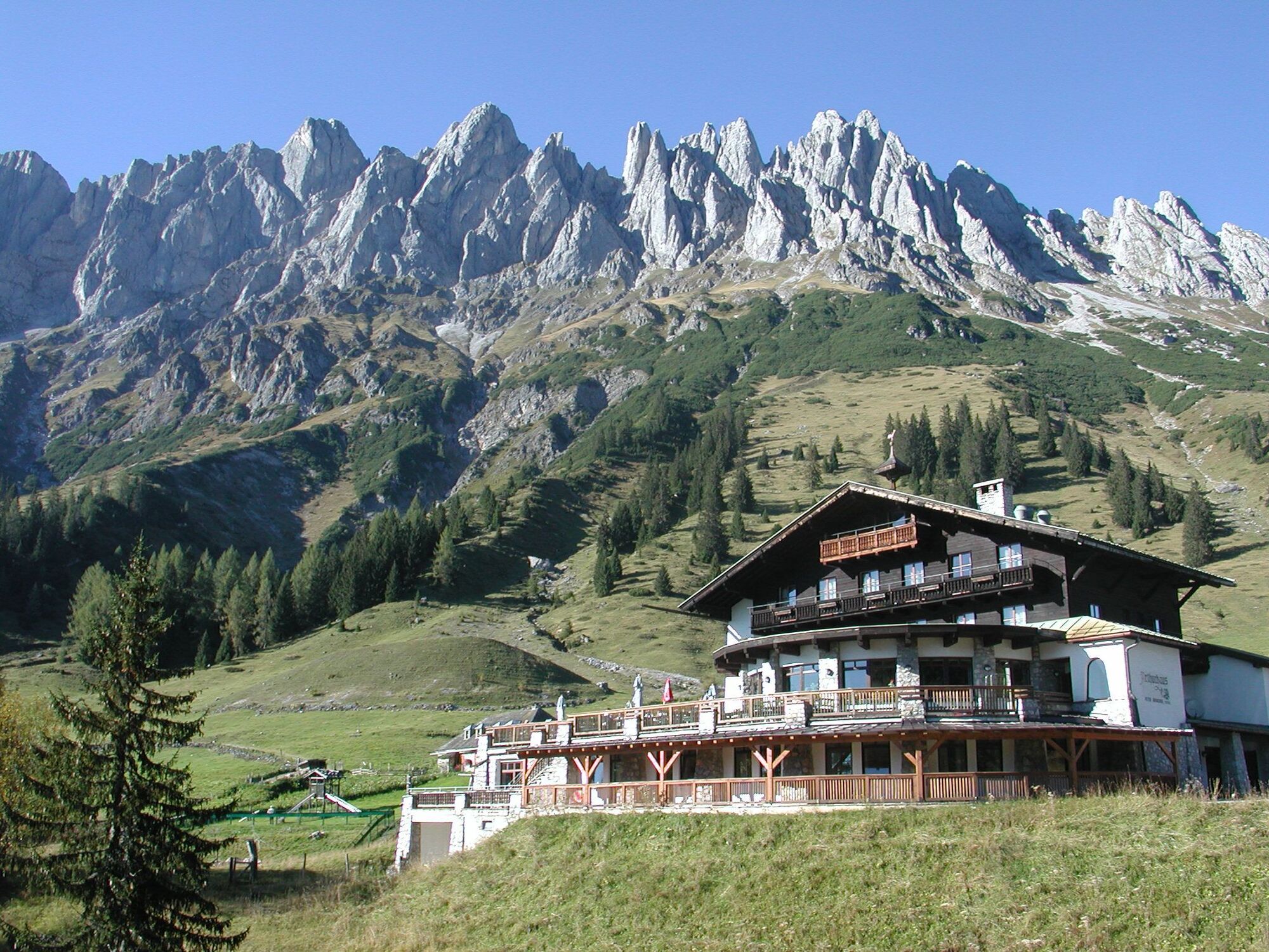
Start your hiking day with the hiking bus to Erichhütte and enjoy the view of the snow-covered peaks of the Hohe Tauern already during the ascent. Past the mighty Hochkönig south face, you hike over the alpine pastures of the "Four Huts" and refresh yourself at the Brandstätt or Molterauhütte. The path gently descends into the Riedingtal with rushing waterfalls and the imposing Großer Bratschenkopf. Over the Windraucheggalm, you reach the Arthurhaus and the Schweizerhütte, known for its cheese specialties. From here, it is comfortable by hiking bus to Mühlbach – or on foot via the Mitterberger Erzweg, which lets you dive into the history of copper mining.

STAGE 2 FROM DIENTEN TO MÜHLBACH
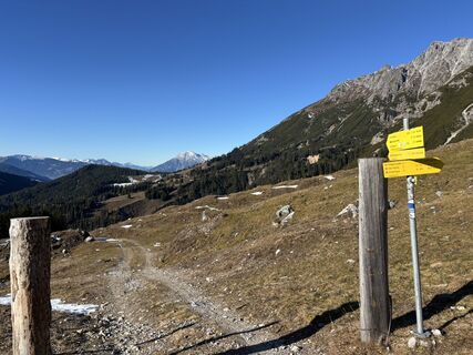
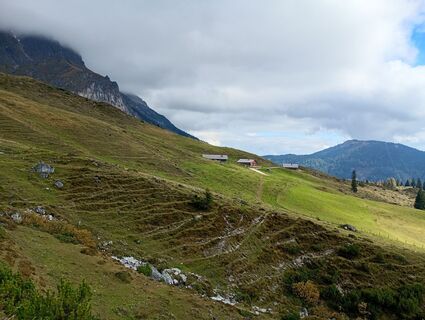
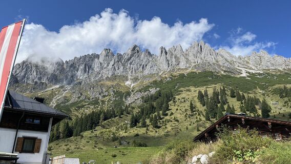
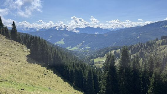
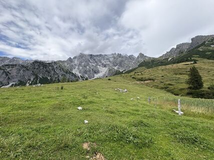
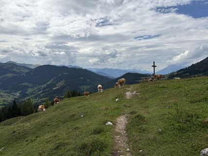
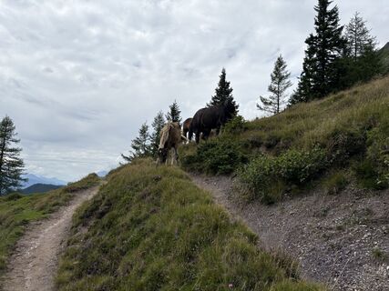
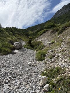
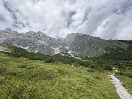
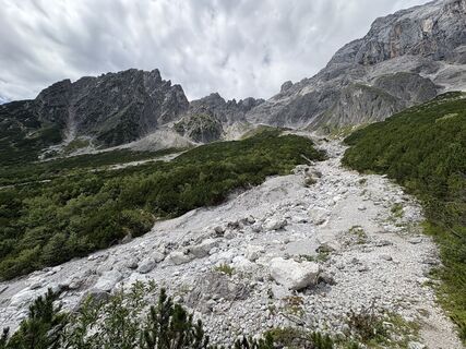
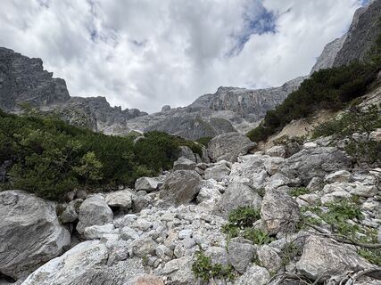
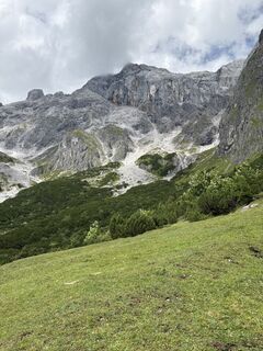
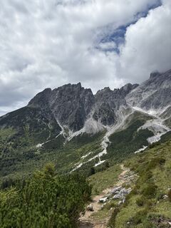
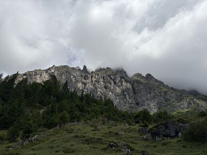
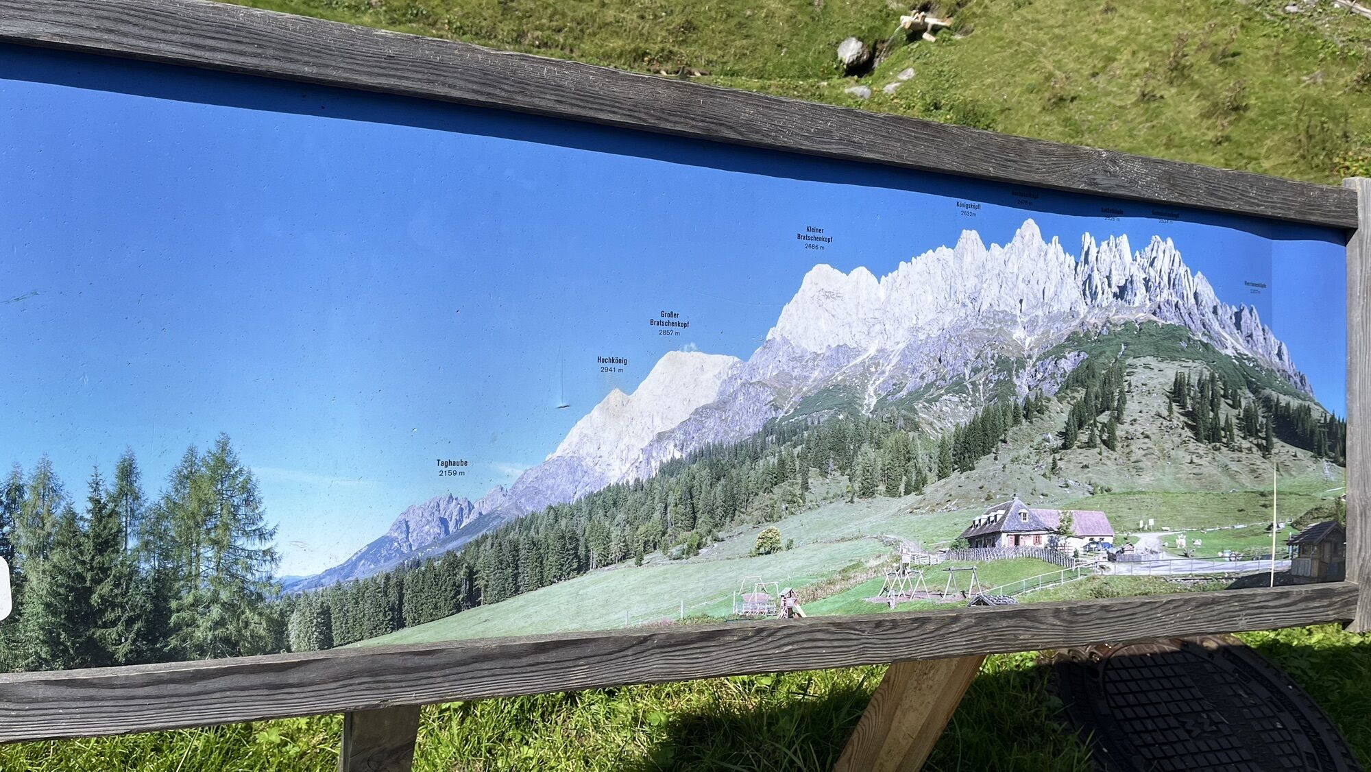
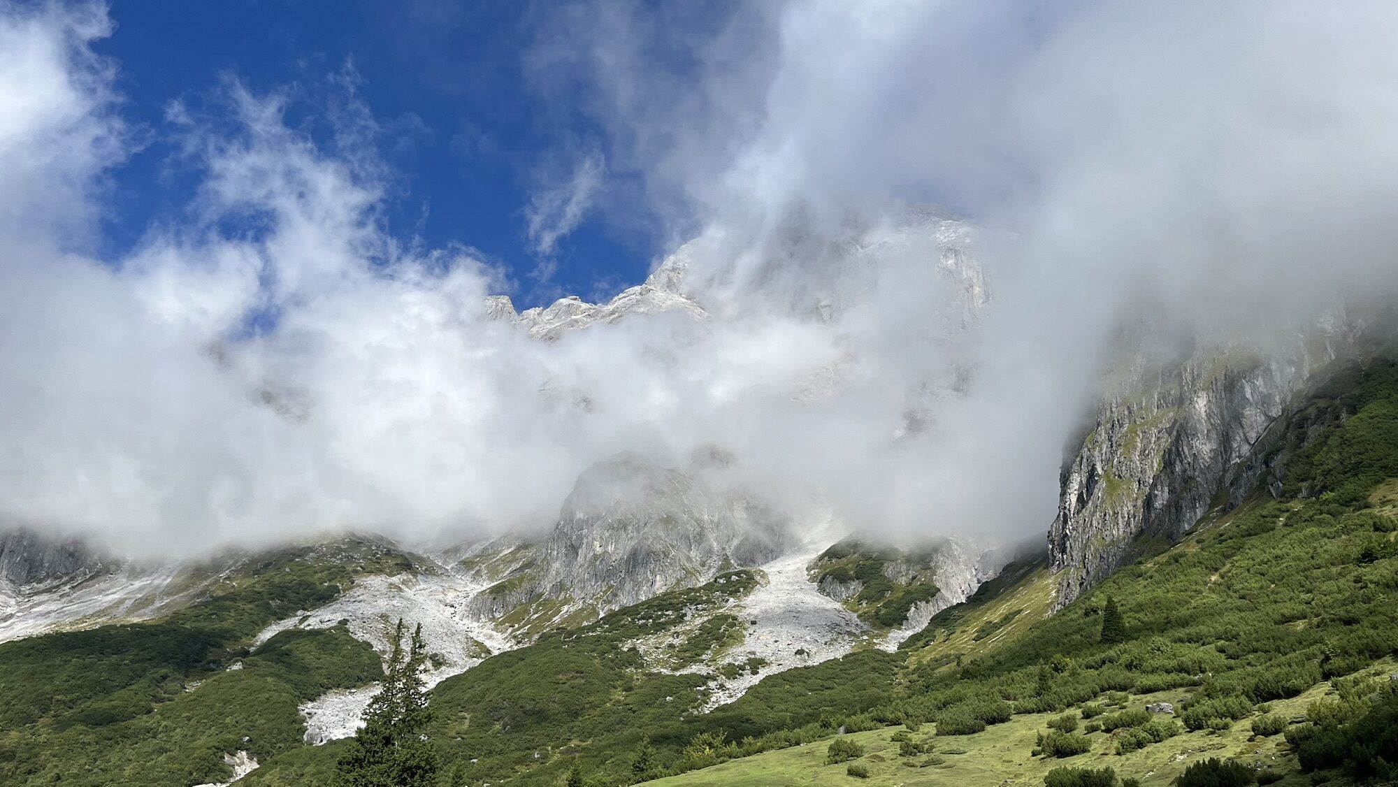
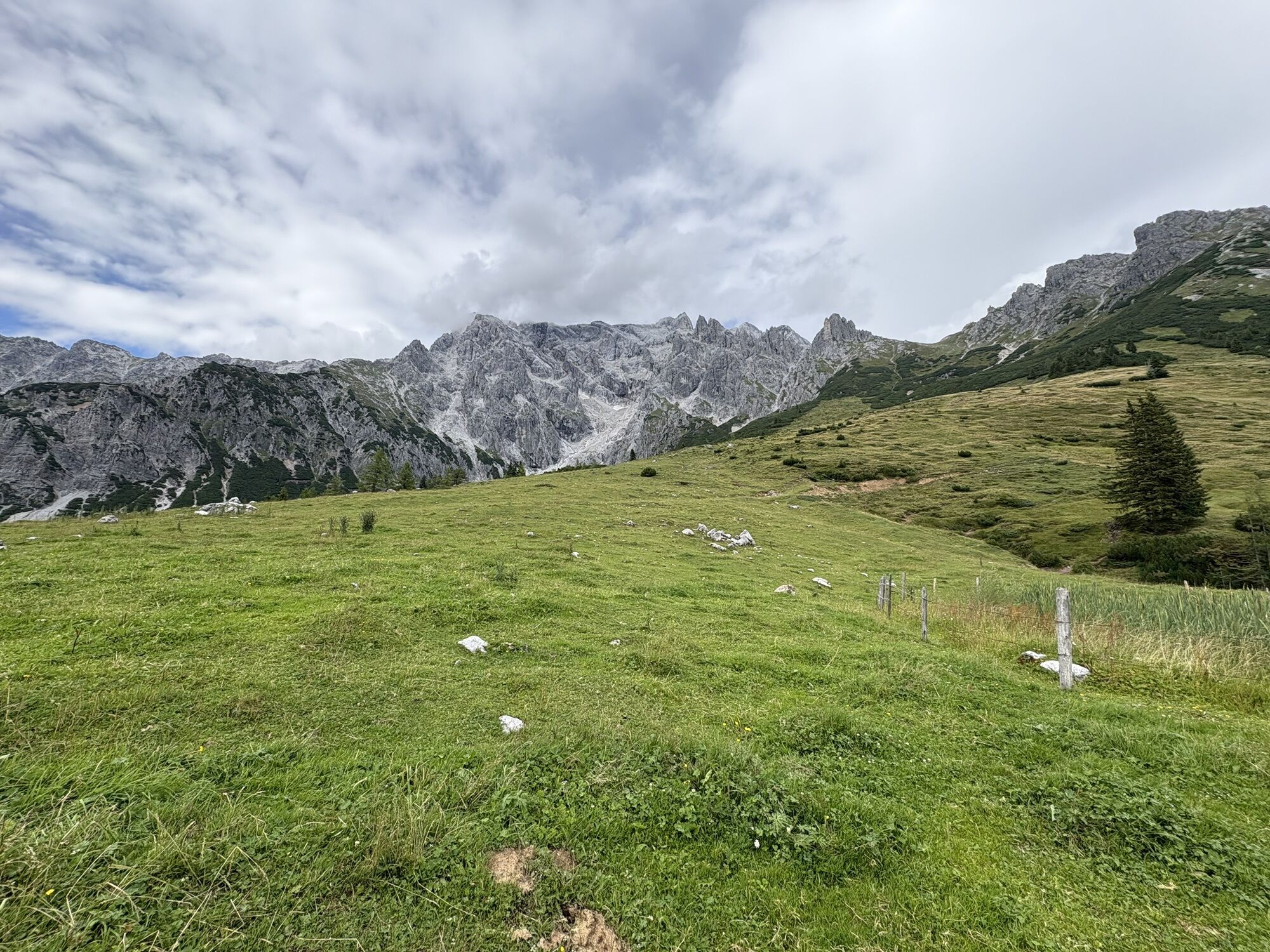
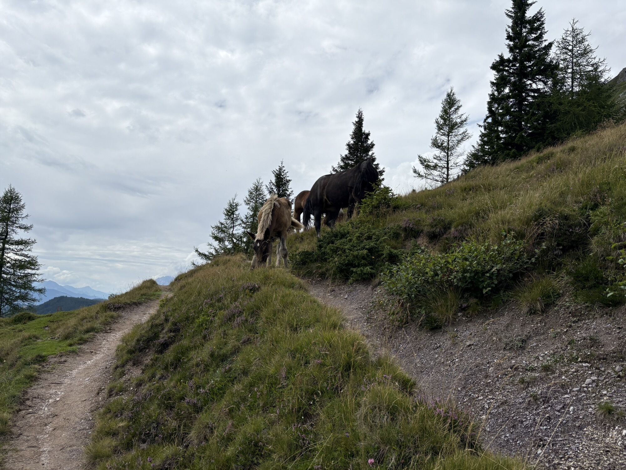
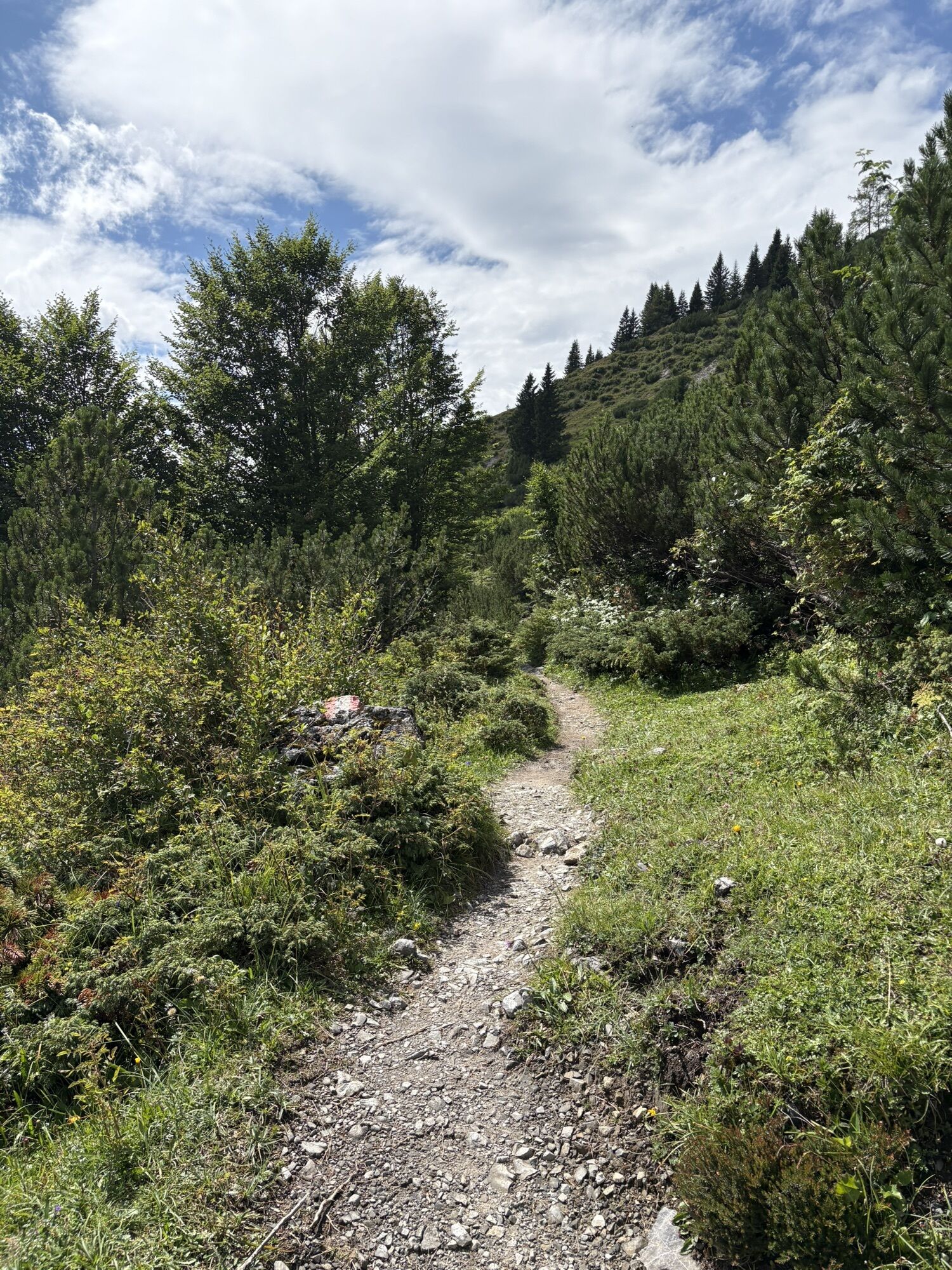
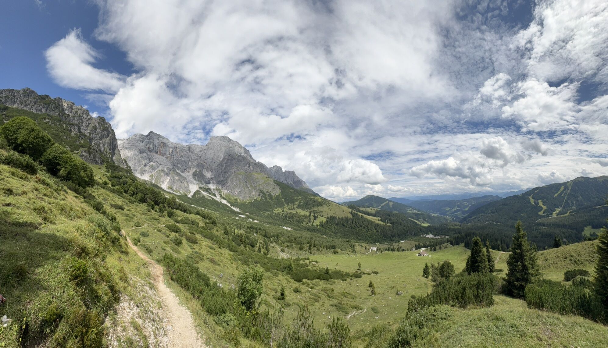
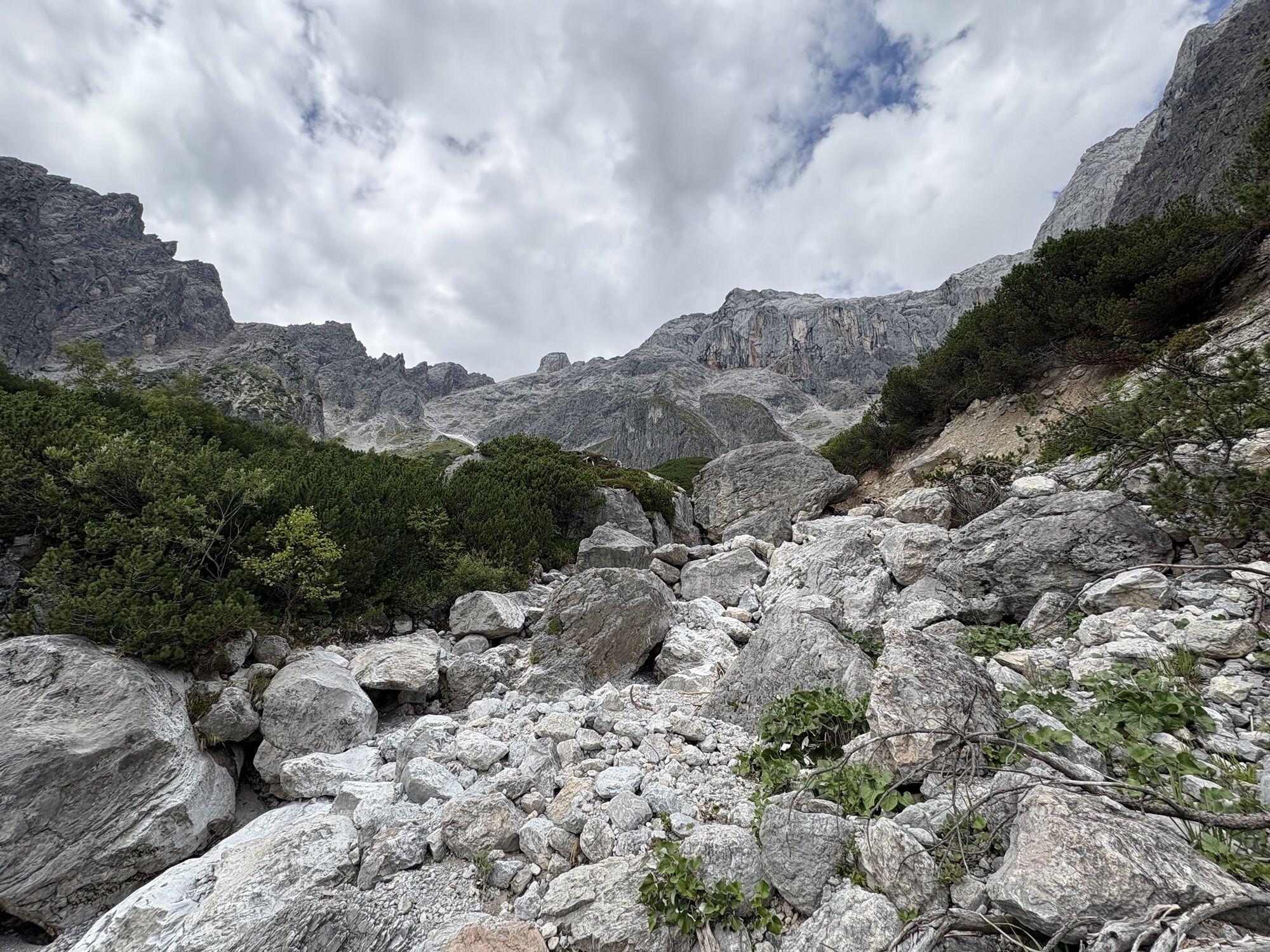
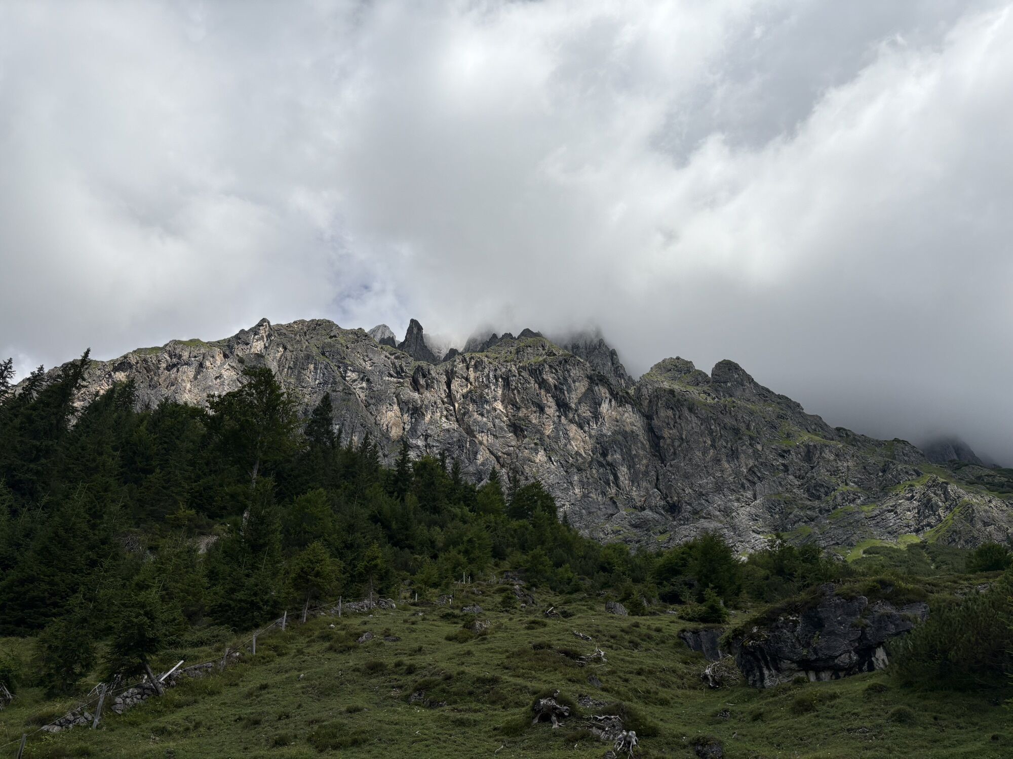
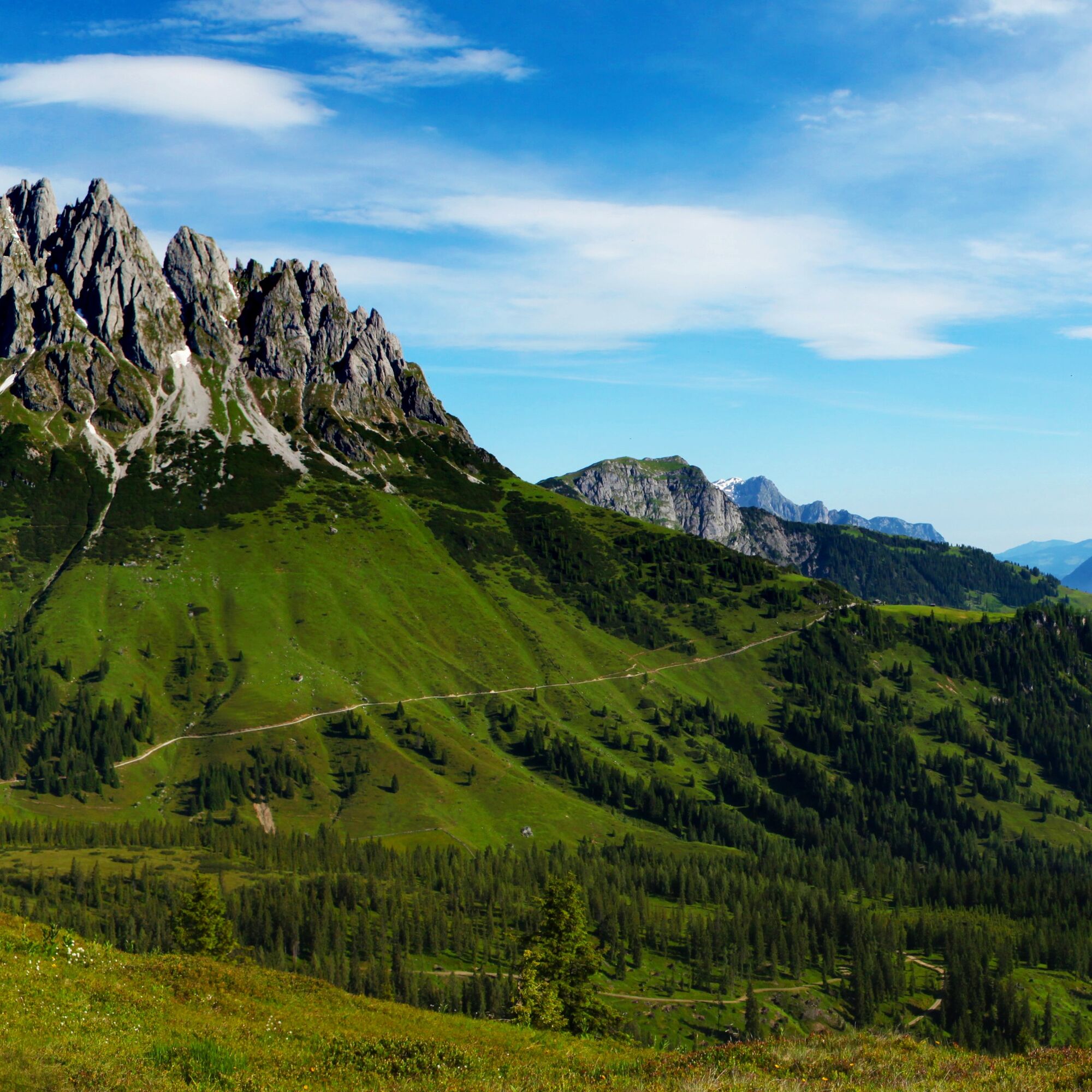
The hiking bus towards Mühlbach takes you to the stop at the Erichhütte parking lot – the starting point of your hiking day. Follow Trail No. 432 and enjoy the impressive natural landscape on the approximately 30-minute ascent to Erichhütte. At the top, you will be rewarded with a stunning panoramic view of the snow-covered peaks of the Hohe Tauern. After a short break, continue the route on Trail No. 436/401A towards Arthurhaus. Ahead of you rises the imposing 800-meter-high Hochkönig south face before the wide alpine pastures of the Four Huts open up.
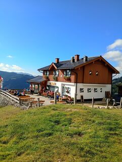
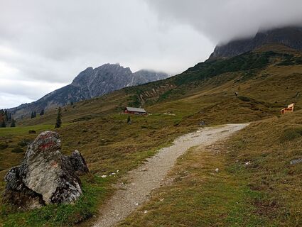
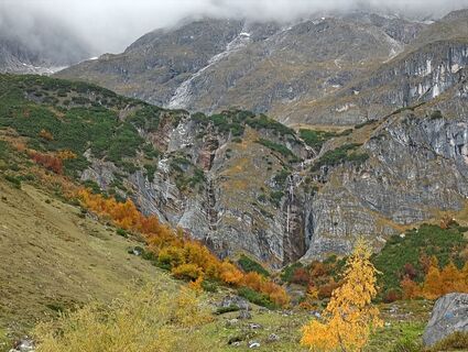
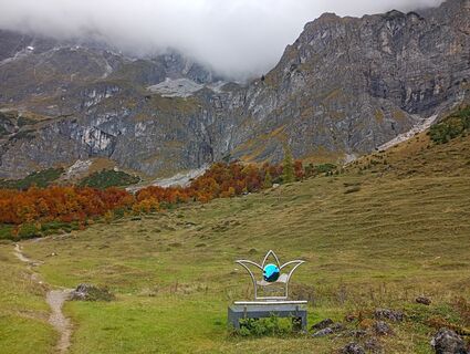
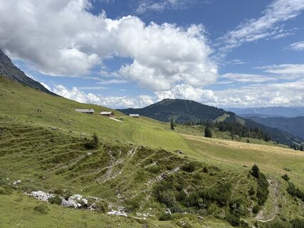
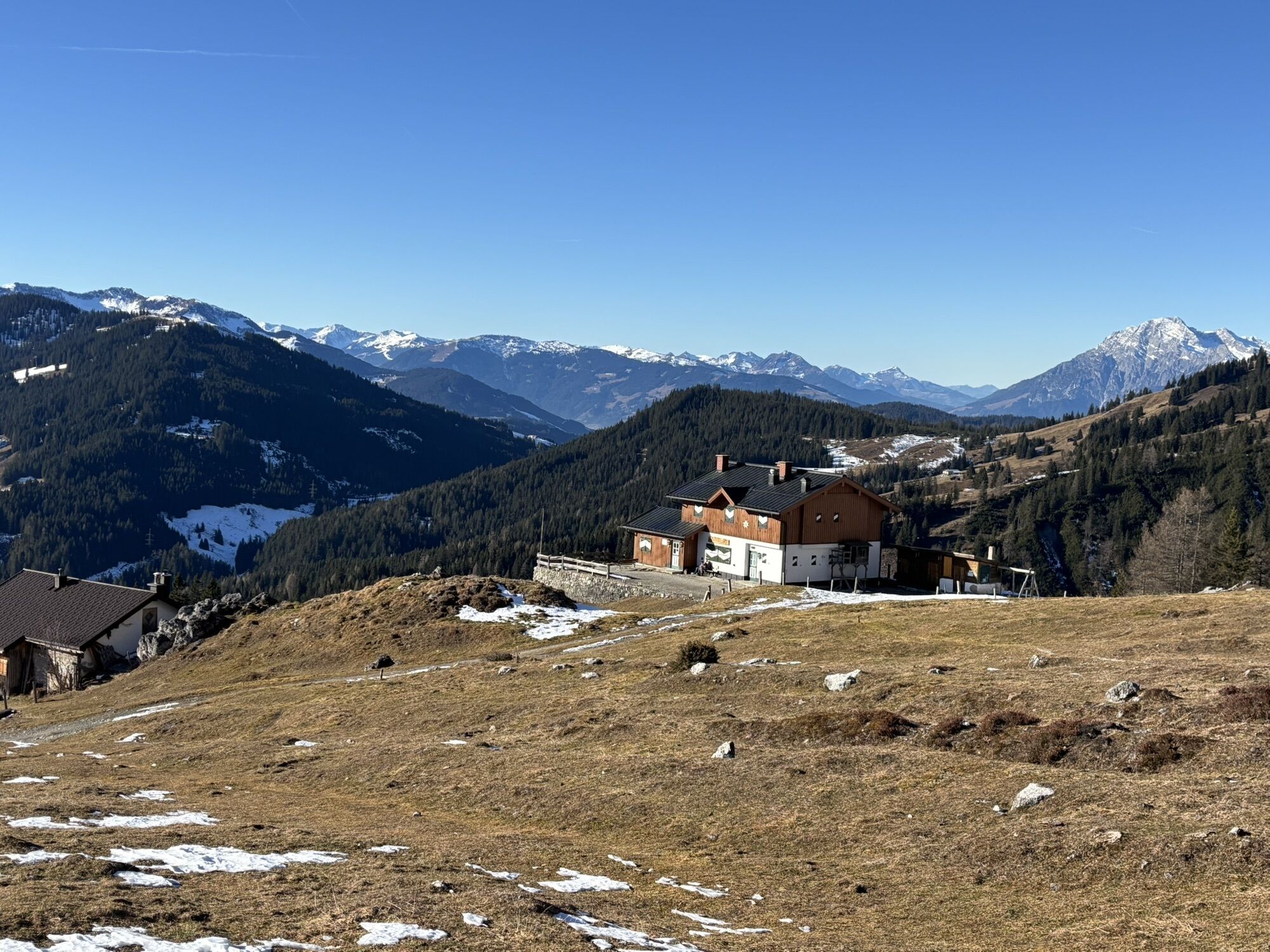
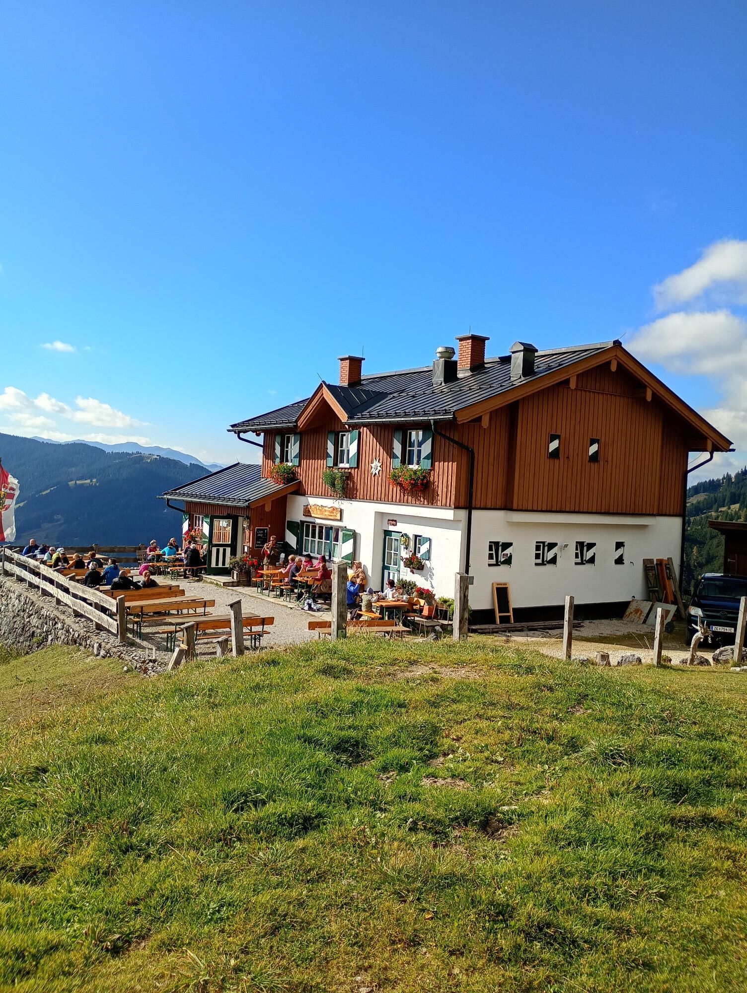
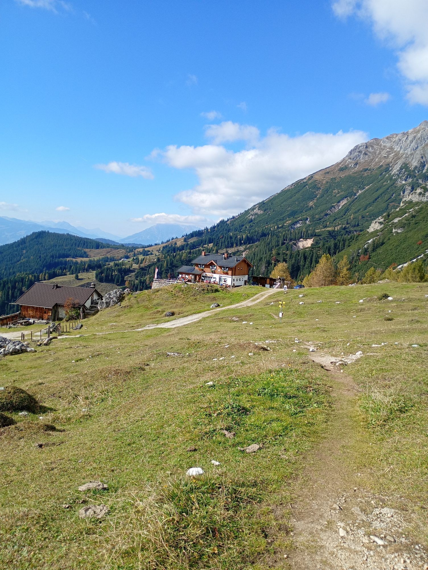
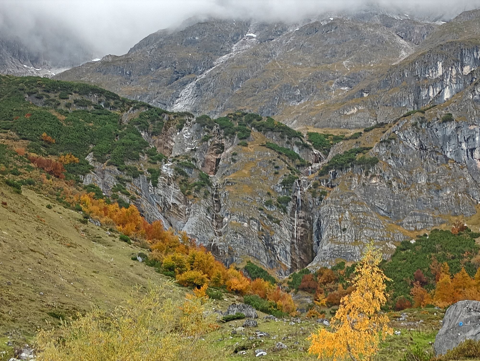
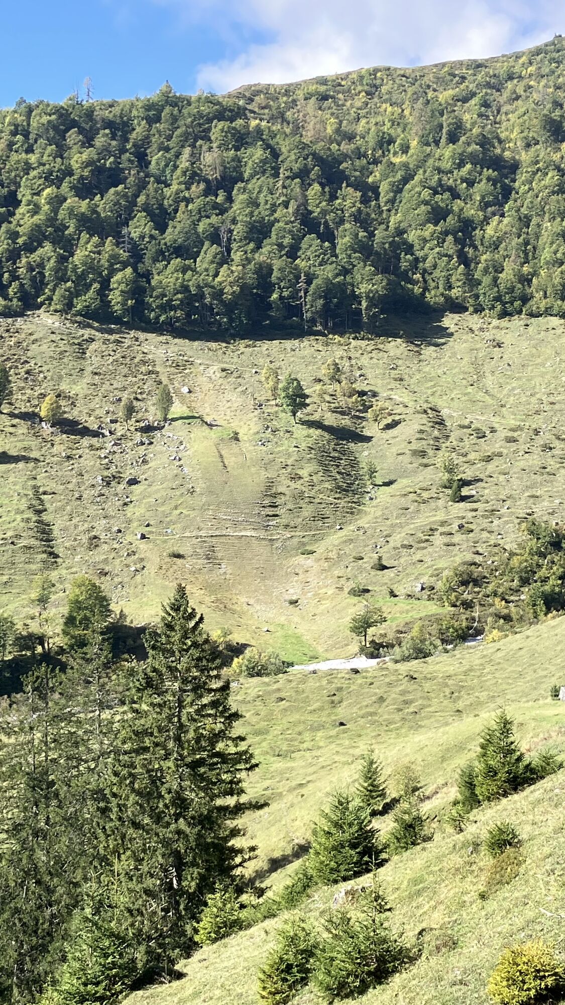
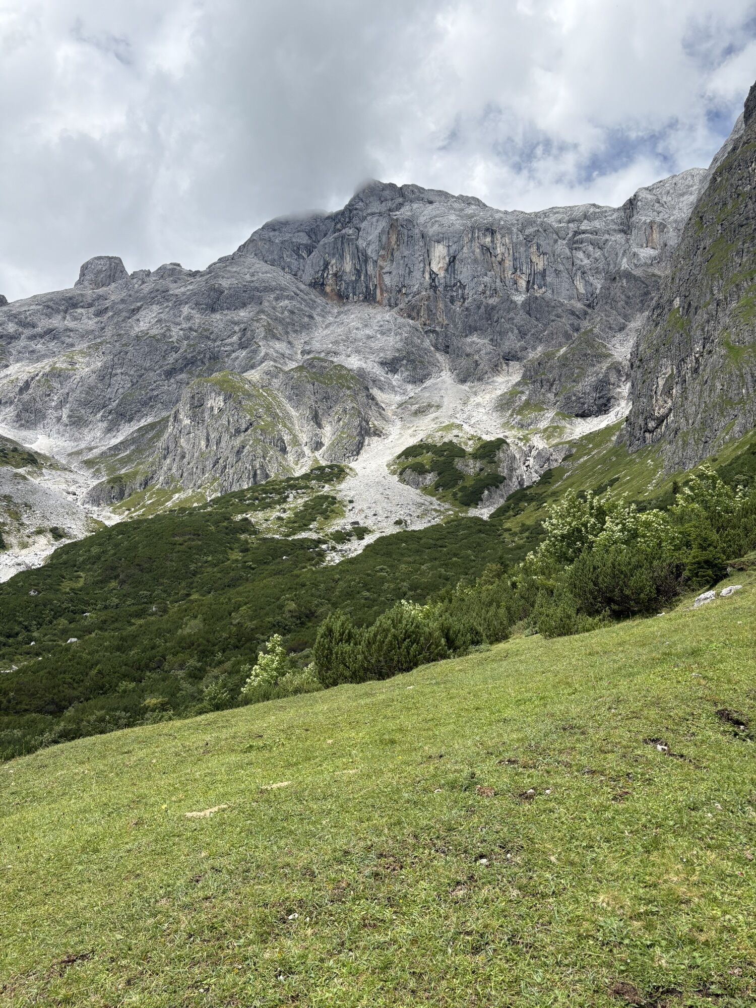
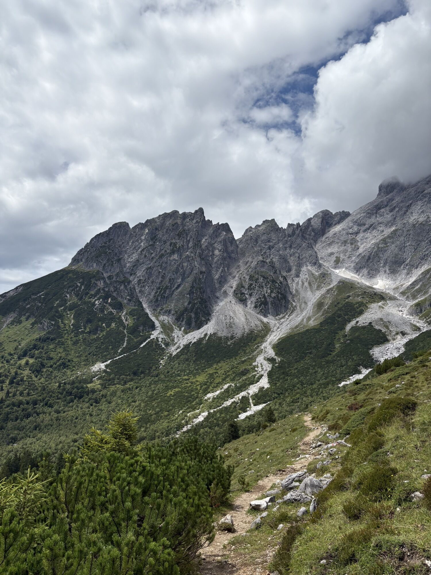
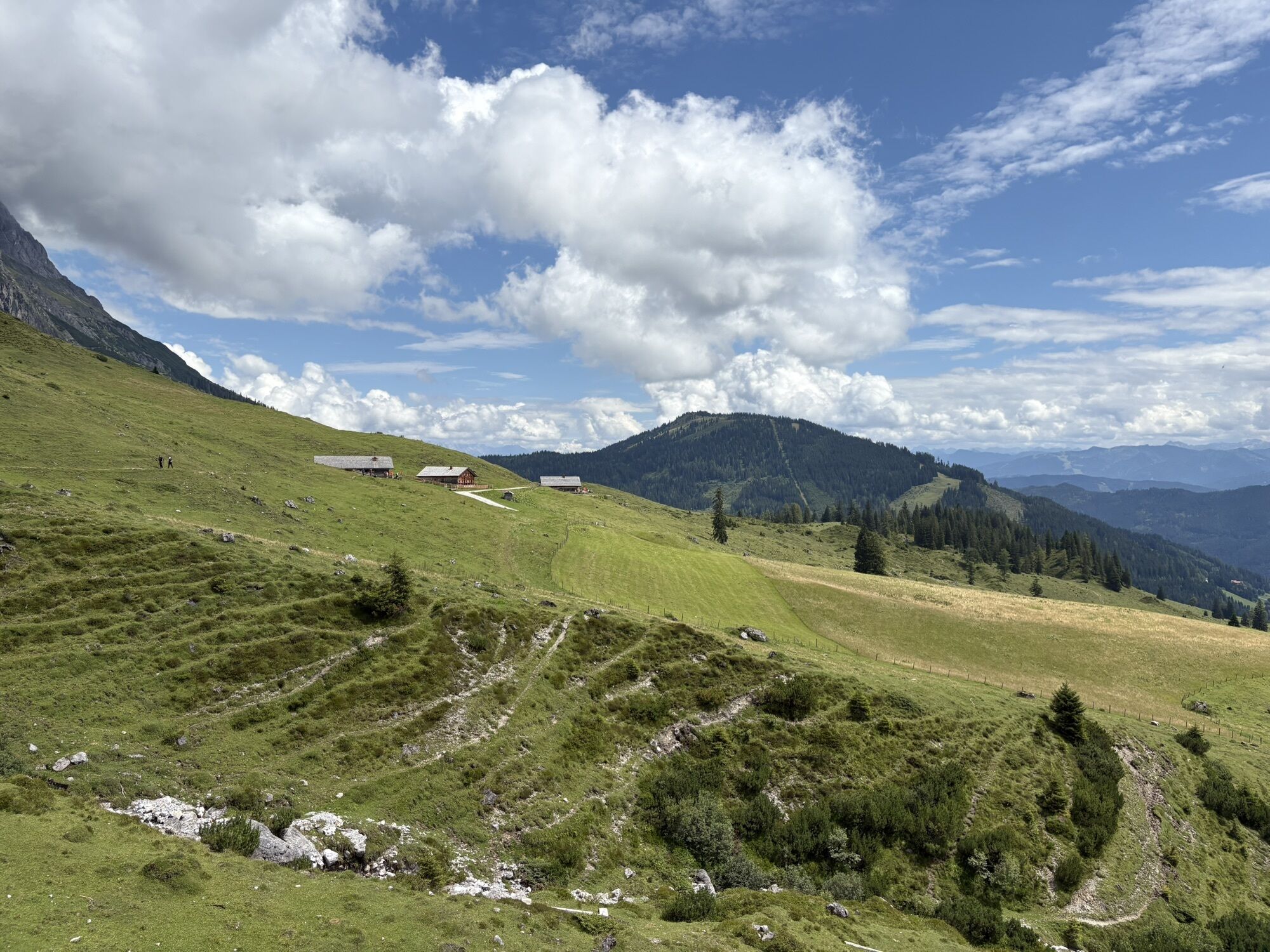
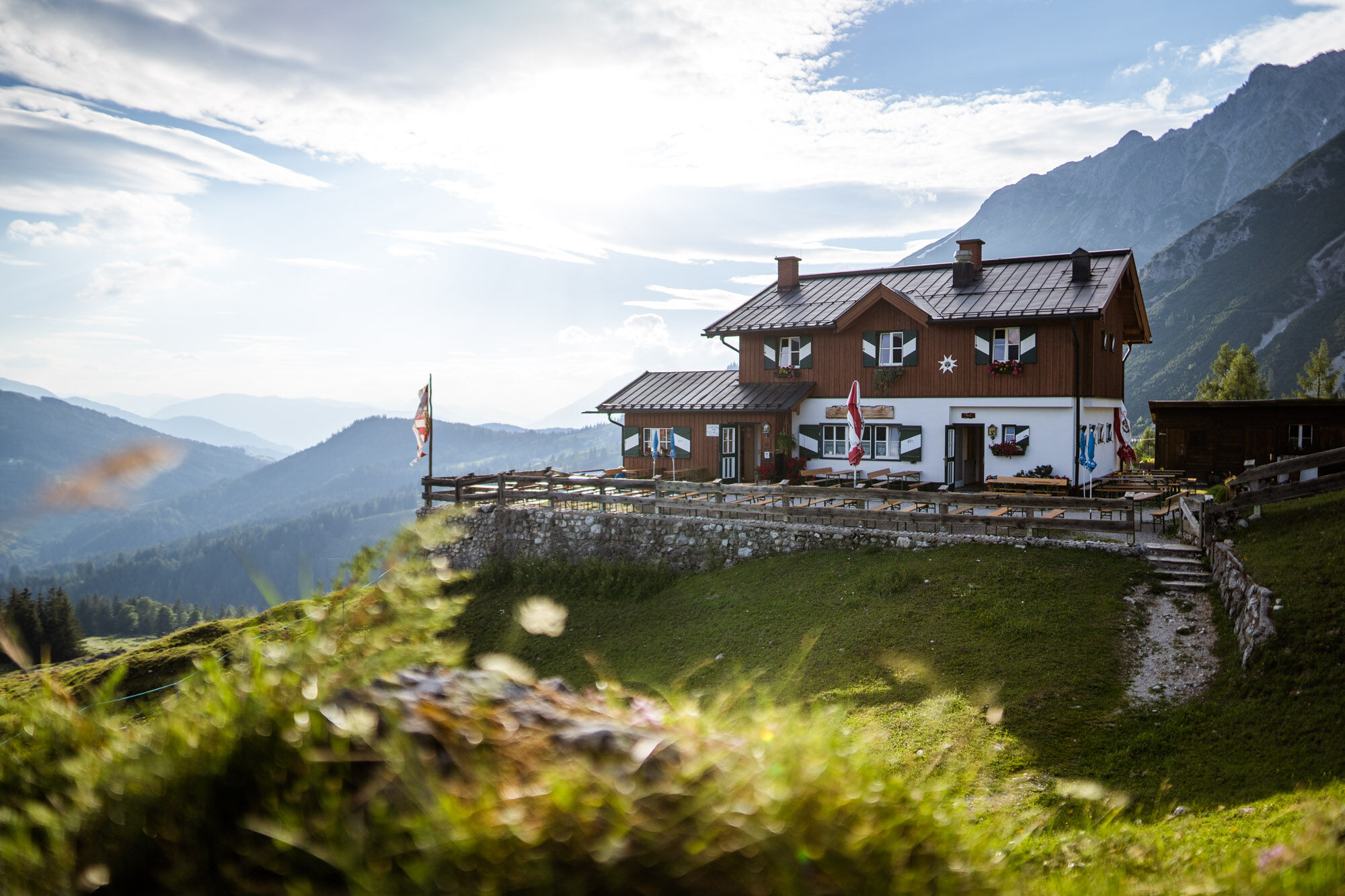
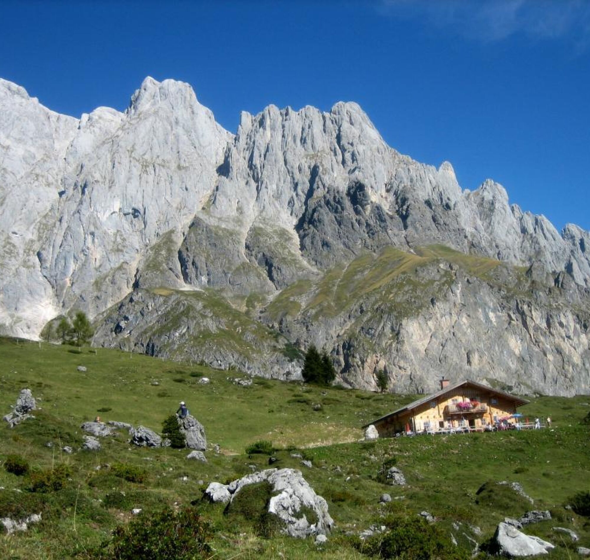
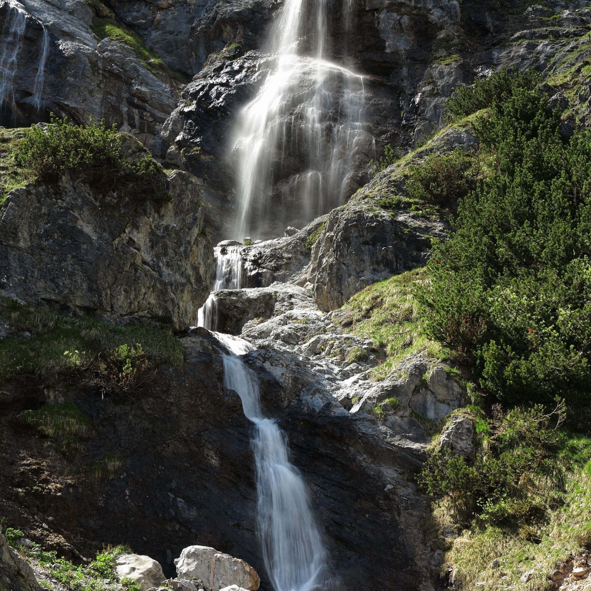
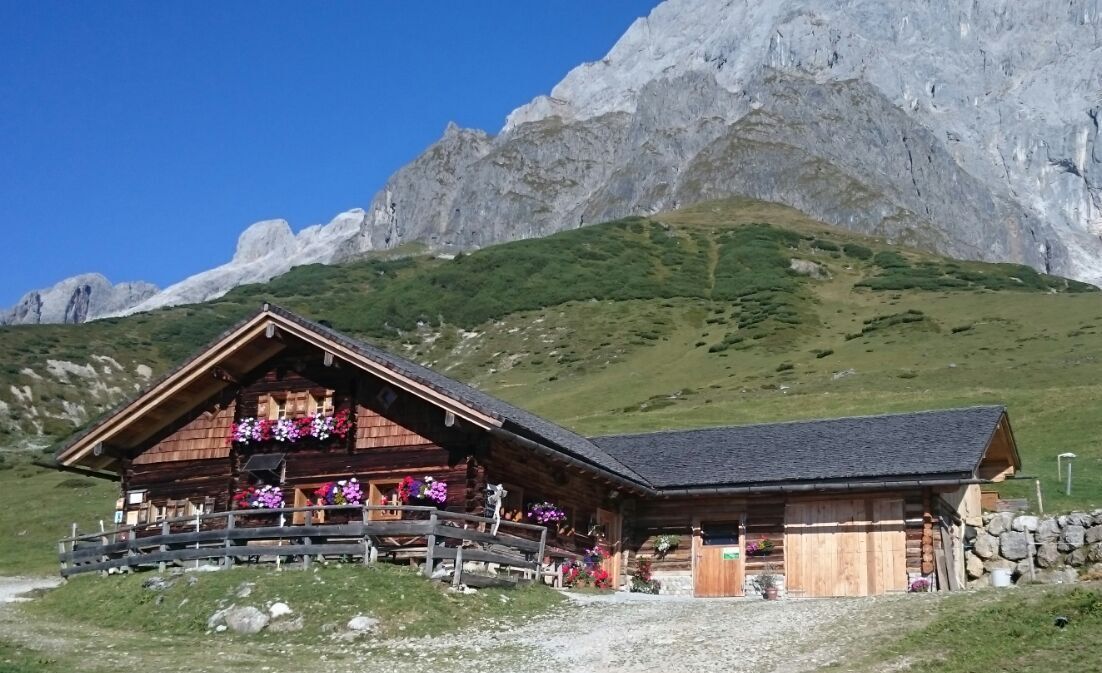
For lunch, the Brandstätthütte or the Molterauhütte invite you. Afterwards, the trail gently descends into the Riedingtal with striking waterfalls and the majestic Großer Bratschenkopf in the background. The path passes the natural ski jumps of the former Riedingtal ski jumping center of Bubi Bradl. After a short forest section, you reach the Windraucheggalm. The last flat section to Arthurhaus and the Schweizerhütte – known for its cheese specialties – rounds off the route delightfully. From Arthurhaus, the hiking bus comfortably takes you to the center of Mühlbach.
Optional: If you prefer to hike down to the valley on foot, plan about 2 extra hours. The descent is worth it: From Arthurhaus, follow the Mitterberger Erzweg No. 85 with stations and information boards on Mühlbach's mining history. Over forest and field paths, past copper mining tunnels and old mining houses, you reach the village center.
Áno
Sturdy, ankle-high footwear
Hiking poles
Headwear
Sun protection
Sunglasses
Rain protection
Drinks and a small snack
Necessary medications
First aid kit
Hiking map
Self-assessment: Check your physical fitness before each mountain hike and accurately assess your strength as well as that of your companions – especially your children! Surefootedness and a head for heights are often very important!
Planning and preparation: Plan every intended mountain hike carefully beforehand. Hiking maps and guides as well as information from alpine clubs and locals such as mountain guides and hut hosts can be helpful.
Equipment: In the mountains, you need appropriate equipment and clothing, especially sturdy, high shoes with a grippy sole. Weather and cold protection are essential, as weather can change suddenly.
Weather forecasts: Check current weather conditions at: zamg.at or www.uwz.at.
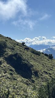
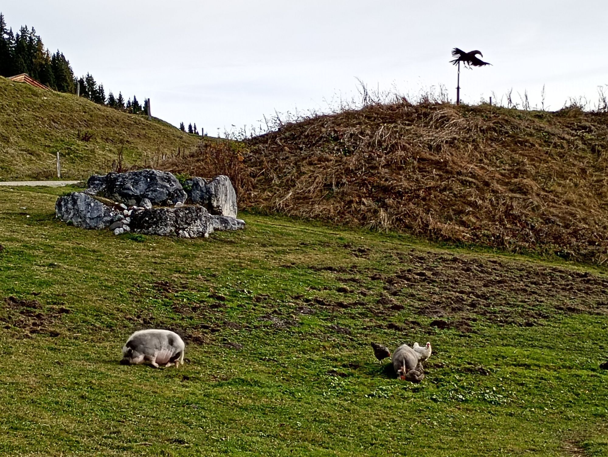
Togetherness: Observe the 10 rules for proper interaction with grazing animals and leave no waste in nature!
Do not dislodge stones: Do not dislodge stones as it can seriously endanger other hikers. Marked areas with rockfall hazards should be crossed as quickly and attentively as possible.
Turn back in time: This is no shame but a sign of reason. It becomes necessary if the weather changes, fog sets in, or if the path is too difficult or in poor condition.
Emergency numbers: Alpine emergency: 140, International emergency: 112, Rescue service: 144
Arrival from Salzburg: Take highway A10 to the Bischofshofen exit, then B311 towards Bischofshofen. Follow the Hochkönig federal road/B164 to Mühlbach and then to Dienten.
Arrival from Innsbruck/Kufstein: On the Loferer Straße/B178 towards St. Johann i.T., then via the Hochkönig federal road/B164 via Saalfelden and Maria Alm to Dienten or the Filzensattel.
A valid vignette is required to use the Austrian highway and expressway network. Carrying a first aid kit, warning triangle, and warning vest is mandatory. More info at Asfinag.
ÖBB-Scotty: timetable information
Bus line 620: timetable information
Bus line 631: timetable information
Hiking bus: timetable information
Parking garage ski center Dienten
T2
More information on hikes and activities in the Hochkönig region:
For detailed information on hiking maps, cable car opening times, and huts and alpine pastures in summer, we recommend visiting the service center on-site. There you will not only obtain the hiking map but also valuable tips on the best hiking routes and current conditions.
Summer cable car opening times: The cable cars offer various opening times during the summer months, which may vary depending on weather conditions and season. Please check the current operating hours in advance.
Hut and alpine pasture opening times in summer: The huts and alpine pastures in the region are ideal resting places for hikers. Opening times may also vary here by season and weekday. Let the friendly hosts advise you on the offers and specialties on site.
For more information, please visit our website: www.hochkoenig.at.
If you have questions or want to get specific information, feel free to contact us:
Email: region@hochkoenig.at
Phone: +43 (0)6584 20388
We look forward to helping you and wish you a lot of fun exploring the beautiful hiking region Hochkönig!
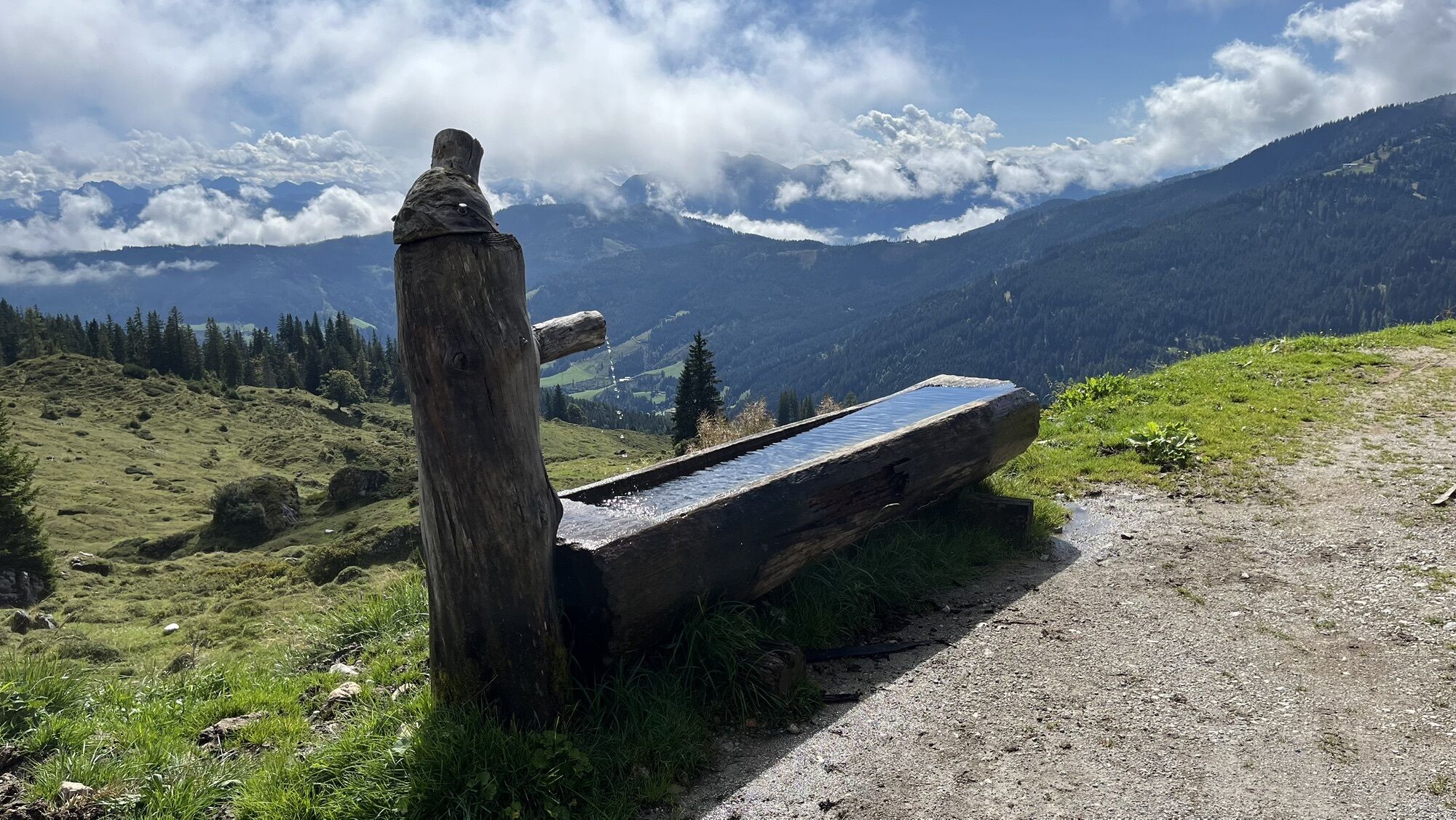
Be sure to stop at the Schweizerhütte – the homemade cheese specialties are a perfect end to this panoramic route.
Webové kamery z prehliadky
-
Mühlbach am Hochkönig
-
Maria Alm - Hochmaisbahn
-
Bürglalmlift - Dienten
-
Mühlbach am Hochkönig
-
Bergstation Kings Cab
-
Matrashaus am Hochkönig
-
Grünegg Alm & Edelbrennerei
-
Dienten - Übergossene Alm Resort
-
Dienten - Almsee
-
Dienten - Übergossene Alm Resort
-
Dienten, Bürglalmabfahrt
-
Bergstation Kings Cab
-
Bergstation Kings Cab
-
Bergstation Kings Cab
-
Bergstation Kings Cab
-
Bergstation Kings Cab
-
Bergstation Kings Cab
-
Bergstation Kings Cab
-
Bürglalmbahn Abfahrt
-
Hochkönigblick
-
Arthurhaus - Mühlbach
Aktivity počas prehliadky
-
Mühlbach am Hochkönig, Salzburg/Österreich
03.10.2025 – Turistika -

Mühlbach am Hochkönig, Salzburg/Österreich
19.09.2025 – Turistika -

Mühlbach am Hochkönig, Salzburg/Österreich
19.09.2025 – Turistika -
Mühlbach am Hochkönig, Salzburg/Österreich
11.09.2025 – Turistika -
Mühlbach am Hochkönig, Salzburg/Österreich
11.09.2025 – Turistika -

Mühlbach am Hochkönig, Salzburg/Österreich
28.08.2025 – Turistika -

Mühlbach am Hochkönig, Salzburg/Österreich
25.08.2025 – Turistika -
Mühlbach am Hochkönig, Salzburg/Austria
21.08.2025 – Turistika -

Mühlbach am Hochkönig, Salzburg/Österreich
14.08.2025 – Turistika -
Mühlbach am Hochkönig, Salzburg/Österreich
09.08.2025 – Mountainbike -
Mühlbach am Hochkönig, Salzburg/Österreich
20.06.2025 – Turistika
Obľúbené výlety v okolí
-
3,6
Wanderung zur Ostpreußenhütte in Werfen (1.630 m)
strednáTuristika 11,2 km -
4,2
Maria Alm - Riemannhaus
Turistika 3,99 km -
4,8
Summit stormer route Lauskopf
ťažkéTuristika 8,16 km -
4,8
Summit storming route Taghaube
ťažkéTuristika 6,25 km -
4,7
About the "Four Huts circular route" to Windraucheggalm
strednáTuristika 10,1 km -
4,7
Panorama hike to the Hochkeil
strednáTuristika 6,07 km -
4,4
Alpine and hut hike "Hochmaisalm & Steinbockalm"
strednáTuristika 8,10 km -
4,9
Hochkönig - Gipfel der Gefühle - Matrashaus
ťažkéTuristika 20,9 km -
4,6
Königsjodler Klettersteig (C/D) Hochkönig
ťažkéVia ferrata 25,8 km -
3,9
To the Ostpreussenhütte
strednáTuristika 16,6 km

Turistika a stopovanie


Nenechajte si ujsť ponuky a inšpiráciu na ďalšiu dovolenku
Vaša e-mailová adresa bol pridaný do poštového zoznamu.