


Königsjodler via ferrata – Hochkönig
Úroveň náročnosti: C/D


The Königsjodler via ferrata was created in 2001 by Richard Franzl, a climber and mountain rescuer from Dienten. Originally conceived as a practice route for the mountain rescue service and a quick ascent...
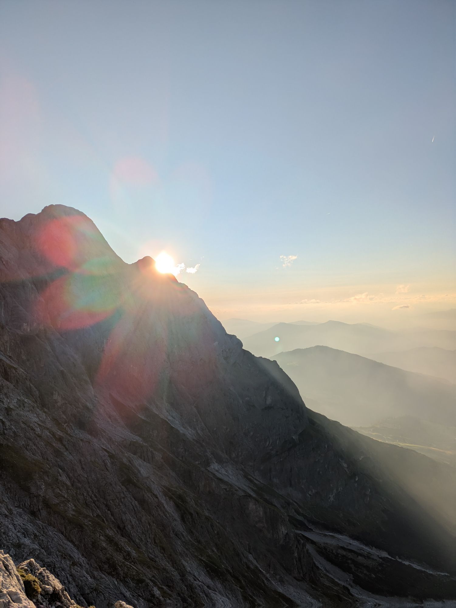
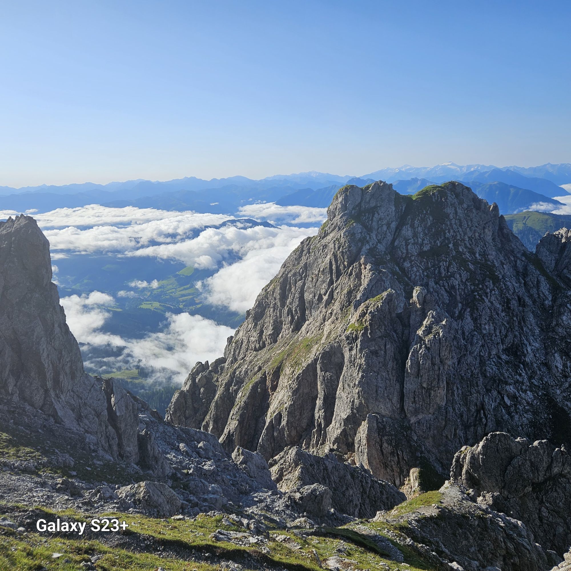
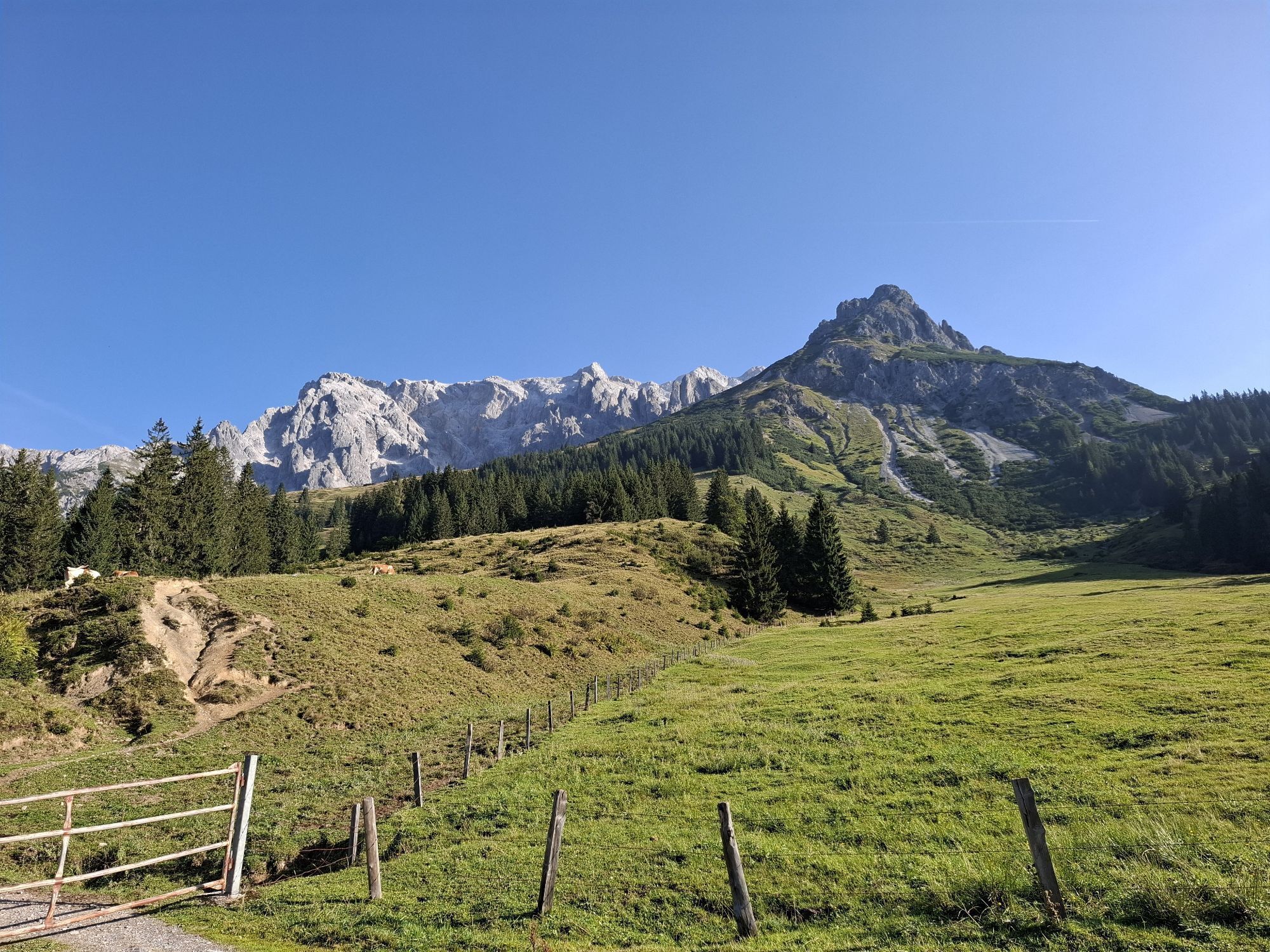
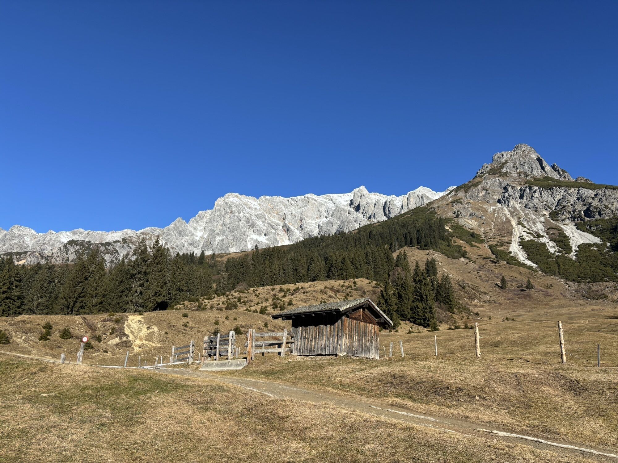
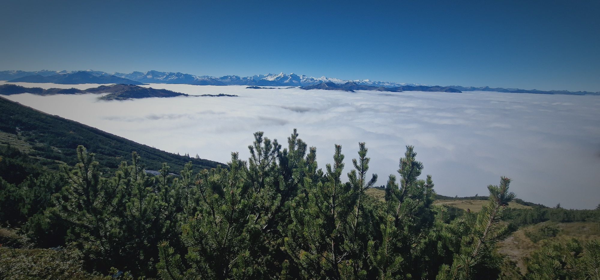
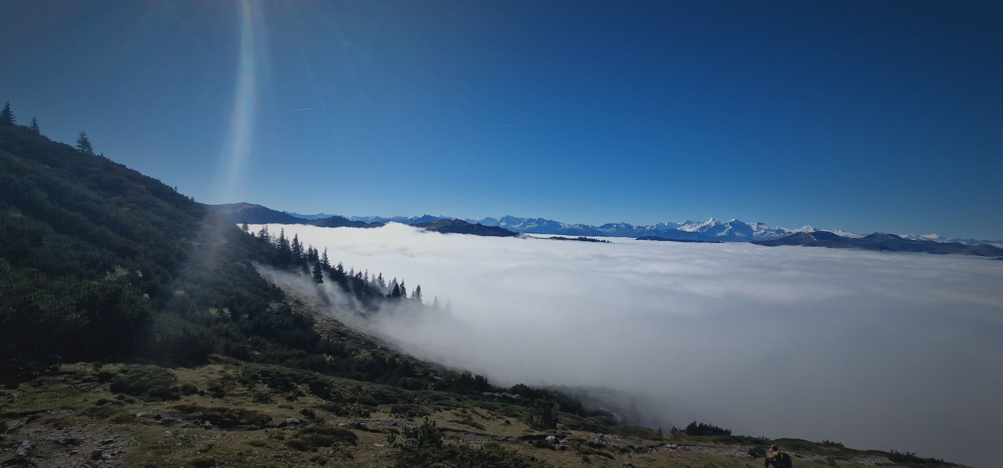
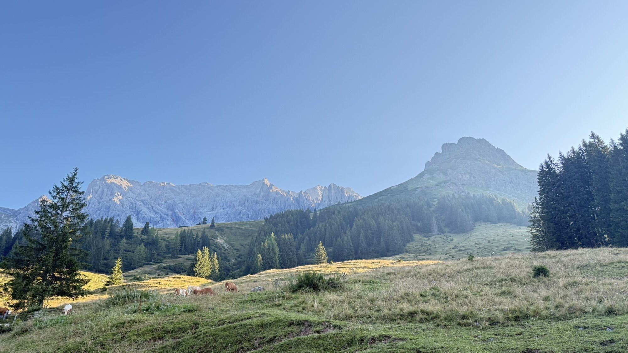
The Königsjodler via ferrata was created in 2001 by Richard Franzl, a climber and mountain rescuer from Dienten. Originally conceived as a practice route for the mountain rescue service and a quick ascent to the Birgkar and Hochkönig, the route quickly excited the via ferrata world. With a length of over 2,000 meters of altitude and the difficulty level C/D, the Königsjodler via ferrata is one of the longest and most challenging via ferratas in Austria. The route requires not only climbing technique but also stamina – the long approach, constant ups and downs, as well as some long walking sections, demand endurance. The Königsjodler via ferrata should only be attempted in secure weather in the Hochkönig region. Those who take on the challenge will be rewarded with breathtaking views of Hochkönig and the surrounding mountains.


Approach - 1.5 to 2.5 hours
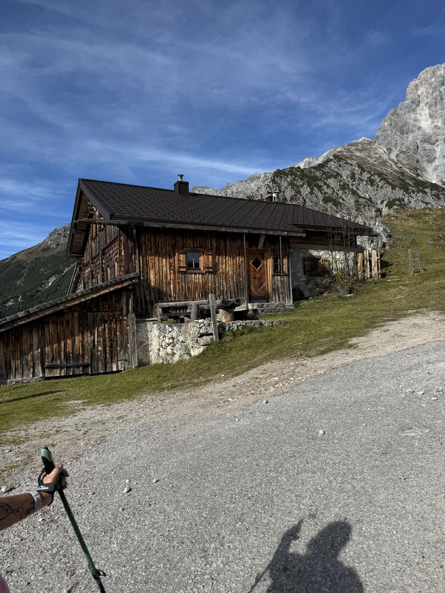
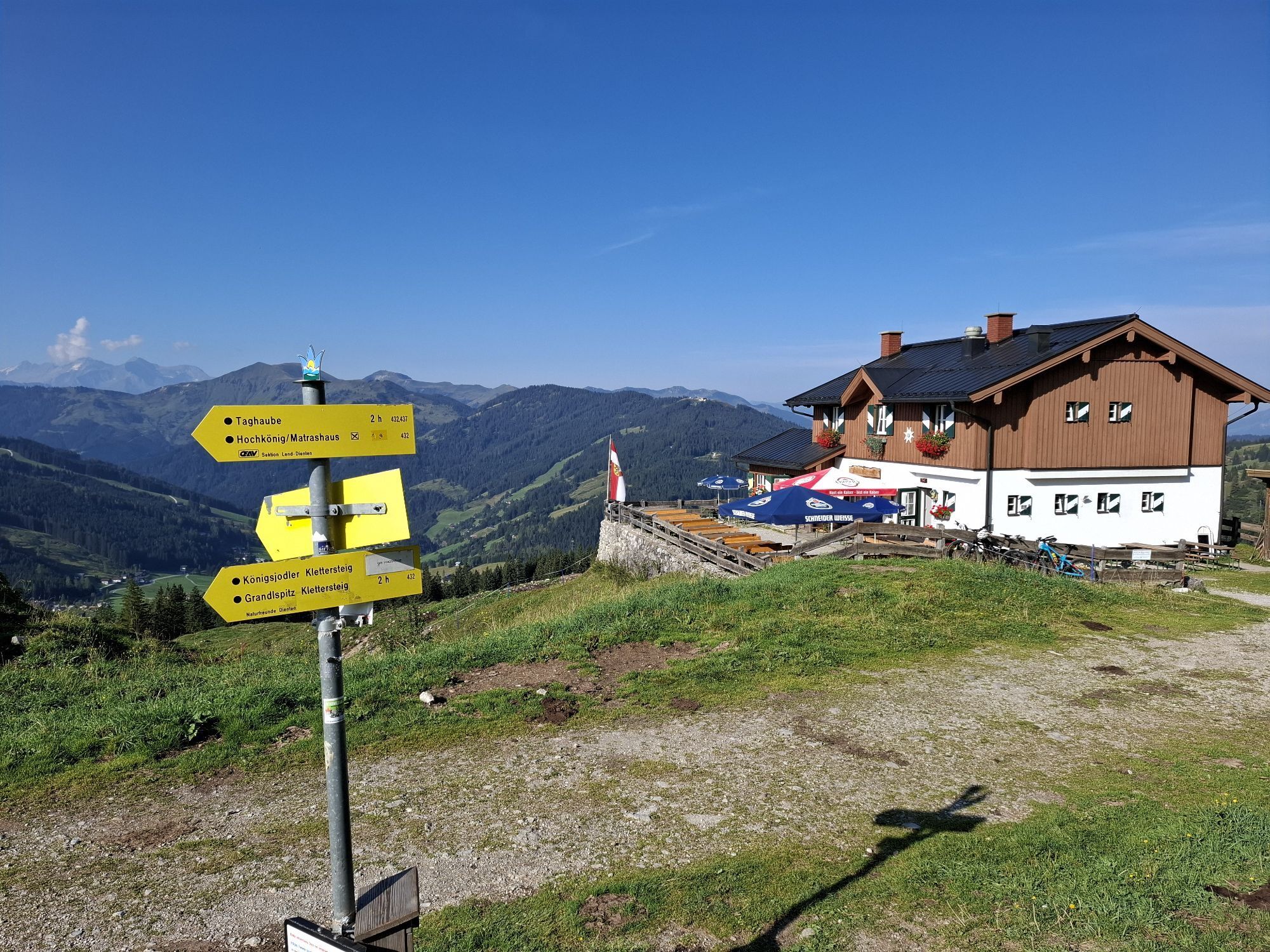
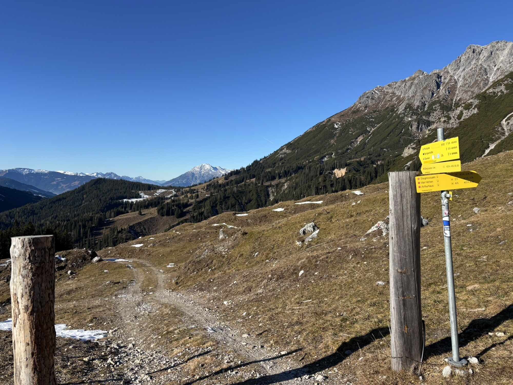
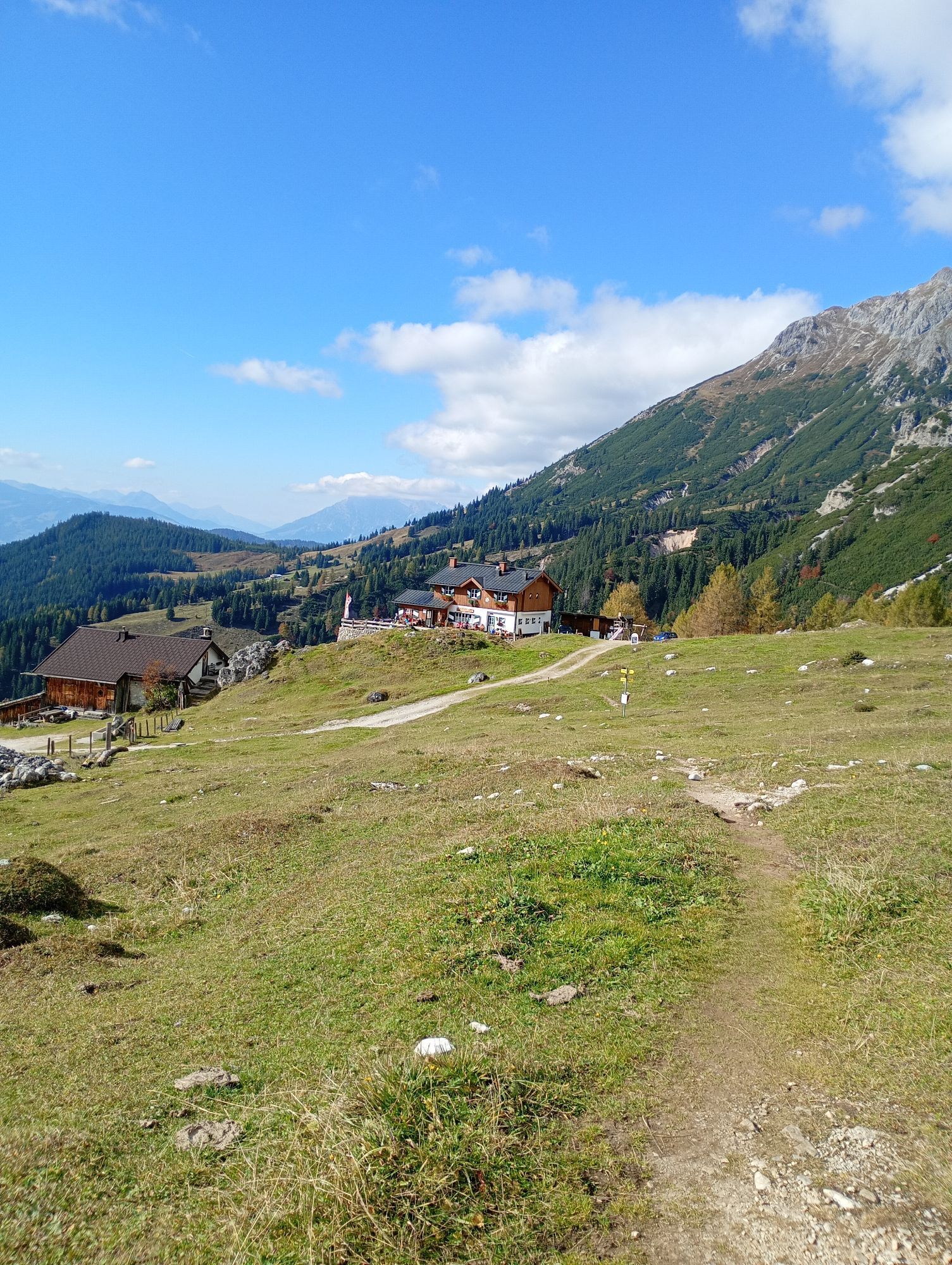
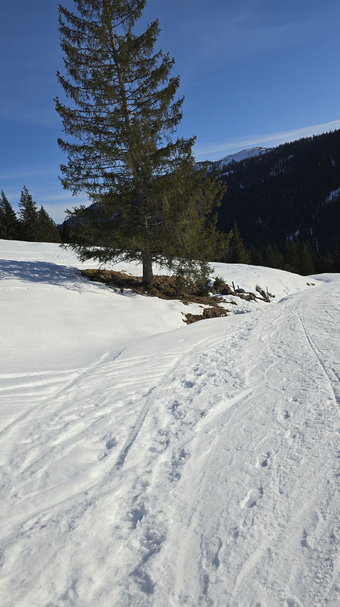
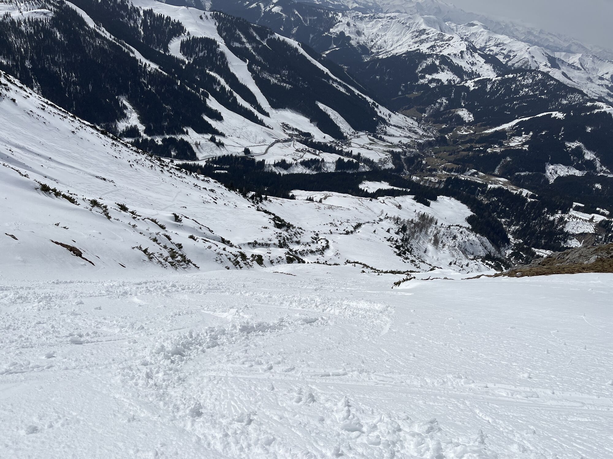
From the parking lot just before the Dientner Sattel ascend on the service road to the Erichhütte. Continue from the Erichhütte on path 432. At 2220 m there is a signpost. Turn left there and go through some gullies and easy climbing sections with ladders to the Hochscharte and then in a few minutes to the belay station below the start.
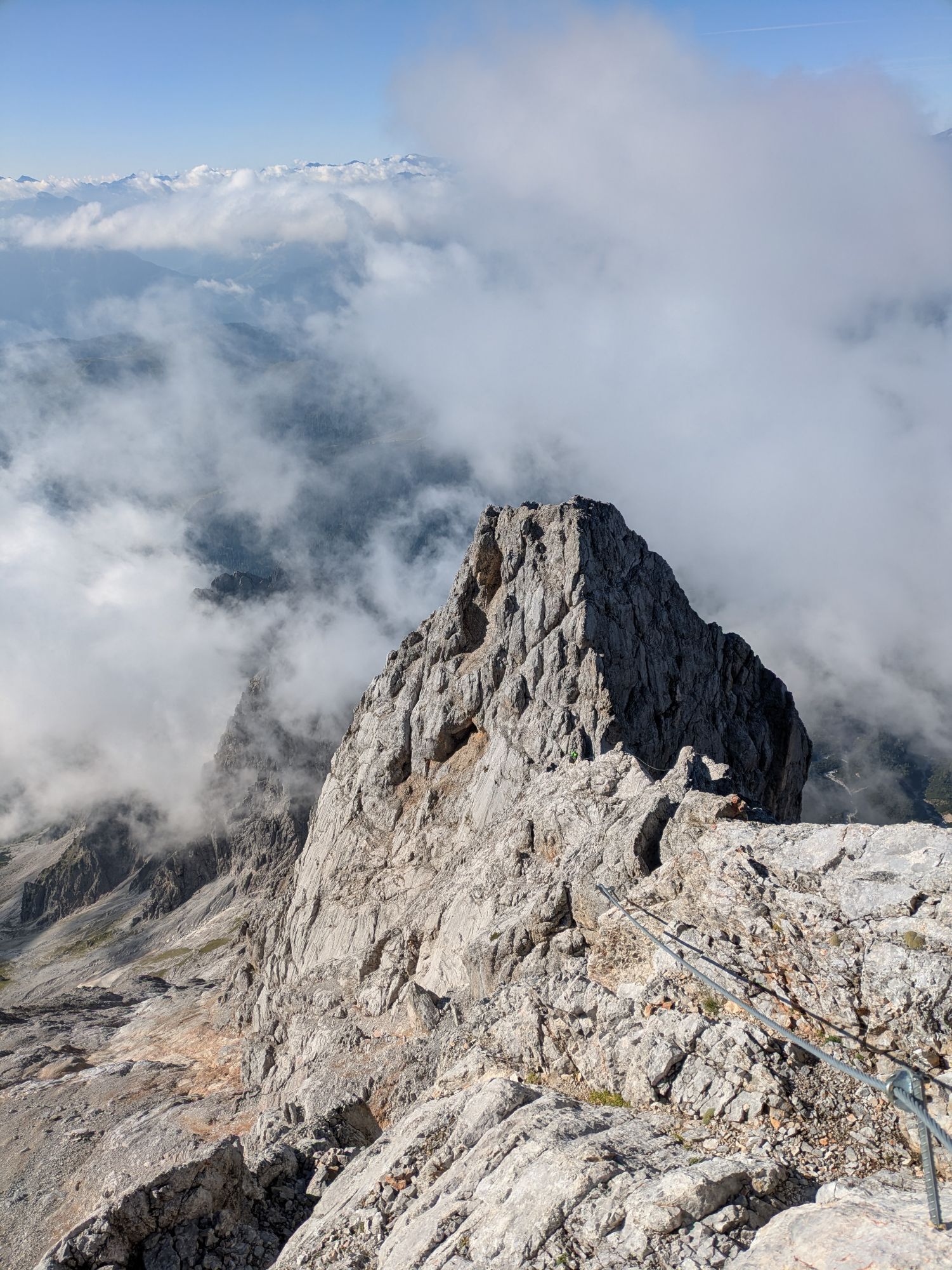
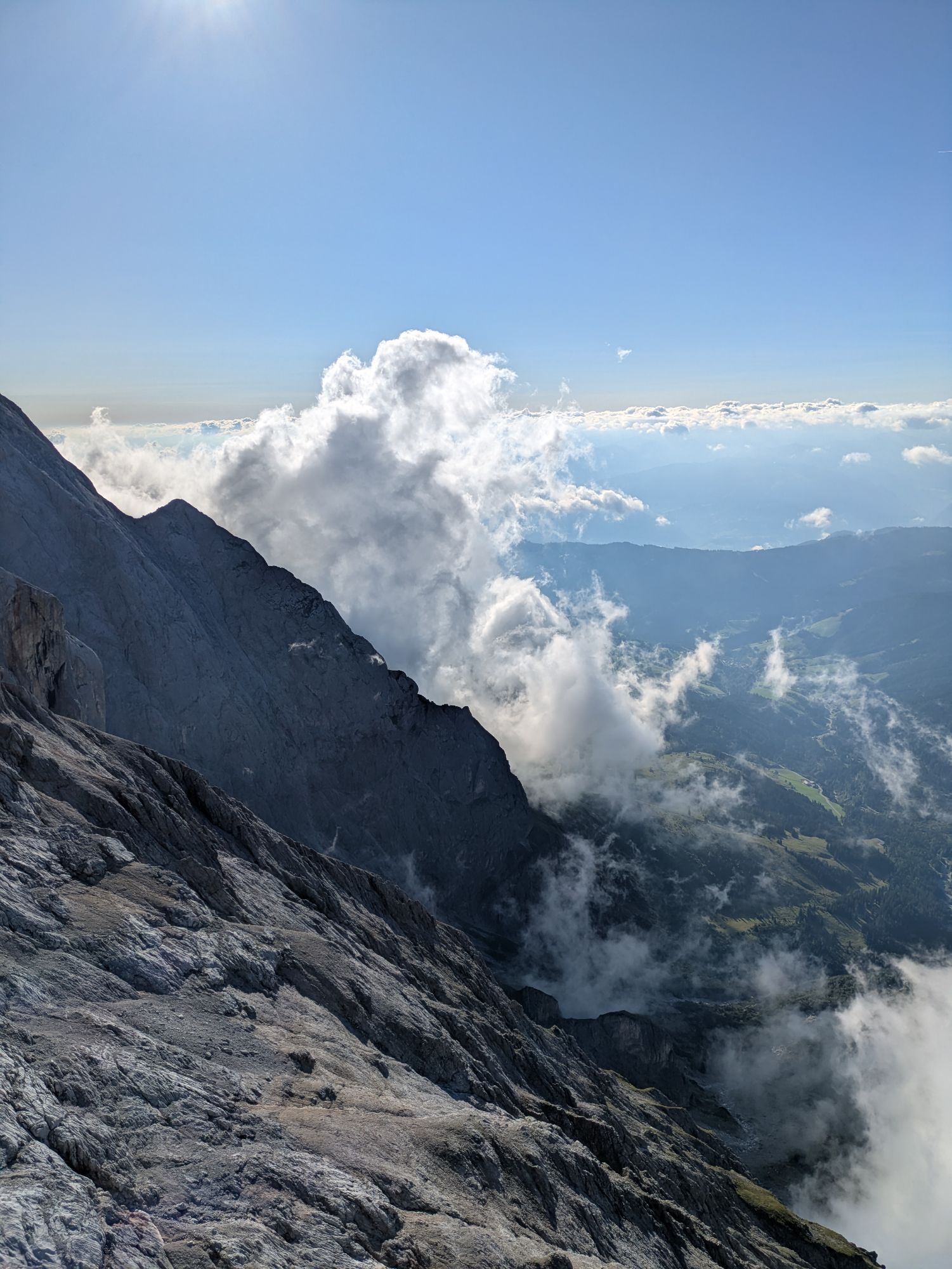
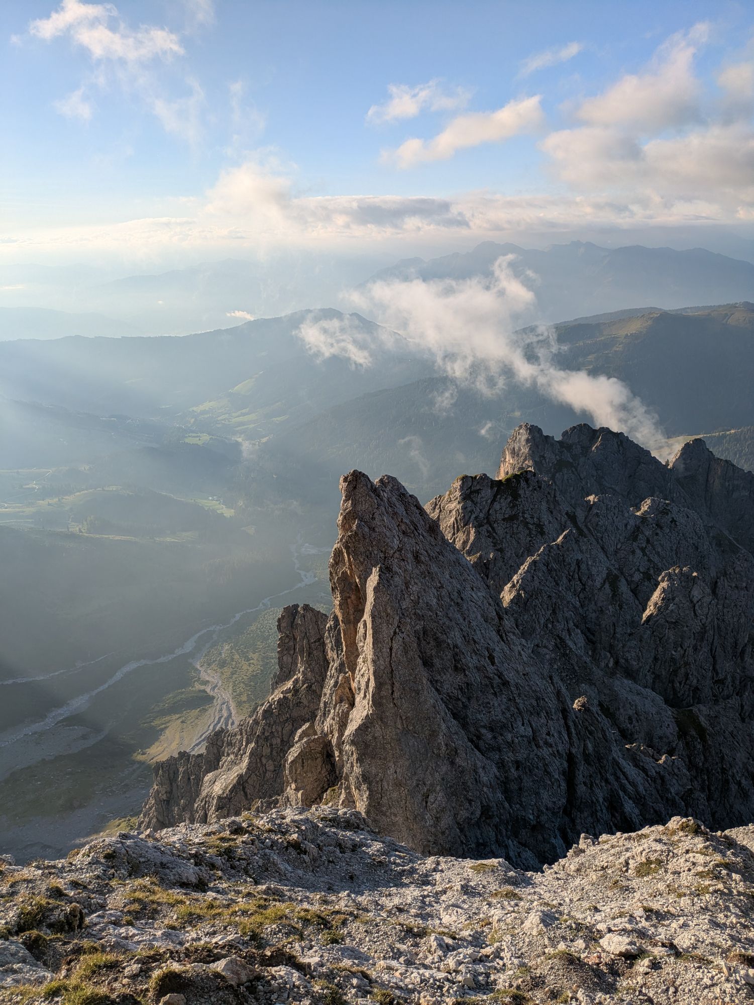
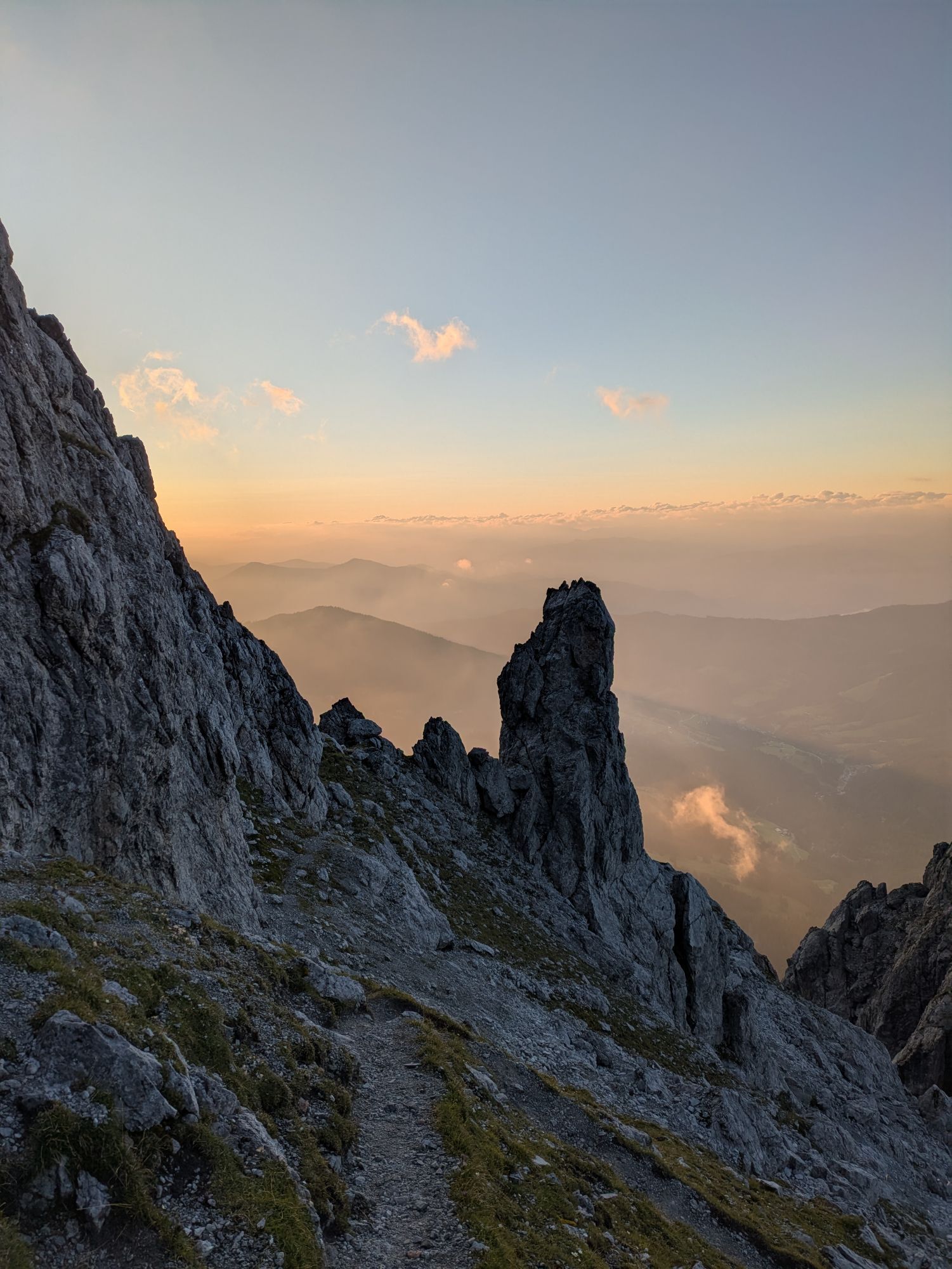
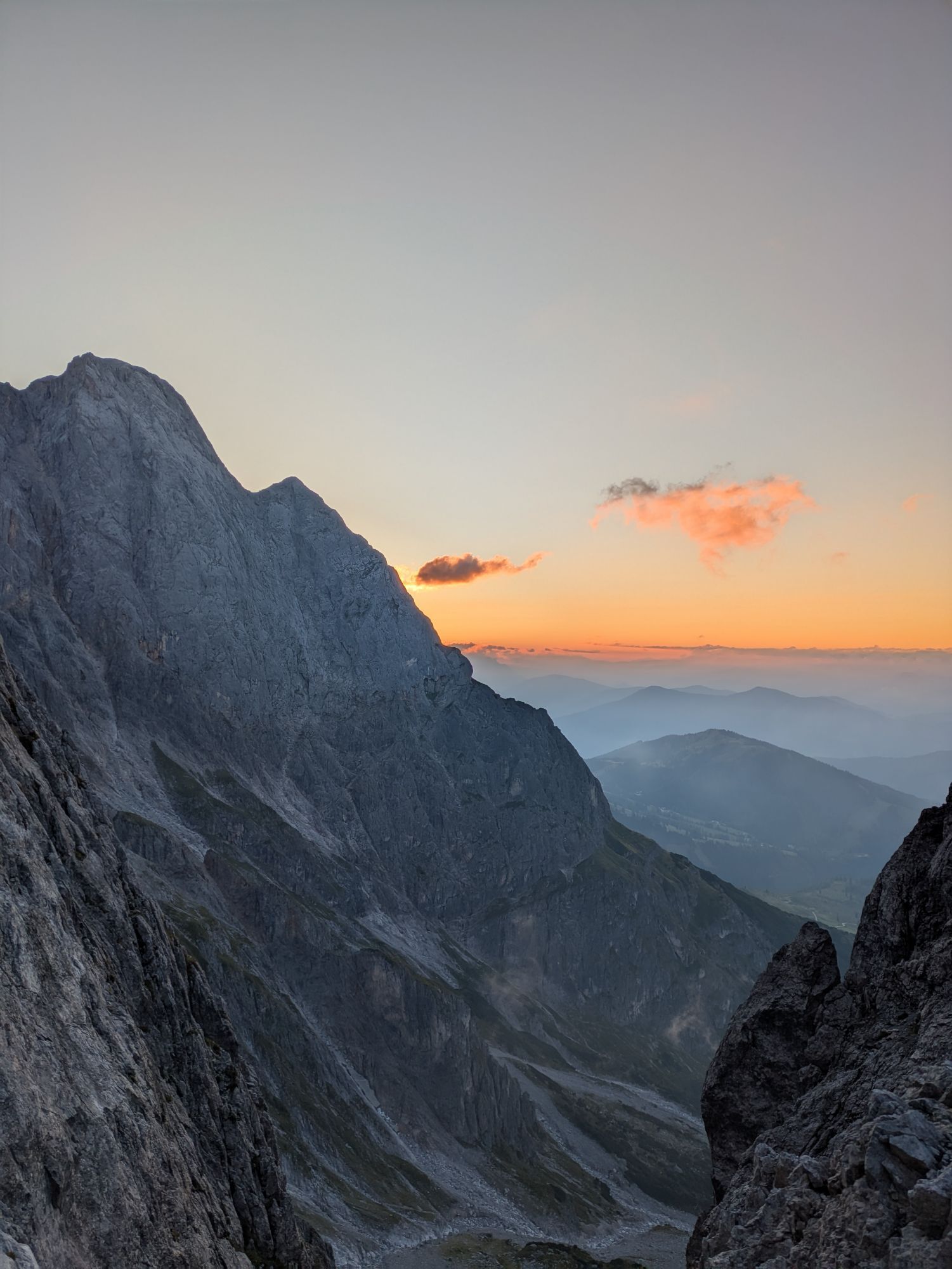
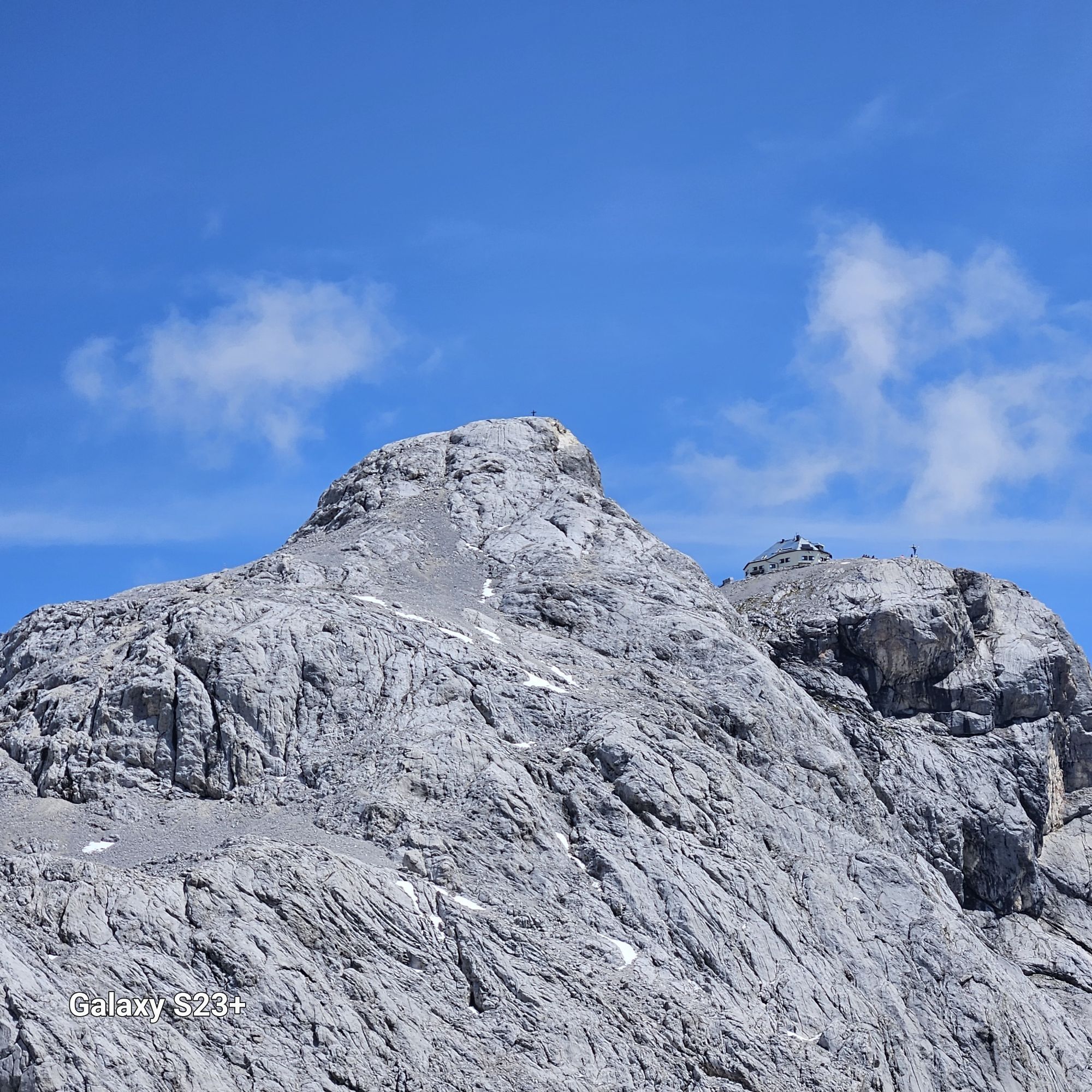
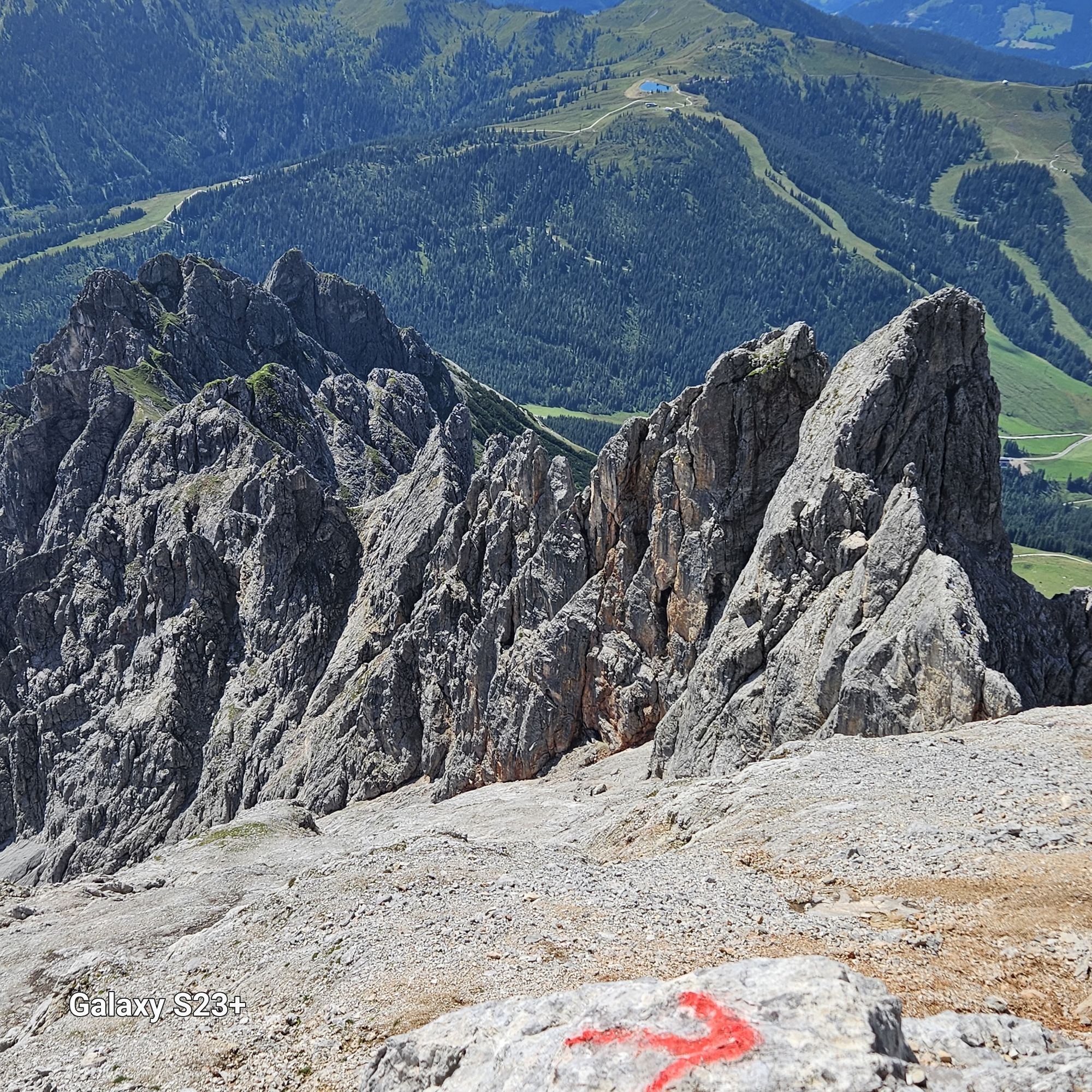
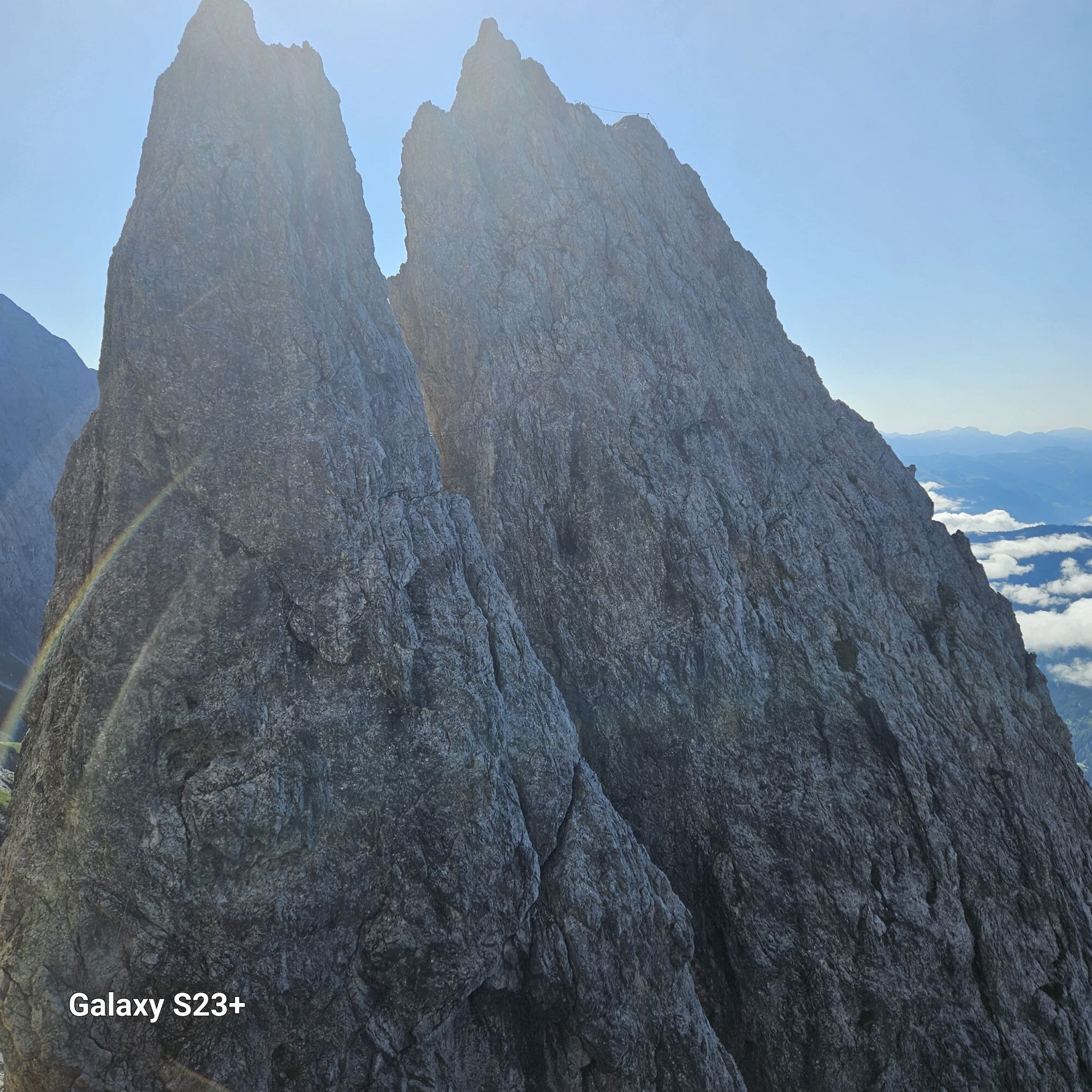
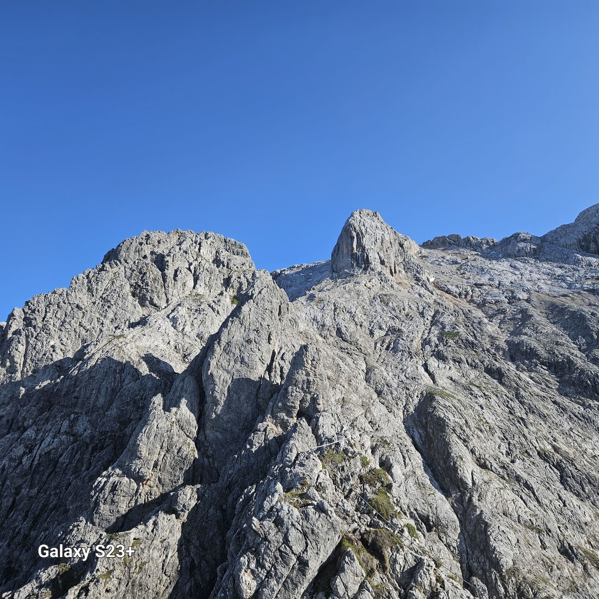
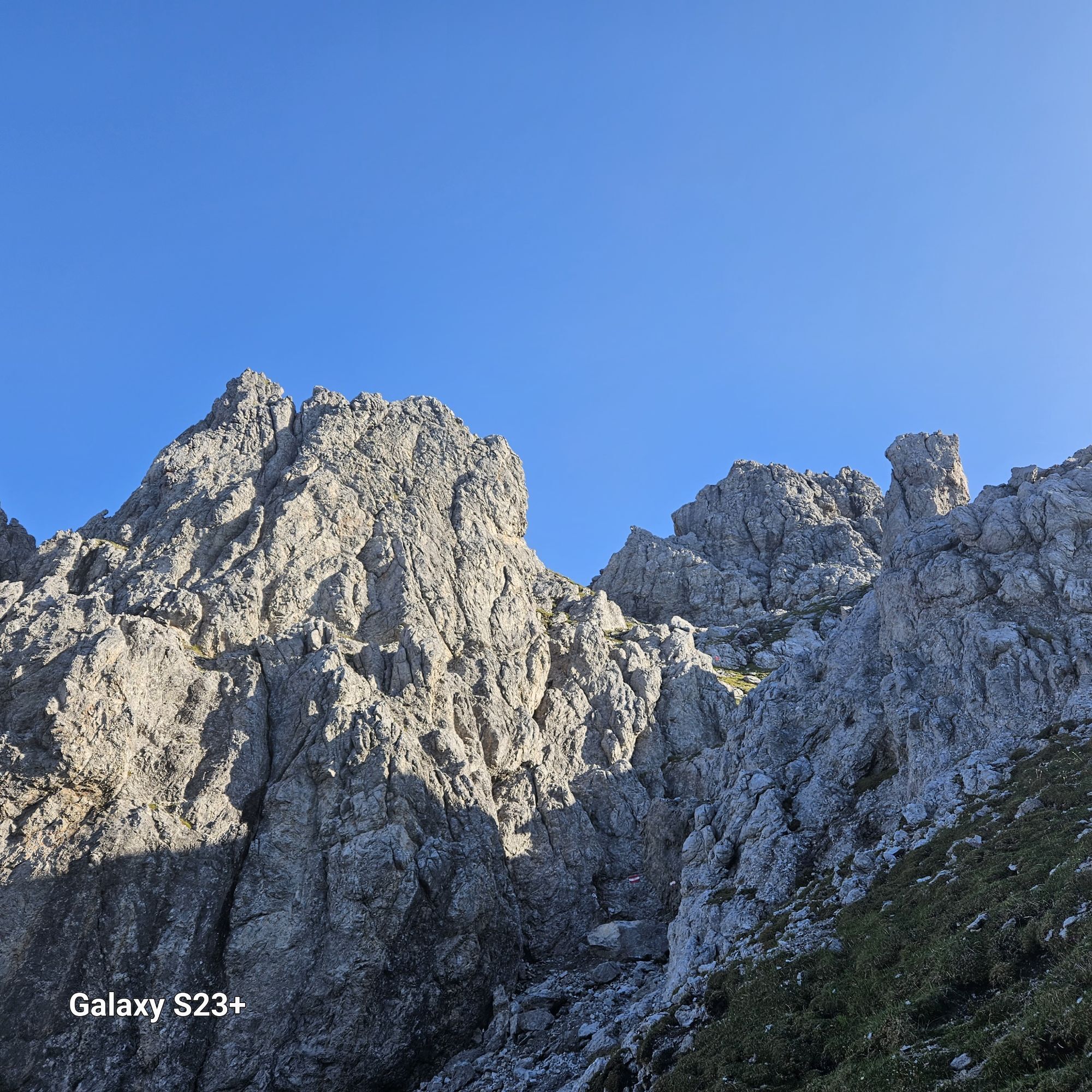
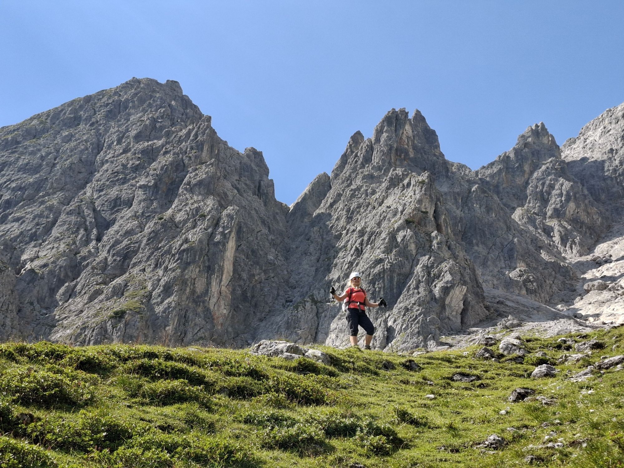
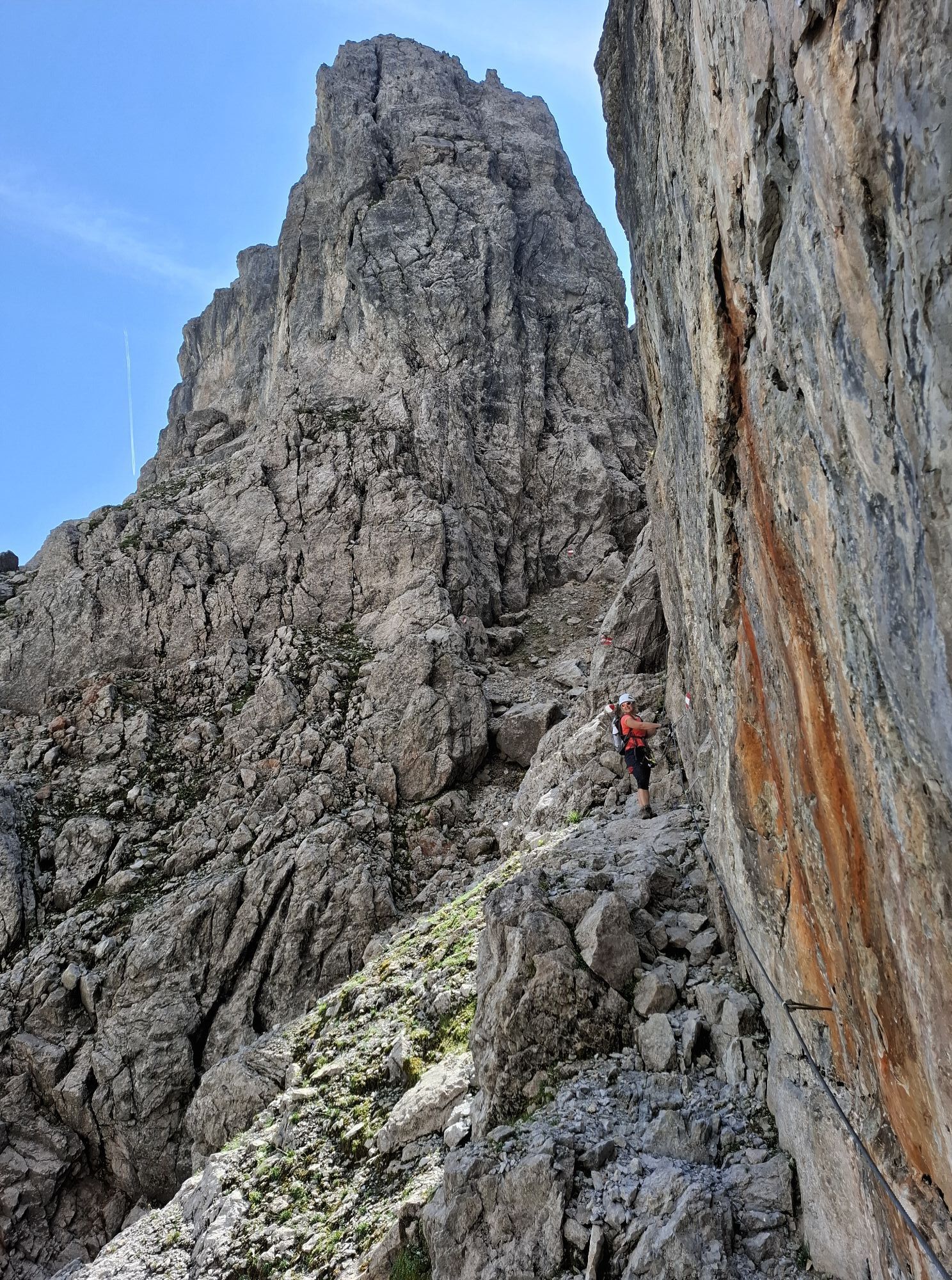
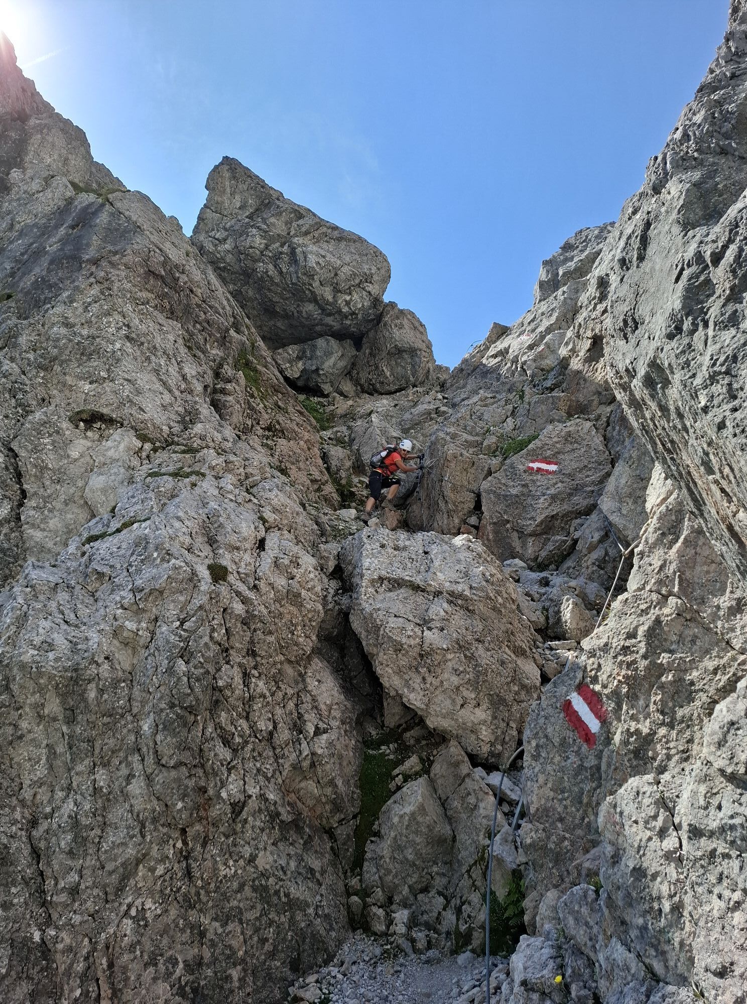
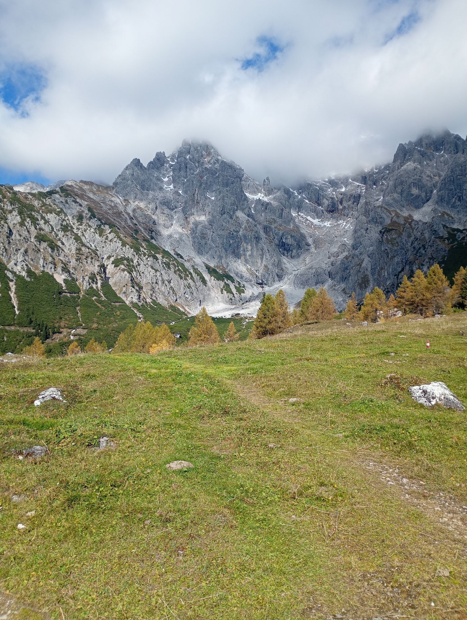
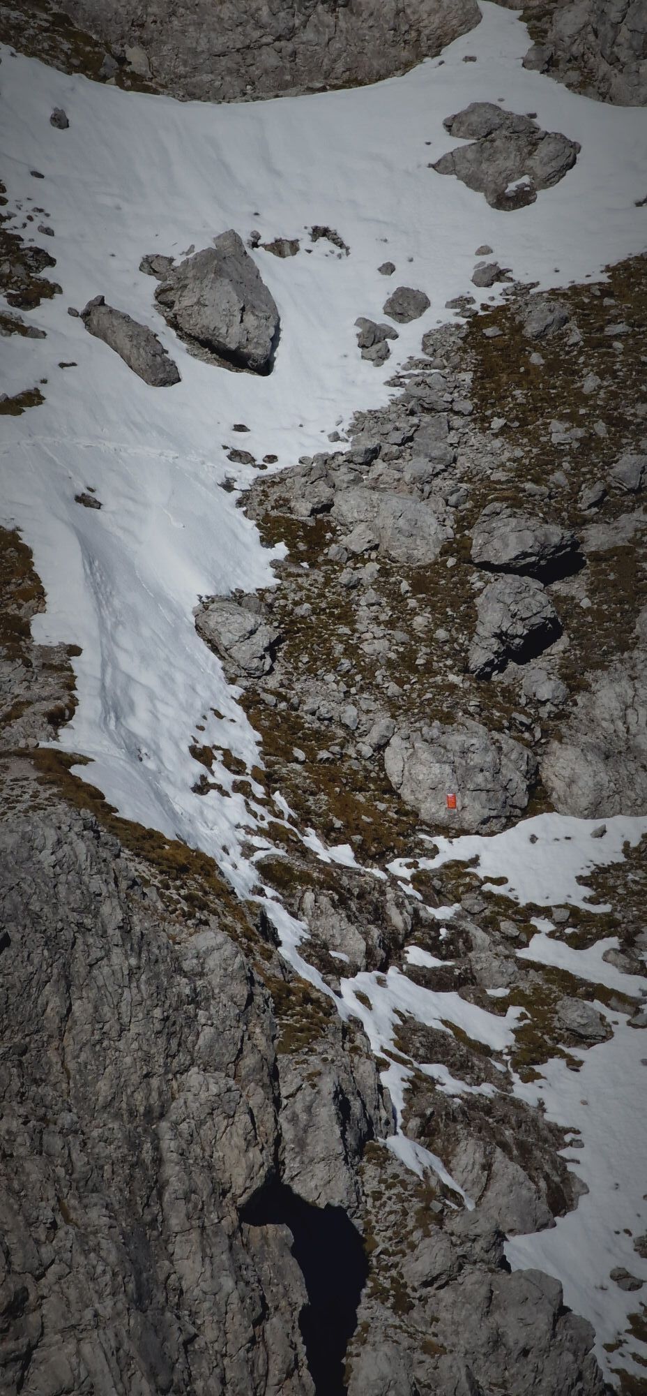
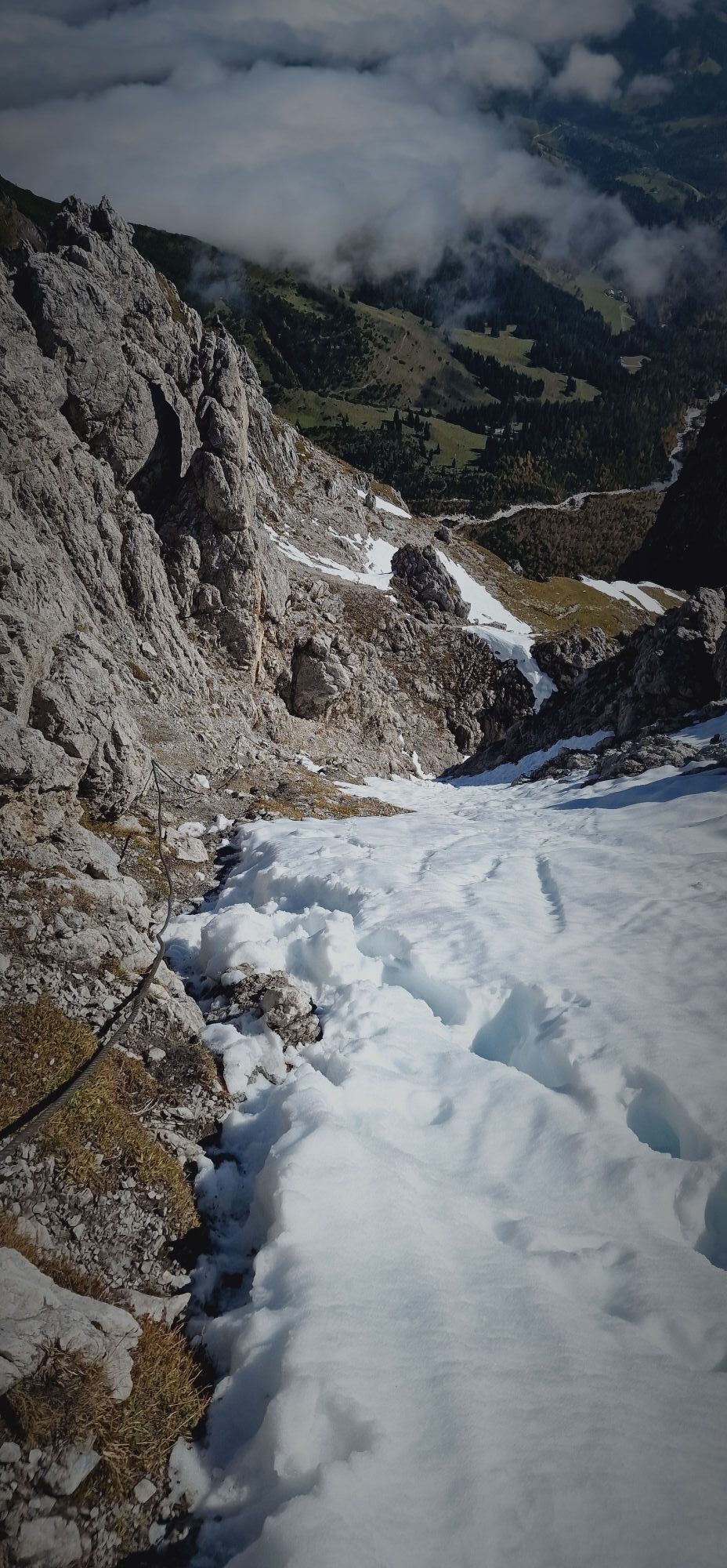
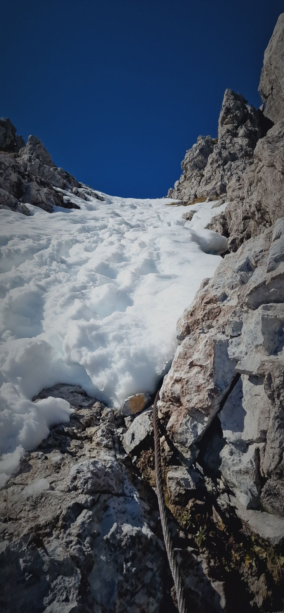
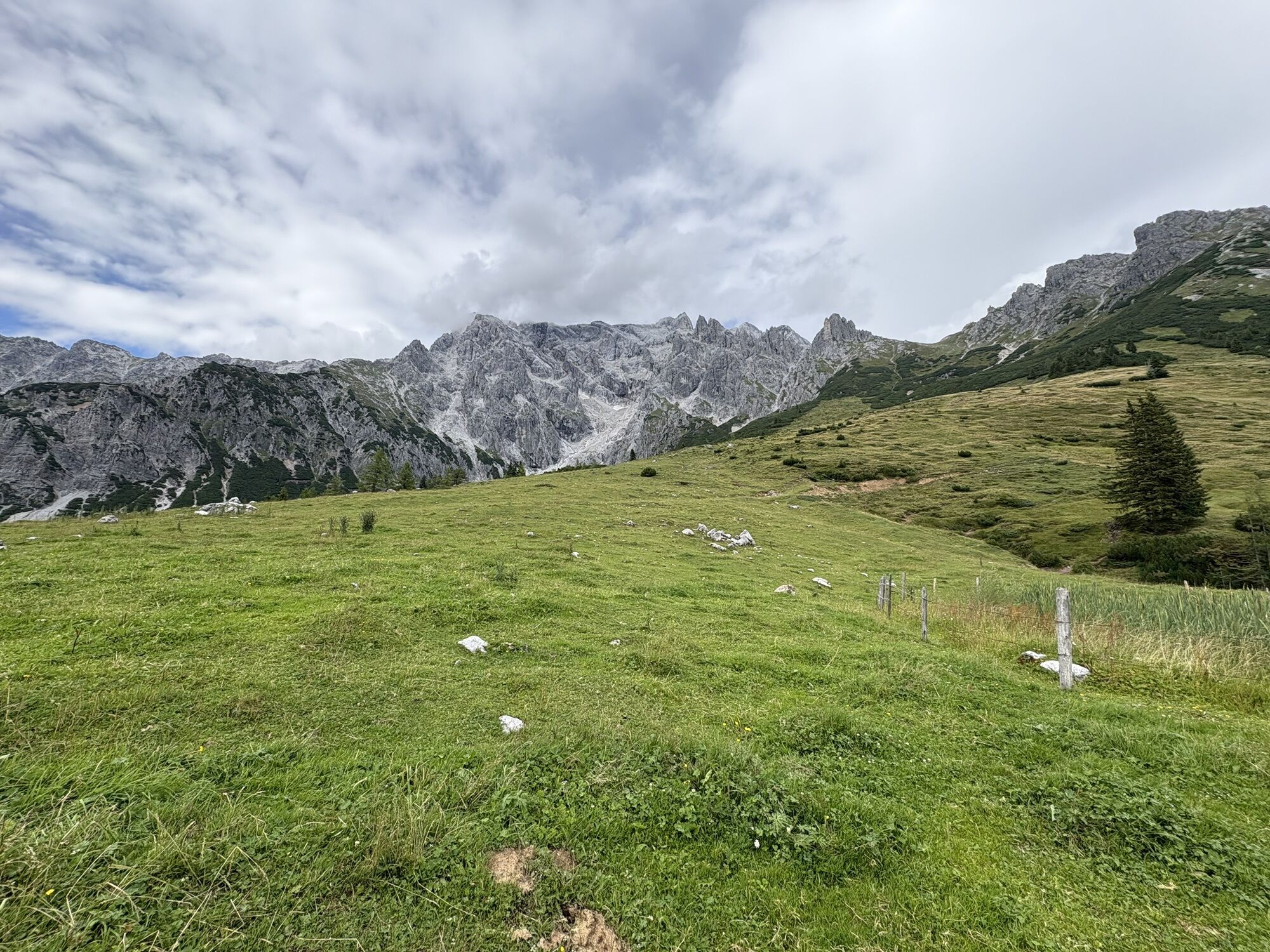
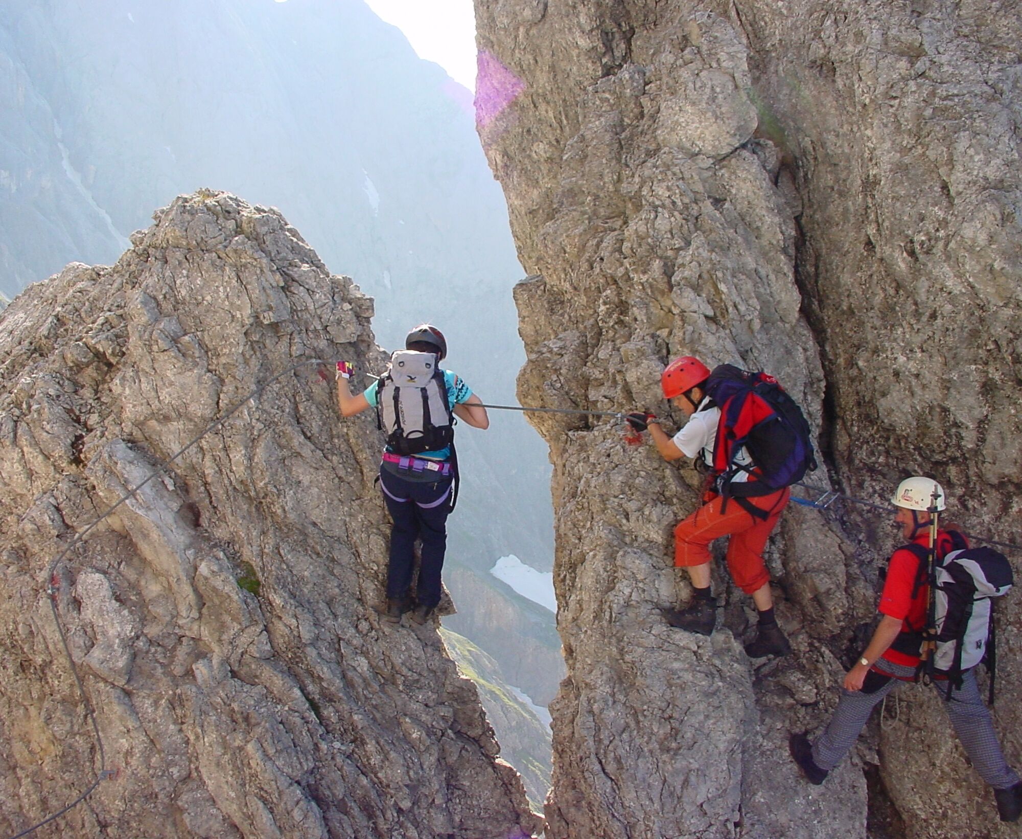
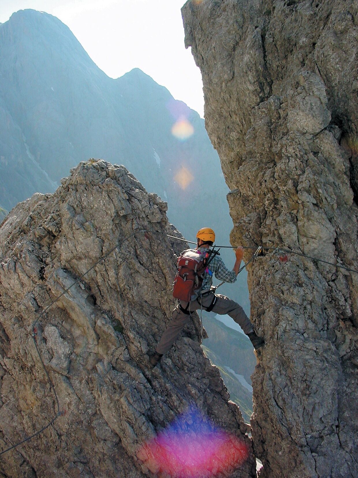
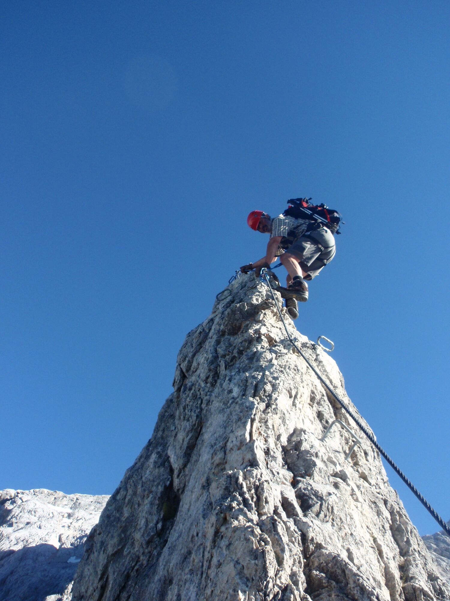
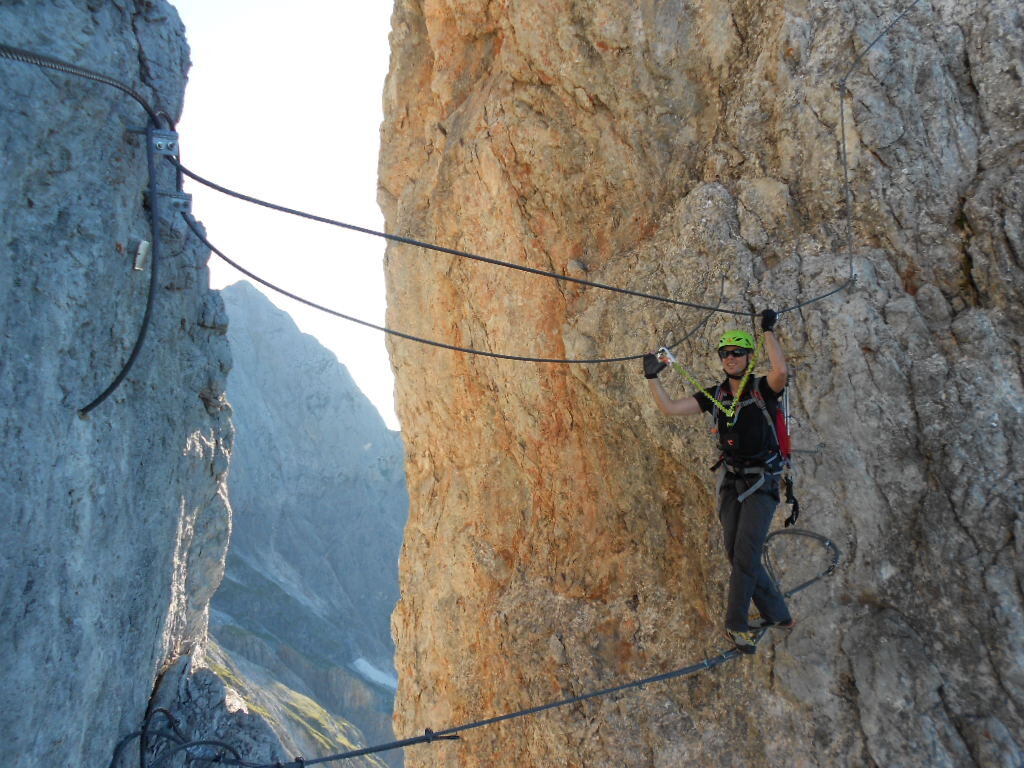
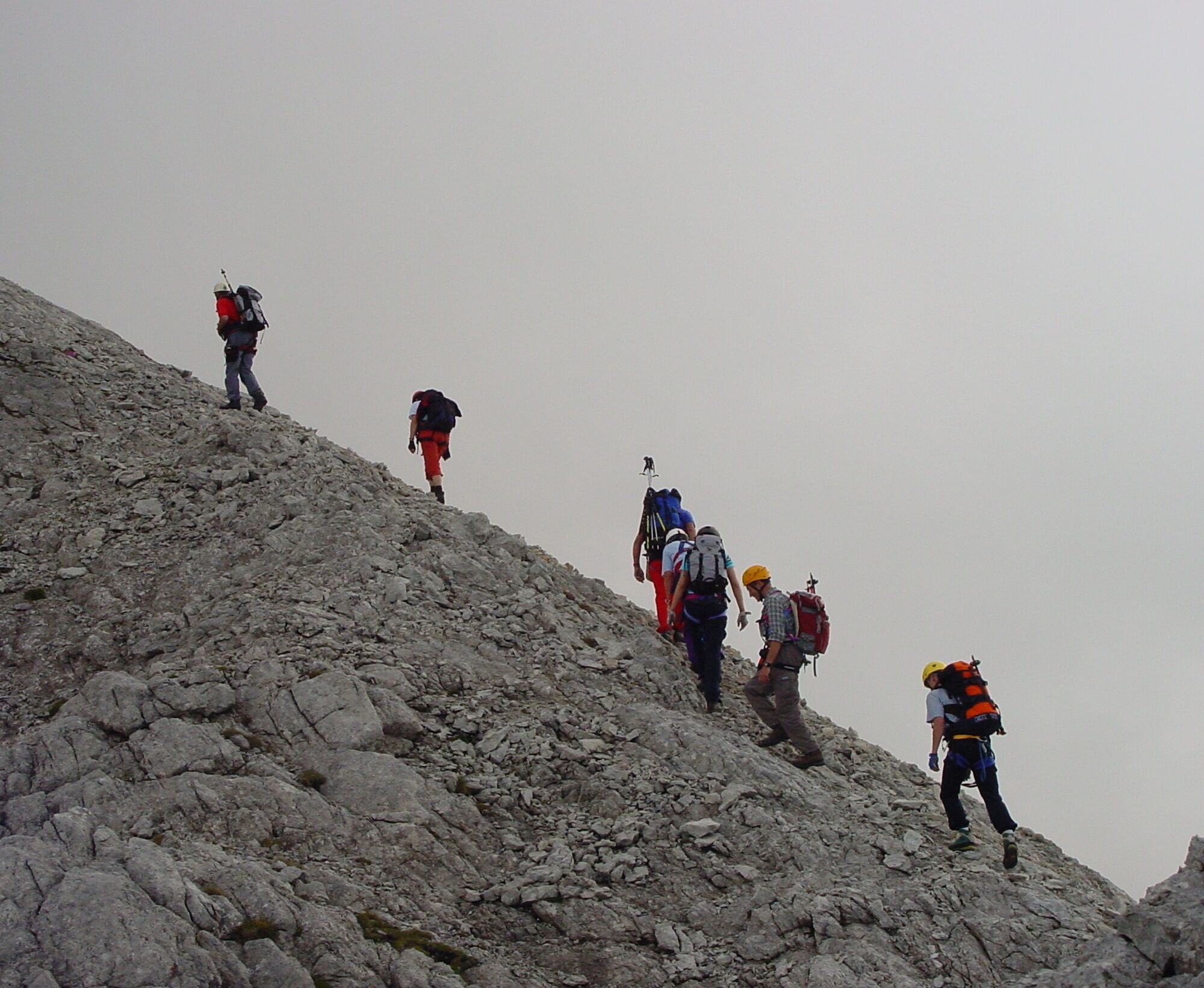
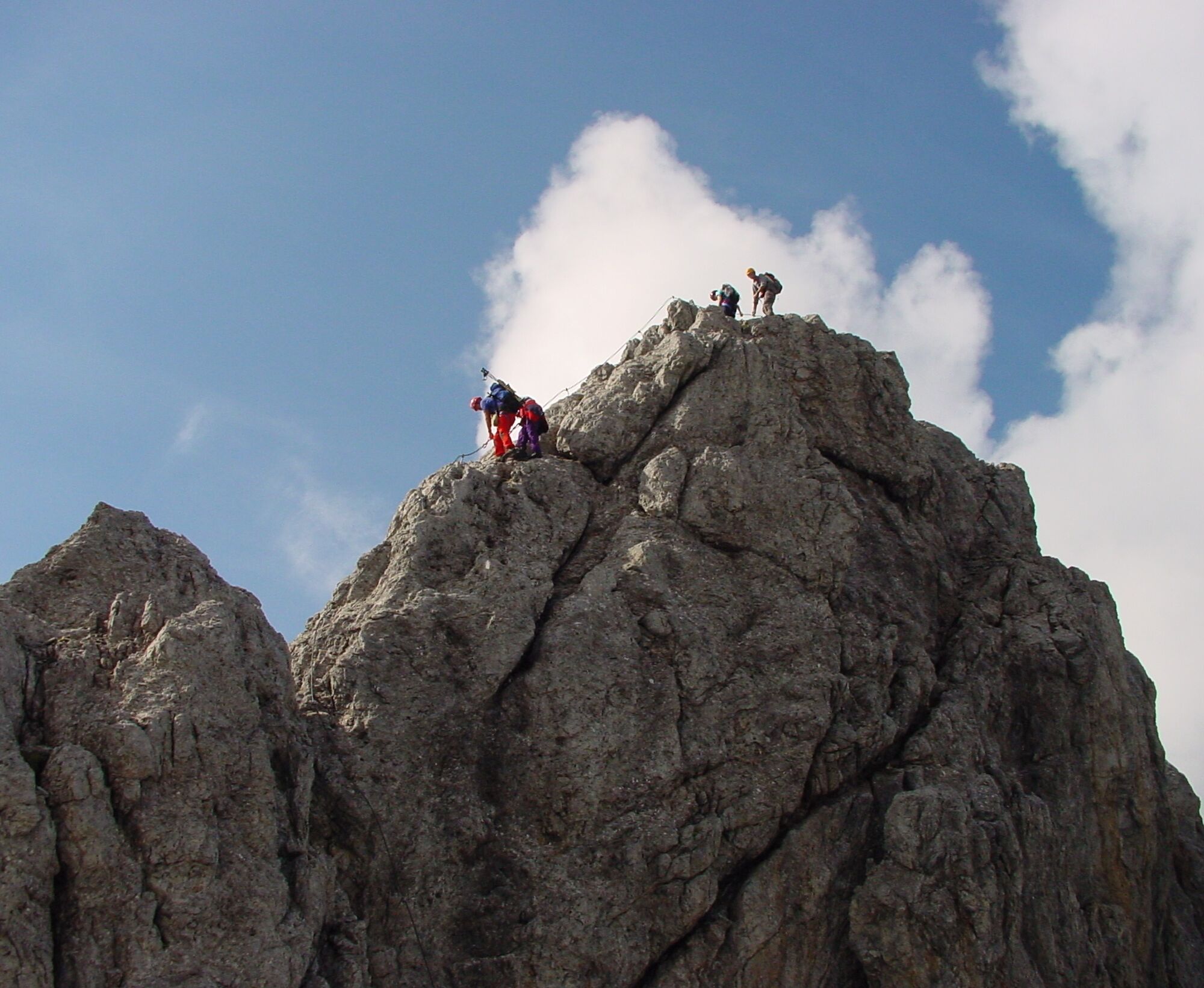
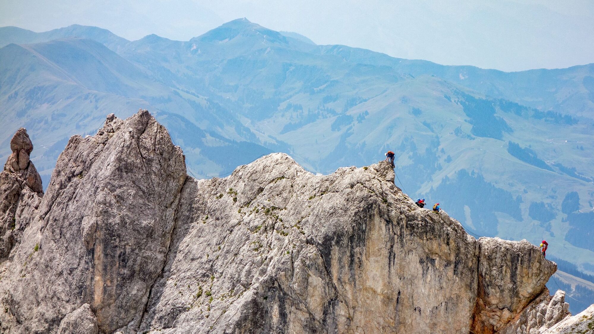
Route - 2.5 to 5 hours After a rather unpleasant difficult start (C/D) a flat gully (B/C) leads to the "Flower Tower". A flat ridge (B) easy to climb leads down to a notch (A/B). Then you climb a beautiful climb up the Mühlbacher Tower (C). Next come the Via Mala Gorge (C/D) and the spread step "Jungfrauensprung" (C). Via the Porti-Sport-Diretissima (max. C) you climb fantastic rock to the Teufelsturm. Then it goes steeply down (max. C) to the airy triple cable bridge "Kranabetter-Steg" (B). On the Lehner Traverse (C) climb down a bit more (C/D). A short unsecured section (1-) follows before a ridge (A/B) is reached again, secured (B/C). Then it goes steeply down into the Sallerriss (C/D). Then steeply (B/C) to the 2522 m high Teufelshörndl. A steep descent (C), then on the airy Brücknergrat (B) to the Dientner Schneid (C). This is perhaps the most spectacular passage on the route. Very airy but never really hard to climb. Then follows the bold Bosch Promenade (B and A). Then descend briefly into a notch (C) and over a rocky ridge (A/B) rather laboriously up to the emergency exit into the Birgkar. Here you will also find a good snack place and a note for further route planning. Continue on stony terrain (1-) to the foot of the Kematstein. The long ascent "Franzl's Fantastica" (max. C/D) and a ridge (A/B) lead to the Kummetstein. This section is the most demanding technically. Clean climbing and less pulling with the arms are the key to success. Descend again about 70 meters over the "Brandner Abfahrt" (short C/D) into a notch. After a traverse steeply to the Matras Head (C/D). Some photogenic spread steps (max. B) still follow. Over the ridge (A/B) interrupted by a short slabby gully (C) the exit at the Hoher Kopf (2875 m) is reached.
Descent:
Variant 1:
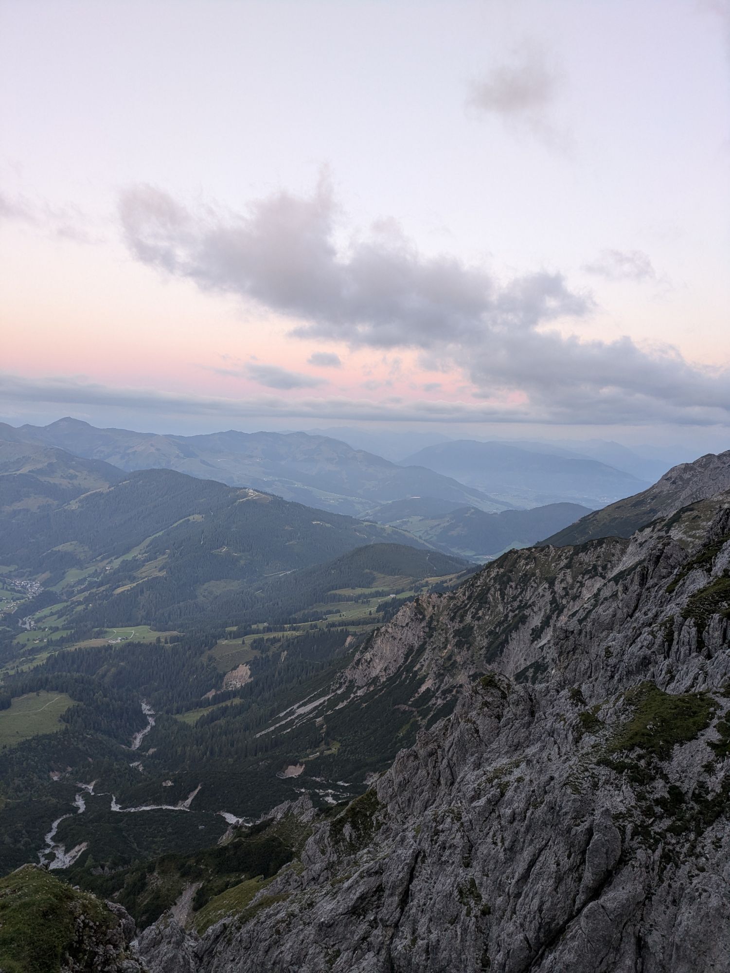
Birgkar - Hochscharte - Erichhütte - parking lot Dientner Sattel 3-5 hours. This descent requires optimal dry conditions and a high level of alpine experience as well as absolute surefootedness on steep stony terrain. Definitely descend along the trail markings. Do not cause unnecessary rockfall by shortcuts in the scree. At the end of the route, it goes briefly steeply but well secured by ropes back to the Hochscharte and from there on the approach path back to the Erichhütte. In wet conditions, old snow patches, fatigue or impending darkness, a descent via the Birgkar is strongly discouraged.
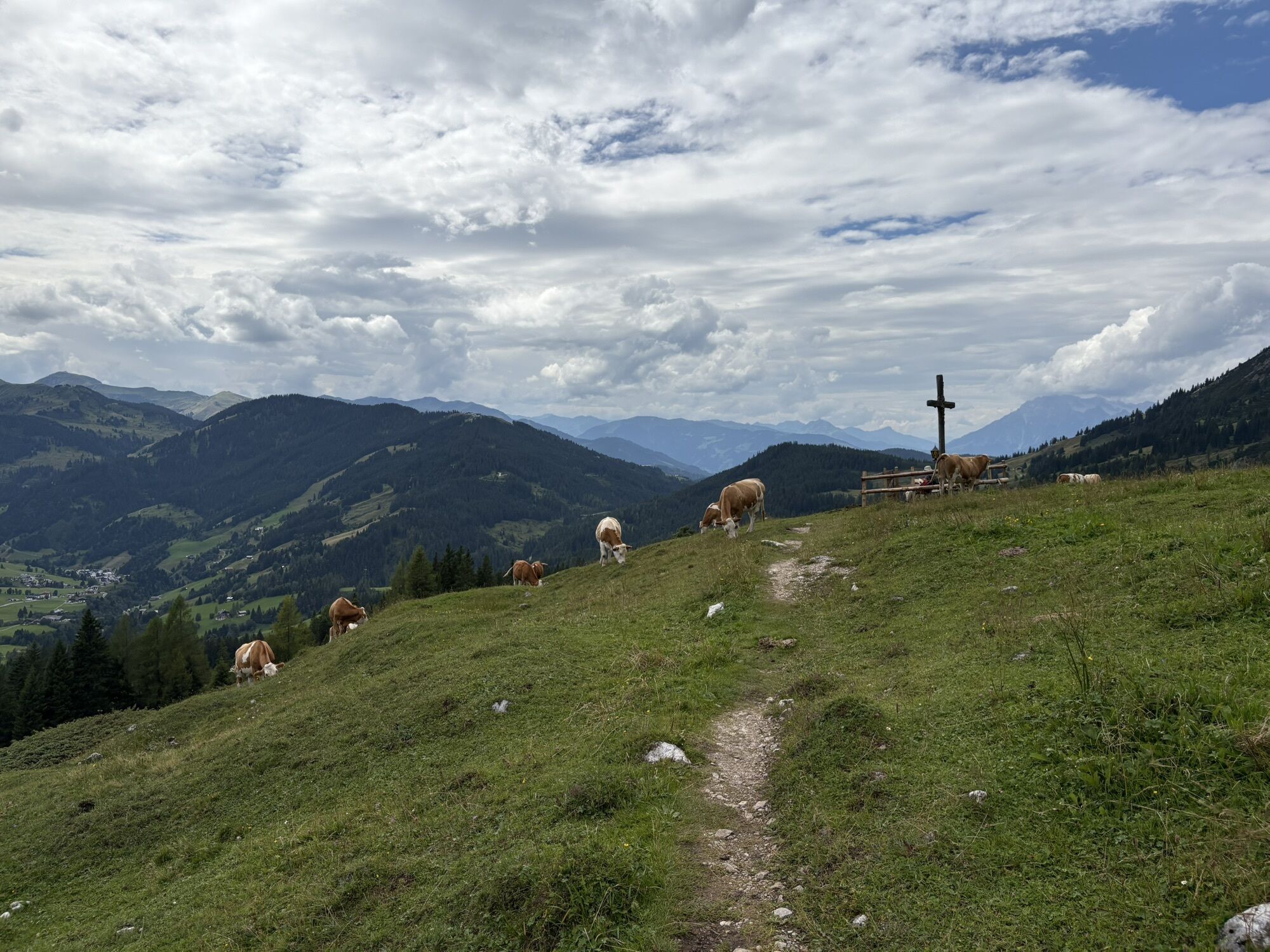
Variant 2: Matrashaus - normal route Mitterfeldalm - Arthurhaus - hiking bus back to the parking lot Dientner Sattel. 3-5 hours.
For fit climbers via the Vierhüttenweg back to the Erichhütte (additional 2 hours).
From the via ferrata exit follow path 401 somewhat tedious with constant up and down to the Matrashaus. Approx. 45 minutes.
From the hut follow the path to the ladders. Climb down over these and follow path 430.
Via the Kniebeisser, past the Torsäule, to the Mitterfeldalm and further to the Arthurhaus.
This descent is technically much easier than the variant over the Birgkar.
Maps:
Alpine Club Map 10/2 Hochkönig-Hagengebirge, 1:25,000, ISBN 3-928777-10-6 BEV ÖK 124 Saalfelden, 1:50,000
Kompass WK 15 Tennengebirge-Hochkönig, 1:50,000, ISBN 3-85491-018-5 Freytag & Berndt WK 103 Pongau - Hochkönig - Saalfelden, 1:50,000
Webinfo:
www.bergsteigen.com www.alpenvereinaktiv.com
Note:
From the Erichhütte there is no possibility to refill water along the entire ascent! The start should be reached at the latest after 2.5 hours.
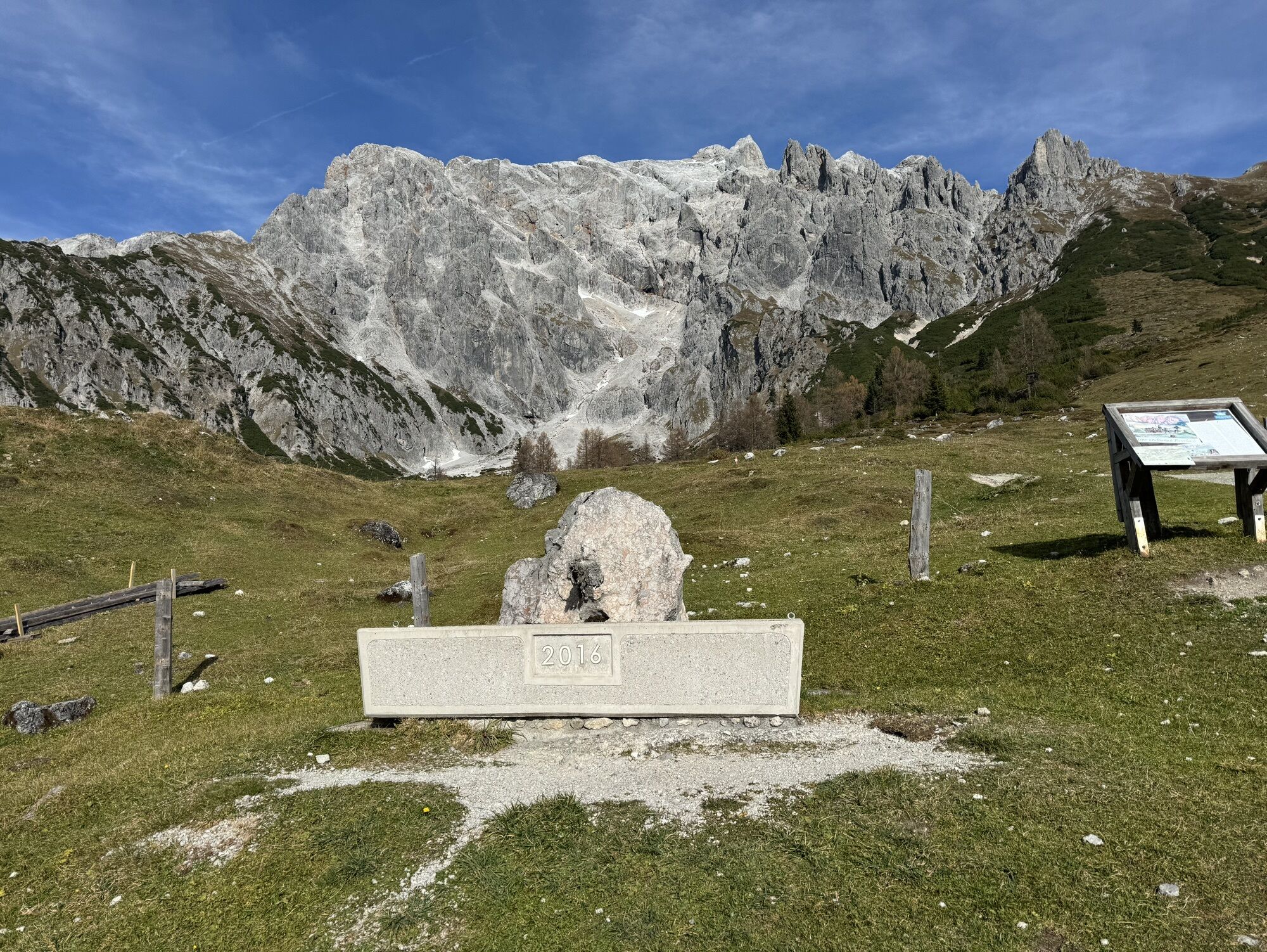
Below the Kematstein is the emergency exit. The route back is easy to walk and well marked.
Although the via ferrata only has a few sections of difficulty "D", it is overall very demanding and especially very physically challenging.
Fast climbing and especially good climbing technique are important.
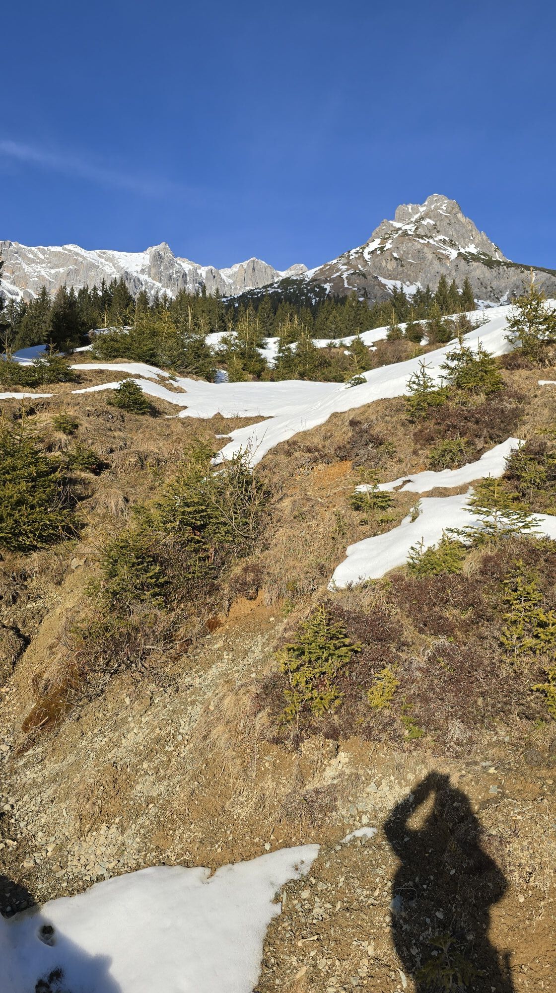
When planning pay attention to thunderstorms and the huge altitude difference and temperature difference! Start height parking lot 1300 m - Matrashaus 2951 m
© Markus Hirnböck
Áno
Complete via ferrata equipment
Helmet
Via ferrata gloves
Sunglasses
Mountaineering boots
Food
Sunscreen
Warm clothing
Rain protection
Arrival from Salzburg: On the A10 motorway to Bischofshofen exit, then on the B311 towards Bischofshofen. Follow the Hochkönig federal road/B164 to Mühlbach and then to Dienten.
Arrival from Innsbruck/Kufstein: On the Lofer road/B178 towards St. Johann i.T., then over the Hochkönig federal road/B164 via Saalfelden and Maria Alm to Dienten or to Filzensattel, continuing towards Mühlbach.
For use of the Austrian motorway and expressway network, a valid vignette is required. Also mandatory to carry first aid kit, warning triangle and safety vest. More info at Asfinag.
Free parking at the Erichhütte parking lot
C/D
Infos Königsjodler & Weather
Youtube Video - Königsjodler Hochkönig
http://www.foto-webcam.eu/webcam/hochkoenig/ - Hochkönig Webcam
Accommodation:
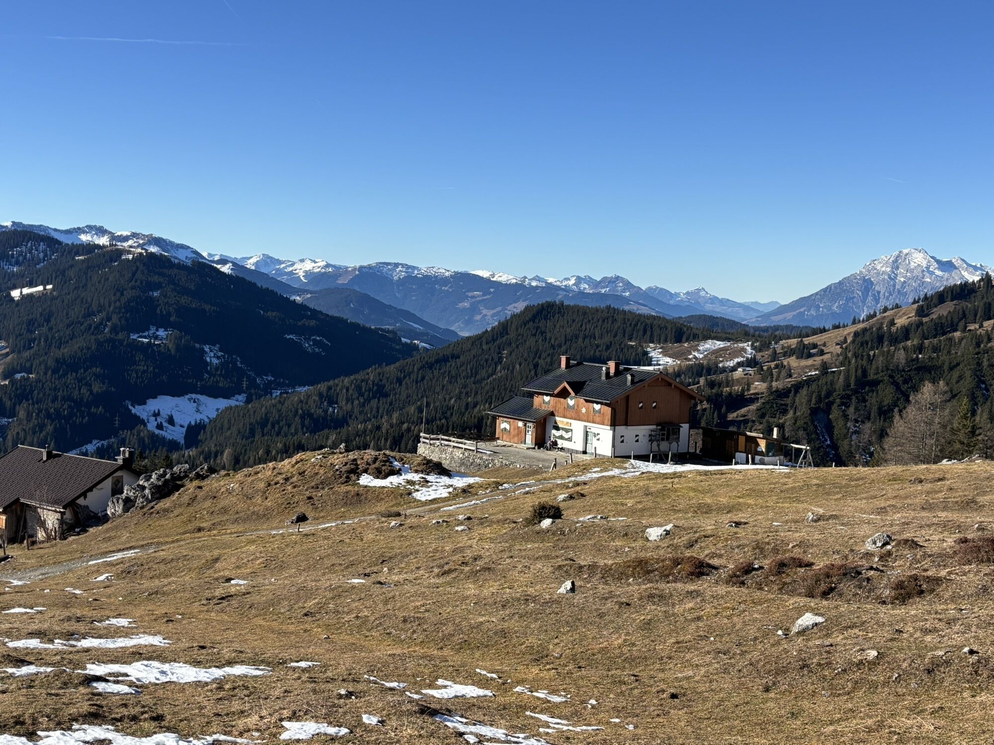
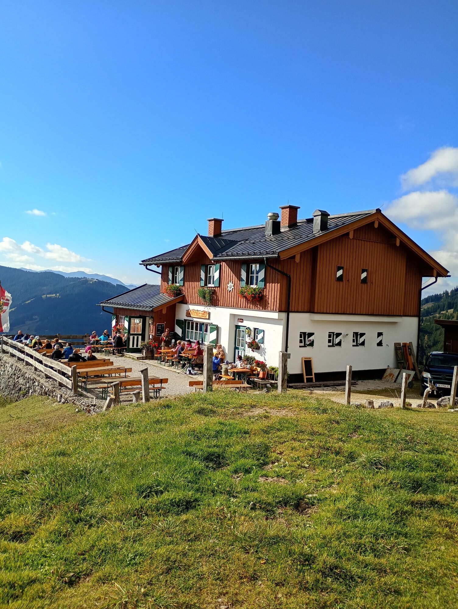
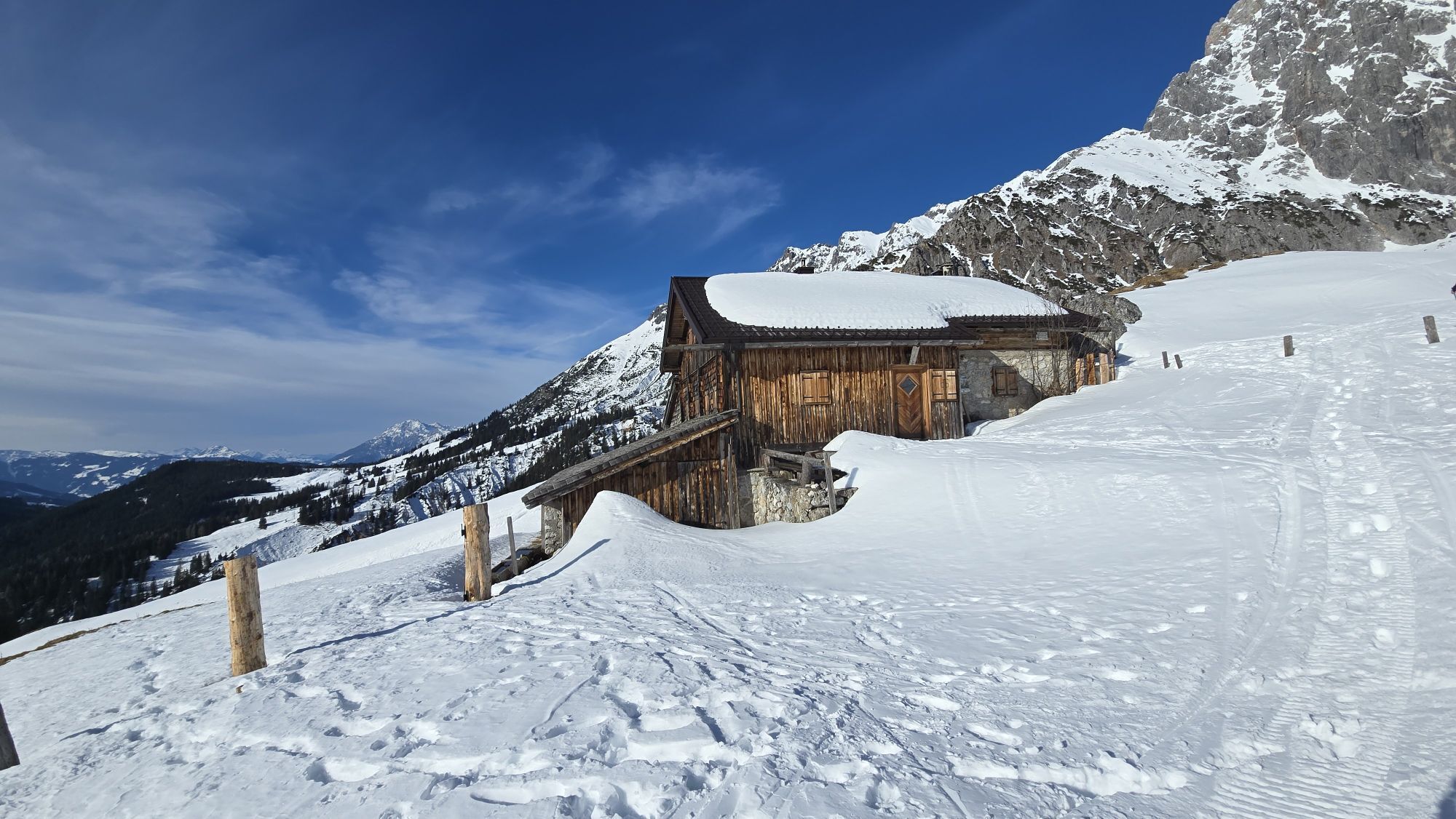
Overnight stays are possible at the Matrashaus (shelter hut). Reservation is requested.
Book accommodation in the village of Dienten
Further information on hiking and activities in the Hochkönig region:
For detailed information on hiking maps, opening times of mountain lifts as well as huts and alpine pastures in summer, we recommend visiting the local service center. There you will not only get hiking maps but also valuable tips on the best hiking routes and current conditions.
Opening times of the mountain lifts in summer: The mountain lifts offer different opening hours during the summer months that may vary depending on weather and season. Please check current operating times in advance.
Opening times of huts & alpine pastures in summer: The huts and alpine pastures in the region are ideal rest stops for hikers. Opening hours may also vary depending on season and weekday. Let the friendly hosts advise you on local offers and specialties.
For more information please visit our website: www.hochkoenig.at.
If you have any questions or you want to receive specific information, feel free to contact us:
Email: region@hochkoenig.at
Phone: +43 (0)6584 20388
We look forward to helping you and wish you lots of fun exploring the beautiful hiking region Hochkönig!
Here are the latest images from Hochkönig with a view of the Königsjodler: WEBCAM
Webové kamery z prehliadky
-
Mühlbach am Hochkönig
-
Maria Alm - Hochmaisbahn
-
Bürglalmlift - Dienten
-
Bergstation Kings Cab
-
Matrashaus am Hochkönig
-
Grünegg Alm & Edelbrennerei
-
Dienten - Übergossene Alm Resort
-
Dienten - Almsee
-
Dienten - Übergossene Alm Resort
-
Dienten, Bürglalmabfahrt
-
Bergstation Kings Cab
-
Bergstation Kings Cab
-
Bergstation Kings Cab
-
Bergstation Kings Cab
-
Bergstation Kings Cab
-
Bergstation Kings Cab
-
Bergstation Kings Cab
-
Bürglalmbahn Abfahrt
-
Hochkönigblick


Obľúbené výlety v okolí
-
4,8
Summit stormer route Lauskopf
ťažkéTuristika 8,16 km -
4,2
Maria Alm - Riemannhaus
Turistika 3,99 km -
4,8
Summit storming route Taghaube
ťažkéTuristika 6,25 km -
4,7
About the "Four Huts circular route" to Windraucheggalm
strednáTuristika 10,1 km -
4,7
Panorama hike to the Hochkeil
strednáTuristika 6,07 km -
3,6
Wanderung zur Ostpreußenhütte in Werfen (1.630 m)
strednáTuristika 11,2 km -
4,6
Steinalm
svetloTuristika 2,71 km -
4,8
Hochkönig - Gipfel der Gefühle - Matrashaus
ťažkéTuristika 20,9 km -
4,4
Alpine and hut hike "Hochmaisalm & Steinbockalm"
strednáTuristika 8,10 km -
4,6
Königsjodler Klettersteig (C/D) Hochkönig
ťažkéVia ferrata 25,8 km

Turistika a stopovanie


Nenechajte si ujsť ponuky a inšpiráciu na ďalšiu dovolenku
Vaša e-mailová adresa bol pridaný do poštového zoznamu.