


(E-)Bike route to the Marbachalms (12)
Úroveň náročnosti: 3


Fotografie našich používateľov
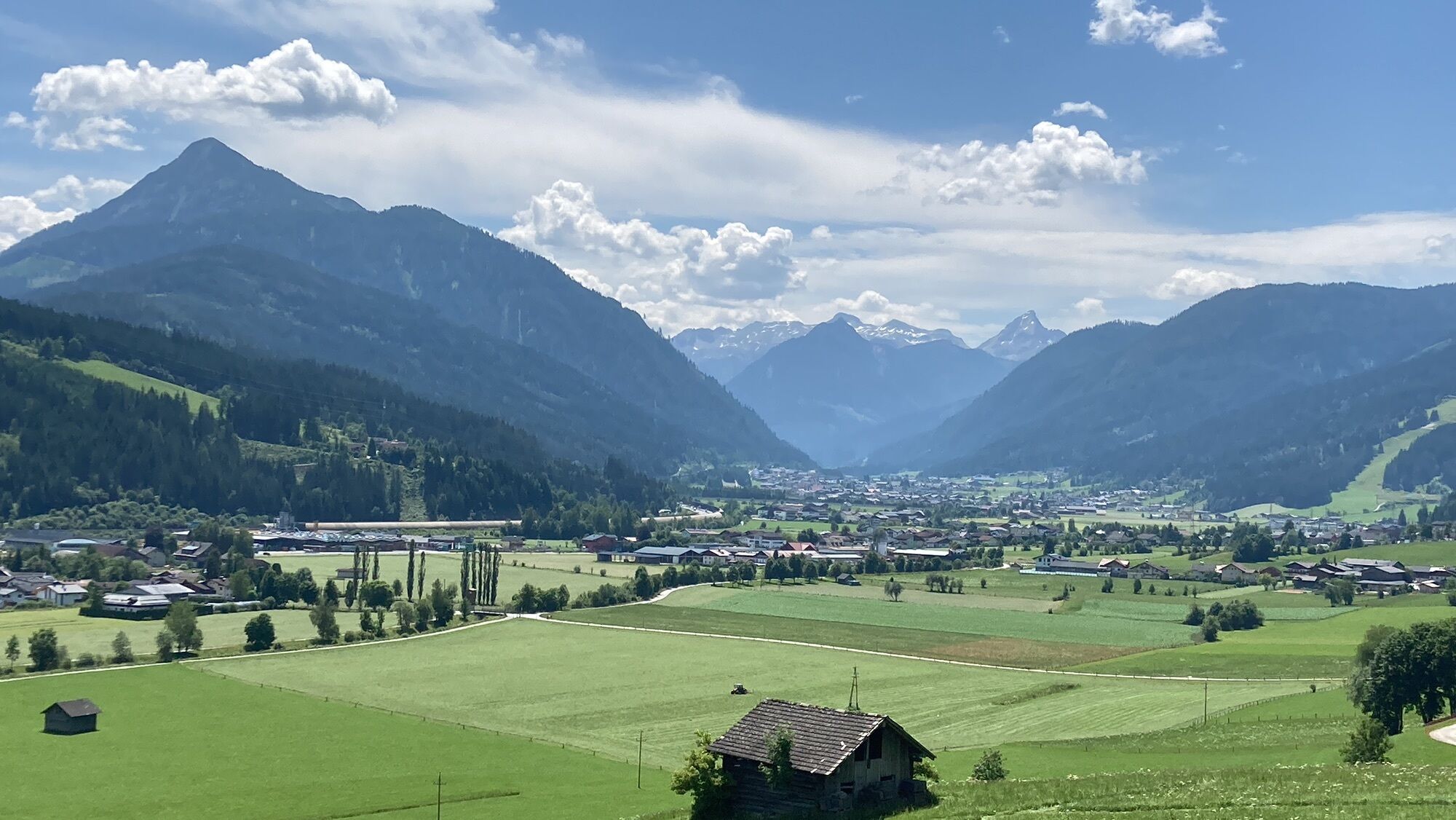
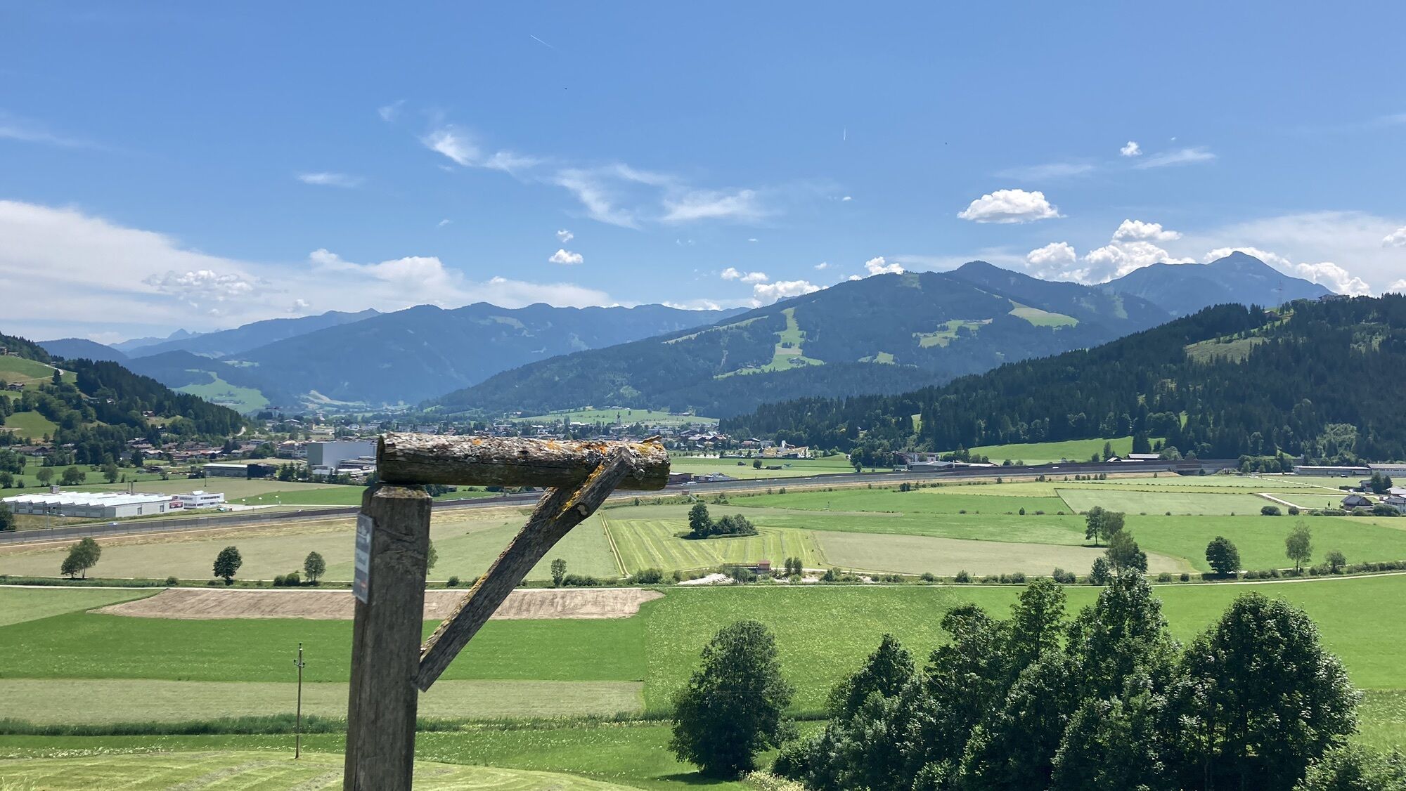
Along the picturesque Marbach in a beautiful alpine pasture area lie the Marbachalms in the valley end of Flachauwinkl. The steep rocks of the Radstadt Tauern, at whose foot the Marbach valley lies, form...
Along the picturesque Marbach in a beautiful alpine pasture area lie the Marbachalms in the valley end of Flachauwinkl. The steep rocks of the Radstadt Tauern, at whose foot the Marbach valley lies, form a magnificent backdrop. Along the route you will find several rustic, serviced huts: Prechtlhütte, Ennslehenhütte, Anichhofhütte.

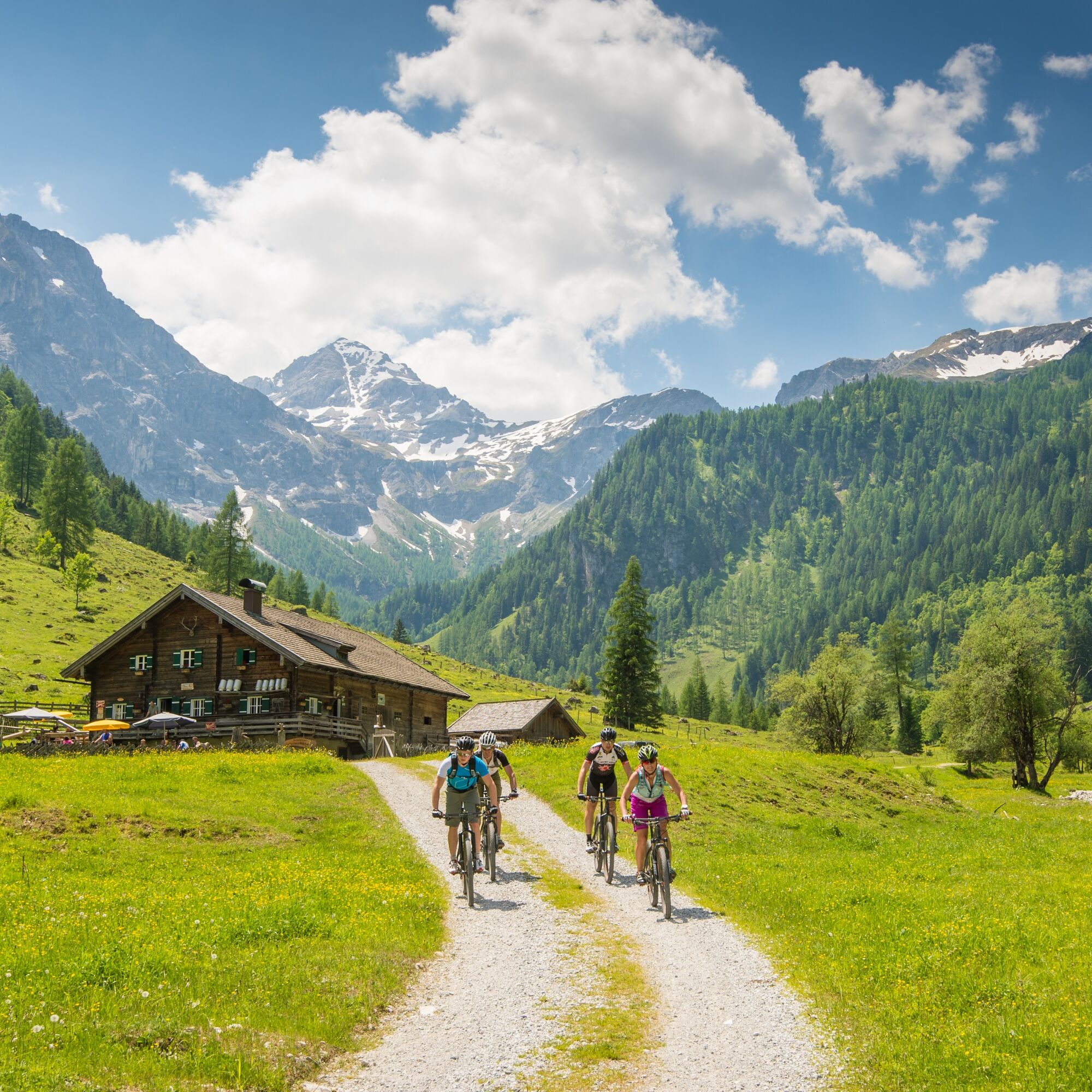
Start at the Altenmarkt-Zauchensee Tourist Office. Continue on the Enns bike path towards Flachau up to the Flachauwinkl valley end. At km 3.5 pass by the Flachauwinkl bathing lake and also at km 6 by the valley station of the Flachauwinkl/Zauchensee ski lift. At km 10 turn right towards the Marbachalms (start of gravel road / barrier), a magnificent alpine valley at the foot of the striking Faulkogel. Several dining options along the Marbach valley. Return on the same route to Altenmarkt-Zauchensee.
Áno
Áno
E-Bike, helmet
Tauern motorway A 10, exit Altenmarkt (EXIT 63), exit Altenmarkt West, along Oberndorfer Straße, at the intersection (BP gas station) turn left onto the federal road (B 163), after 250 m turn right to the parking lot opposite the Altenmarkt-Zauchensee Tourist Office
With the Guest Mobility Ticket you can use all public transport free of charge from your arrival in SalzburgerLand.
Parking lot opposite the Altenmarkt-Zauchensee Tourist Office
3
Altenmarkt-Zauchensee Tourist Office
Sportplatzstraße 6
A-5541 Altenmarkt-Zauchensee
Tel: +43 6452 5511
E-Mail: info@altenmarkt-zauchensee.at
www.altenmarkt-zauchensee.at
www.facebook.com/altenmarkt-zauchensee
Webové kamery z prehliadky
-
Bergstation achterjet
-
Gamskogelhütte
-
Radstadt - Simonyhof
-
Altenmarkt - Sinnhubbauer
-
Altenmarkt - Schartner
-
Absolut Shuttle Bergstation
-
Kemahdhöhe
-
Chill House / Jib Park
-
Bergstation Bubble Shuttle - Powder Shuttle
-
Reitlehenalm
-
Zauchensee
-
Kemahdhöhe
-
Kemahdhöhe
-
Kemahdhöhe
-
Kemahdhöhe
-
Zauchensee
-
Altenmarkt-Zauchensee
-
Lumberjack Shuttle
-
Radstadt
-
Zauchensee - Rosskopf
-
SUN HOUSE Flachauwinkl/Mittelstation
-
Ferienbauernhof Habersattgut
-
Snow Space Salzburg - Flying Mozart
Obľúbené výlety v okolí
-
4,1
Reiteralm Höhen-Rundweg
strednáTuristika 5,50 km -
4,8
Reiteralmrunde
svetloTuristika 5,71 km -
4,5
Mosermandl Windischscharte, Salzburger Land/Österreich
ťažkéTuristika 14,6 km -
4,2
Ennskraxn (2410m)
ťažkéTuristika 14,7 km -
4,3
Glöcknerin
ťažkéTuristika 5,60 km -
5,0
Rundwanderweg von der Fallhausalm und Vögeialm übers Klamml zur Oberhütte am See
strednáTuristika 10 km -
4,7
Ski route Lackenkogel
strednáSkitour 7,82 km -
4,1
Großarl: Unterwandalm - Karseggalm - Breitenebenalm
strednáTuristika 5,93 km -
5,0
Forstau - Rippetegg / Reiteralm
strednáTuristika 13,9 km -
4,4
Ski tour Liebeseck
ťažkéSkitour 14,1 km
Turistika a stopovanie


Nenechajte si ujsť ponuky a inšpiráciu na ďalšiu dovolenku
Vaša e-mailová adresa bol pridaný do poštového zoznamu.