


St. Koloman: Taugler dialect cross route - (4 points)
The Taugler dialect cross route was established in 2011 by the parish and the municipality of St. Koloman.
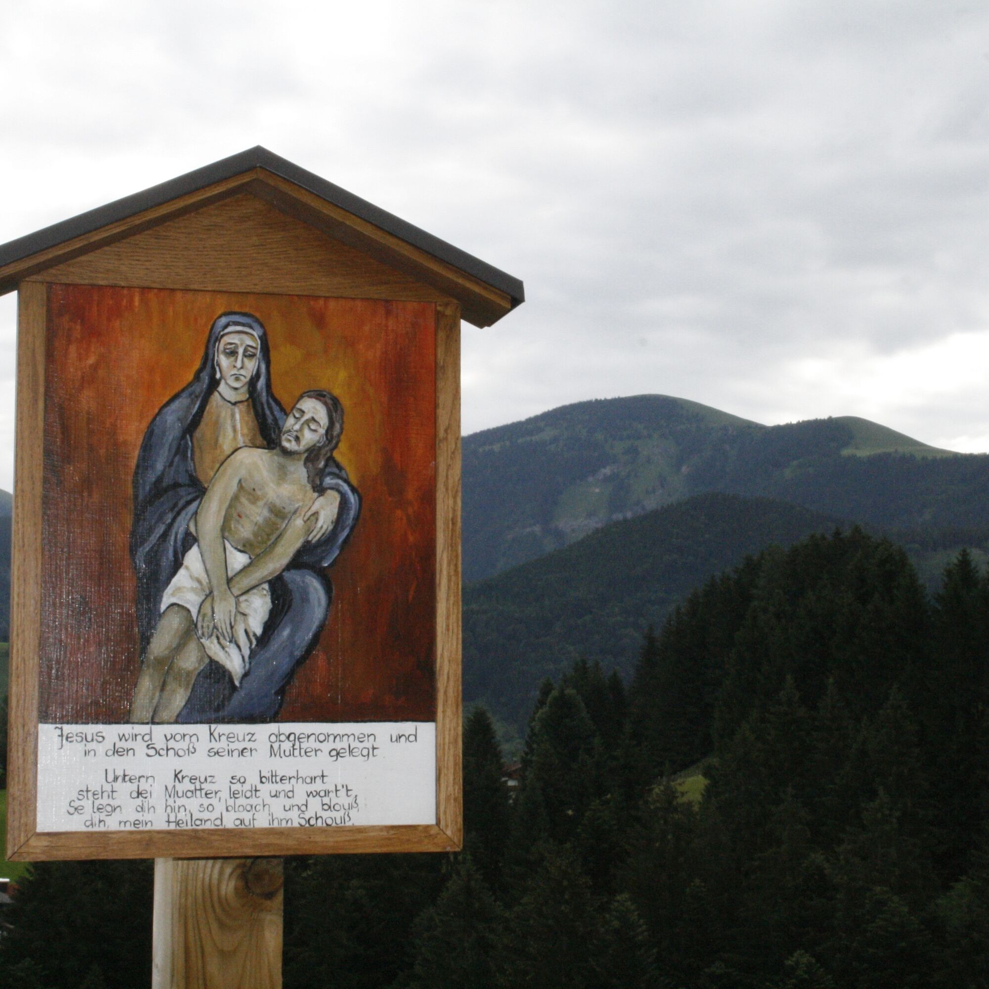
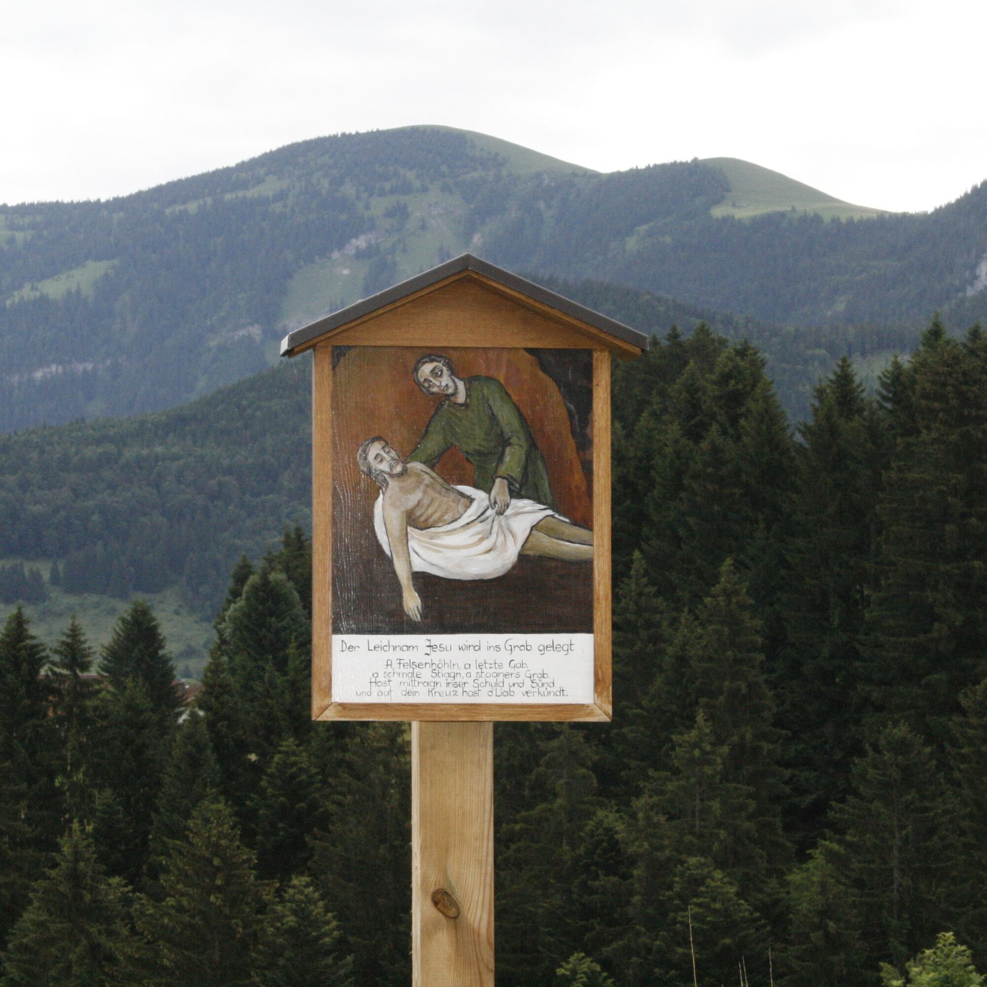
The individual stations, which lead through the charming landscape of St. Koloman with many chapels,...
The Taugler dialect cross route was established in 2011 by the parish and the municipality of St. Koloman.
The individual stations, which lead through the charming landscape of St. Koloman with many chapels, were painted by Ms. Edith Moser and designed with existing dialect texts by Prof. August Rettenbacher.
Detailed information can be found in a dedicated folder and on the overview board on the wall of the parish church in the sacristy area.
The folder for the dialect cross route is also available for download on the tourism association St. Koloman website.


The last part, from Station 11 and Station 12 to the Kirchbühel rest area is steeper; good footwear is recommended here.
The stamp station is located at the Branterer Mill. This is just a short distance from the edge of the village towards Wegscheid on the left side.
If you don't like walking steep downhill (it's only a short section behind the Raiffeisenbank), it is recommended at Station 11 to take the path back to the state road and thus return to the starting point.
Áno
Good footwear, sun or rain protection, possibly hiking poles, water bottle
However, from the Kirchbühel rest area down to the village square it can be icy or slippery in places.
Via Bad Vigaun or via Golling to St. Koloman
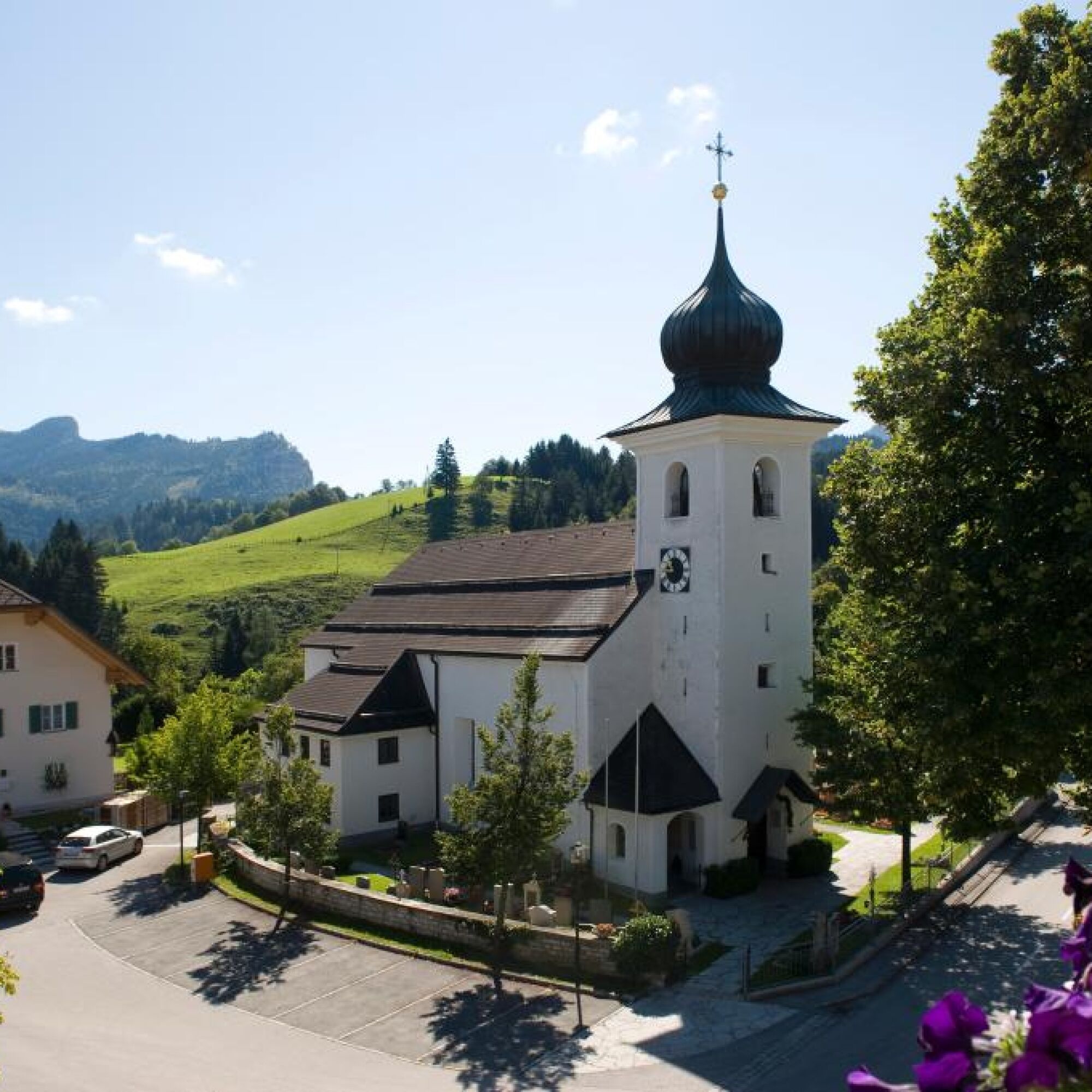
At the village square St. Koloman
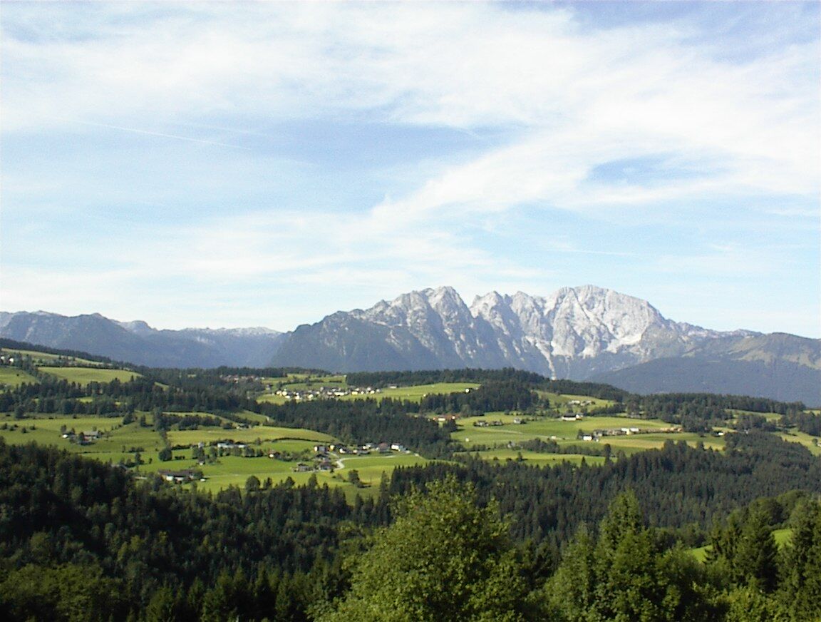
Especially the Kirchbühel rest area, where a huge oak tree once stood (a strong storm brought it down in 2018...), invites you to rest on a viewpoint bench with a dreamlike panoramic view of the Osterhorn group.
After the hike, you can visit the Tauglerei (former church inn) at the village square for refreshments.
Obľúbené výlety v okolí
-
4,7
Schwarzer Berg / Golling
strednáTuristika 2,54 km -
4,6
Kneifelspitze
Turistika 2,53 km -
3,8
Durch die Almbachklamm nach Ettenberg
Turistika 7,54 km -
4,9
Hoher Göll über Mannlsteig
strednáTuristika 16 km -
4,8
Almbachklamm zum Gasthof Dürrlehen
strednáTuristika 8,94 km -
4,8
Gennerhorn über Lämmerbach
strednáTuristika 10,2 km -
4,1
Illinger Alm-Runde
strednáTuristika 9,89 km -
4,7
Mühlenweg und Winnerfall Scheffau am Tennengebirge
strednáTuristika 4,79 km -
4,2
Idyllic Hintersee Rund
svetloTuristika 5,10 km -
4,8
Great and Small Barmstein, the landmarks of Hallein
ťažkéTuristika 6,58 km
Turistika a stopovanie


Nenechajte si ujsť ponuky a inšpiráciu na ďalšiu dovolenku
Vaša e-mailová adresa bol pridaný do poštového zoznamu.