


From Keflau via the Schafbachalm to the Faistenauer Schafberg
Fotografie našich používateľov
-
 © Irmi LechnerVytvorené dňa 26.12.2025
 -
 © Irmi LechnerVytvorené dňa 26.12.2025
 -

 © KurtVytvorené dňa 24.08.2025
 -
 © W.Walter WoerndlVytvorené dňa 11.05.2025
 -
 © Nina WolfVytvorené dňa 01.05.2025
 -
 © Nina WolfVytvorené dňa 01.05.2025
 -
 © Lehel AntalVytvorené dňa 22.02.2025
 -
 © Lehel AntalVytvorené dňa 22.02.2025
 -
 © Lehel AntalVytvorené dňa 22.02.2025
 -

 © Ernest LindenthalerVytvorené dňa 02.12.2024
 -
 © Ernest LindenthalerVytvorené dňa 02.12.2024
 -
 © Ernest LindenthalerVytvorené dňa 02.12.2024
 -
 © StefanVytvorené dňa 21.08.2021
 -
 © StefanVytvorené dňa 21.08.2021
 -
 © StefanVytvorené dňa 21.08.2021

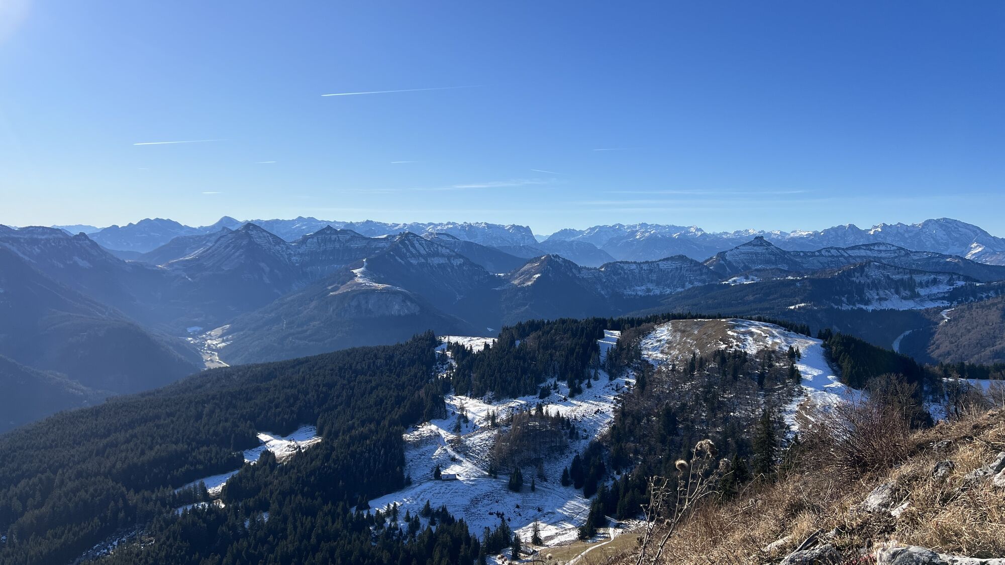

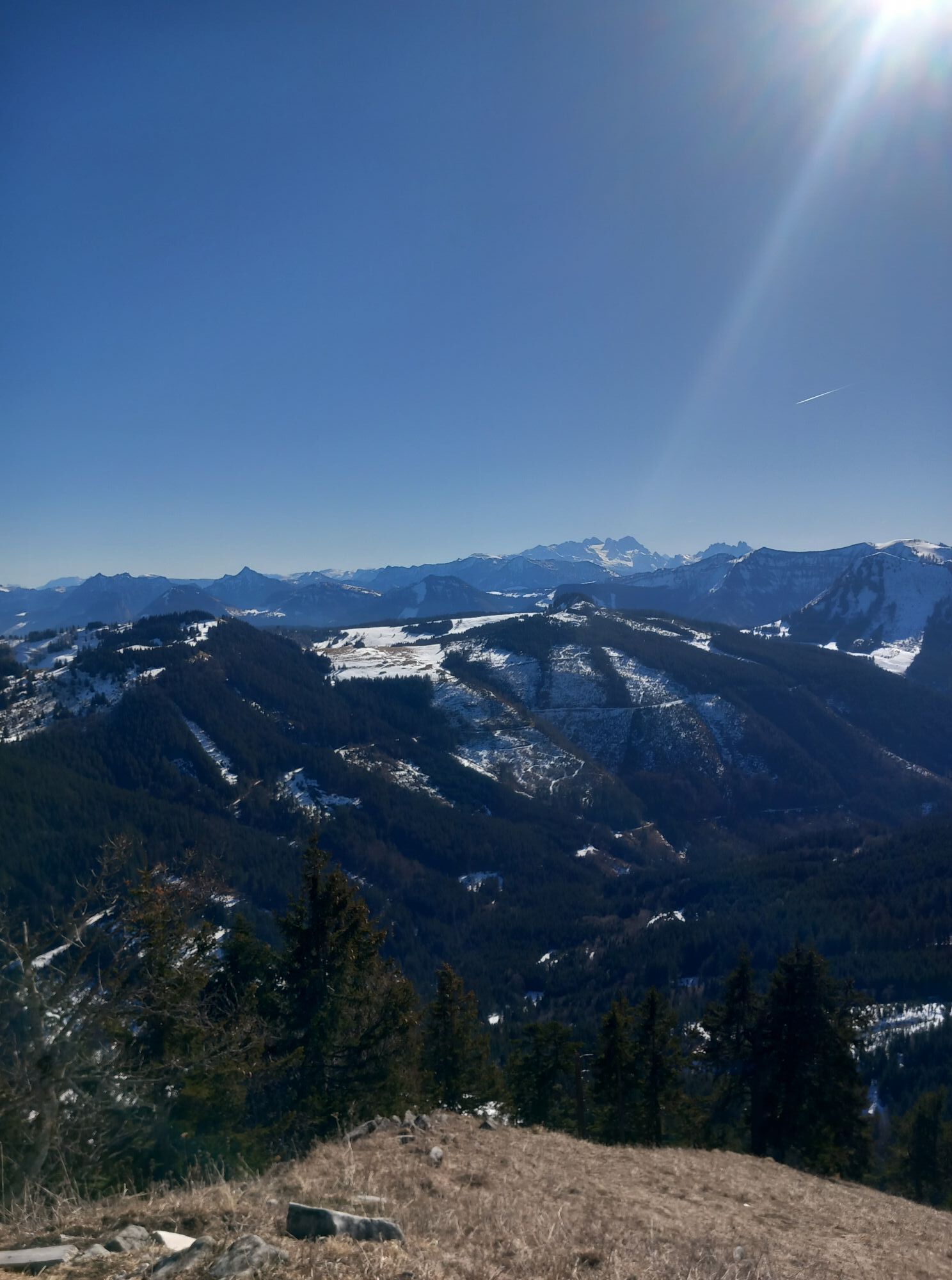
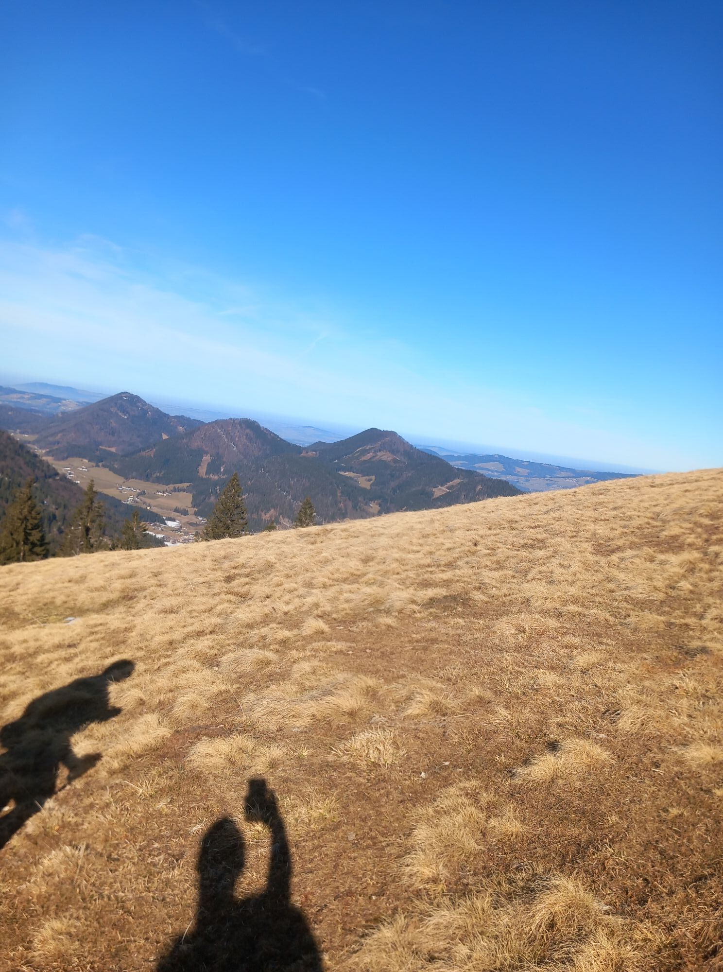


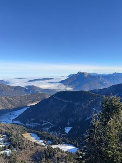
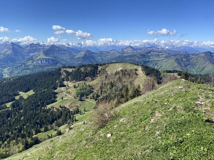
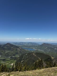
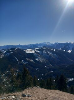
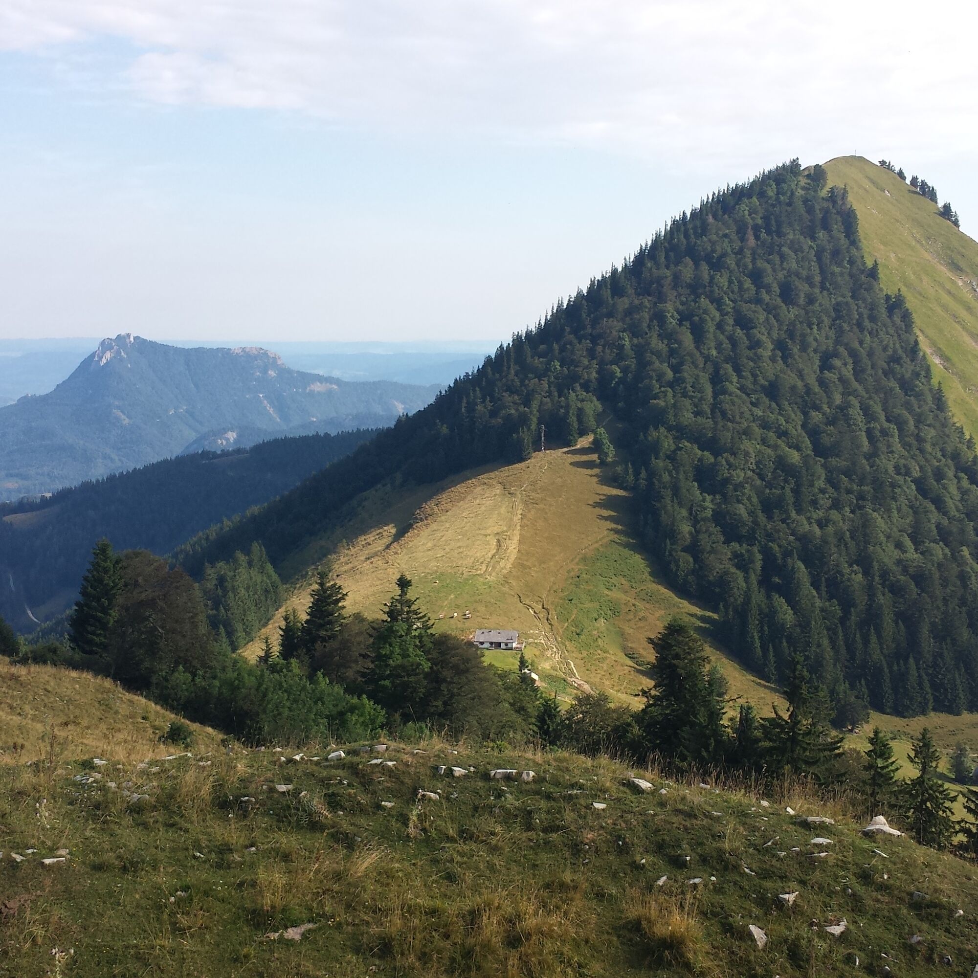
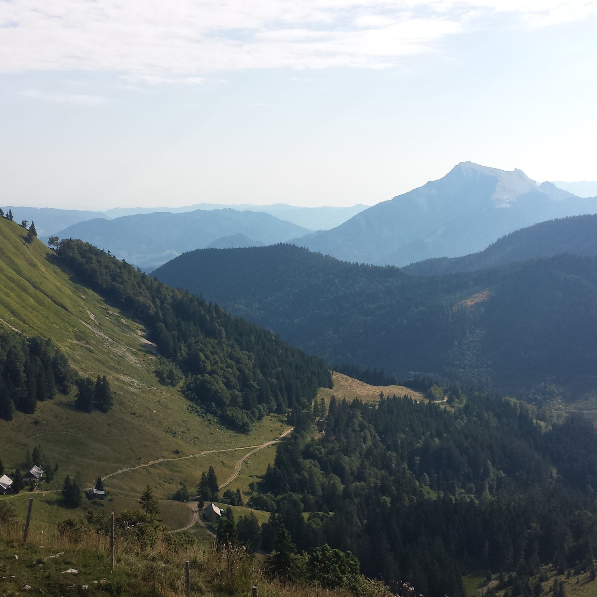
The leisurely hike to the Faistenauer Schafberg is a classic and well known among hikers. The view from the summit is truly incredible! A unique panorama with countless mountain peaks and lakes of the...
The leisurely hike to the Faistenauer Schafberg is a classic and well known among hikers. The view from the summit is truly incredible! A unique panorama with countless mountain peaks and lakes of the Salzkammergut rewards hikers.
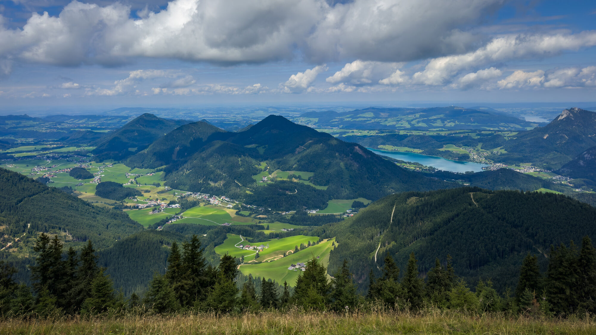
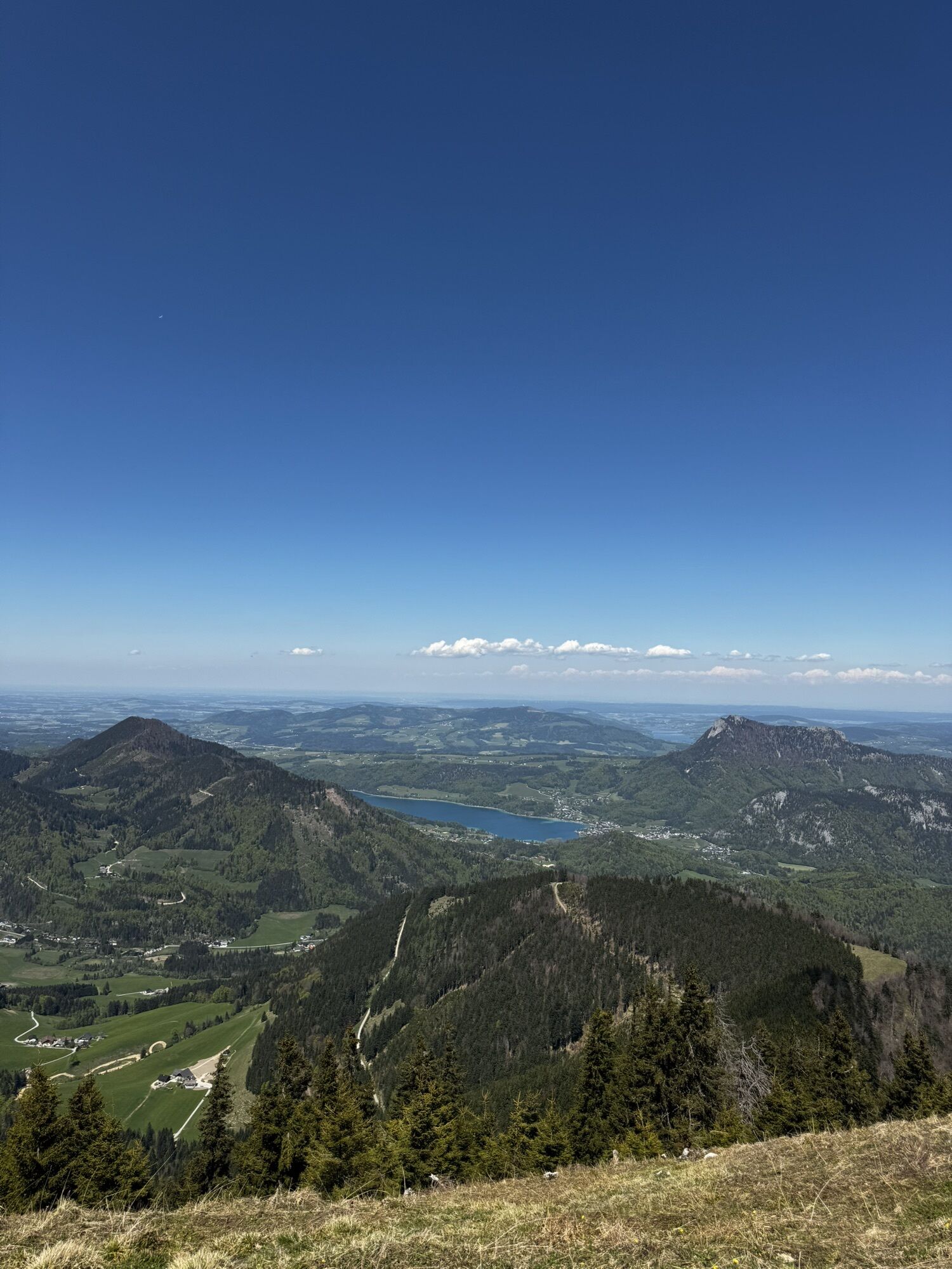
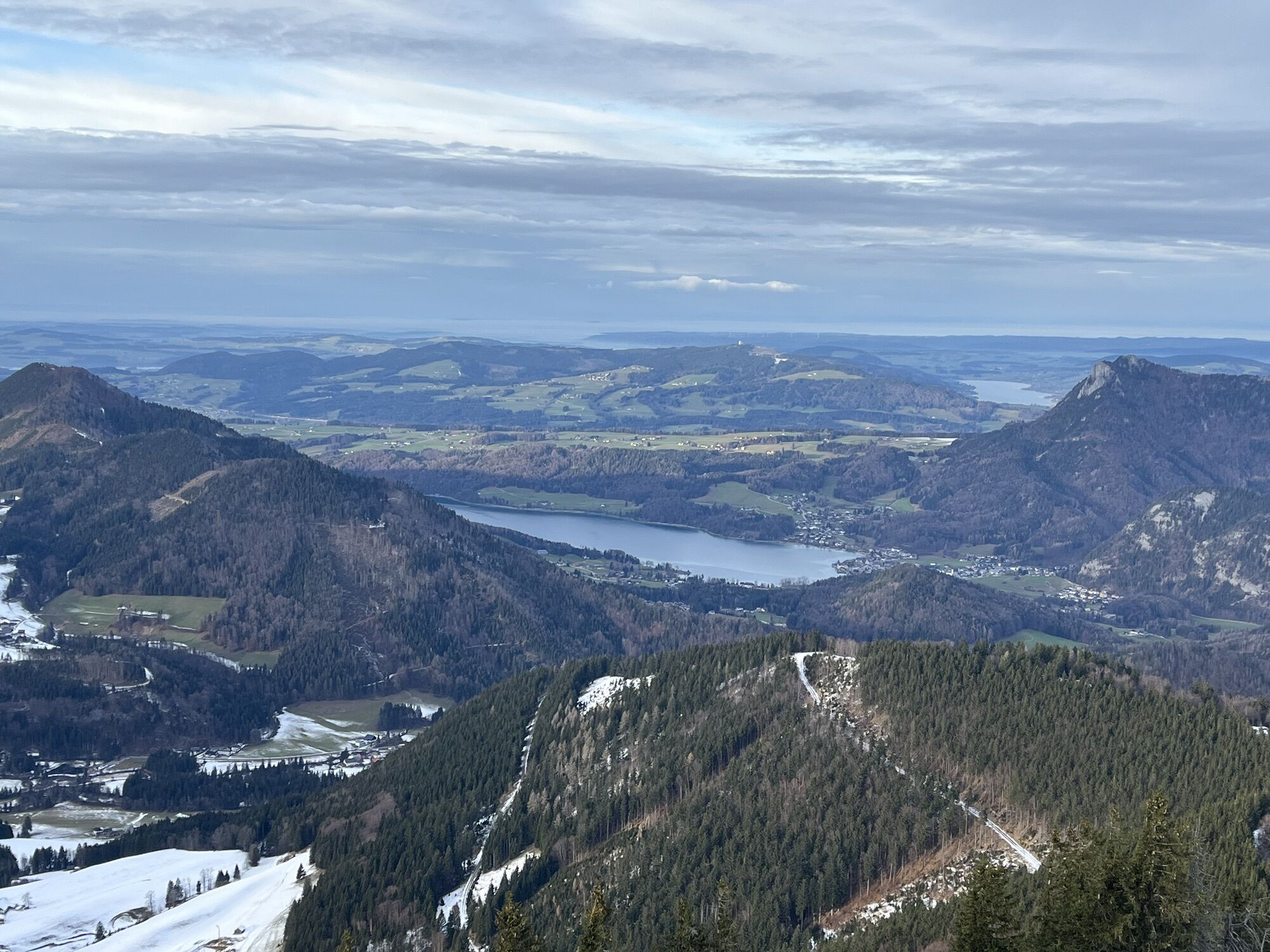
From the summit cross of the Faistenauer Schafberg, you can see countless mountain neighbors of the Faistenauer Schafberg in the Salzkammergut: Schlenken, Regenspitz, Gruberhorn, Gennerhorn, Osterhorn, or the Schafberg at Wolfgangsee, to name a few. The glacier fields of the Dachstein also reflect in the soothing autumn warmth. Particularly beautiful is the view down to the Fuschlsee, nestled by the Schober, Frauenkopf, and the Filbling.
Those who have not had enough of the summit experience can extend the hike and climb a second peak at the Loibersbacher Höhe. The Loibersbacher Höhe is also a popular destination for snowshoe hikers or ski touring enthusiasts in winter.
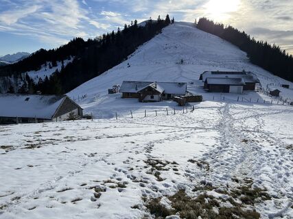
From the Keflau / Streitberg parking lot, walk along the right side of the Schafbach stream past a barrier and a small garage (start of the hiking information trail) along a forest road. After 200m, turn right onto a path, the Fairy Tale Trail. This leads us steadily uphill along the slope of the Wüldersberg to the Grögernalm. We stay on the forest road and follow it to a junction where we turn left towards the Schafbachalm. We follow the forest road for about 500m. At a clearing (parking lot), a path leads right across an alpine pasture. Following the signs, we reach another forest road (Trail No. 41). We stay on this path until the Schafbergalm. To our right is already the Faistenauer Schafberg. At the Schafbergalm, we keep right above the huts and reach the Oberwiesalm. Now follows the last ascent to the Faistenauer Schafberg. A trail leads to the summit, passing the Lanznhütte on the right. The descent is the same as the ascent.
Áno
Áno
Áno
Sturdy footwear and possibly hiking poles; otherwise, no special equipment required.
Trail conditions
The trail runs almost entirely on forest roads and well-prepared paths.
Information from the Faistenau Riding and Horse Breeding Association
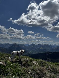
A major concern of the Faistenau Riding Association is a harmonious interaction between riders and hikers. Especially important is mutual considerate behavior. Therefore, please comply with the leash obligation, keep a safe distance from horses, and avoid loud noises and sudden/fast movements.
Leash obligation for dogs
In the entire municipality of Faistenau, since 2009, there has been a dog leash and dog waste disposal ordinance in effect. This also applies to all hiking trails.
Arrival via the A1 West Motorway – Thalgau exit
Follow the federal road (B 158) in Hof bei Salzburg to the Baderluck roundabout. Take the first exit into Hinterseestraße and after a few kilometers, you will reach your holiday destination Faistenau. At the first major intersection, turn left towards Tiefbrunnau. After 6 km, turn right off the main road and follow the signs to the parking lot.
The starting point of this hike is not directly accessible by public transport!
By Bus
From Salzburg main train station, there are excellent post bus connections to the Fuschlsee region or Faistenau. All bus connections can be found online at www.svv-info.at.
By Train
Information about train connections can be found at www.oebb.at or www.bahn.de.
By Plane
The Salzburg W.A. Mozart Airport is located close to the city of Salzburg. Bus lines 2 or 27 take you to the main station, where you can transfer to the post bus.
There are three paid parking lots available in Keflau / Streitberg.
Aktivity počas prehliadky


Obľúbené výlety v okolí
-
4,8
Fuschl: Ruine Wartenfels - Schober - Frauenkopf
strednáTuristika 7,62 km -
4,2
Fuschlseewanderung
svetloTuristika 11 km -
4,1
Pillstein Panorama Rundweg
svetloTuristika 3,40 km -
4,9
Pleasure hike over the Falkenstein
strednáTuristika 9,81 km -
3,6
Mondsee: Rund um den Mondsee
svetloCyklistika 26,3 km -
3,6
Unterach am Attersee: Hochplettspitz
Turistika 4,25 km -
4,4
From Koppl to the Gaisberg summit
strednáTuristika 9,86 km -
4,9
Schwarzeneckalm-Bleckwand
svetloTuristika 5,94 km -
4,9
Eisenaualm
strednáMountainbike 37 km -
4,8
Schlenken and Schmittenstein hike
ťažkéTuristika 10,9 km

Turistika a stopovanie


Nenechajte si ujsť ponuky a inšpiráciu na ďalšiu dovolenku
Vaša e-mailová adresa bol pridaný do poštového zoznamu.