


Hüttschlag: Karteistörl - Tappenkarsee - Draugsteintörl - Draugsteinalmen
Fotografie našich používateľov
-
 © R. HVytvorené dňa 09.05.2026
 -
 © Hannah AnyanVytvorené dňa 27.09.2025
 -
 © Hannah AnyanVytvorené dňa 27.09.2025
 -
 © Hannah AnyanVytvorené dňa 27.09.2025
 -
 © Hannah AnyanVytvorené dňa 27.09.2025
 -
 © Hannah AnyanVytvorené dňa 27.09.2025
 -
 © Hannah AnyanVytvorené dňa 27.09.2025
 -
 © Hannah AnyanVytvorené dňa 27.09.2025
 -
 © Hannah AnyanVytvorené dňa 27.09.2025
 -
 © Hannah AnyanVytvorené dňa 27.09.2025
 -
 © Hannah AnyanVytvorené dňa 27.09.2025
 -
 © Noah RoeVytvorené dňa 07.09.2025
 -
 © Noah RoeVytvorené dňa 07.09.2025
 -
 © Helmut Wagner 2Vytvorené dňa 19.08.2025
 -
 © Helmut Wagner 2Vytvorené dňa 19.08.2025
 -
 © Helmut Wagner 2Vytvorené dňa 19.08.2025
 -
 © Helmut Wagner 2Vytvorené dňa 19.08.2025
 -
 © Helmut Wagner 2Vytvorené dňa 19.08.2025
 -
 © Helmut Wagner 2Vytvorené dňa 19.08.2025
 -
 © Helmut Wagner 2Vytvorené dňa 19.08.2025
 -
 © Helmut Wagner 2Vytvorené dňa 19.08.2025
 -
 © Helmut Wagner 2Vytvorené dňa 19.08.2025
 -
 © Helmut Wagner 2Vytvorené dňa 19.08.2025
 -
 © Helmut Wagner 2Vytvorené dňa 19.08.2025
 -
 © Helmut Wagner 2Vytvorené dňa 19.08.2025
 -
 © Helmut Wagner 2Vytvorené dňa 19.08.2025
 -
 © Helmut Wagner 2Vytvorené dňa 19.08.2025
 -
 © Helmut Wagner 2Vytvorené dňa 19.08.2025
 -
 © Helmut Wagner 2Vytvorené dňa 19.08.2025
 -
 © Josef NockerVytvorené dňa 09.08.2025
 -

 © KHStraussVytvorené dňa 07.08.2025
 -
 © john klokVytvorené dňa 16.07.2025
 -
 © john klokVytvorené dňa 16.07.2025
 -
 © Simon FaißtVytvorené dňa 15.07.2025
 -
 © Simon FaißtVytvorené dňa 15.07.2025
 -
 © Tobias PramhaasVytvorené dňa 02.07.2025
 -
 © Tobias PramhaasVytvorené dňa 02.07.2025
 -
 © Tobias PramhaasVytvorené dňa 02.07.2025
 -
 © eva_mountaininloveVytvorené dňa 18.06.2021
 -
 © eva_mountaininloveVytvorené dňa 18.06.2021
 -
 © eva_mountaininloveVytvorené dňa 18.06.2021
 -
 © eva_mountaininloveVytvorené dňa 18.06.2021
 -

 © Johannes PetschkVytvorené dňa 19.06.2025


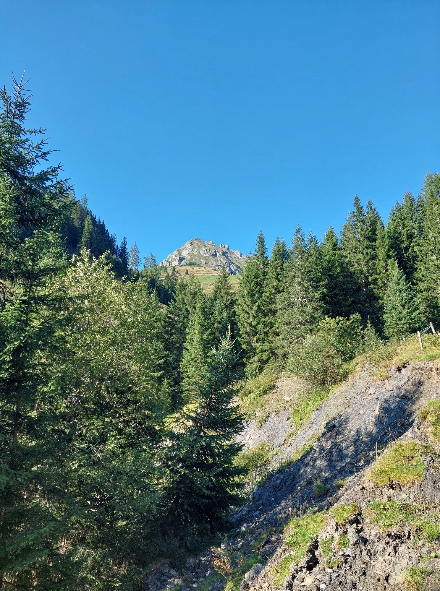


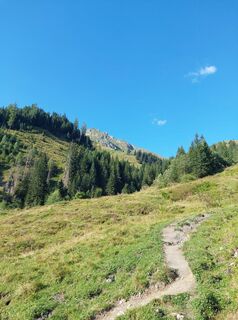
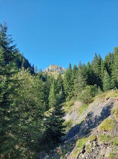
The start of this circular route is the Hallmoosalm parking lot in Hüttschlag. From there, walk a bit through the forest and pass the Karteisalm (not staffed). Then continue over the alpine meadows (especially...
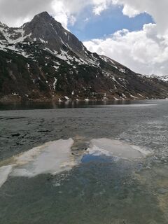
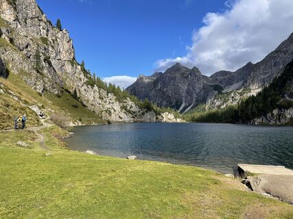
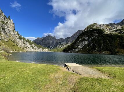
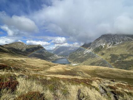
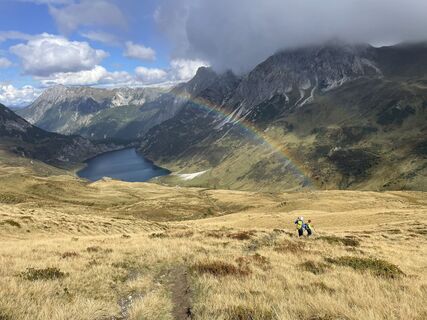
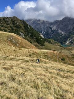
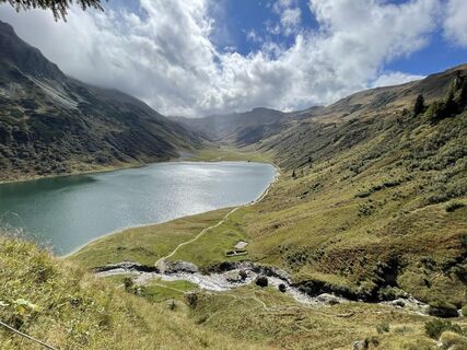
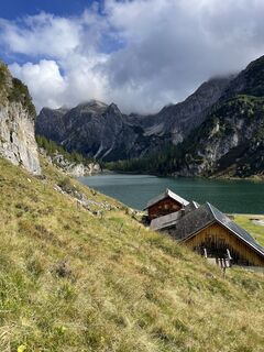
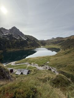
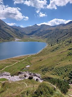
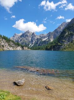
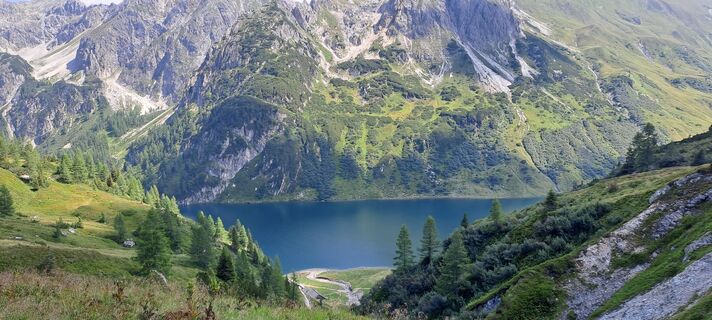
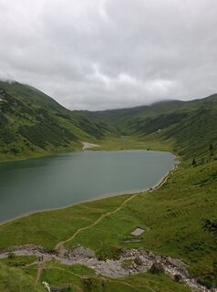
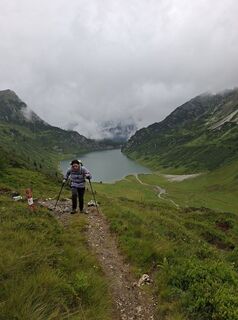
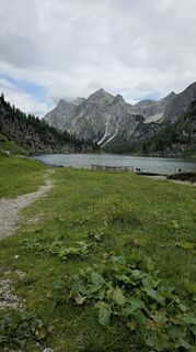
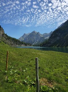
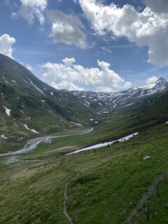
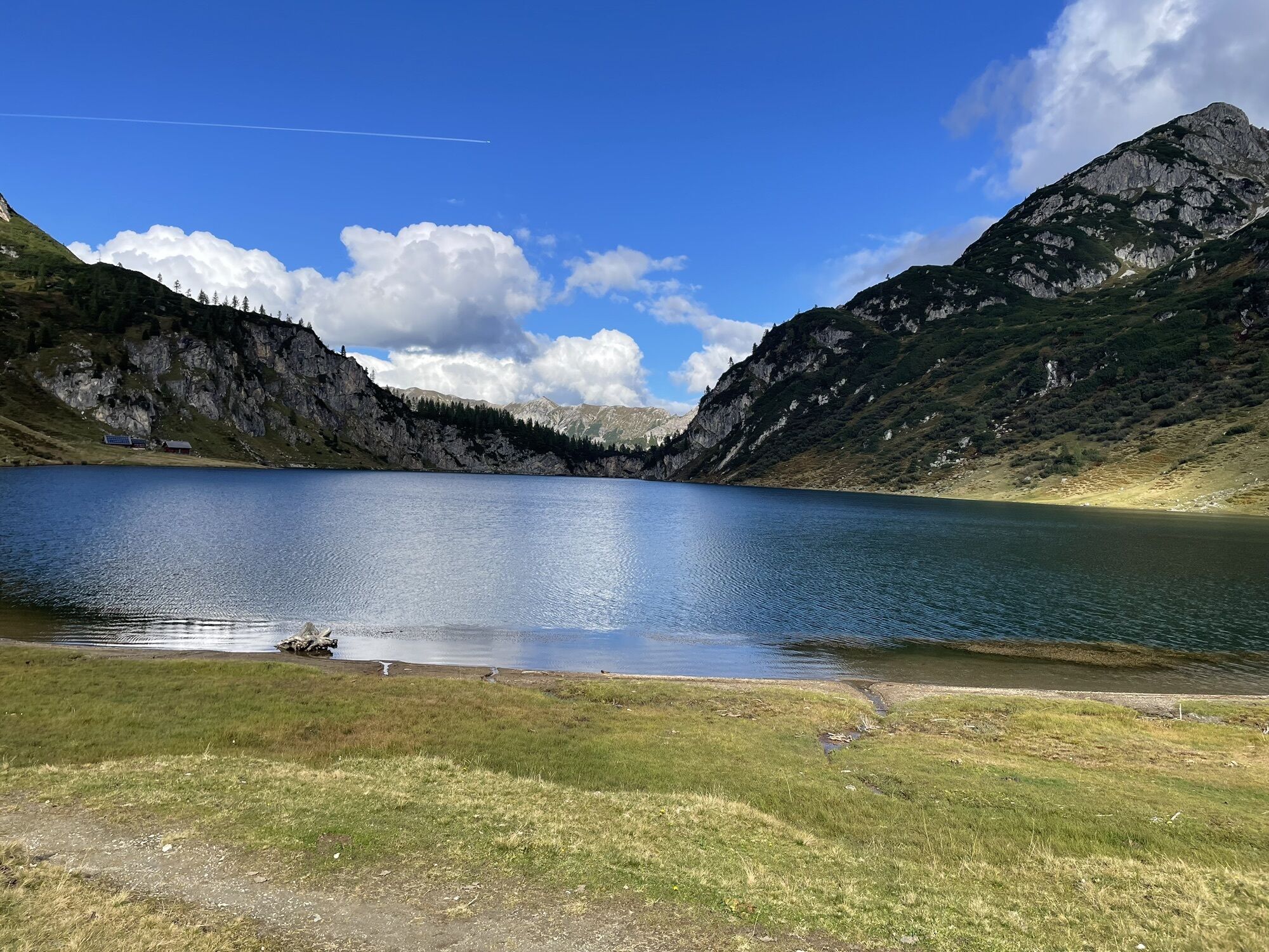
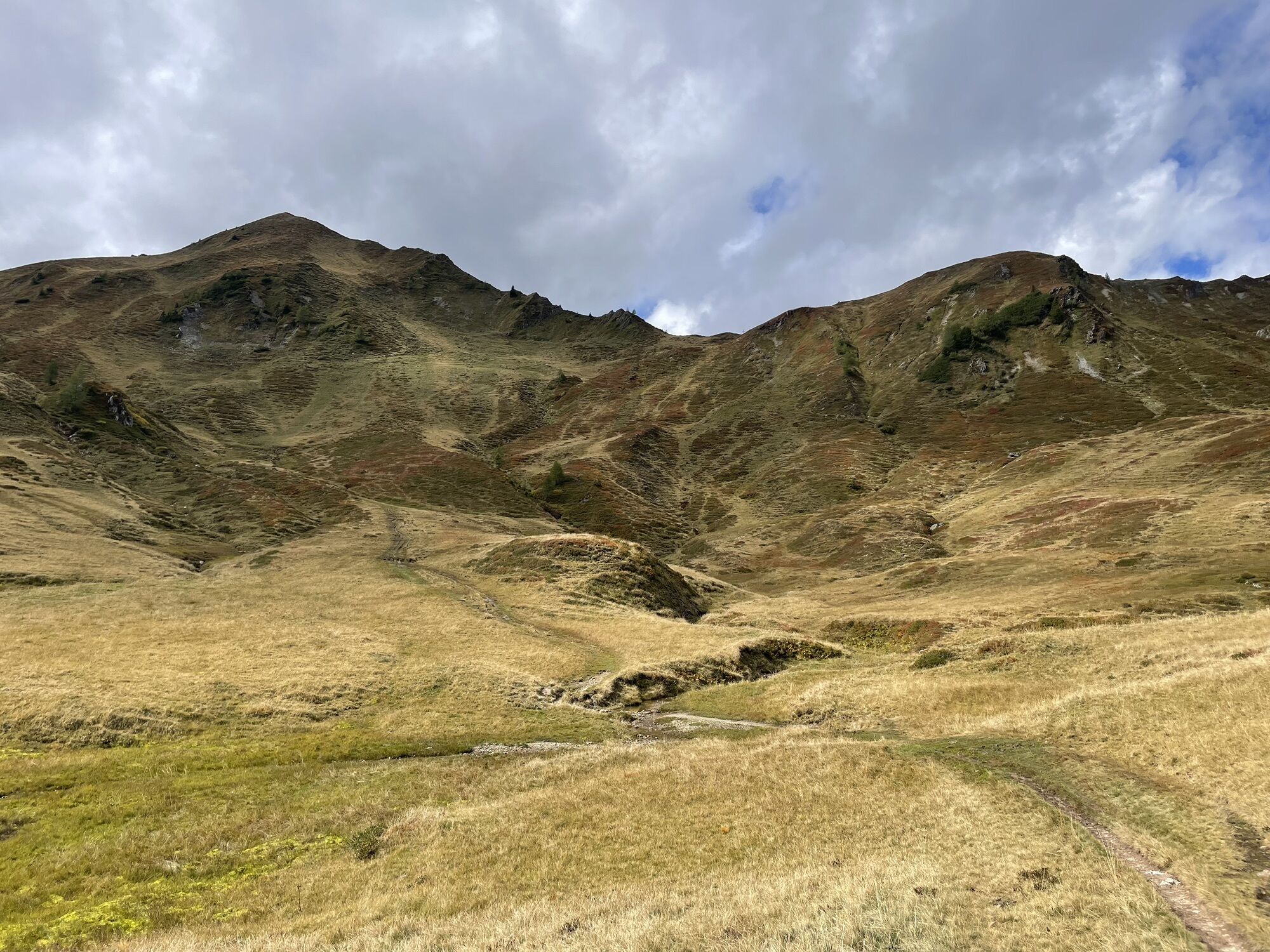
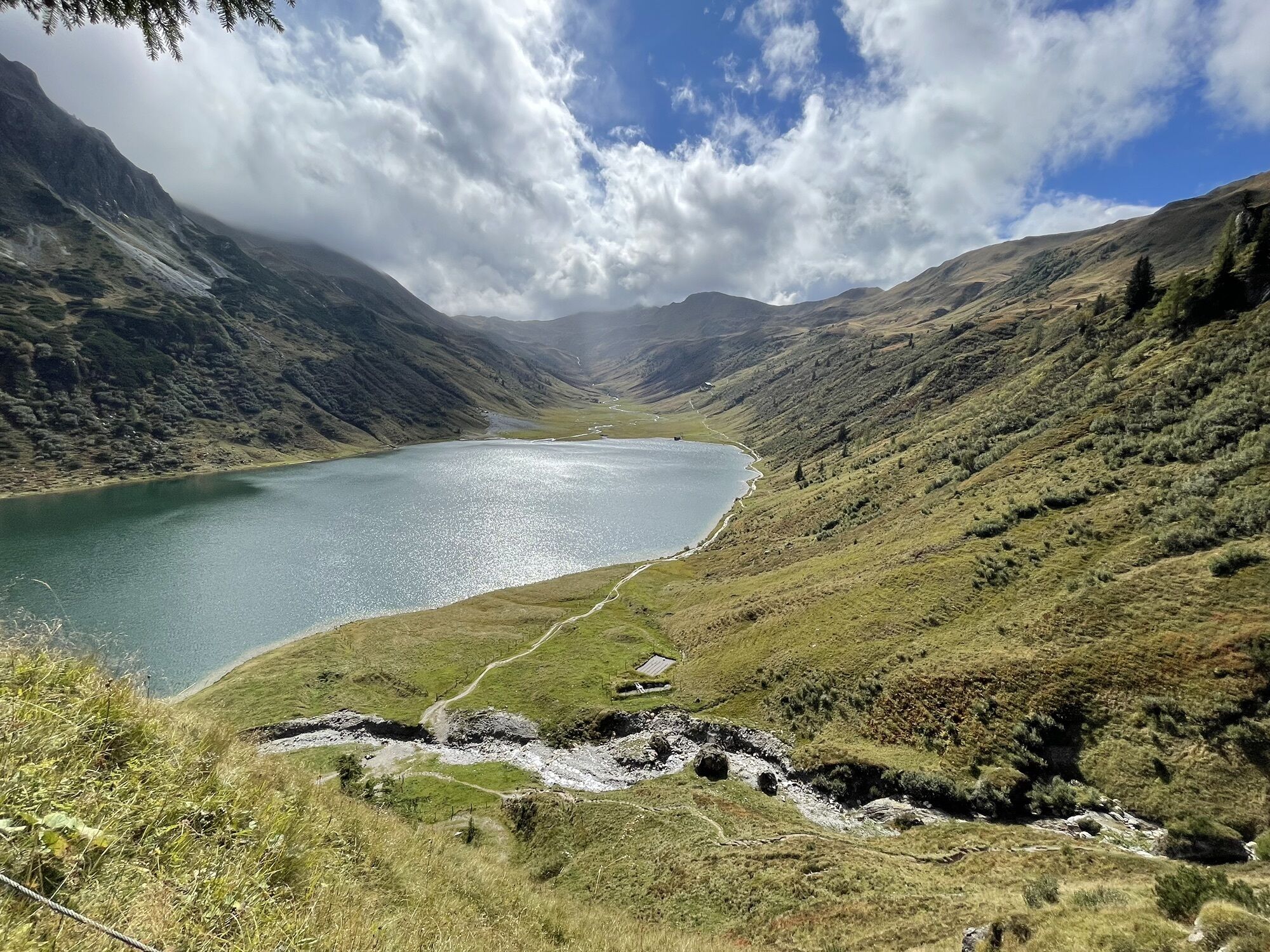
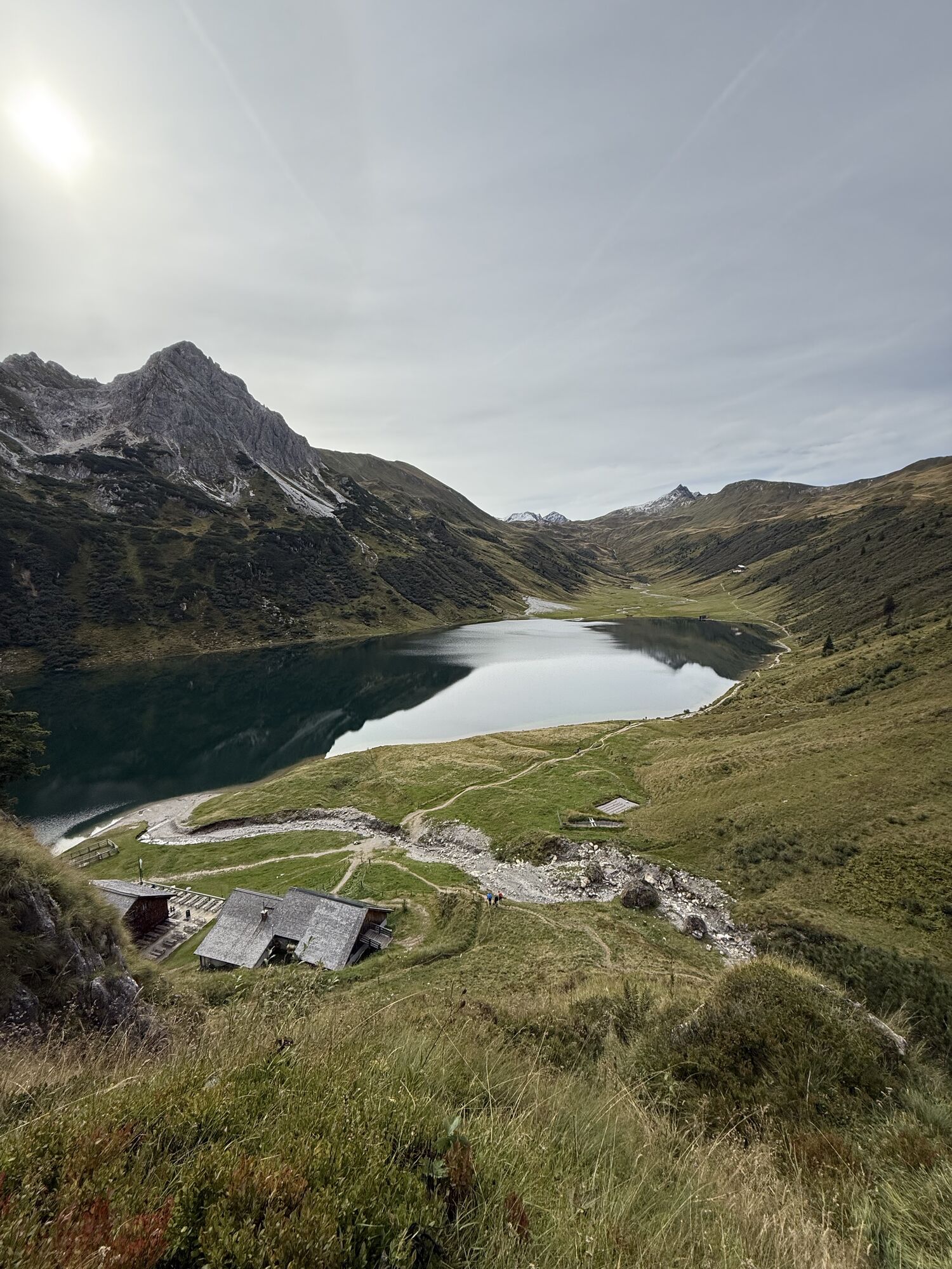
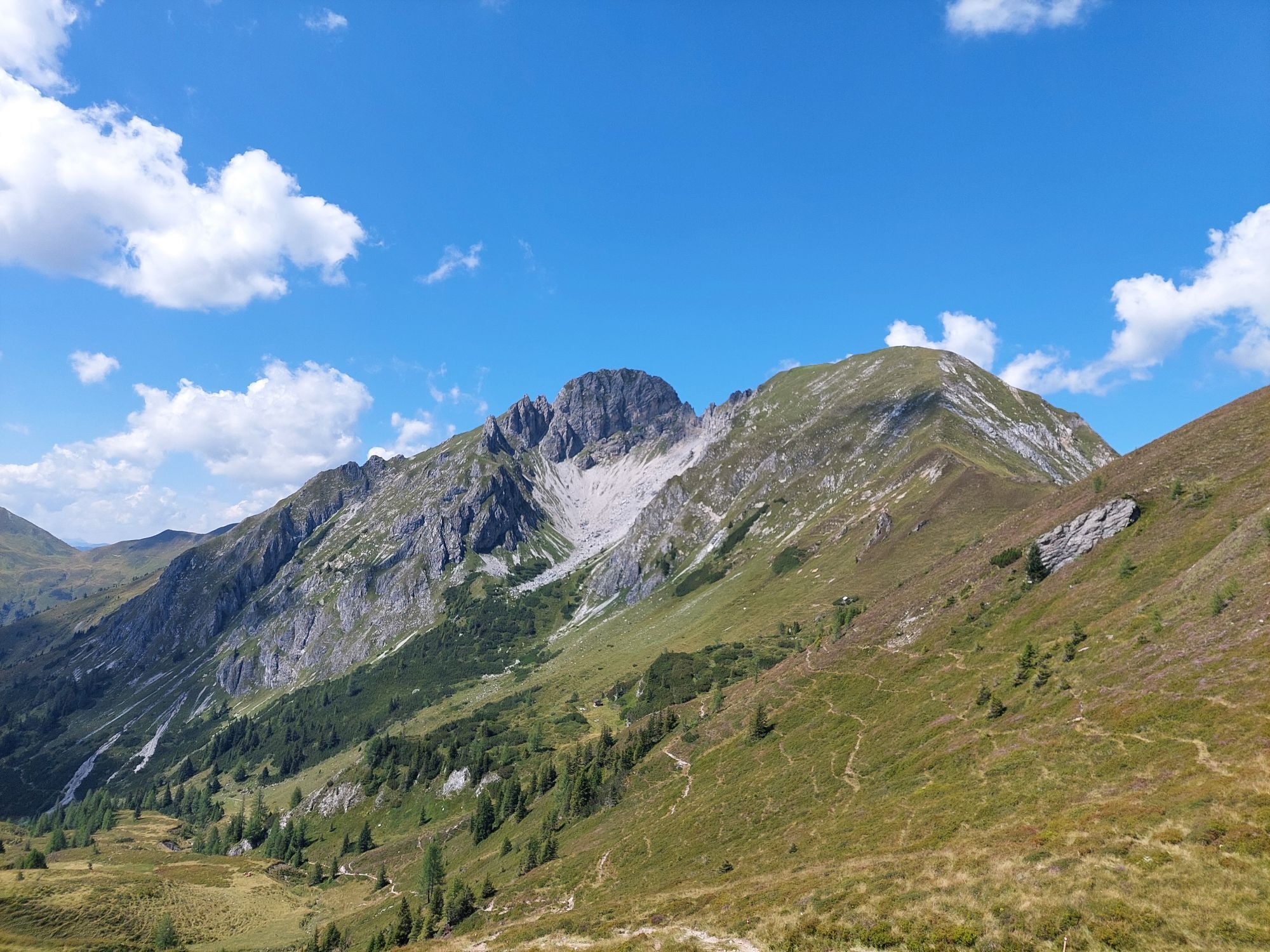
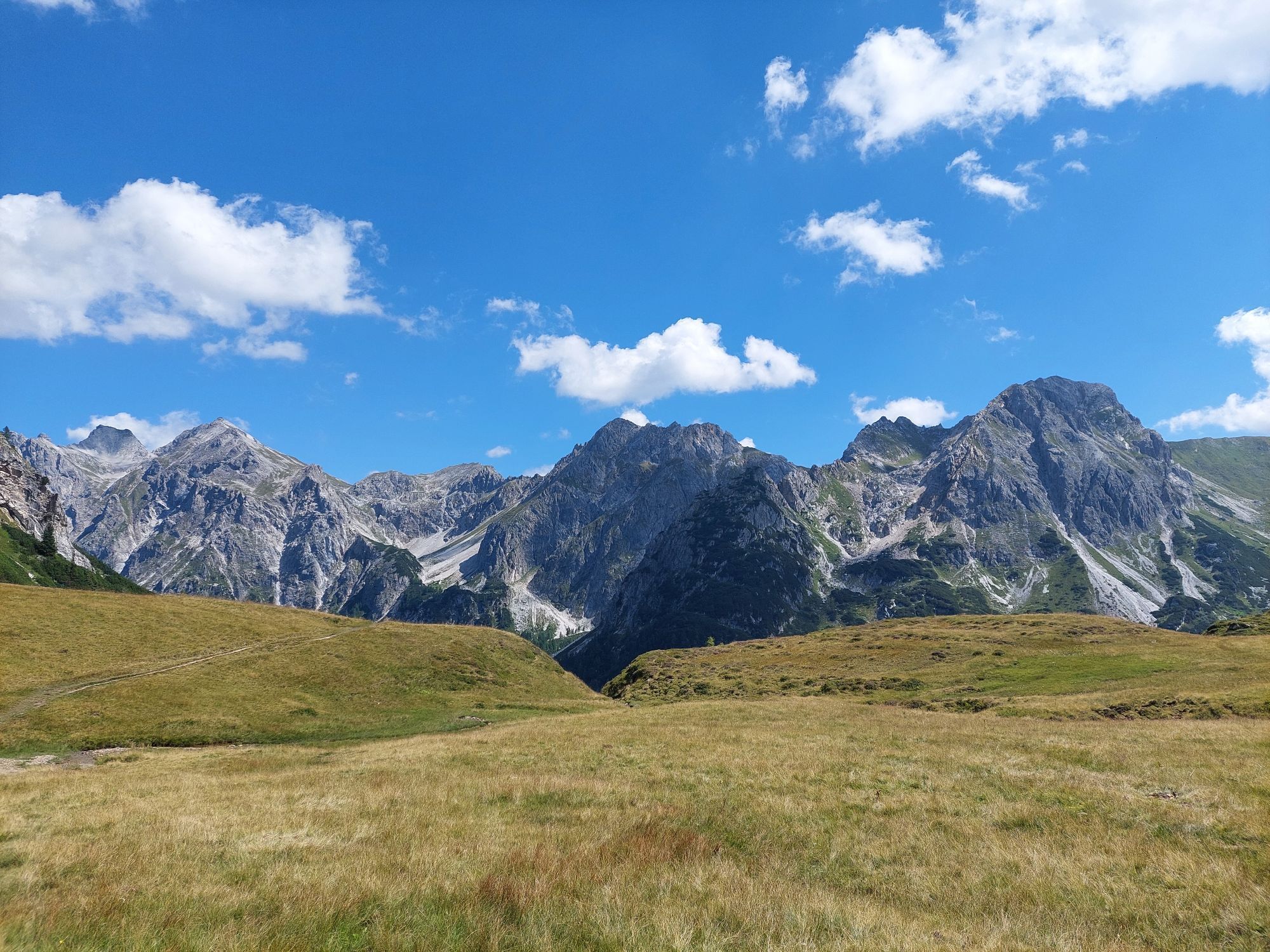
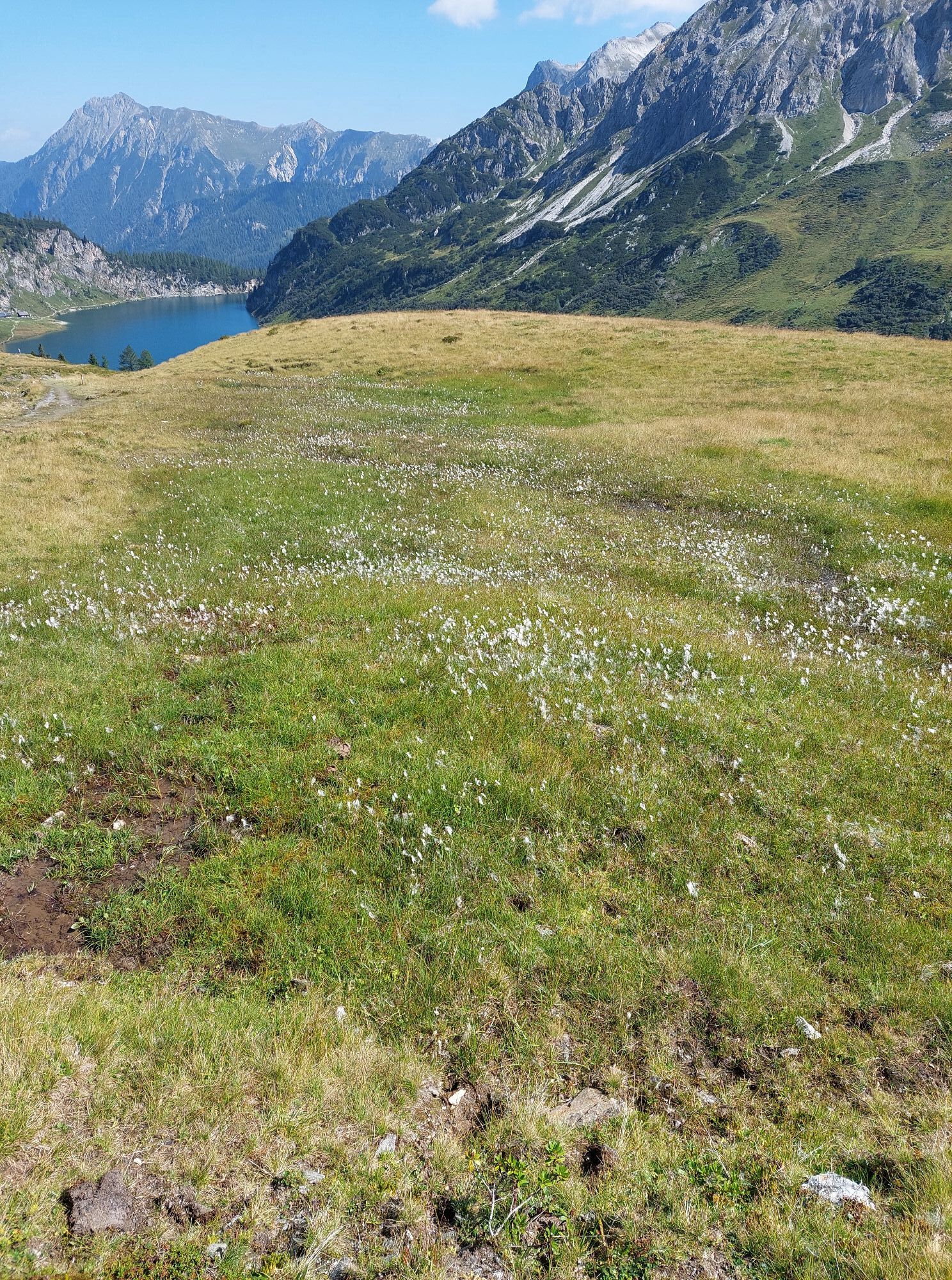
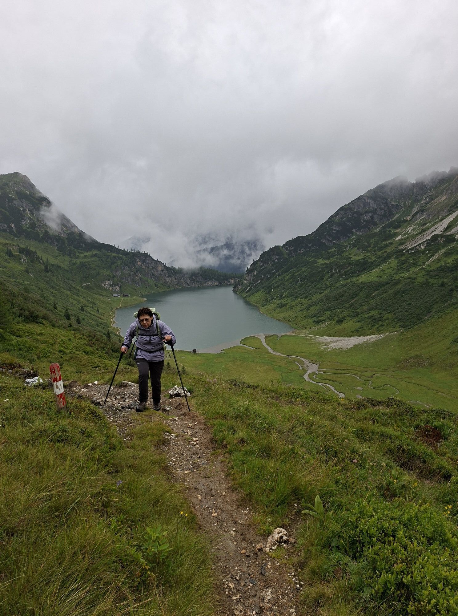
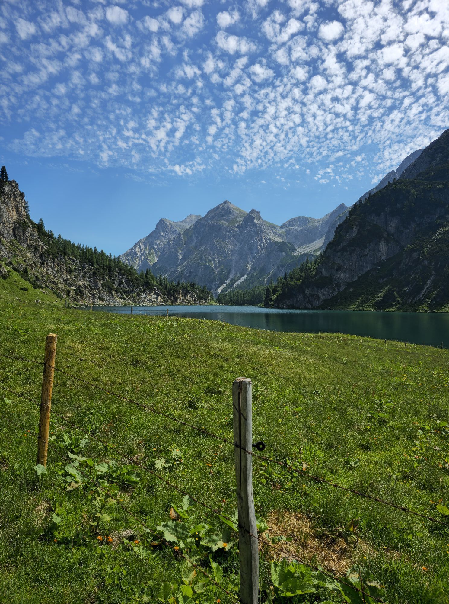
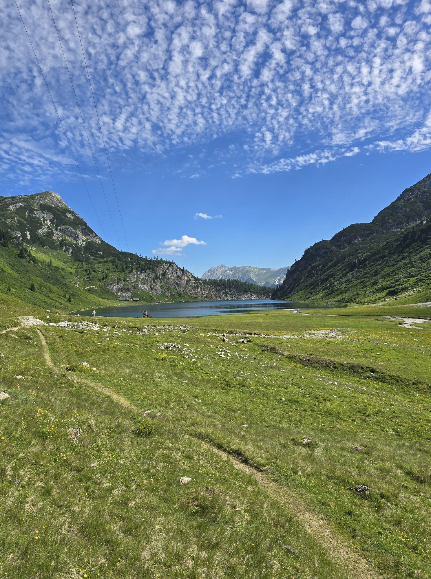
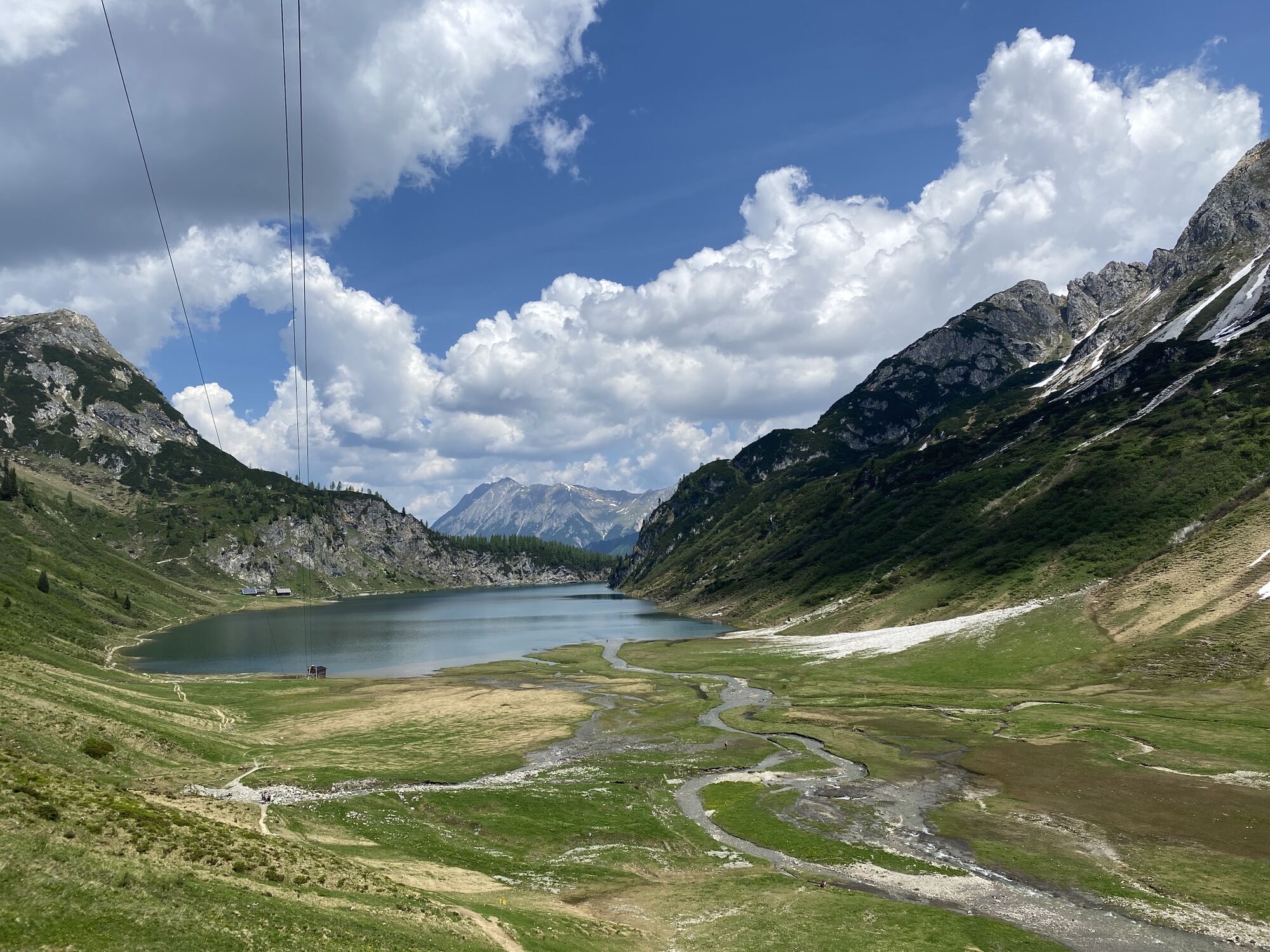
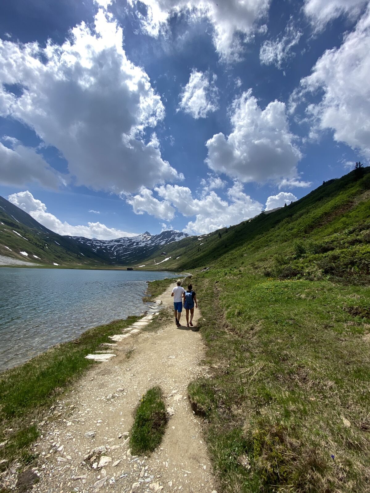
The start of this circular route is the Hallmoosalm parking lot in Hüttschlag. From there, walk a bit through the forest and pass the Karteisalm (not staffed). Then continue over the alpine meadows (especially beautiful in early summer when the alpine roses bloom) to the Karteistörl, from where you get a wonderful view of the Tappenkarsee, the largest mountain lake in the Eastern Alps. According to legend, it is connected with the Schuhflickersee. In the Schuhflickersee, a wagon wheel that fell into the Tappenkarsee was supposedly found.
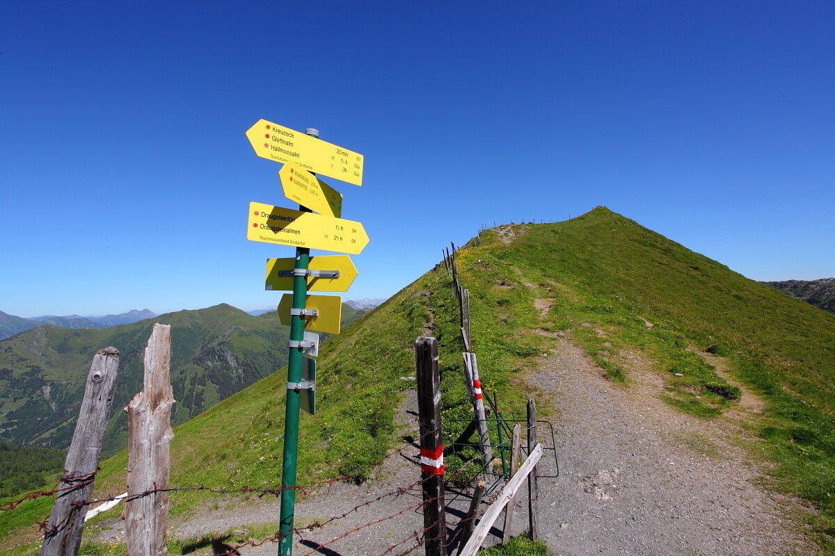
From Karteistörl there are three options for circular hikes:
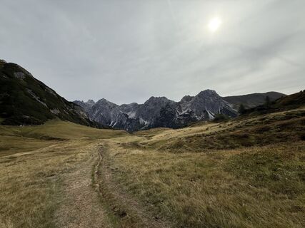
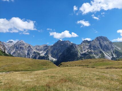
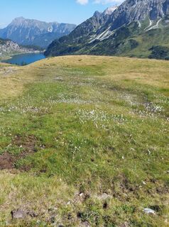
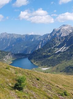
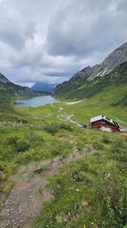
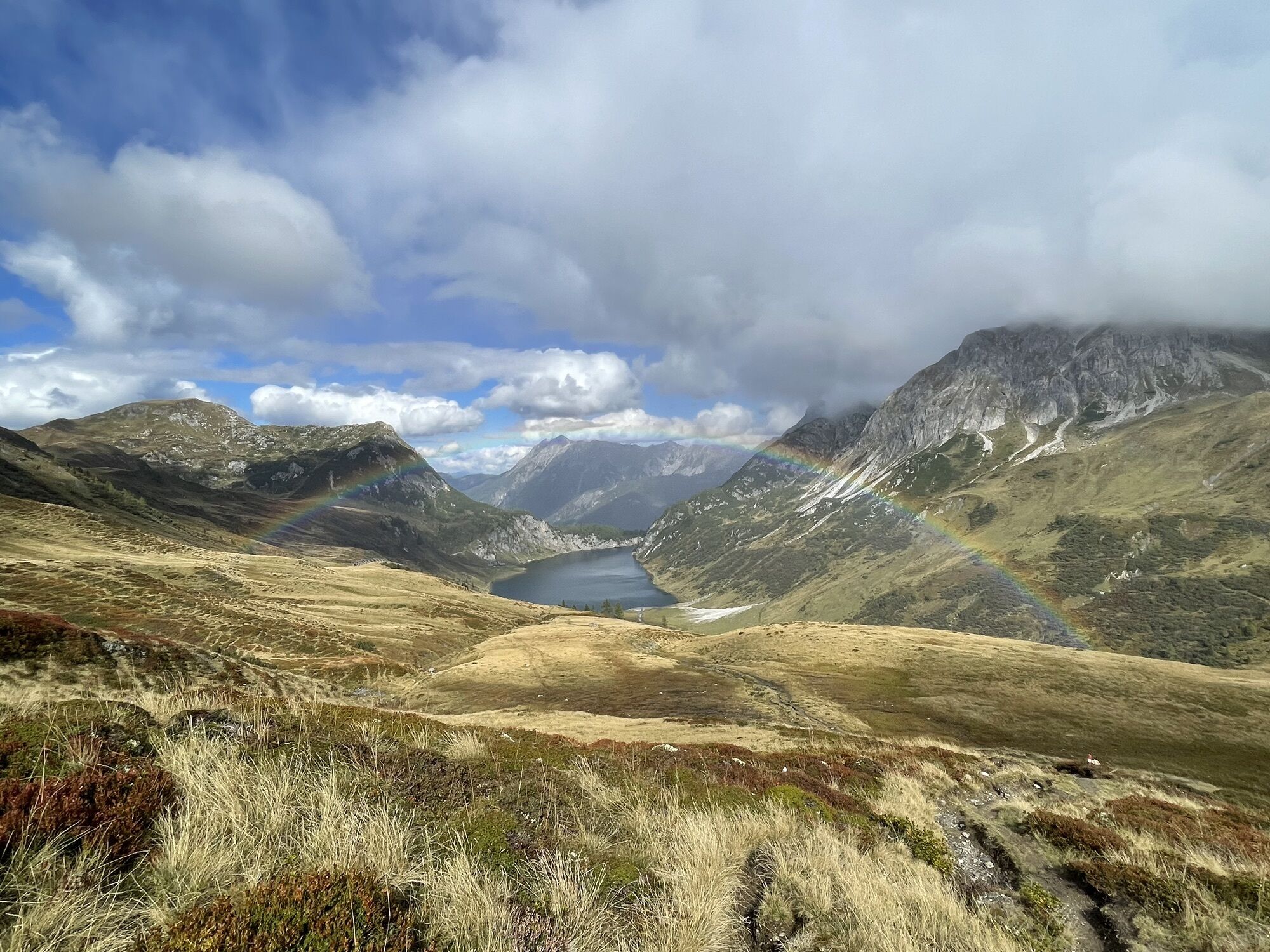
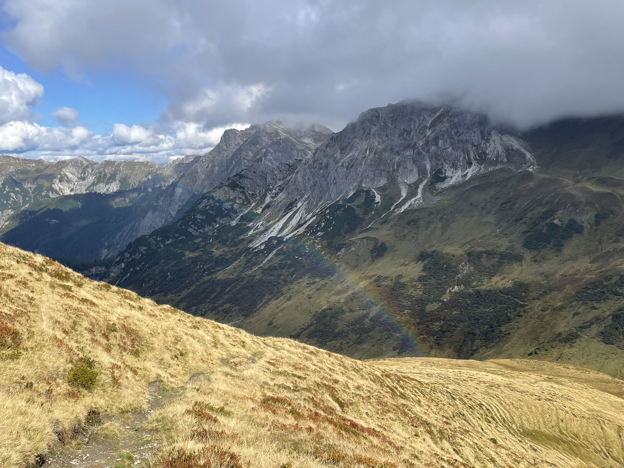
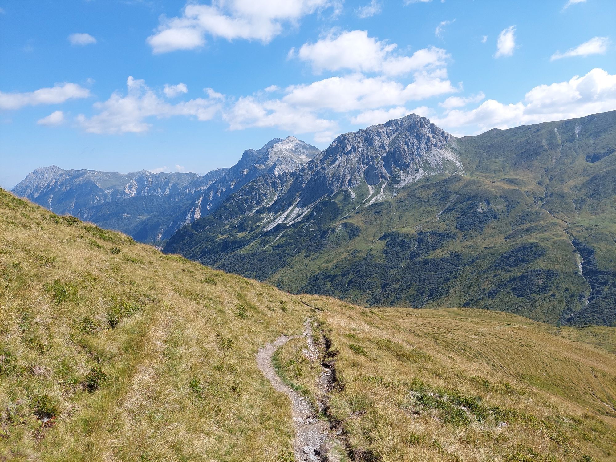
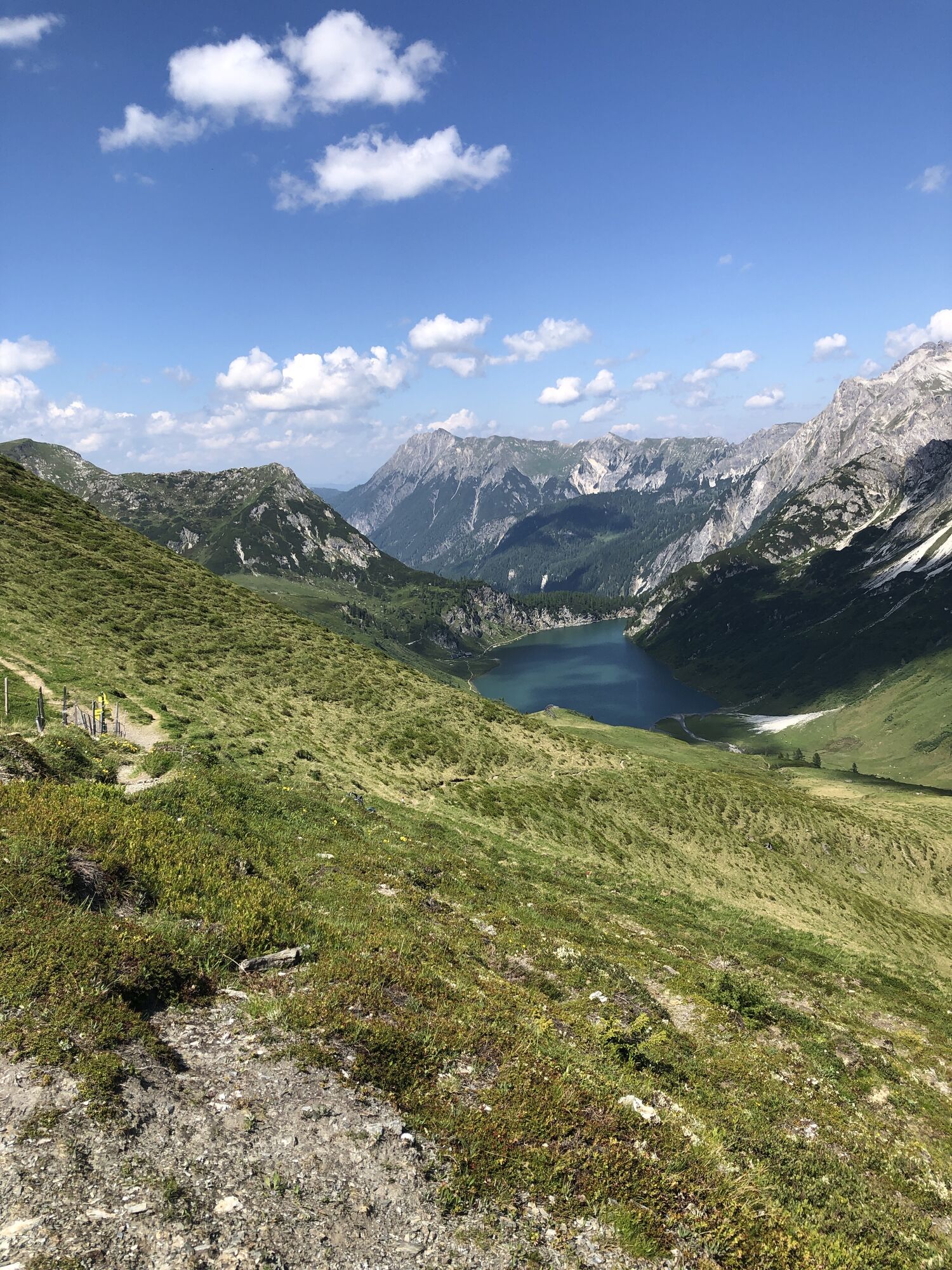
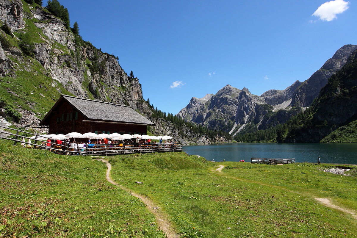
The scenic route follows along the ridge. From Karteistörl, hike on path No. 54 with continuous views of the idyllic mountain lake to Draugsteintörl. Another route leads downhill to the Tappenkarsee hut; from there, hike with wonderful views of the Tappenkarsee gently uphill to Draugsteintörl.
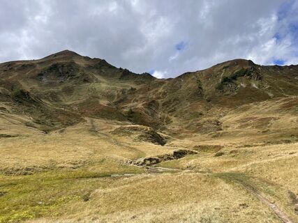
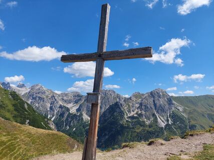
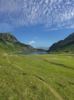
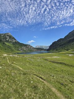
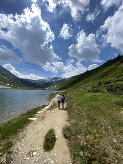
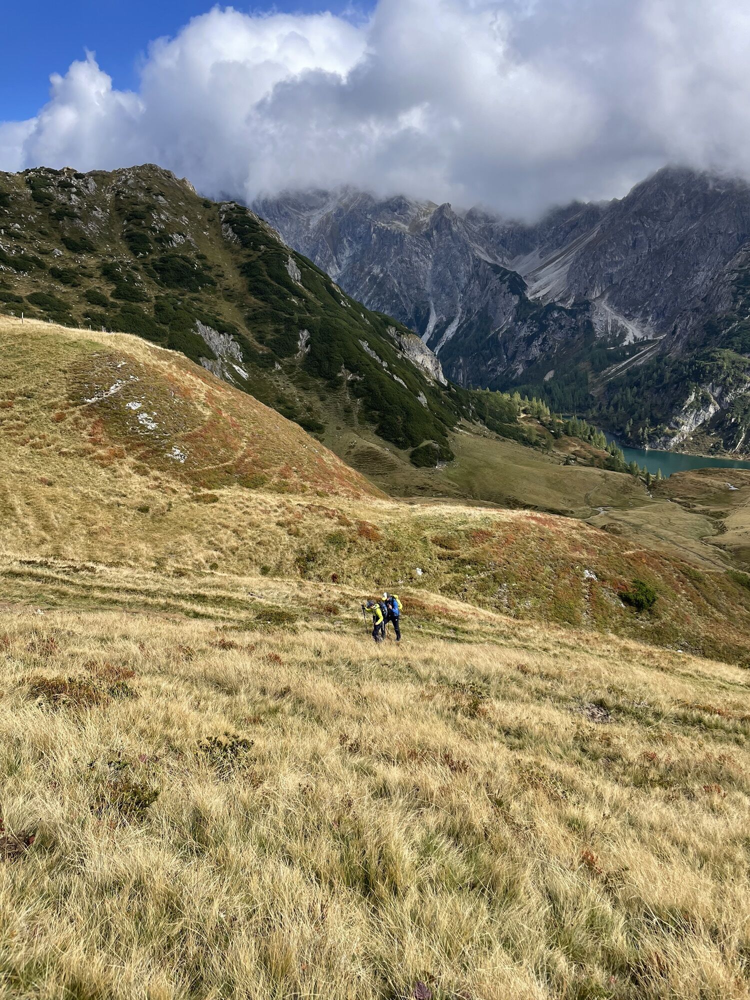
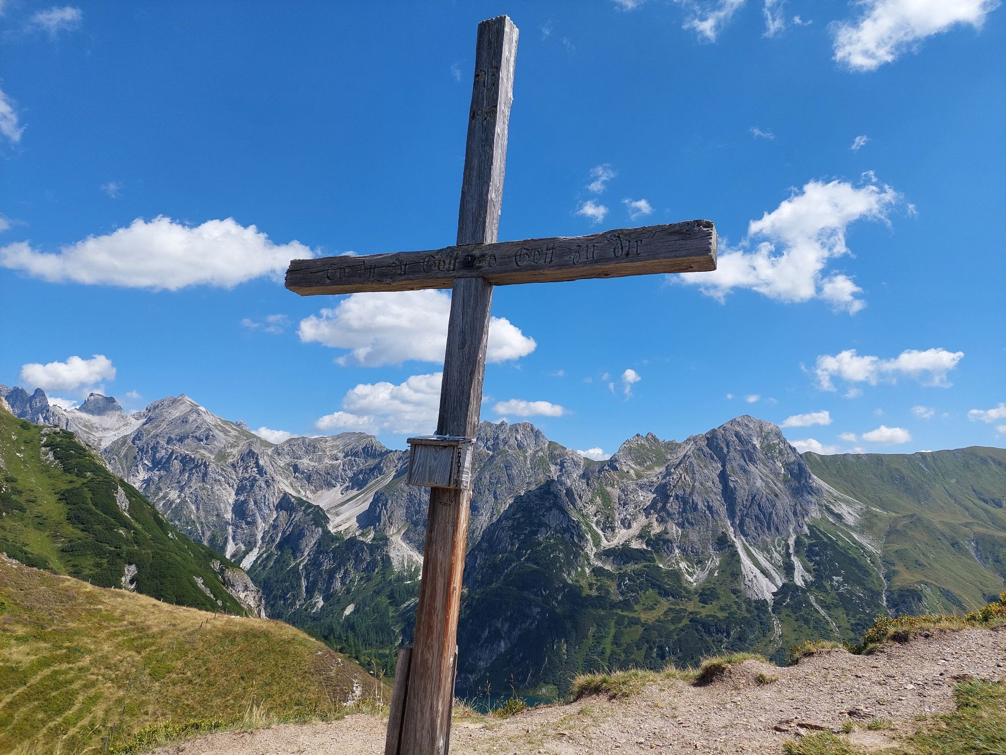
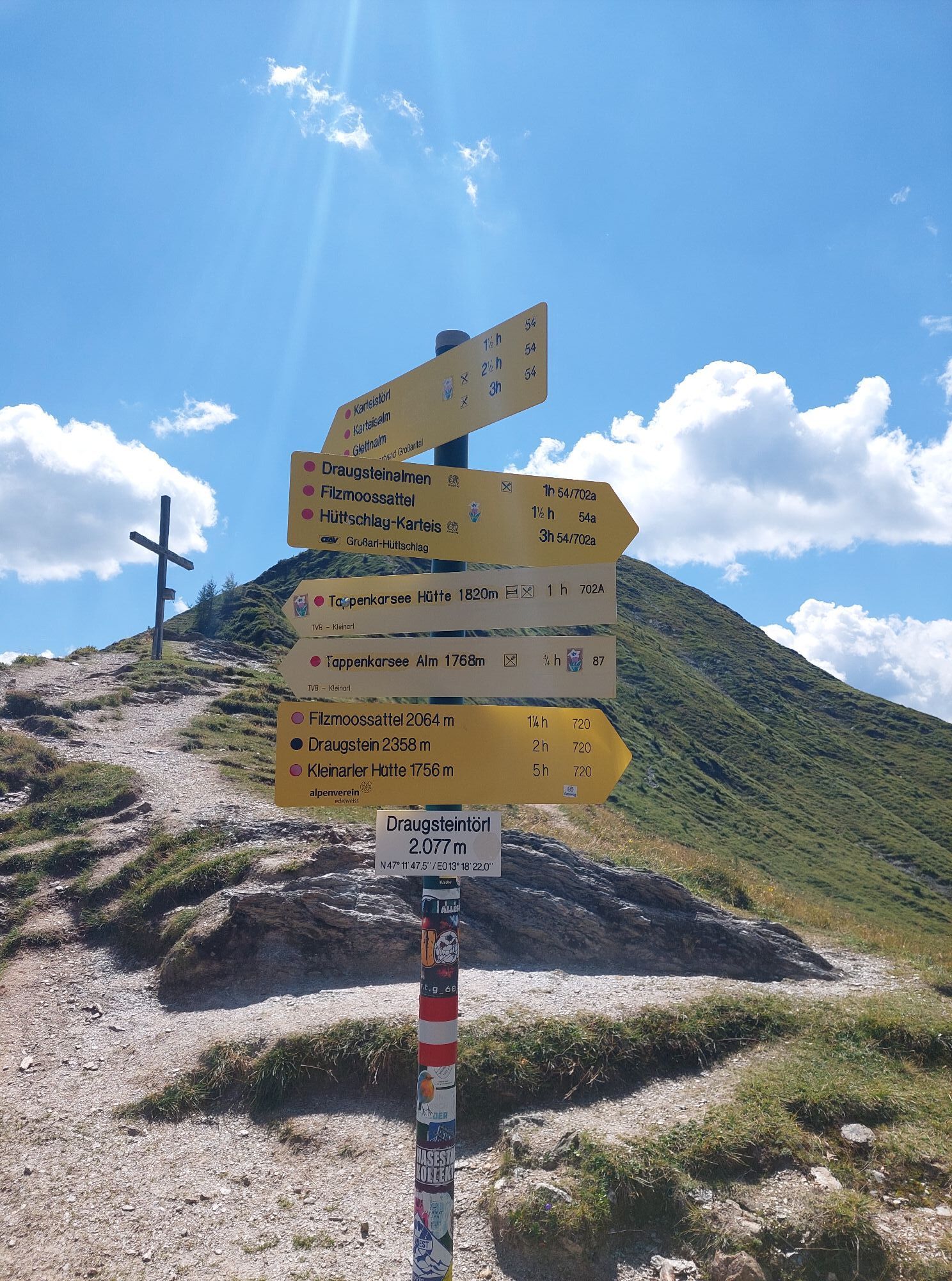
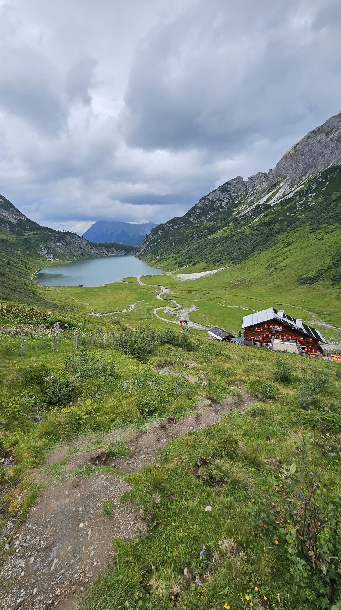
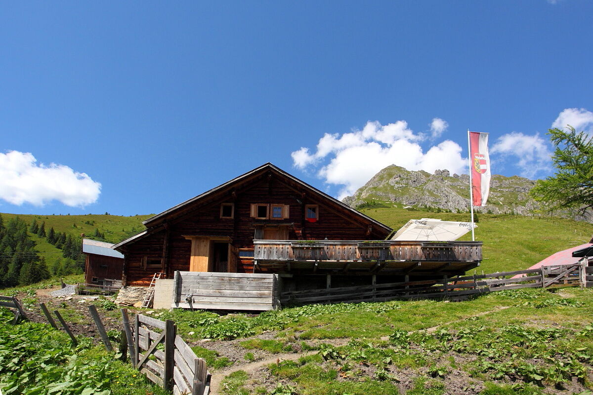
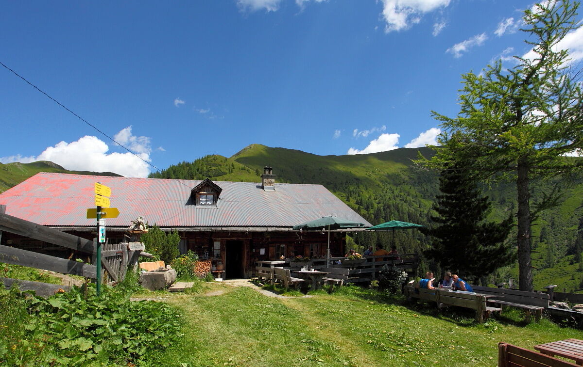
In the suggestion shown on the map here, you also hike comfortably downhill from Karteistörl to the Tappenkarsee. Just above the lake lies the Tappenkarsee hut, the alpine club hut also tempts with warm delicacies such as Kaiserschmarrn or blueberry pancakes. Then continue hiking along the lake to the Tappenkarseealm, where you can also refresh yourself. After that, it goes uphill to the summit cross at Draugsteintörl. Once at the top, you can cast one last look at the Tappenkarsee before descending along the hiking trail to the Draugsteinalmen.
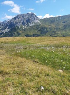
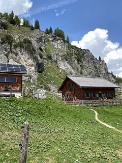
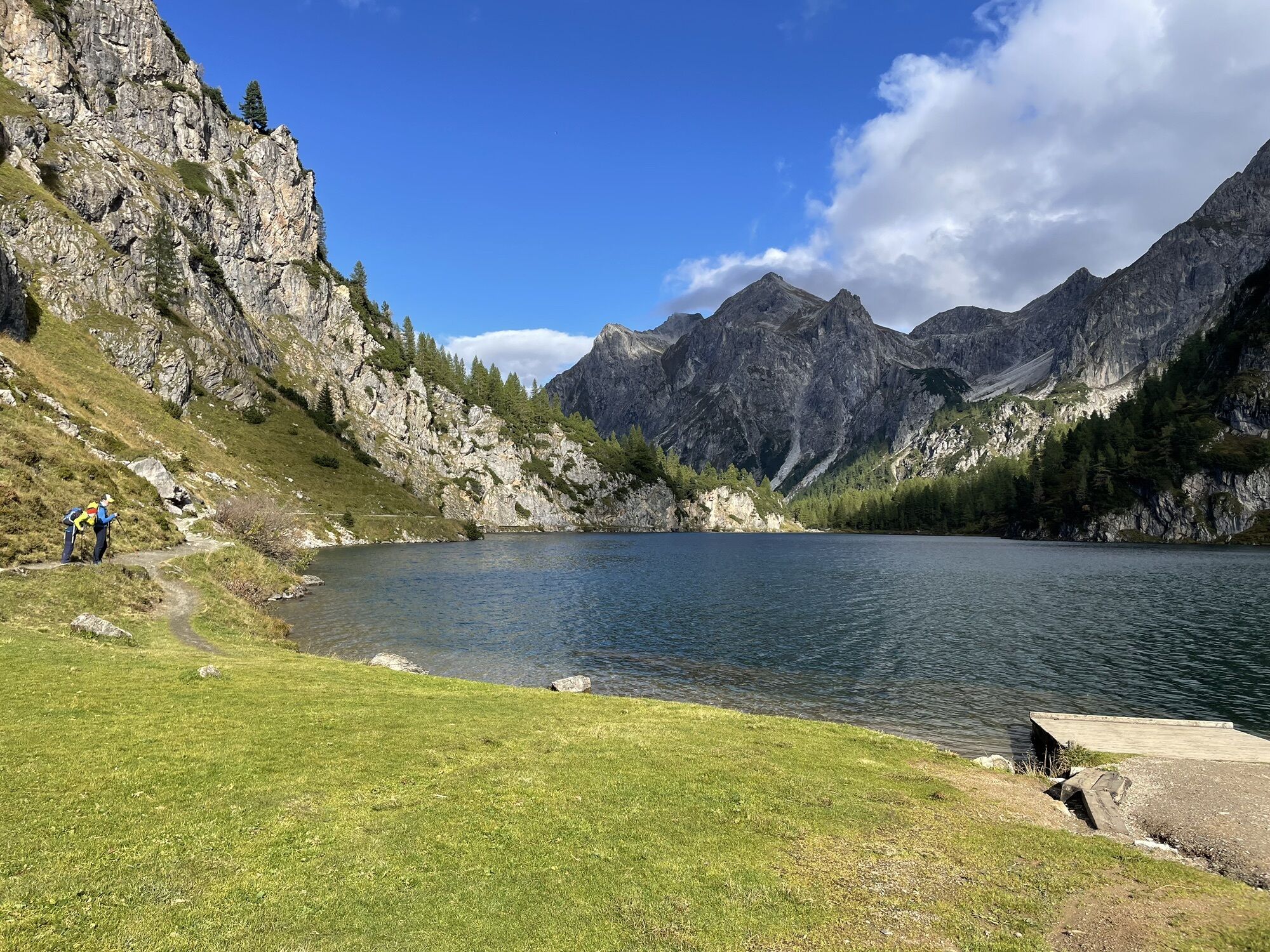
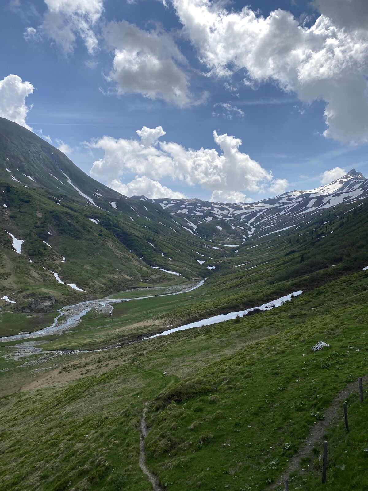
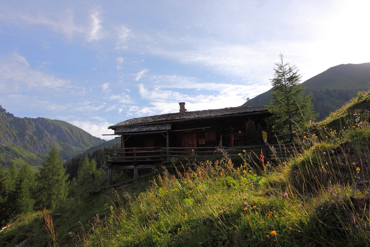
The flora and fauna here are especially beautiful because limestone allows many species of flowers that are otherwise quite rare. Once you reach the Draugsteinalmen, the right of the two huts is the Steinmannhütte and the left one is the Schrambachhütte (viewed from above). Both offer delicacies from their own production. Well fortified, you then return to the starting point of the route.


From the Hallmoosalm parking lot, 1,300 m, first hike a short stretch on the forest road (No. 53, 721), after about 1 km turn left following hiking trail 53, 721 to the Karteisalm, 1,661 m (approx. 1 h, not staffed). Continue on the same path to the Karteistörl, 2,145 m (approx. 1 1/2 h). Descent on path No. 721 to the Tappenkarsee hut, 1,820 m (approx. 3/4 h). Hike along the Tappenkarsee to the Tappenkarseealm, 1,768 m (approx. 1/2 h). Ascent on path No. 12, then 54 to the Draugsteintörl, 2,077 m (approx. 1 h). Then descend via hiking trail No. 54 to the Draugsteinalmen (approx. 1 h). The right alpine pasture when viewed from above is the Steinmannhütte, the left one is the Schrambachhütte. Descent via trail No. 54 back to the starting point of the route (approx. 1 1/4 h).
Áno
Hiking boots with profiled sole, hiking map, backpack with provisions, drinking bottle, and first aid kit
Drive by car or hiking taxi to the Hallmoosalm in Hüttschlag.
Hallmoosalm parking lot - there are parking spaces directly at the Hallmoosalm and further up there are more available.
Summits and mountain lakes in Großarltal
With some luck, you might see marmots during this circular hike around the Tappenkarsee and the Draugsteintörl area.
Fancy a summit experience? Then a detour to Kreuzeck is definitely worth it. Walking time from Karteistörl about 1/2 hour round trip.
Webové kamery z prehliadky

Obľúbené výlety v okolí
-
4,9
Großarl: Aualm - Liechtensteinkopf - Aukopf - Schuhflicker - Schuhflickersee
strednáTuristika 5,84 km -
5,0
Großarl: Alpine pasture circuit in Ellmautal
strednáTuristika 9,69 km -
4,1
Tappenkarsee Kleinarl
strednáTuristika 9,11 km -
4,9
Höhenweg vom Grünen Baum bis Bad Hofgastein
svetloTuristika 7,92 km -
4,8
Großarl: Mooslehenalm – Niggeltalalm – Viehhausalm
strednáTuristika 5,44 km -
4,3
"Elendrunde" Kleinelend Valley - Zwischenelendscharte - Großelend Valley
strednáTuristika 21,9 km -
4,8
Hüttenkogel - Graukogel von der Bergstation
strednáHorská turistika 4,68 km -
4,7
Kölnbreinspeicher bis Osnabrücker Hütte
svetloTuristika 15,9 km -
4,5
Mountain route from the Kötschachtal to the natural jewel Reedsee
strednáTuristika 12,5 km -
4,6
Bahnhof Bad Hofgastein nach Bahnhof Bad Gastein
strednáTuristika 13,0 km
Turistika a stopovanie


Nenechajte si ujsť ponuky a inšpiráciu na ďalšiu dovolenku
Vaša e-mailová adresa bol pridaný do poštového zoznamu.