
Gstoßhöhe
svetlo
Získajte túto prehliadku v mobilnom telefóne
Gstoßhöhe
svetlo
Turistika
13,51
km
Naskenujte kód QR a spustite navigáciu v aplikácii bergfex


Turistika a stopovanie





Gstoßhöhe
svetlo
Vzdialenosť
13,51
km
Trvanie
-
h
Ascent
864
hm
Hladina mora
990 -
1 887
m
Stiahnutie skladby
Gstoßhöhe
svetlo
Turistika
13,51
km
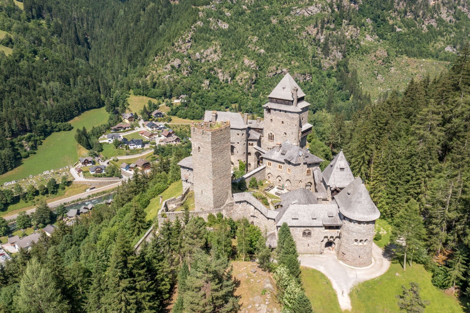
If you follow the main road down the Mur from Tamsweg, after approx. 8 kilometres you will reach the village of Ramingstein with the famous Finstergrün Castle, whose history can be traced back to the 12th...
Opis
If you follow the main road down the Mur from Tamsweg, after approx. 8 kilometres you will reach the village of Ramingstein with the famous Finstergrün Castle, whose history can be traced back to the 12th century.
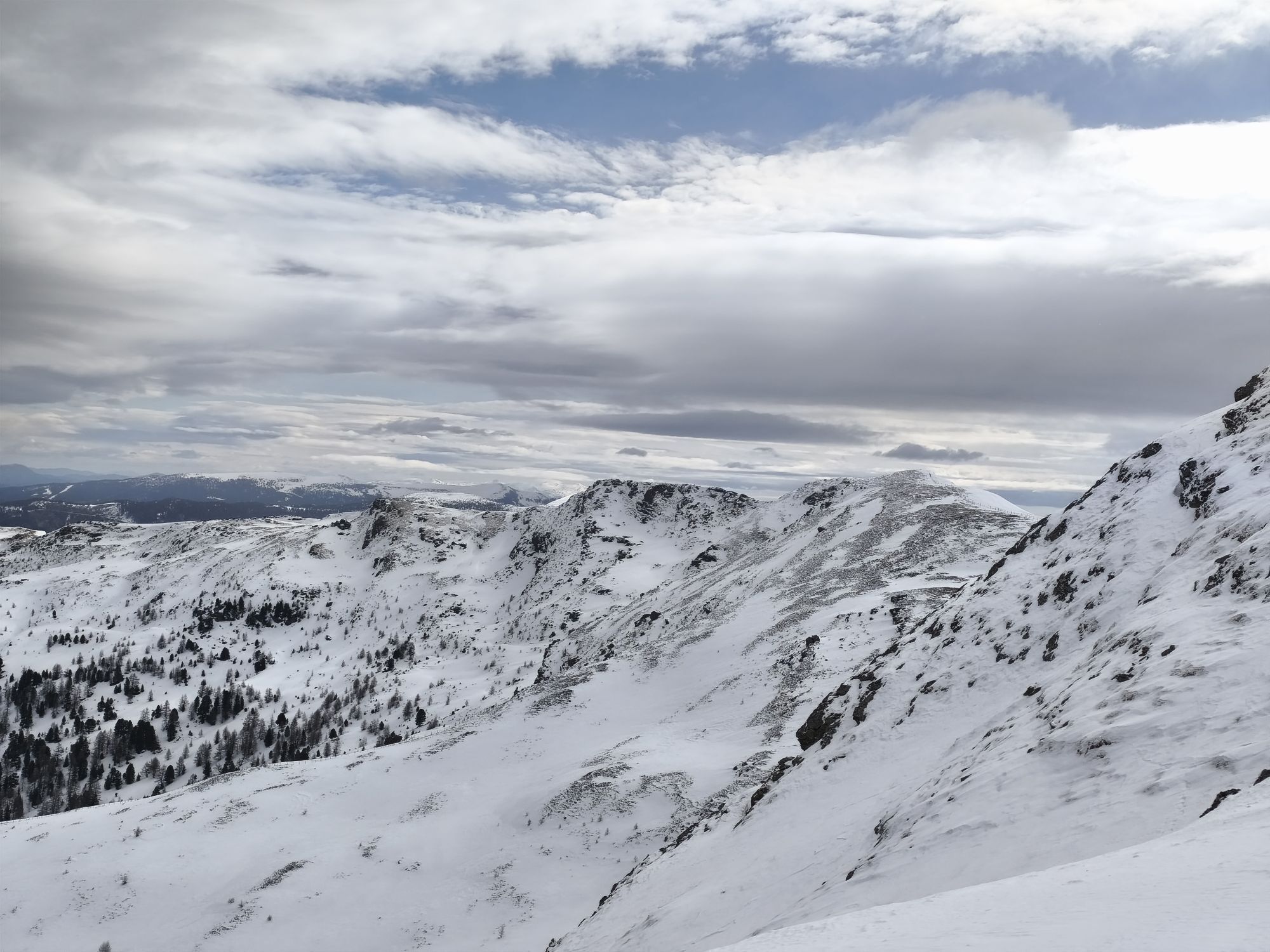
From the town square in Ramingstein, a signposted road leads up to Finstergrün Castle, continuing along the signposted Dürnrain ore trail via the castle promenade, partly on an old ore trail, to tunnels and spoil tips of the mining district. You then reach the Füchsl forest path, along which you walk to the Mühlhauseralm. The walk takes approx. 2 to 2.5 hours. The signposts lead hikers past the Heinereralm, but then nothing stands in the way of enjoying the summit at 1,890 metres.
The Mühlhauserhütte (not serviced) is quickly reached on the descent path. Leave the ascent route here and follow the path to the right into the forest until you reach a clearing. A signposted path branches off here and leads via the Tschrötteralm to Finstergrün Castle.
From the town square in Ramingstein, a signposted road leads up to Finstergrün Castle, continuing along the signposted Dürnrain ore trail via the castle promenade, partly on an old ore trail, to tunnels and spoil tips of the mining district. You then reach the Füchsl forest path, along which you walk to the Mühlhauseralm. The walk takes approx. 2 to 2.5 hours. The signposts lead hikers past the Heinereralm, but then nothing stands in the way of enjoying the summit at 1,890 metres.
The Mühlhauserhütte (not serviced) is quickly reached on the descent path. Leave the ascent route here and follow the path to the right into the forest until you reach a clearing. A signposted path branches off here and leads via the Tschrötteralm to Finstergrün Castle.
Trasa
Trasa
Gstoßhöhe
svetlo
Turistika
13,51
km


Oceňovanie
1 Komentár

Hanza

04. aug. 2025
Kein ersichtlicher Wanderweg
Landschaftlich sehr schön, nur leider kein beschilderter Wanderweg, immer wieder lag Holz vom Schlägern auf der Tour.
Obľúbené výlety v okolí
-
4,9
Schönfeld: Großer Königstuhl
strednáTuristika 11,2 km -
4,0
Schlögelbergrundweg Nr. 82 (Wasserweg Leisnitz)
strednáTuristika 5,15 km -
4,9
Gr. Königsstuhl, Nockalm, Kärnten
strednáHorská turistika 7,15 km -
4,7
Gstoder
strednáTuristika 4,72 km -
4,0
Ski tour educational trail Grünleitennock
svetloSkitour 4,29 km -
5,0
Prebersee und Halterhütte
strednáTuristika 8,20 km -
4,9
Königstuhlrunde im Biosphärenpark Nockberge
strednáTuristika 11,3 km -
4,1
Circular hike Königstuhl / Biosphere Reserve Nockberge
strednáTuristika 7,78 km -
3,2
Eisenhut 2.441 m
Turistika 20,2 km -
4,6
Ebenwald – Krametbichl – Lauβnitzer See – Ebenwald circular route (113/114/114a)
strednáTuristika 13,6 km
Turistika a stopovanie

Viac ako 550.000 návrhov výletov, podrobné mapy a intuitívny plánovač trás robia z aplikácie povinnú výbavu pre všetkých nadšencov prírody.

Nenechajte si ujsť ponuky a inšpiráciu na ďalšiu dovolenku
Prihlásiť sa k odberu noviniek
Chyba
Vyskytla sa chyba. Prosím, skúste to znova.
Ďakujeme za vašu registráciu
Vaša e-mailová adresa bol pridaný do poštového zoznamu.
Zájazdy po celej Európe
Rakúsko
Švajčiarsko
Nemecko
Taliansko
Slovinsko
Francúzsko
Holandsko
Belgicko
Poľsko
Lichtenštajnsko
Česko
Slovensko
španielsko
Hrvaška
Bosna a Hercegovina
Luxembursko
Andorra
Portugalsko
Island
Spojené kráľovstvo
Írsko
Grécko
Albánsko
Severné Macedónsko
Malta
Nórsko
Čierna Hora
Moldavsko
Kosovo
Maďarsko
San Maríno
Rumunsko
Estónsko
Lotyšsko
Bielorusko
Cyprus
Litva
Srbsko
Bulharsko
Monako
Dánsko
Švédsko
Fínsko





