



Bramberg: Elfer circular route

The path to Karalm must be considered for this route.
Starting from Karalm, follow the trail briefly towards Zwölferkogel. Soon, the trail forks off to the left towards Elferkogel. The path climbs steadily...
The path to Karalm must be considered for this route.
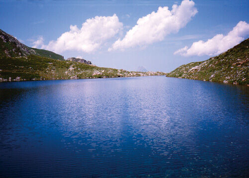
Starting from Karalm, follow the trail briefly towards Zwölferkogel. Soon, the trail forks off to the left towards Elferkogel. The path climbs steadily beyond the tree line to the Elferschlössl - an impressive rock monolith. Passing this, the route continues partly over easy boulder terrain to the Elfer summit. Sure-footedness and a head for heights are required for the last section. The circular route goes over the summit and then descends on the right-hand side to Karsee. Here, you join the Zwölferkogel trail, which leads back to Karalm. From the summit of Elferkogel, there is also the option to descend on the east side to Hollersbach via Geralm in about 3 hours. Since there are no refreshment opportunities on this tour, make sure to pack enough drinks and snacks.

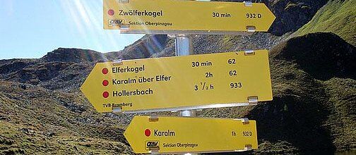

Karalm – Elferkogel – Karsee – Karalm
Trail No. 932, Trail No. 62
Duration approx. 3:30 h (circular route)
Sturdy footwear, good fitness, and sure-footedness are required for this hike.
The last section requires a head for heights.
There are no refreshment stops on this hike – bring drinks and snacks!
Do not leave marked hiking trails - keep dogs on a leash!
Option 1:
Take the Habachtal exit on B 165 and follow the road towards Familienhotel Grundlhof. Immediately after the hotel, turn right and cross a wooden bridge to reach the Habachtal parking lot.
Option 2:
Alternatively, you can start from the parking lot in the Bramberg district of Wenns.
Option 3:
Another possible starting point is the Mühlbach train station.
The public train stations are only a few minutes' walk from the various possible starting points: Habachtal parking lot, Wenns parking lot, or Mühlbach train station.
Option 1:
Paid parking spaces are available at the Habachtal parking lot.
Option 2:
The Wenns parking lot can be used free of charge.
Option 3:
You can park your car for free at the Mühlbach train station.
Wildkogel-Arena
Tourist offices Neukirchen & Bramberg
Tel. +43 (0) 720 710 730 info@wildkogel-arena.at
From the summit, you have the possibility to descend to Hollersbach in about 3 hours via trail No. 933.

Obľúbené výlety v okolí
-
4,2
Gletscherlehrweg Innergschlöß
strednáTuristika 9,36 km -
3,7
Smaragdwanderweg Habachtal/Bramberg
svetloTuristika 7,17 km -
3,9
Mittersill - Hintersee und Plattachsee
ťažkéTuristika 9,90 km -
4,7
Hollersbach - Neue Fürther Hütte
Turistika 16,0 km -
4,7
Vom Matreier Tauernhaus über die Felsenkapelle nach Innergschlöss
svetloTuristika 9,19 km -
4,2
Habachtal bis zur Thüringer Hütte
Turistika 6,53 km -
3,9
Hollersbach: Pihapper path no. 935
ťažkéTuristika 12,8 km -
4,7
Frühmesser
strednáTuristika 10,6 km -
4,1
Via the Schösswendklamm to Hintersee
strednáTuristika 8,29 km -
4,3
Untere Wasserälle Krimml Krimml, Österreich
svetloTuristika 5,04 km
Turistika a stopovanie


Nenechajte si ujsť ponuky a inšpiráciu na ďalšiu dovolenku
Vaša e-mailová adresa bol pridaný do poštového zoznamu.


