


Circular hiking route - "Adventure route around Trusetal" - Thuringian Forest
From the bus station car park, we walk about 150 m in a northwest direction towards Hofberg. Once the plateau is reached, we have a first beautiful view of the district Herges. Our hike continues towards...
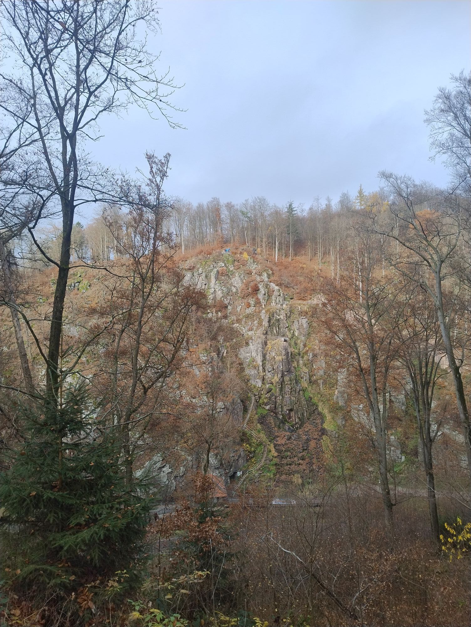
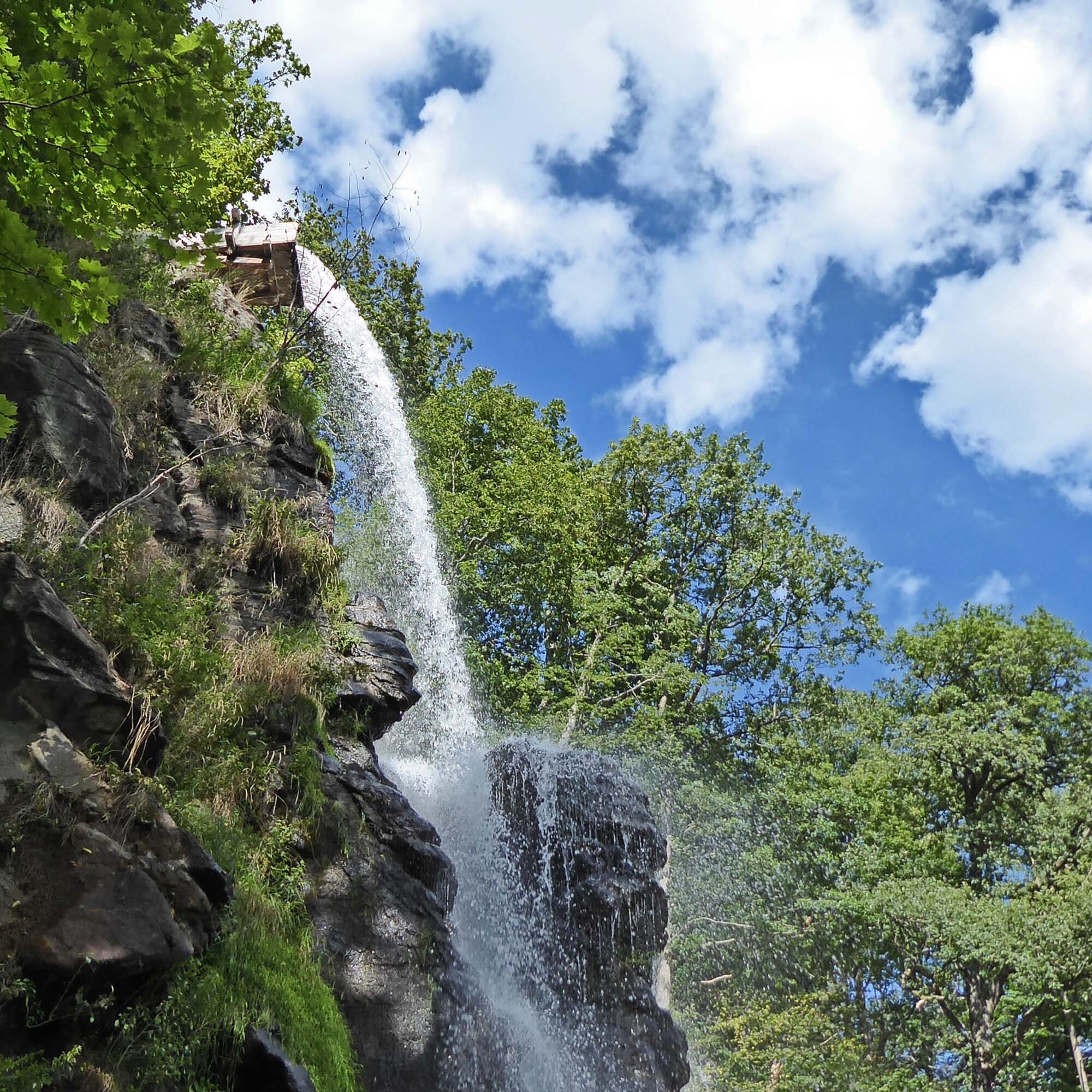
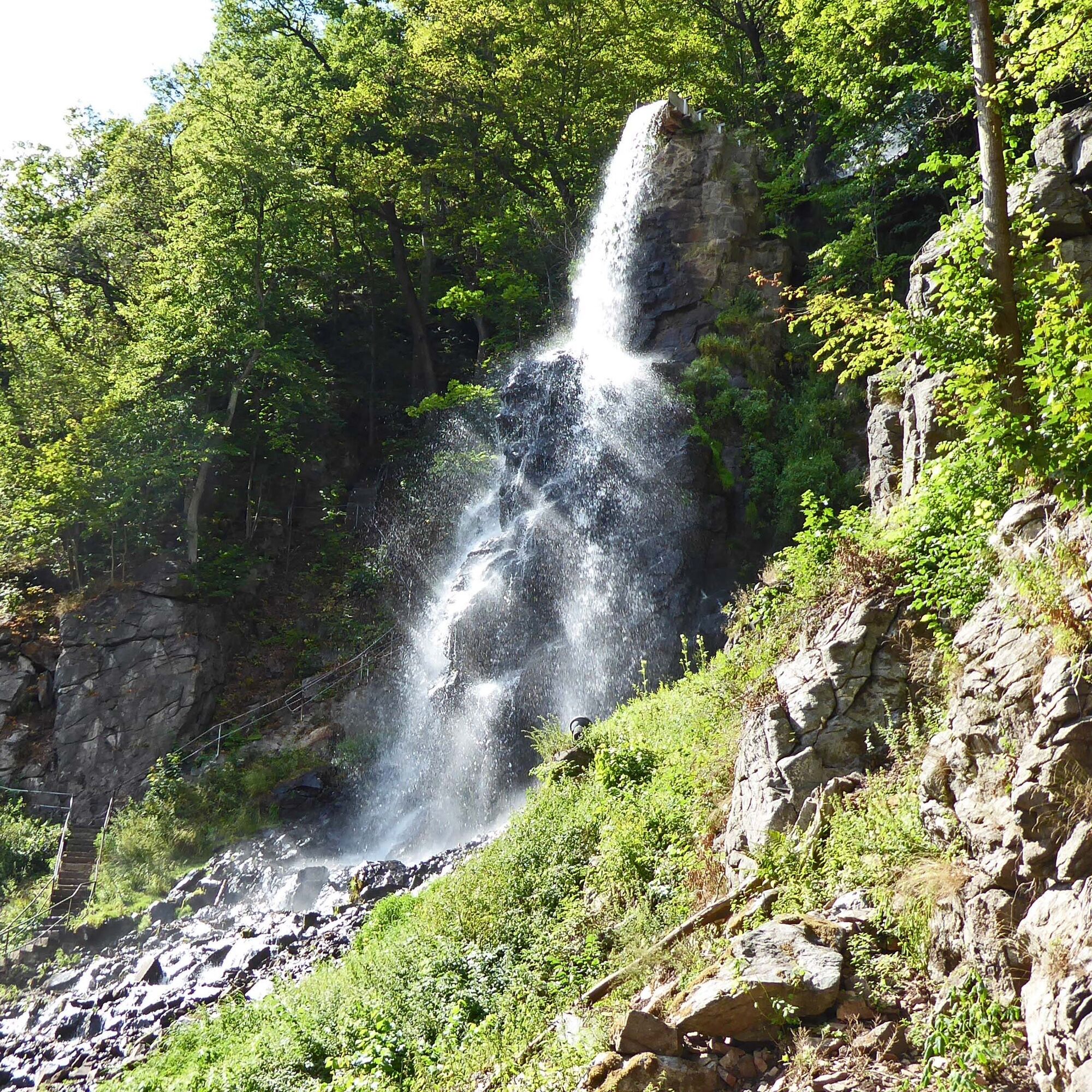
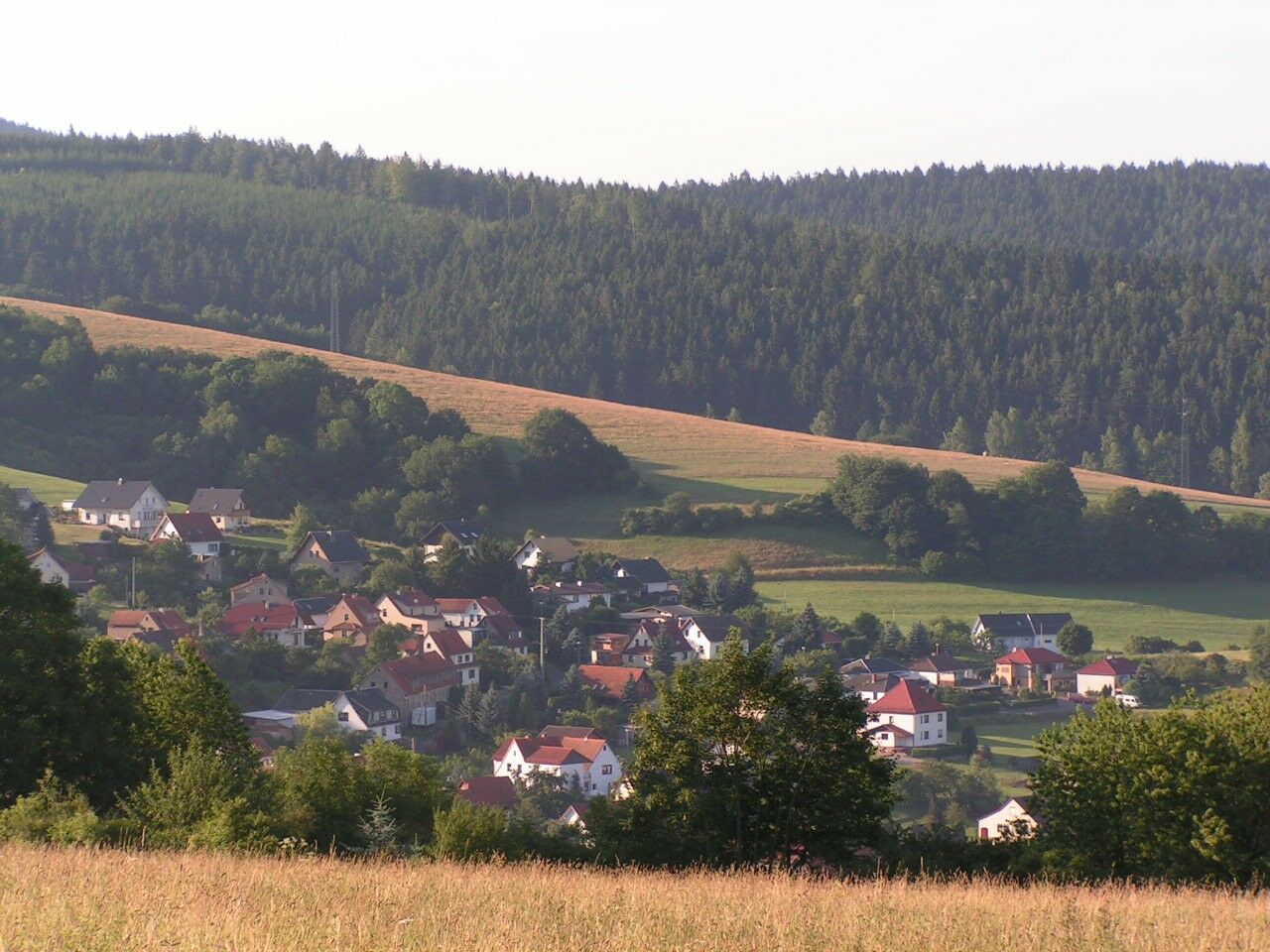
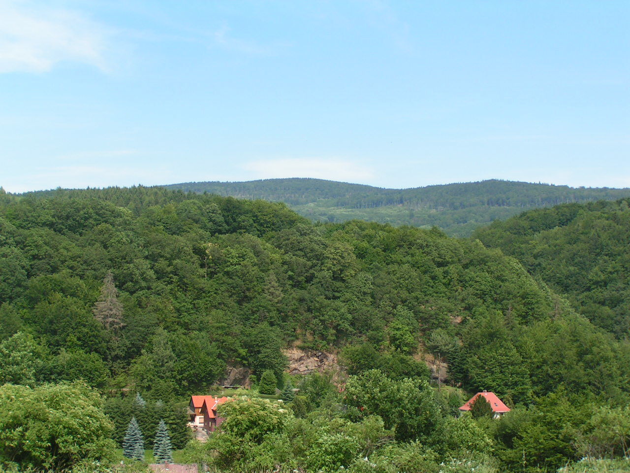
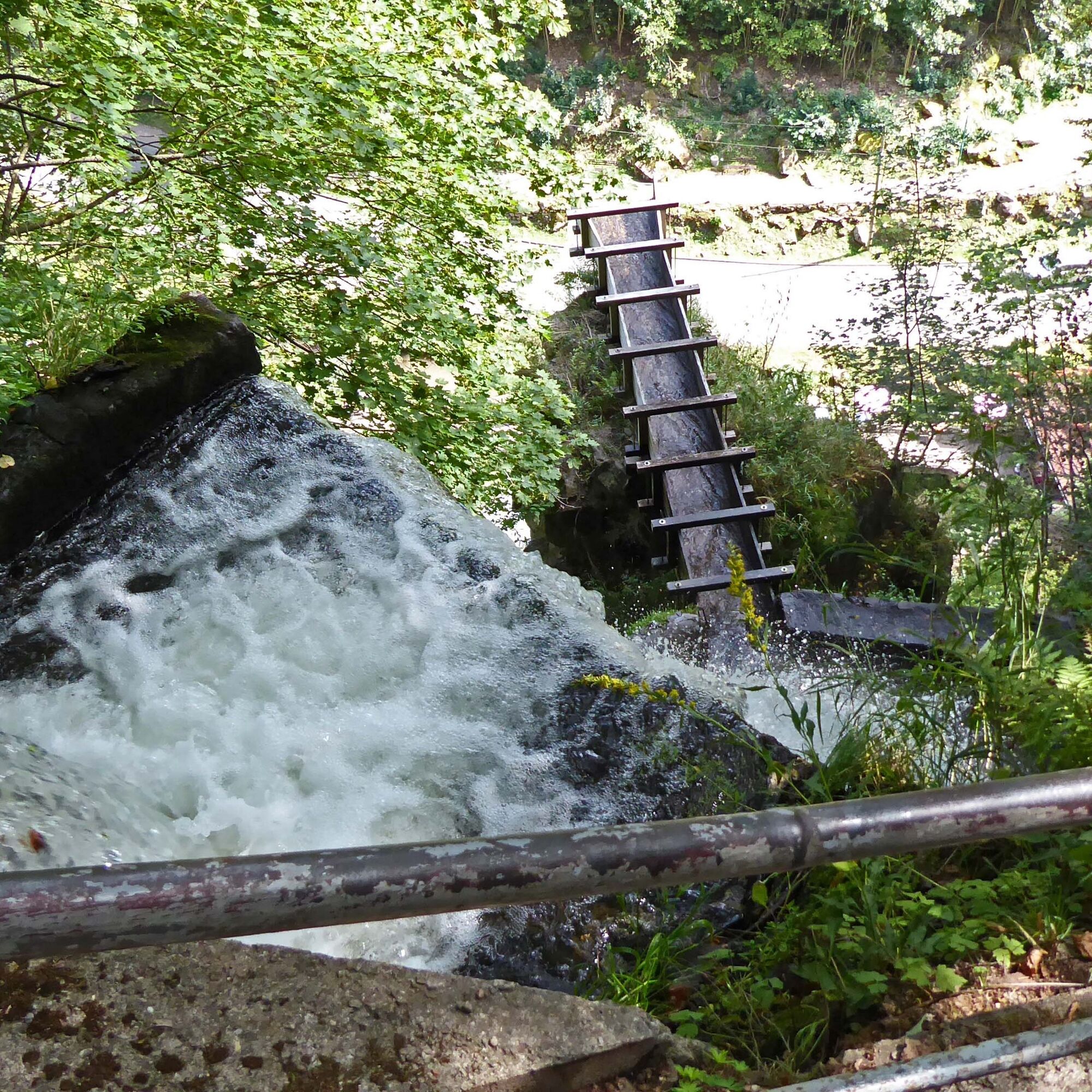
From the bus station car park, we walk about 150 m in a northwest direction towards Hofberg. Once the plateau is reached, we have a first beautiful view of the district Herges. Our hike continues towards the second district, Elmenthal. After walking through the short forest section, we see the beautiful Elmenthal at our feet. Our view goes over a beautiful valley. On the other side, we can already see how our further path continues. After we have walked through the district, we see Elmenthal once again from a different perspective. Now we are at the "Elmenthal forest stadium", a very nice small sports facility. Our hike goes in the direction of the "Devil's Pulpit". There is a beautiful legend about the pulpit. From the "Devil's Pulpit", the hike goes to the Trusetal waterfall, the landmark of our town. Here you can learn a lot about the history of the place. The waterfall also invites you to take a short break. The hike then continues southwards. We walk around the beautiful Oak Head with one last look at the waterfall. From the platform, there is the possibility to photograph the waterfall in all its beauty. After we have walked around the Oak Head, we leave the forest. We let our eyes wander and already see the Wallenburger Tower nearby. The tower is also a beautiful destination and a hike is worth it (circular route 5). Our hike continues towards Trusetal. Along the way, we walk through beautiful winding alleys before returning to our starting point.

Car park at the town hall - Hofberg (1.0 km) - Elmenthal bakers (1.5 km) - Elmenthal forest stadium (2.2 km) - Devil's pulpit (2.6 km) – Waterfall + toilet (3.0 km) – Waterfall view (3.5 km) - Oak head (4.2 km) – Car park at the bus station (5.1 km)
Marking: Blue 2
Áno
Sturdy footwear
Drink supply
First aid kit
GPS navigation device or smartphone
Be aware of the typical dangers of the forest!
Walking is at your own risk!
We wish you a relaxing and eventful hike!
Coming from the A4, take exit 41a (Waltershausen) and then continue on L1027 towards Bad Tabarz and then via Inselsbergstraße to Brotterode-Trusetal.
You can reach Trusetal on weekdays with bus line 445 from the direction of Schmalkalden (connection to DB). Use the following link for travel planning:
→ Travel to Brotterode/Trusetal
Just add your desired travel date and your starting point.
Many beautiful views

Obľúbené výlety v okolí
-
4,5
Summit and panoramic route - Route 1 - Bad Tabarz
strednáTuristika 10,9 km -
3,8
Wanderung zum Spitterfall
strednáTuristika 14,6 km -
Tabarzer Vulkansteig
strednáTuristika 9,91 km -
3,2
Von Friedrichroda zum großen Inselsberg
strednáTuristika 22,4 km -
4,5
Circular hiking trail - "Trusetal Landmark Route" - Thuringian Forest
svetloTuristika 4,02 km -
5,0
Inselsberg tour - Tour 2 - Bad Tabarz
ťažkéTuristika 15,1 km -
3,5
Backofenloch circular route - route 6 - Bad Tabarz
strednáTuristika 7,02 km -
4,0
Circular route - Tanzbuche - Friedrichroda - Thuringian Forest
strednáTuristika 10,2 km -
5,0
Rundwanderweg - Marienglashöhle - Friedrichroda - Thüringer Wald
svetloTuristika 5,29 km -
4,0
Circular route - Spießberghaus - Friedrichroda - Thuringian Forest
strednáTuristika 10,7 km
Turistika a stopovanie


Nenechajte si ujsť ponuky a inšpiráciu na ďalšiu dovolenku
Vaša e-mailová adresa bol pridaný do poštového zoznamu.