


Circular hike - Harcher Leingstamauser Route - Harra
Úroveň náročnosti: T1
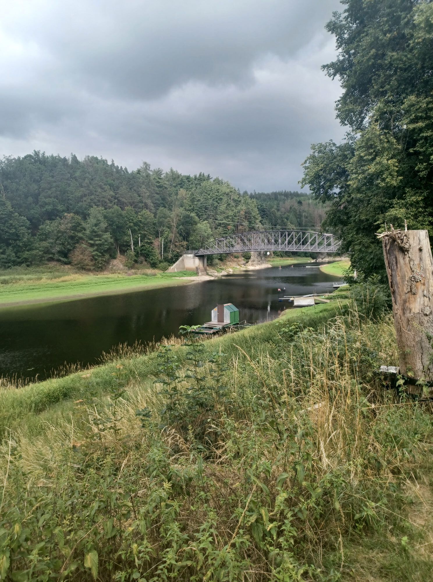
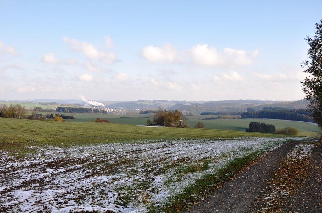
From the Saale bridge in the village, we walk uphill, past the campsite over the railway bridge towards Blankenstein.
Just before leaving the village, we take the climb on the right, past the elevated...
From the Saale bridge in the village, we walk uphill, past the campsite over the railway bridge towards Blankenstein.
Just before leaving the village, we take the climb on the right, past the elevated tank continuing towards Absang, with a great view of Blankenberg, Berg, and Blankenstein.
We reach Bärwinkel, go left downhill at the farm towards Moschwitzgrund, the former inner-German border, now the "Green Belt".
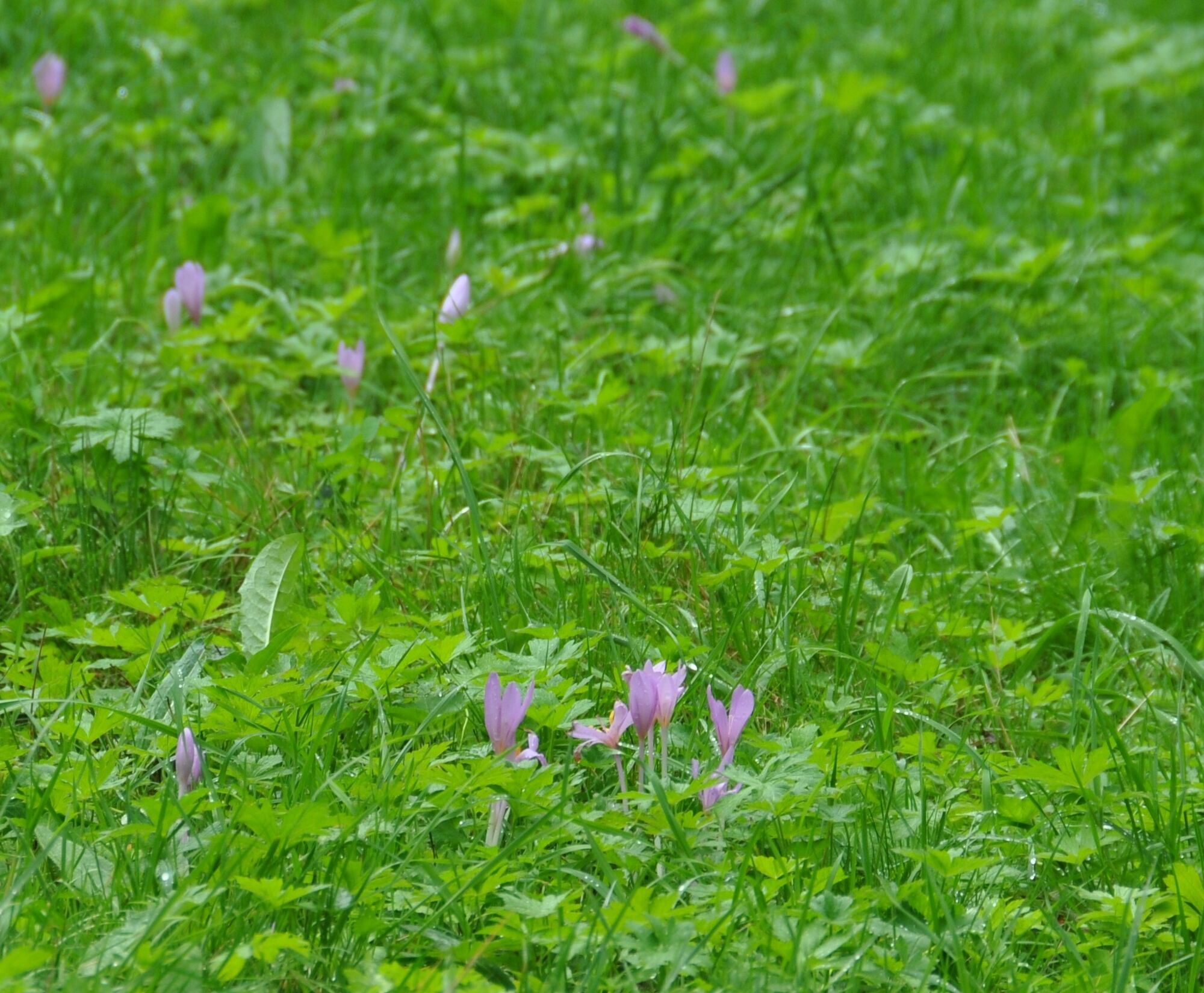
In the valley floor, we walk to Dorschenmühle. From September, a meadow with autumn crocuses can be admired here.
After a short climb, we reach the "Kießlinger Alm," with a view of the Moschwitz valley.
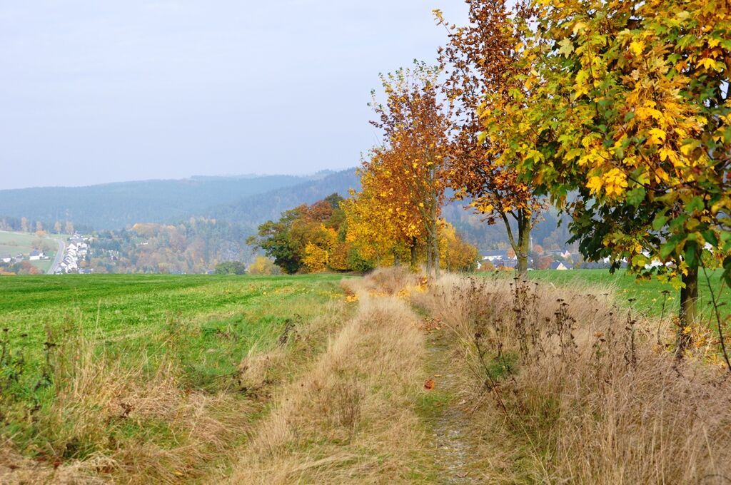
We follow the forest path uphill through spruce and young mixed forest with views of the town of Lichtenberg and the Franconian Forest region. At the highest point of the hike, Wiesbühl at 624m, there is a distant view up to the Ochsenkopf. We walk a short distance on the Rennsteig towards Blankenstein to the seating area. Here we cross the street and continue towards the Matzbühl forest section. At the forest edge, there is a view of the Stauden meadow and the Saale valley to Fürstenhöhe in Saalburg.
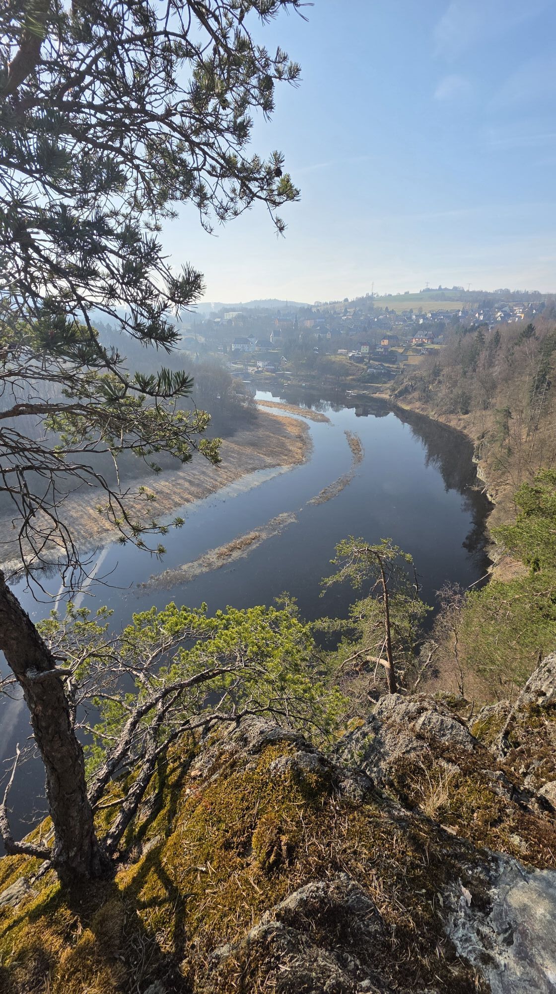
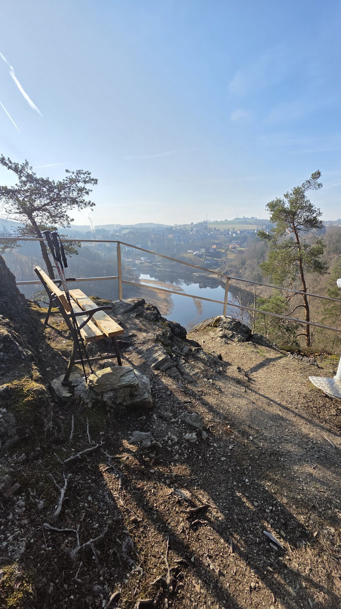
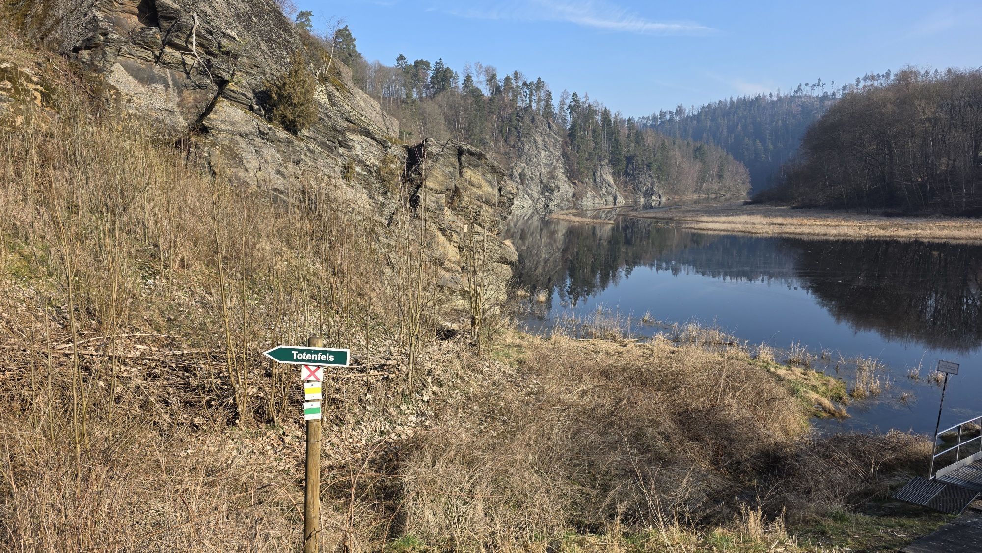
We follow the forest edge downhill to the next forest road to the connecting road Bad Lobenstein/Harra. After about 200 m, we leave the road towards Totenfels with a view of the Alpensteig region.
A detour to the Totenfelsen is worthwhile because of the beautiful view of Harra and the Saale valley.
We continue the route to the starting point of the hike.


The marking of the route is currently being revised.
Sturdy footwear
Rainwear
First aid kit
GPS navigation device or smartphone
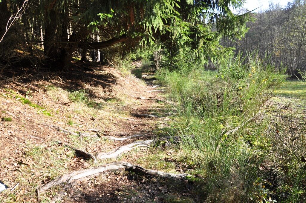
The hiking trail requires sturdy footwear. You walk partly on narrow paths. Avoid stepping on moss-covered stones and rocks due to the risk of slipping, and watch out for deadwood, branches, and fallen trees.
Arrival possible by bus and train, station about 400m away
Arrival possible by passenger ship from Saalburg/Saaldorf.
Restriction: Due to lowering of the water level of the reservoir, there may be changes in the timetables.
Free parking directly at the starting point.
Charging option for e-bikes
T1
We are happy to answer your questions about the nature park!
You can contact us at naturpark.schiefergebirge@nnl.thueringen.de.
The great views of Blankenstein and, in good weather, up to the Osenkopf.
Obľúbené výlety v okolí
-
4,0
Höllental über Hirschsprung und unten wieder zurück
strednáTuristika 9,61 km -
4,5
Hirschberg Primeval Forest Trail - Thuringian Primeval Forest Trails
svetloTuristika 2,84 km -
5,0
Saalepfad - Circular hike at the Green Belt
ťažkéTuristika 34,8 km -
5,0
Circular route - Schönblickweg - Harra
strednáTuristika 7,80 km -
Hike - Rennsteig - Stage 8 - From Brennersgrün to Blankenstein
strednáTuristika 20,8 km -
4,0
Rund um die BleilochTalsperre - Saalburg Beach und zurück
strednáE-MTB 20,1 km -
Roßkunst Geopath - Harra
strednáTuristika 6,23 km -
Venzka - Hirschberg - Saalesteg - Venzka
strednáTuristika 8,24 km -
Circular hiking trail - Mushroom experience trail Gräfenwarth - Thuringia
strednáTematická trasa 5,48 km -
4,0
Von Wurzbach zum Häslich
svetloTuristika 6,70 km
Turistika a stopovanie


Nenechajte si ujsť ponuky a inšpiráciu na ďalšiu dovolenku
Vaša e-mailová adresa bol pridaný do poštového zoznamu.