


Passo S. Uldarico (Cross Country)
Signage: 756. Passo San Udalrico - Tour
The Passo Udalrico crosses from Drena over into the Valle di Cavedine. This you reach after just over four kilometres on minor roads with little traffic. From the...
Signage: 756. Passo San Udalrico - Tour
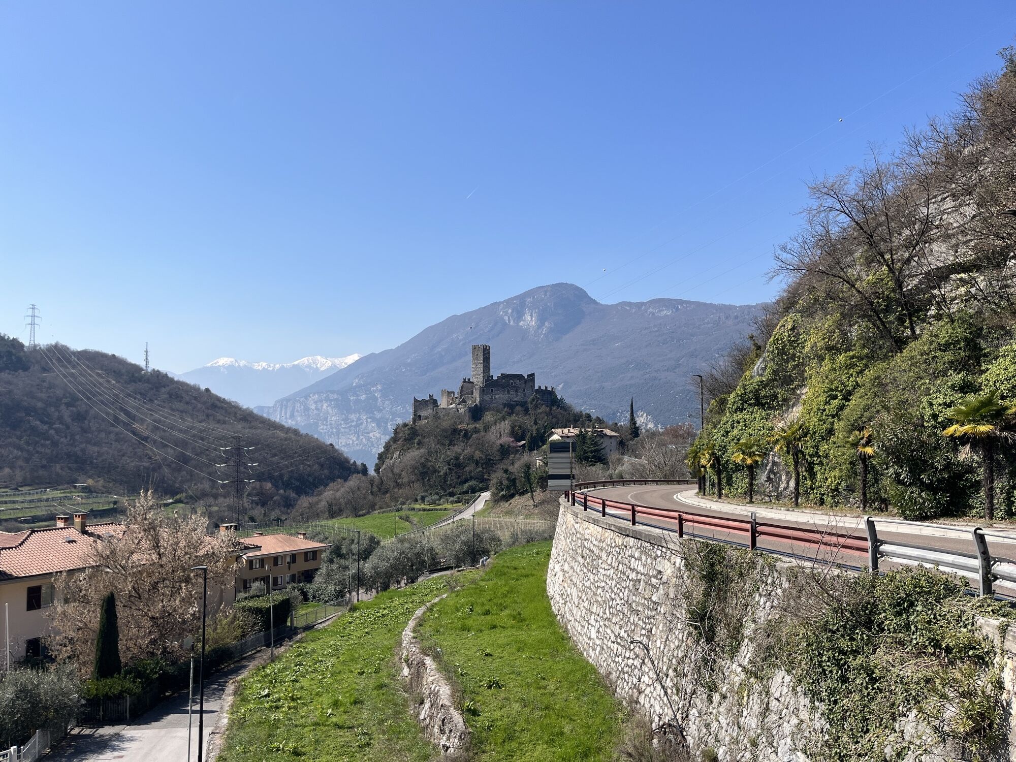
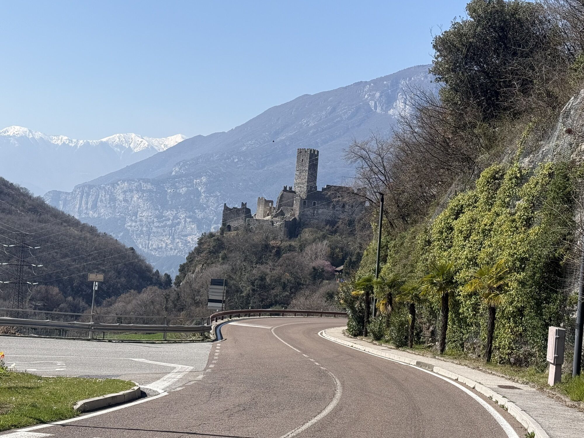
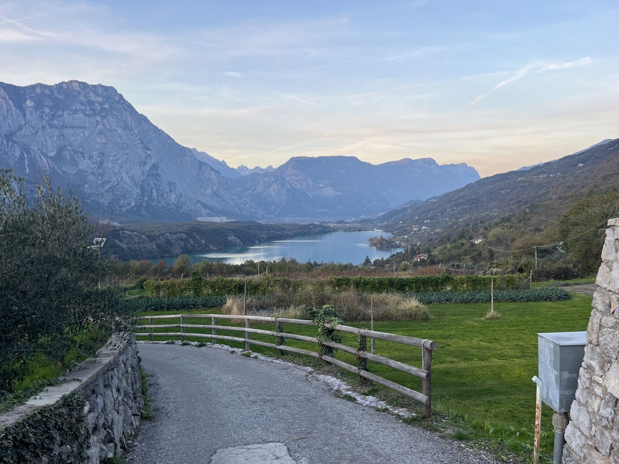
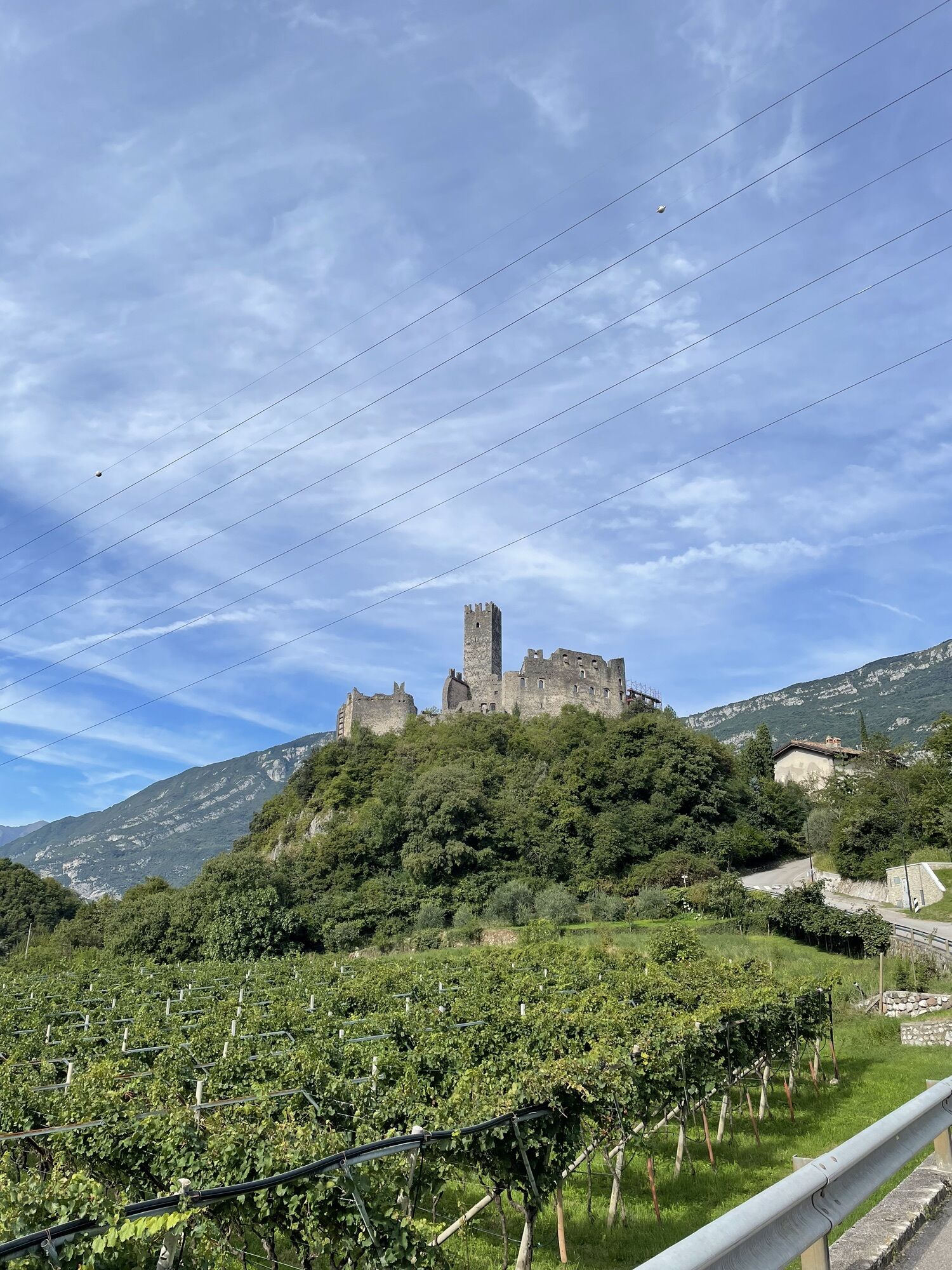
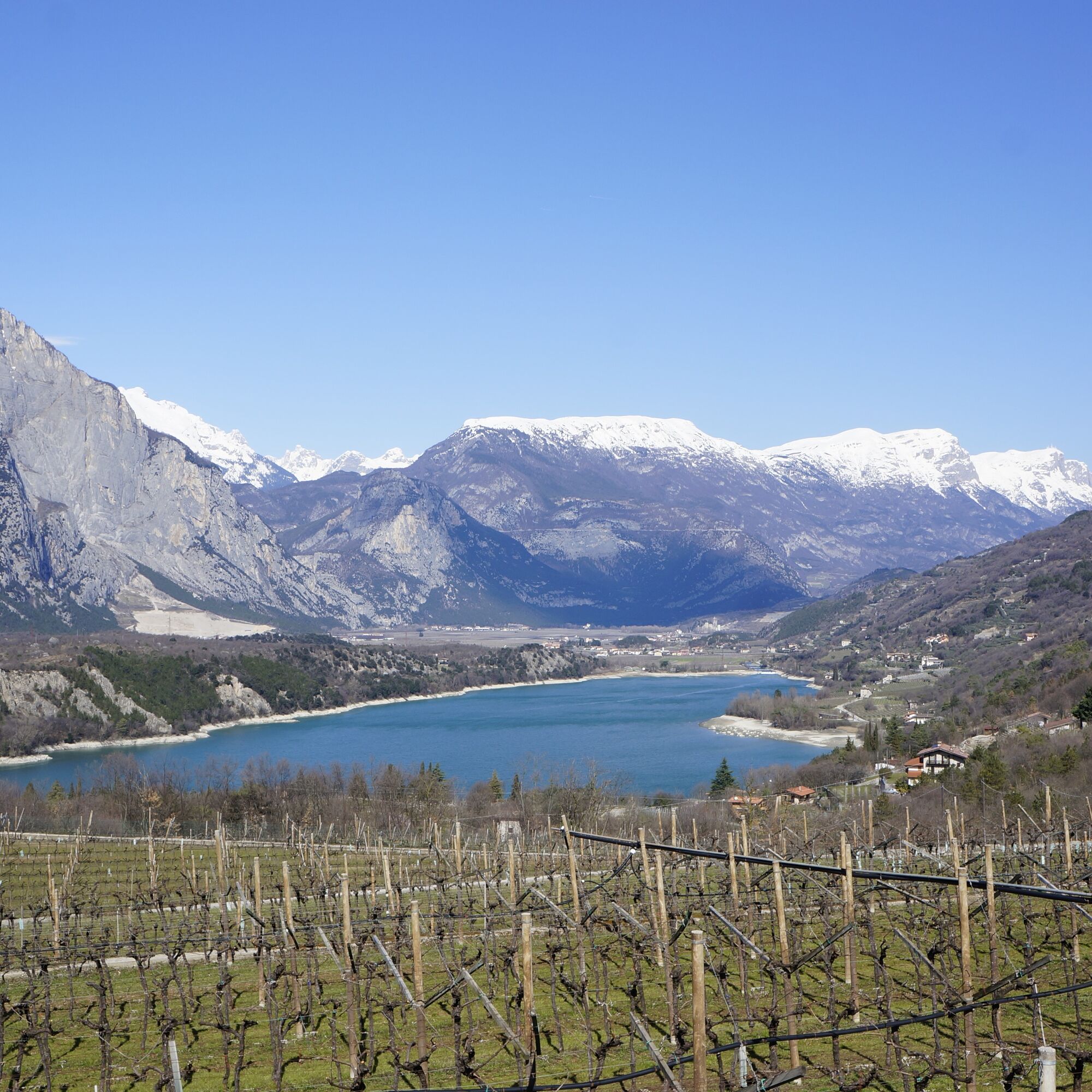
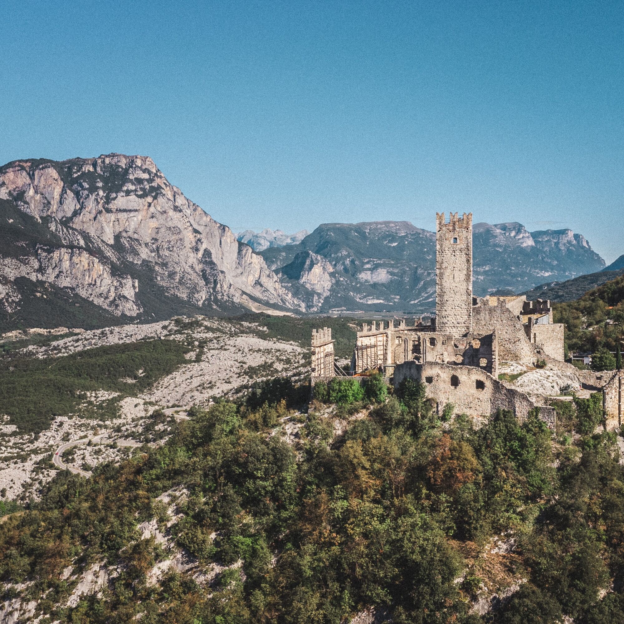
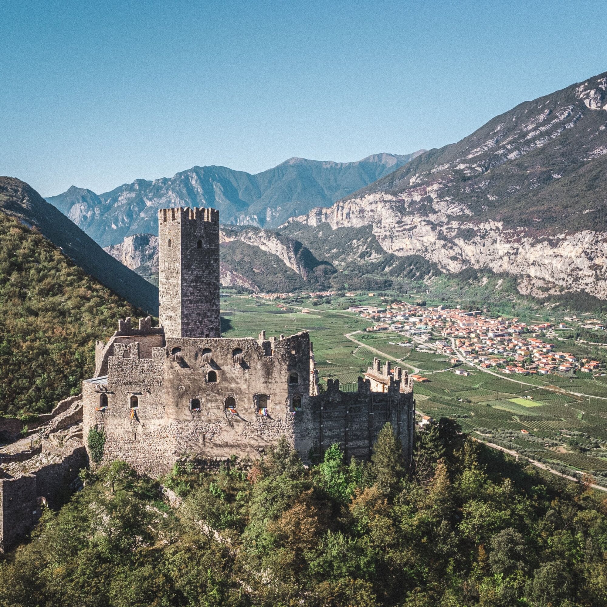
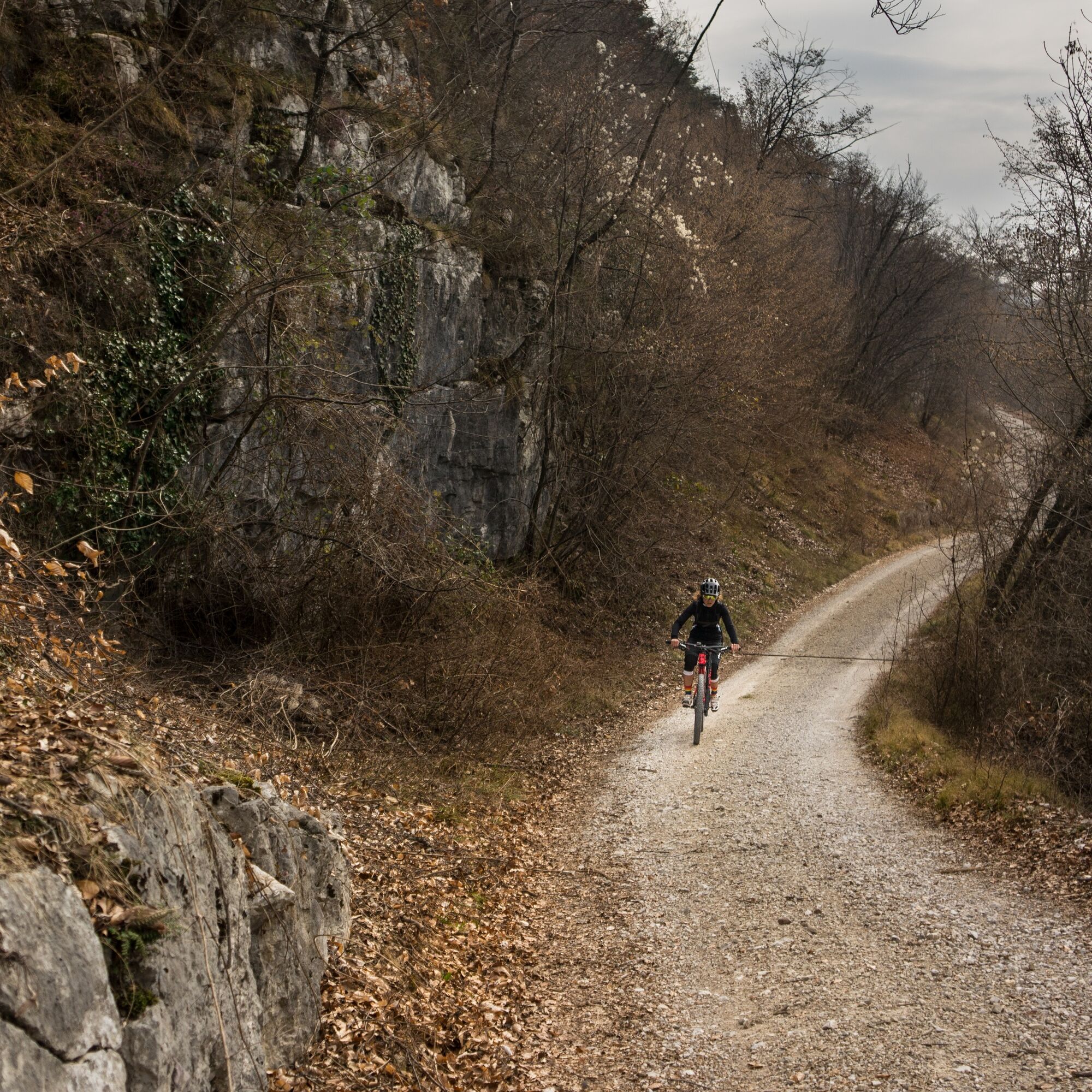
The Passo Udalrico crosses from Drena over into the Valle di Cavedine. This you reach after just over four kilometres on minor roads with little traffic. From the pass, turn left along a road to Chiesetta di Maria Ausiliatrice, passing a lovely set of stations of the cross. Then, a few bends further on, take a forest track and enter the woods. You then coast easily downhill until, after about 9 km, you have the choice of descending via a short, easy trail to the road that leads back towards Drena, or to tackle the appealing San Siro variant. The route back to Drena involves ups and downs on different surfaces and paths, all the time enjoying a beautiful view of Lago di Cavedine and the landscape of the Marocche. Right at the end you climb up the road to Drena Castle.
Variants: 756a. Variante San Siro

The route starts near to Drena castle, in the nearby car park. Initially you will not find the route directions (number 755). First, take the provincial road towards the beautiful village of Drena, leaving the castle behind you. After about 400 meters, cross the road to take the initially steep - Via Rovereto on your left. Follow this quiet internal lane, which leads you to proceed parallel to the provincial road below. After crossing the locality of Naroncol you will again meet the provincial road. Cross this, and after a few hundred metres, turn right - dropping down into Luch. Still riding on asphalt, at the next junction (now led by the signs) - turn left / northwards to ride through the crop fields of the Cavedine valley. After a short gravel track taking you to a crossroads, keep right towards the centre of Masi di Vigo. And before reaching the built-up area turn left again heading north, until you once again meet the provincial road at Passo San Udalrico.
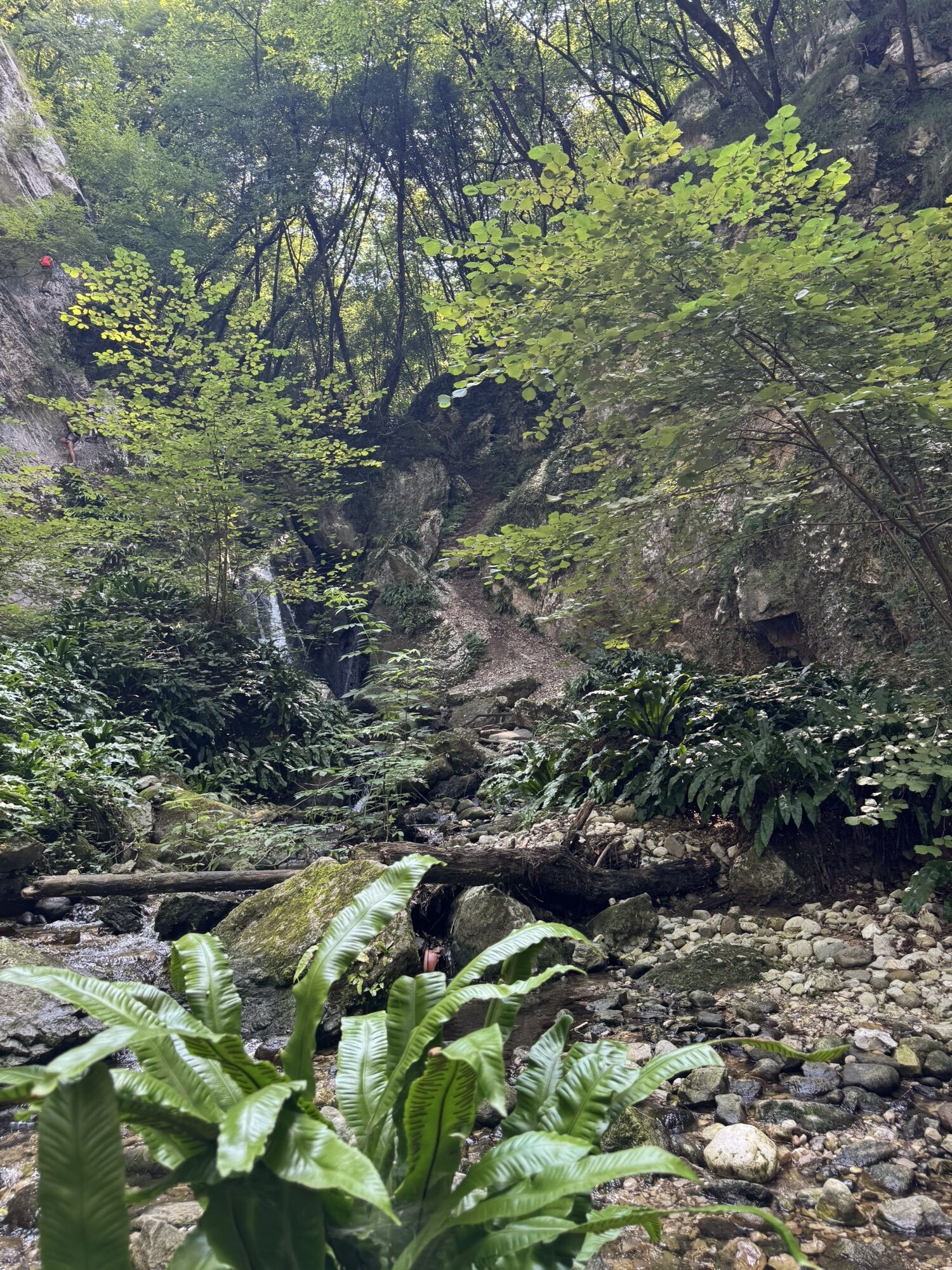
Continue right on the main road, and after around 200 meters turn left to climb up Via Coste, reaching a village of the same name. This road is characterised by a very Italian sight - the stations of the cross, leading you up to a small church. Here continue straight ahead, following the road to discover the route signage which indicates you to continue on the forest road. Ride downhill on the pleasant, undulating path, which is stable and quite flowing. At the end of the forest, continue straight until you reach the stop sign where you must keep left on Via Trebi. Next you will find yourself in an archaeological area which you must leave on your, following the main road. If you want to lengthen your adventure, you could always follow the directions of route 753, which then rejoins this. Otherwise, continuing straight on the road, you will shortly begin to descend, with Lake Cavedine and the Sarca valley below you.
Guided by the signposts - take the second fork that you shall meet on your left, interrupting the descent to continue on a slightly uphill, gravel road.
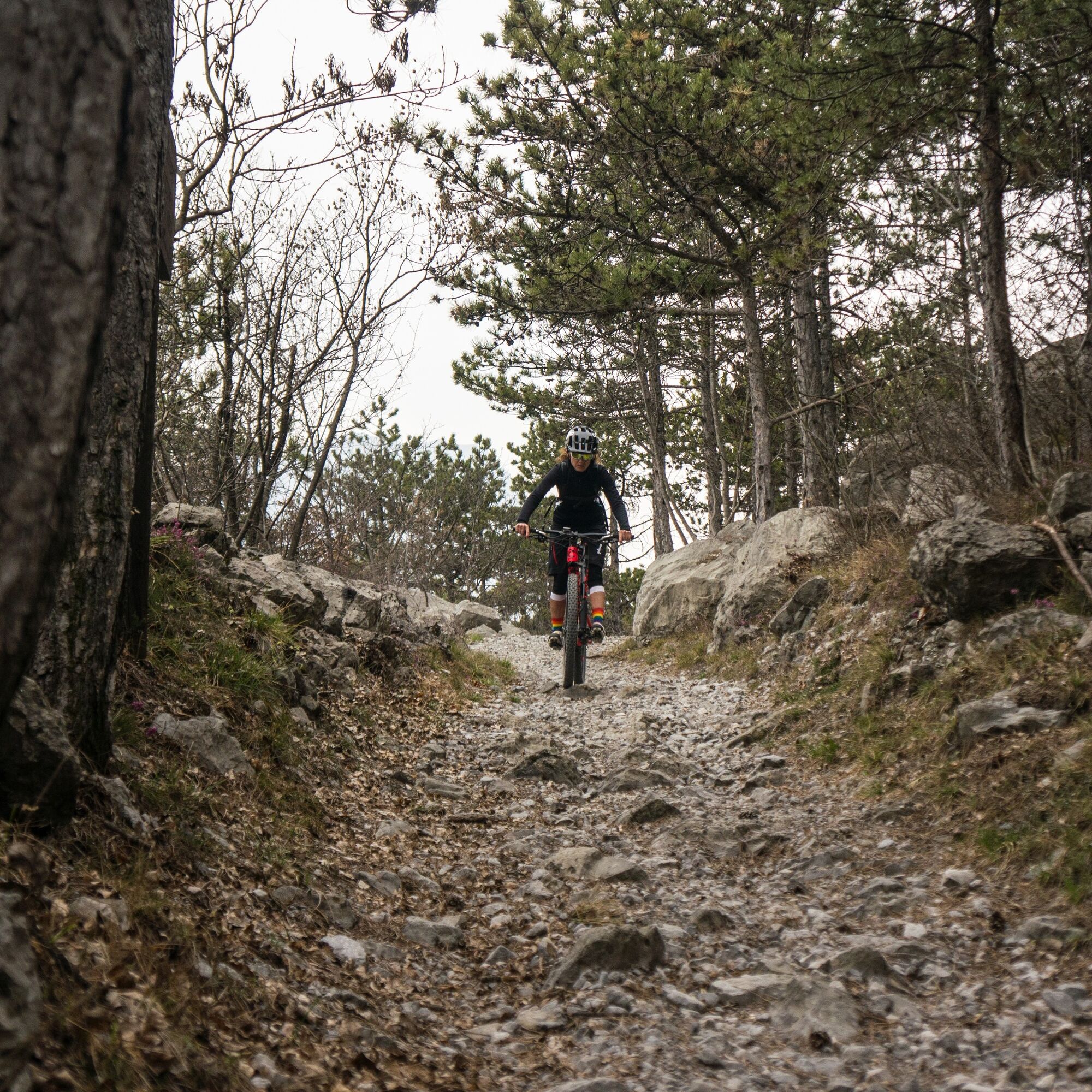
At the end of the road continue straight to face the last downhill stretch, the most technical part of the whole route. Having successfully tackled this section, you shall once again meet the provincial road to Cavedine. Here turn left, going uphill for about a kilometre over a couple of divine hairpin bends to once again reach your start point.
Riding your bike requires specific clothing and equipment, even for relatively short and easy trips. It is always better to be prepared… e.g. for bad weather or a sudden drop in your energy levels. The unexpected things are part of the fun!
Remember to thoroughly evaluate the type of route you plan on doing, the locations you intend to cross and the current season. Has it been raining? Attention: The paths may be slippery and require more caution.
What do I need to bring on my bike tour?
An adequate water supply according to your needs (considering temperature, possibility of refuelling and duration of the route) Plenty of snacks (for example, dried fruit or energy bars) Waterproof / Windproof jacket A spare top / spare socks (Descending in a sweaty garment, will make you cold). Suncream Sunglasses Bike gloves/mitts Map or GPS device Bike lights: best placed on your helmet or handlebars. (It is always best to be prepared) Bike repair kit for punctures and mechanical breakdowns First aid kit Emergency whistleIt is always advised to let someone know where you plan to go and how long you expect to be.
Emergency telephone number 112.
ITRS - International Trail Rating System
The ITRS is an objective way to assess trails and routes from a biker’s perspective, evaluating four aspects:
Technical Difficulty: riding skill level needed Endurance: combined effect of length, uphill and downhill Wilderness: amount of planning required based on mobile phone reception, rescue options, water supply and wildlife Exposure: consequences of a fallDiscover more about the ITRS system and check the classification of this tour in the photo gallery.
Safety Tips
Always wear your helmet. Plan your ride. You share the trail with other users. Yield right of way to hikers. Let your speed be determined by your experience. Ride slowly on crowded trails, overtake with politeness and respect. Cycle only on authorized and open trails. Avoid muddy trails in order not to damage them further. Respect public and private property. Always be self-sufficient. Do not cycle solo in remote areas.This information is subject to inevitable variations, so none of these indications are absolute. It is not entirely possible to avoid giving inexact or imprecise information, given how quickly environmental and weather conditions can change. For this reason, we decline any responsibility for changes which the user may encounter. In any case, it is advisable to check environment and weather conditions before setting out.
Find out how to reach Garda Trentino.
Drena is connected by the intercity bus lines 204 (Riva del Garda – Cavedine – Trento) to the other places in Garda Trentino.
Stop in the locality Marocche on request.
Parking along the main road near the castle or in the locality Marocche, near the Tamburello sports field.
Visitors can climb to the top of the tower of Drena Castle, no less than 25 off the ground, which affords a spectacular view of the Marocche and the Valle della Sarca.
Obľúbené výlety v okolí
-
5,0
Bastione and Santa Barbara, the lords of Riva del Garda
strednáTuristika 2,94 km -
5,0
Via Ferrata Signora delle Acque - Rio Ruzza
ťažkéVia ferrata 5,32 km -
4,8
Via Ferrata Rio Sallagoni
strednáVia ferrata 2,75 km -
4,9
Via Ferrata dell’Amicizia - Cima SAT
strednáVia ferrata 4,41 km -
4,6
Colodri Klettersteig (A/B)
Via ferrata 7,50 km -
4,4
Ferrata via dell'amicizia
strednáVia ferrata 11,5 km -
4,1
The forts of Monte Brione
svetloTuristika 6,11 km -
4,5
Ferrata via dell amicizia
strednáVia ferrata 11,8 km -
4,8
Malga Grassi Trail-Tour
strednáMountainbike 24,2 km -
4,5
Lakes Cycle Path: Torbole – Sarche
strednáCyklistika 24,8 km
Turistika a stopovanie


Nenechajte si ujsť ponuky a inšpiráciu na ďalšiu dovolenku
Vaša e-mailová adresa bol pridaný do poštového zoznamu.