


Ring Pianezze - Col dei Gai - M.te Cimone - Posa
Úroveň náročnosti: T2
A loop combining spectacular views and history, ready to introduce you to hidden corners of the Belluno Dolomites.
It starts from Punta Calderol, among paths surrounded by greenery, up to the equipped...
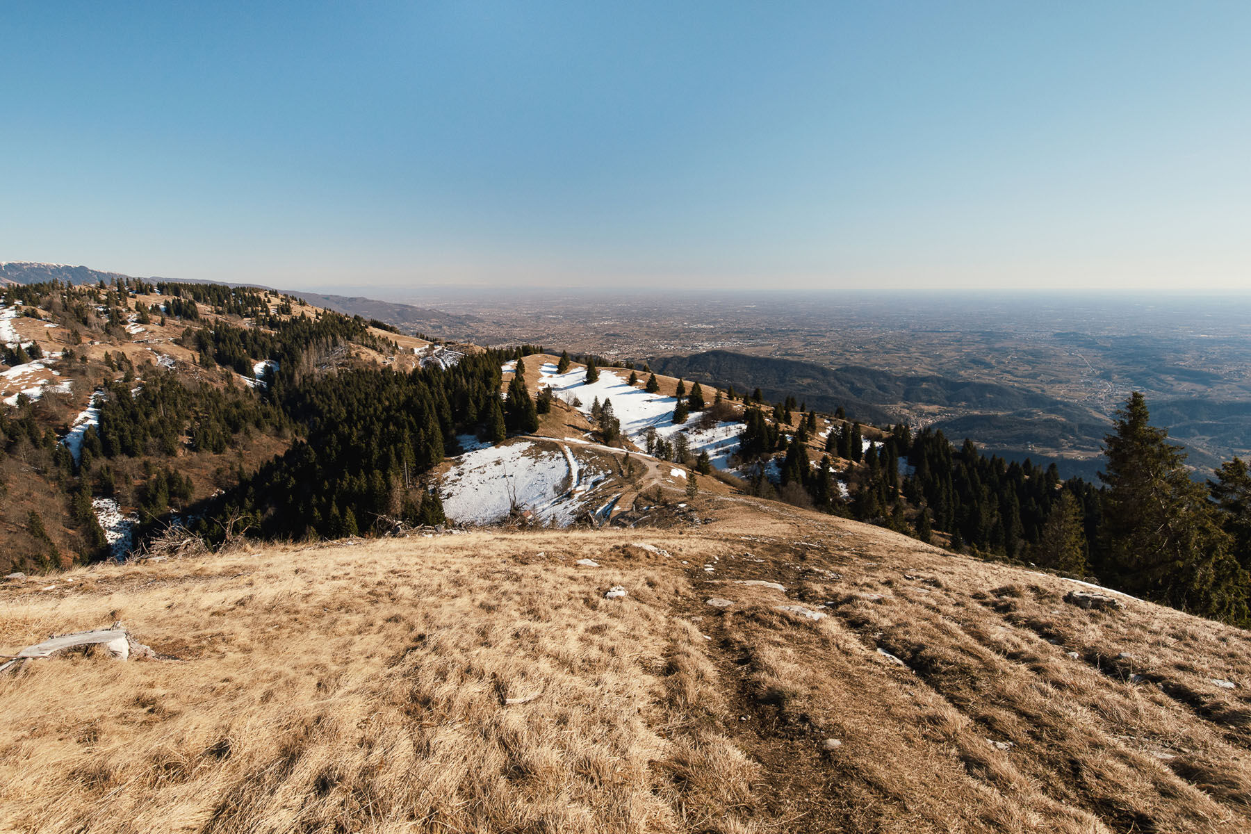
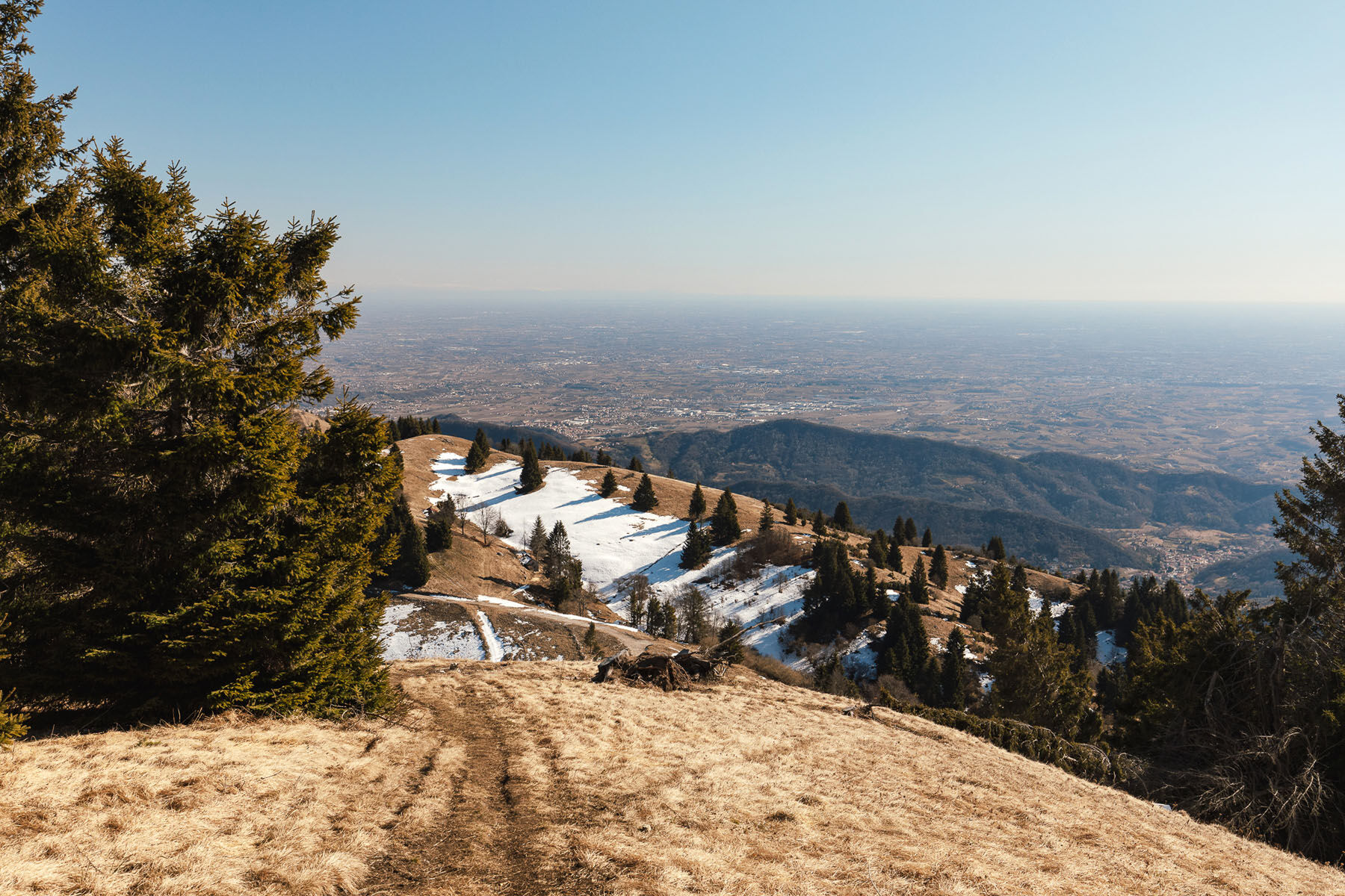
It starts from Punta Calderol, among paths surrounded by greenery, up to the equipped bivouac of "Col dei Gai," where the view opens onto the Valbelluna, between the Monti del Sole and the Vette Feltrine peaks. Continuing on, the summit of Mount Cimone gives a unique view, between sky and mountains.
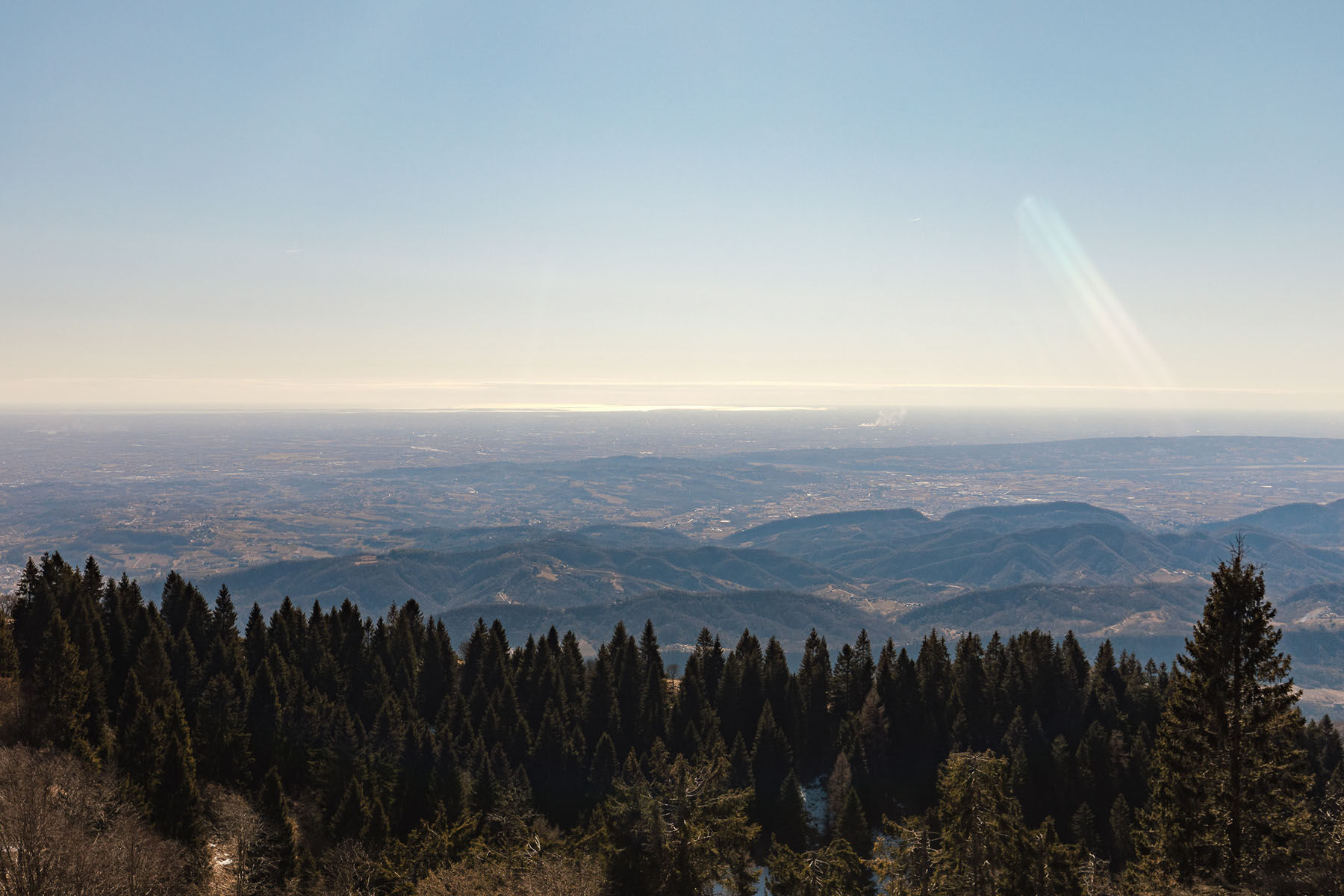
Descending toward La Posa, on clearer days the gaze embraces a panorama ranging from the Gulf of Trieste to Venice, from the Piave with the moraine hills of Montello to the Asolani Hills, from the Berici Mountains to the Euganean Hills. Here, if your heart drives you to adventure, you might see paragliders and hang gliders soaring in breathtaking flights over the Prosecco Hills, a UNESCO heritage site, landing near the lakes of Revine and Lago.
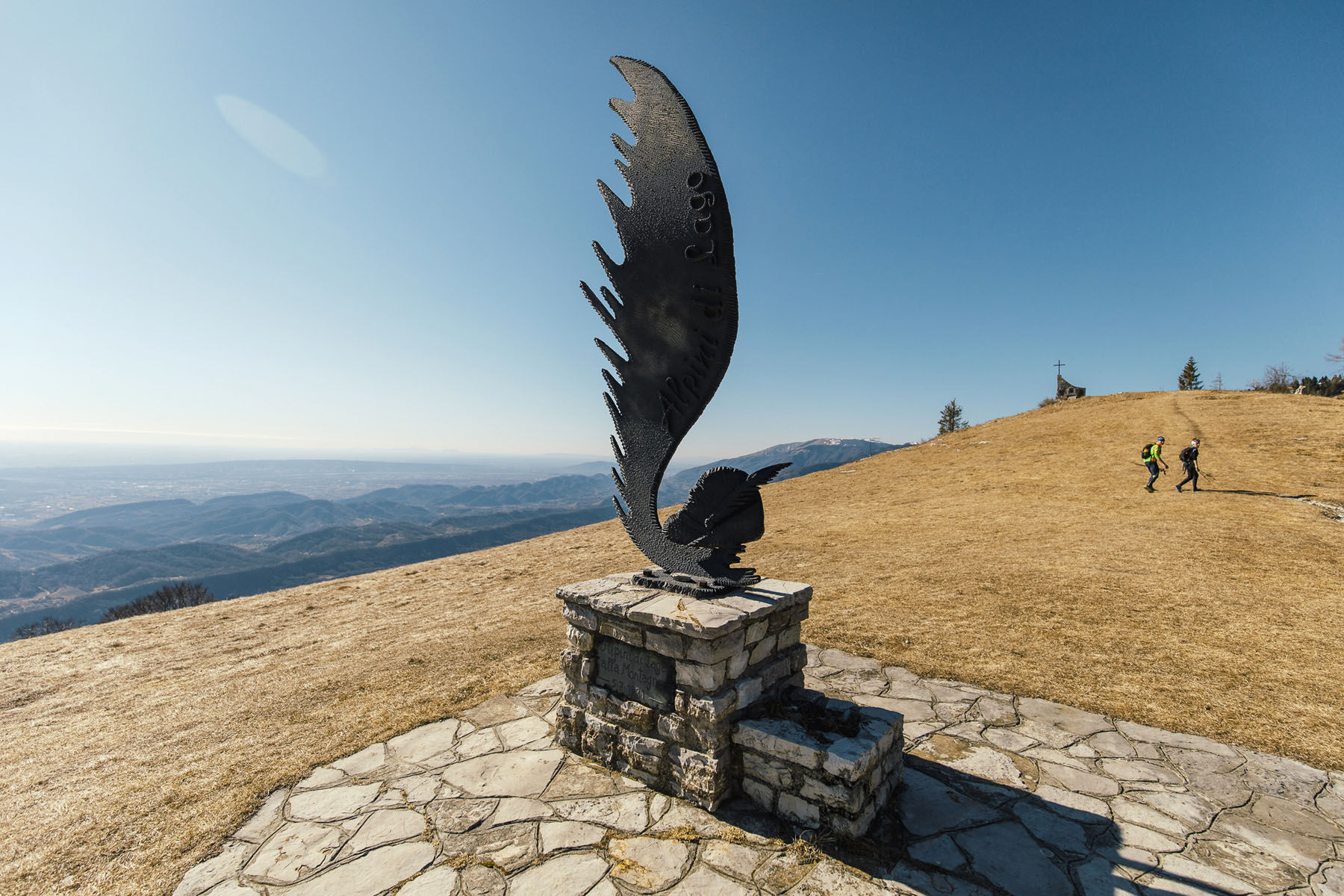
The return trip passes through Busa Todesca, among green fields and restored rural villages, closing a route that tastes of nature, history and timeless beauty.

Áno
Easy hike. Appropriate footwear and clothing are recommended, anticipate any changes in weather, and bring water and snack
This itinerary between Punta Calderol, Col dei Gai and Monte Cimone is a medium-difficulty hike that alternates between wooded trails, ridge sections and more exposed scenic areas. It is important to approach it with a minimum of hiking experience and good physical preparation, especially due to the presence of sustained climbs and descents on natural terrain.
From Venice: about 1h 30 - 2h (A27 to Belluno + Valbelluna)
Arrival at the station of:
Belluno stationConnections from:
Venice Mestre Treviso Calalzo di CadoreBus
Service operated by Dolomiti Bus:
Belluno ↔ Sedico / Sospirolo connections then continuation to hilly areas via local lines or short walking distances( N46° 01.239′ E12° 12.135′)
T2
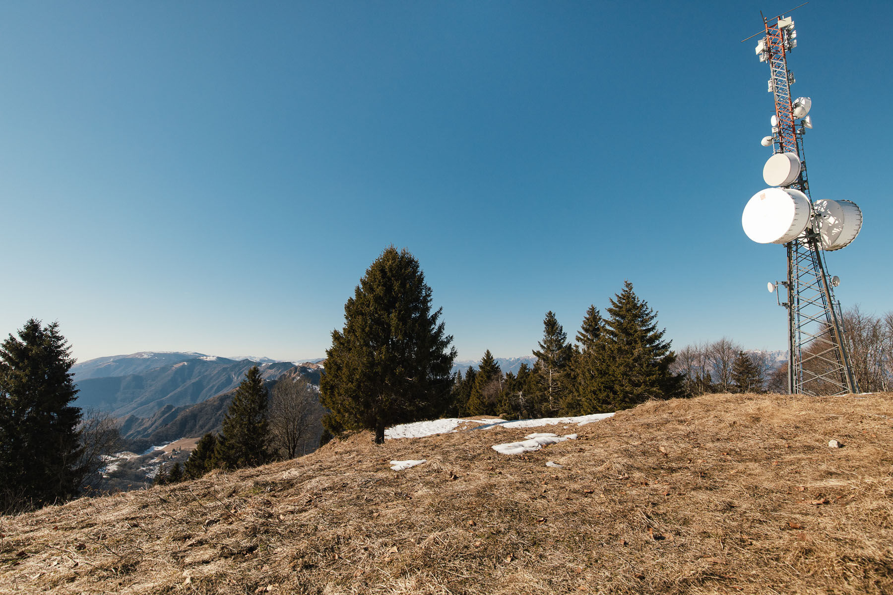
On the summit of Mount Cimone remain the foundations of a U.S. Army barracks, a silent Cold War radio-bridge that connected the missile base on the Cansiglio plateau to the powerful antennas on Mount Venda in the Euganean Hills.
Obľúbené výlety v okolí
-
4,0
Prosecco Morgenwanderung „Uno“
svetloTuristika 6,50 km -
5,0
Belluna Valley Ring
strednáDiaľková cyklotrasa 78,1 km -
Bivacco dei Loff
strednáTuristika 7,98 km -
Pian del Cansiglio: Passeggiata nei dintorni di Vallorch
svetloTuristika 6,60 km -
Grotta azzurra
svetloTuristika 2,68 km -
Brent de l'Art Ring
strednáTuristika 5,78 km -
Monte Pizzoc
strednáTuristika 13,7 km -
TRAIL E7 PREALPS
ťažkédiaľková pešia trasa 100,7 km -
Polpet - Fadalto - Croda Rossa - Visentin
strednáE-MTB 62,3 km -
5,0
Limana - Monte Agnellezze - Col Visentin - Pian delle Femene
strednáTuristika 16,4 km

Turistika a stopovanie


Nenechajte si ujsť ponuky a inšpiráciu na ďalšiu dovolenku
Vaša e-mailová adresa bol pridaný do poštového zoznamu.