


Via ferrata Evolène
Úroveň náročnosti: D
The via ferrata of Evolène is divided into three parts. The starting point is at the exit of the village of Evolène, at the parking lot for paragliders. A quarter-hour walk leads you directly to the foot...
The via ferrata of Evolène is divided into three parts. The starting point is at the exit of the village of Evolène, at the parking lot for paragliders. A quarter-hour walk leads you directly to the foot of the rock and to the start of the via ferrata. At the beginning of the ascent, an overhang takes your breath and your first strength. The middle part is a horizontal path, suitable also for families with children. The last part with impressive overhangs is reserved for experienced climbers!

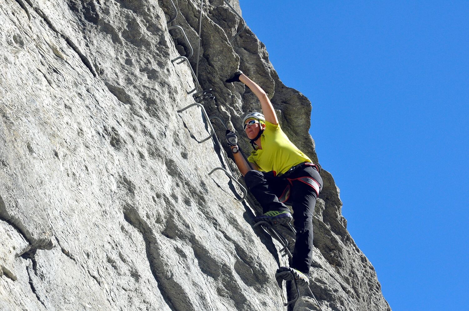
Go to the via ferrata information board slightly above the parking lot and follow the zigzag path through the forest to the start. After two small overhangs, further vertical climbing sections follow until you climb through the "Grand Mur" at the end of the route. Two intermediate exits are available along the way. The descent leads to the right towards the village of Villa, where you can return to Evolène on the marked hiking trail.
A climbing harness with a via ferrata set for self-protection is mandatory for doing a via ferrata. Due to the risk of falling rocks, wearing a helmet is also a must.
Pay attention to good footwear, suitable clothing, and sufficient provisions. Gloves provide additional protection to fingers and joints and prevent abrasions.
Weather: If you are on via ferrata routes, you should consider the weather forecasts. A sudden onset of bad weather can be life-threatening. Via ferrata routes must be avoided in case of thunderstorms.
Risk of falling rocks: Via ferrata routes pose the risk of falling rocks, mostly triggered by preceding climbers or wild animals. Protect yourself with a helmet.
Securing: When doing a via ferrata, make sure to always keep enough distance from the climber ahead. Only one person should be in a securing section at a time.
Access via the A9 motorway to Sion to exit 27 (Sion-Est). Continue on Route d'Hérens towards Val d'Hérens. From Sion, you reach Evolène in about 25 minutes.
Train connections to Sion with subsequent hourly bus connection to Evolène.
Parking lot at the exit of Evolène towards Les Haudères
D
Equipment rental:
in the local sports shopsMore information about the destination can be found here:
EvolèneDo the via ferrata of Evolène in the evening and enjoy a beautiful sunset in the Val d'Hérens.
Obľúbené výlety v okolí
-
Arolla - Vignettes
strednáSkitour 5,04 km -
4,0
Belvédère via ferrata
strednáVia ferrata 1,81 km -
Tour du Lac de Moiry
strednáTuristika 13,4 km -
4,5
Cleuson Dam
strednáTuristika 11,5 km -
Zum Fuss des Gletschers und zurück nach Les Hauderes
strednáTuristika 12,3 km -
5,0
Sentier des bouquetins
strednáTuristika 8,73 km -
5,0
Tour of Val d’Anniviers: Zinal–Grimentz (Stage 3)
strednáTuristika 14,5 km -
Val d’Annivier
svetloTuristika 17,6 km -
Pic d'Artsinol, Evolène, Valais/Suisse
strednáTuristika 13,0 km -
Roc de la Vache - Zinal
strednáTuristika 18,9 km

Turistika a stopovanie


Nenechajte si ujsť ponuky a inšpiráciu na ďalšiu dovolenku
Vaša e-mailová adresa bol pridaný do poštového zoznamu.