


Zwischbergen, Gondo - Scenic & side valleys

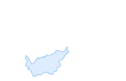
The road opposite Gondo along the Italian border is built on a terrace that eventually opens onto the Zwischbergental, a superb, unspoilt valley 16km in length. The climb up to this remote valley on the...
The road opposite Gondo along the Italian border is built on a terrace that eventually opens onto the Zwischbergental, a superb, unspoilt valley 16km in length. The climb up to this remote valley on the south side of the Simplon Pass is both challenging and surprising: those who venture there appear to have stumbled into a place out of time. An absolute must if you happen to find yourself in the area!


On leaving Gondo, the road that climbs up towards the Zwischbergental is dominated by the summits of the Weissmies and Lagginhorn. This stretch of the route, once used by smugglers crossing the Moncera pass, was also a crucial passageway during the two world wars. The environment here is remarkable: vast forests, mountain pastures carpeted with flowers and refreshing mountain lakes await you. This valley is definitely worth the detour!
Áno
We recommend: bike in excellent working order, helmet, gloves and bell, clothing suitable for the weather (always carry a waterproof), food and drink.
Strictly respect the Swiss traffic rules. Please note that you are running the tour at your own risk and all liability is refused. Please be considerate to plants and animals. For your own safety, wear an helmet every time you ride a bike. Emergency numbers: 144 Ambulance / 117 Police / 1414 Helicopter Rescue (Rega). When planning, take into account participants’ fitness level and ability. All riding is at one’s own risk.
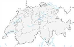
From Brig, take the cantonal road number 9 up to the Simplon pass and then to Gondo. The village is situated just before the italian border.
To get to Gondo, take the post bus from Brig via Simplon pass to Gondo or take the train from Brig to Iselle di Trasquera (simplon tunnel), where you change to the connecting bus to Gondo.
Follow the local car park routeing in Gondo.
Don't forget to take your passport with you.
Don’t forget to take some form of identification with you.
Obľúbené výlety v okolí
-
3,6
Höhenweg Kreuzboden - Almagelleralp - Saas-Almagell
Turistika 9,74 km -
5,0
Weissmies Südgrat von Saas Almagell
strednáVysoké turné 20,5 km -
5,0
Via ferrata Jägihorn
ťažkéVia ferrata 6,14 km -
5,0
San Domenico - Alpe Veglia - San Domenico Rundwanderung
strednáTuristika 13,9 km -
Suonenweg Saas-Almagell - Saas-Grund
strednáTuristika 6,18 km -
5,0
From Visperterminen through the Nanztal to the Simplon Pass
strednáTuristika 18,7 km -
Simplon-Staldenhorn- Simplon
strednáTuristika 8,27 km -
Saas-Grund - Kreuzboden in winter
strednáZimná turistika 10,4 km -
5,0
Simplon Hospiz - Monte Leone-Hütte
strednáTuristika 5,47 km -
Spitzhorn 2724 m
svetloSkitour 10,5 km
Turistika a stopovanie


Nenechajte si ujsť ponuky a inšpiráciu na ďalšiu dovolenku
Vaša e-mailová adresa bol pridaný do poštového zoznamu.